
|
|
Mountain/Rock |
|---|---|
|
|
38.76085°N / 106.07268°W |
|
|
chaffee |
|
|
Mountaineering |
|
|
Spring, Summer, Fall, Winter |
|
|
8403 ft / 2561 m |
|
|
Overview

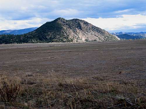
South Face of Sugarloaf and Arkansas River
Arkansas River originates in the mountains of central Colorado and then heads south along the eastern edge of the Sawatch Mountains. Near the town of Nathrop (south of Buena Vista), the river creates a plain that is roughly six miles wide (east-west) and sits at an elevation of 7700 ft. Giant fourteeners such as Mt. Princeton and Mt. Antero rise to the west of the plain. To the east, in contrast, you will only find Juniper covered mountains that are generally lower than 10000 ft high.
Sugarloaf Mountain rises very abruptly above the eastern banks of the Arkansas River. Its western and southern slopes are rocky and steep. Its northern slopes are fairly gentle and provide the best access route to the summit. To the east, Sugarloaf connects to the nearby ridgelines and high points.
Sugarloaf Mountain is covered by a forest of Juniper Trees. It has two summits. The one to the north is slightly higher. From the summit of Sugarloaf, you will have good views of the peaks of the Sawatch Range, the Arkansas River Valley and the Juniper covered lower mountains to the east.
Northwestern Face of Sugarloaf Mountain
Views from the summit of Sugarloaf Mountain:
 Mt. Princeton | 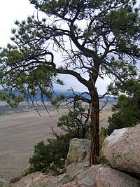 Summit Tree |  Arkansas River |
 South |  North, Buffalo Peaks |  East |
At the base of the northern slopes of Sugarloaf Mountain there is an area where giant boulders have created interesting rocky formations.
 Rock Formations |  Rock Formations |  Rock Formations | 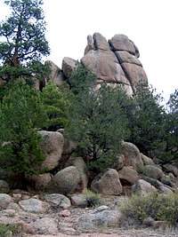 Rock Formations |
Getting There
From the intersection of Routes 24 and 285 south of Buena Vista, follow Route 285 east through Johnson Village. Shortly after crossing over Arkansas River, you will see a sign for County Rd 301 to the south. Turn right onto 301 and follow it south for 2.8 miles until you reach County Rd 300. Turn left (east) onto 300 and follow it 1.2 miles to the intersection of Arnold Gulch Rd. This is your trailhead. (Roads 301 and 300 are well graded dirt roads passable by most/any car). County Rd 301 can also be accessed from Route 285 north of Nathrop.Route

From trailhead (7780 ft), head south and hike to the west of the boulder formations and then find your way up the Juniper covered northern slopes of Sugarloaf to reach its summit. The summit is covered by boulders. One way hiking distance is 0.55 miles per my GPS.

Hiking up the north slopes
Red Tape
No fees or permits for day hiking.For other regulations, see the site for San Isabel National Forest.
 |  |