


-
 4814 Hits
-
 83.1% Score
-
 16 Votes
|
|
Area/Range |
|---|---|
|
|
45.62460°N / 7.62192°E |
|
|
Hiking, Mountaineering, Ice Climbing, Skiing |
|
|
Spring, Summer, Fall, Winter |
|
|
4682 ft / 1427 m |
|
|
Note
La montagna chiama i suoi figli, ed essi rispondono fedelmente al suo appello… Osvaldo Cardellina, Diario alpinistico, 1964-65 Page texts: @ OsvaldoCardellina "Osva", passed away on May 2, 2022. Page owners: Christian Cardellina e Osvaldo Cardellina. Any updates from September 12, 2022: Antonio Giani, page administrator, friend and climbing companion. Testi della pagina: @ OsvaldoCardellina "Osva", scomparso il 2 maggio 2022. Proprietari pagina: Christian Cardellina e Osvaldo Cardellina. Eventuali aggiornamenti dal 12 settembre 2022: Antonio Giani, amministratore della pagina, amico e compagno di salite. |
Overwiev
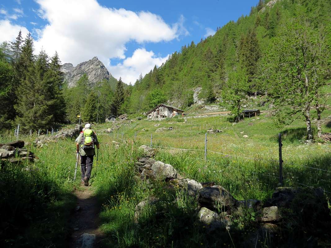
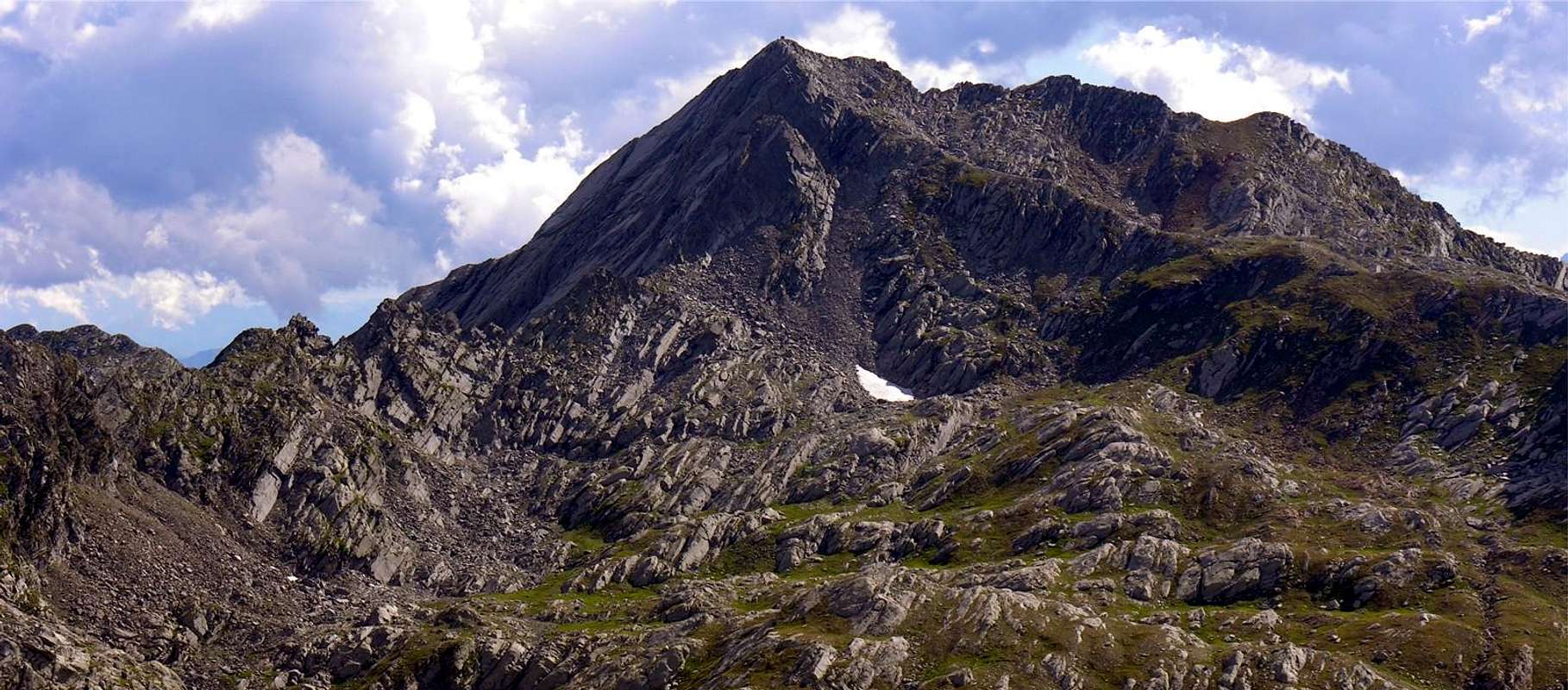
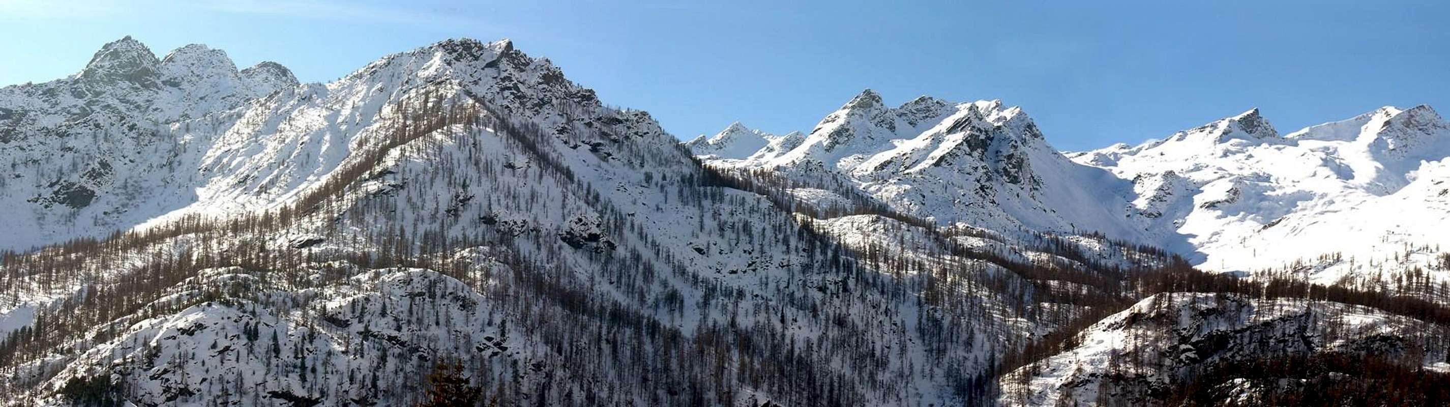
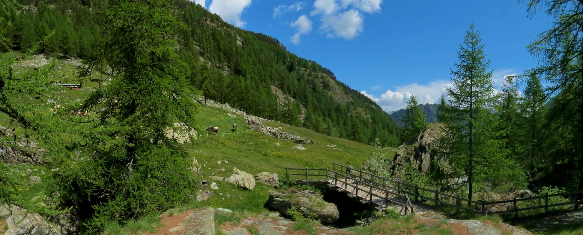
Champorcher Valley is one of the thirteen most important valleys of the Valley of Aosta. Located on the right bank of Dora Baltea shows that, apart from some secondary valley, as the first of the valleys coming from the Po Valley and then by Turin and Milan Cities. Along with that of neighboring Cogne are the only valleys, from this side, not to descend perpendicularly to the Central Valley: "our" down towards the northeast reaching the valley floor at the two nearby towns of Bard and Hône and then in "Lower Valley"; the other towards the Northwest direction to Aymavilles Municipality, or the beginning of the "Upper Valley". The Champorcher Valley, very narrow and compressed at its beginning, gradually fans out with a whole series of walloons that descend from the watershed with the nearby Canavese, belonging to the neighboring Piedmont Region, towards the two Municipalities of Pont Bozet Champorcher and reaching the last Miserin, where begins the border with the long and wide Urtier 's Valley, at the end of the Eastern side of the Valley of Cogne. One way to open up "unbalanced" because on the other side, or Northern, instead climb steep rock-ribbed woodland, designed to separate her from the Central Valley of Dora; only in the last section, or by Hills de la Croix and Lago Bianco, above above the Capital of the Château, the valley begins to present new vallons. But more than the small valleys are small rocky basins in which peep ponds reflecting an ancient glacial activity. Here is the partition with the Valley of the Lakes over Champdepraz and the Vallons of Savoney, secondary to that of Clavalitè, and of Alta Comba Tersiva above the Township of Fénis. The third side, or that more wide and high, coincides with the Cogne valley to valley giving the shape of a long pear with the stalk down. So a valley, gradually you climb out from the steep and winding "remparts" initials, opens more and more lavishing its beauty until the appearance of the two twin pyramids of Mont Delà (3.139m) and Mont Glacier (3.186m), which stand on the right of Champorcher and the next Village of Dondena, last town at least for a good part of the year. Towards the South, after the first "horrid", and by the wild aspect of practicability vallons not falling over Torrent Ayasse, open the next that seem to lose sight of the eye and where, if not for the connoisseur, is difficult to distinguish shapes and lines; much more "gentle" give the idea to extend until the infinite. Perhaps for this are, if not by the locals, little known and even less frequented. Including that of the Legna (Wood's Vallon) that opens after more than a small village of Outre l'Eve, placed upon a clearing beyond the Ayasse, before reaching Champorcher-Château. The beautiful lakes overlying point the way Fishermen, if not the most talented definitely the most willing, because they expect great walks. Compensation of a fish with beautiful and unspoiled silvery trout in Lakes Dondogna, Sec, Noir, Vassoline, Champas, Comony, Chenessy, Chilet, Vercoche and Larìs and their emissaries from the water fresh and turbulent to signal a still completely intact. A Paradise not only addressed the same, but also to those with capital Hikers who like to challenge themselves even themselves with great walks "adventurous" in environments where surely not meet the mass. With the Larìs Vallon disappears after this "Fareast" because resumes its Civilization, the Kingdom of Skiing and by Skiers with tracks dating from the eponymous walloon starting from the Hamlet of Chardonney (1.455m), down there in that great plain surrounded by forest of larch (Larìs from here?) and firs. To get to the Cimetta Rossa (2.466m), under the Bec de Pendant (2.825m) and at the end of the long ridge that descends to the Northeast from Rosa dei Banchi (3.164m). The other undisputed Queen of this valley, above the Glacier des Bantses ie of rocky slabs.
Okay we get it, but for us Mountaineers what remains? Nothing! Like anything? Well, a little something is always, however, we have to make, scrambling, "treks" terrible, vile stuff from ruining your feet, if you want to go exploring what is left. Oh no, we are Climbers of the Modern Era. Understood, then stay down in Pont-Bozet that the walls of the Mont Charvatton (1.787m) offers to you what you seek; with walls of 500 meters, already equipped. Difficulties? 6a+(AO), 6b+(AO)XZYKJWXZZZ. What do you mean? Do not ask me who do not know, I'm going to take a ride on snowshoes up to Dondena and, if I get the urge, I go to the Hill of Rosa to make the Rosa dei Banchi. I love Big Clearances and I have no desire to stay there for hours hung like a sausage. Sometimes, when I get to Champorcher in the morning, I see them already hanging; when returning in the evening are still in the same place. But what they do, they take the sun? There are places more comfortable. I went to pick him up to Glacier and are already back. Really true in this world there is room for everyone and every idea. However, that these types queer & odd! Ah, you over there! On the Royal Road to Dondena and surroundings there is also room for the Skiers-Mountaineers ... ![]()
![]()
Va bene abbiam capito, ma per noi Alpinisti cosa rimane? Niente! Come niente? Mah, un qualcosina c'é sempre, però bisogna far delle "scarpinate" terribili, roba infame da rovinarsi i piedi. Se volete andare ad esplorare ciò che é rimasto. Ah no, noi siamo Arrampicatori dell'Era Moderna. Capito, allora restate giù a Pont-Bozet che le pareti del Mont Charvatton (1.787 m) vi offron ciò che cercate; con pareti di 500 metri, già attrezzate. Difficoltà? 6a+(AO), 6b+(AO)XZYKJWXZZZ. Cosa vuol dir? Non chiedete a me che non sò, io vado a farmi un bel giretto in racchette da neve fino a Dondena e, se mi vien la voglia, vado al Col della Rosa a farmi la Rosa dei Banchi. Io amo i Grandi Spazi liberi e non ho nessuna voglia di stare lì appeso per ore come un salame. A volte, quando salgo a Champorcher al mattino, vedo lor già appesi; quando ritorno alla sera son ancor nello stesso posto. Ma cosa fan, prendon sole? Ci son posti più comodi. Io son andato a prenderlo al Glacier e son già di ritorno. Proprio vero a questo Mondo c'è posto per tutti e per ogni Idea. Però che balzani e stravaganti sti tipi! Ah, Voi laggiù! Sulla Strada Reale per Dondena e dintorni c'é posto anche per Sci-Alpinisti ...
![]()
![]()
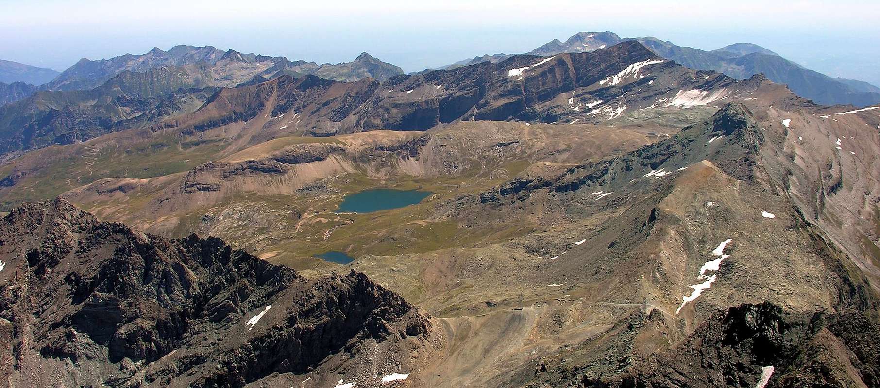
 |
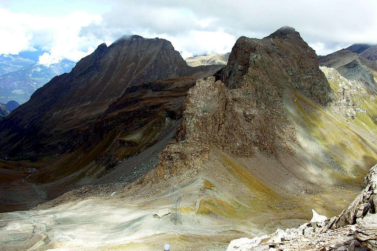
Then with the Rosa begins the world of Mountain Climbing? No sir, because this is not a particularly geared towards them. Even the long and easy Crest Northeast is more a trip for Hikers Experts for Mountaineers. From here the mountain range opens in a semicircle reaching Punta dell'Asgelas, the tiny Punta Giuseppe Corona and, after the Col de la Balma, Cima of Peradzà, where finally abandons the border with Piedmont. A large saddle 2.846 meters is the first useful step between Champorcher and Cogne; important topographical node from which part of the long ridge that reaches even the Central Valley, precedes the Bec Costazza and Tour Ponton before getting up, always true North, the impressive Punta Tersiva (3.515m), the great pyramid at the vertex of three valleys: Champorcher, Fénis-Clavalité and Cogne. Two hills, as important as the antiquity until frequented, through this watershed, real "cul de sac" for all three. At first the Fenêtre de Champorcher (2.826m), between the Bec Costazza and Tour Ponton and immediately below the Col Pontonnet (2.897m), between the latter and the dual and namesake tower, open the two important lines of communication between these two valleys; moments from the last off Col de Fénis (2.857m) allows direct connection with the homonymous municipality and then Valley of Baltea. Then the ridge closes its semicircle projecting towards the East and, after the Tour Moutsaillon or Mussaillon and identical Pass (2.846m) reaches the two pyramids of Delà and Glacier; in addition, the two formats of the Gran Rossa (Great Red) Hills and the same has three other Summit with Boccon Damon, the Tete des Hommes and Torretta reaching Lago Bianco (2.308m) and de la Croix (2.287m) Hills, input ports to the Valley of the Lakes and the Refuge Barbustel. We are on the edge of the Natural Park of Monte Avic and, if you will, with a single step here we go. Reached the Cima Piana partition after having bent twice at right angles, sloping definitively separate themselves more and more to the Mont Charvatton, again above Pont-Bozet and at the entrance of the Valley. The circle is completed and already can admire again the Fortress of Bard. In this stretch the watershed is reached by steep forests above the Township of Issogne with its splendid castle overlooking the Dora of 1480, which makes a counterpart on the opposite side to Verrès 1361; side Champorcher instead a series of tiny villages (Mont Blanc, Petit Mont Blanc, Mellier, Verana, Petit Rosier, Coudreyt, Grand Rosier, Buissoney, Dogier and Barmacreppa) are "clinging" at the foot of the steep slopes forest-rock. Leaving the top Oratoire de Sainte Anne (1.706m), between Bec de None and Tête du Mont.
 |
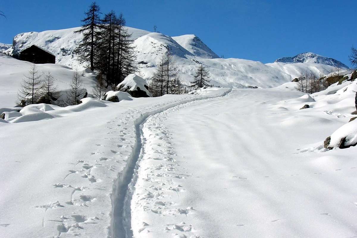
This valley, very important for the profile of cultural history, had been "snubbed" from the point of view of tourism until about forty years ago, being known and preferred destination almost exclusively by inhabitants of Turin; the new facilities aimed at the ski have completely relaunched and now does not bear comparison with the most famous valleys. Although it does not have big mountains or the catchy name like many of the other. Today in Champorcher, oasis of peace in unspoiled nature and understanding of the foothills of the Southern Regional Park of Mount Avic, tourists come not only from all over Italy, but all over Europe. Indeed it is perhaps the proximity to the Barbustel Shelter, not many years now and built in the Valley of Champdepraz but easily accessible and in relatively short time, which greatly increased the "traffic", at least for the summer. Maybe too much because, sometimes, "streams" of people climb to Colle del Lago to the limit with the Park. Even too much. In winter or in midseason instead everything changes and only a few true fan reaches the Dondena candid, sometimes windswept or otherwise buried in deep snow, as in a postcard d'Antan. Across the Torrent Ayasse instead you hear voices, sometimes almost the crowds, on the slopes of Larìs. But it is also the place of the great silences, when the arrival of the cold and the first blow of Aeolus almost all disappear; also from Lake Miserin and its Sanctuary that truly becomes a center of spiritual concentration, with the waters of the Lake trespide and just feel the wind in the Fall that now with its lights and shadows lengthened declines towards Winter. Try to get the Rosa dei Banchi to October and you'll understand. You will see the Winds Northeast push the clouds to the Southwest towards the Soana Valley, making them fly like kites high over the Colle della Rosa. Do not delay because the darkness will come soon and when you pass again at the waters of Miserin a sense of dark tremor invade you bringing you back centuries. The Sanctuary will stand in front of you cool and quiet and its doors and wooden benches assume a medieval appearance. Far away in time. Waiting to see appear a Friar from the window sash that, looking at you with his head down and with only the chin and mouth coming out of his white cap, invites you with a wave of the hand open to enter. A moment to heat up the fireplace eating something hot. You will not see anyone, and the darkness will fall even further but the road to Dondena is wide and safe. Taken from the rush and despair want to shorten the route and get you on the right fording the Torrent Miserin to fall directly on the path of retreat, passing below the Monte Dondena. Do not do this because it goes well with the light of day; instead follow the wide dirt road that the last light at the horizon make enough suggestive and quietly, even with narrowed eyes, reach Refuge Dondena, "hidden" under a rocky promontory. Here you will open, if it is not already too far from the Autumn and Winter too close to. In any case do not worry, you are very close to Dondena. The lights of a bright morning just above Château-Champorcher and welcome you at la Cort. The Royal Route is "virgin" and his immaculate snow. Put on snowshoes and go. You will not find anyone until Dondena Village, there around the corner.
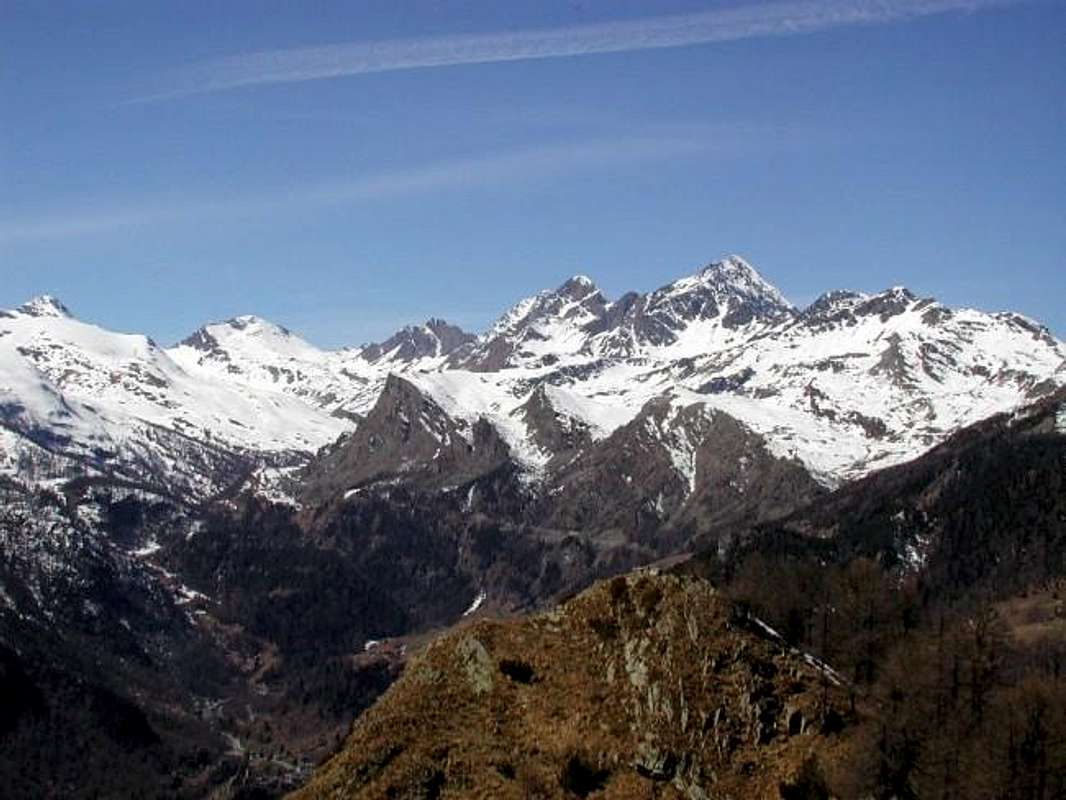
La Valle di Champorcher é una delle tredici valli tra le più importanti della Valle di Aosta. Situata sulla sponda orografica destra della Dora Baltea risulta come, a parte qualche vallone secondario, come la prima delle valli arrivando dalla Pianura Padana e quindi dalle Città di Torino e Milano. Insieme a quella limitrofa di Cogne sono le uniche vallate, da questo lato, a non scendere in modo perpendicolare verso la Valle Centrale: la "nostra" scende verso Nordest raggiungendo il fondovalle presso i due vicini Comuni di Bard ed Hone e quindi in Bassa Valle"; l'altra verso Nordovest in direzione di quello di Aymavilles, ovvero allo inizio della "Alta Valle". La Valle di Champorcher, molto stretta e compressa al suo inizio, progressivamente si apre a ventaglio con tutta una serie di valloni discendenti dallo spartiacque con il vicino Canavese, appartenente alla limitrofa Regione Piemonte, verso i due Comuni di Pont Bozet e Champorcher raggiungendo l'ultimo del Miserin, ove ha inizio il confine con il Vallone dell'Urtier, al termine del lato Orientale della Val di Cogne. Una maniera di aprirsi "squilibrata" poiché sul lato opposto, o Settentrionale, salgono invece ripidi costoloni boschivo-rocciosi, atti a separarla dalla Valle Centrale della Dora; solo nell'ultimo tratto, ovvero dai Colli de la Croix e Lago Bianco, al di sopra di sopra del Capoluogo di Château, la valle inizia a presentare nuovi valloni. Ma più che di questi trattasi di piccoli bacini pietrosi nel quale occhieggiano laghetti a testimonianza d'una antica attività glaciale. Qui il divisorio é con la Valle dei Laghi sopra Champdepraz e coi Valloni di Savoney, secondario a quello della Clavalitè, nonché dell'Alta Comba Tersiva sopra il Comune di Fénis. Il terzo lato, ovvero quello maggiormente largo ed elevato, coincide con la Valle di Cogne dando alla vallata la forma d'una lunga pera con il picciolo in basso. Quindi valle che, a poco a poco che si sale uscendo dai ripidi e tortuosi "remparts" iniziali, s'apre sempre di più elargendo le sue bellezze sino alla comparsa delle due piramidi gemelle del Mont Delà (3.139 m) e del Mont Glacier (3.186 m), stagliantesi sulla destra di Champorcher e del successivo Villaggio di Dondena, ultimo centro abitato almeno per buona parte d'anno. Verso Meridione, dopo i primi "orridi", selvaggi e dall'aspetto impercorribile valloni cascanti sopra il Torrent Ayasse, se ne aprono successivi che paion perdersi a vista di occhio e dove, se non pel conoscitore, vien difficile distinguerne forme e linee; molto più "dolci" dan l'idea di prolungarsi fino all'infinito. Forse per questo sono, se non dagli abitanti locali, poco conosciuti ed ancor meno frequentati. Compreso quello della Legna che s'apre dopo il più che piccolo Villaggetto di Outre l'Eve, posto su d'uno spiazzo al di là dell'Ayasse, prima di raggiungere Champorcher. Gli splendidi laghi soprastanti indicano il cammino dei Pescatori, se non i più bravi sicuramente i più volenterosi, perché aspettano loro grandi camminate. Di compenso un pesce incontaminato con splendide ed argentee trote nei Laghi Dondogna, Sec, Noir, Vassoline, Champas, Comony, Chenessy, Chilet, Vercoche e Larìs e dai loro emissari dalle acque fresche e turbolenti a segnale d'un ambiente ancora completamente integro. Un Paradiso non solo rivolto ai medesimi, ma anche a quegli Escursionisti con la E maiuscola che amano ancora cimentare loro stessi con grandi camminate "avventurose" in ambienti dove sicuramente non incontreranno la massa. Con il Vallone del Larìs scompare questo "Fareast", poiché inizia nuovamente la Civiltà, il Regno dello Sci con le piste che risalgono lo omonimo vallone partendo dal Villaggio di Chardonney (1.455 m), laggiù in fondo a quella grande piana contornata dalla foresta di larici (da qui Larìs?) ed abeti. Per arrivare alla Cimetta Rossa (2.466 m), sotto il Bec de Pendant (2.825 m) ed al termine della lunga Cresta Nordest che scende dalla Rosa dei Banchi (3.164 m). Altra incontrastata Regina di questa Valle, sopra il Glacier des Bantses cioé delle banconate rocciose.
|
|

|
|
|
Questa valle, molto importante per il profilo storico-culturale, era stata "snobbata" dal punto di vista turistico fin ad una quarantina d'anni fa, essendo meta conosciuta e preferita quasi esclusivamente da parte di torinesi; le nuove strutture rivolte allo sci l'han rilanciata completamente ed ormai non teme il confronto con valli più famose. Anche se non possiede grandi montagne o dal nome altisonante come molte delle altre. Oggi invece a Champorcher, grande oasi di pace in una natura incontaminata nonché comprensiva delle propaggini Meridionale del Parco Regionale del Monte Avic, arrivan turisti non solo da tutta'Italia, bensì da tutta Europa. Anzi é forse la vicinanza col Rifugio Barbustel, da non molti anni costruito ed ormai nella Valle di Champdepraz ma facilmente ed in tempo relativamente breve raggiungibile, che ha notevolmente aumentato il "traffico", almeno per quanto concerne la bella stagione. Forse anche troppo poiché, a volte, "fiumane" di persone salgon verso il Colle del Lago al limite col Parco. Anche troppe. In inverno o nella mezza stagione invece tutto cambia e solo qualche vero appassionato raggiunge la candida Dondena, a volte spazzata dai venti o altrimenti sepolta nella neve alta, come in una cartolina d'Antan. Dall'altra parte del Torrent Ayasse invece s'odono le voci, a volte quasi schiamazzi, sulle piste del Larìs. Ma é anche il posto dei grandi silenzi, quando all'arrivo dei primi freddi e delle prime soffiate di Eolo quasi tutti scompaion; anche dal Lago Miserin e dal suo Santuario che diventa realmente un centro di raccoglimento spirituale, con l'acque del suo Lago trespide ed appena accarezzato dal vento dell'Autunno, che ormai con le sue luci e l'ombre allungate declina verso l'Inverno. Provate a salire la Rosa dei Banchi ad Ottobre e capirete. Vedrete i Venti del Nordest spingere le nuvole a Sudovest verso la Valle Soana, facendole volare come degli aquiloni alte sopra il Colle della Rosa. Non tardate perché il buio arriverà presto e quando passerete nuovamente presso l'acque del Miserin un senso di scuro tremore vi invaderà riportandovi indietro nel tempo secolare. Il Santuario s'ergerà di fronte a voi freddo e silenzioso ed i suoi portoni e le panche in legno assumeranno un aspetto medioevale. Molto lontano nel tempo. In attesa di veder apparire un Frate dal battente della finestra che, guardandovi a testa bassa e con solo il mento e la bocca che escon dal suo bianco cappuccio, v'inviterà con gesto aperto della mano ad entrare. Un attimo a scaldarsi al fuoco del camino mangiando qualcosa di caldo. Non vedrete nessuno ed il buio scenderà ancor più, ma la strada per Dondena é larga e sicura. Presi dalla fretta e dallo scoramento volete abbreviare il percorso indirizzandovi a destra guadando il Torrente Miserin per scendere direttamente sul sentiero del rifugio, passando al di sotto del Monte Dondena. Non fatelo, perché và bene con la luce del giorno; seguite invece la larga strada sterrata che gli ultimi chiarori all'orizzonte rendon già abbastanza suggestiva e tranquillamente, anche cogli occhi socchiusi, raggiungete il Rifugio di Dondena, "nascosto" sotto un promontorio roccioso. Qui v'apriranno, se non é ormai troppo lontano dall'Autunno e troppo vicino all'Inverno. In ogni caso non temete, siete a due passi da Dondena. Le luci d'un luminoso mattino v'accolgono appen sopra Château e presso la Cort. La Strada Reale é "vergine" e la sua neve immacolata. Calzate le racchette da neve ed andate. Non troverete nessuno fino a Dondena, lì dietro l'angolo.
Getting There
BY CAR:
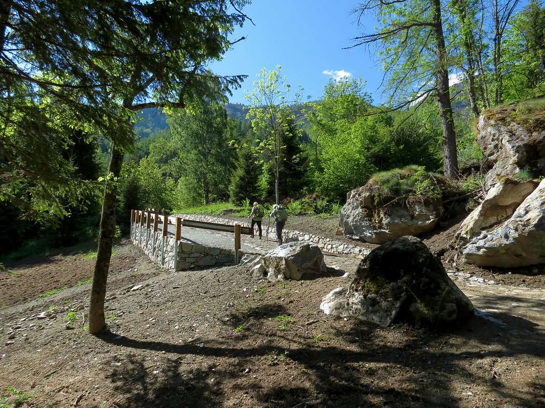
- From TORINO, MILANO, etc: Motorway A5. Exit at IVREA or Quincinetto (PIEDMONT) From IVREA Town: Pont Saint Martin, Donnas, Hône, Bard, Municipalities. Specific Main Road From Pont Bozet (775m) to Champorcher Valley, Camporcher-Château (1.427m), Petit, Grand Mont Blanc, La Cort Villages, towards Dondena Village (2.092m), Dondena & Miserin Refuges, through Royal Road & secondary dirt roads; Barbustel Refuge, through Royal Road and path towards Champdepraz Vallon.
- From FRANCE: through the Mont Blanc Tunnel to Entrèves-crossroads to Vény/Ferret Valleys - Mountain Guides of Courmayeur - La Saxe Rock Gym - Courmayeur. By Little Saint Bernard Pass, closed since November until half May to La Thuile Valley - Pré Saint Didier - Courmayeur. It is not necessary to take Motorway A5: you can drive on SS.26, in the direction of AOSTA - IVREA - TURIN.
BY PLANE:
- Aeroporto "Corrado Gex" Saint Christophe (Aosta).
A small but far History
 |
Where and when does life begin a valley is very complicated thing. If the study is complicated topography and geography, where at least tangible traces remain on the torrents, streams, glaciers and rock layers, imagine what it means to search the time of human remains. It passes from the complicated to the complex and the answer is always highly uncertain and imprecise. For the first we would like to say that his orogeny is very old, as the rocks somewhat transformed by exogenous and endogenous agents over time; for a second think we can say that life here is appeared when, in addition to the flow of water from the glaciers of very different sizes, has appeared the first blade of grass. Like everywhere, where nature has allowed the man is "expanded" looking habitats also up, maybe the most inaccessible places, but that guaranteed the same. The first were indigenous peoples, not necessarily the Salassi source Celtic-Gallic, that from the bottom of the Central Valley of Dora Baltea began to rise gradually to the great Glacier Balteus retreated along its more than 100 Kilometres in length and over 1.000 meters high. From Mont Blanc Mountain Chain to the Plain of Town Ivrea, where it is still clearly visible its lateral moraine of the left called "La Serra". Terracing freed from ice were occupied by men, who were starting to climb up to the edge of the ice above, up to Glacier dei Banchi or Bantses and that of Mont Glacier, which no longer exists. Then the same were overwhelmed by the Romans "thrown" into the streets of Gaul and Helvetia through the Hills of Little and Great St. Bernard (the foundation of the Town of Aosta or "Augusta Praetoria Salassorum" date of 25 BC), because the outside of this main directive, this valley was not affected by this influence. How has particularly affected by the successive invasions of the Burgundians, at least prejudice to the tracks in place. The Middle Ages saw the progressive division of the whole territory of the Valley of Aosta between the Bishop of Aosta and various Vassals trying to contend for the Church profit arising from the work and wealth of the Pasture. His story there is handed down from one of the many existing Castles and Sanctuaries, the dating of which begins around the year 1000 AD. So even for Champorcher with its square Tower, the rest of a castle-fortress built by the Lords of Bard around the year 1100; with the consent of the Count of Savoy, Count Ugo (Hugh) of Bard, a native from Lorraine would have gotten the administration of the Valley of Champorcher. This is the first historical dating and then some noticeable, the rest is Legend. Like the one that wants to see from here go in 286 AD the soldier Besso, the Theban Legion and then converted to Christianity and Missionary, slain by the Romans to the nearby Hill of Arietta. Along with the other soldier Porciero would be saved from the massacre at Martigny accomplished by the Praetorians, Emperor Maximilian. Crossing the hills of the valley would arrive in Val di Cogne and, through the Window of Champorcher, would take refuge in this valley. Later, dividing to escape the enemy, Besso, who later became a Saint, was tracked down and plunged Valley Soana, where now is her sanctuary; Porciero would be hiding in the forest of Larìs managing to save himself and continue his preaching among the shepherds. From its name apparently comes to Champorcher. But is Legend, beautiful and fierce, but still Legend. But it is, and here we return in History, the event that was recorded in 1212 when Guglielmo (William) Lord of Pont Saint Martin and the third son of Hugh now dead, to contrast with the brothers, going up in arms makes burn the old Castle located where today the Church exists. It saves only the Tower, from which derives the current name of Chief Town or Château and representing the Emblem of Champorcher. Indeed, the Church was built in about 1700 due to the remains of the materials of the Castle, as evidenced by its base, and with the same was erected the monument dedicated to the Fallen of the two World Wars, for which Champorcher shed his young blood. In 1728 the same was enlarged, while simultaneously was erected the Bell Tower. The two aisles are instead of 1866, while the four bells were cast in 1863, that took place in the presence of King Umberto I°, Prince of Piedmont; the fourth bell has been replaced in 1866 with the generous patronage of Vittorio Emanuele II°, first Italy's King. It was gone in a previous route and first official visit when the people, taken from an irrepressible enthusiasm, had caused the rupture. Other times, but at least here the People became protagonist, without having to watch helplessly and with fear to stand in front of the quarrels of the various "Signorotti" (Squires). As they had not been afraid to face the Napoleonic Grand Army, commanded by General Duhesmes, in the First Italian Campaign of 1800, when the great Course, coming from Fenetre, wanted to take behind the Fortress of Bard that prevented him from continuing toward the plain. The villagers resisted in defense of the valley to the Fenêtre supporting the Austrian Imperial Troops of the General Suvarow, but the French were able to evade the defense going on near Col Pontonnet, both riding their Tour Ponton. But now, with the Unification of Italy in 1861, although they had a Homeland and, after breaking the bells ringing for an irrepressible joy, in 1862 helped the King to build the Royal Road to Dondena Hamlet accompanying him in his famous jokes hunting Chamois and the Steinbock. They, the "Ciamporciari", born and raised in the white Rosa dei Banchi and verdant Mont Glacier and who knew only the white snow and the green fields, had to know the tricolor of the Italian flag with the contribution of red with their blood ...
 |
Dove e quando ha inizio la vita d'una vallata é cosa alquanto complicata. Se é complicato lo studio orografico-geografico, dove almeno rimangono tracce tangibili sui fiumi, torrenti, ghiacciai e strati rocciosi, immaginiamo cosa significhi la ricerca nel tempo delle vestigia umane. Si transita dal complicato al complesso e la risposta é sempre altamente incerta nonché imprecisa. Per la prima ci sentiamo di dire che la sua orogenesi é molto antica, come dimostrano le rocce alquanto trasformate dagli agenti esogeni ed endogeni nel tempo; per la seconda pensiamo di potere affermare che qui la vita é apparsa quando, oltre allo scorrere delle acque provenienti da ghiacciai di ben altre dimensioni, é apparso il primo filo d'erba. Come ovunque, laddove la Natura lo ha consentito l'uomo si é "espanso" cercando spazi vitali anche verso l'alto, magari nei luoghi più impervi, ma che garantivano la medesima. Le prime furono popolazioni autoctone, non necessariamente i Salassi di origine Celtico-Gallica, che dal fondo della Valle Centrale della Dora Baltea incominciarono a salire a poco a poco che il grande Ghiacciaio Balteo si ritirava lungo i suoi oltre 100 Kilometri di lunghezza e gli oltre 1.000 metri di altezza. Dal Monte Bianco alla Piana di Ivrea, dove é ancor oggi chiaramente visibile la sua morena laterale di sinistra detta "La Serra". I terrazzamenti liberati dai ghiacci venivano occupati dagli uomini, che iniziavano a salire fino al margine dei ghiacci superiori, fino al Ghiacciaio dei Banchi ed a quello del Mont Glacier, che oggi non esiste più. Poi gli stessi vennero sopraffatti dai Romani "lanciati" verso le vie della Gallia e della Helvetia tramite i Colli del Piccolo e del Gran San Bernardo (la fondazione della Città d'Aosta od "Augusta Praetoria Salassorum" data del 25 avanti Cristo); proprio perché al di fuori di questa direttiva principale, questa valle non ha risentito di quest'influsso. Come non ha risentito in modo particolare delle successive invasioni dei Burgundi, almeno restando alle tracce in essere. il Medioevo vide la progressiva spartizione di tutto il territorio della Valle di Aosta tra il Vescovo di Aosta ed i vari Vassalli che cercavano di contendere alla Chiesa il profitto derivante dai lavori e dalle ricchezze dell'alpe. La sua storia ci é tramandata da quella dei numerosi Castelli esistenti e Santuari, la datazione dei quali inizia intorno allo anno 1000 dopo Cristo. Così anche per Champorcher con la sua torre squadrata, resto di un castello-fortezza costruito dai Signori di Bard intorno all'anno 1100; con l'assenso del Conte di Savoia il Conte Ugo di Bard, originario dalla Lorena avrebbe ottenuto l'amministrazione dell'intera valle di Champorcher. Questa é la prima datazione storica e quindi certa riscontrabile, il resto rimane Leggenda. Come quella che vuole vedere da qui passare nel 286 dopo Cristo il soldato Besso, della Legione Tebea e poi covertito al Cristianesimo e Missionario, trucidato dai Romani al vicino Colle della Arietta. Insieme all'altro soldato Porciero si sarebbero salvati dalla strage presso Martigny compiuta dai Pretoriani, Massimiliano Imperatore. Attraversando sui colli della valle sarebbero arrivati in Val di Cogne e, tramite la Finestra di Champorcher, si sarebbero rifugiati in questa valle. In seguito, dividendosi per sfuggire al nemico, Besso, divenuto poi Santo, veniva rintracciato e fatto precipitare sulla Valle Soana, dove adesso si trova il suo Santuario; Porciero si sarebbe nascosto nella foresta del Larìs riuscendo a salvare se stesso per poi proseguire la sua predicazione tra i pastori. Dal suo nome par che derivi quello di Champorcher. Ma é Leggenda, bella e truce, ma pur sempre Leggenda. Ma non lo é, e qui rientriamo nella Storia, l'avvenimento che si registra nel 1212 quando Guglielmo, Signore di Pont Saint Martin e terzogenito di Ugo ormai morto, per contrasti con i fratelli, salendo in armi fà bruciare l'antico Castello situato dov'oggi esiste la Chiesa. Si salva unicamente la Torre, dalla quale deriva l'attuale nome di Château, rappresentante l'Emblema di Champorcher. Anzi la Chiesa fù edificata nel 1700 circa grazie ai resti dei materiali del Castello, come testimonia la sua base, e presso la medesima é stato eretto il monumento dedicato ai Caduti delle due Guerre Mondiali, per le quali Champorcher versò suo giovane sangue. Nel 1728 la stessa venne allargata, mentre simultaneamente veniva eretto il Campanile. Le due navate laterali sono invece del 1866, mentre le quattro campane erano state fuse nel 1863, fatto che avvenne alla presenza del Re Umberto I°, Principe di Piemonte; la quarta campana fù sostituita nel 1866 col generoso patrocinio di Vittorio Emanuele II°, primo Re d'Italia. Era andata rotta in una sua precedente e prima visita ufficiale quando il Popolo, preso da incontenibile entusiasmo, ne aveva provocata la rottura. Altri tempi, ma almeno qui la Gente diventava protagonista, senza dover assistere impotente e con la paura di schierarsi di fronte alle liti dei vari "Signorotti". Come non avevano avuto paura di affrontare la Grande Armata Napoleonica, guidata dal Generale Duhesmes, nella Prima Campagna d'Italia del 1800, quando il grande Corso, arrivando dalla Finestra, voleva prender alle spalle il Forte di Bard che gli impediva di proseguire verso la piana. I valligiani s'opposero in difesa della valle alla Fenêtre appoggiando le Truppe Austriache Imperiali del Generale Suvarow, ma i francesi riuscirono ad eludere la difesa passando sul vicino Col Pontonnet, entrambi a cavallo della loro Tour Ponton. Ma adesso, con l'Unità d'Italia del 1861, anche loro avevano una Patria e, dopo aver rotto le campane per un irrefrenabile scampanio di gioia, nel 1862 aiutavano il Re a costruire la Strada Reale per Dondena accompagnandolo nelle sue celebri battute di caccia al Camoscio ed allo Stambecco. Loro, i "Ciamporciari", nati e cresciuti tra la candida Rosa dei Banchi ed il verdeggiante Mont Glacier e conoscenti solo il bianco delle nevi ed il verde dei prati, dovevano ammirare il tricolore della bandiera italiana con il contributo del rosso del loro sangue ...
 |
Three different zones in an unique area
This long valley, starting from the Municipality of Bard (just adjacent to Hône) and coming to an end with the Western Hills Rosa, Balma, Fenêtre de Champorcher, Pontonnet, Fénis and Moutsaillon or Mussaillon, can be divided into three distinct areas:
A) - Area that the "Lower Valley" reach the Municipality of Pont Bozet, at the entrance into the valley.
B) - Area that the Municipality of Pont Bozet reaches Château, the Chief Town of Champorcher.
C) - Area that from Chief Town Chateaul comes to various hills place after the ancient village of Dondena the border with Piedmont (South), with the Vallon of Urtier in Cogne Valley (West) and with that Fénis-Clavalité High-Comba Tersiva to the North.
 |
 |
 |
 |
 |
Questa lunga valle, partendo dal Comune di Bard (appena adiacente a quello di Hône) ed arrivando al suo termine Occidentale con i Colli della Rosa, Balma, Fenêtre de Champorcher, Pontonnet, Fénis e Moutsaillon o Mussaillon, può essere divisa in tre ben distinte aree:
A) - Zona che dalla "Bassa Valle" raggiunge il Comune di Pont Bozet, all'ingresso della valle.
B) - Zona che dal Comune di Pont Bozet raggiunge Château, Capoluogo del Comune di Champorcher.
C) - Zona che da Chateau Capoluogo arriva ai varii colli posto dopo lo antico Villaggio di Dondena ai confini con il Piemonte (Sud), con il Vallone dello Urtier in Valle di Cogne (Ovest) e con quello di Fénis-Clavalité-Alta Comba Tersiva a Settentrione.
The Vallons most important and the recommended Walks Excursions Climbings (15) Southern Side: Brenve, Manda, Legna, Vercoche, Monte Nero, Larìs, Bantses & Miserin Vallons
Four shelters: two side & three beyond
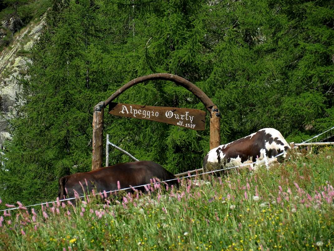
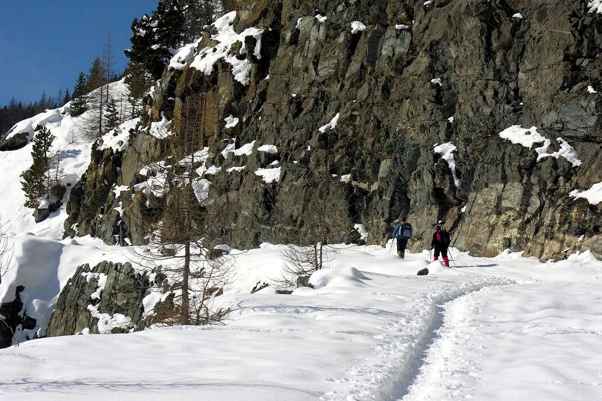
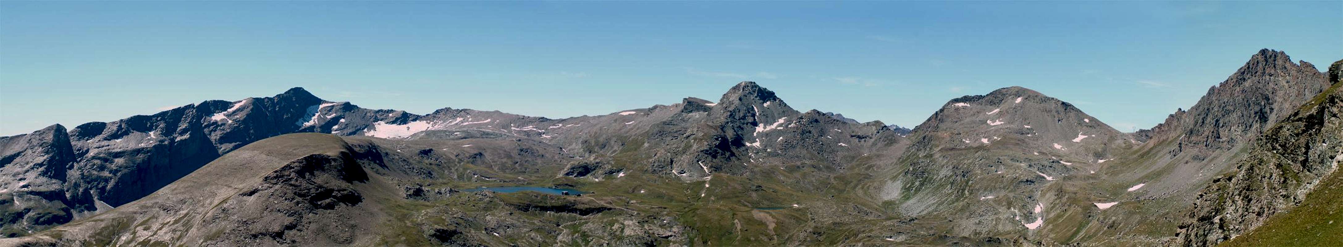
Throughout the Valley of Champorcher are only two shelters, but they can use the same four. The two, typical of this area, are those of Dondena, just upstream of the homonym Village and that of Miserin at Lake and Sanctuary of the same name. But the other two, given the proximity, take you to the Valoon of the Lakes over Champdepraz with Refuge Barbustel at Lake Bianco (White) and the Vallon of Urtier with Refuge "Sogno di Berdze" (Dream of the Shepherd) at the Alp of Péradza, just below the Finestra (Window) of Champorcher. The first is reached, entering the Natural Park of Monte Avic, bypassing the Colle del Lago Bianco and with a small slope, the second allows an easy connection with both the Miserin that with Dondena Village. Both are heavily used by hikers for their trekkings or just to small crossings. It is also possible to reach the new Refuge Borroz Rotary Upper Comba Tersiva, but here the distances increase greatly. All the walloons of the district have a substantial number of pastures whereas pastoralism is widespread both cows with sheep and goats, but it is well to recall that the same are private and mostly closed in winter. No pets emergencies and certainly not the common use, because the same belong to private property. Even the Shrines, like that of Santa Anna in the North or the Re Tempio (King Temple) in Southeast, allow the visit, but not hospitalization. Conversely areas frequented are already somewhat limited in the summer season, given the length of the approach, while in winter the white snow and the great silences mastered the entire valley. Except in the area of Larìs at the Gran Cimetta where they feel the "rings" joy of skiers and theRoyal Route that leads to Dondena, where you practice the Ski-Mountaineering and are all the rage Snowshoeing. For the rest here only dominates Him, "Grandfather Winter", which in the bad season here is repaired by placing its white blankets between the Rosa dei Banchi and Mont Glacier, waiting to see arriving from the Plain of the Po of the Wind Spring, will return to re-dye the entire valley of a bright green.
 |
 |
 |
 |
 |
bIn tutta la Valle di Champorcher esiston due soli rifugi, ma la stessa ne può utilizzare quattro. I due, propri di questo territorio, son quelli di Dondena, appena a monte dello omonimo Villaggio, e quello del Miserin presso il Lago e Santuario con lo stesso nome. Ma altri due, vista la vicinanza, permettono d'accedere al Vallone dei Laghi sopra Champdepraz con il Rifugio Barbustel presso il Lago Bianco ed al Vallone di Urtier con il Rifugio "Sogno di Berdzé" (Sogno del Pastore) presso l'Alpe di Peradzà, appena al di sotto della Finestra di Champorcher. Il primo si raggiunge, entrando nel Parco Naturale del Monte Avic,scavalcando il Colle del Lago Bianco e con una breve discesa, il secondo permette un facile collegamento sia con il Miserino che con Dondena. Entrambi sono molto utilizzati dagli Escursionisti per i loro trekkings o semplicemente per piccole traversate. Inoltre é possibile raggiungere il nuovo Rifugio Borroz del Rotary nell'Alta comba Tersiva, ma qui le distanze aumentano notevolmente. Tutti i valloni del circondario possiedono un notevole numero di alpeggi considerando che la pastorizia é molto diffusa sia con mucche che con pecore e capre, ma é bene qui ricordare che i medesimi sono privati e per la maggior parte chiusi anche in inverno. Sono ammesse esclusivamente le emergenze e non certamente l'utilizzo comune, poiché i medesimi appartengono a proprietà private. Anche i Santuari, come quello di Santa Anna a Settentrione o di Re Tempio a Sudest, permettono la visita, ma non il ricovero. Per contro le zone frequentate sono alquanto limitate già con la bella stagione, vista la lunghezza degli avvicinamenti, mentre d'inverno il bianco della neve ed i grandi silenzi padroneggiano l'intera vallata. Tranne che nella zona del Larìs presso la Gran Cimetta dalla quale si senton provenir "squilli" di gioia degli sciatori e sulla Strada Reale che porta a Dondena, dove si pratica lo Sci-Alpinismo e van di moda le Racchette da neve. Per il resto qui domina solo Lui, Nonno Inverno, che nella cattiva stagione qui si ripara adagiando le sue coltri bianche tra la Rosa dei Banchi ed il Mont Glacier, in attesa di vedere arrivare dalla Pianura del Po il Vento della Primavera, che tornerà a tingere nuovamente l'intera valle d'un verde smagliante.
All its Vallons
 |
 |
VALLEYS & VALLONS In order to deploy clockwise from the Low Valley (Bard & Pont-Bozet Commons) towards Champorcher & Dondena Hamlets.
- 1) - la Cavanna (1.644m), Celleras Alp (1.976m) Vallera (2.377m) in Southeast, Dondogna (2.389m) and Valbella (2.550m) in Southwest Passes, with paths-traces. From Fontana to Mialet (1.544m) and Grand Lavassey Alps
- 2) - Lavere Pass (2.203m), without path; from Creton, Grand Derby (1.747m) Pastures to
- 3) - Eastern Corni (2.546m) Pass, with path and traces in final part. From Barmé Alp (1.923m) to
- 4) - Fricolla (2.542m) Pass, path and traces, and
- 5) - Brouillet (2.450m) Pass, without.
Manda Vallon (Pont Bozet):
- 1) - from Pont Bozet, Cotetta/Barmafumo, Verney (1.298m), la Frete, Low, Upper Bozet (1.573m) Hamlets; from these in Southeast to
- 2) - Secco, Nero (1.940m) and Champas Lochs, with paths. From Nero in Southeast, Lavere Pond to
- 3) - Lavere Pass, without. From Champas, nearby Alp, in South to
- 4) - Cornuto (2.412m) Lake, near Forest Rangers Cabine and Brouillet Pass, Fricolla Pass and Point (2.676m), traces on short crest. From Bataille in South Chanton, La Manda (2.003m) Alpages to
- 5) - Chenessy (2.383m) Lake, with traces;
- 6) - in North-northwest Mount Digny (2.145m), small path. From Mont Digny to Southwest
- 7) - Mont Giavin (2.431m), through path-traces on small easy crest.
Legna Vallon:
- 1) - from Outre l'E(y)ve, Porte Alp (1.344m), Montaz Pasture (1.497m), Ourty Alp (1.507m), alternative to Sant'Antoine (1.831m), Chenessy Pastures (2.051m), Peroisa Alp (2.184m) Alp, Chilett Alp (2.351m) and Lake (2.324m); in South
- 2) - Orti Pass (2.524m), with path-traces. In Southwest
- 3) - Santanel Pass (2.463m) to Santanel Lake, with path, respectively to Chiusella Valley-Pianprato Valleys in Piedmont.
![Vallone della Legna]()
Vercoche Vallon:
- 1) - from Ourty, Vercoche Alps (1.879m), Lake (2.202m), Laris Hill (2.581m), paths; to
- 2) - Pic Molère (2.638m), by crest.
Laris Vallon: from Chardonney (1.455m) in South Pian di Greus, Prarion Alp (1.796m), fork Low Prarion, Low and Upper Laris Alpages (1.950m) after in Southeast Larissa Loch (2.489m) and Hill (2.581m). From this:
- 1) - Bec or Pic Mol(l)ère by easy Southwest Crest or
- 2) - to ake Reale (2.449m) in Piedmont, with paths. Alternative: from Dondena (2.097m), Shelter (2.200m), Cimetta Rossa (2.466m) to Larissa Loch, by dirt road.
Banchi Vallon:
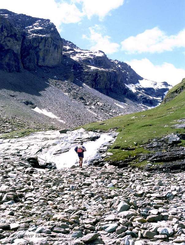
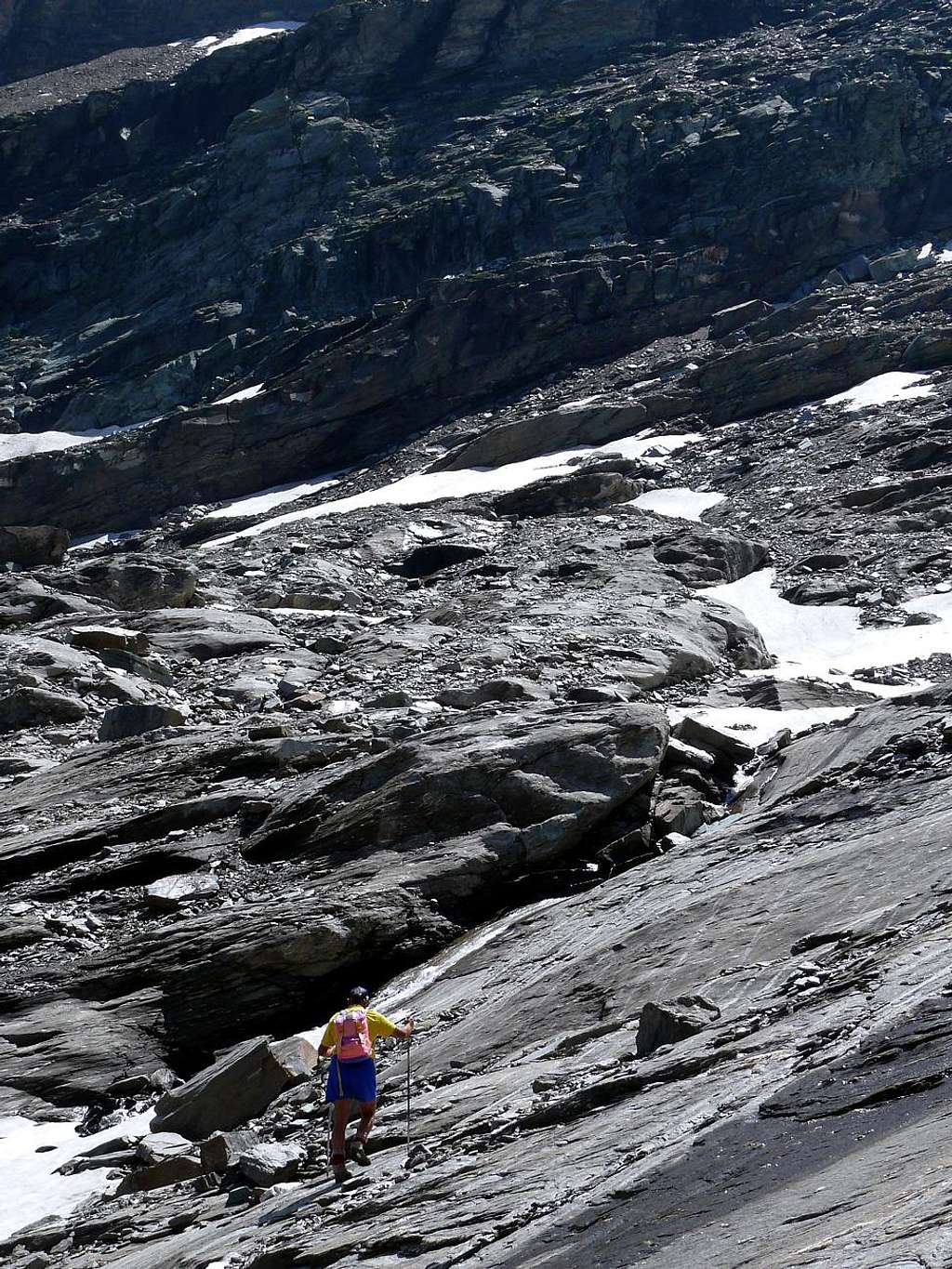
- from Dondena in South, Shelter, Pian di Roche Alp (2.238m), with path, Rosa Pass (2.957m), through morainic traces Rosa Glacier.
Miserin Vallon: from Dondena, Shelter, to Miserin Refuge, Sanctuary, Lake (2.578m), through dirt road. From thys
- 1) - in East Mount Rasciàs (2.784m), with traces,
- 2) - in South Rosa Pass, small path and traces,
- 3) - in Sout-soutwest Balma Pass (2.941m), traces;
- 4) - in West Cima di Peradzà (3.021m) or Saddle 2.946 meters, between Peradzà and Bec Costazza (3.092m), by traces on morainic slopes and easy debris crests. Western Side Fenêtre de Champorcher Vallon: from Dondena, Shelter, fork 2.526 meters, between Blanc (2.527m) and Noir (2.551m) Lochs, with dirt road, fork 2.592 meters to Fenetre Pass (2.826m) and descent to Sogno di Berdzé Refuge (2.531m), near Peradzà Alp, in Urtier Walloon, with paths.
Pontonnet Vallon: from Dondena in West, fork 2.526 meters, Pontonnet Lake (2.702m), Fénis Hill (2.857m), Pontonnet Hill (2.897m), with paths. Northern Side Glacier Vallon: from Dondena in West-northwest, bridge 2.334 meters up Ayasse Torrent to fork 2.800 meters and in Northeast small saddle before Lago Gelato (2.824m); from this
- 1) - in Northwest Col Fussì (2.912m), with paths and descent to Upper Comba Tersiva-Clavalité-Fénis Vallon.
- 2) - In Northeast Great Shoulder (3.003m) and Mount Glacier (3.186m), with path, traces and easy rocks on crest of final part.
Gias(s)et Vallon: from Dondena, in Northeast Giaset Alp (2.155m) and Loch (2.308m), with path; from this in North Gran Rossa Pass (2.766m) to Gran Lago, through traces. In East path to Giaset Hill (about 2.400m) and
- 1) - Western Bec Raty (2.417m), by traces or Lake (2.283m), with path.
Raty Vallon: from parking about 1.800 meters on Dondena's Royal Road, alternative 1.920 meters around, Sapy Alp (1.979m), Raty Lake (2.283m), with path. From thys
- 1) - in North Gran Rossa (2.866m); in Northeast Bocon Damon (2.792m), both through traces and easy rocks in terminal crests.
Vernouille-Muffé Vallons: from Champorcher-Château (1.427m), Arbussey, Mont Blanc, La Cort Villages, la Grand Cort Alp (1.944m):
- 1) - in Northwest Alp and Lake Vernouille (2.145m), with path, to Tête des Hommes (2.614m), through moraine and easy rocks; in North Alp and Lake Muffé (2.019m), Lake Bianco or Croix Hills to Barbustel Refuge in Champdepraz Walloon, with paths.
- 2) - from the last hill in East Cima Piana (2.512m), by path under West Crest;
- 3) - in Southeast Cima Piana Hill (around 2.300m), with path. From Lake Muffé in East Cima Perche (2.396m), with path.
Terra Rossa Vallon: from la Grand Cort in East Terra Rossa Hill (2.075m) and from la Cort Arcomy Hill, Point (1.952m, 1.991m), paths. Others small more to the Northeast: from Mellier (1.293m), Petit Rosier (1.444m) Hamlets to Possoneil or Possoueil Hill (1.842m), with path; from Petit and Grand Rosier (1.452m) Villages or from la Place (1.020m) to Santa Anna Oratory (1.706m), near Plan Fenêtre Hill (1.775m), with paths.
40 and more Walks Excursions & Climbings recommended
 |
2) - Re Tempio Chapel (1.474m): Excursion with path before in South-southeast to Crest di Sotto (1.061m; Lower) Pastures; after to the Southeast, crossing Echellier Bois (Wood) and Brenve Torrent towards Larsine Pasture (about 1.380m). Finally through very tight switchbacks on the trail at the terminal part (E/F; 2h'15/2h'30).
3/3bis) - "Five Lochs Tour" into the Manda (z) or Amanda vallon (2.176m) or to Punta di Chenessy (2.630m): Excursion before with path in Southwest to Bozet di Sopra (1.573m; Upper) Alpage and following fork about 1.600 meters; after in Southesat crossing the forest to the entrance in a small walloon, between Bec Chaty and Grand Bec, always with path to Lago Secco or Lac Sec (1.750m; Dry) immediately under the Betasson Alp (1.833m), Lago Nero (1.943m; Black); after with short return to previous small fork and with path to the West Lac de Champas just before the homonym Alp (1.928m, 1.967m). From this last, without path and along the torrent towards the two ramification of the same:
a) - in Southwest to Chenessy Lake (2.384m), below Chenessy Ridge and Point
b) - In Southeast to Cornuto or Cornouy Lake (2.413m), near Forest Rangers Bivouac and below Punta della Fricolla (EE/F; 4h'00/4h'45). Also
3bis) - Climbing from Mandaz Alp (2.004m) (*** reached from Champas Lake and Alp with crossing from previous routes or directly in walloon floor passing Bozet (1.759m) and Chanton (1.859m) Pastures) by enough easy East-northeast Face and North Crest in final to Punta di Chenessy also towards Manda Pass (about 2.385/90 meters) and by North-northeast Crest in terminal part (two enough exposed steps) (EE/A/F+/PD-; 2h'15/2h'30)
4) - Fricolla Pass or Col de l'Alleigne (2.550m; "Tours of Three Vallons"): Excursion pathless and through traces into the moraines in South from Cornouy Lake to Brouillet Pass (2.450m); after through a brief descent with traces in adiacent Brenve Vallon above Alp Breuil (2.090m). Finally by Eastern Slope, with traces, to pass with. Moreover possibility of descent in Legna's Vallon towards Chenessy and Peroisa Alps, Case Nuove Sant' Antonio Pastures and Outre l'Eve Village (EE/F; 3h'45/4h'15).
5) - Mont Digny (2.145m): Excursion from Pont-Bozet/Delivret Village with path to Bozet di Sopra (1.573m); after in Northwest by path in East Slope (E/F; 2h'45/3h'00).
6) - Outre l'Eve (1.299m) to Punta di Vòrea (2.554m): Excursion-Climbing with path before in South-southwest to Ourthy (1.507m) Pastures, after in South to Saint Antoine Case Nuove (1.833m; New Homes). From this three possibilities:
 |
 |
 |
 |
 |
a) - along a small torrent between steep moraines in West towards Vorea Carving (around 2.455/60 meters) and by North-northeast Crest with steps from II° to III° (Normal Via; A/PD/PD+/AD-; 3h'45/4h'5 Outre l'Eve 0h'30 from carving). Or
b) - through less steep moraines in Southwest at the base of East-northeast Spur with climbing (steps from I°+ to II°/II°+/III°-) on edge of the ridge (A/PD/PD+/AD/AD+; 2h'15/2h'45). Also,
c) - continue from Sant'Antonio Case Nuove to Peroisa Alp (2.184m); leaving left the path to Chiletto Lake go in a small and narrow vallon reaching the South-southwester Ridge at a typical pinnacle shaped cannon. With te same, climbing enough easy on the thread, to Summit (A/F+; 2h'15/2h'45 Peroisa; better route for the descent).
7/8) - Outre l'Eve towards Chilétt or Vercoche Lochs: Excursion with path in Southwest towards Ourthy (1.507m) Alp; from the following fork
a) - in South to Legna's Vallon up to the Lac de Chilet (létt) or Chiletto (2.394m; EE/F; 2h'45/3h'15), below Santanel Hill and Monte Nero. In Southwest to
b) - in Southwest to Vercoche or Vercoce Walloon up to the two homonym Lakes (2.202m, 2.215m) and overhanging Mulère small Loch (2.316m), below Pointe Vòrea and Ridge (2.394m; EE/F; 2h'30/3h'00).
9) - Lake Vercoche to Bec Mollère or Pic Mulère (2.641m): Excursion-Climbing in Southwest from lake through a small path amongst moraines to Larìs Eastern Hill (2.581m); from this through Southwestern Slope to a small West Shoulder and finally by short Southwest Crest (an exposed step) to Top (EE/A/F/F+; 1h'30/1h'45 lake).
10) - Chardonney Village (1.455m) towards "Cimetta Rossa" Upper Station: Excursion from Chardonney in South with path in Larìs Vallon towards Chariou (1.620m), Prarion (1.730m), Larìs Désott and Damon Alps (1.845m, 1.949m); from this to Cimetta Rossa (2.466m) at the end of Upper Station of the Chair lift (E/F; 2h'30/3h'00).
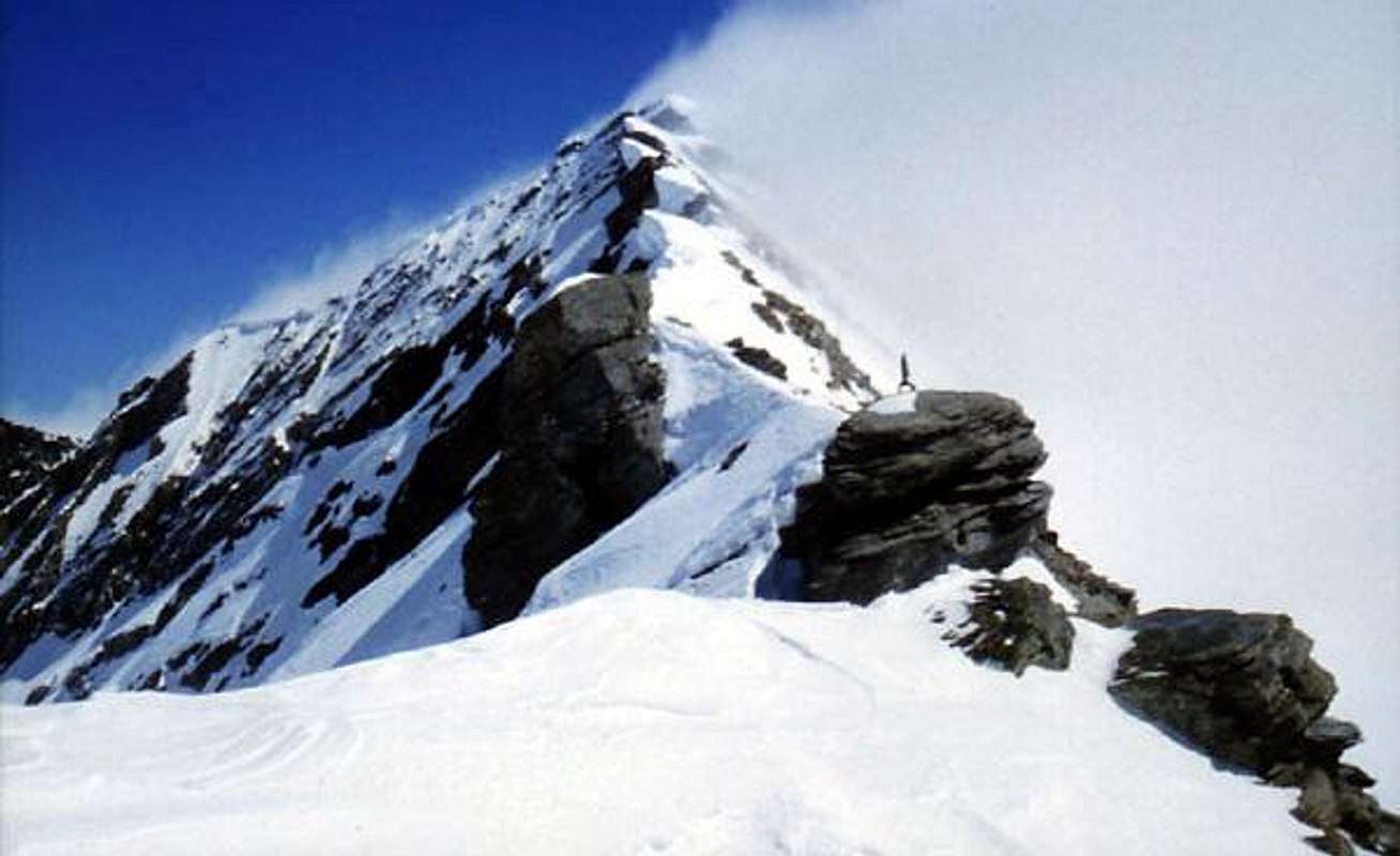
11/11bis) - Dondena towards Rosa dei Banchi (3.164m): Excursion-Climbing before with dirt road in South, after path in Southeast to Bocchetta del Marmo Bianco (2.901m), Cime Beccher (2.940m, 2.973m, 3.038m), Cima delle Fontane (3.084m) and by North Ridge in final part (EE/A; 2h'30/3h'00). Also from Miserin Refuge to Rosa dei Banchi: Excursion-Climbing before with dirt road in South, after path in Southeast to Colle della Rosa (2.958m) and by Western Ridge in final part (EE/A; 2h'30/3h'00)
 |
 |
 |
 |
 |
12/12bis) - Dondena or Dondena Refuge (2.097, 2.193) towards Miserin Lake, Refuge and Sanctuary (2.588m): Walk-Excursion with path in West-southwest towards Alp Chilà (2.427m), below Mont de Dondena (2.543m) and, crossing two secondaries torrents, to Miserin Lake, Refuge and Sanctuary "Notre Dame des Neiges" (E; 1h'00/1h'10). Or, always with same departures, through dirt road in West to fork about 2.375/80m, just before Lago Nero, and to the South in final part (T; 1h'30/1h'45).
13) - Dondena or Refuge (2.097m, 2.193) to Punta dell'Asgelas (3.021m): Excursion-Climbing with path in South-southwest to Colle della Balma (2.936m); from this, through West-northwest Ridge and crossing small Giuseppe Corona Point (2.991m), to Punta dell'Asgelas (EE/A/PD-/PD+; 2h'30/2h'45 Miserin; 3h'15/3h'45 Dondena).
14/14bis) - Dondena or Dondena Refuge (2.097m, 2.193) to Cima di Peradzà (3.021m): Excursion with path in South-southwest to Colle della Balma (2.936m) and by East-southeast Ridge. Also
14bis) - from torrent under Lac Gelé (2.782m) to Saddle 2.946 meters; from this to Cima di Peradzà through Northeast Crest (E/F; 1h'40/2h'00).
15) - Miserin Refuge (2.588m) to Bec Costazza (3.092m): Excursion with path in South-southwest into the Vallon floor through steep moraines and amongst characteristic rocky bands in terminal part towards Saddle (2.946m). From this through Southern Ridge, bypassing various altitudes (3.025m the most important; numerous small cairns), to carving 2.983 meters. Or just in West more easily under the edge of the ridge through a discontinuous traces amongst the more broken rocks. From carving through an evidente track amongst boulders on South-southwestern Slope to Top (EE/A/F+; 2h'10/2h'30). Easy but long traverse, in descent better under the thread.
16) - Dondena or Dondena Refuge to Truc del Lago (2.703m): Walk-Excursion with path before in West-southwest to Miserin Lake, Refuge and Sanctuary "Notre Dame des Neiges" (2.588m); after in Southwest to Truc del Lago (2.703m), splendid photographic point view on a promontory under the Bec Costazza (T/E; 1h'45/2h'00).
 |
 |
 |
 |
 |
17) - Dondena or Dondena Refuge to Bec Costazza (3.092m): Excursion-Climbing with path before in West-southwest to Miserin Lake, Refuge and Sanctuary (2.588m); after through small path and traces to grassy-rocky shoulder (2.841m) and by Eastern Crest (a delicate step) in final part (A/F+/PD-; 3h'45 Dondena; 2h'00/2h'15 Miserin).
18) - Dondena or Refuge to Lakes Bianco e Nero (2.527m, 2.551m): Walk with path in West to two lakes, immediately under the Miserin Lake (T; 1h'00/1h'15).
19) - Dondena or Dondena Refuge to Tour Ponton (3.101m): Excursion with path in West to Lake Bianco (2.527m) and by East-northeast Slope (E; 3h'15/3h'45).
20) - Dondena or Dondena Refuge or from Miserin Shelter to Punta Tersiva (3.515m): Excursion-Climbing with path in West to Lake Bianco (2.527m) and Fénis/Pontonnet Hills (2.857m, 2.897m). From the last, near and over an ancient small hunting shelter, to begin by Southeast Ridge to a first or Southeast Pontonnet Towers (3.174m; yellow signs); with short descent to carving 3.148 meters. Continuing and passing an Ante Summit (3.161m) reach the Northwestern Top (3.185m); after a down hill to following notch (3.085m) and through various altitudes (3.171m, 3.145m) reach "La Raye" (3.457m), great shoulder on south-southeast Ridge, and in short time to Punta Tersiva (A/F+/PD/PD+; 5h'30/6h'30 from Dondena; 4h'15/5h'0 from Miserin Shelter). Not difficult but delicate climbing with various exposed steps on rotten rocks.
21) - Dondena or Dondena Refuge to Moussaillon Pass and Tour (2.847, 3.072m): Excursion-Climbing with path in West towards the small bridge in altitude 2.334 meters, up Ayasse Torrent; from this with path in Northwest to alternative around 2.545 meters. From hill, after a short descent through path in North to Moussaillon Pond (2.766m) and following traverse on steep moraines of Northern Slope, just below East-northeast Ridge. A delicate step to the right in final part (A/F+/PD-; 4h'15/4h'45).
 |
 |
 |
 |
 |
22) - Dondena or Refuge to Mont Delà (3.139m): Excursion-Climbing with path in West towards the small bridge in altitude 2.334 meters, up Ayasse Torrent; from this with path in Northwest to a first alternative around 2.545 meters. Leaving left the path to Moussaillon Pass, continue North to fork (about 2.800 meters); abandoning the following traverse in Northeast to Mont Glacier, climb on South grassy-rocky Slope up to the watershed (delicate in final part). To finish on easy West Crest (A/F+/PD-; 4h'00/4h'30).
23) - Dondena or Dondena Refuge to Mont Glacier (3.186m): Excursion-Climbing with path in West towards the small bridge 2.334m on Ayasse Torrent; continue to fork around 2.800 meters reaching in Northeast the large saddle before Lago Gelato (2.824m). With semi circular way before through small path into the moraines in Northeast after by traces, passing below Fussì Hill and Southwestern Face, climb on Great Shoulder (3.003m); from this by easy Southern Crest to Summit (EE/A/F/F+; 3h'30/4h'00). 24/24bis/24 ter) - from Dondena towards Gran Rossa also traverse to Giasset and Raty Lochs: Walk from upper parking in soil briefly continue by dirt road in Northeast to Giasset Alp (2.155m); through a small path between grassy and various small springs reach in short time the Giasset Loch (2.308m; T; 1h'00/1h'15), under the homonym hill. 24bis) - From this Excursion-Climbing, through small traces in grassy and moraines in North, towards Gran Rossa Eastern Pass (2.766m), through numerous boulders and rocky bends in final part; from pass by Western Crest (corniches in spring) to Gran Rossa West Ante Summit and Top (about 2.858 meters, 2.865/6m; EE/A; 2h'45/3h'15). Also Excursion-crossing
24ter) - from lake with path in East to Giasset Hill (about 2.400 metres) and
a) - easily through traces to Western Bec Raty (2.417m) or
b) - by diagonal path down hill to Raty Lake (2.283m), immediately under the three Becs Raty into the homonym valley (E; 1h'10/1h'20, equally for both choices).
25/25bis) - Becs Raty or Boccon Damon (2.792m): from parking about 1.800 meters on Dondena's Royal Road, with dirt road towards the alternative 1.920 meters around up to the Sapy Alp (1.979m); from this through path in Northwest towards Raty Lake (2.283m), below three Raty Becs. From thys
a) - in South to Becs Raty (2.417m) by Northern Slope and crossing on the edge of the ridge. also
b) - in Northeast towards Boccon Damon (2.792m), through traces and easy rocks in terminal short West Crest.
26/26bis) - Lac Vernouille or towards Tête des Hommes (2.614m):
 |
 |
 |
 |
 |
26) - Walk-Excursion from parking in soil about 1.800 meters on Dondena "Chemin du Roi", with dirt road towards the la Cort Pasture (1.944m); from this through path in Northwest towards Vernouille Alpage (2.119m) and nearby Lake (2.143m; E/F; 1h'30/2h'00). Also Excursion-Climbing.
26bis) - from crossroads near Alp Vernouille in Northwest through moraines and boulders towards the Southeast Slope, by the same and East-northeast Crest in terminal part to Summit ( EE/A/F+; 1h'30/1h'45 from Vernouille Alp; EE/A/F+; 3h'15/3h'45 from parking on dirt road before la Cort small Village).
27) - Lac Muffé and Lago Bianco Hill towards Barbustel Shelter(2.209m): Walk-Excursion from parking in soil about 1.800 meters on Dondena "Royal Road", with dirt road towards the la Cort Pasture (1.944m); from this through path in North towards Alp and Lake Muffé (2.019m); from this always with path in North to Lago Bianco Hill (2.308m). From this through short down hill in north-northwest to Barbustel Refuge (2.209m) in Champdepraz Vallon (T/E/F; 1h'30/1h'45 from parking before la Cort).
28) - Col de la Croix to Cima Piana (2.512m): Excursion from la Cort towards Lac Muffé with previous route; continue up to the fork (2.287m); from the last hill in East Cima Piana, by easy path under West Crest (E/F; 2h'30/2h'45 parking la Cort).
29/29bis) - la Grand Cort to Terra Rossa East Hill (2.075m) or Arcomy Hill and Point (1.952m, 1.991m): Excursion la Grand Cort (1.944m) with path in East-northeast towards Terra Rossa Eastern Hill; or
29bis) - continue, same path but more to the East, towards Arcomy Hill and nearby Point (1.952m, 1.991m) (E/F; 2h'00/2h'15 la Cort).
30) - Sainte Anne Oratory (1.706m): Walk or Excursion from Petit and Grand Rosier (1.452m) Villages also from la Place (1.020m) Hamlet with paths in Northeast also North to Santa Anna Oratory, between Bec de Nona (1.917m) and Plan Fenêtre Hill (1.775m) (T/F; 1h'00/1h'15 from Grand Rosier or Petit Rosier; 2h'00/2h'30 from la Place).
 |
 |
 |
 |
 |
Campings
Remember that free camping is forbidden (except for emergency reasons, over 2.500m, from darkness until dawn).Mountain Conditions
- You can get meteo information at the official site of the Regione Valle d'Aosta:
- Valle d'Aosta Meteo
Books and Maps
BOOKS:- "Guida delle Alpi Occidentali" di Giovanni Bobba e Luigi Vaccarone C.A.I. Sezione di Torino Volume II (parte II), 25 Maggio 1896.
- "Guida dei Monti d'Italia–Emilius Rosa dei Banchi Parco del Mont Avic" di Giulio Berutto e Lino Fornelli-Club Alpino Italiano/Touring Club Italiano, Marzo 2005 (in Italian).
- "I Rifugi della Valle d'Aosta" di Stefano Ardito, Ed. Guide iter, Febbraio 2003.
- "Guida della Regione Autonoma Valle d'Aosta" di Mario Aldrovandi; Ed. S.P.E. di Carlo Fanton, Torino 1964.
 |
 |
 |
 |
|
- Enrico Editore Ivrea-Aosta "Gruppo del Gran Paradiso" 1:50.000.
- I.G.C. Istituto Geografico Centrale Torino "Ivrea Biella e Bassa Valle d’Aosta" (n° 9), 1:50.000.
- L'Escursionista "Valle di Cogne Carta dei Sentieri" 1:25.000.
Important Information
- REGIONE AUTONOMA VALLE D'AOSTA the official site.
- FONDAZIONE MONTAGNA SICURA Villa Cameron, località Villard de la Palud n° 1 Courmayeur (AO) Tel: 39 0165 897602 - Fax: 39 0165 897647.
- SOCIETA' GUIDE ALPINE DI COGNE Tel. 347/9473526 – 328/1373728.
- A.I.NE.VA. (Associazione Interregionale Neve e Valanghe).
Useful Numbers
- Protezione Civile Valdostana località Aeroporto n° 7/A Saint Christophe (Ao) Tel. 0165-238222.
- Bollettino Meteo (weather info) Tel. 0165-44113.
- Unità Operativa di Soccorso Sanitario Tel. 118.