


-
 4892 Hits
-
 80.49% Score
-
 12 Votes
|
|
Area/Range |
|---|---|
|
|
45.71650°N / 6.94437°E |
|
|
Hiking, Mountaineering |
|
|
Spring, Summer, Fall, Winter |
|
|
4728 ft / 1441 m |
|
|
Note
La montagna chiama i suoi figli, ed essi rispondono fedelmente al suo appello… Osvaldo Cardellina, Diario alpinistico, 1964-65 Page texts: @ OsvaldoCardellina "Osva", passed away on May 2, 2022. Page owners: Christian Cardellina e Osvaldo Cardellina. Any updates from September 12, 2022: Antonio Giani, page administrator, friend and climbing companion. Testi della pagina: @ OsvaldoCardellina "Osva", scomparso il 2 maggio 2022. Proprietari pagina: Christian Cardellina e Osvaldo Cardellina. Eventuali aggiornamenti dal 12 settembre 2022: Antonio Giani, amministratore della pagina, amico e compagno di salite. |
Skiing Overview
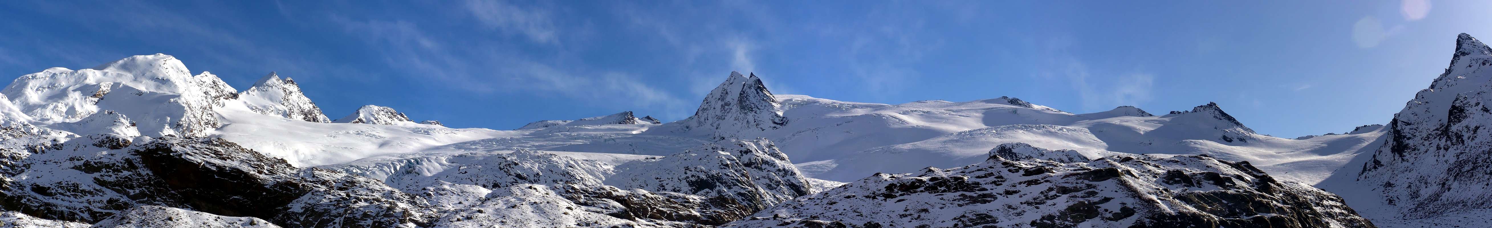
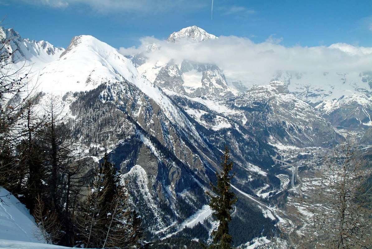
La Thuile Valley is one of the thirteen most important valleys of the Valley of Aosta. Located between the Valley of Aosta and Valley of the River Isère in France, bordering to the East with the parallel Valgrisenche Valley, stretches over 12 km from Pré Saint Didier Municipality, in the Central Valley of the River Dora Baltea, to its Southern end of the Big Summit with high Testa del Rutor (3.486m). The other valleys, starting from the East and clockwise are: Champorcher, Cogne, Valsavarenche, Rhêmes, Valgrisenche. Those on the right orographic and hydrographic or South, while to the North will have the Valleys of Ferret and Veny, at the foot of Mount Blanc Mountain Chain, Valley of the Great Saint Bernard near the Basin By, Valpelline, the Valley of Torrent Marmore or Valtournanche at the top of which stands the Matterhorn and the two valleys of Monte Rosa, or valleys Ayas and Gressoney. We also have other valleys which, because of their length and extension, such as those of Champdepraz (Vallon of the Lochs), Fénis-Clavalité and Saint Marcel (Hunting Reserve Turati's), should be treated as such and not like a simple and exclusive vallons.
Presents fifties more or less important Summits, as many hills and glaciers, but mostly unspoiled Nature, who will return even more so after. Is a place "In" more for the Ski that for Mountaineering, there are a great plant; is a place for lovers of real mountain, one that does not have stupid Indian file for ascents, except for the Testa del Rutor. Its most important peaks are on his Eastern side the Testa (Head) of Rutor and other peaks of height between 3.200 and 3.250 meters (Château Blanc, Doravidi, Flambeau) to Planaval Pass preceding Subgroup Mont Paramont (3.301m) and Mont Colmet (3.024m) up to Testa d'Arpy (2.022m), above Morgex Common. While in the West we have the chain that the Rutor unfolds, after Becca du Lac (3.405m), towards Punta Loydon (3.147m) and the Grande Assaly (3.172/4m); here with a "round arch" reaches the three Monts Fréduaz (2.933m), the Mont Valaisan (2.891m) and the Little Saint Bernard Hill (2.188m), at the height of the eponymous vallon that borders the Tarentaise in France. More to the North of this, a series of parallel valleys (Tormotta, Breuil, Chavannes, Orgères, Bellefaçe, Youlaz, Plan Praz) down parallel forming a hemi circle from Southwest to Northeast reaching Mont Crammont (2.732m) above Pré Saint Didier Common and now at the entrance of the valley. A valley that extends like a great tree from North to South reaching the Hamlet of La Joux (1.646m) at the foot of the three beautiful waterfalls underlying the great Glaciers of Rutor, below Deffeyes Refuge (2.500m); then Westwards to Little Saint Bernard, reaching the same before the Villages la Rosière (1.808m) Séez (984m) into the Tarentaise Region at the beginning of Val d'Isère, by about 28 Km Little St. Bernard. So he has seen, over the centuries, go to the Little St. Bernard Salassians, Romans, Armed French, Spanish, Russian, Austrian, even (?) Napoleon Bonaparte. This is the "La Thuile" ... or the valley of the "tile".
 |
La Valle di La Thuile é una delle tredici valli tra le più importanti della Valle di Aosta. Situata tra la medesima e la Valle del Fiume Isère in Francia e confinante con la parallela Valle di Valgrisenche ad Est, si allunga per oltre 12 Km dal Comune di Pré Saint Didier, presso la Valle Centrale del Fiume Dora Baltea, fino alla sua estremità Meridionale con l'abbastanza alta Testa del Tutor (3.486 m). Le altre Valli, partendo da Est ed in senso orario, sono: Champorcher, Cogne, Valsavarenche, Rhêmes, Valgrisenche. Queste sul lato orografico ed idrografico destro o Meridionale, mentre su quello Settentrionale avremo le Valli di Vény e Ferret, ai piedi del Monte Bianco, la Valle del Gran San Bernardo con vicino la Conca di By, la Valpelline, la Valle del Fiume Marmore o Valtournanche al cui sommo si eleva il Monte Cervino e le due valli del Monte Rosa, ovvero Ayas e Gressoney. Inoltre abbiamo altre valli che, per lunghezza ed estensione, come quelle di Champdepraz, Fénis-Clavalité e Saint Marcel, dovrebbero essere considerate tali e non semplici valloni.Presenta una cinquantina di Cime più o meno importanti, altrettanti colli e numerosi ghiacciai, ma soprattutto Natura incontaminata. Risulta località "In" più per lo Sci che per l'Alpinismo, esistendo un'eccezionale impiantistica; é posto per gli amatori della vera montagna, quella che non presenta stupide file indiane per le ascensioni, tranne che per il Rutor. Le sue cime più importanti sul suo lato Orientale sono la Testa del Rutor ed altre cime d'altezza tra i 3.200 ed i 3.250 metri (Château Blanc, Doravidi, Flambeau) fino al Passo di Planaval precedente il Sottogruppo del Mont Paramont (3.301 m) e del Mont Colmet (3.024m) fino alla Testa d'Arpy (2.022m), al di sopra di Morgex. Mentre ad Occidente abbiamo la Catena che dal Rutor si dispiega, dopo la Becca du Lac (3.405m), verso la Punta Loydon (3.147 m) e la Grande Assaly (3.172/4 m); qui con un "giro ad arco" raggiunge i tre Monts Fréduaz (2.933 m), il Mont Valaisan (2.891 m) ed il Passo del Piccolo (2.188 m), al colmo dell'omonimo vallone confinante con la Tarentaise in Francia. Più a Nord di questo, una serie di valloni paralleli (Tormotta, Breuil, Chavannes, Orgères, Bellefaçe, Youlaz, Plan Praz) scendono paralleli formando un semicerchio da Sudovest verso Nordest che arriva al Mont Crammont (2.732m), sopra Pré Saint Didier ed ormai all'imbocco. Una valle che s'allarga come grand'albero da Settentrione verso Meridione raggiungendo La Joux (1.646 m), ai piedi delle tre belle cascate sottostanti i Ghiacciai del Rutor ed al Rifugio Deffeyes (2.500 m); indi ad Ovest verso il Col du Petit Saint Bernard, raggiungendolo prima della discesa verso i Villaggi di la Rosière (1.808 m) e Séez (984 m), all'interno della Regione della Tarentaise ed all'inizio della Val d'Isère, dopo all'incirca 28 Km dal valico. Sta Valle, ha visto, nei secoli, passar pel Piccolo, Salassi, Romani, Armate Francesi, Russe, Austriache Spagnole e pur (?) Napoleone Bonaparte, il Grande Corso. Si tratta della "Valthuile" ... ovvero la valle della "tegola".
![]()
![]()
![]()
![]()
![]()
La Thuile, the ancient Roman Ariolica, was famous in a past not too far away, as well as for transit through the Col Piccolo San Bernardo, for its coal mines used in Aosta in Steel Mill National Cogne SpA, succeeded in 1927 to Ansaldo of Genoa; also was known for the extraction of stone slabs used for the construction of roofs, whence the name Thuile from French tuile (see Mont Thuilette). Regarding the Vallon of "Piccolo", to signal that it led the Roman Road to Gaul, who crossed the bridge Pont Serrand, the oldest in the entire valley. On this street are transited Armies every nation by Hannibal, Julius Caesar, Vitellius with the XIV° Legion, Septimius Severus and Caligula, who, fascinated, here wanted to build a city; but never by Napoleon that held in high regard this step. Transits more "sensational" are those of the King of Burgundians Gundikar with more than 80.000 men, San Pietro II° Bishop of Tarentaise, Umberto Biancamano, Godfrey of Buglione, Duke Carlo Emanuele I°, Prince Tommaso Savoy's, the Army of Henry IV° and the Generals Huguette, Mauroy, Moreau, Duhesmes and Suvarow, at the head of armies that ranged from 5.000 to 15.000 troops, even with 5.000 horses.
La Thuile, antica Ariolica romana, era famosa in un passato neppur troppo remoto, oltre che pei transiti dal Colle del Piccolo San Bernardo, per le sue miniere di carbone utilizzato in Aosta nell'Acciaieria Nazionale Cogne S.p.A, succeduta nel 1927 all'Ansaldo di Genova; inoltre rinomata per l'estrazione delle lose usate per la costruzione dei tetti, donde il nome Thuile dal francese tuile (vedi Mont Thuilette). Per quanto concerne il Vallone del Piccolo, da segnalare che ad esso conduceva la Strada Romana per le Gallie, oltrepassante il ponte di Pont Serrand, il più antico dell'intera valle. Su questa via sono transitate Armate d'ogni Nazione da Annibale a Giulio Cesare, Vitellio con la XIV° Legione, Settimo Severo e Caligola, che, affascinato, qui voleva edificarvi una città; ma mai da Napoleone che però teneva in gran considerazione questo passaggio. I transiti più "clamorosi" son quelli del Re dei Burgundi Gundikar con più di 80.000 uomini, da San Pietro II° Vescovo di Tarantasia a Umberto Biancamano, Goffredo di Buglione, il Duca Carlo Emanuele I°, il Principe Tommaso, l'Esercito di Enrico IV° e vari Generali alla testa di Eserciti che variavano da 5.000 a 15.000 soldati, con anche 5.000 cavalli.
Getting There
BY CAR:
- From TORINO, MILANO, etc: Motorway A5. Exit at Morgex Municipality. From IVREA Town to Villeneuve, Arvier, Pré Saint Didier Municipalities.
- From Pré Saint Didier to La Thuile & Little Saint Bernard Valleys From Pré Saint Didier (1.010m), with State Road, to La Thuile Valley: Elévaz, Balme Villages, La Thuile Commune, (1.441m); from this to Little Saint Bernard Vallon towards the Little Saint Bernard Hill (2.188m), through State Road. To Albert Deffeyes Refuge (2.500m) with muletrack-path from La Joux Hamlet (1.646m).
- From FRANCE: through the Mont Blanc Tunnel to Entrèves-crossroads to Vény/Ferret Valleys of Courmayeur. By Little Saint Bernard Pass, closed since November until half May to La Thuile Valley - Pré Saint Didier. t is not necessary to take Motorway A5: you can drive on SS.26, in the direction of AOSTA - IVREA - TURIN.
BY PLANE:
- Aeroporto "Corrado Gex" Saint Christophe (Aosta).
La Thuile & Little St. Bernard All small Valley
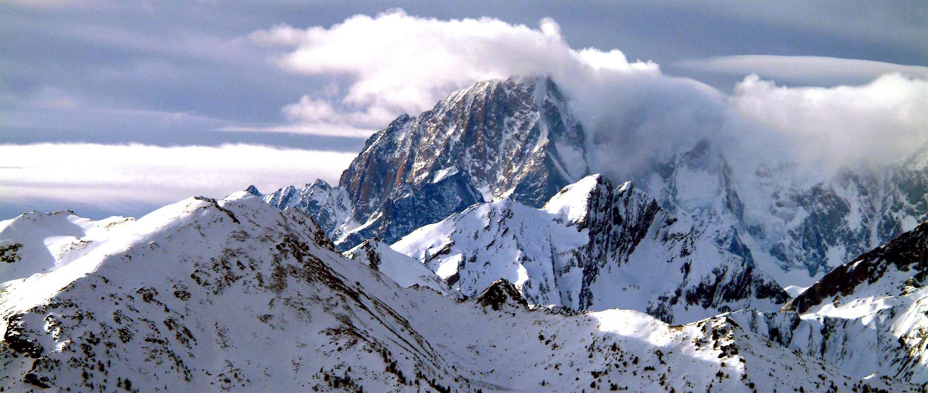
On the opposite side of watershed with the Valgrisenche, the ridge down from the Head of Rutor reaching Point Loydon and immediately below the Grand'Assaly, pivot towards the West. Leaving down on this side of the Tarenteise at the entrance of Val d'Isère, stretches towards the small Chain of the three Mounts Fréduaz and Mount Valaisan before Little Saint Bernard Pass, the ancient gateway to both nations. Entire border is marked by the ruins of the Second World War with small forts, natural shelters, trenches protected by netting and it happened at the Mont Charve, to find the remains of bullets and bombs exploded, and even black rubber gas masks worn by now. Farther, another small but long subgroup, with jagged peaks and little-known, reaches Pointe Léchaud and the Col de la Seigne. Department walloons descend to the East originating Subgroup of Mont Berrio Blanc and moving toward La Thuile and its surroundings, until you reach the Mont Crammont, above the Municipality of Pré Saint Didier. em>After rises Mont Blanc, but it is quite another History ...
VALLEYS & VALLONS In order to deploy clockwise from La Thuile Valley/Little Saint Bernard Vallon to Seigne Hill in La Lex Blanche Vallon
Ru(i)tor Basin: from Refuge to wide Ruitor Lakes and Glaciers to
1) - Planaval Pass (3.016m) in East with path, moraine snowfields and Flambeau Glacier in final part;
2) - to Doravidi Pass (3.309m) crossing Ruitor Glacier to South-southeast.
3) - To Château Blanc Pass (3.266m) same route, but more to South;
4) - to Ruitor Pass (3.373m), near Deffeyes Cabine again more to South.
5) -Saint Grat Pass (3.285m) to Southwest;
6) - Becca du Lac Pass (3.336m) to west-souhwest.
7) - Noeud des Vedettes (3.285m) to West;
8) - Invernet Pass (3.221m) to Northwest.
9) - Loydon Southeastern Pass (3.089m) to West-northwest;
10) - Loydon Northwestern Pass (2.923m) to West.
11) - Assaly Pass (3.002m) towards Northwest. *** All those routes throuhg Glacier of Ruitor; the same require prudence, experience for the transit on glaciers and proper equipment with rope.
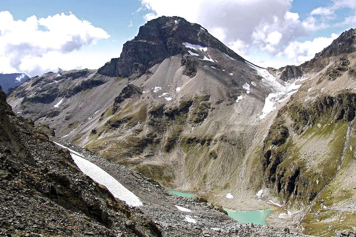
Bellecombe Vallon: from fork about 2.150 meters to West, small bridge 2197 meters up Ruitor Torrent, with good path towards Bellecombe Eastern and Western Lakes (2.379m); between these
1) - in South Tachuy five Lochs (2.550m, 2.569m the most) and Hill (2.673m), with small path and through traces into stony ground
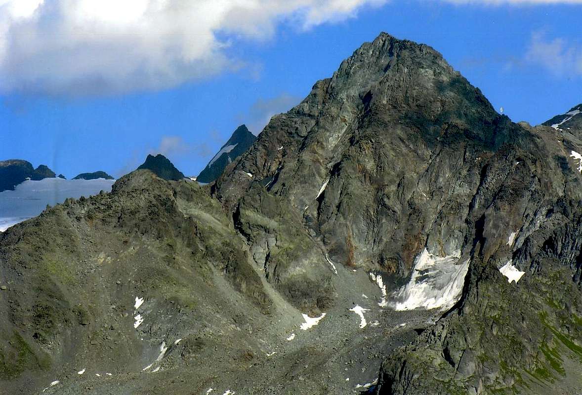
2) - Mount Charve (2.927m), by easy rocky East Crest in final part. In West-southwest
3) - tiny loch to Lex Blanche Hill (2.570m), with small path.
4) - In Northwest towards Lakes de Bellecombe (2.631m) and Serre Hill (2.705m); in North traverse, with scarce traces into the grassy slope or moraines
5) - to three Monts Fréduaz (2.909m, 2.933m, 2.932m), without path and easy rocky ridge in final.
Combes Sozin-Thuilette: from small bridge 2.120 meters after third waterfall to
1) - Comba Sozin Low Lake (2.081m); traverse
2) - to Comba Thuilette and hill nearby quota 2.368 meters to Ponteilles Alp (2.060m).
3) - From hill in West Mont Thuilette (2.428m), through East Crest, or under the same, with short amusing rocky steps; from this
4) - easy crossing on ridge and descent to Upper-Middle Lochs (2.609m, 2.227m), by moraines.
Ponteilles Vallon: from La Joux
1) - to Maisonnettes Pasture (1.894m), Ponteilles Alp (2.060m), with path;
2) - from alp in Southwest to Maisonnettes various ponds. From those in Northwest
3) - Bella Valletta Saddle (about 2.700m), Bella Valletta (2.811m), with traces; from saddle in Southwest
4) - Mount Valaisan (2.891m), through Northeast easy Crest (caution with snow).
5) - From Bella Valletta in North traverse to Belvedere Hill (2.568m), with path and traces also
6) - from quota 2.731 meters on ridge descent in Northeast to Plan of Suches/Ponteilles Alp, through paths.
Belvedere Vallon: from La Suche (2.084m) to just upper La Suche de Cantamont with private dirt road towards Bedalla and Suche Tablelands; leaving South the route towards Bella Valletta or to adjacent Ponteilles Vallon (yellow wooden signal), with the same continue West on walloon floor up to the Belvedere Hill. From this easily with minuscule path more to the West or through the same dirt road on Southern Slope towards Mont Belvedere (2.641m), at the end of watershed and just above the Lower Lac of Verney (2.088m), neighbor the Little Saint Bernard Hill (2.188m). ![]()

Little Saint Bernard Vallon: & surroundings Verney-Tormotta Vallon: from Verney Lake (2.088m), Upper Verney Lake (2.280m), Torveraz Pasture, Saddle about 2.550 meters below Pointe Rousse, Tormotta(z) Lakes (2.486m).
1) - in Westo to Arguerey Pass;
2) - in Northwest to Veys Pass (2.984m), without path and through moraine.
Breuil Vallon: from main road Little Saint Bernard winding 1.861 meters to alternative 1.838 meters before Chaz Pontaille (nice small bridge up Lake Torrent), Chanté Pastures (1.993m), Plan Veyle (2.080m), Biolettaz Alp, Entre deux Eaux Pastures (2.333m), Crotti Alp (2.520m) to
1) - Echelles des Chavannes or East Bassa Serra Hill (2.737m); from this in North
2) - descent to Chavannes Vallon, through path-traces on moraine with farm road to Pont Serrand-La Thuile Resort. In Northwest
3) - to Léchaud Point (2.973m), with moraines and broken rocks on Southeast easy Slope.
Chavannes Vallon:
1) - from fork 1.602 meters before Pont Serrand Village (parking near fountain), Orgères Pastures (1.884m), Monquet Alp, Clos Prevot Alpages, Low Berrio Blanc Pastures, Chavannes d'en Bas, Chavannes d'en Haut Pastures (2.424m); from this to
2) - Chavannes Hill (2.603m). In South to
3) - Lochs of Chavannes Glacier, Bassa Serra Western, Eastern Hills or Echelles des Chavannes and Point (about 2.850m, 2.838m, 2.737m), with path-traces. In South-southwest to
4) - Léchaud Point, path, crossing Chavannes Glacier by rotten rocks easily on Southeast Slope. In Southwest to
5) - Mount Léchaud, through Northeast Crest (a delicate passage of II°-). In North
6) - from Upper Chavannes Pastures to Mount Fortin Lochs, Point (2.758m), with paths and final blocks, near ex-Shelters Major Sonza.
7) - To East Berrio Blanc Pass, high traverse through path.
Orgères Vallon: from Orgères Village (1.884m), along Orgères Torrent, passing Pond du Vallon of Orgères to Orgères Pass (2.708m), with path.
Youlaz Vallon: from Balme-Sainte Marie Madeleine (1.309m), Alpages Low Arp and Peson (1.871m), Mayen de la Youlaz Pasture (2.035m), Youlaz Lac nearby Shelter Maggiore Reggiani to
1) - Youlaz Hill (2.661m);
2) - Arp Hill (2.570m), paths with traverse and upper connection of the same.
Crammont Vallon: from Miatay (1.868m), Plan Praz Alp (2.099m) to
1) - Mount Crammont (2.737m), steep path on East Slope and Tête of Grand Mount (2.749m), through easy, short traverse on rocky Northeast Crest (carving of I°+); to
2) - Mount or Becca de Nona (2.106m), with path.
Sul lato opposto della Valgrisenche lo spartiacque discende dalla Testa del Rutor raggiungendo la Punta Loydon e subito appresso la Grand'Assaly, vero e proprio perno verso Occidente. Lasciando in basso su questo versante la Tarenteise all'imbocco della Valdisère, s'allunga verso la piccola Catena dei tre Fréduaz ed il Mont Valaisan anticipando il Colle del Piccolo San Bernardo, antica porta d'ingresso per ambo le nazioni. Tutto il confine é segnato dai resti della Seconda Guerra Mondiale con fortini, rifugi naturali, trinceramenti protetti da reticolato e ci é capitato, presso il Mont Charve, di ritrovarne resti con proiettili e bombe esplose, nonché persino nere maschere anti gas in gomma ormai usurata. Oltre, un altro piccolo ma lungo sottogruppo, con cime frastagliate e misconosciute, raggiunge la Punta Léchaud ed il Colle della Seigne. Grandi valloni si rivolgono ad Oriente originando il Sottogruppo del Berrio Blanc indirizzandosi verso La Thuile ed il suo circondario, sin a raggiungere il Mont Crammont, sopra al Comune di Pré Saint Didier. Dopo s'eleva il Monte Bianco, ma é tutta 'n'altra Storia ...
A dozen easy Walks & Hiking even by Snowshoes
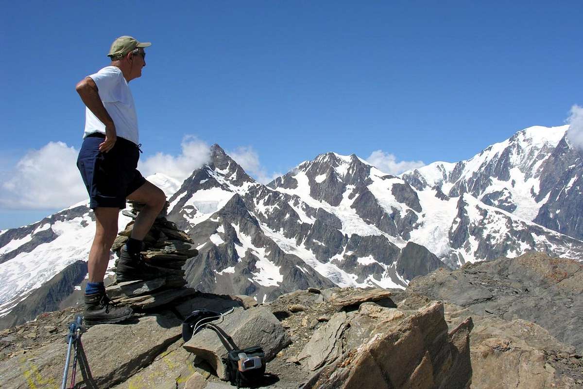
The analysis of this last great valley does not differ much from the previous ones. The Valley La Thuile can certainly be regarded as a queen among those orographic Southern about downhill skiing; In fact, a "domaine skiable" huge stretches over the Tourist Village Les Suches to connect also in La Rosière in Haute Tarentaise. With regard to the Eastern side, we recommend that the ascent to the Refuge Albert Deffeyes, or towards East Ussellettes Lochs, the beginning of the great glaciers that Rutor certainly not suited to this discipline. Then we go to "seek his fortune" on the opposite side, or in those great spaces that stretch from the Great Assaly (3.174m) towards the North-northwest in the direction of Valaisan and the Little Saint Bernard Hill; further and further to the North of the same long parallel vallons are directed towards Pointe Léchaud (3.127m) and Mont Berio Blanc (3.252m), but in winter are very exposed to avalanches. We prefer to avoid sending them back, if anything, to hiking in summer. Instead, we "fall back" on the Vallons Bellecombe and Tachuy with their beautiful lakes and in the wild of Ponteilles from Les Suches door to the crest watershed Belvedere/Bella Valletta/Mount Valaisan. The small range of Fréduazs (2.938m) stands between these two areas just mentioned above. Many are the routes so-called "minimum" and some basic ones that lend themselves to multiple variants; the ascent to the Mont Valaisan can be considered as Exceptional Via, both the length (not excessive in relation to Bella Valletta) for problem situations that can be reserved at the end in case of snow. A trip in itself can be considered as immediately a separate entrance to the Vallon of Crammont (2.737m) or of Praz.
La Thuile, adjacent to Valdisère/Haute Tarentaise (France), Veny Valley-La Lex Blanche Vallon, Arpy Basin and Valgrisenche. It reaches from La Rosière (1.808m) through Little Saint Bernard Hill (2.188m). From Pré Saint Didier (1.017m) or Morgex (920m) Municipslities through San Carlo Hill (1.960m). From La Thuile Municipality (1.484m) to La Joux (1.646m) or to La Suche Resort (2.145m); also to Village Tourist Center Little St. Bernard.
![]()
![]()
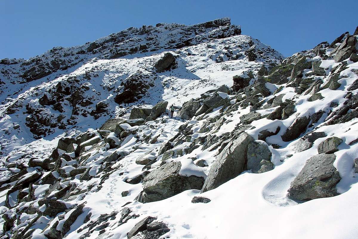
From La Suche de Cantamont Resort to Mont Crammont Important Note: by snowshoes on average doubling the time of route and raise a grade about to the difficulties.
1) - n° 1: from La Thuile, with State Road of Little Saint Bernard towards the alternatives 1.972 meters on Main Road (below Tête de Tsargian 2.708m) and 1.990 meters (to Combemar and "Fourclaz Express" ski lift) metres, where completely reversing direction with a long East straight to Les Suches de Cantamont Resort (2.145m; stone fountain near a small parking). From this, through dirt road in Southwest, passing under three ski lifts and abandoning North the little watershed Terre Noire (2.419m)/Chaz-Duraz (2.579m), to third fork 2.402 meters, neighbor the arrival of "Argillen Express". Continue on dirt private road, discarding left another, up to the following cross in Bedalla Tableland (2.465m; yellow signal); leaving Southwest the road to Fourclaz (2.486m), Mont Belvedere Hill and Summit (2.568m, 2.641m), through path decisively in South with short descent to subsequent vallon floor in Suche Tableland; tourning East through a diagonal ramp and doubling a rocky small buttress enter into a following Ponteilles Vallon, in the upper part. Changing direction completely again and the trail turns into a good military muletrack, reached a more steep section of debris-blocks (possibility snow presence) will gradually go below the ridge. Continuing to the South and crossing two altitudes (2.731m, 2.710m) reaches a grassy-rocky small shoulder (2.767m) and immediately after Bella Valletta Summit (2.811m) with small and occulted bunkers, above Ponteilles Vallon (F; 3h'00/3h'15). ![]()
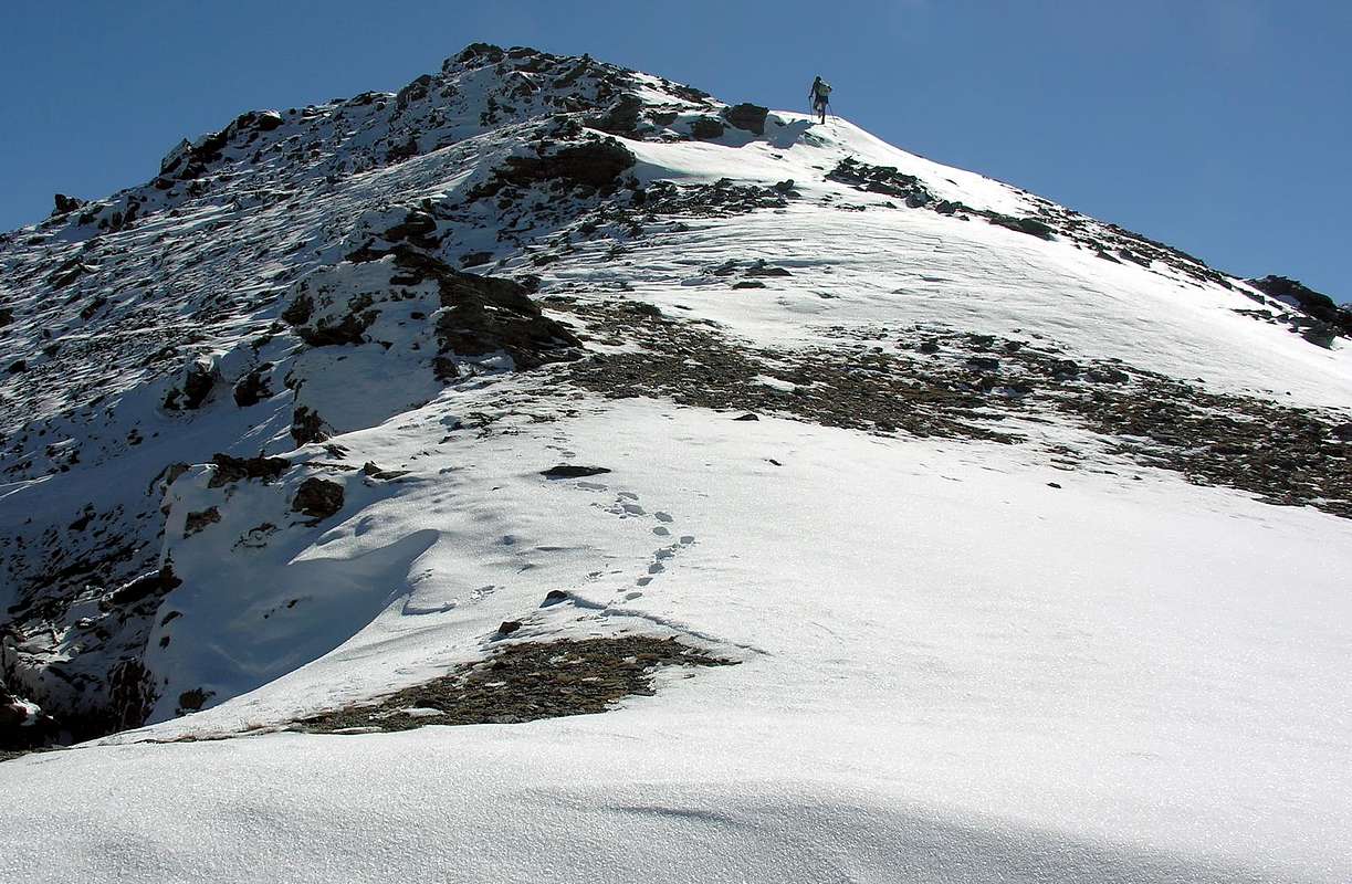
2) - n° 2: from La Suche de Cantamont towards Bedalla Tableland and following Bella Valletta through preceding route; from this, with easy, short descent, to following large Saddle (2.743m). Bending progressively West and, always through military muletrack just under the crest and crossing amongst various boulders, to terminal part on Eastern Slope. Here the trail becomes narrow and steep path and, passing near a bunker, with a short crossing to the South goes over a tiny rocky-grassy promontory; continue through a small rocky spur reaching the conclusive part. Generally, the route ends on the Southeast Ridge (signal output at the Top), which descends the Grand Glacier Pass (2.809m; alternative route through traverse from previous saddle and crossing on Mont Valaisan Glacier with numerous dangerous crevasses in Northern border) below Western Mont Fréduaz or Pointe de la Louie Blanche (2.932m). But in high snow presence (sometimes the rocks are covered with big sticks of ice) should bypass the small turret final with a delicate crossing on the Northern Slope and, finally, to Mont Valaisan (2.891m; F+; 4h'00/4h'15 Les Suches).
5) - n° 6: from La Joux and following parking (1.646m, 1.603m; triple signals no passage on three different dirt roads; restaurant) continue South-southeast through muletrack Alta Via number 2 along Ruitor Torrent and towards First Rutor Waterfall (about 1.700 meters), Parcet (1.770m), Plan Fruitier (1.820m around; source; "Belvedere" just above in Southwest) Pastures, Second and Third Waterfall (1.996m) to subsequent double forks (2.108m; from a mini narrowing with signals, in West to Bellecombe Vallon and two magnificent Lakes; 2.197m; in South, with more small path, to Seracs Lake 2.387m). Leaving the two last and from the first cross go East to Alpage du Glacier neighbor the homonym Lake (2.158m, source; 2.140m) and, through semicircular route to Rutor Alp and just following Albert Deffeyes Refuge (2.500m; near fork towards Ussellettes Vallon, continuing on Alta Via; M-; 3h'00/3h'15).
7) - n° 8 and n° 9: from the junction of two Belle Combe Lakes, tourning decisively South through a small path, to various splendid Tachuy Lochs (2.550m, 2.569m), between Grande Assaly/Mont Favre (F; 3h'15/3h'30 La Joux). Variant n° 9: from Belle Combe Lakes continue West-southwest through small path on vallon floor to easy La Lex Blanche Hill (2.570m), between Serre Pass (2.705m)/Tête du Charvet (2.742m; F; 3h'15/3h'30 from La Joux).
10) - n° 13 (dirt road/paths): up to here (Mialey) with a ride on the private road off to the West through two isolated and unnamed Pastures (1.405m, 1.533m) and through the Alps Combembey (1.506m); after a subsequent winding road and through a shortcut to Maisonnettes. From this two possibilities:
1) - dirt road in West to Chanton Alp;
2) - directly through path to Mialey Alp (E/F; a quarter hour more or less, depending on the route chosen).
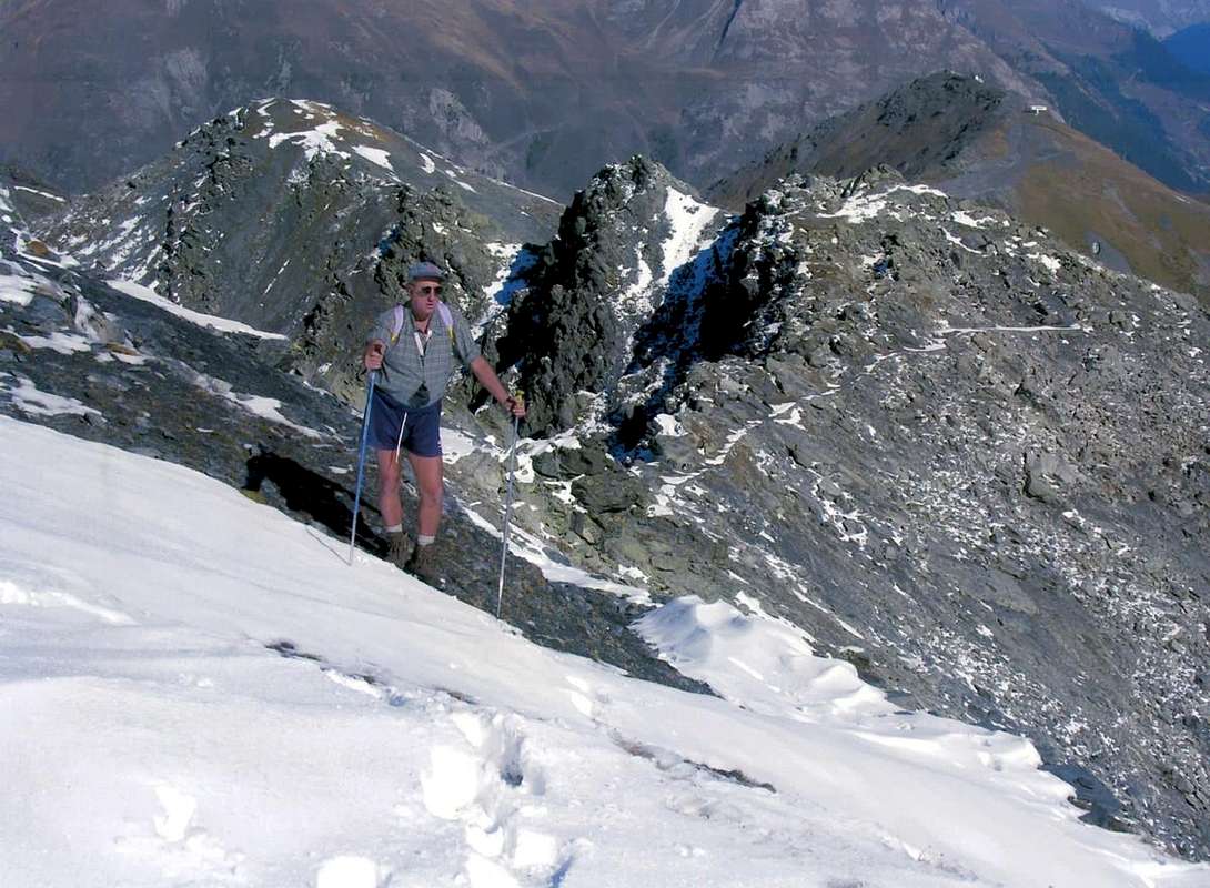
L'analisi di quest'ultima grande vallata non si discosta di molto dalle precedenti. La Valle di La Thuile può essere indubbiamente considerata quale regina, tra quelle orograficamente parlando Meridionali, riguardo lo sci di discesa; infatti un "domaine skiable" enorme s'estende al di sopra del Villaggio Turistico di Les Suches per collegarsi anche a La Rosière nella Haute Tarentaise. Per quanto concerne il lato più Orientale, consigliamo la sola salita al Rifugio Deffeyes all'inizio dei grandi Ghiacciai del Rutor, o ai Laghetti nel Vallone des Ussellettes ad Oriente del medesimo. Andiamo quindi a "cercar fortuna" sul lato opposto, ovvero in quei grandi spazi che dalla Grande Assaly si protendono verso Nord-nordovest in direzione del Mont Valaisan e del Colle del Piccolo San Bernardo; oltre ed ancora più a Nord del medesimo lunghi valloni paralleli s'indirizzano verso la Punta Léchaud e Mont Berio Blanc ma, in inverno, son alquanto esposti a valanghe. Preferiamo evitarli demandandoli, semmai, all'Escursionismo estivo. Noi invece "ripieghiamo" sui Valloni di Bellecombe e Tachuy coi loro splendidi laghi, in quello selvaggio di Ponteilles e nell'area che da Les Suches porta verso la cresta spartiacque Monte Belvedere/Bella Valletta/Mont Valaisan. La piccola catena dei tre Fréduazs si frappone tra queste due zone appena sopr'indicate. Molti sono i percorsi di base che si prestano a molteplici varianti; la sola salita al Mont Valaisan può essere considerata quale leggermente più impegnativa, sia per la lunghezza (non eccessiva rispetto a Bella Valletta) che per le situazioni problematiche riservabili alla parte finale in caso di neve alta. Una gita a se stante può essere considerata quella nel Vallone del Crammont o di Praz, proprio all'ingresso della valle.
![]()
Campings
Remember that free camping is forbidden (except for emergency reasons, over 2.500m, from darkness until dawn).
Mountain Condition
- You can get meteo information at the official site of the Regione Valle d'Aosta:
- Valle d'Aosta Meteo
- Meteo: You can find more weather information on the website 3B Meteo:
- La Thuile
Books and Maps
BOOKS:
- "Guida delle Alpi Occidentali", di Giovanni Bobba e Luigi Vaccarone C.A.I. Sezione di Torino Volume II (parte II), 25 Maggio 1896.
- "Monte Bianco Valdigne" di Alessio e Giuseppe Nebbia, Ed. Musumeci, (1989).
- "La Thuile e dintorni" di Giuseppe Alliod, Ed. G. Alliod (1994).
- "Rifugi e bivacchi in Valle d'Aosta", di Cosimo Zappelli aggiornata da Pietro Giglio, Musumeci Editore.
- "I Rifugi della Valle d'Aosta" di Stefano Ardito, Ed. Guide iter, Febbraio 2003.
- "Guida della Regione Autonoma Valle d'Aosta" di Mario Aldrovandi, Ed. S.P.E. di Carlo Fanton, Torino 31 Dicembre 1964.
- "Guida dei Monti d'Italia–Alpi Graie Centrali" di Alessandro Giorgetta - Club Alpino Italiano/Touring Club Italiano, 1985 (in Italian).
- "Valdigne gli itinerari escursionistici", di Alessandro Giorgetta, Ed. Zanichelli, Giugno 1981.
- "La Thuile" di Giuseppe Alliod, Ed. Musumeci (1989).
 |
 |
 |
 |
MAPS:
- Kompass "Gran Paradiso Valle d'Aosta Sentieri e Rifugi", Carta turistica 1:50.000.
- L'Escursionista "La Thuile-Piccolo San Bernardo", (carta n° 2) 1:25.000.
- A.I.A.T. La Thuile, "La Thuile Pianta dei Sentieri", 2004 (Plastico).
- Carta Comunità Montana "Valdigne e Mont Blanc Les Sentiers", 2001 1:50.000.
- I.G.C. Istituto Geografico Centrale "Il Parco Nazionale del Gran Paradiso", 1:50.000.
- I.G.C. Istituto Geografico Centrale Torino "Monte Bianco-Courmayeur-Chamonix M.B.-La Thuile", (carta n° 107), 1:25.000.
- Studio F.M.B. "Monte Bianco-Mont Blanc", Bologna 1988 1:50.000.
Important Information
- REGIONE AUTONOMA VALLE D'AOSTA the official site.
- FONDAZIONE MONTAGNA SICURA Villa Cameron, località Villard de la Palud n° 1 Courmayeur (AO) Tel: 39 0165 897602 - Fax: 39 0165 897647.
- COMPAGNIE DES GUIDES RUTOR Fraz. Entrèves tel/fax 0039.0165.885574 e-mail Guidealpine@lathuile.it
- A.I.NE.VA. (Associazione Interregionale Neve e Valanghe).
Useful numbers
- Protezione Civile Valdostana località Aeroporto n° 7/A Saint Christophe (Ao) Tel. 0165-238222.
- Bollettino Meteo (weather info) Tel. 0165-44113.
- Unità Operativa di Soccorso Sanitario Tel. 118.