


-
 2100 Hits
-
 79.04% Score
-
 10 Votes
|
|
Area/Range |
|---|---|
|
|
45.59900°N / 7.49794°E |
|
|
Hiking, Mountaineering, Trad Climbing |
|
|
Spring, Summer, Fall, Winter |
|
|
10965 ft / 3342 m |
|
|
Note
La montagna chiama i suoi figli, ed essi rispondono fedelmente al suo appello… Osvaldo Cardellina, Diario alpinistico, 1964-65 Page texts: @ OsvaldoCardellina "Osva", passed away on May 2, 2022. Page owners: Christian Cardellina e Osvaldo Cardellina. Any updates from September 12, 2022: Antonio Giani, page administrator, friend and climbing companion. Testi della pagina: @ OsvaldoCardellina "Osva", scomparso il 2 maggio 2022. Proprietari pagina: Christian Cardellina e Osvaldo Cardellina. Eventuali aggiornamenti dal 12 settembre 2022: Antonio Giani, amministratore della pagina, amico e compagno di salite. |
Knock Overview
 |
 |
 |
 |
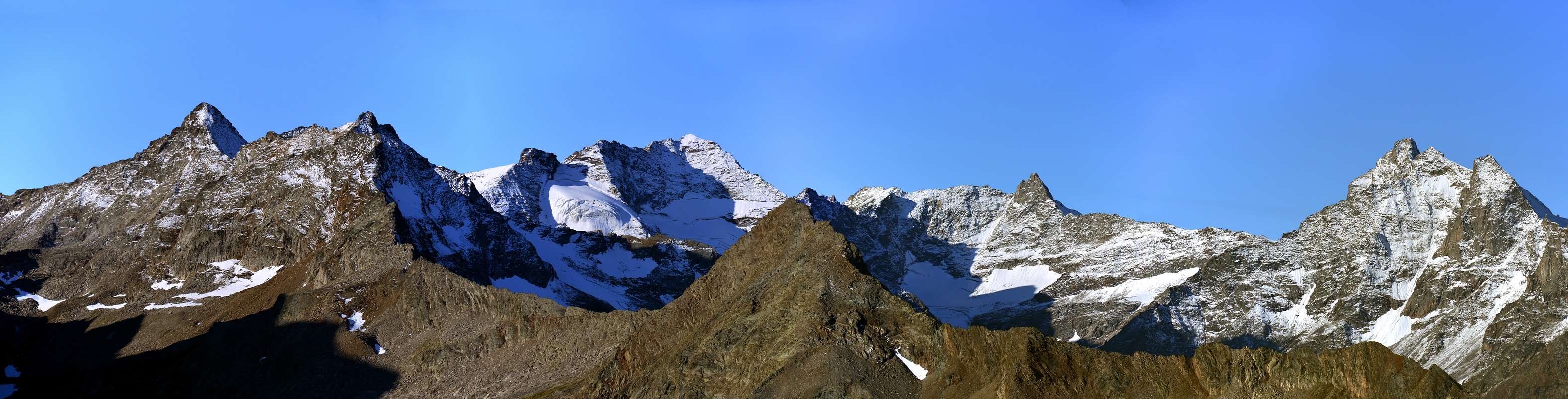
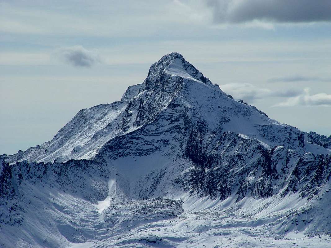
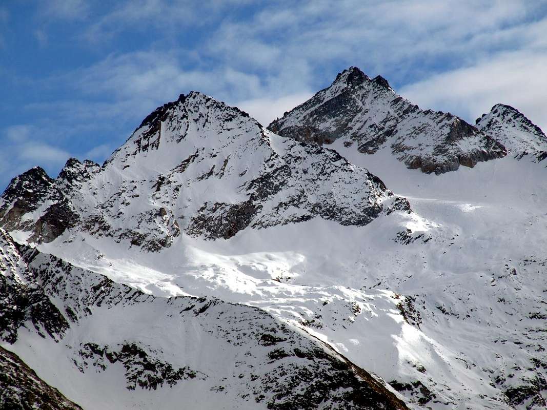
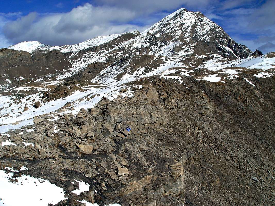
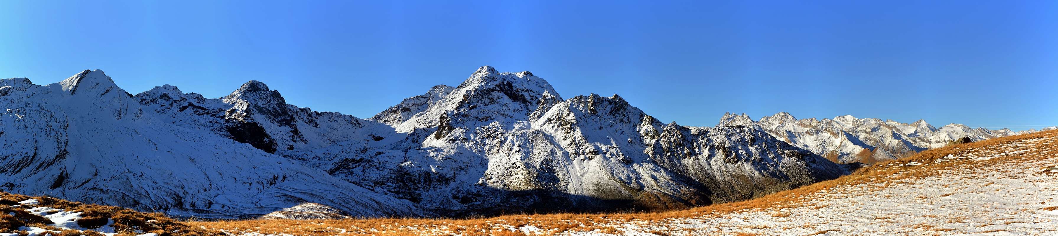
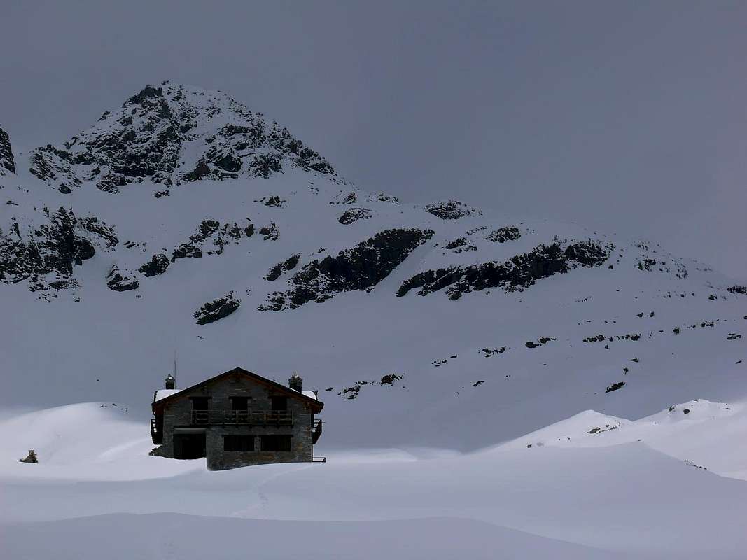
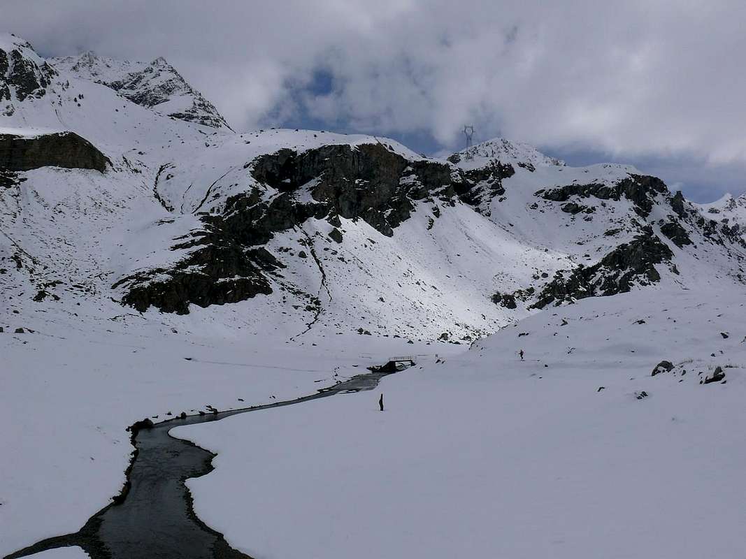
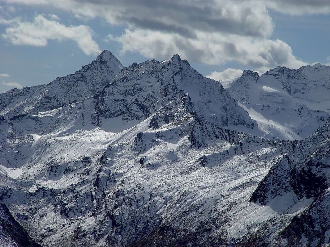
Questo vallone segna il confine Orientale della Valle di Cogne. Là dove si svolgeva nei tempi remoti la vita di questa vallata vivendo lassù nella località del Crest. Questo largo ed esteso vallone, quasi una valle, che si apre a guisa di grande ventaglio trova la sua estremità Orientale al Col Pontonnet (2.897 m) ed alla contigua Finestra di Champorcher (2.826 m), al confine con la Valle di Champorcher, ma il suo vertice culmina nella Grande Arolla (3.342 m) al confine con l'attigua Valeille. Nel suo sviluppo circolare viene contrassegnata da importanti piramidi come la Punta Tersiva (3.515 m) e la Torre di Lavina (3.308 m), prima di raggiungere il Colle di Bardoney ((2.833 m) precedente la Grande Arolla. Tra la Finestra di Champorcher e questo ultimo si dispiegano i tre importanti Valloni di Miserino, Acque Rosse, Bardoney, tutti ormai rivolti al vicino Piemonte. Partendo dalla Frazione di Lillaz all'entrata del Vallone dell'Urtier, e continuando in senso orario, percorrendo questo lungo e frequentato vallone che conduce al Rifugio "Sogno di Berdzé", ai piedi della Fenêtre de Champorcher. Il medesimo viene percorso da una strada poderale, non sempre percorribile, che raggiunge gli Alpeggi di Goilles Damon, Tsavanis e Manda; diverse biforcazioni partono dalle medesima e precisamente: dal bivio 2.280 metri circa ad Ovest-nordovest verso gli Alpeggi di Gueula di Sotto e di Sopra, Seutse e Taveronna, ai piedi dello spartiacque discendente dal Penne Blanche. Da quello 2.363 metri verso Sudest all'Alpe Broillot o Broillat. Il successivo parte dalla biforcazione 2.360 metri verso le Alpi Pianas e d'Invergneux oppure anche conosciuta come des Hevergnes, sotto l'omonimo colle, appena prima di quest'ultima un secondo bivio 2.507 metri conduce alla "Baita dei Cacciatori Orlando" ed alla vicina Alpe Ponton, sotto la Torre Ponton. Oltre, la strada prosegue in modo lineare fino al rifugio, presso l'Alpe di Peradzà. Tutto questo percorso può essere fatto in alternativa con il sentiero dell'Alta Via, che dapprima percorre il fondo del vallone per poi portarsi sulla sponda Meridionale del Torrent Urtier e raggiungere, dopo essersi sdoppiato in alcune diramazioni verso i valloni Meridionali, il rifugio. Quest'area si divide nettamente in due per caratteristiche e peculiarietà dove a Settentrione trovasi la Punta Tersiva, unica montagna d'un certo rilievo in una zona priva di ghiacciai ma ricca di acque. Anche questa montagna su questo lato offre aridi versanti con pareti e creste che di giorno in giorno van in frantumi. Sul versante opposto non é che le cose cambino di molto presentando anche lo stesso uguali sembianze e si deve attendere d'entrar nell'attiguo Vallone di Valeille per trovar veri e propri ghiacciai. In questa zona prenderemo in considerazione, comunque, soltanto le aree specifiche del versante Settentrionale arrivando insino al Colle dell'Arietta, che però trovasi di già verso Mezzogiorno. In ogni caso anche qui non mancan le proposte per belle Passeggiate, anche culturali e storiche, splendide Escursioni e qualche Arrampicatina. Non senza aver effettuato dapprima una visita a Cogne con tutto il fondovalle ...
 |
 |
 |
 |
 |
Getting There
BY CAR:
- From TORINO, MILANO, etc: Motorway A5. Exit at IVREA or Quincinetto (PIEDMONT) AOSTA West/Aymavilles, Cogne Municipalities.
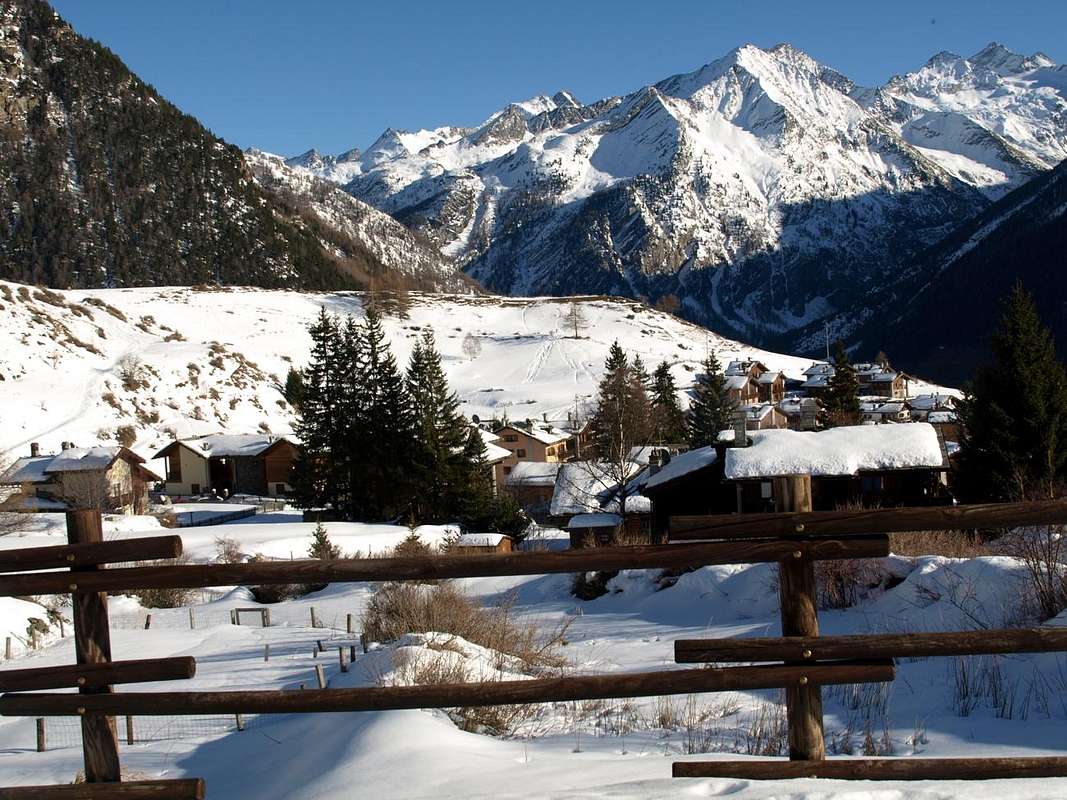
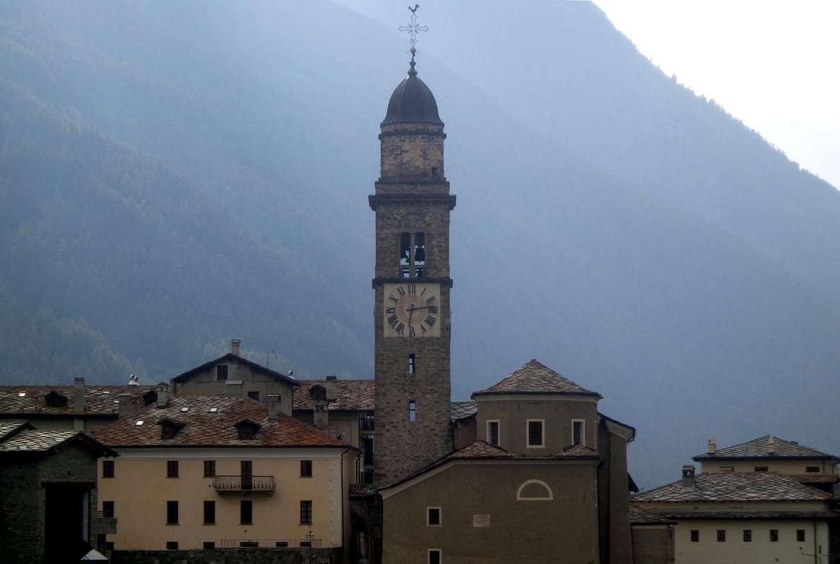
- From Aymavilles (646m) towards Cogne Valley through Vieyes (1.132m), Epinel (1.436m), Crétaz (1.494m) Hamlets up to Cogne (1.534m) Commune with the Main Road reaching Lillaz Fraction (1.607m). From this last in East to Sogno di Berdzé, under the Fenêtre of Champorcher.
- From FRANCE: through the Mont Blanc Tunnel to Entrèves-crossroads to Vény/Ferret Valleys - Mountain Guides of Courmayeur - La Saxe Rock Gym - Courmayeur.By Little Saint Bernard Hill, closed since November until half May to La Thuile Valley - Pré Saint Didier - Courmayeur. It is not necessary to take Motorway A5: you can drive on SS.26, in the direction of AOSTA - IVREA - TURIN.
BY PLANE:
- Aeroporto "Corrado Gex" Saint Christophe (Aosta).
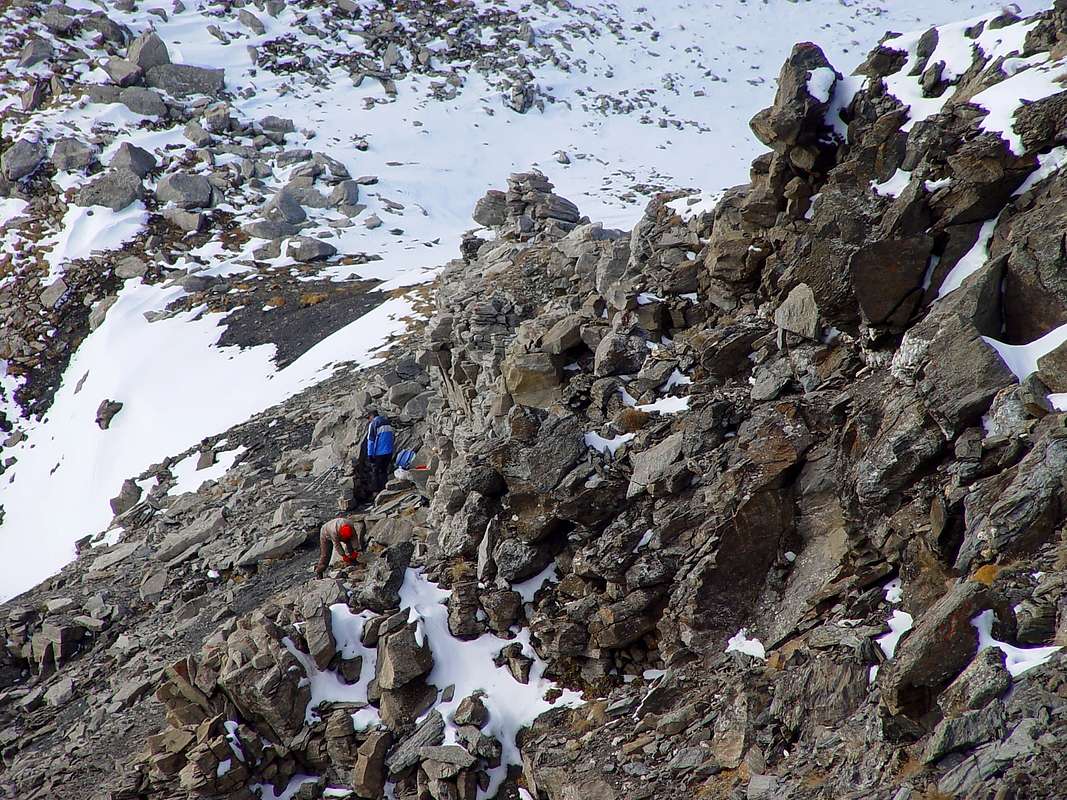
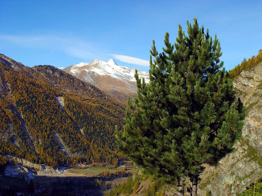
Some Hiker into Urtier
2) - Champlong-St. Pierre Village, Facette Pasture, Colonna and Liconi Magnetite Mines with miners' houses (1.596m, 2.495m): Excursion from Lillaz Hamlet (1.607m) with path in North along Liconi Torrent to Monte Creya (3.015m), through Southern Slope (E/F; 4h'30/5h'00).
3) - Lillaz, Goilles Damon Pasture, Cret Church, Tsavanis Waterfall and Pasture, fork 2.360 meters, Pianas and invergneux Alps (1.607m, 1.869m, 2.020m, 2.293m, 2.405m, 2.524m): Excursion from Lillaz with path-dirt road before in East, after North to Invergneux Pass (2.902m) through Southern Slope (E/F; 5h'30/6h'00).
4) - Lillaz, fork 2.360 meters, Invergneux Alp (1.607m, 2.524m): Excursion-Climbing from Lillaz towards Invergneux Pass through Southern Slope and Eastern Penne Blanche (3.252m) by East Ridge, bypassing quotas and carvings 3.020m, 3.012m, 3.080m, 3.075m, 3.127m, 3.088 meters and Testa Vallonet (3.152m) (A/F+; 6h'45/7h'00).
5) - Lillaz, Invergneux Pass (2.902m): Climbing to pass with crossing towards Serra Madù (3.220m), collar (3.198m) Tersiva, by West Crest (A/PD-/PD; 7h'30/8h'00).
6) - Lillaz, alternative 2.360 meters after Tsavanis Pasture, fork 2.507 meters, "Baita Hunters Orlando" (2.641m): Excursion-Climbing to two Pontonnet Lakes and Hill (2.808m, 2.816m, 2.897m), Tour Ponton (3.101m), by North-northwest Crest (EE/A/F; 6h'30/7h'00).
7) - Lillaz, Cret Church, Tsavanis Waterfall and Pasture, fork 2.360 meters, Manda Alp (1.607m, 2.020m, 2.293m, 2.374m): Excursion from Lillaz with path-dirt road in East to "Sogno di Berdzé" Refuge (2.532m) near Peradzà Alp and Fenêtre de Champorcher (2.826m) through Western Slope (E/F; 4h'45/5h'15).
8) - "Sogno di Berdzé" Refuge (2.532m), Ponton Loch and Alp (2.600m, 2.632m): Walk through paths before in Northeast, after Northwest (T/E/F; 1h'00/1h'15).
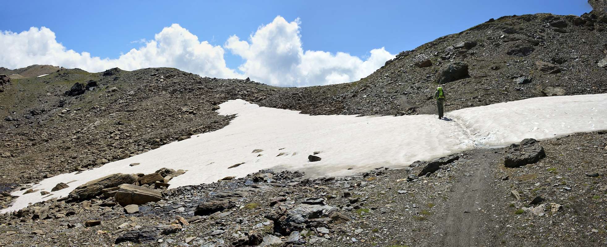
9) - "Sogno di Berdzé" Refuge, Ponton Alp, Invergneux Hill: Excursion with paths in Northwest to pass and Climbing through Serra Madou to Tersiva, by Western Crest or, after a short descent and crossing on Tessonet Glacier, to Tersiva Pass and by North-northwest Crest (Standard Route from Grauson Vallon) (A/PD-/F+; 4h'30/5h'00).
10) - "Sogno di Berdzé" Refuge, saddle (2.946m): Excursion-Climbing pathless in Southeast, after by Southern Crest to Bec Costazza (3.092m) (A/F+; 2h'30/3h'00).
11) - "Sogno di Berdzé" Refuge, saddle: Excursion-Climbing pathless before in Southeast, after by Northern Slope to Cima di Peradzà (3.021m) (EE/A/F+; 2h'00/2h'30).
12) - "Sogno di Berdzé" Refuge or from fork 2.468 meters on dirt road neighbor Torrent de la Nouva: Excursion-Climbing pathless in Southeast to collar 2.974 meters, after by East Crest to Tête de la Nouva (3.034m) (A/F+/PD-; 2h'00/2h'30).
13) - Refuge or from fork (2.468m) on dirt road neighbor Torrent de la Nouva: Excursion with paths in South to Arietta Pass (2.947m) (EE/A/F+; 1h'45/2h'15).
14) - Lillaz, Quertatset, Bioulé (1.631m, 1.750m, 1.721m): neighbor Torrent Urtier and above Lillaz Waterfalls Walk with path in East-southeast (T; 0h'50/1h'05).
15) - Lillaz, Loie Pasture (1.631m, 2.217m): Walk-Excursion with path in East-southeast at the beginning of valeille towards Loee Lake (2.346m) (T/E/F; 0h'50/1h'05).
 |
 |
 |
 |
 |
Mountain Condition
- You can get meteo information at the official site of the Regione Valle d'Aosta:
- Valle d'Aosta Meteo
Books & Maps
BOOKS:- "Guida delle Alpi Occidentali" di Giovanni Bobba e Luigi Vaccarone C.A.I. Sezione di Torino Volume II (parte II), 25 Maggio 1896.
- "Gran Paradiso - Itinerari Alpinistici e sci Alpinistici" di Franco Brevini Ed. Musumeci, Giugno 1982.
- "Il Parco Nazionale del Gran Paradiso (Valli di Champorcher-Clavalitè-Saint Marcel-Laures-Cogne-Valsavarenche-Conca di Pila" di Giulio Berruto 3/volume 2°, IGC, Torino 1981, 2a Ed. 2000. (in Italian)
- "Guida dei Monti d'Italia-Gran Paradiso Parco Nazionale" E. Andreis, R. Chabod, M. C. Santis, Club Alpino Italiano/Touring Club Italiano, prima Ed. 1939; seconda Ed. 1963; terza Ed. 1980.
 |
 |
 |
 |
- Kompass "Gran Paradiso Valle d'Aosta Sentieri e rifugi" Carta turistica 1:50.000.
- I.G.C. Istituto Geografico Centrale "Gran Paradiso-La Grivola-Cogne" Carta turistica 1:25.000.
- A.IA.T "Cogne Gran Paradiso Cogne Aymavilles-Walking map" 1:25.000.
- L'Escursionista "Valle di Cogne Carta dei Sentieri" (n° 10) 1:25.000.
- L'Escursionista "Tour de la Vallée de Cogne Grand Paradis" Carta dei sentieri 1:25.000.
Important Information
- REGIONE AUTONOMA VALLE D'AOSTA the official site.
- FONDAZIONE MONTAGNA SICURA Villa Cameron, località Villard de la Palud n° 1 Courmayeur (AO) Tel: 39 0165 897602 - Fax: 39 0165 897647.
- SOCIETA' GUIDE ALPINE DI COGNE Tel. 347/9473526 – 328/1373728.
- A.I.NE.VA. (Associazione Interregionale Neve e Valanghe).
Useful Numbers
- Soccorso Alpino Cogne (SAR) Tel. 3482685406.
- Protezione Civile Valdostana località Aeroporto n° 7/A Saint Christophe (Ao) Tel. 0165-238222.
- Bollettino Meteo (weather info) Tel. 0165-44113.
- Unità Operativa di Soccorso Sanitario Tel. 118.