


-
 8208 Hits
-
 82.48% Score
-
 15 Votes
|
|
Area/Range |
|---|---|
|
|
45.73550°N / 7.31314°E |
|
|
Mountaineering |
|
|
Summer |
|
|
Note
La montagna chiama i suoi figli, ed essi rispondono fedelmente al suo appello… Osvaldo Cardellina, Diario alpinistico, 1964-65 Page texts: @ OsvaldoCardellina "Osva", passed away on May 2, 2022. Page owners: Christian Cardellina e Osvaldo Cardellina. Any updates from September 12, 2022: Antonio Giani, page administrator, friend and climbing companion. Testi della pagina: @ OsvaldoCardellina "Osva", scomparso il 2 maggio 2022. Proprietari pagina: Christian Cardellina e Osvaldo Cardellina. Eventuali aggiornamenti dal 12 settembre 2022: Antonio Giani, amministratore della pagina, amico e compagno di salite. |
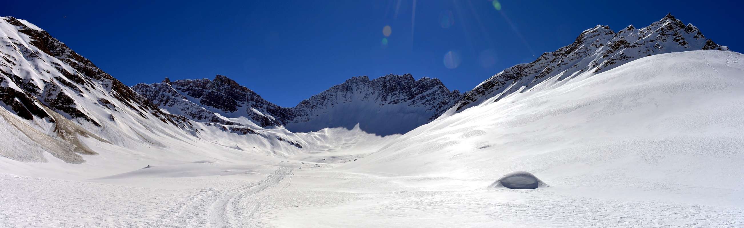
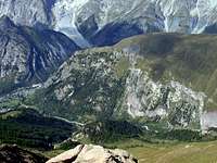
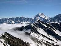
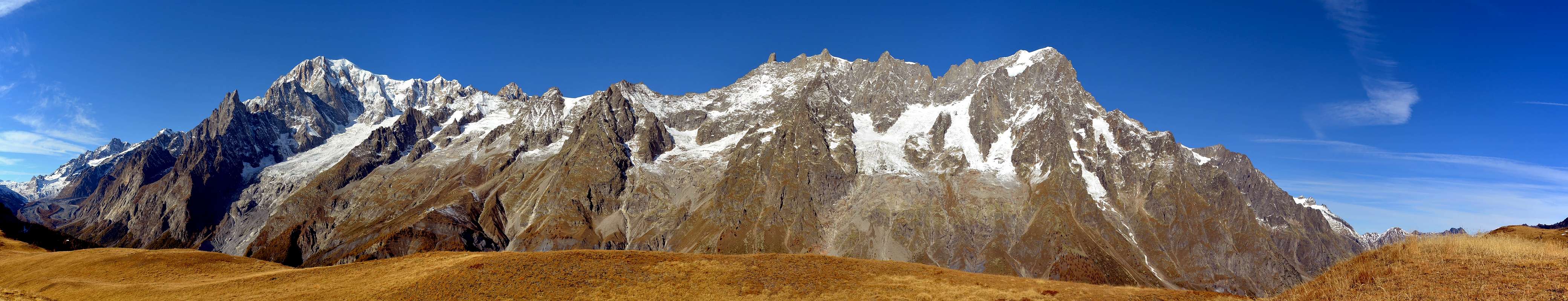
NORTHERN Overview (Mount Blanc/Valpelline)
 |
As well in this particular work we wanted to highlight the Valleys and the small Valleys are the basis of any common denominator ascension and that often are too considered to be neglected and "shabby" in spite of the Summits. Assembled in a first into Summary I of List, dedicated the mountain ranges, deserves, in our opinion, to be located in the study of the relevant areas of the Aosta Valley in one zone of the valleys, never studied and analyzed in a organic way and systematic. We hope to have, at least partially, scored the purpose, considered above the amount of work and effort is not indifferent. Moreover, the aim was to bring the precent job on the correct track, the same being a summary of Part A/F facing the mountains; therefore fell outside the same making heavy and negating much of the work of synthesis which was the primary destination. This is addressed in Part Two of the Valleys & small Valleys and orographic and hydrographic North or left side of Baltea.

This subsequent work, after this to Southern Valleys and Vallons, will be devoted to the opposite or Northern, always starting from Mount Blanc Mountain Chain at the Ferret Hill to the ends over the Southern extreme offshoots above little Town of Pont Saint Martin, at the end of the Aosta Valley Region and towards Piedmont Region and also taking into consideration the adjacent "cousin" walloon that leads out of Carema Hamlet, just below the Pont Saint Martin but now in Piedmont, rises up to the top of the Tre Vescovi (Three Bishops) and the Colma of Mombarone (Mount of Baron), still clearly visible by scrolling the Valley of Aosta from West to East. Small mountains that close the great circle Alpine Valley and then "leak" in the great Plain of the Po River, which shows impressive and the light Mountain Chain of Mount Rosa with its valleys that descend towards Southeast in the direction of the Provinces of Biella and Novara and plains of Vercelli. In addition there is the cities of the great Lombardy and Milan, from which it is still possible, even if only in part, to admire this magnificent spectacle.
Always taking into account, as in the seven previous analytical work, the course clockwise we have tried to summarize what are the characteristics and the particular features of the Valleys and the Walloons, starting from the North, or from the famous Tourist Resort of Courmayeur, at the foot of Mount Blanc to the little Town of Pont Saint Martin, at Eastern Valley of Aosta, coming from Piedmont. Hence our work is split, as at the end of the Ferret Valley is the starting that area which is the orographic and hydrographic or left side of the Northern Valley of Aosta. This leaves the border with France at Mount Dolent (3.821m) to begin the next with Switzerland starting from Ferret Hills at the end of the two, same name for both sides, long valleys. From this point on the border ridge walks in the opposite direction toward reaching the Eastern Group of the Grand Golliaz and the much larger and more important of the Mount Velan, leaving to North the majestic Group of Combins, entirely in Swiss territory, even if considered a little "valdotain" so that there is a Community of Grand Combin, reaches the Col Fenetre Durand and Mount Gelé. Then "down" with an endless series of summits to Dent de Bouquetins, Dent d' Hérens, the Matterhorn to the great Mountain Chain of Monte Rosa. From Signalkuppe of this last, leaving even here in the North Point Dufour higher (4.633/4m), starts the watershed between the Regions of Aosta Valley and Piedmont, again to the small Monbarone above Pont Saint Martin. It closes in such a way the circle of mountains, valleys and valleys belonging to this region. In this work, in summary, we have path valleys and valleys of the North from the famous and known Ferret valley that stretches to the Northeast by the Grandes Jorasses to the valleys that, on the border with Piedmont, took in perpendicular to the West in the direction of the Gressoney Valley, at the foot of Monte Rosa Mountain Chain. In addition, after the neighbor Municipalities of Pont Saint Martin Carema, and to the City of Ivrea, then opens out towards the great Po Plain to the East to Turin and to the West to Milan.

AREAS However, we need to give a more systematic breakdown of the various areas, including the fact that the geomorphology is quite different from that of the South Slope, where the two Valleys of Cogne Champorcher and arranged on an axis nearly parallel to that of the Central Valley Baltea, offering a completely different vision. For that what we thought to divide the entire Northern Sector into four main areas, starting from the West, so we can divide:
1) - Area of the Mount Blanc Massif, from Seigne Hill the two Ferret Passes, where the same ends.
2) - Big angled-triangle, which is bordered on three sides by its Val Ferret, Valley of the Great Saint Bernard with the base on the Central Valley from the Cities of Courmayeur to Aosta.
3) - Big isosceles triangle, based in the West Basin By-Ollomont, contains all the Valpelline with a ridge on the North side of the border until the Dent d'Hérens and another in the South, which goes down from this last to Becca Roisan-Viou on the outskirts of the Municipalities of Roisan and Aosta.
4) - Large rectangular, which includes the walloons perpendicular to the trend Baltea with North/South and the Valleys of Saint-Barthélemy, of the Marmore or Valtournanche, of the Ayas and Gressoney or Lys. *** This fourth and final area will be considered in two another pages in its own right and in its specificity (Saint Barthélemy and Valtournache Yalleys and Ayas/Gressoney), in order to streamline the whole of the work devoted to a very large and extremely expanded. Valleys and small Valleys begin where "die" glaciers, giving shape to any hint of life with their fresh and uncontaminated waters, as dictated by Mother Nature, the same quench the Climber and Hiker returning from giving a first goal achieved signal of rest, security and contentment. After so much hard work ... And for this reason we have also included some short, or rather telegraphic suggestion about crossings hills or climbing to peaks or Valleys at the end of the small Valleys same. They all crossings or ascents of elementary and easy to climb and hence suitable for everyone, or nearly so. Where there are small steps with some difficulty and especially exposed, or even more simply dangerous in certain circumstances, the factor has been highlighted, indicating the Difficulty Overall and Evaluation thereof.
Pur in codesto particolar lavoro abbiamo voluto evidenziare le Valli ed i Valloni costituenti denominatore comune alla base di qualsiasi ascensione e che, spesso, son considerate neglette e trascurate a dispetto delle Vette. Assemblato in antecedenza all'interno del Sommario I di List, rivolto alle catene montuose, merita, a nostro avviso, d'esser collocato nello studio delle aree pertinenti la Valle di Aosta in un settore, quello dei valloni, mai studiato ed analizzato in modo organico e sistematico. Speriamo di aver, almeno parzialmente, raggiunto lo scopo, vista la mole di lavoro non certo indifferente. Inoltre l'obiettivo consisteva nel portare il precente lavoro sui corretti binari, essendo il medesimo un Sommario delle parti A/F rivolte alle montagne; quindi esulava dallo stesso appesantendolo e vanificandone in gran parte il lavoro di sintesi costituente l'obiettivo primario. Questa Seconda Parte é devolutata a Valloni e Valloni della sponda orografica ed idrografica Settentrionale o di sinistra della Dora Baltea; partendo dal Col Ferret al termine del Monte Bianco fino all'estremità Meridionali sopra l'abitato di Pont Saint Martin, al termine della Regione Valle di Aosta e prendendo in considerazione anche l'attiguo vallone "cugino" che dall'abitato di Carema, subito appresso Pont Saint Martin ma ormai in Piemonte, sale insino alle cima dei Tre Vescovi ed alla Colma di Mombarone, ancor bene in vista scorrendo la Valle di Aosta da Occidente ad Oriente. Piccole montagne che dischiudon la grande cerchia alpina della Valle per poi "sfogare" nella grande Piana Padana, dalla quale emerge imponente e luminosa la Catena del Monte Rosa con le sue valli discendenti a Sudest in direzione delle Province di Novara e Biella e sulla pianura del Vercellese. Oltre c'é la grande Lombardia e la Città di Milano, dalla quale é ancor possibile, anche se sol in parte, ammirare questo magnifico spettacolo. Sempre tenendo conto, come nei sette analitici e precedenti lavori nonché dello studio di già rivolto a Valli e Valloni del Mezzogiorno, dell'andamento in senso orario abbiam cercato di sintetizzare quelle che son le caratteristiche e le peculiarietà delle Valli e dei Valloni partendo da Nord, ovvero dal famoso Complesso Turistico di Coumayeur, ai piedi del Monte Bianco insino al Borgo di Pont Saint Martin, all'ingresso Orientale della Valle di Aosta, arrivando dal Piemonte. Da qui il nostro lavoro si sdoppia, poichè al termine della Val Ferret prende inizio quel settore che costituisce la sponda orografica ed idrografica sinistra o Settentrionale della Valle di Aosta. Questa abbandona il confine con la Francia al Mont Dolent (3.821 m) per iniziarne il successivo con la Svizzera partendo dai Colli di Ferret alla fine delle due, omonime per entrambi i versanti, lunghe vallate. Da questo punto la cresta di frontiera si dirige in senso inverso verso Oriente raggiungendo il Gruppo del Grand Golliaz e quello ben più grande ed importante del Mont Velan; lasciando a Nord il maestoso Gruppo dei Combins, completamente in territorio elvetico anche se considerato un pò valdostano tanto che esiste la Comunità del Grand Combin, raggiunge il Col Fenetre Durand ed il Mont Gelé. Poi "discende" con una serie interminabile di cime verso Dent de Bouquetins, Dent d'Hérens, Cervino fino alla Catena estrema del Monte Rosa. Dalla Punta Gnifetti di questo ultimo, lasciando anche qui a Nord la Punta Dufour la più elevata (4.633/4 m), s'inizia lo spartiacque tra le Regioni di Val d'Aosta e Piemonte, nuovamente insino al piccolo Monbarone sopra i limitrofi Comuni di Pont Saint Martin e Carema. Si chiude in siffatto modo il cerchio di monti, valli e valloni appartenenti a questa regione. In questo lavoro, riassumendo, abbiam percorso valli e valloni di Settentrione dalla famosa e conosciuta Valle di Ferret che si allunga verso Nordest dalle Grandes Jorasses fino ai valloni che, al confine con il Piemonte, scendono in perpendicolare verso Occidente in direzione della Valle di Gressoney, ai piedi della Catena del Monte Rosa. Oltre, dopo l'abitato di Pont Saint Martin e verso la Città di Ivrea, si apre a ventaglio la grande Pianura Padana in direzione ad Est di Torino ed ad Ovest di Milano. AREE Però, urge dare una suddivisione più sistematica delle varie aree, anche per il fatto che la geomorfologia é alquanto diversa da quella del Versante Meridionale, dove le due Valli di Champorcher e Cogne, disposte su di un asse quasi parallelo a quello della Valle Centrale della Dora Baltea, offrono una visione completamente diversa. Per la quale cosa abbiamo pensato di dividere tutto il Settore Settentrionale in quattro grandi aree che, iniziando da Ovest, possiamo così suddividere:
1) - Area del Massiccio del Monte Bianco, dal Colle della Seigne ai due Colli di Ferret, dove lo stesso ha termine.
2) - Grande triangolo rettangolo, che viene delimitato sui suoi tre lati dalla Val Ferret, dalla Valle del Gran San Bernardo con alla base la Valle Centrale da Courmayeur fino alla Città di Aosta.
3) - Grande triangolo isoscele che, con base ad Ovest sulla Conca di By-Ollomont, racchiude tutta la Valpelline con un lato a Nord sulla cresta di frontiera fino alla Dent d'Hérens ed un altro a Mezzogiorno, che da questa ultima scende fino alla Becca di Roisan-Viou alle porte dei Comuni di Roisan ed Aosta.
4) - Grande parallelepipedo, che comprende i valloni perpendicolari alla Dora Baltea con andamento Nord/Sud, nonché le Valli di Saint Barthélemy, del Marmore o Valtournanche, di Ayas e del Lys o Gressoney. *** Questo quarto ed ultimo settore verrà ripreso in due ulteriori pagine a se stanti nella propria specificità (Valli di Saint Barthélemy/Valtournache nonché Ayas/Gressoney) , onde snellir l'insieme del lavoro rivolto ad un'area molto grande ed oltremodo espansa.

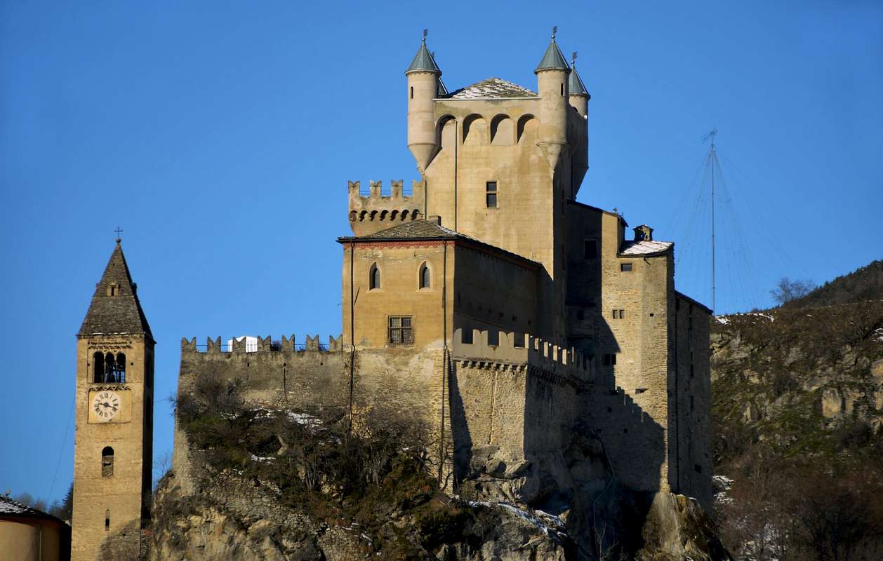
Quante son le Valli in Valle di Aosta, oltre a quella Centrale del Fiume Dora Baltea solcantela da Ovest ovvero dai Valloni di Vény e Ferret ai piedi della Catena del Monte Bianco verso Sudest, ove si distende la Valle del Po? Facile. Far la conta e darne la risposta: son tredici oltre ai tre Valloni di Champdepraz, Fénis-Clavalité e Saint Marcel, che in realtà son, per l'estensione e l'ampiezza, delle vere e proprie valli. Sei son disposte oltre il limite idrografico Meridionale della Dora Baltea ed in ordine da Est ad Ovest: Champorcher, Cogne, Valsavarenche, Rhemes, Valgrisenche e Valle di La Thuile. Tutte perpendicolari all'asse centrale della Dora, tranne la prima discendente a coltello da Sudovest verso Nordest. Sul lato opposto ne contiam altre sette e, sempre con lo stesso criterio: Gressoney, Ayas, Valtournanche, Saint Barthélemy, Valpelline, Ollomont con soprastante Conca di By ed, infine, Valle del Gran San Bernardo. Tutte in perpendicolare, men quella di Cogne messa di taglio da Sudest a Nordovest. Ancor facile. Ma quanti sono i valloni? Penso che nessun ci abbia mai tentato di tenerne conto. Innumerevoli, quasi infiniti. Ad ogni passo n'esce fuori un nuovo, come per i funghi. Oppur come i magnifici Castelli che in Valle d'Aosta son numerosi e ben conservati: si legano direttamente alla Storia delle Montagne, come quello di Saint Pierre che qui ti presentiamo. Contiene tutti i più bei trofei di Caccia di Vittorio Emanuele I°, primo Re d'Italia e Gran Cacciatore. Lo trovi sul lato idrografico Settentrionale nel Comune di Saint Pierre e domina sull'intera Valle Centrale della Dora Baltea. Tornando da un'escursione, non perdere l'occasione di visitarlo. Comprenderai molto di più nel grande discorso delle Alpi, delle loro Vallate e dei loro selvaggi Valloni. In secula ... seculorum ...
"The rock of Castles that is formed by the mountains that have crumbled in time ... " / "La roccia dei Castelli é formata da quella delle montagne che si son sgretolate nel tempo ...", by Antonio ![]()
^^^^^^^
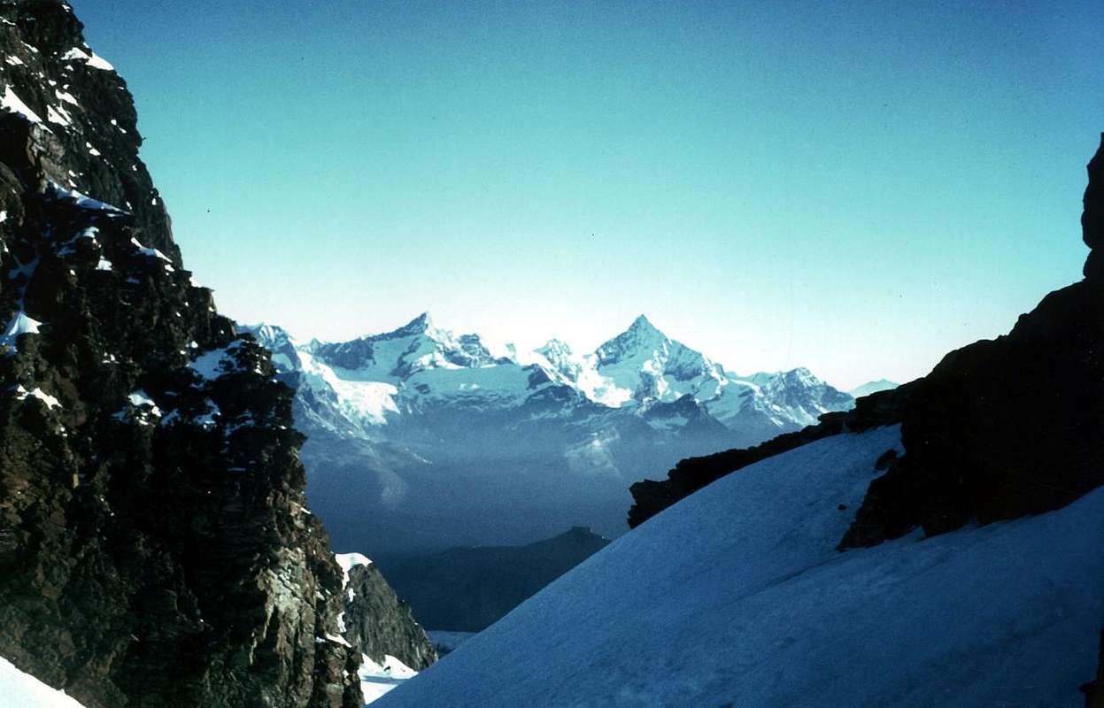
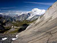
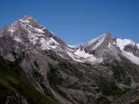
"From M. Blanc, staying to the North, we reach the Rosa / Dal Gruppo del Bianco, restando sempre al Nord, raggiungeremo il Rosa", by as ![]()
1) - Area of the Mount Blanc Massif , from Seigne Hill the two Ferret Passes, where the same ends.
1) - Area del Massiccio del Monte Bianco, dal Colle della Seigne ai due Colli di Ferret, dove lo stesso ha termine.
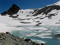
Questi valloni in realtà, allo stato attuale, son più dei circhi glaciali che però, con il loro arretrare, indicano sempre di più ad un'epansione dei primi. Ma non voliamo troppo con la Fantasia, altrimenti vederemo (dicono) il Monte Bianco ridotto ad una verdeggiante collinetta. Tra 400 milioni di anni (sempre dicono). Noi ci limitiamo a parlare di quella ch'é la "parte bassa", ovvero l'inizio dei medesimi tal poi da sfociare, maggiormente in alto, in grandi ghiacciai. All'uopo rimandiamo, sempre in SP, ai lavori: "GLACIERS of the Aosta Valley" ed inoltre "Glaciers Val Ferret (Courmayeur Mont Blanc)" di Antonio Giani, sempre nelle Pagine del Tipo Areas & Ranges, nel quale vi descrive le parti "più elevate". Qui ci limitiamo ad accennarvi dell'ingresso a questi grandi bacini glaciali che, oggi, son più dei ghiacciai che non dei valloni veri e propri.
2) - Big angled-triangle , which is bordered on three sides by its Val Ferret, Valley of the Great Saint Bernard with the base on the Central Valley from the Cities of Courmayeur to Aosta.
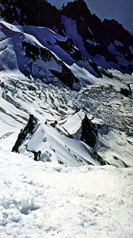
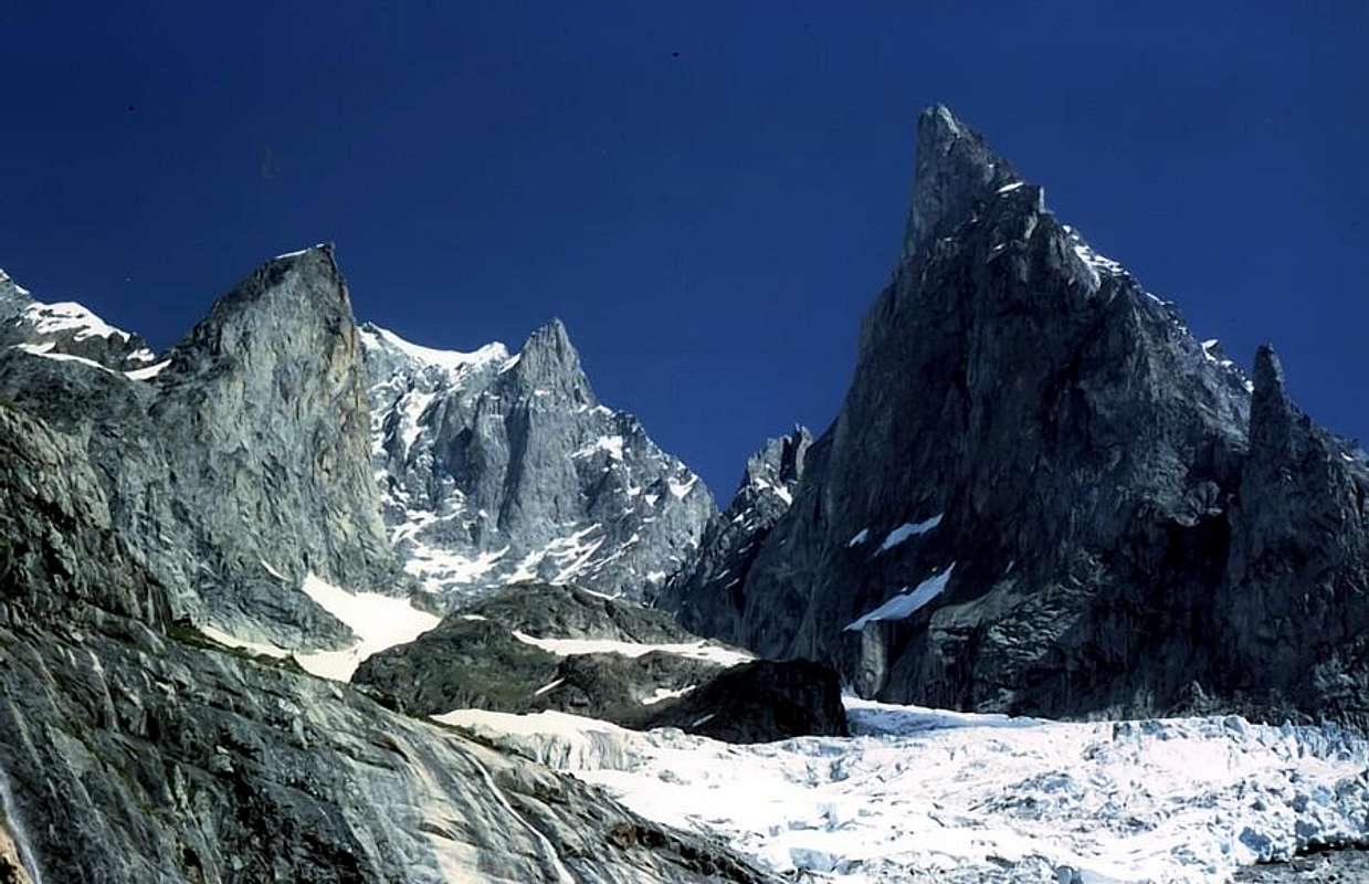
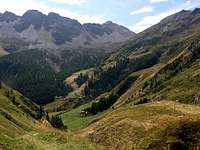
"Ferret Valley &, Malatrà, La Saxe & Sapin small Valleys", by Antonio, marco979, livioz & buxlex
VALLEYS & small Valleys In order to deploy clockwise from Courmayeur-Val Sapin to East above Dora Baltea Central Valley
From Ferret Hills to Courmayeur-Val Sapin Ferret Valley and surroundings of Eastern Side & Val Sapin Ban Darrey small Valley: from Refuge with path n° 25 to fork 2.264 meters, near pastures,; leaving North the path to Gr. Ferret Hill, continue East and through unnumbered path and traces, along the torrent, to Ban Darrey Pass (2.696m), between Pointe de Combette/Aiguilles des Angroniettes. Bellecombe small Valley: from fork 1.695 meters, after Lavachey, with unnumbered path to Giué Desot Alp (2.007m); from this with path TMB in North to Arp Nouva Damon Pastures (2.003m). Variant: from Regional Ferret Road to parking 1.763 meters, before Arp Nouva Desot and with path n° 26 to Damon. From this, before to North after East, to Belle Combe Desot (2.192m)/Damon in the great morainic basin below Great Golliaz/Aig. Bellecombe. Malatrà small Valley: from Giué Desot to Damon and Malatrà Damon Alps (2.213m), with unnumbered path; through path n° 28/Haute Route number 1, before in Southwest, after Northeast, to Malatrà Pass (2.928m). Traverse in descent to Merdeux small Valley into Great Saint Bernard Valley. Armina(z) small Valley: from Regional Ferret Road near Praz Sec-d'en Bas (1.625/30m) with path n° 29 to Armina Pasture (2.009m) and in Southeast to Tsa de Sécheron Alp (2.260m); from the last.
3) - Big isosceles triangle , based in the West Basin By-Ollomont, contains all the Valpelline with a ridge on the North side of the border until the Dent d'Hérens and another in the South, which goes down from this last to Becca Roisan-Viou, on the outskirts of the Municipalities of Roisan and Aosta.
3) - Grande triangolo isoscele che, con base ad Ovest sulla Conca di By-Ollomont, racchiude tutta la Valpelline con un lato al Nord sulla cresta di frontiera fino alla Dent d'Hérens ed altro al Mezzogiorno, che da quest'ultima ridiscende insino alla Becca di Roisan-Viou, alle porte dei Comuni di Roisan ed Aosta.
From Seigne Hill towards Mount Blanc & Ferret Passes
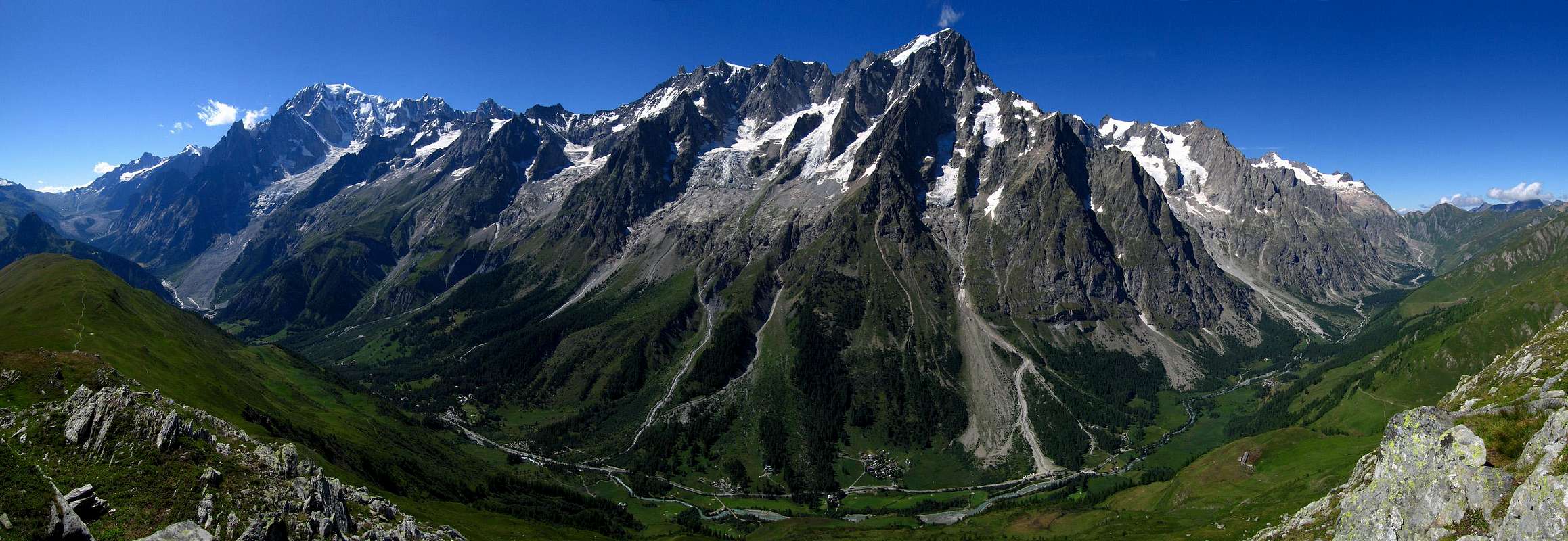
VALLEYS & small Valleys In order to deploy clockwise from the Vény Valley Seigne-Lex Blanche small Valleys to Ferret Valley Grapillon small ValleysIn Courmayeur Municipality Vény & Ferret Valleys with Northwestern, Western & Northeastern surroundings Veny Valley: from Courmayeur through Regional Road to Notre Dame de la Guérison (+ Sanctuary; 1.444m), Perthud, Camping Aiguille Noire, Chalets du Miage, La Visaille, Plan de Lognan (signal no transit; 1.676m), Lakes of Miage and Combal, with farm dirt road. Lex Blanche small Valley: through Veni Valley to Lake of Combal (1.958m); from this to Refuge Elisabetta Soldini (2.197m), Tsa de la Lex Blanche (2.280m), Seigne Hill (2.514m), through dirt road concomitant with the path n° 2/TMB/Haute Route number 2, along Doire of Val Veny. Echellettes small Valley: from Elisabetta Refuge, Northwest direction and by the path n° 13, to Hess or Echellettes Bivouac. Petit Mont Blanc-Trelatete small Valley: from Bar Combal with path n° 14 to Gino Rainetto-Giovane Montagna/Petit Mount Blanc Bivouac (3.047m). Miage small Valley: from Chalets du Miage (1.572m; signal no transit; parking) with path n° 16 to Breuillat/Marmotte Lochs (1.957m); from these with unnumbered path-traces to Miage Moraine to the connection with path n° 15 (starting from Combal Lake) in quota 2.300 meters about. Along Miage Glacier to Chaux de Pesse (2.524m) and through the overhanging rocky promontory to Gonella Refuge (3.072m) at the entrance on Dome Glacier. Miage-Mount Blanc small Valleys: from the previous route through moraines up to the altitude about 2.450 meters and from this North-northeast route to Quintino Sella Refuge (3.368m), on rocky promontory at the foot of Mount Blanc Southwetern Face. Chatelet-Brouillard-Freney small Valleys: from Chalets du Miage, along Torrent of Miage with path n° 16 to Monzino Refuge (2.561m). Noire-Fauteuil des Allemands small Basin: from Perthud (1.489m) through dirt road to Péuterey Alpages (1.507m; signal no transit); from this with path n° 19 to Borelli-Pivano Bivouac (2.316m), nearby "Fauteuil des Allemands". Brenva Basin: from Praz Dèle (1.381m; nearby the entrance of Tunnel M. Blanc) to Brenva Desot/Damon Pastures (1.517m, 1.540m) and, always with unnumbered path and North direction, to Brenva Bivouac (3.140m), under Brenva Rochers in S-SE Ridge of Brenva Aiguille/Brenva Tower. Entrèves small Valley: from Entrèves-la Palud (1.370m; parking; start of Glaciers Cableway) to Velà Chapy (1.467m) and with path n° 20 to Pavillon Refuge (2.174m), near Mount Fréty (first station of Mount Blanc Cable-way); from this, Northwest way, to fork 2.550 meters, below Les Portes. From this alternative to cross in West-southwest to altitude 2.557 meters with the path n° 20b, at the entrance of walloon. Variant: from Brenva Desot-Praz de la Brenva (about 1.600 meters) with unnumbered path to Sheperd Shelter below the Pavillon. Thoula or Thoules small Valley: From preceding route go up with traces to altitude 2.701 meters at the beginning of Thoules Glacier. Planpincieux-Great Jorasses small Valley: from Planpincieux (1.593m; parking) with path n° 21 to Boccalatte-Piolti/Gr. Jorasses Refuge (2.604m). Freboudze or Frébouge small Valley: from Lavachey-Frébouge (1.640m, 1.654m) with path unnumbered to Giusto Gervasutti Bivouac-Refuge (2.835m). Petite Jorasses wild Valley: from Gervasutti Refuge-Bivouac through North ramification of Frébouge Glacier to Petite Jorasses Pass (3.520m). Leschaux-Greuvetta small Valley: from Courmayeur-Entrèves-Montitaz-Planpincieux-Arnouva (signal no transit; 1.769m) with Ferret Regional Road; from this point with dirt road and path n° 23 to alternative 1.875 meters and, with Northwest direction, to Dalmazzi or Triolket Refuge (2.584m). Talèfre-Triolet small Valley and Basins: from refuge through:
a) - the first ramification or Northern of Triolet Glacier to Triolet Pass (3.705m);
b) - the second ramification or Northwestern to Talèfre Pass (3.544m);
c) - the third ramification of Triolet Glacier to Savoie Pass (3.491m);
d) - the fourth or Talèfre Basin, in West, to Pierre Joseph Pass (3.508m);
e) - the fourth or Talèfre Basin, in Southwest, to Leschaux Pass (3.433m). Pré de Bar small Valley: from Arnouva along Ferret Valley with dirt road up to the last winding road before Elena Refuge (2.062m); after in Northwest with path n° 24 to Little Ferret Hill (2.540m) and through path-traces to Fiorio Bivouac-Dolent Refuge (2.780m). Grapillon small Basin: from bivouac or shelter in North-northwest to large Saddle (3.358 meters) between Mount Grapillon and Little Grapillon. Ferret Valley and Ferret Italian small Valleys: from Courmayeur to Refuge Elena, near Pré de Bar Alpage, with Regional and dirt road; from this in Northeast to Great Ferret Hill (2.531m) through path n° 25/TMB (Tour of Mount Blanc).
Northwesterner small VALLEYS (Ferret/Valpelline)
 |
 |
 |
 |
 |
1) - in Northeast to Entre deux Sauts Hill (2.524m), with path n° 42 and, by the same in descent, towards Malatrà small Valley.
2) - In Southeast, with path n° 29, to Battaglione Aosta Pass (2.883m), between Aiguille of Chambave/Great Rochère; in descent with path n° 20 towards Chambave Comba, at the foot of Great Rochère in Planavalle Vallon, above Morgex/La Salle Municipalities. Leuché-La Saxe Basin: from the small bridge on Ferret Doire, before Planpincieux-Montitaz, with path n° 32 to Leuchey Damon (1.929m); by connection with the path n° 31/TMB/Haute Route number 1 in Southeast to Giorgio Bertone Refuge, nearby Praz de la Saxe Pastures (1.946m, 1.991m), at the end of Mount de la Saxe. In Southeast descent with path n° 42/TMB to Val Sapin, above Villair Dessus-Courmayeur (1.373m).
 |
 |
 |
 |
 |
"Liconi, Chambave, Planavalle-Rochère & Clusella Vallons", by livioz, Antonio, Rustichelli & emilius
VALLEYS & small Valleys In order to deploy clockwise from Courmayeur-Val Sapin to East above Dora Baltea Central Valley
In Courmayeur, Pré saint Didier, Morgex, La Salle, Avise, Saint Nicolas, Arvier, Saint Pierre, Sarre Municipalities & Aosta Town Central Valley & surroundings from North to South Val Sapin: from Courmayeur to Villair Dessus Fraction (signal no transit); through the path n° 42 to Refuge Bertone, at the beginning of Mount de la Saxe. In descent, to Northwest, with path n° 3/TMB/Haute Route number 1 in Northwest to Ferret Valley, lower part nearby Planpincieux.
Liconi small Valley: from La Salle Municipality to Planavalle (1.760m; signal no transit) with Regional Road; from this to Southwest and path n° 20/21 to Piginière Alp. After with Northwest to entrance of Chambave Comba, near Chambave Alp (1.880m); crossing to Weast reach Licony Alp (1.878m; Madonna de Lourdes). Along Licony Torrent, with path n° 4, to Lake (2.555m) and Hill (2.674m). In descent, with path n° 44, to Val Sapin.
Chambave-Battaglione Aosta Pass small Valley: from Chambave Alp, with path n° 20 between two torrents, to Grand Plan Alp (2.187m) and through walloon floor to Btg. Aosta Pass; descent in Northwest with traces-path n° 29 towards Armina(z) Vallon to Ferret Middle Valley.
Planavalle-Grande Rochère Vallon: from Planavalle to Eculé Pasture (1.886m) and fork 2.083 meters with unnumbered path along Planaval Torrent; from this in Northwest, without path on moraine, to Grand-Eau Torrent and in West to Grande Rochère (3.326m), West Slopes with traces.
Bonalex-Artanavaz small Valley: from Planavalle in North-northeast to Maison Blanche Pasture (1.871m), Rantin Alpages (2.333m), with path n° 6/7; after with path n° 7 to Bonalex Pasture (2.340m) and with unnumbered path and traces in moraine to Lake (2.782m). In North, through snowfields, Aiguille of Artanavaz (3.071m; ski-mountaineering); in Northeast Grand Creton (3.071m), by easy rocks on South Face or on Northwest Crest. From Bonalé, in West, Pass (2.925m), through traces on moraine, and Aiguille (3.201m) by South-southeast Crest with easy rock (a passage of II°-).
Serena Southern small Valley: from fork before Rantin Alp, path n° 6, below Serena Loch, in Northeast to Serena Hill (2.546m; ski-mountaineering).
Ors-Pisserio small Valley: from fork before Rantin Alp in South with path n° 3A to Tramail des Ors (2.390m), crossing Pisserio Torrent, Felita or Fetita Hill (2.557m). Descent in East to Jovençan in Vertosan Vallon or traverse with path n° 3/2 on South Crest to Borromein/Bard Hills (2.176m).
Court de Bard Basin: La Salle to Challancin Village (1.610m; signal no transit near a mini parking) through Regional Road. In Northeast with path n° 2/2A to Ponteilles Alp and alternative 1.741 meters; from this point in Southeast with path n° 2 to Arpilles Pastures (1.802m; fountain) and in East to Court de Bard Hill. From this:
1) - in South to Mount Court de Bard (2.262m; beautiful by snowshoes);
2) - in North to Felita two Summits (2.623m).
Vertosan small Valley: from SS.26, near Saint Pierre Commune, to Vetan Hamlet with Regional Road; before go left to Vens (1.734m) through a deviation to Vertosan Walloon up to the Joux Saddle (1.934m; signal no transit); continue on dirt farm road with a brief descent into walloon reaching Zette Montagna (1.877m), Or de Breuil (1.850m) and Jovençan (1.867m) Alps. After with various paths to:
1) - in Northwest Felita Hill;
2) - in North-northwest Ziule Lake (2.524m), path n° 11.
3) - In North Citrin Hill (2.605m), path n° 10;
4) - in Northeast Vertosan Pass (2.689m), path n° 20.
Vetan-Leissé Comba: with previous route to Vetan small Resort (1.671m; various signals no transit); from this in Northwest through farm dirt road to Thoules (1.919m), Grand Arpilles (2.120m) Pastures and in North-northeast to ancient Le Crotte Alp (2.392m) in Verrogne Vallon. Also from Grand Arpilles in West to Chaz Creuse Alp (2.330m), below Aouillette (2.618m)/Leissé (2.771m) Comba (various Hiking Tour; ski-mountaineering).
Verrogne-Mounts Rosso-Vertosan-Fallère small Valleys: from Aosta Town or from Sarre Commune, through, in asphalt, "Salassians Road" to Ville sur Sarre (1.212m), Bellun (1.382m), Homenè (1.448m), Verrogne (1.582m) Hamlets; from this last, with path, in North to Montagna Vergioan (2.106m) and Le Crotte Alp. From this point, with various paths, excursions to Leyssé, Paletta (2.810m), Rosso (2.943m), Vertosan (2.822m) Fallère (3.061m) Mounts and Passes of Paletta (2.707m), Southern Vertosan (2.770m), Finestra (2.729m) and Lake Morto (Dead; 2.638m) and Rane (Frogs; (2.367m).
Clusella-Fallère small Valley: from Ville sur Sarre through Municipal Road in asphalt to Touraz (1.652m; signal no transit; in foreground the remains of enourmous landslide from Becca France of July 06th, 1564, with 600 deads, all the inhabitants of ancient Thora). Through farm dirt road to Morgnoz (2.052m), Frumière (2.062m), Chaz de Morgnoz (2.271m) Pastures. Easy excursions to Becca France (2.312m), Lake Fallère (2.415m) and Mount (3.061m; equipped route), Hill 2.674 meters, Mount d'Arsy (2.827m), Croix de Chaligne (2.608m), Met(z) Hill (2.485m) and Point (2.553m), paths.
Clou-Met(z)-Chaligne small Valleys: from Touraz (no transit signal) in East through dirt road to Metz Bionaz (1.731m), Vignon (1.789m), Condemine de Metz (1.874m) Pastures and Metz Alp (2.261m), nearby Labe Torrent. From Alpage with path to Met Hill, between Croix de Chaligne and Met Point.
Arpilles small Valley: from Aosta North Town with Main Route of Great Saint Bernard Valley to alternative nearby Grand Signayes Hamlet (737m); through the deviation, in asphalt, to Arpuilles (1.010m), Excenex (1.046m) Fractions. From these by farm dirt roads or various paths, numbered or not, to Tsa de Metz or "Les Arpes Vieilles" (1.419m), below Checotteyes (1.715m) Alp. From this point to Met Hill and Croix de Chaligne.
 |
 |
 |
 |
 |
"Vertosan, Flassin, Fallère-Clusella, Serena small Valleys & Merdeux Comba", by livioz, "Crevassino", Antonio & marco87
VALLEYS & VALLONS In order to deploy clockwise from Aosta Town in Central Baltea Valley to Great Saint Bernard Valley & By Basin
In Aosta, Gignod, Etroubles, Saint Rhémy en Bosses, Allein, Doues, Ollomont Municipalities to Valpelline Artanavaz/Buthier Streams Valleys & surroundings Gignod-Les Arpilles small Valley: from Aosta North with Main Route of Great Saint Bernard to alternative near Gignod-Lexert Commune/Fraction (1.044m); through the deviation, in asphalt, to Tercinod Dessous (1.108m), Rebiache (1.319m) Fractions. From this by farm dirt road to Arpeilles (1.419m); with unnumbered path to junction Southeast and Northeast Crests, two subsequent small saddles and Chalignes Summit.
Buthier small Valley: from Aosta with preceding road after alternative Lexert Fraction to following fork to Condémine (1.132m); through the deviation, in asphalt, to Grand Buthier (1.431m), Petit Buthier (1.441m), to fork Meriau/Mendey (1.598m; small parking). Reached the last (1.598m), continue on farm road to Roncaille (1.656m), Rombason (1.695m), Arolla (1.788m) Pastures, Refuge Chalignes near the Alp (1.936m) and La Tsa (2.225m). From this:
1) - in South to East Crest of Chaligne, with path;
2) - in West Passo Tardiva (2.410m), with path and in descent to Arsy Comba.
Arsy or Ars small Valley: from Mendey continue on dirt road in West to Meriau (1.603m), Praz Gallet (1.626m), Arsy (1.981m) Pastures; with the same, concomitant with paths n°3C/4, to Chaz d'Arsy Alp (2.263m), nearby three small Ars Ponds. From this:
1) - in Northwest with path to Ars Pass (2.534m), unnumbered path;
2) - in South to Mount Fallère, East Shoulder (3.043m) Northern Slopes, easy but steep with rotten rocks and debris. Flassin small Valley: with St. Bernard Road to Etroubles (1.270m), Saint Oyen (1.373m) Municipalities; leaving right the same go on dirt road/path n°7 to Champex (1.411m), Flassin de Meitin (1.654m), Flassin (1.700m) Pastures to Tsa de Flassin (2.258m) Alp. From this:
1) - in Southeast Fenetre Pass (2.729m), without path;
2) - in South Vertosan Pass (2.689m), unnumbered path and traces in terminal part.
3) - In South-southwest Flassin Pass (2.605m), path n° 7;
4) - in Northwest Testa Cordella(z) (2.663m), with path n° 7B. Easy traverse on ridge to Mount Flassin (2.772m).
Citrin Comba: from Saint Oyen to Saint Leonard Fraction (1.519m), leaving the Main Road to Great Saint Bernard. From this in Southwest Comba/Pont Hamlets, fork 1.464 meters; taking in South the path n° 8 to "Fonte Ferruginosa", Citrin de Meitin (2.005m) Pasture, Citrin Damon (2.312m) Alp to Citrin Hill (2.484m). In descent with path n° 10 to Vertosan Vallon, Vetan Comba and Dora Baltea Stream Central Valley.
Serena Northern small Valley: from Grande Rocher Fraction (1.544m), nearby Saint Leonard, continue with Municipal Road in West to Couchepache, Sainte Anne, Mottes (1.660m) to Maytie (1.676m; no transit signal). With path n° 9, crossing in South Bosses Torrent, to Farettes (1.666m), Arp du Bois Desot (1.936m); along the walloon in Southwest to Serena Hill (2.547m). Descent with path n° 6 to Planavalle Vallon, above La Salle.
Créton du Midi-Tete des Faces Vallon: Arp du Bois Desot (1.936m) Pastures in Southwest to Damon (2.109m); amongst two torrents, without path but debris and moraines, to Saddle 2.557 meters, between Grand Créton/Tete des Faces. In descent, same terrain, to following and in parallel Entremont Vallon: from Mottes to parking under Saint Bernard Motorway, nearby Devies Pasture (1.723m; no transit signal) with path-Haute Route number 1 to Merdeux-Desot (1.919m), Cotes (1.930m), Moindaz (1.973m) Pastures.
1) - Going along small torrent reach a source at the beginning, under the Entremont Point (2.650m); also from fork pastures returning, with unnumbered path, in South to Potz-Ardusi Pasture (1.784m) and through grassy-debris slopes to Entremont Vallon, below Tete des Faces (2.583m). In descent same route or connection between the two.
Merdeux Comba: from Mottes to parking under Saint Bernard Motorway, nearby Devies Pasture (1.723m; no transit signal) with path-Haute Route number 1 to Merdeux-Desot (1.919m), Cotes (1.930m), and in North to fork about 1.950 meters near Moindaz (1.973m) Pastures. After, more in Northwest, to Tsa de Merdeux (2.285m) and in West Malatrà Hill (2.928m). In descent with path n° 28/Haute Route number 1 to Malatrà Vallon.
Saulié or Ceingles Vallon: from Tsa du Merdeux in North with unnumbered path, traces and path n° 12, in final part, to Ceingles Pass (2.817m), between Little Golliaz and Aiguille of Saulié. Descent with the last path to Thoules Comba, below East-southeast Face of Great Golliaz (3.237m).
Tula-Golliaz Comba: from Moindaz or Muenda Pastures:
1) - in North along the Thoules Torrent to cross with dirt road from Tsa de Merdeux or from Merdeux Desot at the beginning of path n° 12 to Saint Rhémy Pass (2.540m);
2) - through valley floor, along the torrent, to ponds 2.622 meters and;
3) - with terminal part of path n° 12 to Saulié Pass, or
4) - in Northwest through steep moraines to Angroniettes Pass (2.936m).
Arc-Saint Rhémy Pass Basin: from Praz de Farcoz Pasture (2.223m; small parking), nearby the SS.27 of Great Saint Bernard,
1) - in Southwest with path n° 12 to Saint Rhémy Pass;
2) - in Northwest to Fourchon Pass (2.696m), through debris, moraines and easy small rocks.
Fenêtre Vallon: from alternative 2.356 meters (small parking), nearby Montagna Baou (2.373m) and just before Great Saint Bernard Hill, in West with unnumbered path and traces;
1) - Mount Fourchon (2.902m; ski-mountaineering); in Northwest with path n° 13A
2) - Fenetre Hill (2.698m).
Great Saint Bernard Valley: from Aosta North by S.S. Great Saint Bernard n° 27 (National Road), leaving Northeast the Regional Road to Valpelline, to Gignod, Etroubles, Saint Oyen, Saint Rhémy en Bosses Municipalities and Great Saint Bernard Hill (2.469m) to Switzerland.
Sports Routes: from Aosta Town or from Gignod Commune
1) - "Road of the Vineyards on Via Francigena" to Etroubles Commune, excursion for Hikers and Walkers;
2) - from Aosta Town "Napoleonic Route" to Great Saint Bernard Hill with descent to Switzerland, for Hikers.
3) - "Snowshoes Route" from Winter No Transit, immediately after Saint Rhémy Municipality (about 1.560 meters; parking), to Great Saint Bernard Hill, for Mountaineers with snow rackets.
Barasson small Valley:
1) - from Etroubles to alternative 1.348 meters and in Northeast to Palais Dessous, Veyaz and Prailles Dessous ("Agriturisme La Granze in Tsi Inconnu"), asphalt road; or
2) - from Saint Oyen (1.373m) in East to Farm, same road. From the fork before Prailles in Westr-northwest to Eternon (1.645m) Village, through Municipal Road. From this dirt road to fork 1.715 meters (signal no transit) and in West to Essanaz or Lessanaz Pasture (1.820m); crossing Ravine Wood and Barasson Torrent to Barasson Alpages (1.868m). After along torrent and path n° 16/17 to Crétoux Alp (2.074m); from this in North and path n° 16 to
3) - Barasson Oriental Pass (2.681m).
4) - In East, path n° 17, to Mount Paglietta (2.320m).
Menouve or Menovy small Valley: from Prailles Dessous-Quaye (signal no) to Menouve Pastures (1.913m), with dirt road; with path n° 21 to Trecaoudette Pasture (2.133m), in North to Tsa de Menovy (2.243m) in West Tsa Nouva. Continue, path n° 21, to Southern Menovy Pass (2.758m).
Molline Vallon: from Menovy with unnumberd path to L'Arvus Alp (1983m). Leaving left Menouve Vallon to Molline Vieille Alp (2.295m; ruines), Molline Bivouac (2.415m) near Alp, with path n° 21 in Northwest
1) - Molline Pass (2.915m), with unnumbered path-traces; in North
2) - Hannibal Pass (2.992m), between Mount Velan (3.734m), West Crest, and Testa Grisa (3.060m), through traces, debris, blocks and easy broken rocks.
Allein-Saron small Valley: from SS.27, after Gignod and before the torrent in altitude 1.083 meters, deviation to Allein Commune (1.253m); from this with dirt road to hanté and Daillon (1.417m; signals no transit). Continue to Crou, Maurier, Comba, Pied du Plan (1.722m), Baravex Desot, du Meitin and Damon (1.925m), Parc (2.014m) Pastures. Through Fontaines Wood with path n° 24 to Fontanin Alp (2.227m) and Mount Saron (2.681m).
Doues-Champillon small Valley: from Regional Road to Valpelline, nearby Rhins Chateau (785m), or directly from Valpelline, to Doues Commune (1.251m); with dirt road to Chatellair, Court, Haut Praz Bas, Pointier, Creux, Baita Novella, Plan Debat (2.076m; signal no transit; source), From this, passing Notre Dame de la Neige Chapel, Champillon Pasture (2.050m; great parking; fountain) in Northwest with path n° 32/TdC (Tour du Combin)/Haute Route number 1 to Pessinoille Pasture (2.146m) and in West to Refuge Letey, near Champillon Alp (2.430m), below the Hill (2.709m).
Ansermin-Cretes Vallon: from Champillon parking continue through dirt road in North to entrance of By Basin up to the Cretes, Togne, Ansermin (2.120m); leaving right the dirt road to By, turn left in West to Tsa d'Ansermin (2.388m) with other secondary dirt. From this:
1) - in Northeast with unnumbered path easily to Monte Rotondo (2.572m; beautiful tour by snowshoes);
2) - in West to Salliaousa Carving and Saillaousa (3.328m).
Berruard-Salliaousa-Faceballa Comba: from Ansermin, through a brief descent on dirt road, to Chevrière (1.928m), Chesal (2.039m), Pleytaou (2.096m), Praz du Champ, Faceballa (2.385m) Pastures at the entrance of Berruard Comba, below the watershed Salliaousa/Faudery Tetes/Faceballa Summits. In West Faceballa Pass (3.239m) and Saddle (3.280m) at the beginning of Mount Velan South Crest (dangerous routes for falling stones). b>Boégno Bà-Plan Bagò Comba: from Berruard (1.947m) or from Chesal Pastures in North with path n° 3, crossing dirt road in altitude about 2.175 meters (small parking) to Bivouac Rosazza al Savoie, nearby Boégno Bà Hill (2.674m). From this
1) - in North-northwest with traces to Valsorey Pass (3.107m);
2) - in Northeast to Farinet Combe, under border watershed Les Trois Frères/Molaires-Jags Valsorey/Luisettes/Verte/Grand Tete de By.
By Conca: leaving left the deviation to Chesal, on dirt to Berruard (1.947m), Cheval Blanc (1.962m), Casa Farinet Pastures; from this in North with path n° 4 to By (2.050m), Commune de By, Tsa Commune (2.304m), Refuge Amiante-Chiarella (2.979m). Ascents on Grand Tete de By Subgroup.
Filone-Bonamort Vallon: from Farinet House continue in East on dirt to Balme de Bal (2.128m), Lombardin (2.309m) Pastures; take left a secondary deviation to Filone Alp (2.478m). From this with traces in North to Filon Tableland, under Arete de la Bonne Mort, Filon Pass (3.251m).
Balme small Valley: from Lombardin continue in Northeast on dirt, always path n° 5 concomitant, and passing nearby two Thoules Lakes to Thoules Pastures (2.381m); from this, along Fenetre Torrent, to altitude 2.449 meters and in North, through debris and moraines, to Avril Pass (3.190m).
Thoules-Durand-Avril small Valley: from Thoules Alp; with path n° 5/TDC, along Fenetre Torrent, to homonym Lake (2.711m), under West Wall Mount Gelé, and Fenetre Durand (2.797m) to Fenetre Vallon, Grande Chermontane, Chanrion Cabane, above Mauvoisin, in Switzerland.
Acqua Bianca Conca:
1) - from Thoules in Southeast with traces and path n° 6 to Basèya Lake (2.513m), near Regondi Bivouac (2.599m);
2) - from Balme de Bal in East with unnumbered path to Plan de Breuil in acqua Bianca Comba and with path n° 6 to Bivouac.
3) - From Glacier Village (1.562m) to Crottes .and with path n° 6 to Gaula Oratory (1.863m), Places Alp (2.150m) and alternative 2.223 meters on Breuil Tableland.
Berrio Vallon: from Ollomont-Cognen (1.356m) in North-northeast with path n° 6/7/Haute Route number 1 to Berrio Damon Alp (1.932m), under Western Face of Mount de Berrio. From pasture
1) - in North with path n° 6 to Tsa de Berrio (2.165m), Cormet or Cornet Hill (2.354m), Lakes de la Clusa (2.418m) and de la Leità (2.358m), Nino Regondi Bivouac.
2) - In Southeast with steep path n° 7 to Brison or Breuson Pass (2.492m).
Faceballa-Arsines Basin: narrow, rocky and wild vallons over the Regional Road from Valpelline to Ollomont; steep, pathless and unwise routes.
 |
 |
 |
 |
 |
"Great Saint Bernard Valley, Fenêtre small Valley, Doues-By-Ollomont & Acqua Bianca Basins", by gabriele, ronfo, SalVal & marco979
Central Northern small VALLEYS (Ollomont/Valpelline/Viou)
 |
 |
 |
 |
 |
Faudery, Crete Sèche & Vertsan small Valleys", by Marco Cossard "Crevassino", ronfo, Antonio & emilius
VALLEYS & VALLONS In order to deploy clockwise from Valpelline to Oyace & Bionaz Municipalities
In Valpelline, Oyace & Bionaz Municipalities Valpelline Valley & Northern surroundings Breuson small Valley: from Oyace-Sergnan (1.390m) or from Close (1.457m) through a long traverse in West-northwest to Eclevey (1.573m), Suchéaz (1.995m), Brison l'Arp (+; 2.195m), Breuson Pass, with path Haute Route number 1. Descent to Comba de Berrio, with path n° 7 and 6 to Ollomont. Plan Mulet-Fiorio small Valley: from Brison Alp, with path in East, to Plan Meulet (2.287m); in North through moraine, blocks to Berrio Pass (3.006m). Baoudié(r)-Va(r)rère small Valleys: from Close Pasture with dirt road to Peson Alp (1.661m); from this, pathless,
1) - in Northwest to Baoudié or Baudier Torrent; along the same climbing on moraines and difficult, steep rocks to Fiorio Pass (3175m), below Punta Fiorio;
2) - in North-northwest to Va(r)rère Torrent and along the same into morainic basin at the foot of Mounts Traversagne/Clapier/Morion South and Central Summits. Faudery Comba: from Oyace-Voisinal (1.309m) with Municipal Road in Northeast to Chez les Chenaux, Boévoz, Crétaz-Saint Michel (1.316m), Sergnan, Close, Condamine, Chentre, Balme, Lac Lexert (1.565m), Dzovenno (1.587m), Chez les Rey, Ru(or Ruz; 1.700m; fountain; toilettes) Hamlets. With path n° 1, crossing dirt road, to alternative 1.870 meters; from this point in West to Plan Faudery (2.185m; source), altitude 2.272 meters. Through moraines to Faudery Pass (3.032m). Various possibilities of the rocky ascents in Morion Mountain Chain (to West) or in Arolletta Group.
3) - Arolletta-Crete Sèche Vallon: from Ru in Northeast with path n° 1 to Primo Pasture (1.857m); after,
1) - with path n° 2/3 to winding road nearby Moulin Torrent. With unnumbered path in North to Berrio Governo, just above Crete Sèche Refuge (2.389m).
2) - Variant: from winding continue in Northeast to Alp 2.167 meters, before Berrier Pastures (2.197m); from this two points, turning left with path n° 2, to Berrio or directly to Refuge. Going up along Torrent Crete Sèche in North-northwest to Franco Spataro Bivouac (2.600m), near Plan de la Sabbla. Crossing the last in North to fork around 2.700 meters:
3) - with unnumbered path and traces to Arolletta Glacier and from this in Southwest
4) - Faudery Pass; in West
5) - Mount Gelé Pass (3.144m) or in North
6) - Oyace or Ayatse Pass (3.038m) and, with equipped route, to Ayatse Jags. From fork continue in North with path n° 2 to Crete Sèche Pass (2.897m; equipped route to Dents d'Oyace); pathless in Northeast to Plateau de Crete Sèche and through traces to Chardonney Pass (3.186m), between Trouma des Boucs/Becca Chardonney. Various ascent possibilities on Arolletta/Crete Sèche Groups.
Vertsan-Berlon small Valley: from Refuge Crete Sèche
1) - in Northeast with unnumbered path to Chardonney Pasture (2.520m);
2) - Variant from Berrier Alp in North with path n° 4 along Vertsan Torrent to alp. From this
3/4) - in West and in Northwest to Sabbla Southern Pass (2.864m), below Mount Crete Sèche, Sabbla Northern Pass (about 2.830/40m), below Mount Berlon;
5) - in North-northwest Berlon Pass (3.009), through very steep moraines-blocks, between Mount Berlon/Peak Chardonney.
6) - in Northeast, through traces, Vertsan Hill (3.007m), under Mount of Charmontane.
Charmontane small Valley/Tsa Combe:
1) - from Berrier in Northeast with path n° 3 to Marmottin Pasture (2.338m), Luseney Alp (2.489m);
2) - Variant: from Bionaz to Chez les Chenaux (1.724m) in North with path n° 5 to Chalon Pasture (1.951m), La Tsa Alpage (2.245m; source) to Marmottin. From this
3) - in Northwest to Vertsan Hill;
4) - in Northeast to Marmottin Pass (2.761m), the both pathless, through debris, moraines.
Comba du Grand Chamin or Chamen: from Bionaz Commune (1.602m) through Regional Road to Ferrère(a) (1.887m), Chamin (1.724m) Villages. Leaving East the road to Place Moulin Dam, continue in North with path n° 6 concomitant with dirt road to fork 1.984 meters (with path n° 3 from Léchère-Saint Roch, below Place Moulin), Grand Chamin Pastures (2.023m; source); continue in North on dirt/path n° 3/6 to Crottes Pastures (2.191m). From this point the valley divides, opening like a big leaf, in various different walloons, which will discuss the most important. Starting from that of the Tower of the Tsa and, along the crest of the border, up to the Sassa Pass, between Chamin/Oren-Collon Vallons
(A/B/C/D/E). A/B/C) - Tsa-Cervo-Rayette-Pecons small Valleys: from Crottes and from West to North three wild vallons below Tsa Tower/Mount Cervo/Becca Rayette/Becca Pecons and Pecons Dents, with two small glaciers and steep morainic flows. All rocky and difficult ascents to various Summits.
D) - Pecons or E'picoun Comba: from Crottes in North with path n° 6 up to the deviaton in Est to Sassa Comba, in altitudes 2.292/2.305 meters; leaving right the via to Sassa Bivouac, continue in Northwest through steep moraines and rocks in terminal part to Pecons or Picion Pass (3.233m)
E) - Chamen-Sassa Combes: from the deviation in East go up with path n° 6, between two torrents, to Sassa Bivouac (2.973m); from this through moraine towards Sassa Occidental Glacier
1) - Bouetta Pass (3.431m), between Becca of Sassa/Bouetta Point.
2) - In East, by moraines along the Northern side margin of Sassa Oriental Glacier to Sassa Pass (3.256m), between Grand Becca Blanchen-La Sengla/Becca des Lacs.
Lacs Comba: from Place Moulin (1.980m; parking at the foot of Great Dam) in North with path n° 7 to Méa (2.320m), Setive (2.446m), Plan Vauon (2.578m) Pastures; from this in West to Lac du Mount Rouge (2.628m) and in North Lac des Tetes (2.620m). Continue in Northeast to Lac Long (2.720m) and in North to Lac Mort (2.843m). From this, pathless and along moraine, to a pond in altitude about 2.950 meters; same similar route, in Northwest to Bovet Pass (around 3.240m) between Becca Bovet/Becca des Lacs, with rocky walls in terminal part. Other difficult ascents in area.
Oren-Collon Comba: from Prarayer-Bas Orein (2.140m; La Lé Chapel) in North with path n° 8 to Praz Modzon Damon (2.153m), Grand Orein (2.165m), Garda (2.216m; source) Pastures, Grand Place, Lac d'Orein (2.460m); in altitude 2.510 meters, nearby junction various torrents, turn right (Northeast) and through moraines to Refuge Nacamouli (2.828m), near Collon Bivouac (2.818m). From these
1) - in North ascents on three d'Orein Summits, E'veque Pass (3.382m);
2) - in Northeast, always path n° 8 through moraines, to Collon Pass (3.080m), Vierge-Punta Kurz-Mount Braoulé.
Vannetta-Kurz-Brulé small Valleys: from Prarayer in North with path n° 9 to Braoulé Alp (2.355m); in Northeast through moraines and Mount Braoulé Glacier in Southwest to
1) - Vannetta Pass (3.246m); in Northwest to
2) - Laurier-Noir Pass (3.295m).
3) - On Mount Braoulé (3.581m) West Face.
Tsa de Tsan Basin: from Prarayer-Praz Raye Refuge (2.021m) in East-northeast with path n° 9/10/11 to fork 2.067 meters, below Gorge Alp; after in North with path n° 10 to fork 2.475 meters, Refuge Aosta (2.788m), under Rocher de la Division/Tete de Valpelline. From this in North
1) - Division Pass (3.315m), nearby Rocher;
2) - continue North through High Tsa de Tsan Glacier to Bouquetins Pass (3.357m), between Central Dents des Bouquetins/Tete de Chavanne. In Northeast
3) - Towards Tsan Glacier, to Valpelline Hill (3.559m), between Tete Blanche/Tete de Valpelline.
 |
 |
 |
 |
 |
"Faudery-Crête Sèche-Vertsan, Chardonney Vallons, Valpelline Valley, Sassa & d'Oren Combes", by andrea.it & om
VALLEYS & VALLONS In order to deploy clockwise from Valpelline Valley-Bionaz Commune to Little Murailles
In Bionaz Municipality Valpelline Valley & Eastern surroundings Grandes Murailles Basin: from Aosta Refuge in Northeast through Tete de Valpelline Glacier to
1) - Westiefmattenjoch (3.365m); in East-northeast through the same and Grandes Murailles Glacier to
2) - Osttiefmattenjoch (3.572m). In East, same route, to
3) - Dent d'Hérens (4.175m) and Bivouac Perelli, near Great Murailles Pass (3.847m).
4) - Ascents on rocky or iced Grandes Murailles Western Faces (North Summits, Margareth and Mackenzie Points, Southern Summit), all difficult, crossing Grandes Murailles Glacier towards East, and for Expert Mountaineers with equipment.
Tete des Roéses small Valley: from Prarayer Refuge, path n° 10 in alternative around 2.250 meters, crossing Valpelline-Buthier Torrent, in East to
1) - Tete des Roéses Bivouac (3.170m), traces pathless; from this, same remarks, to in East
2) - Ratti Bivouac, near Cors Pass (3.715m), between Cors-Gastaldi/Lioy Points. In Southwest at Les Jumeaux
3) - Paoluccio Bivouac, near Budden Pass (3.559m), between Becca of Guin/Pointe Budden.
Northern Bellatsa-Petite Murailles-Chateau des Dames Basin: from Prarayer-path n° 9/10/11 in alternative 2.067 meters in Northeast, with path n° 11, to
1) - Gorge (2.154m), Deré la Vieille (2.254m), Bella Tsa (2.474m) Alpages; from these in East to
2) - Petites Murailles Glacier and Range (Budden, Little Murailles, Tour du Créton Summits). In Southeast through Chateau des Dames Glacier to
3) - Bivacco Fiorio, nearby Créton Pass (3.307m); in South-southeast to
4) - Chateau des Dames Pass (3.316m), between Mount Blanc Créton/Chateau des Dames. Previous considerations.
Southern Bellatsà-Chateau-Dragon small Valley: from Gorge Alp in Southeast, through moraines and pathless, to Bella Tsà Glacier, Pass (3.064m)
 |
VALLEYS & VALLONS In order to deploy clockwise from Petites Murailles to Roisan Becca & Walloon
In Bionaz, Oyace, Valpelline, Roisan Municipalities Valpelline Valley & Southern surroundings Solatset-Dragone small Valley: from Prarayer-Praz Raye, crossing Buthier Torrent by a small bridge, in South-southeast, along Solatset Torrent pathless to point 2.564 meters at the beginning of Solatset Glacier; traverse North/South on the same, to Mount Dragon Pass (3.321m), between Mount Dragon/Fontanelles Northern Summit. In Southeast descent to Mount Dragon (2.875m) and Grand (2.843m) Lochs in Tall Cignana Vallon.
Valcornera Vallon: from Praz Raye in Southwest along the Soutern side of Dam with path n° 12/13 to Plan de l'Arp (1.985m); from this in South to
1) - Valcornière Pasture (2.170m) and, along Valcornière Torrent, to Chardonney Alp (2.364m);
2) - in South-soutwest to Chavacour Glacier and Pass (2.957m). In South-southeast to
3) - to Dome de Cian Glacier; in East with path n° ex-3 to Valcournera Pass (3.075m), between Fontanelles Southern Summit/Valcornière Northern Top. Descent in East to
4) - Perucca-Vuillermoz Refuge (2.909m) in Cignana Vallon, above Dragon Lake.
Mont Charvin Comba: from Plan de l'Arp in Southwest with path n° 13, along the Dam, Southern side, crossing Mount Charvin Wood to Mont Charvin (2.146m, 2.245m; source), Chalet Vieux (2.349m) Pastures; from this in South-southeast to Saddle 2.834 meters, through moraine, pathless.
Livournea(z) Comba: from Chalet Vieux in Southwest with path n° 13 to Cote Livourneaz, above Livourneyaz Pasture (2.176m); from this in South to Livourneaz Lake (2.375m), Tsa de Livourneaz (2.414m) and, progressively approaching Tsa Torrent, Livournea Hill (2.841m), below Luseney Becca.
Dzalou-Praz de Dieu-Luseney Vallons: from Bionaz-Ferrère with dirt road to Champ de Ronc Pasture (1.635m) and through bridge up Valpelline-Buthier Torrent nearby Puillayes Village (1.662m) in South with path n° 14/15 to Lacherette Alp under Comba d'Avée, bridge nearby Bachal Pasture (1.899m) and small saddle 2.115 meters; crossing East the Montagnayes Torrent with path n° 14 at the entrance into Arbière Comba, over the junction Dzalou-Praz se Dieu with Arbières Torrents, in foreground Arbières Alpage (2.113m). Continue in East to Praz de Dieu Alpage (2.274m); from this through scarce traces, between Dzalou/Praz de Dieu Torrents, to Mount Dzalou Pass (2.882m) with steep morainic slope, between Mount Dzalou/Dome de Praz de Dieu. In South Luseney Glacier on Luseney Comba, below Luseney Becca, North-northeast Face, and, towards Luseney Glacier, Livourneaz Pass. Descent in Southeast, traces, to Reboulaz Bivouac (2.585m), near Luseney Lake (2.576m), in Saint Barthélemy Valley.
Arbière Comba: from the small saddle 2.115 meters, before the Arbière three Torrents on path n° 14, turn right (South-southeast) and along thec same, without path, to Rayes Planes Pass (2.883m), between Becca des Arbières Central Summit/Gendarmes des Rayes-Planes.
Montagnaya Comba: from small bridge Bachal in South with path n° 15 to sources 1.930/1.974 meters, Arp Damon (2.019m; Bivouac Forest Ranges, private), Baraque (2.110m), Tsa de Culoz-Aquelou Alp (2.187m); from this
1) - in East-southeast, pathless, to Avoley Alp (2.372m) and through traces Montagnayes Pass (2.903m). In South-southeast
2) - Cuney Pass (2.917m), in South
3) - Merlo Pass (3.076m), in South
4) - Brèche de Culoz (2.967m), in Southwest
5) - Culoz Pass (2.898m), in West
6) - Etresenta and Mélèze (2.956m) Passes. All pathless, through steep moraines.
Invergnaou Eastern small Valley: from Bionaz-Culoz-la Queloz (1.488m) in South with path n° 17 to Moulin, Mont Echeut (1.895m) Pastures; from this in East with unnumbered path to Invergnaou Alp (2.039m), Invergnaou Torrent and, pathless, in South-southeast
1) - to Invergnaou Pass (2.603m), between Bonhomme d'Invergnaou South Summit/Mélèze Becca Northeast Top. In South-southeast, through moraines along the torrent, to
2) - Mélèze Pass, between Becca Invergnaou Central Summit/Southwest Summit also Becca du Mélèze. All these passes are not recommended, because exposed to falling rocks and formed from broken rocks and, at times, marches. Very little frequented, is more an area for hunters and poachers.
Invergnaou Western small Valley or Ombreintes Comba: from Mont Echeut Pasture in Southeast, along Moulin Torrent, without path
1) - to Méléze Pass; in Southeast, always pathless, to Mont Echeut Pass (2.551m), between Becca Invergnaou Southwest Summit/Rayes d'Adam.
Vessona(z) Comba: from Oyace-Vernoche Hamlet (1.257m) to small bridge upon Buthier Torrent with dirt road; from this in East with path n° 3/5/Haute Route number 1, nearby Gouffre de Betenda, to Primaz (1.410m), Clos (1.525m) Pastures. With path n°5/Haute Route in Southeast to Arp Nouva (1.801m), Arp Vieille (1.944m) and, more in South, Arp Damon or Ardamun (2.207m; source). With Haute Route number 1 in Southeast to
1) - Vessona Pass (2.788m), between Mount Pisonet/Mount Faroma; In Southwest through moraines and blocks
2) - Faroma Pass (2.721m), between Mount Faroma/Verdona(z) Point. In West-southeast with path n° 5 to
3) - Vamea Hill (2.591m), between Mount Grand Couta/Vamea Point. From Ardamun in West-northwest with unnumbered path to
4) - Chaz-Sèche Hill (2.523m), bertween Vamea Point/Petite Becca de Nona.
Verdona(z)-Gran Coutà Comba: from Oyace-Vernoche with dirt road in South to signal no transit; after with path n° 4 to Fontaine (1.243m), Verdonaz (1.617m), Broiller (1.889m), Tsavanne (2.165m) Pastures, Tsa de Broiller (2.268m), Tsa de Verdona (2.317m) Alpages.
Combe Vieille: from Valpelline-Fusinaz-Bovet (960m) with Municipal Road to Prailles, Chosoz, Montcorvé up to the alternative 1.100 meters; from fork in South with path n° 6 to Verdzignolettaz Pasture (1.379m; source). From this in East with dirt road to Creselie Pasture (1.352m), nearby Verdzignolettaz Torrent; crossing the same and through Cheselie Wood, pathless, to Comba near Culatte Wood, below Becca Morion (+; 2.713m).
Verdzignola Vallon: from Verdzignoletta, Curtellet (1.594m) Pastures in Southeast, path n° 6, to Verdzignola Alp (1.952m); in East, path n° 6/105, to
1) - Arpeyssaou Alp (2.160m), Lière Bivouac (2.423m; source), under Arpeyssaou Hill (2.492m) or, in Southeast with traces-small path,
2) - Lière Pass (2.556m). In Southwest, unnumbered path and path n° 6, to
3) - Fouillou Hill (2.437m), between Senevé Point/Becca Noail or Novailloz.
Arpisson small Valley: from Valpelline-Ville Grand Combin in East with Municipal Road to alternative 942 meters with small bridge up Buthier Torrent; with path n° 4/5 to Roncéaz (1.095m), Planes (1.512m) Pastures; from this point in Southeast with path n° 5 to Verney (1.730m), Arpisson (1.838m), Porillon-Alpe-Neuve (2.016m), Fouillou (2.087m) Alpages. In East with path n° 105 to
1) - Fouillou Hill; in South with path n° 5/105 to
2) - Arpisson Lake (2.480m) and, through steep moraine, Northeastern Chaudière Pass (2.680m). From Lake in Southwest with n° 5/105 to
3) - Viou Hill (2.696m).
Valfrèyde Combe: from Verney in Southwest wit path n° 1 to Chanté de Meye Alp (1.854m); in South with traces to Baraques (2.383m; ruins).
Roisan Basin: from Roisan Municipality (833/866m) before in Southeast to Pointier Pasture (1.516m), after in Northeast with path n° 1B to
1) - Fontillon (1.408m), Praperìa(z) (+; 1.737m) Alpages, below Becca Roisan/Roisan Pass/Becca Viou;
2) - connection before in Northwest, through path n° 1 with Rond (1.747m), after in Northeast through Billiouque Forest to Chanté de Meye in Valfrèyde or Vofrède also Val Freida Vallon.
Parléaz-Viou small Comba: from Saint Christophe Commune (573m) with Municipal Road to Sorreley (805m), Veynes (834m) Hamlets up to the alternative above Lumian Village (894m); leaving East the road to Crétallaz/Jeanceyaz/Morgonaz Hamlets, turn left or Northwest to Parleyaz Village (1.274m) and continue, same route, to Blavy Village (1.471m); with path n° 25/105 to Viou (2.062m), Tsa de Viou (2.292m) and Viou Hill.
 |
 |
 |
 |
 |
"d'Oren-Collon, Tsa de Tsan, Grandes & Petites Murailles (Mont Blanc de Créton), Luseney small Valleys in Valpelline", by Marco Cossard "Crevassino", Alessandro Cardellina & archiloco
Campings
Remember that free camping is forbidden (except for emergency reasons, over 2.500m, from darkness until dawn).Mountain Condition
- Meteo: you can find all the needed informations at the official site of the Valle d'Aosta Region:
- Valle d'Aosta Meteo
Webcam
- WEBCAM on Aosta Valley:
- Webcam
Books and Maps
BOOKS:- "Guida delle Alpi Occidentali" di Giovanni Bobba e Luigi Vaccarone C.A.I. Sezione di Torino Volume II (parte II), 25 Maggio 1896.
 |
Important Information
- REGIONE AUTONOMA VALLE D'AOSTA the official site.
- FONDAZIONE MONTAGNA SICURA Villa Cameron, località Villard de la Palud n° 1 Courmayeur (AO) Tel: 39 0165 897602 - Fax: 39 0165 897647.
- A.I.NE.VA. (Associazione Interregionale Neve e Valanghe).
Useful numbers
- Protezione Civile Valdostana località Aeroporto n° 7/A Saint Christophe (Ao) Tel. 0165-238222.
- Bollettino Meteo (weather info) Tel. 0165-44113.
- Unità Operativa di Soccorso Sanitario Tel. 118.