
|
|
Area/Range |
|---|---|
|
|
45.72660°N / 10.84410°E |
|
|
7276 ft / 2218 m |
|
|
Overview
Baldo-Altissimo mountain range: one bridge between the Alps and the Padana plain
Geographical Classification: Eastern Alps
The Monte Baldo -Altissimo mountain range is situated in the western side of Trentino: 40 kmq wide, it goes from north-east to south-west, the southern side of M. Baldo belongs to the Veneto Region.
Its boundaries are: on the northen side S.Giovanni Pass, on the eastern side Lagarina Valley, on the southern side the province of Verona and the Garda lake and on the western side the Garda lake.
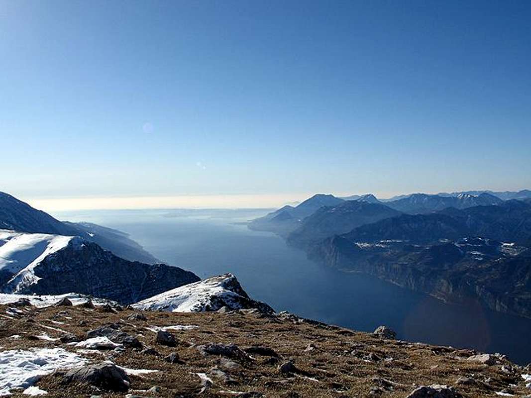
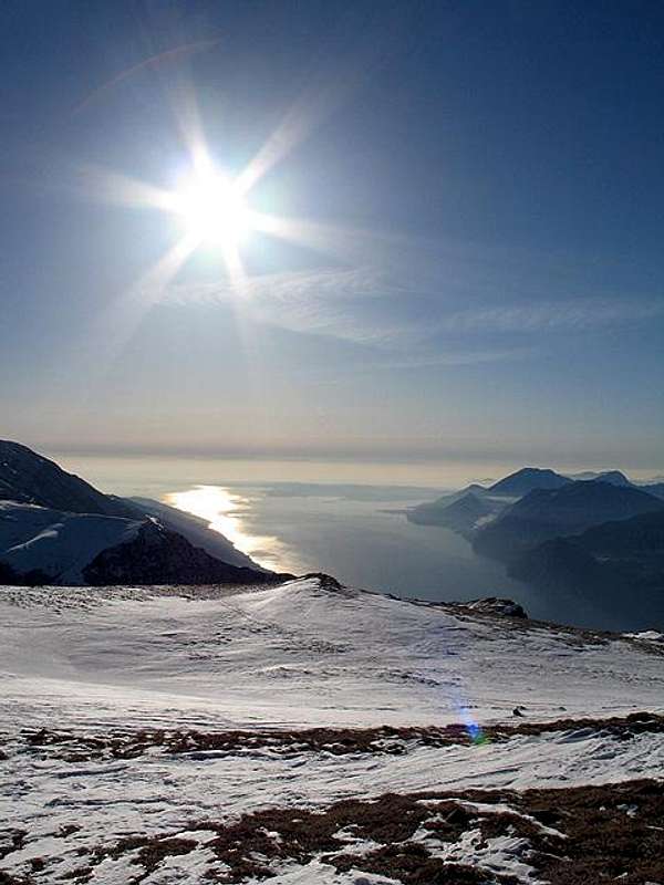
This beautiful and little group is an easy but panoramic destination because from the summit there is a fantastic view of the Garda Lake and other mountains around and the Padana plain

 |  |
Geology
The geological formation of this mountain range is predominantly sedimentary rocks ( dolomia principale,calcari grigi,rosso ammonitico,scaglia rossa, scaglia grigia).The two sides are very different : the western side along the Garda lake is very steep but the other side is very rich in prairies.The Bès-Corna Piana Nature Reserve is the smallest of the Province (150 ha).
"The Reserve, founded in 1972, is situated in southern Trentino between the Baldo chain, Vallagarina and Lake Garda, and involves Brentonico, Avio and Nago-Torbole. Forms of life of pre-glacial origin have evolved on the Baldo slopes, as the expansion of the glaciers - also responsible for the formation of Lake Garda - spared the rather low peaks of the chain. Besides important flowers and plants (anemone, bedstraw, carex, scavoius, genippi silky wormwood, edelweiss, yellow bear´s ear, remarkable primrose and others) for its rare plant species the M.Baldo is know as Hortus Italiae , scientists have discovered the existence of small invertebrates, and of ground beetles, typical of Baldo and hence called "baldensis". Owing to their geological conformation, the rocks of Baldo are very rich in fossils, a phenomenon that generally concerns aquatic forms of life. " (Text by APT Trentino)
 |  |  |  |  |
Main summits
 |  |  |  |  |
Getting There
Car:Autoroute A22 (Brennero-Modena) :
Brentonico and the plateaus can easily be reached on the motorway A 22, exit Rovereto Sud and then on the road SS 240 to Mori and then on the road SP 3 Monte Baldo.
Train:
To the railway station FS Rovereto, from there by bus.
Airplane:
The nearest airports are Verona Catullo (90 km), Venice Marco Polo (195 km), Milan Linate (245 km) and the new airport in Bolzano (60 km).
 |  |  |  |  |
Hiking route
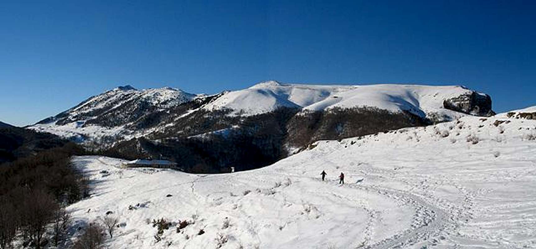
Excursions to Monte Altissimo (2079m) starting from Brentonico-San Valentino"Monte Altissimo San Giacomo-Malga Bes-Graziani refuge hut-Damiano Church
A steep mountain path will take us to the meadows of the Bes pasture and to the Graziani alpine hut. From there we will take a former military path to get to the Damiano Chiesa alpine hut.(2079m.)" ( Text by APT Trentino )
You must going by car towards Brentonico and till S. Valentino, here you must park your car and go along the easy way till the great amphitheater: The south side of M. Altissimo, the Graziani refuge and the Bocca del Creer fork (1617m.). The ascent goes along the slopes through the steep old mule track 633 till the Damiano Chiesa refuge and here you can enjoy the breathtaking panorama: the Brenta Dolomites in the west, the Stivo mountain and the Cornetto in thenorth, the Pasubio chain and the Monti Lessini in the east and finally the lake Garda in the south.

Monte Altissimo Graziani refuge hut-Malga Campo-Prati Malga Campei
A.P.T. di Rovereto e Vallagarina
Ufficio periferico Palazzo Baisi Via Mantova, 4
38060 Brentonico, Italy
Tel +39 (0464) 395149
 |  |  |  |  |
Red Tape
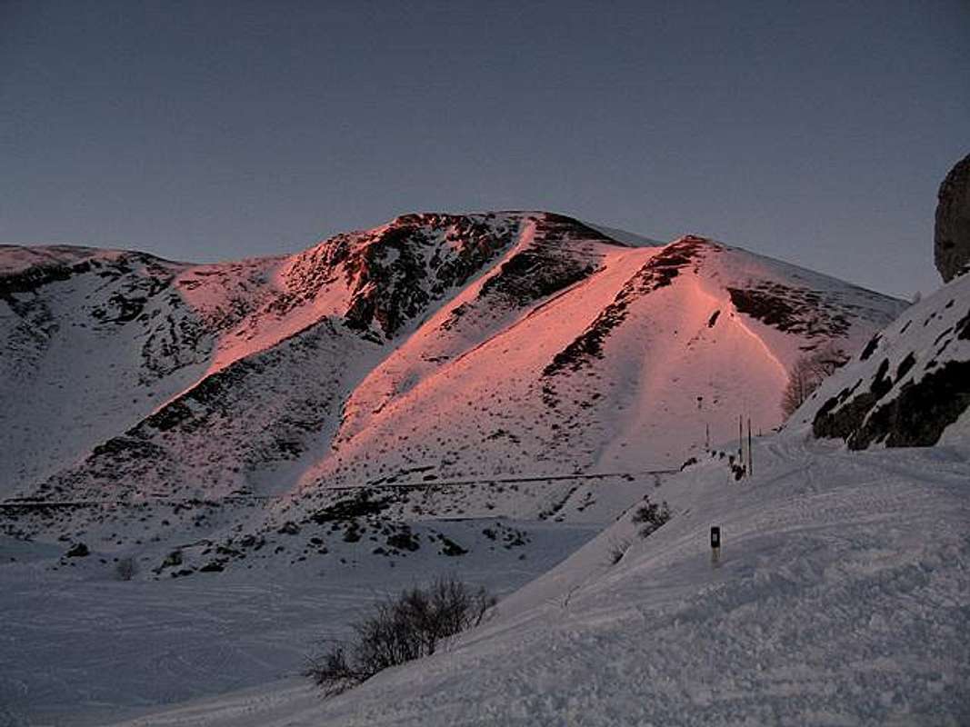
No permits are required and no seasonal closures.In winter monte Baldo-Altissimo turns into a real paradise for skiers, cross country...for sportsmen and nature lovers.
When To Climb
All year long |  |  |
Accomodations
RefugesALTISSIMO "DAMIANO CHIESA"
MONTE ALTISSIMO
Fraz. MONTE ALTISSIMO DI NAGO
I- 38060 BRENTONICO, Italy
Tel +39(0464)867130
CAMPEI
I- 38060 BRENTONICO, Italy
Tel +39(0337)280446
FOS-CE
I- 38060 BRENTONICO, Italy
Tel +39(0464)684946
weather forecast
wetterzentraleMeteotrentino
Meteo Alpin
Società Meteorologica Italiana
Miscellaneous info
Kompass 690 Alto Garda e Ledro - scala 1:25.000Società Alpinisti Trentini
Soccorso Alpino del Trentino
Webcam in trentino
Map making on line
Flora Illustrata del monte Baldo