
|
|
Mountain/Rock |
|---|---|
|
|
42.47130°N / 112.655°W |
|
|
Power |
|
|
8748 ft / 2666 m |
|
|
Overview
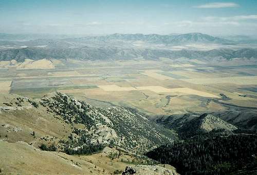
Looking south from the summit of Deep Creek Peak
An interesting peak with a name that indicates that it should be down in the valley rather than high in the sky. Peaks with the name, 'Deep Creek" seem a little out of balance to me but this peak is the highest point in the Deep Creek Mountain range and also is the highest point in Power county.
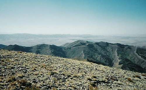
This peak is not well known and if it weren't for the fact that it is the county highpoint of Power County, not many people would even be aware of it but it is in a beautiful area and while the peaks of the area are not overly dominating, the peak is worth a visit.
Tom Lopez's book, "Idaho, A Climbers Guide" has a reference to the Deep Creek Mountains on pages 353&354 and a specific entry for this peak on page 354. In his brief description of two routes up the peak, he mentions that the peak was first climbed by Fred Clark and other members of the Wheeler Survey in 1877. The second of the two routes he mentions is on private property.
Note: Its been reported that the register is no longer there. Remnants of glass from the original register was all the last visitor could find. If you are planning a summit of this peak, please consider taking a register up with you.
Getting There
From I-86, take Idaho state highway 37 south for 20 miles and look for the signed Big Canyon Road, which has both a county road sign and a BLM sign. Turn east on this wide, well-graded road. Follow it as it enters the canyon and becomes steeper and rougher, but remains easily passable in 2WD with normal clearance all the way to the trailhead. At 9.0 miles you'll top out at a saddle where there is a junction with the signed Bull Canyon road heading down to the right - continue up on the main road. At 9.3 miles reach the road's high point, at a shallow saddle at about 7350'. Park here.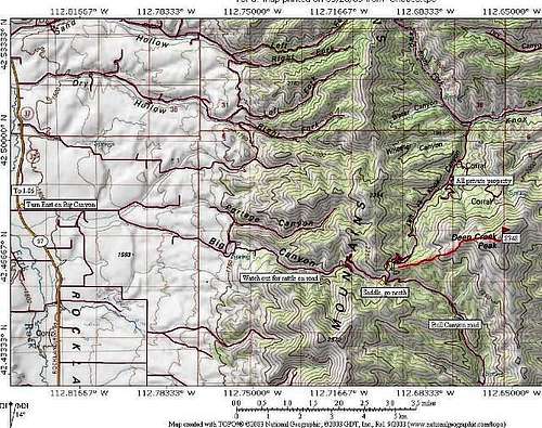
You can also access this peak from I-15 to the east and while I haven't come in from I-15, it looks like some diligent study of DeLorme might be in order to find such a route. I'll be back in this area later this summer and I will see if I can access the peak from I-15. Until that time, it may be best to go up I-15 to the junction with I-86 and go west past the town of American Falls for the hook up with Idaho highway 37.
Red Tape
There were no requirements for permits in this area. The peak it self is on BLM land and the route that will be shown from the west is totally on BLM land and doesn't cross any private property. If you go down Knox Canyon, there are a couple of roads but they are on private property and are signed as such. In studying Power county, I came across an interesting statistic, 25% of Power county is BLM land.
Possible routes up this peak may exist from the east but one may have to cross private property to access the peak therefore only the Western route will be shown for access.
When To Climb
May to late fall when the snow flies. It is probable that this could be climbed in winter but it would depend on whether the access roads are clear (or cleared) of snow which I think is doubtful. There is nothing technical about this peak.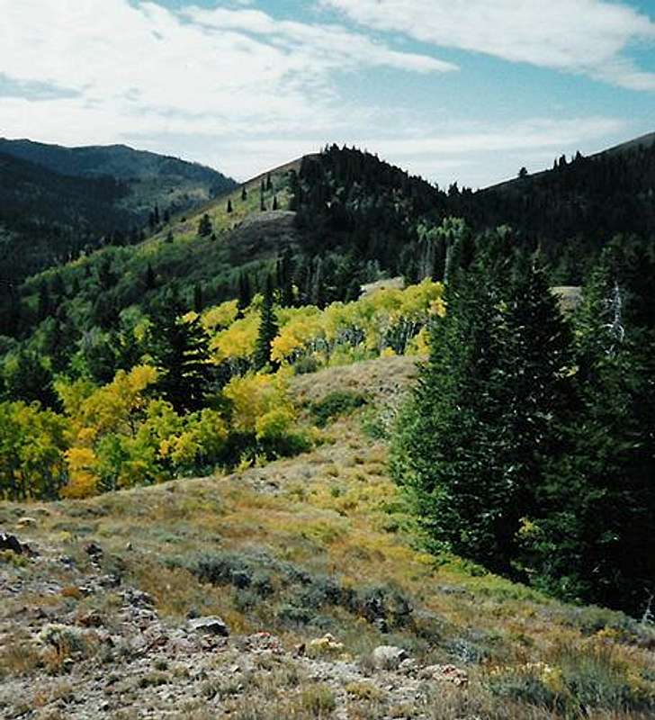
Camping
There is no campground in the area but car camping near the saddle is probable as a few spots in this area have obviously been used by others. Low impact camping and carrying out your own trash is imperative.
Just west of American Falls on I-86 is a must stop and visit place, Massacre Rocks State Park. This area was part of the Oregon Trail history and there is also a campground here. Thanks to SP'er bdogIdaho for sending me the link.
Mountain Conditions
Pocatello Idaho and American Falls are the closest places where the weather for this area is reported.To check on weather conditions in Pocatello, click HERE and for American Falls, click HERE.
Miscellaneous Info & nearby attraction
West of American Falls about ten miles is Massacre Rocks State Park and a campground.
If you have information about this mountain that doesn't pertain to any of the other sections, please add it here.
External Links
Power County
Deep Creek Peak is the highpoint of Power County so its only fair to tell you a little bit about the county it sits in.The most recent census of 2000 indicated that it had a population of 7,538 The county seat is American Falls. Power County was created by the Idaho Legislature on January 30, 1913 by a partition of Cassia County. It is named for the American Falls Power Plant. So here we have a county named after a power plant. The three main towns located in Power County are:
* American Falls (county seat)
* Arbon Valley
* Rockland
brendon - Mar 20, 2005 5:41 pm - Voted 10/10
Untitled CommentThe Deep Creek Range was once a part of the Lost River Range until the Yellowstone hot spot cut its path forming that big flat spot in southern Idaho. A lot of the geological characteristics are identical to those of the Lost Rivers. (I read this in a geology book somewhere. Don't remember too many details.)
brendon - Mar 21, 2005 1:29 pm - Voted 10/10
Untitled CommentHere is an online BLM map that shows the boundaries between private and public land.