
|
|
Mountain/Rock |
|---|---|
|
|
44.35380°N / 112.8212°W |
|
|
Lemhi |
|
|
Hiking |
|
|
Summer, Fall |
|
|
11312 ft / 3448 m |
|
|
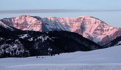
Scott Peak pic by Brendon
Overview
NOTE: Originally there was a page created for this peak by a SP member named BigLost but he deleted all his work from SP and when I realized it, I decided to create a page for Scott Peak and nearby Webber Peak since I really love this area and I've been to this area on two different occasions. Scott Peak deserves a page here at SP and Webber Peak happens to be nearby (further down the main ridge) and is the county highpoint of Clark County. Those of you who have climbed this peak, you may have posted pictures to the original page but those pictures are now just kind of floating. I will attach the ones I have found but would ask you to add them and sign the summit log.Scott Peak is a beautiful mountain easily seen from Rexburg and Idaho Falls which are to the east of Scott Peak . The picture at the left by Brendon gives a feel for what it looks like from that area and as a peak with over 11000 feet of elevation, it also is one of Idaho's top prominence peaks, coming in at #7 on the top 100 list (Lists of John) with 4243 feet.
Scott Peak is also located not far from the county highpoint of Clark County, Webber Peak which is further down the ridge at the 11,200 foot level. More about Webber Peak and the county highpoint in a later section.
The area surrounding Scott Peak is truly a beautiful area and one of the most enjoyable place I've visited in Idaho (which is full of beautiful places). Did I mention that Scott Peak is located in the Beaverhead mountain range?
Since the county highpoint of Clark County is found nearby, I'd recommend that you consider climbing both Clark Peak and adding Webber Peak on the same visit.
More information on the Beaverheads and Scott Peak can be found in Tom Lopez's excellent book on page 317.
Getting There
From Idaho Falls, Idaho Drive north on I-15 to "Sage Junction" at exit #143, drive West through the villages of Terreton and Mud Lake (Idaho hway 33). Just west of Mud Lake the you will encounter a junction with Idaho hway 28, stay on 28 (to the right) and head towards Salmon, Idaho. From the junction drive 42.6 miles to the Nicholia Road, turn right onto this road and drive towards the Nicholia Ranch for about 3 miles, watching for a road that goes to the right, turn right and follow the road southeast for 4.5- 5 miles and turn left up Scott Canyon (FS 190) It was signed as Scott Canyon when I was there and another sign indicated you were entering the Targhee National Forest. Follow FS 190 to its end at 7700 feet and you will know when to stop and proceed no further as the road is blocked at a gate. Adequate room to park here. You can even car camp here if necessary.
From Boise, the direction we came from, take I-84 to Bliss Idaho and take US 26 through Shoshone where it becomes US 26 / US 93 and heads to Carey.
From Carey, head for Arco and take US 20 / US 26 a few miles south to where
SR 22 / SR 33 heads for Howe. At Howe, go east on SR 33 a few miles and
take SR 22 to a junction with SR 28. Head north, passing through a wide spot in the road called Lone Pine (has a gas station and small store) and soon you'll come to the county line sign for Lemhi County. In 5.5 mile from the county line, watch for the turnoff for the Nicholia Ranch. turn right onto this road and drive towards the Nicholia Ranch for about 3 miles, watching for a road that goes to the right, turn right and follow the road southeast for 4.5- 5 miles and turn left up Scott Canyon (FS 190) It was signed as Scott Canyon when I was there and another sign indicated you were entering the Targhee National Forest. Follow FS 190 to its end at 7700 feet and you will know when to stop and proceed no further as the road is blocked at a gate. Adequate room to park here. You can even car camp here if necessary.
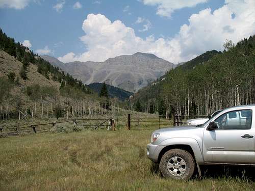
Trailhead
Red Tape
Forest service land. For more information contact:Caribou-Targhee NF
1405 Hollipark Dr
Idaho Falls, ID
83401
(208) 524-7500
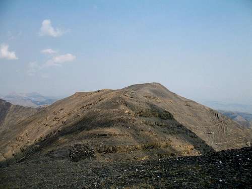
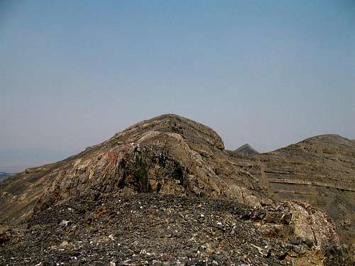
Scott Peak as seen from Webber Peak area
Camping
We camped at the gate as described in the "getting there" section above.No formal campground although there are some small campgrounds along Idaho highway 28 to the south, south of Lone Pine.
Gendarme on route
weather


Route and trip report pages
See the SW Ridge page (on the left) for more detail on the route.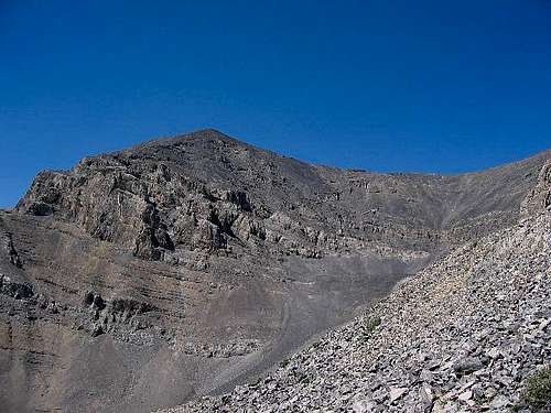
Scott Peak is just out of sight...
Trailhead elevation: 7750

Summit elevation: 11393
Elevation gain to the summit is probably close to 4000 feet (a few ups and downs added in)
The elevation gain is a bit higher if you go to the two spots considered
for the highpoints of Webber Peak.
Distance: 10 miles round trip to Scott and 12 if you include the side trip to the Webber Peak highpoints).
One of the signatures found in the register atop Scott Peak, indicated that the peak was only climbed about once a year (on the basis of the entries) but that in 2006, Bart Robinson had climbed it and he left his website address.
In checking out his website, I found some very very nice pictures and a map.
He had come up from the East via Webber Creek, showing that there is another way to access this mountain. Check out his map HERE. Check out his Scott Peak visit HERE.
Peakbagger.com has a summit log which indicates that 17 people have climbed Scott Peak and lists of John summit log indicates 22 people have climbed this one. For an interesting route page, see Richard Carey's page HERE.

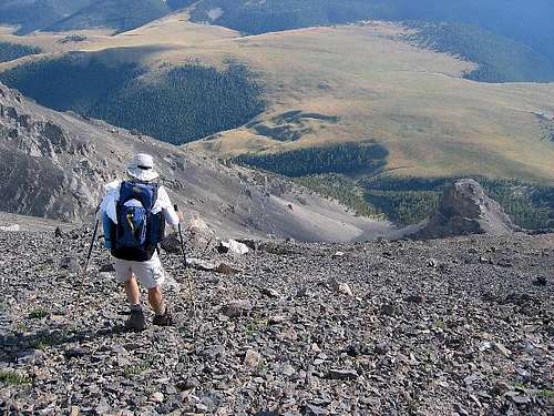
Going up SW ridge route
Prominence information
Many of you are perplexed by the concept of prominence and so I'll provide a couple links here to pages that might enlighten everyone. With Scott Peak being the 7th most prominent peak in the state of Idaho (prominence wise),it might be useful to clarify what this means.
Link one: Wikipedia
Link two: Topographic prominence
Link three: :Peaklist.org
Peaklist.org is really the site that helped me understand and then get excited about the concept of prominence. It has some great links to maps and additional information.
Webber Peak

Dennis heading to Webber Peak
As Webber Peak is close to Scott Peak, those who seek after the summit of Scott Peak may also find it interesting to also add the Clark County Highpoint to their visit. See a good trip report by Ken Jones found on the county highpointing web site HERE.

Me on Webber Peak
The state of Idaho has 44 counties and each one has a peak or a spot that is the highest point of ground and for Clark County, Webber Peak claims that honor. Webber Peak actually has two points that are the same height so in order to claim the county, those who call themselves countyhighpointers will go to both spots. Interestingly enough, Scott Peak is in neighboring Lemhi county so by the placement of a "political boundary", Webber Peak gets the highest honor, even though Scott Peak would claim it if that boundary were further to the west.
As of this moment, there are seven people who have completed all of the Idaho county highpoints which includes some that I know such as Bob Packard from Arizona, Ken Jones from Washington state, Dennis Poulin from Medford Oregon, Adam Helman from San Diego who passed away in January of 2015 and Idaho's own Dan Robbins who lives in Boise.Many others are pursuing the Idaho list of counties and I'm sure that the completion list will grow longer as time goes on. An interesting site that has much more information on county highpointing can be found at www.cohp.org
Summit of Webber Peak
Other trip reports
SP member Dan Robbins, the creator of the website Idaho Summits has this trip report about his visit to Scott Peak. Check out his Idaho Summits web site for much more Idaho peak information.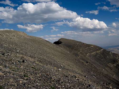
At the 11000 foot area - Go right for Webber, left for Scott