
|
|
Mountain/Rock |
|---|---|
|
|
44.14140°N / 113.083°W |
|
|
12197 ft / 3718 m |
|
|
Prominence Peak
Prominence is the elevation difference between the summit and the lowest contour that encircles it and no higher summit. It is the minimum height by which one would have to descend from a summit in order to re-ascend to a higher peak.
Diamond is one of 3 in Idaho and one of 57 summits in the lower 48 with prominence of 5,000 feet or more. Diamond is #43
Overview
Diamond Peak is the 4th highest peak in Idaho and the highest peak in Eastern Idaho's Lemhi Range. Being one of the much sought after 12ers nets it about 50 to 100 climbers a year.
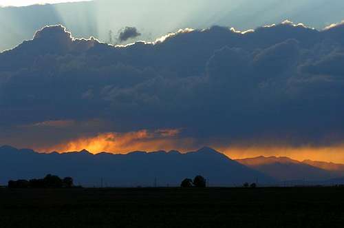
End of the day.....
Shaped like a large pyramid it can be seen from the Lost River Range and the Beaverheads. It is easily seen from the east and southeast (Idaho Falls) on clear days. Much higher than those points around it. Only Bell really rivals it and it is several hundred feet lower.
Outside of the Lost River Range this is the highest peak in Idaho.
It is a solid class 3, with a couple of sections that border on class 4.
The peak was first climbed in 1913 by T.M Bannon (Early Idaho surveyor).
The peak is mainly sedimentary rock - limestone/dolomite, which is typical of the southern Lemhi and Lost River Ranges.
The largest antelope herds in Idaho are to be found in the valleys on each side (east and west)of this peak. Watch for them in on the drive in!
Getting There
East Side Approach
From Idaho Falls Idaho, drive north on I-15 for 24 miles to "Sage Junction". From Sage Junction, drive west on 33 for 15 miles through the small towns of Terreton and Mud Lake. Just west of Mudlake take 28 (to the right) and drive 31 miles northwest to the signed Pass Creek Road. Turn left onto this gravel road and drive 1.75 miles to a road that crosses a ditch to the right. You can take this road to the right , or follow the one you are on. They both end up in the same spot. The road to the right is a little longer, but will get you there faster. It heads north and then bends around to the west so don't get to worried about getting lost. Hard to get lost in this wide open country.
I recommend a 4 wheel, high clearance outfit, but I did drive a 2 wheel drive pickup in once and also my old Plymouth All Wheel drive van, but kissed a few rocks along the way. Ouch!
Pick your spot, park and head up. Sorry to say no shade to park in.
End of the day.....
West Side Approach
From the 118 interchange on I-15 in Idaho Falls, drive west across the high desert on Hwy 20 for 59 miles to Hwy 88. Turn right onto this road and drive 16 miles to the small hamlet of Howe, ID. Continue through town and follow the pavement along the Little Lost River Road for another 22.8 miles to the Badger Creek Turnoff. This dirt road leaves the pavement right at a small gravel pit. When you turn on this road, turn right again immediately and follow the track around the south edge of the pit and continue along a fence line for 5 more miles to the entrance of Badger Creek Canyon. Drive as far as you feel comfortable, find a place to park and head up the Canyon. (I have no route to add, have not climbed Diamond from this side).
Red Tape
Like so much of Idaho there are no permits required for anything (Parking, climbing, camping). As always, remember to carry out what you carry in. Leave as little an imprint on the land as you can. Thank You![img:51743:alignleft:medium:Big Country!]
When To Climb
This like most Idaho peaks is climbed mid-June to mid-September. There are the odd out of season climbs, but few climb this peak outside of the summer and fall months.
Camping
There are camping areas at the base on the east side, nothing fancy (fee and no fee areas). The Birch Creek Campground stretches along Birch Creek for quite a long distance. Weekends you will find it to be quite full, 4 wheeler enthusiasts and fishermen. Birch creek is stocked with trout every year. Fishing is pretty good.
West side camping in Badger Creek a bit better (shade) and also a no fee area.
[img:69136:alignleft:medium:From near the Birch Creek Campground]
Mountain Conditions
Challis Salmon National Forest
RR2 Box 600
Salmon, ID 83467
208-756-5100
Panorama
  |
fjagod01 - Aug 22, 2007 6:15 pm - Voted 10/10
directions from Idaho FallsPedometer Directions from Idaho Falls: http://www.gmap-pedometer.com/?r=1252592