
|
|
Mountain/Rock |
|---|---|
|
|
42.49550°N / 111.2482°W |
|
|
Bear Lake / Caribou |
|
|
Hiking |
|
|
Spring, Summer, Fall, Winter |
|
|
9957 ft / 3035 m |
|
|
Overview
Meade Peak is an important peak to county highpointers and prominence peak chasers alike. It is the county highpoint for both Bear Lake and Caribou counties and has 2497 feet of prominence, making it the 46th most prominent peak in Idaho. Idaho has 100 peaks that qualify for the 2000 feet of prominence list.
Meade Peak is also notable since it is the highest point in the Peale Mountains and the second highest peak south of the Snake River. It only misses being a ten thousand footer by 43 feet. Meade is also the highest point in the Pruess Range, part of the Peale Mountain system. Strangely, the peak was named for General George Meade, who fought in the United States Civil War. (see link)
Getting There
There are several ways to access this peak but the way most people have done it is via the right hand fork of Georgetown Canyon. I will provide directions for this as this is the way I went in.
From Montpelier Idaho, drive north to the small town of Georgetown. (Or from Soda Springs heading south)
Using a combination of fellow county highpointer Jobe Wymore's directions for the most part with a few additions of my own interspersed, this will get you to the end of the road and the jumping off point:
From the center of Georgetown on Hwy 30 look for the green sign that is going to point you into Georgetown Canyon. The sign can be viewed regardless of whether you come from the South or the North. From Hwy. 30 hit your odometer and at 2.4 miles the pavement will turn to dirt. The road sort of splits at this point with signs indicating that if you were to go left at this split you would be going on FR095 and if you just continue straight you will be on FR102. Just keep on heading straight on 102 and at around 0.8 miles from where the pavement ended, look for a road that drops down to the right and take this little side road and hit your odometer again. This road has another fork in a short bit but keep to the right as you are now beginning the right hand fork of Georgetown Canyon.
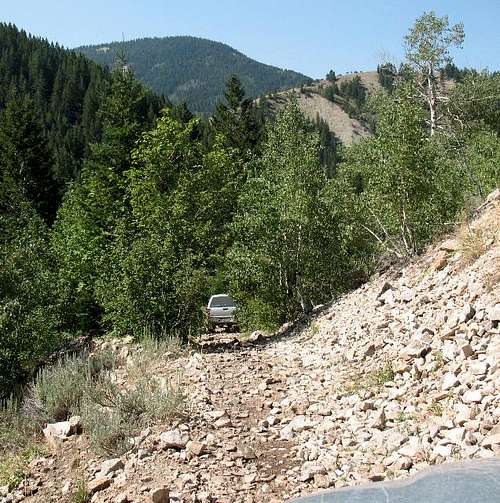
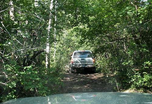
This road gets narrower as you get farther along it (it's not the type of road you want to take a vehicle on if you like the paint job) and roughs up the farther you get, too. Some passenger cars could get about 1.5 miles up with no problem but after that, the road gets much rougher. Muddy sections will intimidate you if you hit this area after a rain but the road has a bottom. Having 4WD and high clearance is a must. A pair of loppers might be a worthwhile addition to your arsenal and you could stop and lop off the worst of the vegetation that could nail your paint but you'd be stopping and lopping alot. Still....

Green watering troughs
At 2.2 miles from the point where you turned onto Right Fork Road the road will split. Take the right split which is in a lot better shape. At 2.7 miles you will pass a some green cattle watering troughs and at 3 miles you will go by a White Pass trail sign on the right side of the road. A small area to park is off to the left. Just keep heading up the main track until you reach a little clearing at 3.8 miles. The clearing will be marked with a fire ring made of white rocks just to the left off the road. You have reached the end of the road and although an ATV track goes on past the clearing, you can take your vehicle no further (not that you'd probably want to. Another small track goes to the right and goes to an old mine (not visited by us)
Odometer readings may not match your odometer but should be close enough.
Congratulations, you have made it. Route information for our visit is found HERE. This is actually another summitpost page i have put together for our route and the stats looked like this:
3 miles round trip with 2400+ elevation gain.
2 hours 15 minutes up with 1 1/2 hrs down.
------------------------------------------------------------------------
There are other ways to access this peak and here are a couple links:
Ken Jones
Jerry Brekhus
Dan Robbins of Idahosummits dot com has a great trip report with helpful pics located HERE
Update: See Sam Grants 6-14-15 peakbagger report for latest info.
Popular peak
Since this is a county highpoint and a peak with over 2000 feet of prominence, that combination makes this one a popular peak to get visited. Peakbagger.com shows at the present moment (July 11, 2015) 28 visitors. Another page of peakbagger shows a half dozen trip reports by county highpointers and all of this adds up to nice information in addition to this summitpost page.
The summit register
Unfortunately it has been reported that the register(s) that were on the summit have gone missing. Where? Anyone know?I took several pictures of some of the register pages that held interest for me because I either knew those who had signed in or knew of them. Here are a few.
 |  |  |
Red Tape

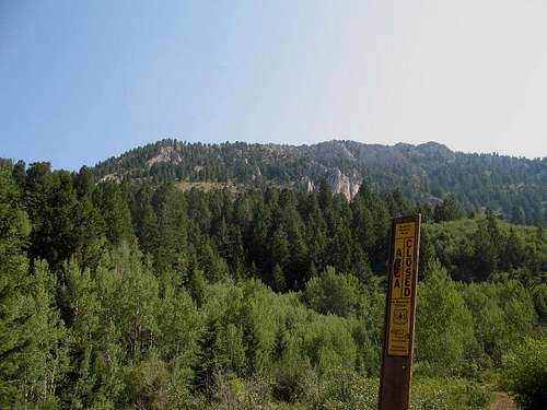
No red tape at all.
Concerns about the area during fire season or road conditions might be
directed to the US Forest service:
RANGER DISTRICT ADDRESSES
Montpelier
322 North Fourth St.
Montpelier, Idaho 83254
208-847-0375
More information can be found HERE.
Camping
It is possible to car camp at the end of the road. You'll note a fire ring where the road ends (and an ATV trail begins) I just sleep in my truck so I didn't look for where a tent spot would be handy. Many people could drive the road, park, and hike the peak and drive back out on the same day. Motels are available in Soda Springs and Montpelier. Campgrounds nearby as shown onthe map of Idaho (Benchmark) are Summit View (left hand fork of Georgetown
Canyon)and Montpelier Canyon campground east of Montpelier off of US 89. A
KOA is just a bit east of Montpelier on US 89.
Weather
Montpelier Idaho Weather
Bear Lake and Caribou Counties
See this wikipedia page for more information on Bear Lake CountyFor Caribou County, click here for the wikipedia information.
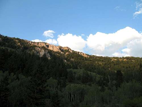
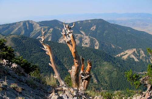
Summit views
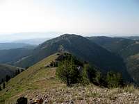 |  | 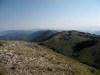 |