
|
|
Mountain/Rock |
|---|---|
|
|
33.17872°N / 111.65111°W |
|
|
Download GPX » View Route on Map |
|
|
Pinal |
|
|
Hiking |
|
|
2279 ft / 695 m |
|
|
Overview
Goldmine Mountain is the most easily accessible peak in the San Tan Mountain Regional Park. It is accessible from both the Main Visitor Center and from the Skyline Trailhead which is a shorter drive from Gilbert/Phoenix. Both trailheads offer nice loops that you can bag the peak from along the way. It is the highest and most prominent *looking* peak in the park. Admittedly, I do not know the history of the area or if this peak is the actual "Goldmine Mountain", but the park ranger and the literature calls it such, despite there being slightly higher peaks along the range within close proximity. That said, there are no trails that take you close to the top of these peaks, but the area is worth the exploration.
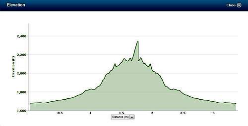
Elevation Profile for Goldmine Mountain from Main Visitor Center
Getting There
Start from either the Phillips Trailhead or the Skyline Trailhead at the San Tan Mountain Regional Park.Phillips Trailhead (Main): From the Phoenix area go east on highway 60 (Superstition Freeway) through Mesa and past the new 202 overpass to Ellsworth. Go south on Ellsworth about 12 miles to Hunt Highway (Ellsworth basically ends at Hunt Highway). Turn left (east) on Hunt highway and go to Thompson Road (clearly marked) and turn south. Go to Phillips road and turn west (right) to the park entrance. From Hunt Highway signs clearly mark the way to San Tan mountain Regional Park.
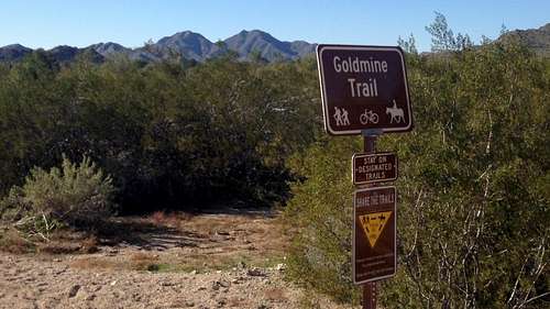
Sign near the Visitor Center
Skyline / Goldmine Trailhead: From central Phoenix, take I-10 east to US 60 east. Exit Ellsworth Road south to Empire Blvd. Travel west on Empire Blvd to Wagon Wheel Road. Take Wagon Wheel Road South to Skyline, and then west on Skyline to trailhead.
Rock Peak Wash Trailhead: From central Phoenix, take I-10 east to US 60 east. Exit Ellsworth Road south to Hunt Highway. Travel east on Hunt Highway to Thompson Road south. Continue south about as the road becomes Brenner Pass Rd to the trailhead.
Route
Route 1 - From San Tan Mountain Regional Park Main Visitor Center:
Take Goldmine Trail from Visitor Center all the way to the saddle/lookout. Look for small trail branching off towards the summit at the lookout. Proceed to summit. My GPS (Garmin Forerunner 620) had us at around 3.5 miles round trip.
Route 2 - Take Goldmine Trail from Skyline Trailhead
Take Goldmine Trail from Visitor Center all the way to the saddle/lookout. Look for small trail branching off towards the summit at the lookout. Proceed to summit. My GPS (Garmin Forerunner 620) had us at around 3.5 miles round trip.
Route 2 - Take Goldmine Trail from Skyline Trailhead
Red Tape
Small Entrance Fee in to the park. Leaving any of the marked trails is apparently prohibited. There is no marked trail to the summit.