
|
|
Mountain/Rock |
|---|---|
|
|
42.73635°N / 0.36080°E |
|
|
Hiking, Mountaineering, Ice Climbing, Scrambling |
|
|
Spring, Summer, Fall, Winter |
|
|
9918 ft / 3023 m |
|
|
Page optimized for a screen resolution of 1280 x 1024 pixels
Overview
 Lustou seen from the northwest
Lustou is a peak located entirely in French territory, at the northern tip of the Massif of Culfreda. This peak stands at the end of a ridge projected from its main one, a part of the Pyrenean divide, to the north. As usual in this area, the summit is a quite prominent pyramid, with a significant elevation gain on the surrounding valleys and is formed by the junction of some ridges, all of them sharp but made of mediocre rock.
Lustou was climbed for the first time in 1864 by Henry Russell, that said that this peak is: “graceful as a nymph, snowy and very fairly acute” and compared the greenness of the surrounding valleys with Ireland (and Russell, though born in France, was of Irish origin!).
Its slopes up to 2000 meters are full of trails and other works to exploit their forest thrives, but from there, loneliness reigns. The hardness of ascents and the lack of a served refuge have kept the crowds away from this beautiful mountain. We can't say the same about Rioumajou Valley, highly tourist place in summer. For that, the impact of loneliness and wild character of the high mountain is most impressive , by contrast, when you climb from this valley
From the summit, the best views are on the massifs of Monte Perdido, Néouvielle, Aret, Culfreda and the valleys around. Bachimala, La Munia, Gourgs Blancs and Midi de Bigorre are also visibles among others.
 Lustou seen from the southwest
 Lustou seen from the southeast
Getting There
 Lustou's summit ridge
The usual bases of ascent in France are the villages of Tramezaïgues and Azet, both in Hautes-Pyrénées Department. Nearest place with all kind of facilities (lodging, banking, shops, etc.) is St-Lary Soulan.
From Spain, there are some possibilities but are very long and have a bad reputation of dangerous, but anyway the base would be Viadós. In this case, there are some lodges in Plan and other facilities in Ainsa or Bielsa.
For a convenient route by car from our point of departure, I recommend to use the Michelin website.
Red Tape
The only limitations are the common ones in natural areas without greater protection: Do not keep the tent settled during the day, outside the areas permitted to do so (see below), and no campfire.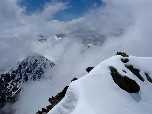 Another limitation is the capacity of the summit...
Camping and huts
 Fredançon bridge camping area
There are two controled camping areas in Rioumajou Valley, both accesibles by car in summer. The rest of the year the road could be closed:
- Pont (bridge) Fredançon, 8 km away from Tramezaïgues by the Rioumajou road.
- Hospice de Rioumajou, 12 km away from Tramezaïgues at the end of the valley road. There is a bar that serves meals.
Really, only the first of this places is a logical base to Lustou but the second one offers some additional services and it’s near.
There is a free hut on the western slope of Lustou, about 2.100 meters high, near the path of the normal route. Called Cabanne du Thou, is in good conditions and usualy clean. It’s not prepared to sleep but four or six people can spent the night. There is a fireplace, some seats and a table inside. To use it permits to divide the ascent in two days (42.75º N / 0.33º E).
Most Common Routes
 The summit from the northwest ridge
 Ridge from Guerreys to Lustou, seen from the south
- Northwest Ridge, from Rioumajou, the most usual route. Elevation gain 1.670 m (F+).
- Northwest Ridge, from Azet, elevation gain 1.900 m (F+).
- South Ridge from Viadós, through Peguere Pass and Guerreys Peak. Elevation gain 1.500 m (PD+, very exposed).
- Ridge from Culfreda Peak to Lustou. About 4 hours summit to summit (PD+).
 Lustou from the west, between the northwest ridge (normal route) and the ridge to Guerreys and Culfreda
Practical Infos
For regional / local weather forecast:- Spanish government weather agency.
- French government weather agency.
Cartography:
- IGN TOP 25 Series, sheet 1748-ET "NÉOUVIELLE"
- IGN TOP 25 Series, sheet 1848-OT "BAGNÈRES-DE-LUCHON"