
-
 9754 Hits
-
 86.37% Score
-
 22 Votes
|
|
Mountain/Rock |
|---|---|
|
|
68.24840°N / 14.47650°E |
|
|
Nordland |
|
|
Scrambling |
|
|
Summer |
|
|
1713 ft / 522 m |
|
|
Overview
Kongstinden 522 m
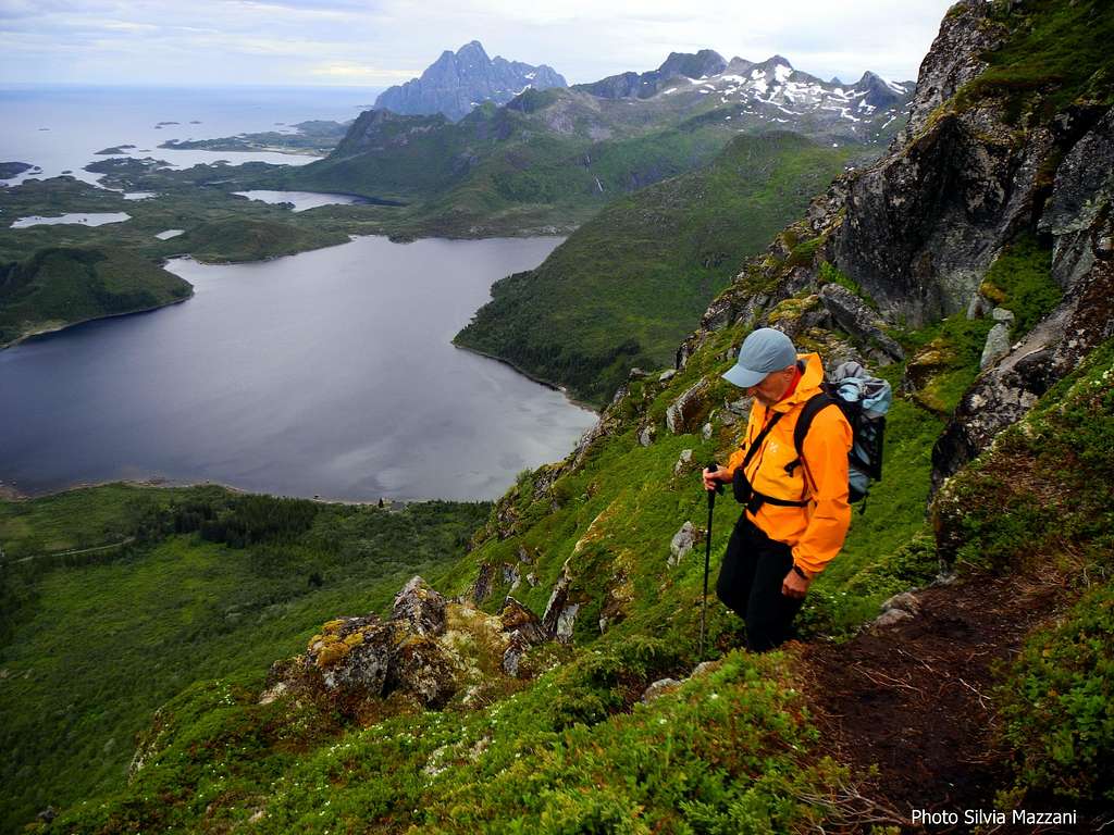
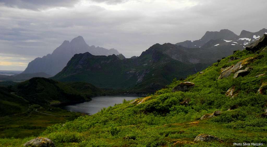
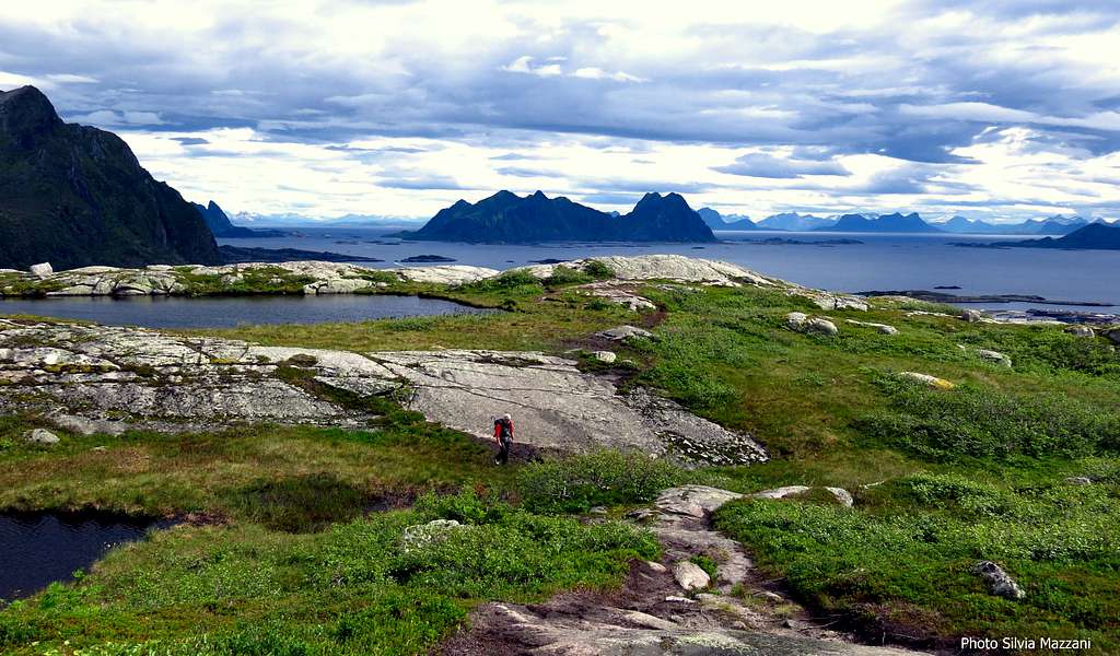
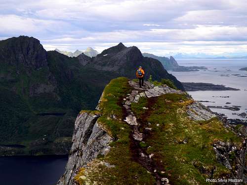
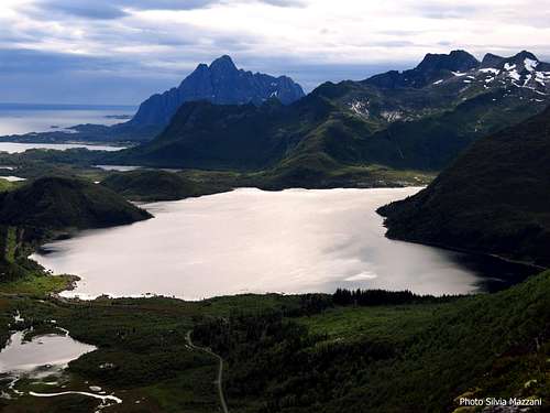
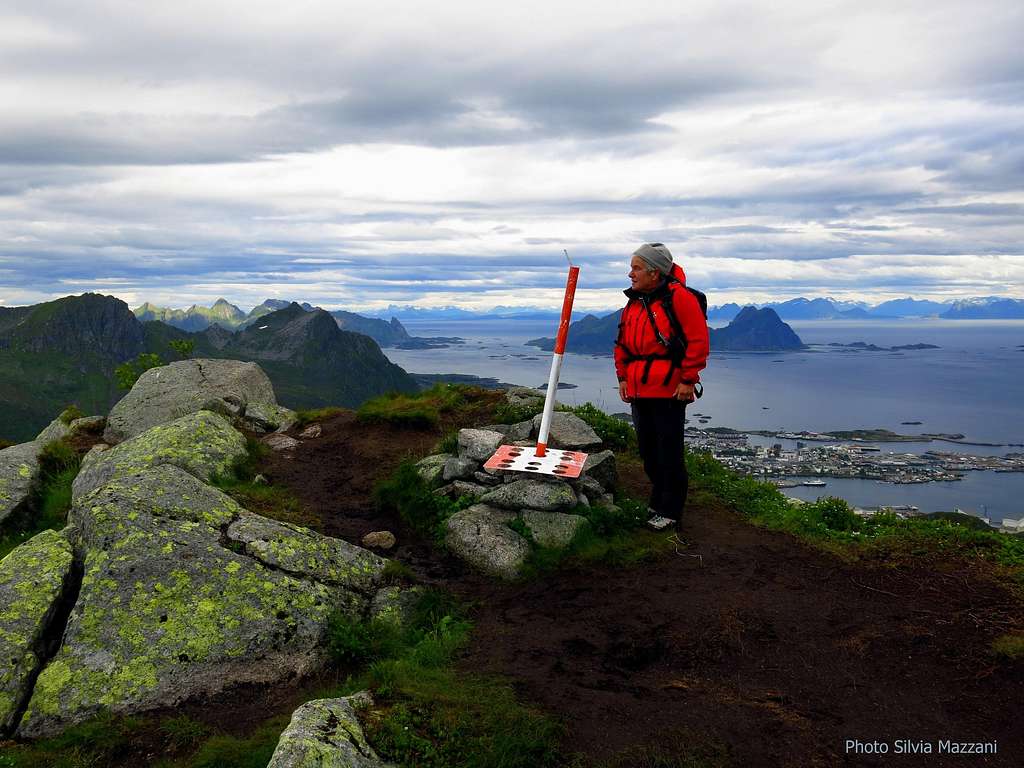
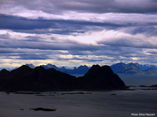
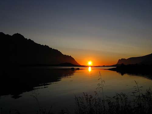
Svolvær, the capital of Lofoten, on Austvagøy Island, is closely dominated by some interesting peaks accessible by short scrambles and featuring incredible views over the town, the surrounding islands and peaks and the mainland. Kongstinden (King’s Peak) is one of these, a charming pyramidal peak lined up on a ridge closely running on the North-West of Svolvær, between the lakes Nøkkvatnet to the North and Kongsvatnet to the South. The mountain is 522 meters high, while the higher and further Lova Tinden, also aligned along the ridge, is 640 meters high. Kongstinden standard route is one of the classic half-day climbs located nearby Svolvaer. It's a rather brief route - about three hours roundtrip from Kongsmarka - and not demanding; for this reason it is suitable even on days of uncertain weather, obviously provided with a fairly good visibility, or taking advantage of a brief period of good weather.
Getting There

Getting to Lofoten
There are various possibilities:
- By ferry boat from Skutvik to Svolvær
- By car from Evenes Airport to Svolvær
- By plane from Bodø
- By ferry boat from Bodø to Moskenes, Værøy or Røst (Southern Lofoten)


The closest town to Kongstinden is Svolvær.
Road approach to Kongstinden
Coming from the E10 Kong’s Olav road – before enter in Svolvær when arriving from South West (Kabelvag) – take on the left the road to Kongsmarka (signpost). Skirting the shore of the Kongsvatnet you will reach the parking lot near the hydro-building. The path starts by the Power Station on the Northeast side of Lille Kongsvatnet.

Normal route
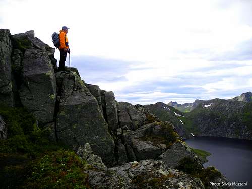
Kongstinden East Ridge standard route
Summit altitude: m. 522
Difficulty: Easy scramble
Vertical gain: 500 m
Exposure: East
Starting point: Kongsmarka, Austvagøy Island

An easy and fun half-day scramble up a scenic ridge facing East, providing stunning views over the surrounding lakes, Austvagøy Island, the mighty Vagakallen and mainland in background
From the Kongsmarka parking area near the hydro buildings on Lille Kongsvatnet North-East shore walk briefly (about 150 m) around the lake, finding soon on the right the start of a well worn path (red marks), rising steeply amongst some granite boulders and slabs and leading to a tiny lake located on a grassy and rocky plateau. Cross briefly the plateau heading West to reach the base of a rounded spur.

Climb it amongst boulders and vegetation, getting to a first rather undistinct fore-summit along the ridge (summit signal), where the marks end. Here you can see clearly the Kongstinden beautiful summit pyramid and the climbing route, entirely visible. From this far fore-summit descend briefly, then follow an airy ridge getting the base of the last rocky step. Climb it with easy scramble, looking for the best alternately to the right or to left of the edge, getting to the summit signal. Enjoy the stunning views at the top. 1 and a half hour from Kongsmarka, about 2 and a half hour roundtrips
Descent: reverse the route
Red Tape
There are no particular restrictions in climbing and hiking.
Climate
On Lofoten the weather can change suddenly from clear and blu sky with sunshine or the Northern Lights (Aurora Borealis) to violent storms with rain or snow. Maximum temperatures go from +30°C in June and July to -15°C in January and February; the average temperatures for these months are from +12°C to -3°C. The period with the minimum rainfall goes from April to June, while we may expect the maximum rainfall or snowfall between October and December.
Midnight sun: from 27 May to 17 July
Polar night: from 6 December to 6 January
The Northern Lights can be seen over Lofoten from September to April.
Useful info about climate: Meteorologisk Institutt
| Month | Avg Low | Avg High | Precipitation (mm) | Wet Days | Daylight (Hours) |
| January | -2°C | 1°C | 65 | 18 | 5 |
| February | -2°C | 1°C | 60 | 17 | 10 |
| March | 0°C | 3°C | 65 | 18 | 14 |
| April | 1°C | 5°C | 55 | 17 | 20 |
| May | 5°C | 9°C | 55 | 18 | 24 |
| June | 7°C | 12°C | 70 | 18 | 24 |
| July | 9°C | 15°C | 65 | 18 | 24 |
| August | 8°C | 15°C | 90 | 20 | 22 |
| September | 7°C | 13°C | 100 | 22 | 15 |
| October | 5°C | 8°C | 110 | 23 | 10 |
| November | 3°C | 6°C | 85 | 19 | 6 |
| December | -1°C | 3°C | 75 | 19 | 2 |
When to Climb
Best months to climb are late May, June, July and August
Midnight sun: from 27 May to 17 July
Polar night: from 6 December to 6 January
Accomodation
In Svolvær and surroundings there is a wide choice of different kinds of accommodations: hotels, campgrounds and the traditional and typical rorbuers, the Norwegian fishermen's cabins, available in Svolvær, Henningsvær, Kabelvåg. In Norway free camping is allowed in every place, if not expressly forbidden
Meteo

Guidebooks and maps


- "Lofoten Rock" by Chris Craggs and Thorbjørn Enevold - Rockfax
External links
ROCKFAX LOFOTEN GUIDEBOOK
LOFOTEN INFO