
-
 3250 Hits
-
 84.03% Score
-
 18 Votes
|
|
Mountain/Rock |
|---|---|
|
|
39.72520°N / 106.2701°W |
|
|
Summit |
|
|
Hiking, Mountaineering, Scrambling |
|
|
Spring, Summer, Fall, Winter |
|
|
12857 ft / 3919 m |
|
|
Overview

Looking up at rocky and rugged "Peak S" from the Slate Creek Basin
By Gore Range standards, “Peak S” is a pretty mellow mountain. Rising above the spectacular Slate Creek Basin, much of the Gore Range neighborhood is on fabulous display from the top of this rocky mountain. Ascent options include a loose scurry up a gully between “Peak S” and “Peak R,” or a more solid and exciting ridge traverse from “Peak T.” The summit area is large enough for lounging and absorbing the jaw-dropping scenery surrounding the peak on all sides.
Rank: 750th highest mountainin Colorado
Prominence: 357 feet
YDS Rating: Class 2+
Planning Maps: Trails Illustrated #108 Vail, Frisco, Dillon (primary) and #107 Green Mtn Reservoir / Ute Pass (secondary)
Rank & Prominence: Lists of JohnGetting There
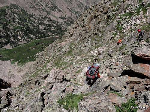
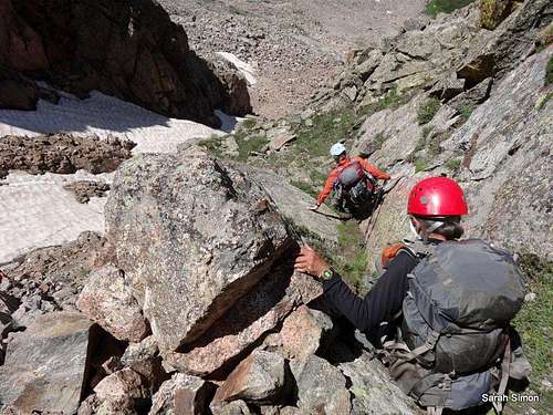
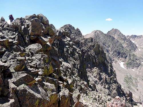 Cruising along the connecting ridge from "Peak T" to "Peak S." | 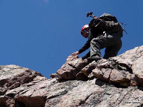 Joe moving along the ridge connecting "Peak T" and "Peak S." | 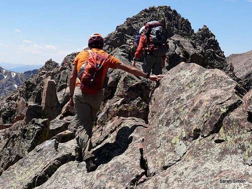 John and Candace on the ridge heading to "Peak S." |
Driving directions courtesy of the US Forest Service.
Rock Creek Trailhead (@9500 feet)
From I-70 take Exit 205, Silverthorne/Dillon, and travel north on HWY 9 for approximately 7.7 miles. Turn left onto Rock Creek Road (FDR 1350) across from the Blue River Campground. Follow the gravel road for approximately 1.2 miles and turn left at the road marked “Rock Creek”. The winter trailhead parking lot is immediately on your left. For summer access, you can continue up the 4WD road for approximately 1.7 miles to the Rock Creek Trailhead and parking lot.
Brush Creek Trailhead (@9000 feet)
From I-70 take Exit 205, Silverthorne/Dillon, and travel north on HWY 9. Travel north on HWY 9 for approximately 16.8 miles. Just after mile marker 118 turn left onto County Road 30 toward the town of Heeney. Follow County Road 30 for approximately 0.5 miles and turn right into the parking area at the old Grandview Cemetery on the right side of the road. Park here if you do not have high clearance 4WD. Across from the Grandview Cemetery Parking is the Brush Creek Road (FDR 1695) where motorized (4WD) access is allowed during the summer if you want to drive to the Brush Creek Trailhead. From the Cemetery parking lot up Brush Creek Road to the trailhead is 2.3 miles.
Boulder Trailhead
See important details regarding driving directions and private property concerns on kane’s “Peak Q” / “Prisoner Peak” page here on SummitPost.
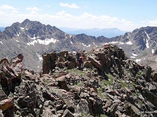 Nearing the summit of "Peak S." |  At the summit of "Peak S," surrounded by the rugged and beautiful Gore Range | 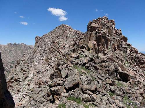 Looking back at the summit of "Peak S." |
Red Tape
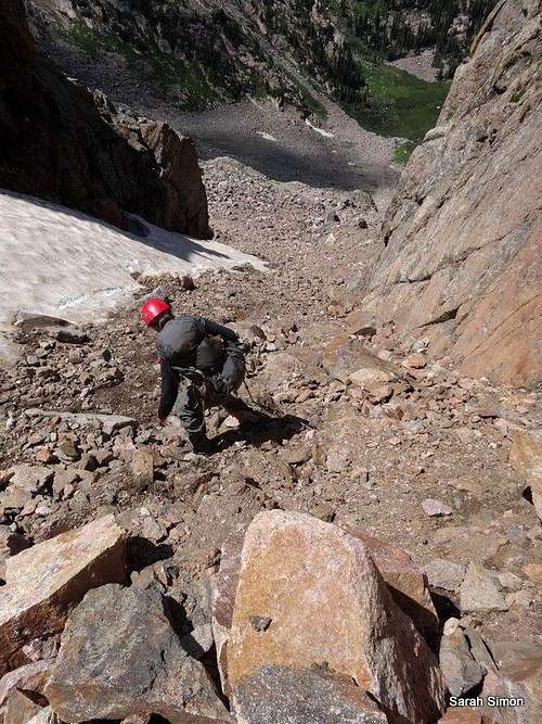
Beginning the initial descent from "Peak S" into the gully to the southwest
Hiking into the gully between "Peak R" and "Peak S."
Please practice Leave No Trace principals:
1. Plan Ahead and Prepare
2. Travel and Camp on Durable Surfaces
3. Dispose of Waste Properly
4. Leave What You Find
5. Minimize Campfire Impacts
6. Respect Wildlife
When to Climb
Gully southwest of "Peak S"
| Long approaches would make a winter or spring ascent of “Peak S” a worthy testpiece. Summer and fall would provide easiest passage, though the mosquitoes in the Slate Creek / Lake Basin can be nearly intolerable in moist conditions. |  Click the National Weather Service image for a zone forecast at an elevation of 12398 ft |
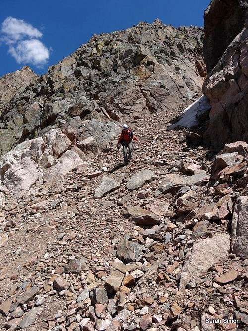 Wear your helmet! | 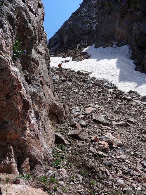 A lot of loose rock | 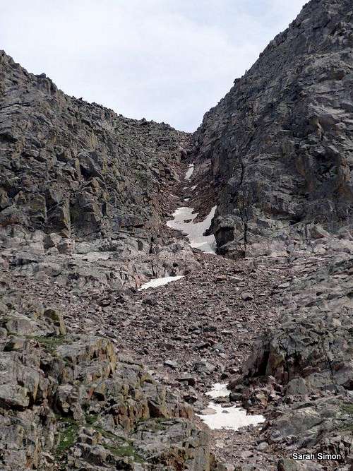 Travel with care |
Camping
Upper Slate Lake is a great place to camp for an attempt on “Peak S.” Regardless of trailhead used, expect about/at least 10 miles one-way and 3,000 feet of elevation gain from truck to campsite. Regulation backcountry sites at least 100 feet from the lake or stream are not super-abundant, but can be found on the lake’s southeast shore. Resist the temptation to grab one of the sites on the eastern end of the lake at the outlet as they are very close to the water.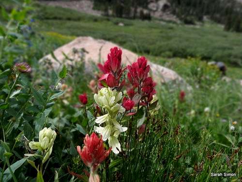 Many colors of paintbrush in Slate Creek Basin | 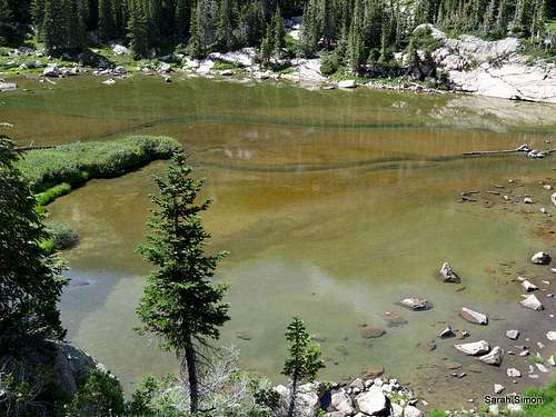 Moose tracks through lake bottom sentiment in the upper basin | 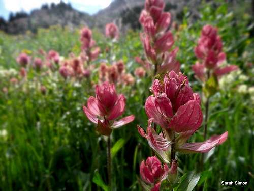 Beautiful paintbrush in the basin below "Peak S." |
External Links
Please let me know of any additional trip reports or other informative resources to attach to this page. Thanks!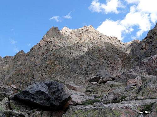
A last view of "Peak S"