


-
 1039 Hits
-
 80.49% Score
-
 12 Votes
|
|
Area/Range |
|---|---|
|
|
45.66170°N / 7.31975°E |
|
|
Hiking |
|
|
Spring, Summer, Fall, Winter |
|
|
7392 ft / 2253 m |
|
|
Note
La montagna chiama i suoi figli, ed essi rispondono fedelmente al suo appello… Osvaldo Cardellina, Diario alpinistico, 1964-65 Page texts: @ OsvaldoCardellina "Osva", passed away on May 2, 2022. Page owners: Christian Cardellina e Osvaldo Cardellina. Any updates from September 12, 2022: Antonio Giani, page administrator, friend and climbing companion. Testi della pagina: @ OsvaldoCardellina "Osva", scomparso il 2 maggio 2022. Proprietari pagina: Christian Cardellina e Osvaldo Cardellina. Eventuali aggiornamenti dal 12 settembre 2022: Antonio Giani, amministratore della pagina, amico e compagno di salite. |
Overview
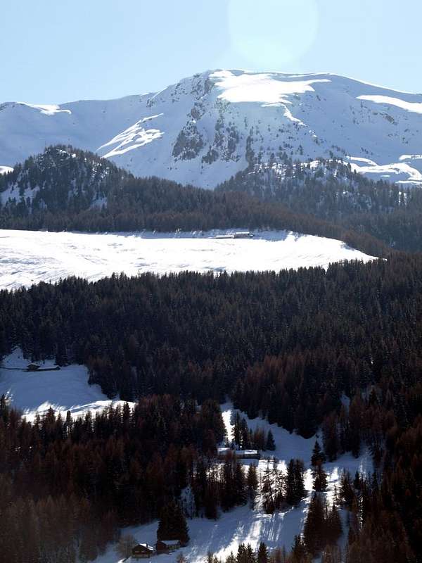
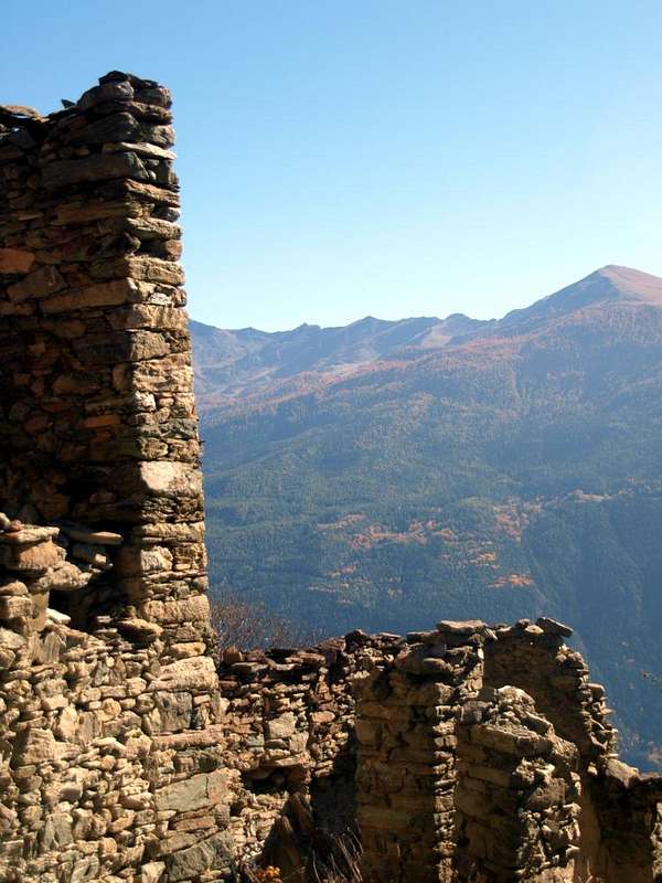
A higher small valley and South of the Pila Basin, which precedes Col Tsa Sètze or Tsasèche, even Chasèche, (2.815m), before going down above the Village of Epinel (1.435m) into homonymous narrow valley in Val di Cogne.
The place name of Tsa Sètze means alp very high, perhaps the last and certainly lack of waters, ie dry. Most likely in the old days, when it was also exploited the last blade of grass, there had to be on the Northern Slope over the Plan de l'Eyve or Eyvie (amongst 2.253/2.330 meters; more water into the tableland) or on the Southern or Arpisson the last pastures, real outposts before reaching the Col Tsa Sétze (2.815m). In fact, on the side of Pila Basin are still a trace of the rushing water from under the hill that joins the tiny emissary from a pond (2.525m) at the Western foot of Mont Bellefaçe (2.970m) and the nearby Punta della Valletta (3.090m) forming the Torrent de Plan de l'Eyvie. The latter runs from South to the North towards Pila-Resort, then joins the Torrent de Fernier with which forms the most important Torrent de Gressan.
Valloncello superiore a Meridione della Conca di Pila, che precede il Col Tsa Sètze (2.815 m), prima di scendere nell'omonimo stretto vallone in Val di Cogne.
Il toponimo Tsa Sètze stà a significare un'alpe molto alta e forse l'ultima e certamente scarsa e povera in acque, cioé piuttosto secca e forse pur arida. Molto probabilmente nei tempi andati, quando veniva sfruttato sin l'ultimo fil d'erba, dovevano esistere sia sul Versante Settentrionale sopra il Plan de l'Eyve od Eyvie (sempre dell'acqua) oppure sul Meridionale o d'Arpisson degli ultimi alpeggi, veri avamposti prima di raggiungere il Col Tsa Sètze. In effetti sul lato Pila troviamo ancora una traccia dello scorrer dell'acque da sotto il colle che si unisce al minuscolo emissario proveniente da uno stagno (2.525 m) alle pendici Occidentali di Mont Bellefaçe e Punta Valletta (2.970 m, 3.090 m) formando il Torrent Plan de l'Eyvie. Quest'ultimo scorre da Sud a Nord fino a raggiungere Pila, per poi inserirsi nel Torrent de Fernier col quale forma l'importante Torrent de Gressan.
Getting There from the Central Valley floor of Baltea
BY CAR:
- From TORINO, MILANO, etc: Motorway A5. Exit at IVREA or Quincinetto (PIEDMONT)
- From IVREA Town: Charvensod, Gressan, Jovençan, Aymavilles Municipalities.
- From Charvensod to Dard-Comboé-Arbolle Vallons towards Ponteilles (1.697m) Alp & Waterfall, through dirt road, Comboé Alp & Saint Ours private Shelter (2.114m), through dirt road, and Arbolle Refuge (2.516m), nearby Lakes (2.495m, 2.497m), by Chair Lift to Chamolé Station (2.309m), Lake (2.325m) and muletrack. From Charvensod (main road from Pont Suaz 567m) or Gressan (603m; alternative road) to Tivet, Les Fleurs Hamlets (1.292m, 1.414m) Pila Basin and Resort (low parking nearby Cableway 1.800m; upper parking 1.850m). Arno Shelter (2.660m), always open but unguarded, nearby Couiss Summit on watershed Pila/Cogne Valley. From Jovençan (631m) to Western Pila Conca, exclusively through path-muletrack to Tourlin Dessous (1.466m) and by dirt road to Pila-Posse Tennis (1.776m). From Aymavilles (646m) to Western Pila Conca, through Main Road to Cogne Valley, alternative road to Ozein/Turlin Dessus Hamlets and dirt road to Pila-Posse.
- From FRANCE: through the Mont Blanc Tunnel to Entrèves-crossroads to Vény/Ferret Valleys - Mountain Guides of Courmayeur - La Saxe Rock Gym - Courmayeur. By Little Saint Bernard Pass, closed since November until half May to La Thuile Valley - Pré Saint Didier - Courmayeur. It is not necessary to take Motorway A5: you can drive on SS.26, in the direction of AOSTA - IVREA - TURIN.
BY PLANE:
- Aeroporto "Corrado Gex" Saint Christophe (Aosta).
 |
 |
 |
Twenty Walks Excursion & Routes even by skis and with snowshoes (20)
We describe some beautiful and easy walks and Excursions, but the most important is their prerogative that all are quite and offer panoramic views at 240/250° in the Aosta Valley, and also, last but not indifferent, presents ideas without particular difficulties or dangers are within everyone's reach. Or almost ... To that end we want to provide a small list of walking, hiking, climbing, trips Ski-Mountaineering or Snowshoeing recommended always from East to West:
1) - Chair lift Station/Col de Chamolè/Arbolle Shelter (2.311m, 2.641m, 2.516m); Walk of 1h'30/1h'45; T.
WALKS
2) - Fork Bois (Wood) de Lap/Lac de Leissé (2.076m, 2.114m); Walk 1h'45/2h'15; T.
3) - Gorraz parking/Grivel Alp/Liautaysaz Alp/Grimondet Pasture (1.850m, 1.910m, 2.077m, 2.105m); Walk of 2h'15/2h'30; T.
4) - Chanté old Alpage/Chamolé Pasture/Lake Chamolè (2.114m, 2.152m, 2.325m); Excursion 1h'20/1h'30; H.
EXCURSIONS
5) - Chair lift Station/Col de Chamolè/Arbolle Shelter/Lake Gelato (2.311m, 2.641m, 2.516m, 2.957m,); Excursion of 3h'00/3h'30; H.
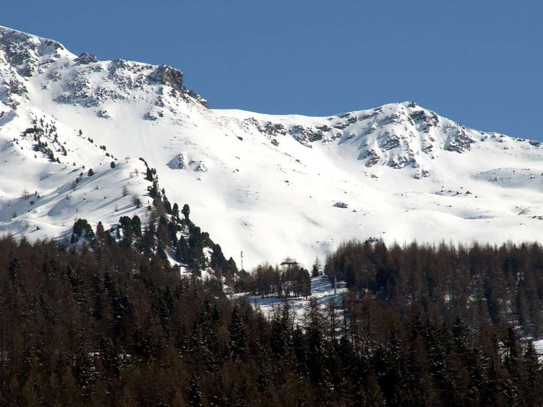
6) - Plan de l'Alpe Eyvie/Col Tsa Setze (2.253m, 2.815m); Excursion 3h'00/3h'30; H.
7) - Punta del Drinc (2.555m, 2.663m); Excursion of 2h'45/3h'15; H.
8) - Punta de la Pierre/Tsa Setze Hill (2.653m, 2.815m); Excursion with traverse of 4h'30/5h'30; EE (Expert Hikers).
ASCENTS 9) - Comboé/Plan Valé/Grand Scez/Becca di Nona through S-SW Slope (2.114m, 2.379m, 2.526m, 3.142m); Ascent of 3h'45/4h'15; E/F.
 |
 |
 |
10) - Plan Valé/Grand Scez/Federigo Bivouac at Carrel Hill/Becca di Nona by E-SE Crest (2.379m, 2.526m, 2.907m, 3.142m); Ascent of 4h'00/4h'30; E/F.
11) - Upper Chair lift Station/Chamolè Hill/Arbolle Refuge/Lac Gelè/Trois Capucins Pass/Monte Emilius through S-SE Crest or Normal Route (2.311m, 2.641m, 2.516m, 2.957m, 3.242m, 3.559m); Ascent of 5h'30/6h'00; EE/F+.
12) - Upper Chair lift Station/Chamolè Hill/Testa Nera/Mont Bellefaçe/Punta della Valletta/Punta di Pian Bessey through NE Crest and traverse (2.311m, 2.641m, 2.820m, 2.970m, 3.090m, 3.085m); Ascent of 2h'30/3h'00; EE/F.
13)- Chair lift Station/Testa Nera (2.820m) through North Face (various routes) or Northwest Crest; Climbing of 250/300 meters in 1h'30/2h'00; A/PD+.
14) - Pila-Perchu Dessus/Chamolé Alp/Plan Fenetre Hill/Comboé Alpages/Plan Valé/Grand Scez/Federigo Bivouac at Carrel Hill/Becca di Nona by S Slope and E-SE Crest (1.865m, 2.152m, 2.114m, 2.379m, 2.526m, 2.907m, 3.142m); Ascent of 4h'00/4h'30; OSA.
SKI-MOUNTAINEERING
15) - Upper Station/Testa Nera/Mont Bellefaçe/Punta della Valletta through "Via degli Alpini" (2.311m, 2.820m, 2.970m, 3.090m); Ascent of 3h'30/4h'30; OSA.
16) - Pila-Gorraz parking/Plan Perdu/Restaurant La Chateleine/Alp La Pera/ Alp La Nouva/Plan de l'Eyvie Upper Pastures/Col Tsa Setze (1.850m, 2.000m, 2.102m, 2.149m, 2.170m, 2.253m, 2.815m); Ascent of 4h'15/4h'45; BSA.
17) - Pila-Gorraz parking/Chaléchemoz Pasture/Champ Vert Pasture/Lake and Alp Leissé/Leissé Damon or Upper Alpage/Superior Station Cableway Gorraz/Platta-de-Grevon (1.850m, 2.031m, 2.171m, 2.114m, 2.126m, 2.163m, 2.357m, 2.701m); Ascent 3h'45/4h'15; BSA.
18) - Gorraz Upper parking/Unnamed Alp/Gorraz Damon/Bois de Chanté/Chamolé Lake (1.850m, about 1.890 meters, 2.325m); Excursion of 1h'45/2h'00; F+.
SNOWSHOES
19) - Gorraz Upper parking/Chalechèmoz Pasture/Lap Pasture/fork 2.112 meters into Bois de Lap/Grand Grimod Dessous/Col de la Pierre/Punta de la Pierre through Northeast Slope and South-southeast Crest (1.850m, 2.031m, 2.076m, 2.112m, 2.158m, 2.584m, 2.653m); Excursion of 3h'45/4h'15; PD+.
20) -Pila Upper Parking/Gorraz Damon/Plan Perdu/Chatelaine (2.102m)/La Pera/La Nouva/junction 2.190m/Plan de l'Eyvie; Excursion of 1h'45/2h'15; F+.
 |
Descriviamo alcune facili e belle passeggiate ed escursioni, ma la loro prerogativa più importante consiste nel fatto che tutte sono alquanto panoramiche ed offrono viste a 240/250° sulla Valle di Aosta ed inoltre, fattore non indifferente, presentano itinerari senza particolari difficoltà o pericoli sono alla portata di tutti. O quasi ... All'uopo vogliam fornire un elenco di passeggiate, escursioni, ascensioni, gite di Sci-Alpinismo o con Racchette da neve consigliate sempre da Est ad Ovest:
1) - Stazione Superiore della Seggiovia/Col de Chamolè/Rifugio di Arbolle (2.311 m, 2.641 m, 2.516 m); Psseggiata di 1h'30/1h'45; T.
PASSEGGIATE
2) - Bivio Bois de Lap/Lac de Leissé (2.076 m, 2.114 m); Passeggiata di 1h'45/2h'15; T.
3) - Pila-Gorraz parcheggio/Alpe Grivel/Alpe di Liautaysaz/Alpeggio del Grimondet (1.850 m, 1.910 m, 2.077 m, 2.105 m); Passeggiata di 2h'15/2h'30; T.
4) - Alpe di Chanté/Alpe di Chamolé/Lago di Chamolè (2.114 m, 2.152 m, 2.325 m); Escursione di 1h'20/1h'30; E.
ESCURSIONI
5) - Stazione Superiore della Seggiovia/Col de Chamolè/Rifugio di Arbolle/Lago Gelato (2.311 m, 2.641 m, 2.516m, 2.957 m); Escursione di 3h'00/3h'30; E.
6) - Alpe Plan de l'Eyvie/Col Tsa Setze (2.253 m, 2.815 m); Escursione di 3h'00/3h'30; E.
7) - Punta del Drinc (2.555 m, 2.663 m); Escursione di 2h'45/3h'15; E.
8) - Punta de la Pierre/Tsa Setze (2.653 m, 2.815 m); Escursione con traversata di 4h'30/5h'30; EE (Escursionisti Esperti).
 |
 |
 |
10) - Plan Valé/Grand Scez/Biv. Federigo al Colle Carrel/Becca di Nona per la Cresta E-SE (2.379 m, 2.526 m, 2.907 m, 3.142 m); Ascensione di 4h'00/4h'30; E/F.
11) - Stazione della Seggiovia/Colle di Chamolè/Rifugio di Arbolle/Lago Gelato/Passo dei Tre Cappuccini Pass/Monte Emilius tramite la Cresta S-SE o Via Normale (2.311 m, 2.641 m, 2.516 m, 2.957 m, 3.242 m, 3.559 m); Ascensione di 5h'30/6h'00; EE/F+.
12) - Stazione della Seggiovia/Colle di Chamolè/Testa Nera/Mont Bellefaçe/Punta della Valletta/Punta di Pian Bessey tramite la Cresta NE e traversata (2.311 m, 2.641 m, 2.820 m, 2.970 m, 3.090 m, 3.085 m); Ascensione di 2h'30/3h'00; EE/F.
13) - Stazione Sup./Testa Nera (2.820 m) tramite la Parete Nord (varie vie) o per la Cresta Nordovest; Arrampicata di 250/300 metri in 1h'30/2h'00; A/PD+.
SCI-ALPINISMO
14) - Stazione Superiore della Seggiovia/Testa Nera/Mont Bellefaçe/Punta della Valletta tramite la "Via degli Alpini" (2.311 m, 2.820 m, 2.970 m, 3.090 m); Salita di 3h'30/4h'30; OSA.
15) - Stazione Superiore/Testa Nera/Mont Bellefaçe/Punta della Valletta tramite "Via degli Alpini" (2.311 m, 2.820 m, 2.970 m, 3.090 m); Ascensione di 3h'30/4h'30; OSA.
16) - Pila-Gorraz parcheggio/Plan Perdu/Ristorante La Chateleine/Alpe La Pera/ Alpe La Nouva/Alpeggio Superiore di Plan de l'Eyvie/Col Tsa Setze (1.850 m, 2.000 m, 2.102 m, 2.149 m, 2.170 m, 2.253 m, 2.815 m); Salita di 4h'15/4h'45; BSA.
17) - Pila-Gorraz parcheggio/Alpe di Chaléchemoz/Alpe di Champ Vert/Lago ed Alpe Leissé/Alpe Leissé Damon/Stazione Superiore Funivia di Gorraz/Platta-de-Grevon (1.850 m, 2.031 m, 2.171 m, 2.114 m, 2.126 m, 2.163 m, 2.357 m, 2.701 m); Salita di 3h'45/4h'15; BSA.
RACCHETTE da NEVE
18) - Gorraz parcheggio Alto/Alpe Innominata di Gorraz Damon/Bois de Chanté/Lago di Chamolé (1.850 m, 1.890 m, 2.325 m); Escursione di 1h'45/2h'00; F+.
19) - Pila-Gorraz parcheggio Alto/Chalechèmoz/Alpeggio di Lap/bivio 2.112 metri nel Bois de Lap/Grand Grimod Dessous/Col de la Pierre/Punta de la Pierre tramite il Versante Nordest e la Cresta Sud-sudest (1.850 m, 2.031 m, 2.076 m, 2.112 m, 2.158 m, 2.584 m, 2.653 m); Escursione di 3h'45/4h'15; PD+.
20) - Pila Parcheggio Superiore/Gorraz Damon/Plan Perdu/Chatelaine (2.102 m)/La Pera/La Nouva/bivio 2.190 m/Plan de l'Eyvie; Escursione di 1h'45/2h'15; F+.
 |
 |
 |
 |
Important Information
- REGIONE AUTONOMA VALLE D'AOSTA the official site.
- FONDAZIONE MONTAGNA SICURA Villa Cameron, località Villard de la Palud n° 1 Courmayeur (AO) Tel: 39 0165 897602 - Fax: 39 0165 897647.
- A.I.NE.VA. (Associazione Interregionale Neve e Valanghe).
Useful numbers
- Protezione Civile Valdostana località Aeroporto n° 7/A Saint Christophe (Ao) Tel. 0165-238222.
- Bollettino Valanghe Tel. 0165-776300.
- Bollettino Meteo Tel. 0165-44113.
- Unità Operativa di Soccorso Sanitario Tel. 118.