|
|
Mountain/Rock |
|---|---|
|
|
63.06909°N / 151.00708°W |
|
|
Denali Borough |
|
|
Mountaineering, Ice Climbing, Mixed, Skiing |
|
|
Spring, Summer, Fall, Winter |
|
|
20320 ft / 6194 m |
|
|
Overview
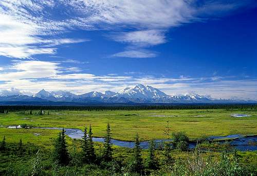
Formerly known as Mount McKinley, the highest mountain in North America has been the goal of aspiring high altitude climbers since it was first climbed in 1913. Its reputation as a highly coveted summit derives from its location near the Arctic Circle and the Pacific Ocean (Gulf of Alaska) giving it some of the most ferocious weather in the world. Because of its notorious weather and ease of access, some climbers use Denali as a training ground for climbing the 8,000 meter peaks of the Himalaya and for extended expeditions in the Arctic or Antarctic. And for all you peakbaggers out there, Denali is the highpoint of the Denali Borough, the state of Alaska, the United States, the Alaska Range, and North America.
Denali offers one of the world's greatest expedition challenges. While it is exceeded in elevation by peaks in South America and Asia, its great height above the Alaskan plain make it a severe test of personal strength, team work, and logistics. No peak in the world has greater relief: Denali rises 17,000 feet above its surrounding plain, Kilimanjaro 14,000 feet, and Everest 13,000 feet. Vertical elevation gain on Everest from the normal base camp for the South Col route is 11,000 feet; from the landing spot on the Kahiltna Glacier Denali's summit rises another 13,000 feet. Further, the mountain (and all mountains this far north or south) behaves like it's taller than it really is --- the reason being that the barometric pressure in the northern/southern latitudes is less than at the equator which makes climbers feel higher than they really are.
What's In A Name?
Denali is known by its Athabascan name, meaning "The Great One" and some climbers refuse to use "McKinley" when referring to the mountain. In fact, at least half a dozen names exist for the highest mountain in North America and most translate to "The Great One." Americans are the only ones who have previously bucked this trend and named it after a President from Ohio (William McKinley has often been considered a straw President --- put into power by Rockefeller's enormous campaign contributions in order to avoid a then-aspiring Teddy Roosevelt and his party's threat to break up the industrial monopolies with new anti-trust legislation).
Denali was renamed Mount McKinley by the Princeton graduate and gold prospector, William Dickey. Dickey was one of the hundreds of prospectors seeking gold in the 1896 Cook Inlet stampede. He had written an article for the New York Sun where he described the mountain as the highest in North America at over 20,000 feet. When later asked why he named the mountain after McKinley, Dickey replied that "the verbal bludgeoning he had received from free silver partisans had inspired him to retaliate with the name of the gold-standard champion" (Source: Mt. McKinley: The Pioneer Climbs by Terris Moore). Since the turn of the 19th century, the official name of this great mountain has not rested in peace. In 1914, following his historic first ascent of the mountain in 1913, Hudson Stuck wrote in the preface of his book, The Ascent of Denali, "forefront in this book, because forefront in the author's heart and desire, must stand a plea for the restoration to the greatest mountain in North America of its immemorial native name."
Ever since the mountain's name was changed to McKinley, an effort has been underway to change it back to Denali. In 1980, the name Mount McKinley National Park was officially changed to Denali National Park and Preserve. The State of Alaska Board of Geographic Names has also officially changed the mountain's name back to Denali. The State of Alaska now recognizes it as Denali and the Feds have changed the name of the national park. Shortly after Winston Churchill's death in 1965, the National Park Service, after being goaded to do so by Alaska's Senator Ernest Gruening, named Mount McKinley and the North Peak of Mount McKinley the Churchill Peaks. The individual summit is still officially known as Mount McKinley. Thanks to SP member, Steve Gruhn for that info (he's also one of the best all-around resources for mountaineering information in Alaska).
In 2009, Alaska State Representative Scott Kawasaki sponsored Alaska House Joint Resolution 15, which urged Congress to rename the mountain Denali. Despite efforts in Alaska, Ohio Representatives Betty Sutton and Tim Ryan introduced H.R. 229 which reads: "Notwithstanding any other authority of law, the mountain located 63 degrees 04 minutes 12 seconds north, by 151 degrees 00 minutes 18 seconds west shall continue to be named and referred to for all purposes as Mount McKinley."
A January 2015 bill submitted by Alaska Senator Lisa Murkowski re-proposed renaming North America's highest peak as Denali. In June 2015 testimony to Congress, the National Park Service's associate director stated that the NPS "has no objection to adopting the name of Denali for Mt. McKinley". On August 30, 2015, Sally Jewell announced that the mountain would be renamed Denali, under the authority of federal law which permits her as Secretary of the Interior to name geographic features if the Board of Geographic Names does not act within a "reasonable" period of time. In media interviews, Jewell cited the board's failure to act on the state's four-decade-old request, saying "I think any of us would think that 40 years is an unreasonable amount of time."
Denali National Park
The park was established as Mt. McKinley National Park on February 26, 1917. The original park was designated a wilderness area at inception and was further designated an international biosphere reserve in 1976. The Park was incorporated into Denali National Park and Preserve in 1980. Today the park accommodates a wide variety of visitor use including wildlife viewing, mountaineering, and backpacking as well as providing a laboratory for research in the natural sciences. More than 425,000 people visit this world-class national park every year.
The park was originally established to protect wildlife and its habitat. At the time there were many people living and hunting in the area, and they needed meat for themselves and their dog teams. The easiest source of meat was hunting Dall sheep. Charles Sheldon, a hunter and naturalist, came to the Denali area in 1906 to study the Dall sheep. Seeing the need to protect this area and the sheep from commercial hunting, Sheldon lobbied Congress to set the area aside as a national park. Congress agreed with Sheldon, and in 1917, about two million acres of an area (including Denali) were set aside as Mt. McKinley National Park. In 1980, through the Alaska National Interest Lands Conservation Act, the park's name was changed, and at the same time, its acreage was tripled, setting the footprint of what today is Denali National Park and Preserve. The park covers more than six million acres which includes a complete sub-arctic ecosystem home to large mammals such as grizzly bears, wolves, Dall sheep, and moose. Additionally, almost the entire original two million acres are designated a wilderness area. The Park and Preserve is located in the heart of the Alaska Range and is home to countless glaciated mountains and granite peaks accompanied by some of the worlds largest, longest, and deepest glaciers. - Source NPS Website
Mountain History
Location
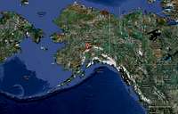
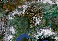
Denali (and the National Park) is located approximately 200 miles north of Anchorage, Alaska. Please see maps below for more detail.
Geology
Denali, underneath its sheath of glaciers, consists primarily of a granite dome. About 60 million years ago (Paleocene epoch), semi-liquid magma intruded below the surface of the earth, and slowly cooled from 100 degrees Centigrade to form the McKinley/Denali pluton (a body of igneous rock formed beneath the surface of the earth by consolidation of magma). The pluton composing Denali's neighboring peaks is considerably younger, 38 million years old. As the millennia went by, a sea covered the area where the park is today and deposited much sediment. Later, a tropical forest grew here, resulting in the coal-bearing formation which is mined near the park today. Eventually geological forces caused the land to rise and buckle, resulting in the metamorphic rock (rock that has been transformed from one type of rock to another by heat and pressure) sequences found in the park. Much more recently, two to five million years ago, the McKinley/Denali pluton and the metamorphic rock lying on top of it were uplifted to the great height of today, forming the Alaska Range and Denali.
Some of the molten rock cooled in large pools called batholiths (large masses of igneous rock that have melted and intruded surrounding strata at great depths). The slowly-cooled rock, granite, is resistant to the effects of wind, water, and ice. Denali is a batholith that was once deep in the earth. As the tectonic plates shifted, it pushed through the softer rock surrounding it to the surface and up to 20,320 feet, creating the tallest mountain in North America. This granite mountain contains some of the most dramatic rises in the world, such as the 15,000-foot Wickersham Wall. While water and wind have taken their toll on most of the softer sedimentary rock, some of this rock still remains, like a lovely hat capping the top of the North Peak.
Climbing History
Early Climbing Controversy
The earliest attempts at climbing Denali began in the late-1800's. In 1906, Frederick Cook claimed the first ascent, but his claim was later discredited after his "summit" photos were proven to be from the summit of an insignificant peaklet more than 10 miles away from Denali's true summit. In 1910, a team of four "sourdoughs" with no previous mountaineering experience managed to climb the lower North Peak of Denali. Their claims were dismissed until later climbers found a 14-foot spruce pole they had erected near its summit.
First Ascents
Karstens Ridge/Muldrow Glacier - 1913, the first ascent of Denali's 20,320-ft south summit achieved by Hudson Stuck, Walter Harper, Harry Karstens, and Robert Tatum. Harper, a Native Alaskan, is first to set foot on top.
West Buttress - 1951, route pioneered by Bradford Washburn. Art Davidson, Dave Johnston, and Ray Genet made the first winter ascent of the mountain via the West Buttress route in 1967.
West Rib - 1959, Peter Sinclair, Jake Breitenbach, Barry Corbet, and Bill Buckingham - 1960 American Alpine Journal. First solo ascent was in 1977 by Rupert Kammerlander. First winter ascent was a group in 1983.
Cassin Ridge - 1961, Riccardo Cassin et al. 1967 - Japanese variation (standard beginning of Cassin that joins another "Japanese Couloir" about halfway up the route). The first solo ascent was in 1976 done by Charlie Porter (in 36 hours to the summit nonetheless) and the first winter ascent was in 1983 done by Jonathan Waterman, Roger Mear, and Mike Young. The immortal Mugs Stump made the summit in 15 hours in 1991 which is still considered (arguably) the strongest climb of the route since the first ascent.
Please see the NPS website for other "firsts."
Climbing Today
During the 2012 season, Denali saw 1,223 climbers try for the summit. Of those attempts, 498 (or 41%) made the summit.
Since 1903, the mountain has a historical summit rate of 52%. The climbing rates didn't start to jump until 1976 when the mountain saw more than 500 climbers for the first time in a calendar season. Since then, the year with the greatest summit rate was 1979 (79%) and the year with the lowest was 1987 (31%). Most people will agree that the summit rate is higher with guided groups and they make up approximately 40% of the traffic. Therefore, a rough estimate is that guided groups get to the summit about 55-60% of the time and private groups about 45-50% of the time.
There have been 19,564 people (including repeats) to reach the summit through the 2011 climbing season. The legendary Vern Tejas (currently a guide with Alpine Ascents International) is widely thought to have the most summits (approximately 50) and was the first solo ascentionist in calendar winter. In 2011, May saw 236 summits, June 358, and July 93. The busiest summit days were June 6 (66 people), May 27 (45 people), May 30 (45 people), June 17 (39 people) and July 7 (39 people). 131 women attempted Denali (or about 11%). US climbers make up about 60% of the total, and Canada, the UK, Poland, and Japan with 3-5% each. Climbers from Alaska, Washington, Colorado and California make up the bulk of the US participants. For more information, please see the NPS website.
Route Choices
The majority of climbers on Denali (over 90%) attempt the West Buttress route, which is considered the least technical way to get to the summit. The Muldrow Glacier on the north side of the mountain is similar with regard to technical difficulty and length, but is far more committing and involved as you begin the climb by hiking in rather than flying to a base camp. Though technically much more difficult, the West Rib is the next most attempted route after the West Buttress, but only sees a handful of parties each year. In technical terms, it is substantially more difficult and more objectively dangerous as compared to the West Buttress. Beyond those three well known routes, the remaining options are significantly more technical, committing, and difficult.
West Buttress (Alaska Grade 2+, Class 3-4)
The West Buttress has been derided as "the Denali Iditarod" or "the Scenic Loop." However, this is in context to Denali being fondly referred to as the "Mid-life Crisis Mountain" --- in 2011, the average age of a Denali climber was exactly 40 years old. While there is always some truth to nicknames, many people aspire to climb the West Buttress and the climb is undoubtedly considered as an exceptional mountaineering challenge. Nowhere in the world does one travel with so much gear over so much vertical in such a hostile environment. Although there are no technically difficult sections on the route, many stretches of "The Butt" leave very little margin for error (the lower glacier in warm conditions, Windy Corner, the Autobahn, Denali Pass, and the Summit Ridge). Furthermore, the West Buttress is just as exposed as any other route to Denali's legendary weather. Prospective climbers should be highly competent in travel on moderately steep snow/ice slopes and exposed traverses.
The most popular camps are located at 7,200 ft (base camp); 7,800 ft; 9,500 ft; 11,000 ft; 14,200 ft; and 17,200 ft. Other camps are located at 12,500 ft and 16,000 ft, but should only be used under ideal weather conditions as the 12,500 ft camp is vulnerable to avalanches and the 16,000 ft camp is very exposed to high winds. The 11,000 ft camp also experiences avalanches and serac fall, and care should be taken to avoid these two hazards when setting up camp. Above 14,200 ft, snow caves or igloos are usually constructed as a back up shelter in case bad weather moves in. There are usually NPS Rangers at 7,200 ft and 14,200 ft.
Total horizontal length of the West Buttress route is approximately 13 miles with about 13,500 ft of vertical gain. Between base camp and 11,000 ft, the route is relatively flat and the main hazards are crevasse falls. Above 11,000 ft, the route steepens to moderate slopes (35-45 degrees) alternating with flat benches and bowls. Equipment and supplies are typically carried by sled to 11,000 ft or all the way to 14,000 ft. Above 11,000 ft, gear and food can be ferried between camps in two trips. West Buttress expeditions average around 17 days, but climbers should take at least 3 weeks of supplies. A 2-3 day supply of food and fuel should be left at base camp in case weather prevents planes from landing on the glacier (climbers have been stranded for as long as two weeks due to inclement weather).
West Rib (Alaska Grade 4, AI 3)
For some Denali aficionados, the West Rib is the next step after completing the West Buttress or Karstens Ridge, but it represents a significant step up in skill and experience. The route involves moderate to steep snow as well as mixed snow and rock. The West Rib is a commiting route but does offer retreat/escape points along the way. The West Rib offers steeper climbing and fewer crowds then its neighbor to the west. The Rib is not known for its technical challenges, but more for its sustained steepness and appeal for climbing on Denali's south face.
The West Rib offers two variations --- the Complete West Rib or the West Rib Cutoff. The complete Rib starts in the NE fork of the Kahiltna Glacier and is the most dangerous portion of the climb with respect to objective hazards (avalanche, crevasse). If conditions allow entrance into the NE fork, then a 9,000 ft ridge climb comprises the Complete West Rib. Most climbers choose to do the West Rib Cutoff, which ascends the standard West Buttress route until 14,200 ft. At 14,000 ft you leave the crowds of the West Buttress and traverse to the West Rib gaining the ridge at around 15,700 ft. You then ascent the upper ridge making one camp along the way.
Cassin Ridge (Alaska Grade 5, 5.8, AI 4)
The Cassin Ridge is today considered a "50 Classic" of North America and was first climbed in 1961 by a group led by Italian alpinist Riccardo Cassin, for which the route is named. The Cassin Ridge rises 8000 feet from the very bottom of Denali's South face to within a few yards of the true summit of the mountain. Steep snow, ice, and mixed climbing make this one of the most sought-after big mountain alpine climbs in the world. Climbers completing the Cassin Ridge find themselves in a small fraternity of elite Alaska climbers. The route ascends the prominent ridge on the south face and is steep, demanding, and committing --- escape routes are few and far between. As a result, only the most experienced climbers will think of attempting it.
Muldrow Glacier (Alaska Grade 3, Class 3-4)
The Karstens Ridge/Muldrow Glacier was the route of the first ascent and used to be the standard route before Bradford Washburn pioneered the West Buttress route. This route is similar in difficulty as the West Buttress but receives far less traffic. Expeditions are, on average, a week longer than West Buttress trips because of the longer approach from Wonder Lake. More adventurous climbers will attempt "the Traverse," by ascending the West Buttress and descending Karstens Ridge or vice versa. The Traverse is more strenuous than doing either route alone because climbers must haul all equipment and supplies over Denali Pass whereas climbers doing one route or another typical cache equipment and supplies that are not needed higher up on the mountain.
Ratings
Alaska Grades are confusing. In 1966, Boyd Everett, Jr (a then-very accomplished Alaska mountaineer) presented a paper titled The Organization of an Alaskan Expedition at a Harvard Mountaineering Club seminar where he attempted to outline a rating system for Alsaka routes/summits (on a scale 1-6). For many years, this system was the standard (as the basis of it still is). In Alaska: A Climbing Guide, Michael Woods & Colby Coombs attempted to simplify the system with definitions that make more sense for today's alpinists. Taken into account are things like: length of time on the route, camping options, length of the route, technical difficulty, the sustained nature of the route, difficulty of descent, and difficulty of retreat. Its fundamental belief is that the system reflects "the average time for recent ascents by climbers with experience and physical level compatible to the chosen route." What follows is their interpretation of what Alaska grades are to mean today:
Alaska Grade 1: Can be climbed in one day from base camp and requires third and fourth class travel. Remoteness can contribute to seriousness.
Examples include: Mt Goode (E Ridge), Mt Redoubt (N Face), Mt Dickey (W Face), Mt Brooks (N Ridge) --- and for comparison sakes, Mt Rainier (Disappointment Cleaver) is Alaska Grade 1+ which translates to 35-45 degree ice and snow slopes, Grade II.
Alaska Grade 2: Moderate fifth class climb that can be accomplished in a day, or a multiday climb involving third and fourth class travel. one or more of the following will contribute to the seriousness: altitude, remoteness.
Examples include: Four Horsemen (W Couloir to S Ridge), Denali (W Buttress), Blackburn (N Ridge), Mt Bona (E Ridge), Mt Hayes (E Ridge).
Alaska Grade 3: Difficult fifth class climb that can be accomplished in a day, or a multiday climb involving fourth and easy fifth class travel. One or more of the following will contribute to the seriousness: altitude, remoteness, cornicing, knife-edge ridges.
Examples include: Mt Foraker (Sultana Ridge), Mooses Tooth (Ham & Eggs Couloir), Mt Fairweather (Carpe Ridge), Mt Huntington (W Face Couloir).
Alaska Grade 4: Moderate fourth and fifth class climbs that require multiple days on route. One or more of the following will contribute to the seriousness: altitude, remoteness, cornicing, knife-edge ridges.
Examples include: Mt St Elias (Harvard Route), Mt Hunter (W Ridge), Mt Moffit (N Ridge).
Alaska Grade 5: A climb requiring a high level of commitment with sustained fifth class climbing; multiple days on route. One or more of the following will contribute to the seriousness: altitude, cornicing, knife-edge ridges, limited options for retreat, scarce bivi sites.
Examples include: University Peak (E Face), Mt Augusta (S Ridge).
Alaska Grade 6: A climb requiring an extreme level of commitment with difficult and sustained fifth class climbing for more than 4,000 feet requiring multiple days on route. One or more of the following will contribute to the seriousness: altitude, remoteness, cornicing, knife-edge ridges, poor retreat options, scarce and/or hanging bivis.
Examples include: Mt Hunter (Moonflower), Mt Foraker (Infinite Spur).
- Source: Alaska: A Climbing Guide by Michael Woods and Colby Coombs (Mountaineers, 2001).
Other Technical/Alpine Routes
Please see the list below for some of the better-known climbing options on Denali. For more information, please see R.J. Secor's book Denali Climbing Guide.
Northern Routes (Wonder Lake Approach)
• Wickersham Wall, Canadian Variation (Alaska Grade 2, 60 deg ice)
• Traleika Spur (Alaska Grade 3)
• Pioneer Ridge (Alaska Grade 3)
• Wickersham Wall, Harvard Route (Alaska Grade 4, 5.5, 70 deg ice)
• Butte Direct (Alaska Grade 5, 5.10, A2)
Western Routes (Kahiltna Base Camp Approach)
• Orient Express (Alaska Grade 3, 45 deg ice)
• Messner Couloir (Alaska Grade 3, 50 deg ice)
• West Buttress Direct (Alaska Grade 3, 50 deg ice)
• McClod’s Rib (Alaska Grade 3, 60 deg ice)
• West Face (Alaska Grade 3, 5.8, 70 deg ice)
• Northwest Buttress (Alaska Grade 4, low 5th class rock)
• First Born (Alaska Grade 4, 5.8, 70 deg ice)
• Collins-Powers-Walter Route (Alaska Grade 5, low 5th class rock)
• Beauty is a Rare Thing (Alaska Grade 5, 5.8)
Southwestern Routes (NE Fork of Kahiltna Glacier Approach, i.e. Valley of Death)
• Trans Canada (Alaska Grade 3, 50 deg ice)
• Wickwire/Patterson Route (Alaska Grade 4, 45 deg ice)
• Clod Face (Alaska Grade 4, 50 deg ice)
• Reilly’s Rib (Alaska Grade 4, 60 deg ice)
• Denali Diamond (Alaska Grade 5, A3)
• McCartney-Roberts Route (Alaska Grade 5, 5.9)
Southern Routes (E Fork of Kahiltna Glacier Approach)
• South Buttress (Alaska Grade 3, 70 deg ice)
• American Direct (Alaska Grade 5, 5.7, A2, 65 deg ice)
• Krissak Memorial Route (Alaska Grade 5)
• Mascioli’s Pillar (Alaska Grade 5, 5.10, 80 deg ice)
• Czech Direct (Alaska Grade 5, VI+, 90 deg ice)
Southeastern Routes (Ruth Glacier/Sheldon Mountain House Approaches)
• 1954/Thayer Route (Alaska Grade 3, 60 deg ice)
• Hosemeister Couloir (Alaska Grade 3, 60 deg ice)
• East Buttress (Alaska Grade 3, 70 deg ice)
• Southeast Spur (Alaska Grade 4, 65 deg ice)
• Catacomb Ridge (Alaska Grade 4, 75 deg ice)
• Reality Ridge (Alaska Grade 4, 75 deg ice)
• Isis Face (Alaska Grade 5, 5.8, 60 deg ice)
• Ridge of No Return (Alaska Grade 5, V, 65 deg ice
Ski/Board Lines
Other than the West Buttress and Muldrow Glacier routes, skiers have been known to attempt the following lines (and of course, there are others):
• Traleika Spur
• Pioneer Ridge
• Orient Express
• Messner Couloir
• West Buttress Direct
Getting There
Air Travel
The major international airport in Anchorage is called the Ted Stevens Anchorage International Airport (ANC) named after the (in)famous Senator Ted Stevens who died in 2010. The airport is located about four miles south of the city proper. Anyone not from Alaska is better off flying to Anchorage for an attempt on Denali. While Anchorage is not a huge passenger destination compared to the rest of the world, it is the 5th largest cargo airport in the world (after Hong Kong, Memphis, Seoul, and Shanghai).
Most people will land in one of the three concourses in the Southern Terminal. Major airlines that service the area include: Air Canada, Alaska Airlines, American, Delta, Frontier, JetBlue, Sun Country, United, and US Air (read NO Southwest - bags DONT Fly For Free).
Regarding TSA...
Camp stoves can travel as carry-on or checked luggage only if they are empty of all fuel and then cleaned such that no fuel vapors or residue are noticeable. Aerosol insecticides are not permitted in carry-on; however they are permitted in checked baggage as long as they are not labeled as hazardous material (HAZMAT). Wrap cords and layer items in bags so officers can get a clear view of the items. Flammable items include aerosols, fuels, gasoline, gas torches, lighter fluid, flammable paints, turpentine, paint thinner and realistic replicas of incendiaries. Lighters that do not contain fuel are permitted in checked baggage. Any sharp objects placed in carry-on or checked baggage should be properly sheathed or securely wrapped to prevent injury to TSOs and baggage handlers. Even if an item is generally permitted, it may be subject to additional screening or not allowed through the checkpoint if it triggers an alarm during the screening process, appears to have been tampered with, or poses other security concerns. The final decision rests with TSA on whether to allow any items on the plane.
Also, wear your boots on the plane. In the event your luggage is lost you can salvage almost everything in Anchorage, EXCEPT your boots.
Anchorage
From the Anchorage airport, it is roughly a two-hour drive to Talkeetna (Talkeetna is a small town and the main staging area for climbing most routes on Denali and the Alaska Range in general). Limited supplies and equipment are available in Talkeetna, so it is best to get most of your shopping done in Anchorage before heading out. Retailers in Anchorage include the following:
Alaska Mountaineering & Hiking
2633 Spenard Road
Anchorage, AK
(907) 272-1811
alaskamountaineering.com
REI
1200 West Northern Lights Blvd
Anchorage, AK
(907) 272-4565
rei.com
Automobile transportation to Talkeetna is provided by the following providers:
Denali Overland Transportation
P.O. Box 330
Talkeetna, AK 99676
Toll-Free: (800) 651-5221
Fax: (907) 733-2385
www.denalioverland.com
Talkeetna Taxi
Talkeetna, AK 99676
Phone: (907) 355-TAXI
www.talkeetnataxi.com
Should you wish to take the train from Anchorage to Talkeetna, see the following provider:
Alaska Railroad
P.O. Box 107500
Anchorage, AK 99510
Phone: (907) 265-2494
Toll-Free: (800) 544-0552
www.akrr.com
And should you wish to send supplies on ahead, see the transport company listed below:
Exposure Alaska
(Food packaging & transportation)
200 W. 34th Ave. #82
Anchorage, AK 99503
Phone: (907) 761-3761
www.exposurealaska.com
Recommended accommodations in Anchorage can be found on any travel search website, but I found the Best Western to be affordable, clean, and convenient (as of 2009).
Best Western Golden Lion Hotel
1000 East 36th Avenue
Anchorage, AK
(907) 561-1522
book.bestwestern.com
Talkeetna
Upon arrival in Talkeetna, recommended accommodations include the following:
Swiss-Alaska Inn
22056 South F Street
Talkeetna, AK
(907) 733-2424
swissalaska.com
Meandering Moose Lodging
14677 E Cabin Spike Road
Talkeetna, AK
(907) 733-1000
meandering-moose-lodging.com
Talkeetna Hostel
P.O. Box 361
Talkeetna, AK
(907) 733-4678
talkeetnahostel@gmail.com
Should you need additional provisions during business hours see the following retailer:
AMS Mountain Shop
F Street
Talkeetna, AK 99676
(907) 733-1016
(907) 354-1233
If you are climbing the Muldrow Glacier and wish to have your gear cached in advance of your arrival, contact Denali Dog Freight Expeditions (907-683-1008). Expeditions approaching from the north side of the Alaska Range needing to haul in freight may contact Denali North Side Supply (360-313-7038 or denalinorthside@yahoo.com).
Those choosing to go into the park should be advised of the road conditions (if you rented a car). The park is serviced by a 91-mile (146 km) road from the George Parks Highway to the mining camp of Kantishna. It runs east to west, north of and roughly parallel to the Alaska Range. Only a small fraction of the road is paved because permafrost and the freeze-thaw cycle create an enormous cost for maintaining the road. Only the first 15 miles (24 km) of the road are available to private vehicles, and beyond this point, visitors must access the interior of the park through concessionary buses. Wonder Lake can be reached by a six-hour bus ride from the Wilderness Access Center. Eielson Visitor Center is located four hours into the park on the road.
Several fully narrated tours of the park are available, the most popular of which is the Tundra Wilderness Tour. The tours travel from the initial boreal forests through tundra to the Toklat River or Kantishna. A clear view of the mountain is possible only about 20% of the time during the summer, although it is visible more often during the winter. Several portions of the road run alongside sheer cliffs that drop hundreds of feet at the edges, and there are no guardrails. As a result of the danger involved, and because most of the gravel road is only one lane wide, drivers should be trained extensively in procedures for navigating the sharp mountain curves and yielding the right-of-way to opposing buses and park vehicles.
While the main park road goes straight through the middle of the Denali National Park Wilderness, the national preserve and portions of the park not designated wilderness are even more inaccessible. There are no roads extending out to the preserve areas, which are on the far west end of the park. The far north of the park, characterized by hills and rivers, is accessed by the Stampede Trail, a dirt road that stops at the park boundary. The very rugged south portion of the park, characterized by enormous glacier-filled canyons, is accessed by Petersville Road, a dirt road that stops about 5 miles (8.0 km) outside the park. The mountains can be accessed most easily by air taxis that land on the glaciers.
Glacier Flights
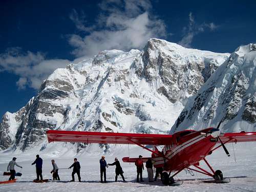
Climbing routes on the south side of McKinley require that you take a bush plane from Talkeetna to Base Camp on the Kahiltna Glacier. The same services can also arrange to fly you from Anchorage to Talkeetna for an extra charge. See below for a complete listing of bush plane (air taxi) services:
Fly Denali
PO Box 1152
Talkeetna AK, 99676
Phone: 907-733-7768
Toll-Free: (866) 733-7768
Fax: 907-733-7767
www.flydenali.com
K-2 Aviation
P.O. Box 545
Talkeetna, AK 99676
Phone: (907) 733-2291
Toll-Free: (800) 764-2291
Fax: (907) 733-1221
www.flyk2.com
Sheldon Air Service, LLC
P.O. Box 648
Talkeetna, AK 99676
Phone: (907) 733-2321
Toll-Free: (800) 478-2321
www.sheldonairservice.com
Talkeetna Air Taxi
P.O. Box 73
Talkeetna, AK 99676
Phone: (907) 733-2218
Toll-Free: (800) 533-2219
Fax: (907) 733-1434
www.talkeetnaair.com
When To Climb
Major Climbing Season
The normal climbing season is from late-April to mid-July with the most popular period from mid-May to late-June.
In general, the earlier you climb, the colder it will be high up on the mountain and the later you climb, the sloppier conditions will be on the lower Kahiltna Glacier. Later in the season, many climbers opt to travel on the lower mountain during the evening hours when the snow is relatively firm. Denali veterans have said that the weather tends to be windy in May, stormy in July, and a mix of both in June. However, once you're on the mountain, you will find the weather to be more of a crapshoot than anything else.
Sample Itinerary
Day 1: Land at Base Camp
Day 2: Rest day to organize gear and practice crevasse rescue
Day 3: Move to 7,800 ft camp
Day 4: Move to 9,500 ft camp
Day 5: Move to 11,000 ft camp
Day 6: Rest day
Day 7: Ferry loads to 14,200 ft camp, return to 11,000 ft camp
Day 8: Move to 14,200 ft camp
Day 9: Rest day
Day 10: Ferry loads to 17,200 ft camp, return to 14,200 ft
Day 11: Rest day
Day 12: Move to 17,200 ft camp
Day 13: Summit day
Day 14: Descend to 11,000 ft camp
Day 15: Descend to base camp, fly out
Keep in mind that this itinerary does not factor in bad weather days when you will be tent-bound. Itineraries are also adjusted according to how quickly members of a team acclimatize to the altitude. Here is an actual itinerary from a 1996 expedition:
June 25: Fly into base camp, weather closes in before entire team makes it into camp
June 26: Rest of team flies into base camp
June 27: Logistics day and crevasse rescue practice
June 28: Move to 7,800 ft camp
June 29: Move to 9,500 ft camp; storm moves in
June 30: Bad weather day
July 1: Move to 11,000 ft camp
July 2: Rest day
July 3: Ferry loads to 14,200 ft camp; return to 11,000 ft
July 4: Move to 14,200 ft camp in inclement weather
July 5: Rest day
July 6: Ferry loads to 16,000 ft; return to 14,200 ft
July 7: Move to 16,000 ft camp
July 8: Move to 17,200 ft camp
July 9: Bad weather day
July 10: Summit day; storm moves in as summit is reached
July 11: Descend to 14,200 ft camp in inclement weather, 70-knot winds
July 12: Move to 7,800 ft camp in bad weather, total whiteout
July 13: Bad weather day
July 14: Move to base camp, fly out, get drunk at Fairview Inn
Winter Ascents
The first winter ascent was accomplished on February 28, 1967, and is documented in the mountaineering classic, Minus 148. In 1998, three Russians made the first January ascent of Denali, a time of the year when the mountain receives only five or six hours of sunlight a day (click on this link for the press release: Mountain Zone). It seems as though every year, someone tries to climb Denali in calendar winter. Since the famous expedition of Art Davidson's Minus 148 book fame, a winter ascent of Denali has taken on an almost mythical notion. At that time of year, the sun is up from approximately 9am to 3pm. Temperatures can reach -100 or more. It's a sufferfest, but so goes the human race. Below are the last few excerpts from the Anchorage Daily News that cover these nuts every year.
Lonnie Dupre
Christine Feret
Red Tape
Permits
Mountaineers attempting a climb of Denali or Mt. Foraker must register with the Talkeetna Ranger Station at least 60 days prior to their start date. Climbers are required to pay the full permit fee when they submit their registration form at Pay.gov. The cost of a mountaineering permit as of the 2020 climbing season is $375. Climbers who are 24 years old or younger at the time their expedition begins are eligible for a $275 youth fee. Please note that the mountaineering special use fee is subject to an annual increase based on Consumer Price Index changes. At the time an expedition checks in for their climb, the Denali National Park entrance fee of $15 per individual is due. Interagency passes are accepted in lieu of entrance fee payment (actual passes must be presented). If the climb is cancelled prior to January 15 of the year in which the climb is scheduled, all but $100 of the fee will be refunded. No refund will be made for cancellations after January 15. Once the form and payment are correctly submitted, registrants will immediately receive a receipt confirmation from Pay.Gov via email. For groups who are unable to register online, the expedition leader can contact the Talkeetna Ranger Station to initiate manual registration.
Mountaineers who have climbed Mt. McKinley or Mt. Foraker since 1995 can request a "seven-day exception" to the 60-day pre-registration period and instead register only 7 days in advance of the climb. Individuals seeking registration under the "seven-day exception" must be on record at the Talkeetna Ranger Station as climbing in or after 1995. This rule is applied on an individual basis -- in order for the entire expedition to be eligible for the seven-day exception, all members must qualify. Expeditions are permitted to add one new member to their expedition using either the 30-day exemption or the 7-day rule. When using the 30-day add-on, the climber must register and pay their fee at least 30 days prior to the start date of the expedition.
Please see the Denali National Park Mountaineering page for up to date information:
https://www.nps.gov/dena/planyourvisit/mountaineering.htm
Clean Mountain Canisters (CMCs)
Conceived by mountaineering ranger Roger Robinson, the Clean Mountain Can (CMC) is a portable toilet designed to address Denali's remote, rugged environment and the unique logistical challenges presented by a 3-week long expedition. Clean Mountain Cans are required for all teams on Denali, as they promote the Leave No Trace ethics in glacier environments and help protect the environment for future generations. Additionally, they are lightweight, convenient, durable and reusable.
The durable CMC comes with a harness system that can lock the lid down and is sturdy enough to strap on a pack or sled. The CMC capacity is 10 to 14 uses (approximately one-half pound per use) including the addition of some toilet paper. The current model Clean Mountain Can (CMC) is designed to hold 1.88 gallons of human waste and has a U.S. Department of Transportation-approved two-way vent. Several CMC's have even been accidentally dropped off the West Buttress, tumbling over 2,000 feet without damage!
Clean Mountain Cans (CMCs) are required on the West Buttress Route, including and especially at High Camp (17,200’, 5200m). A CMC bag or bags is not an acceptable substitute for the actual CMC. The NPS Rangers will send any team back down if they do not have their CMCs at High Camp.
All human waste must be deposited into biodegradable bags (provided by the National Park Service) and transported in CMCs. These CMC bags are marked with the expedition’s name or permit number prior to flying to Base Camp. Human waste from the lower mountain (any elevation below 14,200’, 4300m) is to be removed from the mountain in the CMC can when the climbing team leaves from Base Camp. Human waste from the upper mountain including High Camp, in a CMC Bag may be deposited in the NPS approved crevasse near the camp at 14,200’, 4300m. This crevasse is marked with an orange marker. This is the only place where it is acceptable to deposit human waste on the West Buttress route, and there is no place where it is acceptable to deposit trash.
In an effort to make sure that the snow is clean for other climbing teams and future water supplies please consolidate pee holes away from camping areas and do not leave human waste on the snow. Pee holes should be consolidated at every camp, and especially at High Camp (17,200’, 5200m).
The proper disposal of trash, fuel cans and human waste are not only the right thing to do, it is required. Failure to follow these requirements may result in the issuance of a violation notice, a fine, and/or other additional legal actions.
All trash must be carried off the mountain. Climbers violating these rules will be fined and may have their permit cancelled. If you decide to break these rules, be aware that the NPS rangers are not the only people looking for violations. Enough climbers want to see Denali kept pristine that they will not hesitate to snitch on violators. If climbing in a private group, you should have your trash organized and contained upon return to basecamp (airstrip). Air taxis will not fly climbers out if their trash is not contained and clean.
Fuel
Contact your air service operator before purchasing white gas, as they are prohibited from flying with passengers and white gas, and therefore supply pre-purchased white gas in bulk at the Kahiltna Base Camp. White gas and butane/propane canisters are available in limited supply in Talkeetna. Other bottled fuels are available in Anchorage.
NPS/Rangers
In 1977, the National Park Service established a ranger station specifically for mountaineers in Talkeetna. Since 1984, the station has been staffed year-round to provide information and assistance to mountaineers before, during and after their climbs. The mountaineering rangers have extensive experience in the Alaska Range and can provide invaluable information. The station maintains a reference library including a complete set of American Alpine Journals, a map collection, and specific route information for numerous other peaks, including the Ruth, Kitchatnas and Little Switzerland. You must check in at the Talkeetna Ranger Station before departing for Base Camp and check out when you leave the mountain. The park rangers will question you about your mountaineering experience and strongly discourage you from going if they feel your experience is insufficient.
Talkeetna Ranger Station
P.O. Box 588
Talkeetna, Alaska 99676
Phone: (907) 733-2231
Fax: (907) 733-1465
email: dena_talkeetna_office@nps.gov
Rescue
The National Park Service undertakes rescue missions at their discretion and with rescuer safety as the highest priority. The NPS rangers will respond to emergencies only if conditions allow for rescue attempts. At this time, The National Park Service does not have a policy to charge climbers for rescue services, however, any hospital, air ambulance or other associated costs after leaving the mountain are the sole responsibility of the climber. Rescue insurance or health insurance (if your rescue is a medical emergency) can help with the costs of the rescue. Most climbers will bring FRS (Family Radio Service) radios for on-mountain communication. FRS channel 1 is monitored for emergencies, and because of that climbers are asked to use other channels for non-emergency communication. Satellite phones or other 2-way satellite communication devices are encouraged but not required. Cell phones are not reliable as they do not work well at any point on the mountain.
In 2011, Denali Rescue Volunteers (DRV) was established as a 501 (c)(3) non-profit organization. The mission of Denali Rescue Volunteers is to support volunteers in assisting NPS rangers to ensure safety, provide educational experiences, and deliver high-quality technical assistance and medical care for imperiled mountaineers. There are over 30 volunteers each season contributing approximately 7000 work hours providing medical and rescue assistance and educating climbers.
While direct costs for rescue efforts are covered through National Park Service funding, many expenses incurred by volunteers are not. Donations to DRV help defray these costs to volunteers and assists DRV in augmenting the park’s mountain program. Donations are administered by a Board of Directors. More information can be found at: https://www.denalirescue.org/
Donations help provide:
-Short term housing while in Talkeetna during patrol prep and training, as well as post-patrol, debrief and clean-up.
-Transportation funds to offset volunteers’ costs for Talkeetna-Anchorage shuttles.
-Expensive and highly specialized high altitude mountaineering equipment for use on patrols.
-Public outreach including development and maintenance of DRV’s website https://www.denalirescue.org/
-Equipment stipends to defray costs incurred by individual volunteers.
-Stipends for medical and technical training.
-Support for an exchange program with Nepalese instructors from the Khumbu Climbing Center.
Costs
The cost of a fully funded (middle of the road, so to speak) private expedition* should be approximately +/- $3,500 (USD). It's broken down as follows (and please remember people, it's an estimate):
> Round trip flight to Anchorage from continental US: $500
> Bag fees (coming/going): $200
> Accommodation in Anchorage (2 nights, coming/going): $300
> Transport to/from Talkeetna: $150
> Accommodation in Talkeetna (2 nights, coming/going): $150
> Food and drinks before and after the mountain: $200
> Air Taxi flight: $500
> Permits: $360
> Food on the mountain (assumes three meals/day for 21 days + snacks): $500-750
> Fuel on the mountain: $50
> Misc expenses (taxis, tips, drinking, bad decisions, etc): $300
*and remember, this assumes you have all the gear and it's all in working order!
Gear
Sample Gear List
- Source: American Alpine Institute website (as of 12/2012)
• Outerwear
Base Layer Top: Bring two. This will be your base layer and should be lightweight or silk weight synthetic or wool. Bring at least one that is white or light in color for use on the lower glacier (reflects sunlight as opposed to absorbing it). Synthetic and wool only, no cotton.
Base Layer Bottom: Look for the same features as your Base Layer Top. One pair is usually sufficient.
Undergarments: Also known as underwear, most climbers wear them underneath their base layer. 1-3 pairs depending on personal preference for changing.
2nd Layer Top: A lightweight fleece or wind shirt. A chest pocket is a helpful feature of this multi-use layer.
Expedition Weight Bottoms: A thicker pair of long underwear bottoms that will serve as an additional insulating layer for use in colder temperatures. This layer will go on top of your base layer but under your softshell pants. One-piece suits (Farmer-John/Union Suit) are popular but require more planning and effort when answering the call of nature and work best with other layers designed for using the bathroom without removing layers. Windproof/Windstopper pants are heavier and less functional and will not work for this layer.
Soft Shell Jacket: Thin, light, stretchy, breathable but wind and snow-resistant layer that is comfortable to wear is ideal. This will be your action layer and the outer layer that you spend the most time in. Hoods are optional but highly recommended. Size your jacket to be trim fitting, but large enough to fit over your base and second layers. Light to moderate insulation/thickness is recommended. This layer will go over your base and expedition layers, but under your shell and parka if wearing this layer in combination with those layers.
Soft Shell Pants: Look for the same features as your Soft Shell Jacket. This will be your outermost layer most of the time for your legs. A thigh pocket is a useful feature for storing small items. Your base and expedition weight layers need to fit under these pants comfortably.
Light Insulating Layer, Top: The goal for this piece is to add warmth to your internal layering system. Depending on your clothing system, and the environment you are in, you may fit this layer underneath your shell gear (e.g. fleece sweaters) or over your shell gear (lightweight insulated jackets). If choosing fleece, pick modern fleece garments with waffle-grid patterns and avoid windproof fleece – it is not breathable enough. The weight and design of this piece will vary based on the other items of climbing that you are bringing.
Parka (Expedition Weight w/ Hood): These jackets come in many shapes, sizes and temperature ratings. If you tend to get cold easily, opt for a slightly warmer and more substantial parka. Otherwise, choose a lightweight down parka that is still baffled, includes a hood, and offers sufficient coverage over your waist.
Insulated Pants: Sized to fit over your softshell pants and long underwear layers on the bottom, these pants are the last line of defense in extremely cold temperatures. Hip to full-length side-zips are a critical feature. Fleece is undesirable because it picks up snow, is bulky, and low-loft with respect to its weight. Down or synthetic fill pants are preferred and lighter weight, but require more care to not get them wet and/or frozen. The warmth of this layer will vary based on the temperatures expected at the time of your trip.
Shell Pants: Made of a waterproof/breathable material, your lightweight shell bottoms must have full or hip-length side zips. This garment should be extremely lightweight and packable. A zipper fly is a nice, but optional.
Shell Jacket: This layer needs to be made of waterproof/breathable construction and ultra-light. Your shell should be sized to comfortably fit over your other base and mid-layers (minus your parka). Choose the lightest, most packable shell that will still get the job done. Avoid extra pockets (one or two chest pockets is all you need), 3-layer Gore-Tex, and hanging linings. Your hood should fit over your climbing helmet (if you plan on bringing one – i.e. non-West Buttress routes).
• Head/Hand/Footwear
Socks: Bring three complete changes, more if you know you have very sweaty feet. If you plan to wear 8000-meter boots or Intuition liners, bring several light-to-mid-weight socks and one pair of heavy/warm socks. Adjust your sock system ahead of time to perfect your boot fit.
Gaiters: Knee height is required. Check the fit of the gaiter to your boot in advance to make sure the coverage is adequate. Not required for those with integrated boots.
Overboots: Required for all boots except integrated boots. Please verify these fit over your boots and that your crampons stay on without fail. Guiding services point out that Mountain Hardwear Absolute Zero overboots and OR Brooks Range overboots have not performed well on past expeditions. 40-Below Overboots are the lightest, warmest, most functional and highly recommended.
Glove Liners: You wear these for much of your time on the mountain. They need to be dexterous and comfortable, but not necessarily very insulating. Bring one pair.
Mid-weight Fleece/Schoeller Gloves: The most desirable glove is one that is comfortable and dexterous so that it can be worn all day. It should be durable enough (leather/synthetic palms) to handle ropes, jumars, and ice axes. These come in different weights, so choose the thickness that works with your glove system. Bring one pair.
Expedition Gloves: Composed of heavy-duty waterproof shells with extremely warm liners, these modular gloves should have removable liners. These gloves must be dexterous enough to handle ropes, carabiners, and jumars. Gauntlets should extend to mid-forearm.
Expedition Weight Mittens: Make no compromise with these as they are the first and often last defense against frostbite. These are expedition weight modular mittens, down or synthetic, with a storm-proof shell. You want your mitts to be extremely warm and thick. This is more important than dexterity. Gauntlets should extend to mid-forearm. These need to be large enough to allow for liner gloves to be worn underneath. Attach keeper loops to them.
Beanie Hat/Toque: A warm hat that will fit under your climbing helmet (optional) and over your balaclava/buff. Fleece, wool, or similar fabrics are best. Your cold-weather head/face system should not leave any skin exposed. When wearing your warm hat, balaclava/face mask, and goggles, there should not be any gaps in your clothing where wind and snow might penetrate close to the skin level. The outside edge of your goggles is a common place for climbers to overlook and as a result, get frostbite. Have a friend double-check your system to make sure you have complete coverage.
Warm Hat: Big, puffy and warm. Windstopper fabric can be a good idea but makes hearing difficult. This hat will primarily be used while sitting around camp or in very cold and windy conditions.
Balaclava/Buff: Balaclavas are thin to medium weight thickness hat plus face mask combos. You should be able to pull it over your face to the base of your neck so that it completely covers the head except for an opening for the face.
Sun Hat: A baseball cap or visor serves well. Models with a tail are recommended for increased sun protection.
Nose Protection: Designed to protect your nose from the sun, this is a cloth nose guard that fits onto your glacier glasses (Beko is a company in Santa Barbara CA that makes these). Try the fit on your sunglasses; they should fit well without pushing the frames off your nose.
Glacier Glasses: Choose a model with 100% UVA/UVB protection and side shields. If you have an extra pair, bring them too. Note: Those using contact lenses should also bring a pair of prescription glasses in the event that your contacts or solutions are lost or damaged by freezing.
*Contact Lens Care and Precautions: Most contact lenses are perfectly acceptable for climbing trips at altitude and in very cold conditions. If you plan on wearing contact lenses on Denali, you should be familiar with the intricacies of long-term maintenance and care in these conditions. You should plan on bringing at least two spare pairs of lenses and a few small bottles of whatever solutions you will require. Bringing a pair of glasses as a backup or to give your eyes a rest is a good idea as well.
Ski Goggles: For use in high winds and heavy snow. These should be lightly tinted but not so dark that the will reduce visibility in low light conditions. They should block 100% of UV light. If you wear prescription glasses, these must fit comfortably over your glasses.
• Boots
High Altitude/Cold Weather Mountaineering Boots: Double boots are required. They should be designed for extended use in temperatures at least as cold as -40F. Modern synthetic integrated boots (those with a built-in overboot/gaiter) are suitable for this climb. For traditional plastic boots, thermo-mold liners are warmer, lighter, and more comfortable than standard liners. If you have heat-moldable liners in your boots already and you have worn them for several trips, you may want to have them re-fit to ensure that the foam has not compressed and the temperature rating has been retained.
• Tents
Four Season Expedition Tent: Tents come in various shapes and sizes, so eventually you’ll have to find something that works best for you and the number of people in your group. Most people will spend a considerable amount of time in their tent, so you’ll want to error on the side of comfort and safety. But weight will always be a concern, especially for a two-man team. Most parties on the mountain have large, heavy, and sturdy tents. Durability is the most important factor – as such, your trip (or worse) is essentially over if something happens to your tent that cannot be repaired.
• Packs
Large Internal Frame Pack: Choose the pack that fits your body type best. This pack must be at least 5500 cubic inches in size; larger is better if possible. An external frame is not adequate or functional. Avoid bells and whistles like large, full-length zippers, separate sleeping bag compartments, etc. Many top-brand packs weigh up to 8 pounds, but there are a few better ones that weigh closer to five or six pounds. It is very important that your pack be in good working order and not prone to failures of any sort. Packs are a hugely important item and a climber may not be able to continue due to a pack failure.
• Bags
Sleeping Bag: Down Only. Synthetic bags are not acceptable due to their size and weight. Bags should be rated to -30F (-34C) for the early and mid-May expeditions; to at least -20F (-28C) for expeditions in June. If you know you sleep cold take this into consideration when purchasing/selecting your bag.
Sleeping Pads: Two are required. One should be a full-length 1/2" thick closed-cell foam pad. The second pad can be either a closed-cell pad or an inflatable pad. It can be ¾ length or full length. Your inflatable pad should be a modern, lightweight, and packable version. Newer pads are less bulky and can be folded in half when rolled so that they take up only a tiny portion of your packs volume. Old Thermarests with metal valves are not acceptable as the valves freeze.
• Technical Gear ("Sharps")
I will not go into this too much because each expedition is a bit different, but essentially you should have the following items (at a minimum):
Expedition Climbing Harness: This harness should fit over bulky clothing. Bring the simplest, lightest harness you can find. Black Diamond Alpine Bod harnesses are the standard on the West Buttress route. You will not need any padding on the waist or legs. Adjustable leg loops are key for changing pants. Make sure that your harness fits comfortably in combination with your fully loaded backpack. Some models have features that cause wear and tear on your waist and hips when used with a heavy pack.
Climbing Helmet: Guiding services require a helmet for this expedition (over the many years a few people have been hit by falling rocks near the Polo Field – as such the guiding services require a helmet for liability reasons). As such, choose the lightest weight helmet that still fits your head shape well.
Ice Axe: A variety of axes are suitable, but bring one that is 65 cm max; 55cm to 60cm is preferred. A wrist loop/leash is not required or recommended. Many climbers insulate the head of their ice axe with a small piece of foam or similar material. In colder temperatures, heat can be lost conductively through your glove when gripping the cold axe. This insulation should be small enough to not affect the performance of the ice axe or your ability to grip it, swing it, and self-arrest.
Steel Crampons: Modern new-matic crampons are recommended. Step-in crampons are easier to put on with cold fingers, but they can be harder to work well with overboots. Strap-on crampons provide more reliable attachment to boots with overboots. Regardless, be sure your crampon, overboot, and boot combination work well together. You should also bring crampon adjustment tools if your crampons require them. Your crampons should be suitable for steep ice climbing. Aluminum crampons are not functional on Denali.
Trekking Poles: Two are required. Even if you don’t normally use trekking poles, on this expedition, in particular, they are invaluable in helping with balance while carrying heavy packs on snowshoes.
Snowshoes (or Skis): They should be equipped with an integral crampon and/or aggressive traction on the bottom of the snowshoes. Snowshoes can be sized smaller than is typically recommended by manufacturers since deep snow is not common on the climbing route. Large profile basic models made by Tubbs, Atlas, and Sherpa do not work well and are not recommended. Models by MSR are proven and quite durable. Length should not exceed 25-28 inches.
Personal Gear: Caribiners (4-10, w/lockers), Slings (thinner spectra/dyneema slings are not recommended because they are hard to remove knots from with gloves on), Prusiks (2-3), Pulley, Pickets (1-2), Ascender, Ice Screws (1-8), Ice Tools (1-2), Belay Device, etc.
Group Gear: Ropes (45-50m, 9mm), Shovels, Ice Saws, Wands, Sleds, Medical Kit, Stoves, Pots, Fuel, etc
• Duffel
Duffel Bag: Your large duffel should have a full-length zipper and be of durable construction (this duffel will be used in the sled while on the lower mountain). A second duffel or travel bag will be needed to store your town clothes and personal items while on the mountain (usually at a secure storage locker at the airport where you departed on your flight onto the glacier).
Suggested Brands
• Outerwear – ArcTeryx, Patagonia, RAB, Marmot, North Face, Feathered Friends, Mountain Hardwear, Mont Bell, GoLite, Mammut
• Head/Hand/Footwear – Outdoor Research, Black Diamond, Mountain Hardwear, REI, Marmot, Smartwool, Julbo
• Boots – Scarpa, La Sportiva, Millet, Kayland, Lowa, 40 Below
• Tents – Hilleberg, Mountain Hardwear
• Packs – Gregory, Mountain Hardwear, Osprey, ArcTeryx, Cilogear
• Bags – Western Mountaineering, Feathered Friends, REI, Marmot, Thermarest
• Technical Gear – Black Diamond, Petzl, Mammut, ArcTeryx, Grivel, MSR, Metolius
• Duffel – Wild Things, Dana Designs, Patagonia
Food
When re-packaging food (into Ziplocs or similar), buy in bulk and remove all commercial packaging (cardboard & some plastics can be recycled). By reducing the packaging, it means less weight and less trash to carry. Repackage group meals in plastic bags and add spices to repackaged meals ahead of time. Label bags with contents and cooking instructions and consider pot size and fuel need when repackaging food. And as always, keep notes on what works and what does not.
Food Tips for International Climbers:
• Check with U.S. Customs regarding restricted food items (www.usda.aphis.gov).
• Custom Agents have discretionary power. It is not uncommon to have the majority of your food confiscated.
• Allow a few extra days in Anchorage to purchase food and repackage it before arriving at base camp.
• Check with Talkeetna ranger station regarding ethnic markets available in Anchorage.
Training
Start your entire fitness training program well in advance of your climb, and increase the intensity and duration of your exercising as you gain fitness. Very generally, a six-month minimum is needed to implement an effective program. Your first weeks in this new fitness program will most likely be focused on getting into a routine. Discipline yourself to begin both the cardiovascular and motor fitness training from the outset, but start carefully to avoid overuse or over-enthusiasm injuries. Use a variety of exercises, activities, locations, etc. to keep physically challenged and mentally engaged. Be cautious of month-by-month formulaic programs that tend to over-simplify expectations and promises. You should have a plan that is both regimented specifically for you and be flexible enough to meet your personal needs. The more your training can simulate real climbing, the more you will benefit. - Sources: Rainier Mountainerring Inc and Alpine Ascents International
Cardio
Cardiovascular fitness is measured through your aerobic capacity, your body’s ability to take in and use oxygen. At sea level, the restrictive factor in delivering oxygen to the muscles is the heart’s ability to pump blood, not the capability of the lungs to take in oxygen. It is at altitude, where oxygen is effectively less available, that lung capabilities come into question. Aerobics should be directed at conditioning your heart muscle even though it can also improve somatic muscle fitness. There are a variety of aerobic exercises which are fantastic for training. They include: climbing and descending hills, stairs or stadium bleachers, any kind of skiing, snowboarding, running, swimming and cycling. Other excellent aerobic activities that can benefit you but tend to be less focused for climbing mountains include: aerobics classes, stationary cycling, circuit weight training, boxing, and martial arts. Try to maximize cardiovascular fitness and maximize the strength and endurance needed for climbing.
In addition to the benefit of cardiovascular fitness, there needs to be concentrated effort on developing your aerobic ability for the descent from the summit. Some training recommendations for aerobic exercising include:
(1) Keep your training range at 65 to 85% of your maximum heart rate. There is a well-known formula for ascertaining your maximum heart rate that is based on your age, which you subtract from the number 220 (beats per minute). This is arbitrary at best. Begin with that formula, and then be aware of how you feel. Your perceived exertion can actually be a better indicator of how you ought to be performing on a given day.
(2) Spend a solid 30 minutes a day working aerobically, but don't exceed 60 minutes. In order to train for the long days in the mountains, you’ve got to get out and do lengthy training climbs; nothing else will prepare you as adequately.
(3) The frequency of your aerobic workout can be rather unlimited. Use interval training to advance your cardiovascular fitness. The technique of interval training calls for including surges in the activity while maintaining an elevated heart rate. Remember that the heart’s ability to pump blood to the body is a major limiting factor in our athletic performance. Interval training, when used over a longer period of time, can aid in increasing the heart's capacity for pumping blood through the body. This is a very strenuous manner of training, and it shouldn’t be initiated at the last minute.
Weight Training
Motor fitness is needed to complement cardiovascular fitness. Motor fitness refers to strength (the ability to exert force), power (the ability to exert force rapidly), endurance (the ability to withstand exertion), balance (the ability to maintain stability), agility (the ability to perform actions quickly and smoothly), and flexibility (the ability to bend without breaking).
When working with weights, limit it to 2 sets of 20 repetitions with lighter weights (lighter than the heavy weights customarily used to intensify muscle growth). Your first 15 reps ought to go easy; your last five with each set should be tough. Rest for 30 to 60 seconds between sets. It is important that in addition to a sound lower body, you develop a sound upper body as well. A sound torso (both back and stomach) is especially important for mountaineering where heavy pack weights add a new dimension to our physical activities. These training principles are essentially the same for our upper and lower bodies. Stretching, balance, aerobic and abdominal exercises can be done every day. You should work with lower body and upper body weights at least twice a week (once every 3 days). Don’t fail to include a good warm-up and warm-down in your workout. Include 10 to 15 minute aerobic warm-up and a 5 to 10 minute warm down in your program. This is an important component of any program. Keep your heart rate in an aerobic range; don’t get anaerobic. Examples include walking, jogging in place, step mills, treadmills, cycling, and jumping rope.
Include 15 minutes of quality stretching into your program. Focus on slow, static stretching. Avoid bouncing, ballistic stretching. With static stretching, hold the stretch for 30 to 60 seconds, breathing through the stretch. Hold it only to the point of tension, not to the point of pain. Don’t stretch through pain; you are stretching and tearing muscle fibers with this activity. Be patient. The reward of proper stretching is the joy of movement which results. Remember that stretching is a warm-up and warm-down exercise as well as a real workout for your body. Your goal is the reduction of muscular tension, not an attainment of extreme flexibility. Improper stretching can lead to injury and disillusionment with this aspect of motor fitness training. Stretch at the beginning of a workout, just after the warm-up, and also, even more importantly, after the workout when the muscles are at their warmest and most supple state. Stretching after a workout will do a tremendous amount of good toward alleviating muscle soreness and decreasing the chance of injury.
For abdominal exercise, focus on the quality of the exercise, not the number. Changing up the exercises (cross-training the abdomen) is key to increasing abdominal fitness. The abdominal muscles adapt remarkably well to a punishing workout – continue to change up your workout, even if you don’t switch exercises, switch the routine.
Balance exercises reward you with increased body awareness and can aid in your ability to negotiate tricky terrain under a heavy pack. Distinguish between static and dynamic balance exercises. Static exercises will keep one or both feet on the ground. Dynamic exercises involve the body in motion. Both are important for the development of this motor fitness skill. Balance is a motor skill like strength and can be improved over time.
Hiking/Pack Work
I have made this a separate category to emphasize that this needs to be done prior to a trip to Denali and is another 'pillar' or your training regimen. Even putting a large heavy pack on and walking to work in your mountaineering boots will help. You will want to get used to your pack and boots well ahead of time and you will want to get used to breaking a sweat in them for a long period of time. DO NOT buy boots right before the climb and expect to make it up the mountain. Your equipment MUST be dialed in and you MUST be able to work well with it.
Mountain Activities/Climbing
Obviously, this will pertain to people that can train in the mountains. But anything like trail running, ice climbing, rock climbing, mountain biking or running at altitude will help your heart's pumping capacity and will allow you to have a solid base of skills and endurance when you arrive on the mountain.
Sled Work
Sleds are a very underestimated part of a climb in Alaska. Via any route on the mountain, you will likely be using a sled at some point. The hip flexors and lower back/core often get overlooked in a standard training program. Make sure you train with a sled. Even if it means tying rope and an old tire to your waist and running around a parking lot, this is absolutely necessary to have an enjoyable climb. Also, make sure you are familiar with rigging the sled in a manner that is consistent with your training.
Glacier Travel
Glaciers
Seventeen percent of the national park's land area is covered with glaciers. The largest glaciers are on the south side of the Alaska Range (the Kahiltna, Ruth, Eldridge, Tokositna, and Yentna each are between 35 and 40 miles long). The largest glacier on the north side of the Alaska Range is the Muldrow, on Mt. McKinley, 34 miles long. The deepest measured glacier is the Ruth, at 3,805 feet or 1,160 meters; the surface ice of the Ruth moves about 3.1 feet or .95 meters each day.
Sled Travel
Nothing needs more to be said than this.
Crevasse Rescue
All party members must have worked together on similar techniques for crevasse rescue. Crevasse falls are imminent while traveling on glaciers in the Alaska Range. Each climber should be rigged for a crevasse fall with foot loops, mechanical ascenders or prussiks, and a pulley ready to be used. Attach the pack and sled to the rope while traveling. Skis should be attached with safety straps since they are easily lost in a crevasse fall. Each member should carry a picket or snow fluke in addition to their ice axe.
Solo Attempts
Not recommended. But read Jon Krakauer's chapter on Denali in Eiger Dreams for an overview of contraptions people strap to themselves in order to travel "safely" on the lower glacier. Unless you are a world-class alpinist, find a friend to go with. Or, just find a friend anyway.
The major hazard facing a soloist on Denali is that even the most cautious and experienced climber is unable to determine the location of and/or strength of the many snow bridges that must be crossed. Each year, a number of people take serious crevasse falls on the large Alaskan glaciers. Unfortunately, experience plays little part in determining who falls through these snow bridges. Some crevasses may be faintly visible while others are totally undetectable. Some soloists have devised crevasse spanning poles attached to their climbing harness that provide a degree of protection in case of a crevasse fall. Many are experienced enough to identify and avoid most mountain hazards, but hidden crevasses add a new dimension of objective risk to soloing. Virtually all experienced Alaska Range mountaineers are not willing to accept this level of risk. A solo climber has virtually no self-rescue ability in the event of a serious accident or illness and creates an undue risk to the search and rescue party. All climbers that are planning on climbing solo must complete the supplemental solo form for their registration to be processed.
Ski/Board Ascents/Descents
There are people who attempt to ski the West Buttress route (and others). Please be advised that when you are a skier, you are considered a soloist unless roped up to another party. While roped travel uphill on skis takes coordination and patience, going downhill while roped is of the expert persuasion only. It will likely be done with a large pack and possibly a sled. It is done, but only by the most seasoned ski mountaineers. Skiing unroped is no better than solo-ing the route when below 14,200 ft. Extreme caution is advised.
Mountain Weather
The weather is broadcast nightly on FRS 1. Weather is also available from rangers at the 7,200-foot and 14,200-foot camps. When checking in with the NPS, you will also be given a phone number with a daily weather forecast recording. However, forecasting weather for Mt. McKinley and Mt. Foraker is imprecise and difficult. Do not rely solely on the forecast; good judgment should always be used.
Denali is located in the subpolar low, a region where arctic air moving from the north converges with warmer air moving from the south at a latitude of 60 degrees (Denali is located at 63 degrees). This convergence creates a belt of unstable weather at this latitude. Associated with the subpolar low is a semi-permanent area of low pressure known as the Aleutian Low, located in the vicinity of the Aleutian Islands. Weather systems generated or passing through the Aleutian Low often take a straight path for the Alaska Ranges and hit Denali with little warning. Denali also has a reputation for streaky weather with long periods of continuous bad weather or more rarely, long periods of good weather.
As a result of its proximity to the Aleutian Low, the weather on Denali is unlike the weather on any other major mountain in the world. Extreme cold is another hallmark of Denali's weather and temperatures routinely fall to -40 F (-40 C). Unfamiliarity with Denali's weather is an underlying cause of many accidents.
Denali also undergoes long periods of clear skies and high winds, and these conditions are most often seen during the early part of the climbing season (April and May). During these periods, many of the mountain slopes are swept clean of snow leaving behind solid blue ice and testing the cramponing skills of even the most experienced climbers. Denali Pass and the upper part of the West Rib are especially notorious sites for accidents when these conditions occur. During such weather, many climbers are lulled by the clear skies into going for the summit. However, these winds routinely exceed 100 mph and have been known to knock climbers down the slopes. Windstorms often come with little if any warning and are thus amongst the most feared weather patterns on the mountain. The first signs of increasing high winds are the appearance of lenticular cloud caps over the summit. Many people look to Mt Foraker as an indicator of what weather patterns are soon headed to Denali.
Low-pressure systems from the Gulf of Alaska are the cyclonic weather systems that sweep in from the southwest and vary in intensity, the strongest of which have been described as hurricanes that dump snow. During the more powerful storms, it is generally unsafe to be above 14,000 feet. Fortunately, climbers usually have at least 12 hours warning before such a storm hits as they are usually preceded by mare's tails in the sky.
Low-level moisture occurs when warm, moist air migrates inland from the Pacific Ocean and creates a period of steady drizzle in the lowlands. During these periods, the top of the cloud layer occurs between 10,000 and 14,000 feet and conditions above these altitudes may be quite good. At other times, skies above 14,000 feet will be clear, but windy. Conditions on the lower mountain, however, tend to get sloppy and may even experience periods of rainfall and whiteout.
Good weather days, in which there is not a cloud in the sky and not a breath of wind, are rare on Denali. Instead, good weather is when winds are blowing at less than 10 knots and precipitation is limited to a snow squall here and there. One should not think that from these descriptions, the weather on Denali will easily fall into one of the above four categories. Instead, the distinctions between these patterns fall into a thousand different shades of gray and other weather patterns occur that do not fall into these categories. For example, low-pressure systems may descend from the north from the Arctic Ocean. Because these storms approach from the north, they may catch climbers by surprise. Even the most experienced veterans have a difficult time forecasting the weather, but for amateurs unfamiliar with subpolar weather, reading Denali's weather can be more akin to rolling the dice.
Guiding Services
General Philosophy
It is the individual climber's responsibility to ensure that the guide chosen is one of the six authorized guide services. Any individual or group that is found to be guided by an unauthorized guide will have their registration voided, be removed from the mountain, and issued a citation. Please see this link for a detailed treatise on how to choose a guide. It's very well written and was composed by Coley Gentzel, a former guide on Denali who is now a Park Ranger in Talkeetna.
Services Provided
Guiding services typically provide logistical support (to and from the glacier), group gear (such as tents, cooking supplies, ropes, shovels, saws, etc), food (less snacks), and cooking services (guides will cook and boil water, but the clients do the dishes). Guides do not haul gear for the clients in Alaska. There are no Sherpa, no Kenyans, and no mules. You bring it, you carry it. Guides also make decisions on weather, campsites, and team dynamics.
Costs
Guided expeditions on the West Buttress (in a 9 client to 3 guide ratio) typically run $5,000-$7,000 depending on what exactly is being offered. Some guiding services also run people up the West Rib ($8,000 for a 4 client to 2 guide ratio) and the Cassin Ridge ($18,000-$26,000 depending on the ratio). They can also rent certain gear to clients should they need it.
Contact Information
Alaska Mountaineering School
P.O. Box 566
Talkeetna, AK 99676
Phone: (907) 733-1016
Fax: (907) 733-1362
www.climbalaska.org
Alpine Ascents International
109 W. Mercer St.
Seattle, WA 98119
Phone: (206) 378-1927
Fax: (206) 378-1937
www.alpineascents.com
American Alpine Institute
1515 12th Street
Bellingham, WA 98825
Phone: (360) 671-1505
Fax: (360) 734-8890
www.mtnguide.com
International Mountain Guides
31111 State Route 706 E
Ashford, WA 98304
(360) 569-2609
www.mountainguides.com
Mountain Trip International, LLC
P.O. Box 658
Ophir, Colorado 81426
Phone: (970)369-1153
Fax: (970) 728-3779
www.mountaintrip.com
N.O.L.S.
P.O. Box 981
Palmer, AK 99645
Phone: (907) 745-4047
Fax: (907) 745-6069
www.nols.edu
Rainier Mountaineering, Inc.
P.O. Box Q
Ashford, WA 98304
Phone: (360) 569-2227
Fax: (360) 569-2982
www.rmiguides.com
Recommended Reading
There are dozens of books on Denali on the market, most of which are readable, a few of which are not. Denali is also the frequent subject of magazine articles and climbing anthologies. Check out back issues of Climbing Magazine and Rock & Ice Magazine for articles giving guidelines geared for recreational climbers. Climbers interested in more detailed discussions of Denali's routes should consult High Alaska or the Mount McKinley Climbers Handbook. Additionally, the American Alpine Club Journal contains detailed trip reports on Denali's more technical routes. The following is a list of recommended books.
• Denali's West Buttress by Colby Coombs and Bradford Washburn (Mountaineers Books, 1997)
• High Alaska by Jonathan Waterman and Bradford Washburn (American Alpine Club, 1991)
• Mount McKinley Climbers Handbook by Glenn Randall (Chockstone Press, 1992)
• Mount McKinley: The Conquest of Denali by Bradford Washburn and David Roberts (Abradale Press, 2000)
• Mount McKinley: Icy Crown of North America by Fred Beckey (The Mountaineers, 1999)
• Minus 148: The First Winter Ascent of Denali by Art Davidson (Mountaineers Books, 1999)
• Surviving Denali: A Study of Accidents on Mount McKinley 1903-1990 by Jonathan Waterman (American Alpine Club, 2nd Edition, 1991)
• Accidents In North American Mountaineering, Published annually by the American Alpine Club, (issues from 1977 to the present are especially valuable).
• Glacier Travel and Crevasse Rescue by Andy Selters (The Mountaineers)
• The Illustrated Guide to Glacier Travel and Crevasse Rescue by Andy Tyson and Mike Clelland (Climbing Magazine publication)
• Medicine for Mountaineering, Edited by James A. Wilkerson, M.D. (The Mountaineers, 4th Edition)
• Mountain Sickness: Prevention, Recognition, and Treatment by Dr. Peter Hackettt (American Alpine Club)
• Snow Sense: A Guide to Evaluating Snow Avalanche Hazard by Jill A. Fredston and Doug Fesler (Alaska Mountain Safety Center, Inc.)
• Alaska: A Climbing Guide by Michael Wood and Colby Coombs (The Mountaineers)
• Dangerous Steps by Lewis Freedman (Stackpole Books)
• Denali: Climbing Guide by R.J. Secor (Stackpole Books)
• Denali, Symbol of the Alaskan Wild, An Illustrated History of the Denali-McKinley Region, Alaska by William E. Brown (Alaska Natural History Association)
• In the Shadow of Denali by Jonathan Waterman (Dell Books)
• Mount McKinley, The Pioneer Climbs by Terris Moore (The Mountaineers)
• The Ascent of Denali by Hudson Stuck (University of Nebraska Press)
• The Hall of The Mountain King by Howard Snyder (Charles Scribner's Sons)
• To the Top of Denali by Bill Sherwonit (Graphic Arts Center Press)
• White Winds by Joe Wilcox (Hwong)
Authors Note
I was fortunate enough to reach the summit of this mountain in 2009. I climbed with a guided group from the American Alpine Institute and also spent an additional 10 days on the lower glacier in 2008 during a skills course. Let me be the first to tell you that I am by no means an expert in anything. This page used a lot of information from the National Park website, the guides websites, and my personal library of books on Denali (about five or six of them). I also tried to put sources in lots of places so that if you have more questions, you can dive into that information more thoroughly. I recently took the page over from SP member Greg Yanagihara. We have never met or spoken, but I emailed him extensively asking for editing rights --- because I felt that the page needed a refresher. With the help of the Elves, I was able to secure the page and have made what you see above as my changes (using as much of Greg's material as possible).
The preceding page has taken some time and effort, but if you have something more to add, please feel free to PM me or post in this forum. I welcome comments and suggestions, but I will warn you --- if you are looking to overhaul the page, then please put your money where your mouth is and take the page from me. I'm certainly not enamored with the page, so you can have it with enough convincing. But I would ask that you please maintain the integrity of the page going forward, if not for yourself, for the SP community at large. I have taken a lot of information and knowledge from this site and a mountain like Denali deserves a good page. This is my small effort to give back to the community of members that have taught me so much through my early years of mountaineering. Thank you for reading.
Finally, if you are interested, here's a website to SP Member Alasdair's phenomenal Denali photographs. Make sure you contact him if you plan on using them in any way --- they are copywritten.
P.S. Have a nice day.


