


-
 108134 Hits
-
 98.36% Score
-
 81 Votes
|
|
Area/Range |
|---|---|
|
|
39.82815°N / 113.91975°W |
|
|
Hiking, Mountaineering, Trad Climbing, Scrambling, Skiing |
|
|
Spring, Summer, Fall, Winter |
|
|
12087 ft / 3684 m |
|
|

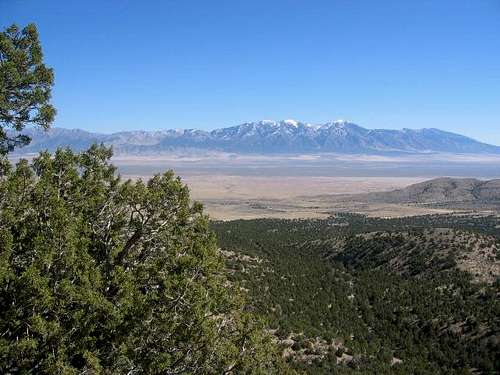
The Middle of Nowhere
 Ibapah Peak
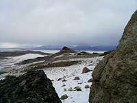
Oftentimes, when you are in the western Utah desert, you feel like you are indeed in "the middle of nowhere". Armed with a sturdy vehicle, proper preparation and good maps, you can minimize the middle of nowhere feeling. Perhaps the best way to look at the information contained on this page is to think of the Great Basin with this page covering those ranges and peaks that are contained in the portion that is in Utah. Now, onto the main body of work, which is a work in progress. Mainly ignored by the large population base of the Ogden-Salt Lake-Provo urban areas, the western desert area of Utah is a true treasure waiting to be discovered. Few have heard of Ibapah Peak, a gem on the nevada border nor of the Wah Wahs or the Fish Springs range that contains George Hansen Peak. Nor are they aware of the wonders of the Newfoundland range or the sheer drop from the summit of Notch Peak to the desert floor below. How about the Confusion range containing peaks like King Top or Conger Mountain? Or the Drum or Keg mountains ranges? Well, you may be getting the picture I am trying to paint here, there are a lot of varied ranges in the western Utah great basin/desert area and all are worthy of exploration. This page is at the moment, the best resource for learning about this area on the web at this time. The western desert of Utah is located near the eastern boundary of the Great Basin. The area was stretched in East-West direction by mighty tectonic forces, creating a series of sunken valleys separating ranges and escarpments running North to South. In the past 20 million years, the Earth crust here has experienced extension by as much as factor of two. The west escarpment of the House Range, near the geographical center of the area, stands out as the most prominent. A sheer limestone cliff of Notch Peak, over 4,000 feet tall, has a number of technical rock climbing routes. Further south, it is carved by unique limestone slot canyons such as Upper Hell'n Moriah.
 Crystal Peak
The weakened, rift-ridden crust resulted in strong recent (Tertiary) volcanism. The highest summits of the Western Desert are the legacy of metamorphizing intrusions, which left behind the granites of Deep Creek Range near Nevada state line. Ibapah Peak is one of the 3 rare 5,000 ft. prominence giants in the area. Lava fields and tubes, and geothermal hot springs may be found both North of Delta and further South across the Sevier Desert, where Meadow Springs, Pahvant Butte, and Tabernacle Hill are all prominent reminders of the recent volcanic activity. Further West and South of highway 6 is Crystal Peak in the Northern Wah Wahs. It is a giant white geyser tufa cone amidst vast lava fields and stands as a unique monument to the past geothermal activity. North-East of Delta, a large area of sand dunes is known as Little Sahara. Though mostly left for motorized recreation, this is also a place where one can sand-ski in summer. Really. Just don't bring any new fancy gear if you go.
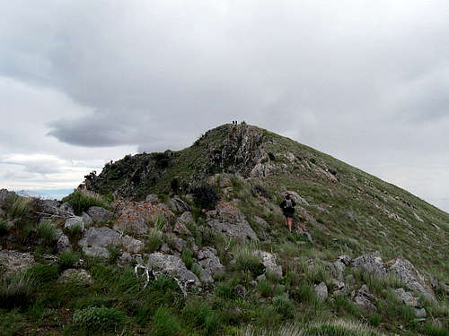
 Craner Peak in the Lakeside Mountains
Great Salt Lake Ranges
Utah is a state with alpine mountains and desert terrain. When people want to visit Utah for the first time, they think about the national parks in the south or the Wasatch Mountains east of Salt Lake City. The main thing I have noticed about hiking and climbing in the lesser known areas of the state is the feeling of isolation. Mountain ranges that are located in this area of the west desert and northern Utah include: the Southern Promontory Mountains, Antelope Island, Stansbury Island, Newfoundland Mountains, Hogup Mountains, Matlin Mountains, Grassy Mountains, and Lakeside Mountains.
For more information about the northern ranges, click on the link above. This includes ranges and peaks north of Interstate-80 and south of the Idaho border. I’ve included info about some of the ranges on both pages. Other ranges on the Northern Utah Ranges page are the Grouse Creek Mountains, Goose Creek Mountains, Hansel Mountains, Blue Spring Hills, Crawford Mountains, West Hills, Bovine Mountains, Raft River Mountains, and a few others. Then there is the Northern Wasatch including the Monte Cristo Range and links to the Bear River Range, and Wellsville Mountains. Several of these ranges extend into Idaho.
The Great Salt Lake
Many of the mountain ranges in Northern Utah are located around the Great Salt Lake. Anyone who has seen a map of Utah will notice the lake that dominates this area. It is the largest lake in the Western United States. The present lake is about 75 miles long and 35 miles wide, with a maximum depth of 33 feet. After a series of wet years, the lake's surface area may be much larger but it will be only a little bit deeper. Great Salt Lake is salty because it does not have an outlet. Much of the precipitation that falls each year evaporates leaving salt behind. The salt content varies depending on the water level, but percentages of salt are usually around 14% to as high as 27%, eight times higher than the ocean. This gives the water buoyancy. The Great Salt Lake is what remains of prehistoric Lake Bonneville, which covered some 20,000 square miles of land in what is now Utah, Nevada, and Idaho about 10,000 to 30,000 years ago. The most obvious reminders of Lake Bonneville are the ancient terraces etched into the landscape along the lakes former shorelines. The terraces were eroded by wave action and are relatively flat areas that follow a contour line. After the ice age the earth's climate became drier and Lake Bonneville gradually receded to form Great Salt Lake. The Bonneville shoreline trail travels along the mountain sides of much of the Wasatch Front. Over time, the Great Salt Lake has varied from elevations of 4,192 to 4,212 feet above sea level. The Great Salt Lake and its islands provide outstanding scenery and recreational opportunities in Northern Utah. There are eight named islands in the lake that have never been totally submerged during historic time. All have been connected to the mainland by exposed shoals during periods of low water. The largest islands in the Great Salt Lake include Antelope, Stansbury, Fremont, Carrington, Dolphin, Cub, Badger, Strongs Knob, Gunnison, and Goose Island. Antelope and Stansbury are the most developed islands. The shoreline of these islands have formed extensive wetlands making the Great Salt Lake one of the most important places for migrating and nesting birds. The high salinity of the lake makes it habitable for only a few species, including brine shrimp and algae.
 Tangent Peak in the Hogup Mountains
Northwest of the Great Salt Lake: The Hogup Mountains and Matlin Mountains are located near the northwest side of the Great Salt Lake. They are generally reached by two ways. First route is by driving west of Golden Spike National Historical Site. There is a dirt road that travels along the north shore of the lake past Lone Rock. Then the road goes to Kelton. From here a dirt road leads south to the Hogup Mountains and Matlin Mountains. The second route goes along Highway 30 to Curlew Junction. From here you can drive south to Kelton and then farther south to the mountains.
 Tangent Peak Tangent Peak |
 Race Benchmark Race Benchmark |
 Matlin Mountains Matlin Mountains |
HOGUP MOUNTAINS
The Hogup Mountains are located at the northwest corner of the Great Salt Lake. This range is separated into two main ridges which are divided by a large valley and the highpoint of the road, Big Pass. The western ridge has the highest peaks including, Tangent Peak, 7,047 feet. Scorpio Peak, 6,660 feet, is located at the southern end of the range. Shelter Peak, 5964 feet, is on the west side. The eastern ridge of the Hogup Mountains is lower in elevation. Race Benchmark, 6,614 feet is located on this ridge. The Fingerpoint is a small peninsula on the southeast side of the range. Deadman’s Knoll is farther to the west.
Tangent Peak - (7,047') Tangent Peak is the highest summit in the Hogup Mountains. It’s an easy hike to the summit but the long drive to get there keeps the crowds away. The drive involves many miles of dirt roads and this is a place where you wouldn’t want your vehicle to break down. Tangent Peak is located on the western ridge of the range. The standard route starts from Big Pass. Then you can hike west up to the ridge and follow it north to the summit. It has over 2,300 feet of prominence and most people were hiking to it because of that reason.
Scorpio Peak - (6,660') Scorpio Peak is south of Tangent Peak on the same ridgeline. One route would be to do a long ridge traverse between the two peaks. This would also go over unnamed Peak 6,782 along the way. Another route would be to drive south of Big Pass and park as close as you can east of Scorpio Peak. This route has about 1,500 feet of elevation gain.
Race Benchmark - (6,614') Race Benchmark is located on the eastern ridge of the Hogup Mountains. It has a better view of the Great Salt Lake than Tangent Peak farther west. The peak can also be climbed from Big Pass or a place just north of it. Race Benchmark is the highpoint of this area of the Hogup Mountains. Peak 6,485 is farther south.
MATLIN MOUNTAINS
The Matlin Mountains are a small range located near the northwestern corner of the Great Salt Lake. They are northwest of the Hogup Mountains. This range is usually accessed from the north near Kelton or the east near the turnoff to Golden Spike. The mountains run northwest to southeast and are divided by a dirt road in the middle. This road can be used as access to hike to the top of highest peak which is 5,970 feet at the southern end of the range. The Baker Hills are to the east and Coyote Hill and the Horse Hills are located to the west. An old railroad grade trail ran through the area in the 1880's until the early 1900's.
Matlin Mountains HP - (5,970') The highpoint of the Matlin Mountains is easy to get to if you have a 4WD vehicle. The same driving directions for the Hogup Mountains can be followed south of Kelton. Then you’ll get to a junction near Table Mountain and instead of going south you’ll turn west toward the Baker Hills. Follow this road as it goes up to a saddle that divides the Matlin Mountains in two sections. From here there is five hundred feet of elevation gain to the summit.
CROCODILE MOUNTAIN - (4,810 feet)
Crocodile Mountain sits near the northwest corner of the Great Salt Lake by the Mud Flats. It is an oddly shaped uplift that is located east of Peplin Flats. Across the other side of the flats is Peplin Mountain which is higher than Crocodile Mountain by over five hundred feet. You will actually drive past both of these peaks when traveling to the Hogup Mountains which are farther south. A dirt four-wheel drive side road leads to the saddle on Crocodile Mountain. The highpoint, 4,810 feet, is to the north and another point labeled as, Loco, 4,715 feet, is to the south.
 Messix Peak summit in the Promontory Mountains
North of the Great Salt Lake: The Promontory Mountains are located at the north end of the Great Salt Lake. This is west of Brigham City. You can get there by driving on Interstate-15 and taking exit 365. Then you'll want to drive west on Highway 83. When you get close to the range you’ll see a dirt road with a sign pointing to Promontory Point. This road follows the east side of the range. To get to the other side of the range, drive to Golden Spike National Historical Site. Drive past the visitor center and continue on a dirt road that runs along the west side of the range.
 Messix Peak Messix Peak |
 Mount Tarpey Mount Tarpey |
 Messix Peak Messix Peak |
PROMONTORY MOUNTAINS
The Promontory Mountains are a long mountainous peninsula located at the northern end of the Great Salt Lake. The range was named for the large promontory cape projecting south into the Great Salt Lake. The highest mountain in the range is Messix Peak. Other peaks such as Mount Tarpey are also prominent. The southern area of the Promontory Mountains are largely located on private land. Several ranchers live near the eastern and western side of the range and there are fences with No Trespassing signs posted everywhere. Luckily, some people have been able to get permission and hike in these mountains. The Promontory Mountains extend farther north but some of those peaks are also located on private land.
Messix Peak - (7,372') Messix Peak is the highpoint of the Promontory Mountains. This peak and others in the range are located on private property. So this is the reason why Messix Peak isn’t climbed very much. I know that the area is open by special permit to controlled hunting during fall. You’ll need to get permission from land owners to be on their property even if you are just hiking. The best route is from Messix Canyon on the east side of the range. This peak is located in the southern Promontory Mountains near the northern section.
Chockcherry Peak - (7,218') Chockcherry Peak is located several miles south of Messix Peak. It is unofficially named but I called it this because Chockcherry Canyon is below the east side of the peak. This would be the best route up the mountain. It starts near Chockcherry Spring which is reached via dirt roads. Also in the area is Owen Spring to the north and Broadmouth Canyon to the south.
Long Peak - (7,075') Long Peak is the highest point at the southern end of the Promontory Mountains. Long Canyon is the large canyon leading up the west side of the peak. Brushy Canyon is on its north side. Maple Canyon is on the east side and that would be the easiest way to reach the mountain. Promontory Benchmark, 6,592 feet, is a named peak across the valley to the east.
Mount Tarpey - (6,979') Mount Tarpey is west of Messix Peak and they are separated by Maple Canyon. Mount Tarpey has over 1,100 feet of prominence even though it seems like a small peak. It is best seen from the west where the shortest route starts from Maple Canyon although you’ll need permission to hike here. Mount Tarpey overlooks the northern end of the Great Salt Lake above Rozel Flat.
 Elephant Head on Antelope Island
Eastern Area of the Great Salt Lake: Antelope Island is located near the east side of the Great Salt Lake. It is accessed from the city of Syracuse which is southwest of Ogden, Utah. This is reached by taking exit 332 off Interstate-15. Then you'll drive west on Antelope Drive for several miles to the park entrance. There is a fee to pay at the entrance booth before you begin the drive along the paved causeway leading to the island.
Walkin on Water Trip Report - Antelope Island to Fremont Island - by Zeejay
 Frary Peak Frary Peak |
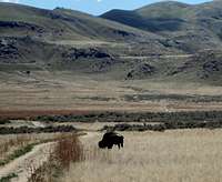 Antelope Island Bison Antelope Island Bison |
 Buffalo Point Buffalo Point |
ANTELOPE ISLAND
Antelope Island is the largest and most accessible island in the Great Salt Lake. There is a seven mile long causeway that connects it with the mainland near the city of Syracuse. The island occupies an area of 28,022 acres and lies entirely within Davis County. The highest mountain on the island is Frary Peak. It rises for over 2,400 feet above the Great Salt Lake. A maintained trail goes all the way to the top. There is a great view of the Wasatch Range from the summit. Hiking off-trail is usually not encouraged on the island. You must be done with your hike before dark because the entrance to the island is gated. Other notable peaks include Buffalo Point, Dooly Knob, Beacon Knob, Elephant Head, The Sentry and Mollys Nipple.
Buffalo Point - (4,785') Buffalo Point is located at the northwestern end of Antelope Island. It is one of the easiest hikes in the area and offers an outstanding view from the summit. There are two main routes to the top. The easiest is from the Buffalo Point Interpretive and Picnic Area. A trail can be seen leading up the hillside from here. The more scenic route is from the Lakeside Trail. This follows a trail along the Great Salt Lake shore from Bridger Bay to White Rock Bay.
Elephant Head - (5,126') Elephant Head is located on the western side of Antelope Island. With a little imagination, it does resemble the head of an elephant. The White Rock Trail starts out as a service road. It then turns into a trail and reaches a junction. At this point you can choose to go left and start the Split Rock Loop trail or continue on to Elephant Head which can be seen to the west. There is a great view looking down to Split Rock Bay.
Dooly Knob - (5,278') Dooly Knob is located north of Frary Peak. It is approached from the same trailhead. There is a junction with a side trail heading up the ridge toward Dooly Knob. The summit is indeed a rocky pointed knob. The peak was named after John Dooly Sr. He was a businessman and rancher who purchased Antelope Island. He then introduced a dozen bison. The state of Utah later bought the island and turned it into a state park. The bison herd would flourish on the island where hundreds of them now live.
 Dooley Knob Dooley Knob |
 The Sentry The Sentry |
 Frary Peak Frary Peak |
Stringham Peak - (6,374') Stringham Peak is located on the ridge north of Frary Peak. It only requires a short side trip so these two peaks are usually hiked together since they use the same approach. Stringham Peak was named after Briant Stringham. He was an early explorer of Cache Valley and the Ogden area but is best known for helping manage the Mormon Church's Tithing Herd of wild horses on Antelope Island. At the time there were nearly 1,000 wild horses that were roaming the island.
Frary Peak - (6,596') Frary Peak is the highest peak on Antelope Island. It is a popular hike because a trail goes all the way to the summit. It can be hiked year round and winter is a great time to visit. There are also bison which may be seen anywhere on the island. Captain Howard Stansbury set up base camp at Antelope Island to survey the Great Salt Lake during the years of 1849-50. Later several private homesteads were established on the island. The peak was named after George and Alice Frary and their family. They were homesteaders that actually ended up staying for a long time on the island.
The Sentry - (5,446') The Sentry is located several miles south of Frary Peak. It probably received its name because it looks like it's standing guard above the southern part of the island. A nice trail was built that goes around the peak as a loop but not to the summit. Going to the top of the peak is not difficult. You'll need to pick up a permit at the Fielding Garr Ranch before the hike.
 Stansbury Island South - by Eric Willhite
South of the Great Salt Lake: Stansbury Island and the Lakeside Mountains are located on the south side of the Great Salt Lake. They are accessed from Interstate-80 west of Salt Lake City. The first mountain range that you will see to the northwest is Stansbury Island. It extends into the lake via a causeway.
 Stansbury Benchmark Stansbury Benchmark |
 Stansbury Island HP Stansbury Island HP |
 Stansbury Island South Stansbury Island South |
STANSBURY ISLAND
Stansbury Island is the second largest island in the Great Salt Lake. It is located at the southern end of the lake. It is now connected to the mainland by a nice gravel road and is surrounded on the west and south by evaporation ponds. The island is approximately 11.5 miles long and 4.5 miles wide. The Great Salt Lake was officially surveyed in 1850 by Howard Stansbury, for whom the island was named. Stansbury Island HP, 6,649 feet, is the highpoint of the island and is north of Castle Rock. From the summit you can see the Great Salt Lake, the Oquirrh Mountains and Wasatch Mountains.
Stansbury Benchmark - (6,553') Stansbury Benchmark is the name of the peak located north of Stansbury Island HP. It's not done as much because it's lower in elevation. Most people reach this peak from a ridge traverse between it and the highpoint. If you follow the ridge directly you’ll run into 4th class scrambling. You can avoid this by dropping down the west side and ascending a gully to the summit.
Stansbury Island HP - (6,649') This is the highest point on Stansbury Island. There is a big gap on the ridge between Castle Rock and the highpoint to the north. The best way to get from one to the other is to go over to the west and drop down and then scramble along the ridge until you see up a wide chute. You can go up that chute and hike along the ridge to the summit of the Stansbury Island HP.
Castle Rock - (6,610') Castle Rock is located south of Stansbury Island HP. Many people combine it with the highpoint of the island. You'll want to park below the no trespassing signs to avoid any trouble. The route ascends up to the ridgeline south of Castle Rock. There are some faint trails along the ridge but routefinding is quite easy from here to the summit of Castle Rock.
Stansbury Island South - (6,070') This peak is located at the southern part of the range. You don't have to worry about crossing private land here. There is a mountain bike trailhead below the west side of the peak. This is where you can park and start hiking up the peak. I climbed this peak a few years ago and it was a nice hike with a little scrambling near the top of the ridge. There was a cairn on the summit at the time.
 Craner Peak Craner Peak |
 Black Mountain Black Mountain |
 Lakeside Mountains Lakeside Mountains |
LAKESIDE MOUNTAINS
The Lakeside Mountains are located at the southern end of the Great Salt Lake just north of Interstate-80. The range sits right next to the Great Salt Lake and that is how they received their name. They are northeast of the Cedar Mountains and east of the Grassy Mountains. The range is divided into three sections. The highest mountain in the range is Craner Peak, which is located on the south end. It is also one of the Utah prominence peaks. The middle section of the range is a long ridge with the name Sally Mountain. The northernmost section is labeled as Death Ridge with Lakeside Butte above the road. Other peaks in the Lakeside Mountains include Black Craner, 6,607 feet, which is south of Craner Peak. Then there is yet another Black Mountain, 6,574 feet, which has many communication towers on its summit. Peaks located in the northern part of the Lakeside Mountains are on the Hill AFB: Utah Test and Training Range or (UTTR). This includes Sally Mountain, 5,861 feet, Deardens Knoll, 4,869 feet, right beside the Great Salt Lake, Scad Ridge, 5,369 feet, which is east of Death Ridge, 5,529 feet, and Homestead Knoll, 5,310 feet.
Jedediah Mountain - (5,849') Jedediah Mountain is in the central area of the Lakeside Mountains. It is north of Black Mountain and south of Sally Mountain. The highest point is 5,849 feet elevation and the south peak, which is named on maps, is only eleven feet lower. The easiest way to approach the mountain is from its west side. The summit has a good view of the Great Salt Lake and of the military area nearby. There is a metal structure that was lying down on its side on the summit.
Black Mountain - (6,551') Black Mountain is located north of Craner Peak. When viewed from Craner Peak it has a pyramid shaped appearance. The name of the peak may have come from the black colored rock bands around the summit. The distance between Craner Peak and Black Mountain is about one and half miles. On the east side of the mountain are Peepstone Canyon and Vindicator Canyon. On the west side is the Marblehead Quarry.
Craner Peak - (6,625') Craner Peak is the highest summit in the Lakeside Mountains. You can get there from I-80 east of Delle. A road goes north into Lakeside Valley toward MagCorp. The best access is from Craner Canyon. There are two suggested routes. One starts near Craner Spring. It goes west up to the ridgeline and then north to Craner Peak. Another route starts lower down on Craner Canyon road and ascends the peak from the east.
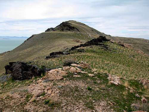
 Desert Peak in the Newfoundland Mountains
West of the Great Salt Lake: The Grassy Mountains and Newfoundland Mountains are located west of the Great Salt Lake. They are accessed from dirt side roads off of Interstate-80 west of Salt Lake City. The Grassy Mountains are west of the Lakeside Mountains and are not too far from the interstate. The Newfoundland Mountains are located northwest of the Grassy Mountains but are much more isolated and a longer drive. The Silver Island Mountains are described in detail in the Wendover section.
 Grassy Mountain Grassy Mountain |
 Grassy Mountain Grassy Mountain |
 Grassy Mountain Grassy Mountain |
GRASSY MOUNTAINS
The Grassy Mountains are located west of the Great Salt Lake. The range is small and covers an area that is about 12 miles long and 4 miles wide. The highest peak in the range is Grassy Mountain, 6,596 feet. Farther to the south is Cobble Hill. To the west is Finger Ridge and to the east are the Puddle Valley Knolls. This mountain range is west of the Lakeside Mountains and separated by Puddle Valley. Puddle Valley received it name because its base is made of clay and has no drainage. This means that large puddles form after heavy rain storms. The Great Salt Lake mud flats separate the range from the Newfoundland Mountains to the northwest. These mountains are located above Ripple Valley to the southwest and German Valley to the north.
Grassy Mountain - (6,596') Grassy Mountain is the highpoint of the Grassy Mountains. The peak can be accessed by turning off of I-80. There is a road that goes toward the mountain range. There are two ways to approach the peak. The route from the east starts in Puddle Valley and has 1,400 feet of elevation gain. The route from the west is shorter and has less elevation gain because a dirt road goes close to the peak. From here it's an short hike that can be done with other peaks in the area. You'll get a good view of the Lakeside Mountains and of higher ranges such as the Stansbury Mountains.
The Cobblers - (5,948') The Cobblers are a group of peaks located in the southern area of the Grassy Mountains. Cobble Hill, 5,740 feet, is the only named summit. The other Cobblers have been given delicious dessert nicknames. South of Cobble Hill is Apple Cobbler, 5,777 feet. The two peaks at the south end are Banana Cobbler, 5,837 feet and the highest Peach Cobbler, 5,948 feet. These low elevation peaks provide a nice hike during winter.
 Desert Peak Desert Peak |
 Desert Peak Desert Peak |
 Desert Peak Desert Peak |
NEWFOUNDLAND MOUNTAINS
The Newfoundland Mountains were named by Quince Knowlton. He founded a silver mine in the area that he called the Newfoundland Mine. The range was named after the mine. This is one of the most remote mountain ranges in the West Desert. The range is shaped like a sea horse. The area is about 15 miles long and 4 miles wide. The mountains run north to south and rise for over 2,700 feet above the valley. It is surrounded by the Great Salt Lake Desert mud flats. Some of the rock walls and boulders have odd erosional features. The highest mountain in the range is Desert Peak. There is little water and the area is very dry. The range is rugged with steep granite and quartz monzonite cliffs. A small area of the range is located on the Utah Test and Training Range.
Desert Peak - (7,005') Desert Peak is the highest in the Newfoundland Mountains. It's located in the northern part of the range. If you are able to get to the mountain then you're doing well. It's a long way out there and will take most people at least two hours from I-80 to get there on dirt roads. It can be approached from several directions. From the southwest above Miners Basin is the shortest route. Another route is from Dell Canyon on the east side of the range.
South Newfoundland BM - (6,058') This is the highest point in the southern area of the Newfoundland Mountains where few people go. The Utah Test and Training Range is also located at the southern part of the island. It looks like the summit is located just north of their range and it should be okay to hike to. You would probably have to approach the peak from the northeast or northwest. I'm not sure because few people go out there to climb it.
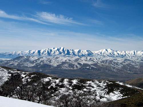 Oquirrh Mountains in Winter
From Salt Lake City
Salt Lake City is the largest and most well known city in Utah. With so many people heading to the Wasatch Mountains on the weekend, it is no wonder that the desert peaks located to the west see fewer people. These peaks give an extensive view of much of the area. Many of them stand out above the valley. The Stansbury Mountains and Oquirrh Mountains are among the most prominent in the state. The Mormons left Nauvoo, Illinois in 1846 because of religious persecution and went searching for a place where they could practice their religion freely. They traveled across Iowa and went to Winter Quarters, Nebraska. On April 5, 1847, an advance company led by Brigham Young set off from Winter Quarters on their trek across the country, 1,040 miles to a new home. Salt Lake City was founded in 1847, on July the 24th, by the Mormons. When they arrived their religious prophet Brigham Young reportedly stated, "This is the place." At first it was called the State of Deseret referring to the honey bee in the Book of Mormon. Then they named it the Great Salt Lake City after the salty inland lake that was located in the desert to the west.
OQUIRRH RANGE
 Oquirrh Foothills
 Settlement Canyon
Oquirrh Range The Oquirrh Mountains are located south of the Great Salt Lake and west of the Wasatch Front and Interstate 15. They are seen by everyone that drives through northern Utah but some people may not know much about these mountains. The range runs north to south for approximately thirty miles separating Salt Lake Valley from Tooele Valley. The Oquirrh Mountains have a reputation of having a lot of private property. This is true but there are many places in the range that are open to the public. The northern area is usually accessed from the west. The lower elevation Oquirrh Mountains rise above Herriman. These mountains rise to elevations higher than 10,000 feet and receive large amounts of snow in winter. This is due to the lake effect which tends to hold storms over the lake and mountains for long periods of time. Inversions in winter are common.
The name Oquirrh is pronounced as Oh-Ker. It is a Goshute Indian word meaning "Wooded Mountain.” It is also a Ute Indian word that translates to "The Shining Mountains" or "Glowing Mountains". This is because of their appearance when the sunlight shines on the mountains in the winter. The mountains have been mined for gold, silver, lead, and most famously for copper, as home of the copper porphyry deposit at Bingham Canyon Mine, one of the world's largest open pit mines. From Salt Lake City, the view of the mountain range is dominated by the displaced rock material which are known as "spoils" dug from the Kennecott mine. At the north end of the range is Kennecott's smelter complex which refines ore concentrates from the mine into useful metals. Dark colored tailings from past metal refining at the complex can be observed from the adjacent freeway, I-80. The value of the minerals taken from the range has been estimated to far exceed the combined value of those taken in the California, Nevada, and Klondike gold and silver rushes. The Oquirrh Mountains are often overlooked by hikers. Much of this is because of the close proximately to the Wasatch Range and Cottonwood Canyons which are more popular. Access to the area is somewhat complicated due to the large amounts of privately owned land in the area. It is a good idea to check road access beforehand to make sure you don’t travel on private property. Kennecott owns 93,000 acres of land along the Oquirrh Mountains and foothills. About 80,000 of these acres are located on Salt Lake Valley’s west bench. At the north end of the range are Kessler Peak and Farnsworth Peak which both have radio towers on their summits. Nelson Peak, Barneys Peak, and Clipper Peak are all located near Bingham Canyon mine.
 Flat Top Mountain Flat Top Mountain |
 Lowe Peak Lowe Peak |
 Lewiston Peak Lewiston Peak |
Flat Top Mountain - (10,620') Flat Top Mountain is the highest peak in the Oquirrh Mountains. It is also one Ultra Prominence Peaks in the United States with over 5,000 feet of prominence. The name of the mountain doesn't sound exciting but it is the most sought after summit in the range. Flat Top is located on a long ridge but is not really that flat at all. It is a great mountain to climb and provides an outstanding view of the area including the Wasatch Range across the valley. The best route for climbing the mountain is from the town of Ophir on the west side of the range. There are no private property issues with this route. You can also climb Lewiston Peak while you are there since it is on the ridge southwest of Flat Top Mountain.
Lowe Peak - (10,589') Lowe Peak is the second highest peak in the Oquirrh Mountains. It is located approximately three and a half miles to the north of Flat Top Mountain. They are connected by a long ridgeline. Lowe Peak has a more sharp and pointed appearance than Flat Top Mountain. The mountain is usually covered in snow into early summer. The peak lies on the border of Utah County to the east and Tooele County to the west. Ophir Canyon is the standard route to the summit. It is a relatively short and easy approach route to reach Lowe Peak. It is also located on public BLM land, and avoids potential problems of passing over privately owned land which exists on other routes from the east.
Lewiston Peak - (10,411') Lewiston Peak is located on the ridge south of Flat Top Mountain. It is also at the southern part of the Oquirrh Mountains. It blends in with the other high peaks and reaches over 10,000 feet. Many people climb Lewiston Peak on the way to the highpoint of the range, Flat Top Mountain. The most popular route is from Ophir Canyon. This route is from the west side of the range. Other routes may cross private property.
 Kelsey Peak Kelsey Peak |
 Rocky Peak Rocky Peak |
 Bald Mountain East Bald Mountain East |
Kelsey Peak - (10,373') Kelsey Peak is located southwest of the Butterfield Peaks, north of Rocky Peak, and south of White Pine Peak. The peak was named after Nancy Kelsey, the first white woman to cross the state of Utah. Kelsey Canyon to the west was also named after her. There are several ways to approach the mountain. The Butterfield Canyon Trail is the easiest route. It goes over the Butterfield Peak and continues on the ridge all the way to Kelsey Peak. Another route goes up Ophir Canyon which is near Lowe Peak and another route ascends Picnic Canyon.
Rocky Peak - (10,278') Rocky Peak is located northwest of Lowe Peak in the Oquirrh Mountains. The name is appropriate because its summit is rocky and rugged compared to other mountains in the range. Other peaks in the vicinity are Kelsey Peak which is located to the north and Bald Mountain located to the west. The peak can be accessed from Ophir Canyon. Be aware of all of the private property in the area. Rocky Peak can be approached most easily from its east ridge or from its south slopes. You can combine it together with Lowe Peak which is climbed more often.
Bald Mountain East - (10,006') Bald Mountain East is located south of the highest peaks in the Oquirrh Mountains at the southern end of the range. The mountain has two summits. The South summit is higher at 10,006 feet and the North summit is close to the 9960+ foot line. You can easily hike to both summits on the same hike. The standard route starts from Ophir Canyon. Be careful of any private property in the area. You can also hike up Chandler Peak while you are there which is above Chandler Saddle. Bald Mountain is not climbed often especially during winter.
 Sharp Mountain Sharp Mountain |
 Butterfield Peaks Butterfield Peaks |
 Nelson Peak Nelson Peak |
Sharp Mountain - (9,980') Sharp Mountain is part of the Bald Mountain ridge. There are three peaks which are located in the same area. They are Sharp Mountain, Bald Mountain East, and Bald Mountain West. The same approach up Ophir Canyon and then to Serviceberry Canyon can be used. The best route goes up to Chandler Saddle at 8,550 feet elevation. The highest point is Bald Mountain East which is over a mile away to the west.
Butterfield Peaks - (9,370') The Butterfield Peaks are south of West Mountain. There are several points of the ridge and one has a large cairn. The peaks received the name because of their proximity to Butterfield Canyon. The mountain is best hiked during summer and fall. The roads used to access these peaks are only open after the snow melts. The easiest approach is from Butterfield Canyon Pass and the ridge south of West Mountain. A longer approach is from Middle Canyon.
Nelson Peak - (9,359') Nelson Peak is the highest point in the Northern Oquirrh Mountains. It is located south of Farnsworth Peak and Kessler Peak on the same ridge. Just like those peaks, the east side of the mountain is located on private land and the west side on BLM land. There is also a communication tower on the summit. You can hike up the west ridge from the end of the road at Churchwood Gate.
 Clipper Peak Clipper Peak |
 West Mountain West Mountain |
 Farnsworth Peak Farnsworth Peak |
Clipper Peak - (9,207') Clipper Peak is located on the ridge north of West Mountain. The best route would be to follow that ridge but it is located on private property. Kennecott actually owns the land so no trespassing signs are marked everywhere. The Bingham Canyon Mine is on the east slope of the peak. Other peaks in the area include Clipper Ridge to the west, and Markham Peak, Barneys Peak, Freeman Peak, and Curry Peak to the north.
West Mountain - (9,070') West Mountain is south of Clipper Peak and north of the Butterfield Peaks. It is the only mountain in the Oquirrhs that has a road that leads near its summit. The road is paved and narrow with some sections of dirt. Any vehicle can drive there. This would also make it the most accessible mountain in the range. It was named after: The West Mountain Mining Company. The main attraction is Bingham Canyon Mine which can be seen from the scenic overlook.
Farnsworth Peak - (9,060') Farnsworth Peak is located at the northern end of the Oquirrh Mountains. It is recognizable because of the antennas on its summit. The peak was named after Philo T. Farnsworth. He was one of the inventors of Television. The east side of the mountain is on private land and access is restricted. The west side is located on BLM land and is the best way to approach the mountain. The route follows the northwest ridge to Kessler Peak and then goes south along the ridge to Farnsworth Peak. Just remember that there is an area of private land around the summit and it is your choice whether or not to hike over it.
 Kessler Peak Kessler Peak |
 Porphyry Hill Porphyry Hill |
 Eagle Hill Eagle Hill |
Kessler Peak - (8,820') Kessler Peak is located at the north end of the Oquirrh Mountains. It is also north of Farnsworth Peak which is higher in elevation. The east side of the peak is located on private property but the mountain can be approached from the west which is on BLM land. The route climbs up the ridge south of Rogers Canyon. This is also the recommended route for Farnsworth Peak which can be reached by following the ridge south of Kessler Peak.
Porphyry Hill - (8,716') Porphyry Hill is located at the southwest part of the Oquirrh Mountains. It’s north of Eagle Hill and Sunrise Hill which are near the Sacramento Open Mine Pine. It’s south of Silveropolis Peak, 8,790 feet, and Silveropolis Hill and Lion Hill. All of them are located in a mining area and this is where Porphyry Hill received its name. Lewiston Peak is located east of Porphyry Hill and they can be combined together.
Eagle Hill - (7,918') Eagle Hill is a southern highpoint in the Oquirrh Mountains. It is noticeably lower than its neighbors such as Flat Top Mountain and Lewiston Peak. Because of its location, it stands out enough to have a great view of Rush Valley and Cedar Valley. It is located in a mining area near Sacramento Open Pit Mine which is not far from Sunrise Hill. The peak can be approached from McFait Canyon to the southwest.
 South Mountain South Mountain |
 South Mountain South Mountain |
 South Mountain South Mountain |
South Mountain - (6,824') South Mountain is a highpoint on the ridge above the city of Herriman in the Oquirrh Mountains. There are new houses and subdivisions being built below the mountain. The current access to the trailhead is not far above. The best thing about South Mountain is the view. Winter is a good time to hike up above the city. Spring is also good and may have a clearer view. There are several ridges you could choose to ascend with minor bushwhacking along the way. In 2010, a fire burned much of the mountain and also destroyed houses and property below.
Step Mountain - (6,117') Step Mountain is an interesting little peak and it isn't very well known. You can see the peak from the summit of South Mountain but from most vantage points it is somewhat hidden. The mountain received its named from its appearance of rock steps that make up the summit. It’s not a long hike and is a great peak to climb during the cooler months of the year. It is located west of South Mountain near the city of Herriman.
Shag Mountain - (6,068') Shag Mountain is also known as Shaggy Peak. It is located in the Oquirrh foothills above the city of Herriman. It's northwest of Step Mountain and is a little more prominent. Shag Mountain forms a divide between Butterfield Canyon and Rose Canyon. Dry Canyon is below its north face. The best access is from the south since other areas near the peak are located on private property.
 South Mountain West View
Tooele and Grantsville are located west of Salt Lake City and just south of I-80. There are several mountain ranges in this area. The Cedar Mountains are located west of the Stansbury Moutains. The Stansbury Mountains reach above 11,000 feet at Deseret Peak. South Mountain West is located in Tooele Valley between the Stansbury and Oquirrh Mountains. The origin of the name Tooele is not certain but some say it evolved from a Native American name. The local Indians called the early Mormon pioneers who lived in the valley, "Tooelians". Other people say it came from the Spanish word for the bulrush plant which is common in the area. Wherever it came from, it fits Utah, since we have a lot of quirky names here. Captain Howard Stansbury spelled it as "tuilla" on his surveying maps in 1849 to 1850. Rush Lake is located below the southeast side of the South Mountain Range near the town of Stockton. It's a shallow saline lake that eventually drains into the southern end of the Great Salt Lake. The Stockton Bar is one of the largest and most well preserved shoreline remnants of Lake Bonneville.
 South Mountain West South Mountain West |
 South Mountain West South Mountain West |
 South Mountain West South Mountain West |
SOUTH MOUNTAIN RANGE
The South Mountain Range is the small range located west of the Oquirrh Mountains and east of the Stansbury Mountains. It's located in Tooele Valley and you may have driven past it without even knowing it. The range is southwest of Tooele which is the largest city in the area. The range is in the middle of the valley so that is why it's prominent although not very high. The Tooele Army Depot is to the north. These mountains form a dividing line between Tooele Valley and Rush Valley. Most hikers are only interested in the higher peaks so that is a good reason to recommend visiting this range. You will have a great view of the Stansbury Mountains and Oquirrh Mountains.
South Mountain West - (6,597') South Mountain West is the highpoint of the range. There are dirt roads that are located all around the mountain so it could be approached from many directions. You should try to avoid any private property in the area. The recommended route is from the east side. Depending on where you park, you'll be following a jeep road for a little while. Then it is a short off trail hike to the summit.
South Mountain East - (6,541') This mountain is located on the east side of the South Mountain Range as its name says. There are two ways to approach it. One is from Rush Lake. A dirt road goes north until it is below Peak 6,493. You can hike up South Mountain East which is to the west from here. Another route is from the north from a dirt road not far from the army depot. It goes up to within a thousand feet of the peak.
 Stansbury Mountains - by lcarreau
STANSBURY MOUNTAINS
 Stansbury Mountains
 Tooele Valley
The Stansbury Mountains are the premier mountain range in western Utah. The range is located east of the Cedar Mountains and west of the Oquirrh Mountains. The mountains rise to elevations of over 11,000 feet. They are very prominent due to their location above the valley near the cities of Tooele and Grantsville. During much of the year, you can see these mountains in the distance from the Wasatch Front, especially in winter when they are covered in snow. The range runs in a north to south direction for approximately 40 miles. On the west side of the range is Skull Valley, to the north is I-80 and the Great Salt Lake, to the east is Tooele Valley, and to the southeast is Rush Valley. The Stansbury Mountains were named after Captain Howard Stansbury. He was an early surveyor and explorer in Utah. Stansbury Island located at the southern end of the Great Salt Lake was also named after him. He was sent by Brigham Young to survey the Great Salt Lake area in 1850. Tooele is the county's largest city, and took its name from the valley, which Captain Howard Stansbury spelled as "tuilla" on his surveying maps in 1849-50. The word Deseret is often used to mean the state of Utah. When the Mormon pioneers first came to the territory, they named the area The State of Deseret, a reference to the honey bee in The Book of Mormon. The beehive can be seen as the centerpiece of the Utah Great Seal and the Utah State Flag.
 Flux Peak Ridge Flux Peak Ridge |
 Onaqui Benchmark Onaqui Benchmark |
 Onaqui Benchmark Onaqui Benchmark |
Northern Stansbury Mountains
The Northern Stansbury Mountains are located in a wilderness study area. It contains 10,480 acres of land. The entire wilderness area is six miles long and three miles wide so almost everything can be climbed in a one day although the terrain is rugged. There are no trails in this area but it is open to anyone willing to explore these mountains. There are a few things that distinguish the North Stansbury Mountains from the Deseret Peak Wilderness to the south. The first is that these peaks are lower in elevation. The second is that this is a dry mountain range and you will need to carry all water. The 9,143 foot high point of the North Stansbury Mountains is labeled as Onaqui Benchmark on maps. It resembles Mount Olympus in the Central Wasatch Mountains. This is because it has tilted quartzite rock slabs and a lot of fun moderate scrambling. There is a great view of the surrounding area from the summit. The climb is mostly off-trail hiking with elevation gain and loss on steep slopes. The best route for climbing Onaqui Benchmark is from Muskrat Canyon to the northwest. This would be about a ten mile hike. Other routes include Mack Canyon and West Canyon from the east side of the range.
Flux Peak - (8,003') Flux Peak is hiked less often than the southern peaks in the range. It's unnamed on maps but known mostly because it's near the small mining area of Flux which is located northeast of the peak. It can be approached from the west side heading south of the Timple Exit. A road goes along the side of the range but may be closed for various reasons. A route that leaves Muskrat Canyon and ascends the southern slopes of the peak is recommended.
Onaqui Benchmark - (9,143') Onaqui Benchmark is the highest peak at the northern end of the Stansbury Mountains. A good route for climbing Onaqui Benchmark is from Muskrat Canyon to the northwest. The approach road may be gated at times since there was fire damage to the area. Mack Canyon and West Canyon are two routes starting from the east side. It can also be done as a ridge traverse from Flux Peak. This would be a longer day hike depending on trailhead access.
 Deseret Peak Deseret Peak |
 South Willow Lake South Willow Lake |
 South Willow Peak South Willow Peak |
Deseret Peak Wilderness
This area is where the majority of the people come when they visit the Stansbury Mountains. The Deseret Peak Wilderness is located in western Utah, near the cities of Tooele and Grantsville. The Wilderness was established by Congress in 1984 with passage of the Utah Wilderness Act. It is entirely located in the Wasatch-Cache National Forest. The Deseret Peak Wilderness consists of approximately 25,500 acres and is generally bounded on the north by the Pass Canyon drainage, on the south by Vickory Mountain, on the west by Skull Valley and on the east by the Mack Canyon-Big Hollow Trail. Deseret Peak is the highest summit in the Stansbury Mountains. It is a high mountain above the desert and rises to an elevation of 11,031 feet. These mountains are almost the only Great Basin Range in Utah with a good system of hiking trails. It is clearly visible for many miles around, particularly from across the Great Salt Lake to the north and the desert valleys to the west. It has impressive cliffs that drop precipitously down toward South Willow Canyon. While the Wasatch Range is crowded with hikers on the weekends, you can expect more solitude here. Vickory Mountain is located south of Deseret Peak and is one of the few named peaks in this area.
South & North Willow Peaks - (10,685') These are two unofficially named peaks located on the ridge north of Deseret Peak. They are similar in the fact that they also have steep east faces. They are commonly referred to as North Willow Peak and South Willow Peak. North Willow is Peak 10,521 and South Willow is Peak 10,685. The Wasatch Mountain Club has nicknamed them North Medina Peak and South Medina Peak. You can combine them with a day hike of Deseret Peak from the Pockets Fork route.
Deseret Peak - (11,031') Deseret Peak is the most hiked summit in the Stansbury Mountains and one of the most prominent peaks in Utah. It is also the highpoint of Tooele County. For these reasons, many people come to this mountain range each year. It is one of the few west desert peaks with a maintained trail to its summit. This hike can be done as a scenic loop if you choose. You get an extensive view from the top with Skull Valley and the Cedar Mountains to the west and Tooele Valley and Rush Valley with the Oquirrh Mountains to the east.
Bald Mountain - (9,203') The Stansbury Mountains wouldn't be complete without a Bald Mountain. This one is located east of Deseret Peak. It can be done as a loop hike starting from Box Elder Canyon to the northeast. A trail can be followed much of the way up White Pine Fork to Box Elder Pass and then the summit of Bald Mountain. Instead of returning the same way, you can descend Abbots Fork, and hike to Little Bald Mountain, 7,681 feet, which is a short side trip.
Vickory Mountain - (10,330') Vickory Mountain is located on the southern boundary of the Deseret Peak Wilderness area. It is south of Bald Mountain and north of Johnson Pass which is on Highway 199. It can be approached from several directions. The point that is southeast of the summit is interestingly labeled as Stan on maps, which is perhaps short for Stansbury. The south ridge is a good route in winter because the trailhead is easy to access. After the snow melts, you can drive a high clearance vehicle to Hickman Pass. This is where the route up the east ridge of Vickory Mountain begins.
 Vickory Mountain Vickory Mountain |
 Vickory Mountain Vickory Mountain |
 Stookey Peak Stookey Peak |
Southern Stansbury Mountains
The Southern Stansbury Mountains are the Onaqui Mountains. On the early maps, this range was named Onaqui Mountain. The first transcontinental survey placed a survey marker designated Onaqui on a prominent high point on the ridge in 1887. Five years later they decided to place an additional benchmark at the highest point of the range, and named this second survey mark "Deseret". As it often happens, benchmark designation on the topo was co-opted as the name of the peak. The name "Onaqui" is still used both for the Northern prominence of the Stansburies and for the Southern part of the range. The highest point in the Onaqui Mountains is Stookey Peak which is 9,020 feet in elevation. Stookey Peak has 2500 feet of prominence over the surrounding area. This is the main reason why the mountain is climbed. The Onaqui Herd Management Area (HMA) is located 40 miles southwest of Salt Lake City. The HMA extends from Johnson's Pass south to Lookout Pass. Wild horses can be seen on the bench and flat areas along the east and west side of the mountain range. The HMA contains 43,880 acres of Federal, State, and privately owned land. Wild horses have occupied the Onaqui Mountains since the late 1800s.
Stookey Peak - (9,020') Stookey Peak is noticeable because of its location in the southern area of the Stansbury Mountains. It is in the Onaqui Mountains which is north of Lookout Pass and the Pony Express Road. This is also what separates it from the Sheeprock Mountains. Stookey Peak is usually approached from the east side. With a high clearance vehicle, this is a short and steep off trail route. North Stookey, 8,845 feet, may be combined with Stookey Peak from the ridge connecting the two.
 Cedar Peak view toward the Stansbury Mountains
CEDAR MOUNTAINS
The Cedar Mountains are located in the west desert staring just south of Interstate 80. Access to the range is relatively easy. The Cedar Mountains run in a north to south direction for approximately thirty miles. They are located southeast of the Grassy Mountains and southwest of the Lakeside Mountains. Skull Valley Indian Reservation is located on the east side of the Cedar Mountains separating it from the Stansbury Mountains. The vegetation on the upper elevations of the range is dominated by junipers. They were referred to as "cedars" by early pioneers and that is where the name came from. The Cedar Mountains Wilderness lies on the eastern edge of the Great Salt Lake Desert and contains 50,500 acres of land. It is one of the newest wilderness areas in the United States. The area is an excellent example of the unique basin and range topography featuring pinon and juniper covered mountain peaks rising to over 7,000 feet in elevation. The foothill and valley regions include mixed desert shrubs and sagebrush. Cheatgrass is prevalent over large areas burned by fires.
The remains of the Aragonite mining plant can be seen below the foothills on the southeast end of the range. The range is home to mule deer, pronghorn antelope, coyote, bobcats, bats, golden eagles, red-tailed hawks, ravens, reptiles, and mountain lions. The Cedar Mountain Wilderness includes more than half of the 180,000 acres of the Cedar Mountain Herd Management Area, where feral horses have grazed since they were introduced in the late 1800s. It is estimated that over 200 horses live seasonally in the range. About 20 stay throughout the summer and a herd can often be seen in the southern end of the wilderness area. The Bureau of Land Management fills watering troughs for the horses when springs dry up in the summer. This artificial water supply benefits other wildlife species such as pronghorn antelope. The Cedar Mountains are located near the protected military airspace of the Utah Test and Training Range. The southern portion of the range, that includes Wig Mountain, is off limits. A controversial proposal to ship nuclear waste to a dumpsite on the Reservation created the momentum to designate the Cedar Mountains as a wilderness area in large part because the designation would help block railway access to the proposed nuclear waste dump and therefore allow the Air Force to continue to use the UTTR airspace. Members of the Utah congressional delegation and the military were concerned that if the nuclear waste facility was to be built that the Air Force would have to curtail operations in the southern portion of the UTTR for safety reasons.
 Cedar Peak Cedar Peak |
 Cedar Peak Cedar Peak |
 Cedar Peak Cedar Peak |
Hastings Benchmark - (6,714') Hastings Benchmark is located at the northern area of the Cedar Mountains. It can be approached from the Hastings Cutoff Road which is east of Aragonite. There is northern side road that branches off from it. An old ATV track can be hiked all the way to the summit. This peak was named after Lansford Hastings. He is known as the developer of Hastings Cutoff on a route for emigrants traveling to California.
Cedar Peak - (7,712') Cedar Peak is the highest summit in the Cedar Mountains. It is also known as Cedar Mountains Highpoint or Cedar Benchmark. The mountain can be accessed from either the east or west side of the range. The west side is preferred because of closer access. Low clearance vehicles can park at the beginning of the canyon that leads toward Quincy Spring. A rough dirt road goes to a starting point for Cedar Peak. This route follows the northwest ridge.
Tabbys Peak - (6,921') Tabbys Peak is located south of Cedar Peak and was named for nearby Tabbys Spring. This knob shaped peak stands out because of its steep cliff bands. It can be approached from the south by starting near Rydalch Pass. A dirt road leads to the pass from either side of the range. The west side is probably a little easier to navigate although a high clearance vehicle is recommended.
 Silver Island Mountains and Pilot Peak - by Bubba Suess
From Wendover
Wendover and West Wendover is thought to be named after, Charles Wendover, a surveyor working for the railroad. Others say the name came from the fact that "wending" over the desert was required to get there. It was established in 1907 by the Western Pacific Railroad as a water, fuel and supply stop. In the 1920s, William Smith, aka Bill, got a job at the potash mine near town and he never left. After two years in Wendover, Bill Smith and a partner, Herman Eckstein, opened a garage and gas station, known as the Cobble Stone. He put a light bulb on a tall pole so that motorists would be greeted by it when they came. It was the only light in this desolate area at night. This outpost served a useful purpose since it was the only one out here for hundreds of miles. Smith and Eckstein then opened The Stateline, a 15-room hotel. It later became a casino after Nevada legalized gambling in 1931. In 1935, Bill Smith married, Anna Sorensen, who was a waitress. In 1938, the Smiths decided to build an air conditioned hotel. There was an increase of visitation because of World War II and in 1952 the Smiths expanded the hotel again to fit the needs of their customers. The A-1 Club was originally a gas station and coffee shop and then it was expanded in 1948 to include a casino. It was owned by Fred West. Bill Smith died in 1958 and Anna continued to run the family business. She purchased the A-1 Casino in the 1960s and renamed it Jim's Casino.
With several casinos established in the area, Wendover continued to grow and became a prime destination for gamblers. People from Salt Lake City and other cities near the Wasatch Front were particularly attracted to it. Wendover saw its largest boom during World War II. Wendover Air Force Base was finished in 1943 after three years of construction by the Army Air Corps. There were about 19,000 soldiers and they enjoyed spending time at the Stateline. The purpose of the base was to conduct bombing training exercises in a remote area. B-17 and B-24 pilots perfected their skills here. Heavy duty aerial bombing practice continued until April 1944. Wendover Air Base played a large role that changed history about a year later. The "Enola Gay" was named after, Enola Gay Tibbets, the mother of B-29 pilot Paul Tibbets. It was housed in a hangar in Wendover. It was the atomic bomb that was used to drop over Hiroshima, Japan on August 6, 1945. Wendover Air Force Base was later abandoned. The words, Enola Gay, are still on the side of the hangar. Time has faded the words away and the buildings in the area have been mostly left alone in the sun. The city of Wendover is located in the middle of the desert on the border of Nevada and Utah. It's easy to get to because Interstate-80 runs right through it. Wendover is known for its gambling and there are numerous casinos and motels. This includes Peppermill's Goldrush, Rainbow, and Montego Bay Casinos. The casinos are lined up on the Nevada side while the Utah portion is quiet and rural. Needless to say, a large percentage of the gamblers are from Utah. Wendover is a nice place to stay if you are in the area to climb several peaks during one trip. This is also where you can buy food and fill up your gas tank. There are over 4,000 people that live in West Wendover in Nevada and over a thousand people that live in Wendover in Utah.
NORTH PILOT RANGE
Pilot Peak is located in Nevada but the northern portion of the range is in Utah. Most everyone is focused on Pilot Peak since it is one of the Ultra Prominence Peaks in the U.S. The highest mountains in this group include Peak 8,721 which I like to call South Patterson Peak because of its location south of Patterson Pass. There is also Bald Eagle Mountain which is 8,028 feet elevation. Peaks that are over 7,000 feet include Mineral Mountain, McGinty Ridge, and Copper Mountain. Other peaks include The Nipple, Ryolite Butte, and Black Butte. Farther north and east are Gartney Mountain and Lion Mountain.
 Silver Island Mountains - by D-bo
SILVER ISLAND RANGE
 Silver Island View
 Graham Peak
The Silver Island Mountains is located near the Nevada-Utah border northeast of Wendover. This range is geologically impressive with several different rock layers exposed in a colorful arrangement. The mountains are about thirty two miles in length and run in a northeast to southwest direction. It is on the west side of the arid and barren Great Salt Lake desert. The mountain range is called an island because it is surrounded by the salt and mud flats of the ancient Lake Bonneville. The highest mountain in the range is Graham Peak, 7,563 feet. It is located near the northern side of the range. There are eight named summits and several unnamed points in range that are also worth climbing. They include Cobb Peak, Jenkins Peak, Campbell Peak, Lamus Peak, Rishel Peak, Tetzlaff Peak, Leppy Peak, Volcano Peak, and Crater Island. The best time to climb is during spring and fall. Summer is usually too hot for most people to hike here. The Silver Island Mountains and Pilot Range were important landmarks to the early pioneers. On the northeast part of the range is Donnor Canyon which was named after the ill fated Donnor-Reed party. They crossed the harsh Salt Lake desert just north of the Hastings Cutoff Trail. The area was a major route used by people trying to make their way to California. Mining was also and important resource in the range. The area is now a favorite place for rock hounds.
There are several caves that were used by Native Americans. Excavations at nearby Danger Cave have proven occupation of the area as early as 8300 BC. The first recorded crossing of the desert was made in 1845 by Captain John C. Fremont's survey party, with scouts Kit Carson and Joe Walker. The Silver Island Mountains Backcountry Byway is 54 miles long. The drive should take about two to three hours at a leisurely pace. It loops around the base of the range of jagged volcanic peaks. Some of the mountains bear names of land-speed legends of the Bonneville Salt Flats. They include W.D. Rishel, Ab Jenkins, John Cobb, Sir Malcolm Campbell and “Terrible” Teddy Tetzlaff. The Bonneville Salt Flats are the flattest place in the U.S. and is a very photogenic environment. It is a nice side trip off I-80 and is very beautiful later in the day. There are spur roads from the main loop that go into Jenkins, Cave, Silver Island, and Donner Canyons. From these side roads hikers can access peaks. The Bonneville Salt Flats are located over an area of 30,000 acres. It is administered by the Bureau of Land Management and is located along I-80 east of the Silver Island Range. The area is named in honor of Captain B.L.E. Bonneville, whose expeditions in the 1830's proved the area was part of an ancient basin. The salt flats potential for racing was first recognized in 1896 by W.D. Rishel while looking for a bicycle race course from New York to San Francisco. Daredevils started racing automobile speed records on the flats. By 1949, the raceway on the Bonneville Salt Flats was the standard course for world land speed records. On this natural race course the 300, 400, 500, and 600 mile per hour land speed barriers were broken.
 Silver Island Mountains Silver Island Mountains |
 Silver Island Mountains Silver Island Mountains |
 Silver Island Mountains Silver Island Mountains |
Graham Peak - (7,563') Graham Peak is the highest summit in the Silver Island Mountains. It also stands over 3,000 feet above the desert so this is the main reason why people want to climb it. Graham Peak can be approached from several directions. The shortest route starts northwest of Campbell Canyon. Canyons on the east side of the peak include Cave Canyon and Silver Island Canyon. These are longer routes that can be used to reach the summit. The ridge traverse between Campbell Peak and Graham Peak is a more challenging hike. This peak was named after Athol Graham. He was a mechanic and race car driver from Salt Lake City. He was the first person to die in record runs at the Bonneville Salt Flats.
Campbell Peak - (7,272') Campbell Peak is located southwest of Graham Peak. Campbell Peak can be climbed by the same routes as Graham Peak. Recommended routes are Campbell Canyon from the west or Cave Canyon from the east. The peak was named after Sir Malcolm Campbell. He was an English racing motorist and journalist. He broke the world speed record on land and on water during the 1920s and 1930s. He was the first person to drive an automobile over 300 miles per hour. His son, Donald Campbell, continued the tradition and also broke many speed records.
 Graham Peak Graham Peak |
 Campbell Graham Ridge Campbell Graham Ridge |
 Jenkins Peak Jenkins Peak |
Jenkins Peak - (7,268') Jenkins Peak is north of Lamus Peak and south of Campbell Peak. Jenkins Peak is best approached from Jenkins Canyon to the east or by a ridge traverse from surrounding peaks. The peak was named after Davis Abbott Jenkins aka Ab. He was a professional race car driver and land record enthusiast that helped establish events on the Bonneville Salt Flats. He also held the record for 24 hour average land speed record for fifty years. Jenkins drove a Duesenberg which was known as the Mormon Meteor for the simple reason that he was Mormon.
Cobb Peak - (7,021') Cobb Peak is located east of Graham Peak in the Silver Island Mountains. It is quite prominent since it is located on the east end of the main group of peaks and also across from Floating Island. The recommended route is from the northwest. The peak was named after John Cobb. He was a racing motorist from Britain. He broke land speed records at Bonneville Salt Flats and he was also interested in water speed records. John Cobb died while trying to break the water speed record over 200 mph at Loch Ness in the Scottish Highlands.
 Cobb Peak Cobb Peak |
 Lamus Peak Lamus Peak |
 Lamus & Jenkins Lamus & Jenkins |
Lamus Peak - (6,284') Lamus Peak is located south of Jenkins Peak. The main route from the southwest goes up rugged terrain but is still class 2 hiking. There are great views from the summit. The peak was named after Blair Lamus. His father was the first mayor of Wendover but he passed away before his term expired. Then Blair was appointed to serve as the mayor. Blair, his father, and another contractor built the road between Wendover and Knolls. He was instrumental in getting the Bonneville Race Track going out in Wendover.
Tetzlaff Peak - (6,267') Tetzlaff Peak is located northeast of Rishel Peak. From the north or southwest would be the preferable routes. The peak was named after Teddy Tetzlaff. He was from Los Angeles, California. He earned the nickname "Terrible" because of his rough treatment of his vehicles. Teddy was a racecar driver during the beginning years of auto racing and he raced in the first four Indianapolis 500s. He also appeared in many silent movies as a stuntman. His son, Dale H. aka Teddy Tetzlaff Jr, became a well known cinematographer.
 Rishel & Tetzlaff Rishel & Tetzlaff |
 Rishel Peak Rishel Peak |
 Volcano Peak Volcano Peak |
Rishel Peak - (6,212') Rishel Peak is located southwest of Tetzlaff Peak. It is a pointy triangle shaped peak. The peak can be climbed from its north ridge. It was named after Bill Rishel. In 1896, he noticed that the salt flats did not work well for bicycle races and wondered if automobiles would be better. In 1907, he tested a Pierce-Arrow car and drove it across the salt flats making the first crossing. He recognized the potential that it could have for racing and encouraged Teddy Tetzlaff to make the first land speed record in 1914.
Volcano Peak - (6,011') Volcano Peak is southwest of Rishel Peak at the southern end of the Silver Island Mountains. It is not far from the city of Wendover. Volcano Peak is the lowest of the named summits on the main crest of the range. The easiest route to the top is from the northeast. It is short and steep and can be done in a few hours. It also has the advantage of not requiring a 4wd vehicle to reach the trailhead. The peak has a unique shape and is thought to resemble a volcano.
 Crater Island Crater Island |
 Crater Island Crater Island |
 Floating Island Floating Island |
Crater Island - (5,743') Crater Island is located at the north end of the Silver Island Mountains. It is also north of Donnor-Reed Pass. You can drive to the pass and continue north to reach the base of the highest point. It’s along a dirt road that runs across the east side of the island. This isn't a high peak but it does have over 1,300 feet of prominence so that is one of the reasons why people climb it. It also has great views of the higher peaks in the range and of the salt flats.
Floating Island - (5,109') Floating Island is located east of the main crest of the Silver Island Mountains. It is connected by a dirt causeway. When viewed from other nearby peaks, such as Cobb Peak, it has the appearance of a small floating island in the middle of the desert. It is a lonely summit that is only climbed by prominence peak chasers or people who like exploring obscure places. Floating Island is best hiked from its west and south side.
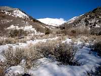
 Sunrise from Woodman Peak near Dutch Mountain - by Eric Willhite
NORTH DEEP CREEK MOUNTAINS
This is the group of mountains located north of the high peaks of the Deep Creek Range. They are lower in elevation but several of the peaks are prominent. Mountains located north of Pony Express Canyon include Dutch Mountain, 7,794 feet, and Ochre Mountain, 7,540 feet, which both have over 1,000 feet of prominence. Other peaks include Woodman Peak, Twin Peaks, Red Mountain, and Wilson Hill. This area is known as Gold Hill. It was established in 1892 as a mining town. The name was simply taken after the gold bearing hill or mountain nearby. It became known for its many minerals that included silver, gold, copper, lead, tungsten, and arsenic. The Deep Creek Railroad was later built into Gold Hill in 1917. Over 3,000 people lived in the town during its heyday. There was a school, pool hall, and several stores. They even had a successful newspaper. Arsenic was productive because it was needed during World War I to control insects that were damaging cottonfields in the South. After arsenic became more readily available, people left Gold Hill to live elsewhere. During World War II it came back to life for a little while. Tungsten was mined so it could be used to make steel and electric filaments that were shipped out. After the need for tungsten was gone, Gold Hill was abandoned again.
Dutch Mountain - (7,794’) Dutch Mountain sits by itself with over 1,900 feet of prominence. A few SPers have climbed this peak and really enjoyed it, especially during winter. The recommended route starts from Gold Hill Pass and goes up the southwest ridge. It also goes over Woodman Peak so you climb two peaks.
Ochre Mountain - (7,540') Ochre Mountain is located south of Dutch Mountain and northwest of the Clifton Hills and Montezuma Peak. It received its name for its yellowish ochre color. The peak is north of Pony Express Canyon. There are dirt road below all sides of the peak because of all of the mines in the area.
 Dutch Mountain Dutch Mountain |
 Woodman Peak Woodman Peak |
 Utah Peak Utah Peak |
CLIFTON HILLS
The Clifton Hills are part of the North Deep Creek Mountains. The hills are located in the eastern section. The highest summit is Montezuma Peak at 7,370 feet elevation. It has over 1,200 feet of prominence. Other peaks include Blood Mountain, Lucky Day Knob, and Gold Hill.
Montezuma Peak - (7,370') Montezuma sounds like a cool name for a peak. It is located southeast of Ochre Mountain and south of Dutch Mountain which are all prominent. With a 4WD vehicle you could get close to the mountain. There are several mines in the area that have roads leading to them. Monocco Mine is on its western slope.
FERBER HILLS
The Ferber Hills are located on the Nevada-Utah border. This small range was named after the Ferber brothers who discovered an area of Elko Nevada. Ferber Peak is in Nevada and is 6,620 feet in elevation. The highest Ferber Hills peak in Utah is appropriately named Utah Peak at 6,722 feet. Other points farther north are Rocky Point at 5,536 feet, Elephant Knoll at 5,271 feet, and Peak 5,745 and Peak 5,456. The Ferber Hills are west of the North Deep Creek Mountains. They are connected by dirt roads and a valley called White Sage Flat.
Utah Peak - (6,722’) Utah Peak is the highpoint of the Ferber Hills. Ferber Peak in Nevada is actually over a hundred feet shorter. There are dirt roads surrounding the mountain on the east side which can be used to get near the base. The summit is not far from the Nevada border so the views are quite extensive.
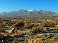
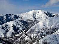
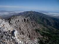
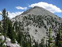
 Ibapah Peak in the Deep Creek Range - by Castlereagh
DEEP CREEK RANGE
The Deep Creek Mountains are the highest range in the West Desert of Utah. They rise above 12,000 feet. These mountains often have snow remaining when other nearby ranges are dry. The range runs in a north to south direction. These mountains are located just east of the Nevada border, west of the Fish Springs Range, and northwest of the Confusion Range and House Range. On the west side of these mountains is the Goshute Reservation and Deep Creek Valley and on the east side is Snake Valley. The town of Ibapah is inhabited mostly by the Goshute Indians. The name Ibapah came from the Goshute word "Aibimpa" which means "White Clay Water" for the nearby creek. That creek would later be known as Deep Creek and so would the mountain range. What stands out about the Deep Creek Mountains is that they rise so steeply out of the valley. The highest peaks include Ibapah Peak, Haystack Peak, and Red Mountain. They consist mostly of granite as well as quartzite and shale. You may also see Bristlecone pines here. Mule deer, elk, mountain lions, and bighorn sheep live in these mountains. North of Ibapah Peak and Haystack Peak and south of Pony Express Canyon are several notable peaks. They include North Peak, South Peak, Young Peak, and Abercrombie Peak. Peaks over 9,000 feet include Pole Benchmark, 9,227 feet, Bald Mountain, 9,685 feet, and Rocky Peak, 10,748 feet. Ibepah Azimuth, 11,987 feet, is the point on the ridge north of Haystack Peak. The other peaks in the range see even fewer people considering the long drive and location.
 Ibapah Peak Ibapah Peak |
 Haystack Peak Haystack Peak |
 Red Mountain Red Mountain |
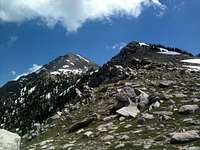
Ibapah Peak - (12,087') Ibapah Peak is the highest mountain in the Deep Creek Range. It is one of the peaks in Utah with over 5,000 feet of prominence. This is why many people choose to climb it and the fact that it is the highpoint of Juab County. The west side of the mountain is located on the Goshute Indian Reservation so almost everyone will be approaching from the east side. A good route is from Granite Creek Canyon. It's not a technically difficult peak, steep class 2, but it is strenuous. There is a lot of elevation gain and it will take much of a day to climb. Some people may want to camp nearby to get an early start.
Haystack Peak - (12,020') Haystack Peak is the second highest in the Deep Creek Mountains. We all know that second place doesn’t always get respect but this peak is worth climbing too. Haystack Peak is located a few miles north of Ibapah Peak on the same ridge. You can combine them together if you have time. Another point located on the ridge to the north of Haystack is Peak 11,987 which is named Ibepah Azimuth. One of the recommended routes ascends the east ridge via Indian Farm Bowl area to Ibepah Azimuth and then follows the ridge south to the summit of Haystack Peak. Another route ascends via the Red Cedar Bowl area.
Red Mountain - (11,588') Red Mountain was named for its red color. This should be obvious when you see the mountain up close for the first time. The color comes from the red quartzite rock on the peak which contrast with the white granite of nearby Ibapah and Haystack. The mountain is actually a series of several points. The summit is 11,588 feet and the point to the west is 11,565 and to the east is 11,386. Red Mountain is located south of Ibapah Peak near Granite Creek Pass. If you decide to approach from Granite Creek you could climb both peaks in the same day. Despite its location, the mountain is not climbed often.
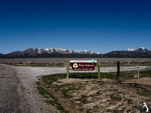 The Pony Express Trail toward Lookout Pass
Pony Express Trail
 Pony Express Marker
 Pony Express Marker
The Pony Express was a horse-and-rider mail delivery system between the eastern and western United States. It was created because the older mail delivery system was slow and would take six months. William Russell was a businessman who owned a stage and freight company based in Leavenworth, Kansas. He along with his partners Alexander Majors and William Waddell talked with the Senator of California, William Gwin, about the possibility of an Express Mail Company. They agreed on a route that followed the Oregon Trail and California Trail to Wyoming. Then it went along the Mormon Trail to Salt Lake City, Utah. From there it followed the Central Route from Utah to Carson City, Nevada. It then went over the Sierra Mountains into Sacramento, California. The Pony Express lasted from April 1860 to October 1861.
 Pony Express History
The time to deliver mail was shortened considerably and riders were able to cover approximately 1,900 miles in about ten days. The riders for the Pony Express were generally young, lightweight men who were tough and could handle the difficult work. A famous advertisement said, "Wanted: Young, skinny, wiry fellows not over eighteen. Must be expert riders, willing to risk death daily. Orphans preferred." The route across the West Desert of Utah was considered one of the most difficult sections of the Pony Express route. The hot, harsh and dry conditions in the desert made circumstances even harder. Another thing that riders had to worry about were Indian attacks. The Paiute War took place from May to June 1860. It was the only time in the entire history of the Pony Express where mail delivery was briefly stopped and did not make it all the way through until later. The Pony Express had an estimated eighty riders. They could be on the trail at any given time. There were also other employees such as station keepers, stock tenders and route superintendents. Four hundred horses were used in total to deliver mail for the Pony Express. William Cody, better known as Buffalo Bill, is one of the most well known riders for the Pony Express. He became a rider when he was just fifteen years old. Cody was an important frontiersman during the gold rush, the building of the railroads, cattle herding on the Great Plains, and as a scout during the Civil War. Jack Keetley rode for the Pony Express for the entire time it existed. Robert Haslam rode while wounded, at a record pace, as he carried Abraham Lincoln's inaugural address. You can follow the Pony Express route by vehicle on graded dirt roads. The Utah portion travels through 133 miles of the west desert. There are no services and you should allow four hours of traveling time. The eastern terminus of the trail is located at Stagecoach Inn State Park in Fairfield, Utah. This is southwest of Salt Lake City. The route goes over Lookout Pass to Simpson Springs. Then it goes up to Dugway Pass and across to Fish Springs and then to the town of Callao. The western terminus of the trail is located at Ibapah, Utah near the border. This is south of the city of Wendover near the Deep Creek Range which are the highest range in the West Desert of Utah. These mountains can be reached from both Wendover and the Pony Express Trail.
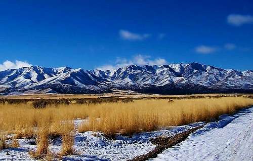 Black Crook Peak in the Sheeprock Mountains - by gjagiels
SHEEPROCK MOUNTAINS
The Sheeprock Mountains received their name because of the large population of bighorn sheep that were in these mountains when Mormon settlers arrived. You can still see them on the rocky ridges and cliffs in the range. This range runs in a northwest to southeast direction. It is approximately twenty miles long and ten miles wide. The Sheeprock Mountains begin south of the Onaqui Mountains which are the southern area of the Stansbury Mountains. This is south of Lookout Pass. The southern area of the Sheeprock Mountains forms its widest point and this is where it meets the West Tintic Mountains. The Simpson Mountains are located to the west. To the south is Desert Mountain and to the southwest is the Keg Mountain Range. Lookout Pass was originally named by Captain James H. Simpson in 1858 as General Johnston's Pass in honor of his commanding officer. Now most people refer to it as Point Lookout or Lookout Pass and you get a good view of the area from here. Vernon is the small town that is northeast of the Sheeprock Mountains in Rush Valley. It was named after Joseph Vernon. He was an early settler who was killed by a local Indian. Harker Canyon is located southeast of Black Crook Peak. Harker Canyon was reported to have the highest concentrations of heavy metals in its groundwater of any sampled area in the Sheeprock Mountains. It's a good idea to bring your own water with you. These mountains were extensively mined for gold, silver, lead, iron, copper, and tungsten.
 Sheeprock Mountains Sheeprock Mountains |
 Sheeprock Mountains Sheeprock Mountains |
 Sheeprock Mountains Sheeprock Mountains |
Red Pine Mountain - (8,516') Red Pine Mountain is located at the northern end of the Sheeprock Mountains. The mountain is southwest of Little Red Pine Canyon. It was named after Red Pine Creek to the northeast which flows into Rush Valley. You can get to the mountain from a dirt road leading into Little Valley which is south of Lookout Pass. The peak can be approached from the north from any of the ridges. This seems to be a popular hike with the locals.
Black Crook Peak - (9,274') Black Crook Peak is the highest in the Sheeprock Mountains. There are several ways to approach the peak. North Oak Brush Canyon via the southeast ridge and North Pine Canyon via the northeast ridge are the recommended routes. Other routes include South Oak Brush Canyon to the southwest and the north ridge. Black Crook Peak is also known as Bennion Peak from the benchmark. It was named after the Bennion family, specifically Israel Bennion, who settled in this area. The nearby town of Benmore was named after Israel Bennion and Charles Skidmore. It only lasted for a decade and old buildings can be seen today.
Dutch Peak - (8,964') Dutch Peak is southeast of Black Crook Peak and north of Black Peak. Dutch Creek flows from its northeast slopes. Bennion Creek is southeast of Dutch Peak. It is another feature in the range named after the Bennion family. This creek was named after Samuel and Mary Bennion who were early settlers in the area. Dutch Peak is best approached from Bennion Creek or Hard to Beat Canyon to the west.
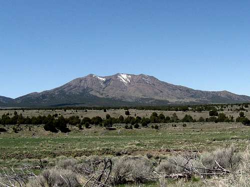 Indian Peaks in the Simpson Mountains
SIMPSON MOUNTAINS
The Simpson Mountains were named after Captain James H. Simpson. These mountains are located west of the Sheeprock Mountains, south of the Davis Mountain Range, east of Table Mountain in the Slow Elk Hills, northeast of the Keg Mountain Range, and northwest of Desert Mountain. The range runs north to south and is about twelve miles long and eight miles wide. Indian Peaks is the main mountain and highest in the range. Grassy Mountain, 6,898 feet, is west of Indian Peaks. Peak 7,890 is east of Indian Springs and above Lee Canyon. Lion Peak is located east of Lost Canyon and north of Death Canyon. Peak 8,965 is west of Erickson Pass. Captain James H. Simpson was an Army officer and member of the United States Topographical Engineers. In May 1859, he surveyed a new route from Camp Floyd south of Salt Lake City to Genoa, Nevada. This route crossed the central Nevada desert instead of following the Humbolt River route. This made the route about 150 miles shorter. Simpson's new route was then used for the Pony Express route. The Transcontinental Telegraph was laid along the route in 1861 and the Pony Express was no longer needed. Simpson Springs was also named after James H. Simpson. It was one of the main water sources that was used along the Pony Express route. Simpson Springs was an important station for freighters and stages until the 1920s. A Civilian Conservation Corps camp was built at Simpson Springs during the late 1930s and early 1940s. There is a nice campground at Simpson Springs that is open year round.
 Indian Peaks Indian Peaks |
 Indian Peaks Indian Peaks |
 Indian Peaks Indian Peaks |
Indian Peaks - (8,420') The Indian Peaks are the highest in the Simpson Mountains in the northern part of the range. They make up a long ridge with three points that are close in elevation. The southern peak is the highpoint. If you’re not sure you could just hike to all of them. The southeast ridge is the shortest route. The north ridge route goes over all of the points. Another possible route is from Indian Springs. These springs are what the mountain was named after. The springs were the site of old Indian camping grounds. Later, during the 1890s, it was a temporary mining camp.
Death Canyon Peak - (8,334') This peak is located south of the Indian Peaks and east of Lion Peak, 8,205 feet. It is unnamed but I like to call it Death Canyon Peak after the canyon located to the south. It has an interesting name and history. Death Canyon and nearby Blain Canyon were mined during the 1880s. There are several ruins, log cabins, and extinct mines left from the mining era. Lee Canyon which is north of the peak is probably the shortest route to the top. A high clearance vehicle is recommended.
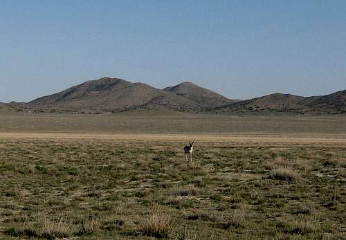 Antelope and Round Top in the Davis Mountain Range
DAVIS MOUNTAIN RANGE
This range was named after David E. "Pegleg" Davis. He operated the telegraph station which was located on the southern slope of the mountains along Government Creek in the 1860s. The creek was about eight miles west of Lookout Pass. It may have been used as a Pony Express relay station but no one knows for sure. It was between Simpson Springs and Lookout Pass which would have been an ideal location for a change of horses. The telegraph was operational until 1869 and then it was moved north to parallel the new transcontinental railroad. The Davis Mountain Range is located north of the Simpson Mountains, northwest of the Sheeprock Mountains, west of the Onaqui Mountains, southeast of the Cedar Mountains, and east of Dugway Proving Ground. It's a small mountain range that is about three miles long from north to south and five and a half miles wide from east to west. This range is low in elevation compared to the surrounding mountain ranges. The Davis Mountain Range is located all by itself in the middle of a desert valley and that's why it stands out so much. If you like seeing wildlife, there is a good chance you will see it here. There are a lot of pronghorn antelope, wild horses, and mule deer in the area. The wild horses are part of the Onaqui Mountain Herd. It is really a neat experience to see those animals. When temperatures warm up, you may run into rattlesnakes. There are also birds of prey in the area. This is nice place in winter or early spring because snow melts early from the mountains. Information for both Round Top and Davis Mountain can be found on Dean's Round Top page.
 Round Top Round Top |
 Round Top Round Top |
 Round Top View Round Top View |
Round Top - (6,434') This is the highest peak in the Davis Mountain Range. When viewed from other nearby mountain ranges, you can see how it got its name. It's a round top peak. You could approach Round Top from any direction but the closest is from the east since a dirt road goes into that canyon. You can ascend the east ridge of Round Top and descend to the saddle between it and Davis Mountain or vice versa. This will let you do a loop hike and two peaks in the range.
Davis Mountain - (6,252') Davis Mountain is located across the canyon to the south of Round Top. You can combine both together. Davis Mountain is lower in elevation but worth hiking to as well. Hiking up from the saddle between it and Round Top is the easiest route. There is another peak known as Davis Mountain South, 6,200 feet, located south of Davis Mountain. You may want to hike to that peak too. You could take a different descent route back to the trailhead if add that peak.
 Dugway Range Highpoint - by Eric Willhite
DUGWAY RANGE
The Dugway Range is a northwest to southeast running range. It is west of the Simpson Mountains, northwest of the Keg Mountain Range, north of the Thomas Range, and southeast of Granite Peak in Dugway Proving Ground. The northern part of the range is in Dugway Proving Ground and restricted to hiking. The highpoint of the range and other peaks are farther south and open to the public. So this range is recommended if you want to hike in a place that sees few people or if you just want a good view of Dugway from the top. The community of Dugway is in Tooele County about eighty miles southwest of Salt Lake City. It's located to the northeast of the Dugway Range and not far from the Davis Mountain Range. The name "Dugway" is used for this range, the valley, the proving ground, and the nearby community. A dugway is where early pioneers cut a trench in the side of a very steep hill so that wagons could anchor their uphill side wheels in the dugway or trench. Then they used their mules, oxen, or horses to pull the wagons up and over the pass without tipping over and tumbling down the hillside. Dugway Pass forms the divide between the Dugway Range to the north and the Thomas Range to the south. It was originally called "Short-Cut Pass" by Captain James H. Simpson. One of the soldiers called it "Break-Neck Hill" for its steep grade. The other side of the pass going west was more gradual. It goes toward the Black Rock Hills. The Dugway Range is known more for the Dugway Geode Beds than for its hiking. Geodes are volcanic rocks that are filled with crystals in a hollow center cavity. They can be found in abundance in this area. The Geode Beds are located below the southwest side of the Dugway Range. There is a dirt road leading to the geode beds. It is located on BLM land. The rule is that you may collect small amounts of gemstones and rocks from unrestricted federal lands in Utah without obtaining a special permit. If you want to collect large quantities for yourself or for commercial purposes, you need to obtain a permit, lease, or license from the BLM. Also, there are mining claims that exist in some areas so you should ask for permission first.
 Castle Mountain Castle Mountain |
 Dugway Range Highpoint Dugway Range Highpoint |
 Southern Dugway Range Southern Dugway Range |
Castle Mountain - (6,765') Castle Mountain is located northwest of the Dugway Range Highpoint. There are cliffs around the mountain and then it levels off near the top of the ridge below the summit. So it is thought to resemble a castle. Englemann Canyon is located on its northeast slopes. The mountain can be reached from the dirt road the runs along the base of the west side of the range. The summit ridge has two points. The south peak is the highpoint and the one farther to the north is a little lower.
Dugway Range Highpoint - (6,830') This is the highest peak in the range. It is unofficially named but most know it as the Dugway Range Highpoint. Fandangle Canyon is located to the north of the highpoint. This peak is more easily approached from the southwest side of the range northeast of the Geode Beds. The point that looks like the summit is actually a false summit, 6,775 feet. It has cliffs on it and a pointed appearance. You can do a ridge traverse between it and the summit which is farther to the northeast.
Pyramid Peak - (6,120') Pyramid Peak was named for its appearance of a triangle shaped fortress. No doubt the early pioneers saw this peak every time they traveled over Dugway Pass. You could hike to it from the pass but it's probably a shorter distance from the west side. A dirt road runs along the base of the west side of the range. From here you could park at a point that is northwest of Pyramid Peak. The face of the peak is steep but the ridge looks like a nice hike.
BLACK ROCK HILLS
The Black Rock Hills are a small group of hills located southwest of the Dugway Range, west of the Thomas Range, and east of the Fish Springs Range. They are in the middle of valley known as Fish Springs Flat. The hills are low in elevation as you would expect. They stand out because of their color and their location. None of the hills have official names either. The range received its name from the black basalt rock. An outcrop was located on the north side of the Pony Express Trail near Black Rock Station. This was also known as Butte, Desert Station, or Black House. This station was manned by George Washington Boyd for some time. He worked under Major Howard Egan. Boyd supplied Black Rock Station with water barrels and cord wood during the 1860s. He also built the stations for Willow Springs, Boyd Station, Fish Springs, and Dugway Station and furnished hay and wood for them. Black Rock Station was described by many as being a bleak and desolate place.
Black Rock Hills HP - (5,782') This is the highpoint of the Black Rock Hills. It is unnamed and located on the east side of the range. The main interest of this peak is that it has over a thousand feet of prominence. A dirt road goes along the eastern edge of the hills. Goshoot Canyon is located on the south side of the peak. It was named after the Goshute Indians, which is sometimes spelled as Goshoot, who live in this area. This canyon or one of the ridges would offer the shortest route to the summit.
 George H Hansen Peak in the Fish Springs Range - by gjagiels
FISH SPRINGS RANGE
The Fish Springs Range is located west of the Black Rock Hills and Thomas Range, southwest of the Dugway Range and north of the House Range with the divide at Sand Pass. It is northeast of the Confusion Range and east of the Deep Creek Range. Dugway Proving Ground is located to the north. The Fish Springs Range runs north to south for about twelve miles. It is a narrow and steep mountain range that is three miles wide. The terrain is rugged and remote and there are no maintained trails. This is the reason that few people hike here. You can get here from the Pony Express Road or farther south from Highway 174. The springs were an important resource for local Native Americans. In 1859, Captain James H. Simpson traveled to this area and noticed numerous fish in the springs. Simpson stated that they were not the best tasting fish. Native fish in the springs included Utah Chub, Least Chub, and Speckled Dace. That is where the name of the springs and mountain range came from. Navigating through the mud flats was not particularly easy for early explorers. This part of the Pony Express route was described as being dusty, bumpy, and smelly. The road would turn muddy after it rained and would be slow to travel over. The Fish Springs area is a remnant of Lake Bonneville. The Fish Springs Wildlife Refuge was established in 1959 for waterfowl nesting, wintering and migratory habitat. There are many large springs and green marshland that is home for hundreds of species of birds. An auto tour route on gravel roads traverses portions of the refuge. Wildlife viewing and photography is welcome. The Thomas Ranch Watchable Wildlife Area is the best place to visit. It is located north of the refuge headquarters. The water is not safe to drink because it is warm and very saline. No swimming or fishing is allowed at the wildlife refuge. George H Hansen Peak is the only named peak in the Fish Springs Range. There are other peaks that look like they would be fun to climb. Of course, many of them have fishy nicknames. At the north end of the range is what I call "Fish Springs Peak" 6,953 feet. This peak is southwest of Fish Springs Wildlife Refuge. Peak 7,900 is the pointy peak north of George H Hansen Peak. Peak 8,354 is known as "Fish Head Peak" and Peak 8,220 farther south is known as "Fish Scales".
 George H Hansen Peak George H Hansen Peak |
 George H Hansen Peak George H Hansen Peak |
 Peak 8354 Peak 8354 |
George H Hansen Peak - (8,523') This is the highest peak in the Fish Springs Range. It was named after George H. Hansen. He was a geologist, university professor and administrator at Brigham Young University for 45 years. The peak is approached from the east side. There is a 4wd road that that goes toward the canyon below the peak. From here, it is a steep off trail hike with scrambling. The difficulty of the route depends on how well you navigate around cliff bands. There may be other routes but all of them are strenuous. George H Hansen Peak has over 3,600 feet of prominence.
Fish Head Peak - (8,354') Fish Head Peak is located south of George H. Hansen Peak. It's a sharp looking peak that is unofficially named. It can be approached from the same trailhead as George H. Hansen Peak on the east side of the range. You can do a ridge traverse from one to the other. Point 8,001 is located between them. Several peaks can be reached on this ridge and you can combine them as a loop hike.
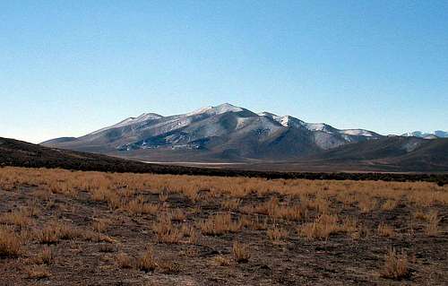 Topliff Hill with a Dusting of Snow
VERNON HILLS
The Vernon Hills were named from their proximity to the town of Vernon which is west of the hills. It was named after Joseph Vernon was killed by a local Indian. The Vernon area began settlement in 1857. A small group of Mormon pioneers came into the region and began to farm and raise livestock. It remains a small town today. The Vernon Hills are located at the southern end of Rush Valley. They are southeast of the Onaqui Mountains, northeast of the Sheeprock Mountains, north of the West Tintic Mountains, and west of the East Tintic Mountains. You could say that the Vernon Hills are a northern extension of the West Tintic Mountains. The hills can be accessed from the Pony Express Trail south of Faust between Fivemile Pass and Lookout Pass. A type of rock you may see in the Vernon Hills is called wonderstone. The red and yellowish brown colors are from iron oxides in the rock.
Vernon Hills HP - (6,334') There are three main peaks in the Vernon Hills. Dirt roads are located throughout the range. With a 4wd vehicle you can get close to all of the points. The highpoint of this small range is Vernon Hills South, 6,334 feet, which you can hike to from any direction as it is a short hike. Vernon Hills North, 6,241 feet, is also known as Center Benchmark. There is a radio facility on the point to the north. Vernon Hills East, 6,174 feet, is the lowest of the three. There is a dirt road that goes across the southwest ridge not far from the summit.
 Thorpe Hills Thorpe Hills |
 Topliff Hill Topliff Hill |
 Vernon Hills South Vernon Hills South |
THORPE HILLS
The Thorpe Hills are located at the intersection of Rush Valley and Cedar Valley. The hills are located south of Fivemile Pass on the Pony Express Trail. The Thorpe Hills are similar to the Vernon Hills in the fact that they are extensions of larger mountain ranges. The Thorpe Hills and Topliff Hill could be considered part of the East Tintic Mountains. These mountains are composed mostly of volcanic rock. You'll see welded-vitric tuff that looks like folded glassy layers of rock. There are a lot of 4wd roads in the area. ATV riders like to come here. You can use these dirt roads to get close to all of the peaks here. South of Fivemile Pass are other passes that include Sevenmile Pass and Tenmile Pass. Tenmile Pass separates the Thorpe Hills from Topliff Hill. Twelvemile Pass is south of Topliff Hill.
Thorpe Hills HP - (6,190') The Thorpe Hills Highpoint is also known as Lava Benchmark, 6,190 feet. This name is probably from the volcanic activity that took place in the area. The highpoint is located at the north end. It is a short hike from the 4wd road on the southwest side of the peak. Other peaks in the Thorpe Hills are Sevenmile Pass East Peak, 6,188 feet, and Sevenmile Pass West Peak, 6,033 feet. At the south end of the Thorpe Hills is Tenmile Pass Peak 5,813 feet.
Topliff Hill - (6,510') Topliff Hill is located south of the Thorpe Hills and north of the East Tintic Mountains. It was named for the mining town of Topliff which was active from 1875 to 1937. This is where they removed limestone from a nearby quarry and used it in the smelters up north. It is still currently mined for limestone rock so there may be trucks transporting it to other areas. The mountain was also burned in a forest fire. Topliff Hill is a short hike from the northeast.
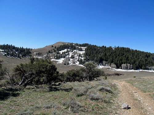 Boulter Peak in the East Tintic Mountains - by Castlereagh
From Eureka
Eureka is located on U.S. Highway 6. People usually drive through this town on their way to other places. Many are unaware of the mountains, trails and roads that are located in this area. Main Street has many old historic buildings on both sides of the road. There is a gas station here and a small grocery store. For lodging there is a place called, The Tintic Goldminer's Inn Bed & Breakfast. The Tintic Mining Museum is something you may want to check out if you're in the area. It has a lot of historical artifacts from Eureka's early beginnings. The town of Eureka is in the Tintic Mountains. It was originally known as Ruby Hollow. Then it became Eureka which means, "I have found it". The Tintic Mining District was established in 1869 after silver ore was discovered here. Eureka was then founded in 1870. Gold and other ores were found later and the place became a productive mining town. The mines made millions of dollars in profits. Eureka grew in population and it was one of the larger cities in Utah at the time. In 1910, over 3,500 people lived in Eureka. The largest mines included Bullion Beck and Champion, Eureka Hill, Gemini Mine, and Centennial Eureka or Blue Rock. This later became known as the Chief Consolidated Mining Company. From 1930 to 1940 many of the mines were closed down. Some of the mines were still producing ore until around 1957. Then water began to flood the mines making it more difficult and expensive to retrieve the ore. Then the population of Eureka began fading away. Today, it is a quiet town with about 800 or so people living there. Eureka was placed in the National Register of Historic Places in 1979. This was to help protect the town's historical sites and buildings.
TINTIC MOUNTAINS
The Tintic Mountains run in a north to south direction. The range is divided into eastern and western areas. They are separated by Highway 6 and Tintic Valley. Besides Eureka, there were other mining towns in the Tintic Mountains. They are now ghost towns. Knightville was named after Jesse Knight. Silver City was located at the mouth of Dragon Canyon. The town of Mammoth was the result of prospecting and claims after the discovery of silver. The story goes that one of the prospectors stated, "Boys, she's a mammoth strike!" and "We've got ourselves a mammoth mine". The town of Robinson was named after George H. Robinson who was the supervisor of the Sioux Mill and Mammoth Mill. Mining entrepreneurs were important in the development and success of Eureka and Tintic history. John Q. Packard was a mining millionaire. He bought the Eureka Hill Mine. John Beck was a miner from Germany who became a Mormon after moving to Utah. He formed the Bullion Beck & Champion Mining Company. The Bullion Beck became one of Eureka's big four mines. Jesse Knight was a Mormon mining millionaire originally from Nauvoo, Illinois. He worked as a prospector and discovered the Humbug Mine near Eureka in 1896. He then acquired other mines in the area that included the Uncle Sam, Beck Tunnel, Iron Blossom, and Colorado mines. He also founded the city of Raymond in Alberta, Canada. Walter Fitch Sr. was from London, England. He developed the Chief Consolidated Mining Company. The Tintic Mountains were named after the Sub-Chief of the Ute Indians named Tintic. He and his tribe roamed these mountains. In 1856, the Tintic War occurred. This was a series of clashes which resulted in deaths and injuries between the Indians and Mormons who lived in Tintic Valley and Cedar Valley. The Indians were thought to be stealing cattle from nearby herds due to starvation from the drought. A group of townsmen with warrants set out to arrest Chief Tintic and his band. A battle occurred after dark in Cedar Valley. Chief Tintic and his brothers were later killed by gun shot in their teepee during a fight with John Clark and George Carson in Cedar Valley. John Clark fled while George Carson died from wounds. Several other Indians were also killed and wounded.
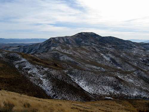 Tintic Mountain in the East Tintic Mountains
East Tintic Mountains:
The East Tintic Mountains are located south of the Thorpe Hills, southwest of Utah Lake, west the Southern Wasatch Mountains, north of the Gilson Mountains and Canyon Mountains, and east of Tintic Valley and the West Tintic Mountains. The East Tintic Mountains are divided into northern and southern areas by Highway 6 near Eureka. This area of the Tintic Mountains has a large number of peaks. The highest peaks rise above 8,000 feet elevation. I listed many of the well known peaks below. Other mountains include Gardison Ridge, 7,629 feet, Old Baldy, 7,321 feet, 7,629 feet, Teutonic Ridge, 7,061 feet, Quartzite Ridge, 7,340 feet, Eureka Peak, 7,917 feet, Godiva Mountain, 8,048 feet, Sioux Peak, 8,102 feet, Mineral Hill, 6,550 feet, Treasure Hill, 6,870 feet, Volcano Ridge, 7,148 feet, Rattlesnake Peak, 7,166 feet, and Furner Ridge, 6,504 feet. Paul Bunyan's Woodpile is worth seeing if you are in the area. It's located west of Ferner Benchmark in the southern East Tintic Mountains. Paul Bunyan's Woodpile was formed from volcanic activity approximately 30 million years ago. It resembles a stack of wood piled up by a giant person such as Paul Bunyan. That is how it received its name. The woodpile was formed when the lava flow cooled into orderly columnar joints similar to Devils Postpile in California. You can get to Paul Bunyan's Woodpile from a road turnoff of Highway 6 southwest of Eureka.
Bismark Peak - (8,063') Bismark Peak was named after Bismark Mining Company. It is south of Gardison Ridge. Bismark Peak can be approached from Chiulos Canyon. The southeast ridge can be used as a route. You could also continue driving farther up the canyon. There is a 4wd road leading up to Silver Dollar Mine. This road may be washed out so the length of your hike will depend on where you park.
Greeley Benchmark - (6,850') Greeley Benchmark was named after Greeley Mining District. The peak is located on the ridge north of Pinyon Peak. There are several mines in the area. On the west side of Greeley Benchmark is Lehi Mine and Tintic Empire Mine. This peak can be approached from Twelvemile Pass Road on the west side of the mountain.
Pinyon Peak - (7,720') Pinyon Peak was named after several features around the mountain. Pinyon Canyon is to the north and Pinyon Creek is below the southeast side of the peak. There is a road that travels through Pinyon Creek Canyon. Pinyon Peak is north of Lime Peak and also near Homansville. The recommended route is from Homansville Pass. You can follow a 4wd road up toward the pass. Then the route ascends the southwest ridge.
 Bismark Peak Bismark Peak |
 Pinyon Peak Pinyon Peak |
 Lime Peak Lime Peak |
Lime Peak - (6,986') Lime Peak is located above Homansville. The town developed in 1872 and produced water for other mining towns such as Eureka. Limestone was also mined and quarried here. That’s how the peak received its name. Homansville is now a ghost town and there isn’t much left except charcoal kilns. Lime Peak can be hiked from the saddle between it and Pinyon Peak.
Boulter Peak - (8,308') Boulter Peak is the highest summit in the Tintic Mountains. It's in the northwest part of the range. Boulter Peak is not located on the main ridge crest but on a ridge farther west of it. It is northeast of Boulter Summit on Highway 36. There are several ways to approach the peak. On the east side are three canyons with 4wd roads. They are Black Rock Canyon and Mill Canyon. Miners Canyon is farther south and it goes to New Bullion Mine. Hiking distance depends on how far you are able to drive on the dirt roads. Dry Lake is below the north side of the peak.
Hannifin Peak - (8,121') Hannifin Peak was named after Brennan Hannifin. He and Duke Page reopened the Eureka Hill Mine. Then they moved their operation down the hill to Bullion Beck and Champion Mine. Hannifin Peak sits on Utah and Juab county line. It is located west of Old Baldy and across the canyon to the east of Boulter Peak. Mines located below Hannifin Peak include Dan Hough Mine and Bradley Mine to the south and Waveland Mine and Van Wagoner Mine to the southwest. The peak can be approached from all directions because of the mining roads below its slopes.
 Packard Peak Packard Peak |
 Boulter Peak Boulter Peak |
 Mammoth Peak Mammoth Peak |
Packard Peak - (7,828') Packard Peak was named after John Q Packard who was one of the mining entrepreneurs in the area. He owned the property of Eureka Hill Mine and Gemini Mine. This peak sits directly above the north side of the town of Eureka. An old airplane beacon is on its summit which has a small microwave structure affixed to it. There is a 4wd road that switchbacks up the south side of the mountain from Cole Canyon.
Mammoth Peak - (8,108') Mammoth Peak was named after Mammoth Mine. The mine was one of the most successful in the area. Mammoth Peak is in an area that is south of the town of Eureka. It is surrounded by mines and mountains. To the north is Godiva Mountain and Sioux Peak and to the northwest is Eureka Peak. One route starts from Eureka and goes up a dirt road in Gardner Canyon to the top of a peak with a radio facility. From here, you can hike south to Mammoth Peak.
Silver Benchmark - (7,593') Silver Benchmark was named after Silver City which is west of the peak. The city was developed shortly after Eureka. Mining in Silver City was able to produce silver, copper, gold, lead, and bismuth. From Silver City a road goes up Ruby Hollow on Silver Pass Road leading to the pass of the same name. The peak is located southeast of the pass. Other peaks above Ruby Hollow include Treasure Hill, 6,870 feet, and Fitchville Ridge, 7,070 feet.
Sunrise Peak - (7,712') Sunrise Peak is located above Sunrise Canyon to the south and Diamond to the north. This town of Diamond was settled about 1870. It mistakenly received that name because prospectors thought that the crystals in the area were diamonds. What they found was actually quartz. It’s now a ghost town and was abandoned in 1890. Not much is left except some old mines and a cemetery. Rising Sun Mine and Buckeye Mine are on its west slopes.
 Buckhorn Mountain Buckhorn Mountain |
 Tintic Mountain Tintic Mountain |
 Tintic Mountain Tintic Mountain |
Buckhorn Mountain - (7,861') Buckhorn Mountain is located south of Sunrise Peak, east of Volcano Ridge, and north of Tintic Mountain. Buckhorn Mountain can be accessed from two routes. The southern approach is from the Dennis Road leading north from Copperopolis Creek. A 4wd road continues around the west side of the peak where you can hike up the ridge. The northern approach is from Sunrise Canyon. A 4wd road goes up toward the north ridge of the peak which is a short hike from here.
Tintic Mountain - (8,218') Tintic Mountain is one of the highest peaks in the range but not quite as high as Boulter Peak farther north. The mountain is part of a prominent north to south running ridge. Tintic Mountain is reached from Dennis Road which follows interestingly named Copperopolis Creek. This 4wd road goes past the old Dennis site and then continues up to Bens Spring. You can hike up the north ridge of Tintic Mountain from here.
Ferner Benchmark - (7,431') Ferner Benchmark is located at the southern end of the East Tintic Mountains. This peak isn’t well known and Paul Bunyan’s Woodpile farther west is visited more often. Ferner Benchmark is located north of Furner Valley. The name of the valley is spelled slightly different. The peak can be approached from the west above Tintic Chief Mine or from the north from Birch Canyon Road.
Long Ridge - (7,042') Long Ridge is exactly as its name describes. This long ridge parallels the main crest of the East Tintic Mountains on its east side. Dog Valley is located to the west, Juab Valley and Mona Reservoir are the east. The highpoint of Long Ridge is across the canyon to the east of Tintic Mountain. There is a dirt road that is west of the peak. Be aware of private property in the area near Long Ridge.
 Sabie Mountain Sabie Mountain |
 Maple Peak Maple Peak |
 Maple Peak Maple Peak |
West Tintic Mountains:
The West Tintic Mountains do not have as many peaks as the East Tintic Mountains. The two main peaks here are Sabie Mountain and Maple Peak. The West Tintic Mountains are located south of the Vernon Hills and north of the Little Sahara National Recreation Area. Highway 36 is located at the northern part of the range. It then meets a junction with Highway 6. Highway 6 is on the east side of the range and then it goes south. The eastern part of the Sheeprock Mountains join with the western part of the West Tintic Mountains at Vernon Creek.
Sabie Mountain - (8,021') Sabie Mountain is located at the northern portion of the West Tintic Mountains. Sabie Creek flows on its north slopes and that is where the mountain got its name. The mountain can be reached by driving south of Vernon Reservoir. There is a dirt road that goes toward Sabie Mountain from the west. You can start hiking up the west side of the peak which is less than a mile away.
Maple Peak - (8,060') Maple Peak is located on the ridge south of Sabie Mountain and north of the Little Sahara National Recreation Area. Cherry Creek Reservoir is west of Maple Peak. To the north of the peak is Maple Spring which is what the peak was named after. A dirt road leaves Cherry Creek Road and goes toward Maple Peak. It turns into a 4wd road. You can start hiking up the north ridge to the summit.
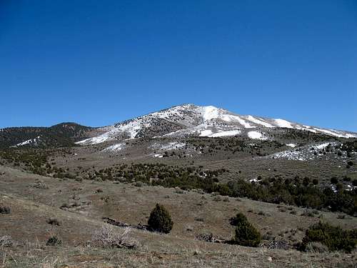 Sabie Mountain in the West Tintic Mountains
From Delta
Delta is probably the most important town in all of the western Utah desert, not including Wendover, and is also considered the gateway to the Great Basin National Park via Highway 50, which is the main highway in Delta. It is really key for many of the most popular peaks such as Notch and Swasey in the House Range as the town provides gas, food, and lodging. It even has a McDonalds. Delta was developed mainly for agriculture. It was different in the fact that it wasn't originally established by the Mormons. The settlement of Delta began in 1907 on town lots that had been laid out a year before. The townsite was first named Melville, after James A. Melville, but the U.S. Postal Service did not like it because it sounded too much like Millville in Cache Valley. Then the name was changed to Burtner in honor of a helpful railroad passenger agent. Several industrious families started moving into the town. Directors encouraged former Utah surveyor General George A. Snow to investigate local prospects. Snow was able to bring outside capitalists into a new enterprise named the Delta Land and Management Company.
The name of the town was officially changed to Delta in 1911. Then land started to sale and the population grew. The soil in the area seemed like a perfect place to grow sugar beets. This only lasted for a few years due to drought which made it hard to grow the crop successfully. Delta would become one of the largest alfalfa seed and hay producing regions in the west. Livestock production later increased during the Depression. Mining and smelting helped the economic growth of the area. They were able to produce salt, fluorspar, copper, manganese, sulphur, gypsum, and beryllium. In the 1970s, the Intermountain Power Project's huge coal-burning plant was built near Delta. Other states actually buy much of the electricity generated here. An unfortunate chapter of history was the creation of the Topaz War Relocation Camp. After the attack on Pearl Harbor, Japanese-Americans and immigrants who had come to the U.S. from Japan, were placed in camps with the intention of protecting military installations from espionage. During World War II the federal government forcibly relocated 110,000 Japanese-Americans from their West Coast homes to internment camps. A relocation camp was built approximately fifteen miles west of Delta, Utah. It was named Topaz after the mountain located in the southern part of the Thomas Range. It housed about 9,000 internees from 1942-1945. You can still see the remnants left over from Topaz. The Topaz Museum is located in Delta.
Northwest of Delta: Highway 174 is located northwest of the city of Delta. The turnoff is south of the city of Lynndyl on U.S. Route 6. This road is paved most of the way and leads to the Fish Springs Range where it connects with the Pony Express route. Mountain ranges that can be accessed along the way from Highway 174 include the Thomas Range, Drum Mountains, Keg Mountain Range, and Desert Mountain Range.
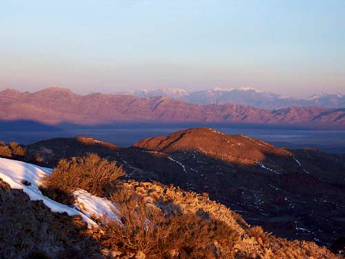 Thomas Range Highpoint - by gjagiels
THOMAS RANGE
The Thomas Range runs in a north to south direction. It is about fourteen miles long and ten miles wide. This range is south of the Dugway Range and Dugway Pass on the Pony Express Trail. It is located west of the Keg Mountain Range, north of the Drum Mountains, northeast of the House Range, east of the Fish Springs Range, and southeast of the Black Rock Hills. The range can be reached from the Pony Express Road via graded dirt roads or from Highway 174 farther south. From Salt Lake City, it takes close to the same time to drive there from either route. Highway 174 is probably preferred since it is a paved road most of the way toward Topaz Mountain. That is why I decided to place this information in the Delta section of the page. This range was named by Captain James H. Simpson after Lieutenant Colonel Lorenzo Thomas. He would later be promoted to Adjutant General in the U.S. Army in 1861. His career had both controversy and success. Thomas did not get along very well with Secretary of War, Edwin M. Stanton. On February 21, 1868, President Johnson attempted to replace Stanton by appointing Thomas as Secretary of War ad interim. Thomas was then sent on assignment outside of Washington, D.C. Some historians thought this was a form of punishment for Thomas after conspiring to defame General William T. Sherman. After the Civil War, Thomas was breveted a major general in recognition of his military service. The Thomas Range is best known for its minerals. Maynard Bixby was a mineralogist and mineral collector. He was from Wyalusing, Pennsylvania and graduated from Lafayette College. He later became involved in mining in the western United States. This led him to Juab County, Utah. He explored the Thomas Range and found topaz and other minerals. The mineral bixbyite, which he discovered in the Thomas Range, was named in his honor in 1897. He also discovered red beryl here. It was named bixbite after him but was later thought to be a variety. The Thomas Range isn't visited much by hikers. Most people are searching for minerals in the rhyolite. Topaz Mountain is the most popular area. Topaz also happens to be the state gem of Utah.
Dugway Pass South Peak - (6,228') This is the peak that faces toward the southern end of the Dugway Range. It is unnamed and has a steep northeast face. The best route would be to park at Dugway Pass and hike up the north ridge. This is the most prominent peak in the northern end of the Thomas Range. Elevation gain is less than a thousand feet from the pass.
Cairn Benchmark - (6,938') Cairn Benchmark is located near the center of the range. The mountain is above the north fork of Pismire Wash. Red beryl was first described in 1904 at Maynard's Claim near the Pismire Knolls. Cairn Benchmark can be accessed from a 4wd road leading into Pismire Wash or from a dirt road off of the Pony Express road that is the northwest of the peak.
Thomas Range Highpoint - (7,106') This is the highest peak in the Thomas Range. It is located on an unnamed point that is south of Colored Pass. This is actually one of the easier peaks to reach if you have a 4wd vehicle. The pass is located above The Dell and the south fork of Pismire Wash. From Colored Pass, hike south and follow the ridge to the highpoint which is less than a mile away.
Spor Mountain North - (6,580') Spor sounds like a funny name for a mountain. It's located on the southwest side of the main Thomas Range separated by The Dell. There is a north peak, 6,580 feet, which is the highpoint and a south peak, 6,460 feet. Eagle Rock Ridge, 6,020 feet, is on the ridge farther east. Large deposits of Beryllium were found at Spor Mountain. The highpoint is easy to get to because of all of the mining roads in the area.
Topaz Mountain - (7,046') Topaz Mountain is the most well known mountain in the Thomas Range and rises above 7,000 feet elevation. It is part of the southern portion of the range. The mountain was named after the mineral, topaz, which can be found in abundance the area. Topaz Mountain is recognizable because of its light gray to white rhyolite color. The southeastern point is known as the Topaz Mountain Amphitheater. This area is also known as Topaz Valley or Topaz Cove. The highpoint is farther north on the ridge between Starvation Canyon and Picture Rock Wash.
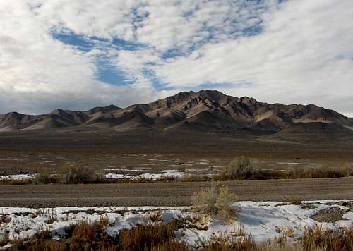 Drum Mountains seen from the east
DRUM MOUNTAINS
The Drum Mountains are located south of the Thomas Range, southeast of the Fish Springs Range, northeast of the House Range and Whirlwind Valley, southwest of the Keg Mountain Range, and northwest of the town of Delta. The Drum Mountains run in a northwest to southeast direction. It is divided into two areas with a valley in between, the Drum Mountains to the north and the Little Drum Mountains to the south. Early prospectors discovered large amounts of manganese which they were not so impressed with at the beginning. Later, they uncovered gold and silver ore. Several mines were developed including the Drum Mine, Major Drum, Black Boy Mine, Howard Mine, Desert Mine and Ibex Mine. Two mining engineers named Harry Joy and Charles Howard came to the range in 1872. They were from Detroit, Michigan. They organized the Detroit Mining District and this range was known as the Detroit Mountains for a while. The small mining settlement of Joy wasn't named for its cheerful and beautiful scenery. It was named after Harry Joy. They mostly mined manganese and also copper, silver and gold. It was located in a desolate canyon below Mount Laird and Lady Laird Peak. Lack of water and the cost of transporting ores and supplies forced the mine to shut down. No one lives there anymore and it is a ghost town. The name of this mountain range is interesting and unique. According to local legend, "a noise could be heard from a low, rumbling sound, like drums, that comes from deep within the ground around the ghost town of Joy." People have noted hearing strange sounds of rumbling and echoing. Other people thought that the range was shaped like a drum when viewed from a certain angle. I really don't see it so I tend to agree with the story about "drum noises" in these mountains. Prominent peak are listed below. Other peaks in the range include Peak 6,658 which is located north of Schoenburger Spring and "Middle Drum", 7,233 feet, located southwest of the Drum Mountains HP and northwest of Drum Benchmark.
 Drum Mountains HP Drum Mountains HP |
 Drum Mountains HP Drum Mountains HP |
 Drum Mountains HP Drum Mountains HP |
Wildcat Hills HP - (6,750') The Wildcat Hills are part of the northwest area of the Drum Mountains. These hills are south of the Thomas Range. Their name may have come from the number of mountain lion sightings in these hills. The Wildcat Hills are located west of Horse Valley. The highpoint is unnamed and on a north to south running ridge. It is about a thousand feet above Horse Valley Road.
Mount Laird - (6,424') Mount Laird is located north of Joy and Lady Laird Peak. The mountain is a short hike from the road above Laird Spring. Lady Laird Peak is also a short hike from the mining roads below its west slopes. Mount Laird was named after Mac Laird. He was a bartender that married Mary Laird, aka Lady Laird, in 1895. They operated Laird's Store together. After Mac Laird died of the flu in 1917, she continued running the store until her death in 1934.
Lady Laird Peak - (6,980') Lady Laird Peak is located south of Laird Peak. Lady Laird was named after Mary Alice Devitt Laird. She preferred the name May Laird. Legend has it that she was a lady of the night. In the mining camp of Joy she had the nickname, Queen of the Desert. She decided to call herself Maggie after arriving at a mining saloon at Fish Springs. They nicknamed her, No-Nose Maggie, after a fight where scars were inflicted to her face. She made a new life for herself after her disfigurement. Later she married Mac Laird and became a cook in a cafe and operator of the Laird's Store, a supply post, in the west desert.
Drum Mountains HP - (7,298') The Drum Mountains Highpoint is located on an unnamed point at the northeast part of the range. This is east of a large mining area of the range. It can be approached from all directions but the shortest is from the west. A dirt 4wd road is located to the north and then it goes below the west side of the peak. From here, you can hike up the mountain. This is an off trail route but not difficult with less than two thousand feet of elevation gain.
Drum Benchmark - (7,045') Drum Benchmark is located southeast of the Drum Mountains Highpoint. The best way to access the peak is from the road located in between the Drum Mountains and Little Drum Mountains. The road goes into the heart of the range where several old mines and mine tailings are located. You can hike up to Drum Benchmark from its west slopes above Drum Mine.
Little Drum Mountains HP - (6,594') The Little Drum Mountains are south of the Drum Mountains. They may seem insignificant because of their lower elevation and title as being little. The highpoint is worth hiking to. It is an unnamed peak that is located at the northern part of the range. There are two ways to approach the peak. One is from Petes Canyon to the east and the other is from Horse Canyon to the south.
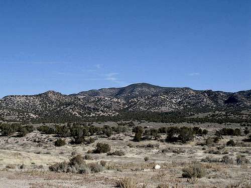 Keg Mountain Range
KEG MOUNTAIN RANGE
Are you looking for a keg in Utah? No need to worry, we have a Keg Mountain Range! I like to put Keg Mountain on the same list with other geographical features in the state such as Whiskey Island Lake, Bourbon Lake, Beer Bottle Spring, Brew Canyon and Moonshine Canyon. If you do enough hiking here, you'll notice that there are a lot of places named after alcohol. All joking aside, this mountain range was probably named after kegs of water taken from the large nearby spring. According to reports, "Captain James H. Simpson and his exploring party were saved from certain doom by a spring they found on Keg Mountain." The Keg Mountain Range is a small range that is about ten miles long and eight miles wide. The range is located south of the Slow Elk Hills, southwest of the Simpson Mountains, west of Desert Mountain, north of Crater Bench and Fumarole Butte, northeast of the Drum Mountains, east of the Thomas Range, and southeast of the Dugway Range and Dugway Valley. The Keg Mountain Range is divided into two areas, an eastern and western half, with a road through the middle leading to Keg Pass. Two important springs in the range are Keg Spring and Willow Spring. There are two ways to reach the range. One is from the Pony Express Trail south of the Slow Elk Hills. The other way is from Highway 174 northwest of Delta.
 Keg Mountain Keg Mountain |
 Keg Mountain Keg Mountain |
 Keg Mountain Keg Mountain |
Keg Mountain - (7,305') The highpoint of the Keg Mountain Range is an unnamed point in the eastern part of the range. It sits on the ridge south of Peak 7,155, aka Simpson Benchmark, which was named after Captain James H. Simpson. It is southwest of Willow Spring which can be used as an ascent route. Another recommended route is from Keg Pass. A dirt road is southeast of the pass and heads up the canyon. Drive as far as you can and park. You can hike up the southwest ridge from this route.
Keg Mountain West - (6,881') Keg Mountain West is the highpoint of the western part of the range. It is located southwest of Keg Spring. You can get to the spring by hiking or by driving with a 4-wd vehicle. Another route that would be easier to get to, is to drive to Keg Pass and start hiking from there. The peak is due west of the pass. This route goes over several points along the ridge.
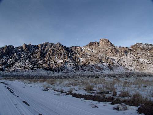 Desert Mountain Range - by MikerHiker
DESERT MOUNTAIN RANGE
The Desert Mountain Range is a small round shaped range that is approximately six miles long and five miles wide. It was named after its highest point, Desert Mountain. The range is located southeast of the Simpson Mountains, south of the Sheeprock Mountains, west of Little Sahara Recreation Area, east of the Keg Mountain Range, and north of Delta. The mountains are separated into sections by dirt roads. The road leading to Desert Mountain Pass runs through the middle. Little Sahara is where most of the off road vehicles are and Desert Mountain is farther away so you probably won't see too many of them here. Other peaks in the range do not have official names. The second highest is "East Desert Peak", 6,157 feet, which is east of Desert Mountain Pass. Other peaks include Peak 5,538 and Peak 5,647 on the west side. "Prospect Rock", 5,590 feet, and "The Bell Tower", 6,050 feet, are located at the south end of the range. Triangle shaped Peak 6,013 is southwest of Desert Mountain. "The Steeple", 5,914 feet, and "The Mineret", 6,022 feet, are on the east side.
Desert Mountain - (6,480') Desert is a common name for peaks in this area and it is appropriate. This mountain range sits alone in the Sevier Desert surrounded by other mountain ranges. Desert Mountain may not be high but it is prominent. It can be approached from several directions. Dean's route from the west is a good choice. Another route is from the north with scrambling along the ridge. A southern route looks like another possibility since there is a 4wd drive road in that area. I think a route directly up the east slopes from Desert Mountain Pass would also work too.
 Desert Mountain Desert Mountain |
 Desert Mountain Desert Mountain |
 Desert Mountain Desert Mountain |
LITTLE SAHARA
The Little Sahara Recreation Area is located between the towns of Eureka and Delta and south of the Tintic Mountains. It was named after the desert in Africa although this one is a much smaller scale. For Utah, it is the one of the largest sand dune areas in the state. Another one is Coral Pink Sand Dunes in southern Utah. Little Sahara is located in the northeastern part of the Sevier Desert and covers an area of 124 square miles. It is a remnant of Lake Bonneville left from the Sevier River some 15,000 years ago. When the lake receded the wind picked up sand from the desert and deposited it in this area. This place is very popular since it is only about 115 miles from Salt Lake City. This is where people who like to ride ATVs, motorcycles, and dune buggies come to play. Unfortunately there are fatalities or accidents at Little Sahara each year for a number of reasons. There are four campgrounds. They include White Sands, Oasis, Sand Mountain, and Jericho. There are over two hundred and fifty designated sites plus primitive camping. Jericho Ridge, 5,891 feet, is northeast of Little Sahara. Access to the ridge is from No Name Road west of Jericho which goes to the north side of the peak. Jericho Ridge was named after the settlement of Jericho to the east. It wasn’t much of a town. Jericho was known mostly for its wool production which only took place during shearing season. Union Pacific built the sheds and holding pens. Jericho Junction and Jericho are two different areas although not much remains. Besides Jericho Ridge, Black Mountain, and Sand Mountain, the best place for hikers is Rockwell Outstanding Natural Area. It is in the northwest region of Little Sahara. The area is off limits to vehicles and was set aside to provide a safer protected habitat for desert plants and wildlife. This is a quieter environment for hikers although you never fully get away from the sight and sound of vehicles. There are mule deer, pronghorn antelope, several species of birds, and snakes.
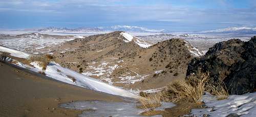 Sand Hills from Sand Mountain - by Zeejay
Black Mountain - (5,830') Black Mountain is the highpoint of the Black Mountains. They were named for the dark colored rock in the area. This is a small range located on the eastern side of Little Sahara. To the southwest of Black Mountain are many low sands dunes. This is where beginner recreation riders like to go. Black Mountain is a short hike from any direction because of all the dirt roads surrounding the mountain.
Sand Mountain - (5,702') Sand Mountain is the highest sand dune in Little Sahara. Basically it's a big pile of sand with a good view. It is about 700 feet from the base to its highest point. It takes about half an hour to hike up and will be much faster to descend. You might see some ATV riders on the steep slopes of this mountain. A quiet time for this hike may be early in the morning to watch the sunrise from the summit.
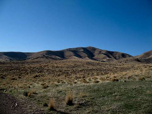 Champlin Peak in the Gilson Mountains
Highway 6 - Eureka to Delta:
The Little Sahara Recreation Area and the Gilson Mountains are accessed from the area between Eureka and Delta on Highway 6. Little Sahara and the sand dunes are to the west and Desert Mountain is farther west. The Gilson Mountains are on the east side of the highway. The sand dunes are where most people go but you can find some solitude at other areas since many of them are not interested in hiking up mountains. There are a few towns near the Gilson Mountains. The closest is Delta which isn't that far away to the southwest. Lynndyl is on the southwest side of the range. It began as a railroad junction in 1907 and was a small farming community later. The name came from a funny story. A Salt Lake City telegrapher asked a woman who lived in Lynndyl where she was at and she looked at her shoe and noticed that "Lynn Mass" was printed on it and gave that answer. There was already a town named Lynn in Box Elder County so she added "dyl" to the end of it. The name stuck which originally came from Lynn Massachusetts. That city was known as the, "shoe capital of the world" at the time. The town of Leamington is south of the Gilson Mountains. Settlers from Oak City near the Canyon Mountains built a dam in Leamington in 1871. The town was then settled in 1873 by Thomas Morgan. It was named after a city in England.
 Champlin Peak Champlin Peak |
 Champlin Peak Champlin Peak |
 Champlin Peak Champlin Peak |
GILSON MOUNTAINS
The Gilson Mountains were named after Samuel H. Gilson. He was originally from Plainfield, Illinois. Samuel Gilson and his brother James moved west in hopes of finding gold. They ended up raising livestock in Nevada and supplying horses for the Pony Express instead. Then they moved to Utah in 1870. They established the Mountain Ranch in Sevier River Valley. Samuel Gilson is known most for promoting Gilsonite which was first discovered in the 1860s. Gilsonite is a natural, resinous hydrocarbon, which is similar to hard petroleum asphalt. In 1888, he and a partner formed the first company to mine and market Gilsonite for commercial use. Samuel Gilson was also a U.S. Marshall and a defender of organized labor. This mountain range is located between Highway 6 to the west and Highway 132 to the east. Highway 132 goes through Leamington Canyon where the Sevier River flows. The Gilson Mountains are located southwest of the Sheeprock Mountains, south of the Tintic Mountains, west of West Hills and San Pitch Mountains, north of the Canyon Mountains, east of Little Sahara Recreation Area, and northeast of the towns of Lynndyl and Delta. Two large canyons on the west side of the range are Long Canyon and Broad Canyon. Other peaks above 7,000 feet in the range include Peak 7,339 at the head of Long Canyon, Peak 7,098 at the northeast part of the range, and Peak 7,202 on the south side of Broad Canyon.
Champlin Peak - (7,504') Champlin Peak is the highest in the Gilson Mountains. The recommended route is from the north. There is a dirt road that gets close to the peak. From this route, you gain over a thousand feet of elevation in a short distance. The abandoned settlement of Champlin was northeast of Leamington. The name may have come from Champlin Petroleum Company. It is considered a siding of Union Pacific Railroad. There was one incident where two trains derailed near Champlin.
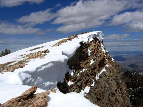 Fool Creek Peak summit in the Canyon Mountains - by Joe Bullough
CANYON MOUNTAINS
The Canyon Mountains are seen by many people because they are located above Interstate-15 northwest of the city of Scipio. The east side of the range rises steeply above the valley. The west side is more gradual and there are many canyons. Perhaps the number of canyons is where the name of the range came from. Oak City is located below the west side of these mountains and is east of the city of Delta. The Canyon Mountains are surrounded by roads on all sides. The Gilson Mountains are to the north and the Pavant Range is to the south. The Valley Mountains and San Pitch Mountains are to the east. The Church Mountains form the southern anchor to the Canyon Mountains. Scipio Valley was originally called Round Valley because of the oval shaped region where it was located. In 1861, the city of Scipio was named for, Scipio Kenner, an early settler in the area. Oak City was settled in 1868. Settlers liked the area because of the nearby creek and the quality of the land for farming and letting their cattle roam. Oak Creek Campground is located east of Oak City. This is a good place to camp overnight if you are hiking up any of these peaks. It sits at 5,900 feet elevation and was named after the oak trees that early settlers saw while exploring the canyon. Two other campgrounds farther east in the canyon are Plantation Campground and Little Creek Campground. Listed below are the most well known peaks. There are others that I will mention here. Two unnamed peaks are located at the north end of the range. They are Peak 6,761 which is south of Leamington Canyon. The other is Peak 6,670 which is located north of Pass Canyon Road. It has a communication tower on its southeast ridge. Partridge Mountain, 8,850 feet, is located in the center of the range. It’s part of a long ridge with the highpoint on the east side. The mountain is south of Oak Creek Canyon and north of Dry Creek Canyon. Blue Mountain, 8,645 feet, is at the southwest part of the range.
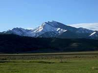 Fool Creek Peak Fool Creek Peak |
 Williams Peak Williams Peak |
 Oak Creek Canyon Oak Creek Canyon |
Fool Creek Peak - (9,712') Fool Creek Peak is the highest peak in the Canyon Mountains. It is also known as Fool Peak or Scipio Peak. This peak is easy to recognize when viewed from the east because of the large cliff below the summit. The name comes from Fool Creek which flows below the peak. There was an incident that involved early Mormon pioneers who found the creek which contained plenty of water. They later returned with their families and the creek had dried up. This left them without water, and they felt as if they had been fooled. The two most used routes are from North Walker Canyon or from Buck Hollow.
Williams Peak - (9,236') Williams Peak is the second highest peak in the Canyon Mountains. It is located south of Fool Creek Peak. They are similar in the fact that they both have cliffs on their east faces. The mountain was named after John Williams Gunnison whom the nearby city of Gunnison was also named after. The benchmark on the summit is labeled as South Scipio. This is because the benchmark on Fool Creek Peak is labeled as Scipio. The peak can be approached from Eightmile Canyon via its south ridge or from John Williams Canyon on the east side.
Buck Peak - (8,612') Buck Peak is located west of Fool Creek Peak. You can reach Buck Peak by two approaches. The first is from North Walker Canyon from the same route as Fool Creek Peak. At the saddle just head west to the top. The second route is from Buck Hollow. A dirt road goes up the canyon a ways. This route may be shorter than from North Walker Canyon but it depends on how far you can drive up the canyon.
Wild Horse Peak - (7,631') Wild Horse Peak is the highest peak north of Fool Creek Peak. It was named after Wild Horse Canyon to the west. Wild Horse Peak is south of Leamington Pass. There is a dirt road that starts near Fool Creek Flat on the west side of the range. It goes into the canyon and there is a trail that goes part way up below the ridge. This looks like a good route to the summit. Wringer Canyon to the east is another potential route.
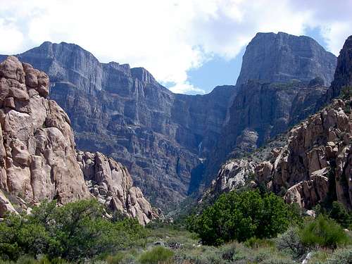 Notch Peak and West Sawtooth Canyon in the House Range
HOUSE RANGE
The House Range is a rugged and dramatic mountain range. These mountains run for about forty miles in a north to south direction. The House Range is south of the Fish Springs Range, southwest of the Drum Mountains, and east of the Confusion Range. This range is remote by most standards and the closest place to get gas and amenities is the city of Delta. For this reason, the mountains are not climbed often. Winter brings snow to the area and dirt roads may be inaccessible. Summers can be quite hot so the best time to visit is spring and fall. The main crest of the range is divided into three sections. The northern section forms an area south of Highway 73 near Sand Pass and is north of Death Canyon. This area contains Tatow Knob and Swasey Peak which is the highest mountain in the range. The central section is the least visited area of the range. This is known as the Middle Range and the highpoint is located at the summit of Howell Peak. The Middle Range is located south of Death Canyon and north of Marjum Canyon. The southern section of the range is located in an area called Sawtooth Mountain. It contains Notch Peak which is the most popular and recognizable mountain in the range. The range ends where it meets Highway 6. The views from any of these mountains are very good. To the southwest is Great Basin National Park and Wheeler Peak which will probably be covered in snow. To the west is Mount Moriah about 45 miles away. To the northwest is Ibapah Peak in the Deep Creek Mountains which are 48 miles away. To the northeast is Mount Nebo at the southern end of the Wasatch Range. It can be seen on a clear day about 90 miles away. To the southeast are the Tushar Mountains which are 80 miles away. To the west you will look down into Tule Valley and on the east side is Sevier Lake. The House Range contains three separate wilderness study areas. They include Swasey Peak, Howell Peak, and Notch Peak.
 Tatow Knob Tatow Knob |
 Swasey Peak Swasey Peak |
 Howell Peak Howell Peak |
Tatow Knob - (8,416') Tatow Knob is located at the northern part of the range. Its distinctive shape can be seen from many vantage points. Tatow Knob refers to a pair of buttes which represent the big toes of an Indian giant. The name Ta-too or ta-taugh means big toe. The summit knob is guarded by cliffs on all sides. Most people will want to bring technical gear to climb it. The limestone rock and vertical appearance of its summit knob keep most people away. If it wasn't located in the west desert, and was more accessible, it would no doubt be climbed more often. Robbers Roost Cave is one of the larger caves in the range. This is actually more of an alcove that's located on the east side of the mountain.
Swasey Peak - (9,669') Swasey Peak is the highest mountain in the House Range. It doesn’t receive as much attention as Notch Peak. The mountain was named after Rodney Swasey who was an early pioneer in the area. Swasey Peak is the highpoint of Millard County and many of the names written in the summit log are from county highpointers and prominence peak hikers. It has over 4,500 feet of prominence. There are several ways you could climb the mountain. The easiest route is up the southeast ridge. This is an off-trail route and you’ll have to navigate through trees and bushes most of the way. Another route is from Sinbad Gulch up the west face. This route is steeper and weaves around cliffs.
Howell Peak - (8,350') Howell Peak is located in the central part of the House Range. It is the highpoint of the Middle Range which is south of Death Canyon and north of Marjum Canyon. The north slope goes up a sagebrush covered canyon up to a ridge overlooking Tule Valley. There is a spectacular overlook that you can hike to with a view down many cliffs of a thousand feet or so. The summit is reached by hiking farther south from the overlook up the ridge. There are great views of the northern and southern peaks of the range from here.
Notch Peak - (9,654') Notch Peak is the most well known mountain in the House Range. The mountain is named for the large notch located north of the summit. Notch Peak rises vertically for thousands of feet and has one of the highest limestone cliffs in North America. Rock climbers consider the face one of the finest and most challenging climbs in Utah. There are interesting bands of gray and white limestone on the sheer face of the mountain. It is an awesome mountain when viewed from Tule Valley. There is also a route for hikers. A trail can be followed up Sawtooth Canyon to the summit.
Black Hills:
The Black Hills are the southern extension of the House Range. The hills are located above Tule Valley to the west and Sevier Lake to the east. The name of this range comes from its dark color. The Black Hills begin south of Skull Rock Pass and Highway 6 and goes south to Crystal Peak Road. There are a few named peaks in the range. Mesa Benchmark, 5,955 feet, is in the northern section of the Black Hills west of Burnout Canyon. Red Tops, 5,660 feet, is north of Lava Dam ridge and west of Red Canyon. Steamboat Mountain, 5,820 feet, is located north of Steamboat Pass.
Law Benchmark - (6,330') Law Benchmark is the highpoint of the Black Hills. It is at the southern end of the range. Steamboat Pass is a nearby landmark located north of Law Benchmark. There is a dirt road that runs north to south on the west side of the peak. This would be a good route to the summit. A route from Steamboat Pass would be short too. Law Benchmark has over a thousand feet of prominence.
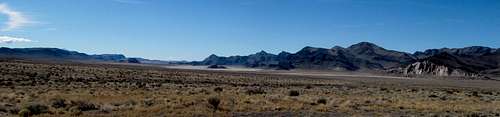 Confusion Range - by Castlereagh
CONFUSION RANGE
The Confusion Range is a long mountain range running north to south for over sixty miles. Along the way it goes through several areas and passes. It received its name because of its rugged isolation and confusing topography. This is true since the range is hard to define. You’ll understand the confusion better after I try to describe it. I like to separate it into four areas: The Northern Ridges, the Central area : Conger Mountain, the Southern area : Kingtop, and the Barn Hills. The Northern area is south of Trout Creek and north of Cowboy Pass. It has many different ridges running together. Peak 6,940 in the northern part of the range has a radio facility on top. The ridges from west to east are the Salt Marsh Range, aka Gandy Mountain, Cockscomb Ridge, 6,275 feet, the Disappointment Hills, and Granite Mountain. The Middle Range is located in between the Confusion Range and Fish Springs Range. A little farther south are more ridges. From west to east they are the Foote Range, Chevron Ridge, and Plympton Ridge.
The Central area is located south of Cowboy Pass and north of Kings Canyon on Highway 6/50. This area includes Conger Mountain, Snag Benchmark, and Round Top Benchmark, North Rim Peak, Buckskin Hills, 6,552 feet, and High Benchmark, 6,331 feet. The Southern area is south of Kings Canyon on Highway 6/50 and north of Crystal Peak Road. At the northern end is Peak 7,820 near a radio facility. Peaks in this area include Kingtop, which is the highpoint of the range, Center Benchmark, 7,662 feet, Dome Benchmark, Bonny Stairs Peak, Double Benchmark, Fossil Mountain, Painted Rock Mountain, 6,510 feet, Painted Mountain, and Crystal Pass Peak.
The Barn Hills are in the area which is part of the southern section of the Confusion Range. There is a natural, deep valley called, The Barn, that is enclosed. Jack Watson grazed his cattle here around 1910. He was the one who named the Barn Hills because he thought that when contained in this depression, his cattle were so safe they might as well be in a barn. The Barn Hills were originally known as the Ibex Hills. The northern end of the range begins southeast of the Deep Creek Range and the southern end of the range ends where it meets the Northern Wah Wah Mountains. The Fish Springs Range is to the northeast, The House Range is to the east, and the Snake Range in Nevada is to the west. The Confusion Range is above Tule Valley to the east, Snake Valley to the west, the Great Salt Lake Desert to the north, and Ferguson Desert to the south. Cowboy Pass was named because it was a well known cattle trail through the range between Snake and Tule Valleys. You can get to the Confusion Range from east to west along old Highway 6/50, on a dirt road through Cowboy Pass, or from US Highway 6/50, through Kings Canyon, or the north from Callao, Utah through Sand Pass.
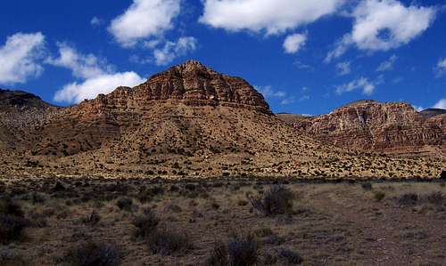 Fossil Mountain in the Confusion Range - by gjagiels
Northern Confusion Range:
Disappointment Hills HP - (6,660') The Disappointment Hills are at the northern part of the Confusion Range. The highest point in the range is on the point south of Partoun Benchmark. You can get close to the peak from dirt roads on both sides of the range. The nearby town of Partoun was named after a town in Scotland. It was founded in 1949 by the religious group called the Aaronic Order. They were disappointed and some of the excommunicated Mormons and others decided to establish the religious group.
Granite Mountain - (6,492') Granite Mountain is located east of the Disappointment Hills and west of the Middle Range. It is also southeast of the Smelter Knolls and southwest of Hole-in-the-Wall Reservoir. The mountain is on a ridge that is steeper on the east side. Roads circle the entire mountain and it can be approached from any direction.
Foote Range HP - (6,300') The Foote Range is located east of Foote Reservoir. The reservoir is near Bishop Springs in Snake Valley. It was named after the family of George Bishop who was an early settler in the area. The Foote Range is southeast of the Salt Marsh Range and west of Chevron Ridge. The highpoint of the range is south of a point named Nipple, 6,140 feet.
Chevron Ridge HP - (6,660') Chevron Ridge is located east of the Foot Range and west of Plympton Ridge. The ridge is in an area called the Big Horseshoe and Little Horseshoe. This is where you can view tilted layers of rock and folded ridges. The ridge is divided by a dirt road near Indian Pass. The highpoint is in the northern part of the ridge.
Plympton Ridge HP - (7,197') Plympton Ridge is also known as Confusion Benchmark. It's the highest peak in the northern Confusion Range. The ridge is east of Chevron Ridge and west of Confusion Hills Reservoir. Similar to Chevron Ridge, Plympton Ridge has a curved shape. The ridge highpoint is at the northern end. Lieutenant Peter W. L. Plympton is who the ridge was named after. He served in the Mexican War and in the Civil War under General Canby. He helped lead the Mormon Battalion in opening a wagon road from Santa Fe to San Diego, a road used by thousands of immigrants in the California gold rush.
Northern Sub-Ranges:
Gandy Mountain - (5,936') Gandy Mountain is the highest point in the Salt Marsh Range. The name of the range comes from Salt Marsh Lake. The lake is located to the west in the lowest depression in the Snake Valley. It’s different from a normal salt marsh. There is no vegetation here and the lake is shallow and usually it is quite dry during the summer. The highest point in the range is north of Wild Horse Pass. It’s known as Gandy Mountain from the nearby town of Gandy and hot springs. It was named after local resident Isaac Gandy. Also near the town of Gandy is the Crystal Ball Cave.
Middle Range Highpoint - (6,830') The Middle Range is located in between the Confusion Range and the Fish Springs Range and that’s how it got its name. It is to the east of the main ridge of mountains in the Confusion Range. The range runs parallel to the road going west from Sand Pass north of the House Range. The benchmark on the summit is labeled as Sand. The highpoint has over a thousand feet of prominence.
 Conger Mountain Conger Mountain |
 Conger Mountain Conger Mountain |
 Bonny Stairs Canyon Bonny Stairs Canyon |
Central Confusion Range:
Conger Mountain - (8,144') Conger Mountain is located in the central part of the range. The mountain was named for a local cattleman who moved his livestock in the area. The mountain is usually approached from Little Valley Road to Browns Hole. This is near Conger Spring which is south of the mountain. If you can get your vehicle all the way to Browns Hole then it will be a shorter hike. The route to the summit is off trail but doesn’t involve any scrambling.
Snag Benchmark - (8,070') Snag Benchmark is in the same area as Conger Mountain. It is across the canyon to the southeast and not much lower in elevation. I would think that the same approach from Browns Hole could be utilized for Snag Benchmark. You could hike right up the ridge that is east of the peak and follow it as it curves around toward the summit. I’m not sure where the name came from, perhaps from all the pinyon and juniper trees in the area.
Round Top Benchmark - (7,372') Round Top Benchmark is located southeast of Snag Benchmark. It was named for its rounded shape. This mountain creates forks in the canyon to the east. To the north is Little Mile and a Half Canyon and to the south is Mile and a Half Canyon. There are dirt roads around the whole mountain. The western side is a little less steep although it can be approached from any direction.
North Rim Peak - (7,420') North Rim Peak is the highpoint of the rugged ridge located on the north side of Kings Canyon. It is north of Rim Benchmark so I gave it this unofficial name. If you are approaching from Kings Canyon you can follow the south ridge which would be a nice hike of several points that includes Rim Benchmark, 7,139 feet, Peak 7,367, and North Rim Peak, 7,420 feet. The peak can also be approached from the north from Payson Canyon.
 Fossil Mountain Fossil Mountain |
 Fossil Mountain Fossil Mountain |
 Fossil Mountain Fossil Mountain |
Southern Confusion Range:
Bonny Stairs Peak - (8,348') This is the second highest peak in the Confusion Range. It is unofficially named after Bonny Stairs Canyon below the peak. This is a scenic hike from the bottom of the canyon to the top. There is an easier route from the west. It starts from the same parking area as Kingtop from its north route. You can combine the two peaks since they are in the same general area.
Kingtop - (8,350') Kingtop is an appropriate name for the highest peak in the Confusion Range. The peak is usually approached from the north by driving on the road that separates Horse Heaven from Little Horse Heaven. The road ends to the north of the head of Bonny Stairs Canyon. From here you hike off trail south toward the highpoint. The peak can also be hiked from the mouth the Bonny Stairs Canyon which is a more interesting route.
Dome Benchmark - (8,162') Dome Benchmark is southeast of Kingtop. The dome stands above Francis Canyon to the east, Burnout Canyon to the south, and Rock Canyon to the southwest. It is more commonly approached from the summit of Kingtop. You’ll lose a some elevation in the process but it’s not much. Distance between the two is less than two miles.
Double Benchmark - (7,766') Double Benchmark is located southeast of Dome Benchmark. It is part of the steep ridge that is northwest of Fossil Mountain. On the east side of the peak is Trail Canyon above Blind Valley and on the west side is Red Ledges Canyon and Smooth Canyon. The route from Red Ledges Canyon goes up to the ridgeline where you can go south toward the summit.
Fossil Mountain - (6,649') This isn't one of the high peaks in the range but it is one of the most interesting. It was named for the large amount of the fossils located on and around the mountain. This includes trilobites, brachiopods, cephalopods and echinoderms. Fossil Mountain is also near Ibex which is a popular rock climbing area in the Barn Hills. The recommended route is from Blind Valley around the south side of the mountain and up the south ridge.
Painted Mountain - (7,500') This is an unofficially named mountain located above and west of Painted Rock Mountain. One route is from the saddle west of Painted Rock Mountain, 6,510 feet. This route follows the east ridge to Point 7,020 and then farther east to the summit of Painted Mountain. Other routes are possible and one may want to visit Point 7,230 southeast of the summit which is located above cliffs.
Crystal Pass Peak - (7,792') Crystal Pass Peak is an unofficial name for the prominent peak that is located north of Crystal Peak Pass. It can be approached from here. The peak is across the canyon of Crystal Peak and often photographed from its summit. They just happen to be in two different mountain ranges that are next to each other. Crystal Peak is in the northern Wah Wah Mountains and this peak is in the southern Confusion Range.
Barn Hills: The Barn Hills are the rugged hills between Blind Valley and Tule Valley. The hills have a natural, deep valley called, The Barn, that is enclosed. Jack Watson grazed his cattle here around 1910. He was the one who named the Barn Hills because he thought that when contained in this depression, his cattle were so safe they might as well be in a barn. The Barn Hills were originally known as the Ibex Hills. The name Ibex would go to the nearby ranch, town, and climbing area. More information about Ibex can be found in the rock climbing section. Blind Valley was named because of its isolated geography. Some stories suggest that early settlers said that they went blind for a while and couldn't see very well while crossing the salt deposits in the valley. Blind Valley is located to the east of the main crest of the range and to the west of the Barn Hills.
Barn Hills HP - (7,200') This is the highpoint of the Barn Hills. It is an unnamed point at the southwestern part of the range. The peak overlooks Blind Valley to the west and The Barn valley to the northeast. It is south of The Barn Pass and north of Ibex. The Barn Pass has a 4wd road leading to it. From here the north ridge can be hiked to the top. You can also hike from anywhere along Blind Valley Road on the west side. The south ridge can be hiked from Ibex and goes over Peak 6,387.
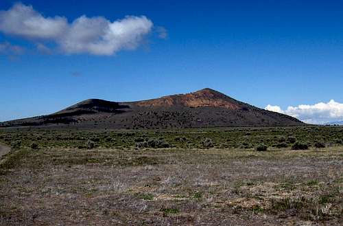 Pahvant Butte in the Black Rock Desert
Interstate-15 between Delta and Cove Fort:
This area can be reached from Interstate-15 south of Delta. An alternative route is Highway 257 to the west. Along I-15 you drive through several other places. The town of Holden is southeast of Delta. It was named for Elijah E. Holden who was one of the first settlers in Holden. He was a member of the Mormon Battalion and he later died in a snowstorm in 1858. The city of Fillmore was named by Brigham Young in 1851 in honor of President Millard Fillmore. Farther south is the town of Meadow and was named after Meadow Creek which flows from the Pavant Range. Kanosh is located south of Meadow and north of Cove Fort. Cove Fort forms the southern end of this volcanic area. It is located near the junction of Interstate-15 and Interstate-70.
BLACK ROCK DESERT
The Black Rock Desert is a group of volcanic fields located south of Delta to Cove Fort Utah. A volcano exploded and erupted from the bottom of the rising Ice Age Lake Bonneville approximately 15,500 years ago. These volcanic fields are of the Pleistocene-to-Holocene age. The Black Rock volcanic field is the youngest volcanic area in Utah with lava flows at Ice Springs. White Mountain located west of the town of Meadow and east of Tabernacle Hill is the youngest known rhyolite formation in Utah. This area is located west of the Pavant Range. Note that the spelling of Pahvant is also commonly seen spelled as Pavant. The Cricket Mountains are to the west and the Mineral Mountains are to the southwest. This volcanic area is in a region, described from north to south, as the southern part of the Sevier Desert, the Black Rock Desert, and the northern part of the Escalante Desert. Clear Lake Waterfowl Management Area is located in this area. It can be accessed two ways. The first is by driving south of Delta on Highway 257. The second is from the Clear Lake turnoff from I-15 around Pahvant Butte. Clear Lake is in an area of over 6,000 acres. It has many lakes and ponds and over a hundred natural springs. They are used heavily by migratory waterfowl and other birds and animals. It is estimated that almost 100 different species of birds visit Clear Lake every year. Snow Geese are one of the main attractions and they come here in large numbers. Other birds include hawks, various ducks and avocets. Most of the Clear Lake Waterfowl Management area is closed during the bird nesting season. Some observation points remain open to viewing.
 Pahvant Butte Pahvant Butte |
 Pahvant Butte Pahvant Butte |
 Pahvant Butte Pahvant Butte |
Volcanic Fields:
The Deseret volcanic field is southwest of the town of Deseret which is near Delta. This is located in an area of lakes from the Sevier River that is west of Clear Lake. It has a basalt lava flow on a small plateau named Black Rock. On its north side is a rock formation called the Great Stone Face, 4,876 feet. It was thought to have a resemblance to the face of Joseph Smith. Also nearby are Sunstone Knoll, 5,649 feet, and Pot Mountain, 4,830 feet. The Pahvant volcanic field is one of the most well known in the Black Rock Desert. Pahvant Butte, 5,751 feet, is the main feature. It is described in more detail later. This volcanic field is located south of Delta, west of Holden, and east of Clear Lake. There are basalt flows around the butte and also to the south of it. The lava at Pahvant volcanic field is mainly pahoehoe which has many lava tubes. To the northeast is Knobby which is 4,708 feet elevation.
The Ice Springs volcanic field is located west of Fillmore. The area has three large craters and several smaller ones. The Crescent Crater is the largest with a 500 meter diameter. The Miter Crater has a 300 meter diameter with a large lava flow. The Terrace Crater has a 300 meter diameter and is the youngest of the three to erupt at Ice Springs. It is a collapsed crater and was named for the several terraces it has that were formed by cooled lava lakes. The Tabernacle volcanic field is located west of the town of Meadow which is in between Fillmore and Kanosh. It covers a small area composed of basalt flows that erupted from the base of Tabernacle Hill, 4,970 feet, which is the small tuff cone near the center of the field. It is thought to resemble the Salt Lake Tabernacle. The lava flow to the north is called The Cinders, 4,990 feet. The Cinders is south of Devils Kitchen and west of West Mountain. Beaver Ridge, 5,088 feet, is to the southwest and White Mountain, 4,829 feet, is to the east. The Kanosh volcanic field includes Black Rock Volcano, 5,282 feet. There are basalt flows near the base of the volcano which has a dissected cinder cone. This is on the east side of Interstate-15 near Kanosh. It was named after Chief Kanosh who was leader of the Pahvant Utes. He grew a small farm in this area before the arrival of the Mormons in Utah. Some of the descendents of Chief Kanosh still live in the area.
The Twin Peaks volcanic field is located west of the town of Kanosh. It consists of several rhyolite domes that include South Twin Peak, 6,427 feet, North Twin Peak, 5,913 feet, and Lava Ridge, 5,258 feet. Some of the basalt flows are layered with the rhyolite. The nearby Cudahy Mine is known for its snowflake obsidian because it has light gray blotches mixed with the black rock. The Cove Fort volcanic field is located southwest of the historic site of Cove Fort. The Cove Fort crater is the main feature. It has is a loose red colored cinder and ash cone. A lava flow extends to the southwest of the crater. It was named after Cove Fort which was built by the Mormons as a way station. It was made with nearby volcanic rock rather that wood which was usually used.
Pahvant Butte - (5,751') Pahvant Butte is also known as Sugarloaf. It is a dormant volcano located in the Black Rock Desert. Pahvant is a Ute word meaning, "being at the water." The butte formed above older pahoehoe and a'a lavas of the Pahvant volcanic field. Its eruption released particles of basaltic lava into the air which later fell back down in the form of tuff. It was originally a subaqueous volcano which formed under Lake Bonneville about 15,000 years ago. The highest point of the butte was over a hundred meters above the water at the time. You can hike up to the top of Pahvant Butte and observe the volcanic history of the area. There is a vertical cliff on its north face that is known as the Lace Curtain. It was named for its white, lacey pattern caused by partial cementation of the tuff by minerals deposited by groundwater. Another strange feature on the mountain are a row of stone pillars. They were built in 1923 by a man who was hired to construct a windmill for electricity to nearby houses and farms. That guy never finished building it and disappeared with the money given to him by Millard County.
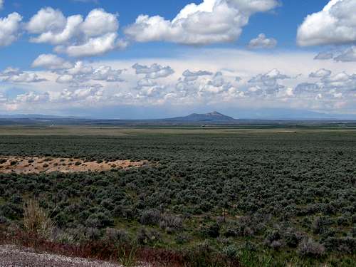 The Black Rock Desert view toward Pahvant Butte
From Milford
Milford is a center location and gateway to the western desert ranges. Milford is the perfect place to get gas (be sure to top off your tank here) and supplies. As you head west on highway 21, you will not see another gas station for 100 miles (near the Nevada border) and most of the ranges and peaks listed here are well off the beaten path (or pavement if you wish). For those needing a motel for a night, I can recommend this accomodation on the west side of Milford Oak Tree Inn and found it to be a very nice motel and the price of the room includes a full breakfast. ($80 range) Personal note: I had no cellular coverage at all, even in Milford with AT&T. Verizon might be the best choice there but don't expect to have cellular coverage in most areas of the western Utah desert. A ham radio might be a good option if you have a ham license. Cautions and Warnings: In some areas west of Milford, if you were to suffer a breakdown in your vehicle, it might be days or even weeks before someone came your way. As it is, even on the main highway, Highway 21, vehicles are few and far between. Be warned. If you drive out here, be prepared and self sufficient. Let others know your schedule and travel routes and ask them to send for help if you don't show up when expected. Take lots more water than you think you will need. Take warm clothes, a hat and good boots. Some cellular providers show this area as working. In January of 2008 a couple who were stranded by a snowstorm near the Hamlin Valley area (not far from Indian Peak) barely escaped with their lives. The link to that story is HERE. The couple ended up being rescued after they walked out 10 days into their ordeal but it was a reminder that this is an isolated area that they had ventured into. Story of rescue HERE.
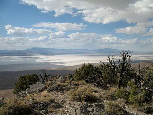 Sevier Lake seen from the Cricket Mountains
CRICKET MOUNTAINS
The Cricket Mountains are located northwest of the Mineral Mountains, northeast of the San Francisco Mountains, east of the Confusion Range, and southeast of the House Range. Sevier Lake is located below to the west and the range is surrounded by the Sevier Desert. The lake is in an endorheic basin and it is dry most of the time. Other times it will have water and during years with good snow levels it will have more water than you would think. Sevier Lake is a remnant of Lake Bonneville just like its more famous neighbors, the Great Salt Lake and Utah Lake. The Cricket Mountains were named by John R. Murdock who moved stock in the range during the early 1880s. He saw large hordes of Mormon crickets moving out of the mountains and hills down into the lower valleys. Many desert hikers in Utah will encounter these crickets at some point in their life. Mormon crickets are not really crickets but shield-backed katydids. If you don't already know, during the first settlement of Utah, the seagulls saved Mormon pioneers by eating large amounts of crickets that were destroying their crops. This explains the love that people in Utah have for seagulls, the state bird. The range is located north of Milford. You can get there from Beaver and then drive to Milford and continue on highway 257 to the turnoff for the Cricket Mountains. If coming from the north, there is a shorter way. You can drive to the city of Delta and drive south for a few miles to the exit for highway 257. Drive until you get to the turnoff for Headlight Canyon toward the mountains. There are a lot of dirt roads in the range and you may see ATV riders.
 Cricket Mountains HP Cricket Mountains HP |
 Cricket Mountains HP Cricket Mountains HP |
 Cricket Mountains View Cricket Mountains View |
Cricket Mountains HP - (7,231') This is the highpoint of the Cricket Mountains. It is 7,231 feet elevation at the northwestern part of the range. It’s an easy summit to get to with a little over a thousand feet of off trail hiking. The view and location will make it worth the short hike. The peak has over 2,000 feet of prominence. Winter is a good time to climb here if access on dirt roads is dry enough. If it is too snowy then spring and fall should be nice too.
Snow Mountain - (7,182') Snow Mountain is located north of the Cricket Mountains HP. I called it Snow Mountain because Snow Benchmark, 7,156 feet, is located on a point just north of it. Poison Mountain, 6,125 feet, is to the southeast and Black Benchmark, 6,316 feet, is farther north. There is a road north of Big Sage Reservoir which looks like you could park for the beginning of the hike up to the ridge.
Headlight Mountain - (6,749') Headlight Mountain is at the southern part of the Cricket Mountains. It stands over 1,100 feet above the valley. There is also Headlight Canyon and road that runs along the east side of the range. Headlight Gap is to the north and Lone Cedar Pass is to the south of the mountain. Other points include Monument Point to the west and Red Hills West and Red Hills East are to the southwest.
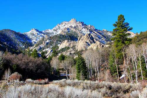 Granite Peak in the Mineral Mountains - by Phenom
MINERAL MOUNTAINS
The Mineral Mountains are located west of the city of Beaver and east of the city of Milford. They are across the valley from the Tushar Mountains. The Black Mountains are to the south and the Escalante Desert and the San Francisco Mountains are to the west. The Mineral Mountains are the largest exposed plutonic batholith in Utah. It's a special place with incredible rock domes. The highest peaks above 9,000 feet are Granite Peak, Milford Needle, and Bearskin Peak. There are several other peaks in the range worth visiting too. The name of the range comes from the rock which is rich in minerals. The granite is mixed in with quartz and pumice. For this reason, rockhounding is very popular here. People can find garnets, smoky quartz, obsidian, feldspar, pyrite, blue beryl, and rhyolite. I've seen more people looking for rocks than I've seen hikers in these mountains. The other thing that people like to do here is camp or have picnics during the day. Rock Corral is a small campground that is open all year. Other campsites can be found elsewhere. The eastern side of the Mineral Mountains is lower in elevation. Notable peaks here include Cinder Crater, 7,048 feet, Peak 7,277, Woodtick Hill West, 7,590 feet, Crater Knoll, 7,702 feet, Bald Ridges North, 7,858 feet, and Gillies Hill, 7,888 feet. At the south end of the range are Bradshaw Mountain, 8,011 feet, and Adams Benchmark, 7,334 feet. The rock buttresses on and below Granite Peak are worthy goals in their own right. The summit of major formations, such as Geode Dome, can only be reached by rock climbers. Scramblers can explore the area enough to find their way up other rock formations.
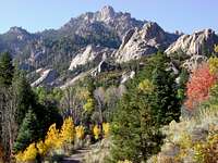 Granite Peak Granite Peak |
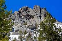 Milford Needle Milford Needle |
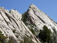 Geode Dome Geode Dome |
Antelope Benchmark - (7,719') The Antelope Mountains are located at the northern end of the Mineral Mountains. There are a number of dirt roads on both sides of the ridge below the mountain. Farther south on the ridge is Pinnacle Pass named for the rock pinnacles in this area. Antelope Benchmark is the highpoint of the ridge at 7,719 feet and Antelope Mountain, 7,230 feet, is farther north. Bailey Benchmark is at the south end of the Antelope Mountains at 7,918 feet elevation.
Bearskin Peak - (9,099') Bearskin Peak received its named from an incident involving a Piute Indian named Pant. He killed a large bear in the area of the mountain and draped the bearskin on some shrubs to dry. The peak is located north of Wildhorse Mountain, 8,940 feet, and southwest of Bailey Mountain, 8,307 feet. Little Bearskin Mountain is to the west, 8,725 feet. The mountain is usually reached by driving to Bearskin Flat to the north and hiking from there.
Twin Flat Mountains - (8,196') These are two mountains, North Twin Flat Mountain, 8,196 feet, and South Twin Flat Mountain, 7,951 feet. They can be accessed from Ranch Canyon. The left fork goes toward North Twin and the right fork goes toward South Twin. North Twin can be reached by a short off trail hike while South Twin has an jeep trail leading to the top. Like Bearskin Peak, both Twin Flat Mountains are volcanoes. Bailey and Little Bearskin are too but are smaller in size.
Milford Needle - (9,582') Milford Needle is located on the same ridge as Granite Peak a short distance farther north. The needle isn’t climbed often for a number of reasons. The summit block requires 5th class climbing. It is in a remote area and many rock climbers don’t want to hike that far. From photos, it does look to be a little higher than the summit of Granite Peak. The same approaches for Granite Peak are used for Milford Needle and you can climb both on the same day.
Granite Peak - (9,580') Granite Peak is the most well known peak in the Mineral Mountains. The mountain has a reputation for bushwhacking through thick brush and this is probably why the summit doesn’t see that many people. Granite Peak is surrounded by granite rock buttresses and domes and this is where it got its name. The two most used routes are from the north or from the southwest. The elevation gain doesn't seem like much but the terrain may slow you down a bit.
Pole Canyon Peak - (8,829') This is an unofficially named peak. It's in the southern portion of the Mineral Mountains. The peak is south of The Pass Road and west of Soldier Pass. I decided to call it Pole Canyon Peak because that canyon is located below the northwest side of the peak. A dirt road in Pole Canyon leads to Honey Bov Mine. It can also be approached from Cave Canyon to the southwest. A dirt road in Cave Canyon leads to Hecla Mine. Either approach will work. Harkley Mountain to the northeast is another peak you could hike to in the area.
 Poorman BM in the Black Mountains
BLACK MOUNTAINS
The Black Mountains are located southwest of the city of Beaver, south of Minersville, and northwest of Parowan. Highway 21 separates the Black Mountains with the Mineral Mountains to the north. They are located above the Escalante Desert to the west and Parowan Valley to the east. It is surrounded by roads. Interstate-15 is to the east and Highway 130 travels north to south through the middle of the range. The range is usually accessed from the west side. There is a lot of private property near I-15 on the east side. That side is also a bit steeper. There's a good chance that you've seen this mountain range but didn't know what it was called. The Black Mountains were named for their lava rock base and dark green vegetation. There are several Black Mountains in Utah and this is another one on the list. The Black Mountain Mining District was organized in Minersville in 1895. Other notable peaks in the Black Mountains include Mahogany Knoll, 7,976 feet, which is north of Chalk Hollow Pond. The South Hills are located right above the west side of I-15 as it goes through Nevershine Hollow. They form the northeast end of the Black Mountains. The South Hills are just south of Greenville Bench and north of Little Valley. The highpoint of the South Hills is Peak 7,728 which is unnamed. Monument Peak, 6,780 feet, is on the west side of the range south of Twin Peaks. Farther to the east are Badger Peak, 6,733 feet, and Mule Peak, 6,374 feet. North of Horse Valley is Mound Mountain, 6,526 feet. Southwest of Dry Willow Peak is Baboon Peak, 7,310 feet and farther south is Ladybug Benchmark, 7,177 feet. Jack Henry Knoll, 7,994 feet, is the second highest named peak in the range. Chipman Peak, 7,966 feet, is located northeast of Jack Henry Knoll.
Black Mountain East - (7,226') Black Mountain is located at the northern end of the range. It has two main peaks, Black Mountain East is the highpoint at 7,226 feet and Black Mountain West is 7,010 feet. The west peak has a 4wd road and a radio tower on its summit. There is also Peak 6,897 which is southwest on Black Mountain Ridge. The name of the mountain comes from its dark pinyon pine, juniper, and exposed dark lava rock. This is what also inspired the name of the range. Blue Ribbon Summit to the southeast was named after nearby Blue Ribbon Mine.
Dry Willow Peak - (7,593') Dry Willow Peak is located near the center of the range on the west side of Highway 130. It was named after Dry Willow Spring on its north slopes. There is a dirt road leading up to radio facilities on the peak southwest of it near Baboon Peak. That road also branches off and goes near the west side of Dry Willow Peak and turns into a 4wd drive road that continues to its summit.
Poorman BM - (8,674') This is the highpoint of the Black Mountains. I assume it was named after Poorman Ranch Canyon northwest of the summit. Poorman BM is located on top of a plateau overlooking Parowan Valley. Getting to the peak may be the hardest part. There are dirt roads on the west side of the range which can get you close to Poorman BM with a 4wd vehicle. The distance will depend on where you are able to park but for most it will be an easy hike. This mountain is mostly hiked by prominence peak chasers because it has over 2,000 feet of prominence.
 Poorman BM Poorman BM |
 Poorman BM Poorman BM |
 Poorman BM Poorman BM |
RED HILLS
The Red Hills are located at the south end of the Black Mountains. They are west of the Little Salt Lake and northeast of Rush Lake. Parowan was settled in January 1851 by the Mormons. It was originally known as Little Salt Lake Valley. Parowan Gap is the most well known feature in this area. It is located in a natural gap in the Red Hills that has an incredible amount of Native American rock art. Parowan is from the Paiute words, paragoons which means "marsh people" and pah-o-an which means "evil water". According to local Paiute legend, "One day the tribe was camped along the banks of the Little Salt Lake grinding corn for their meal. A wind storm crossed the lake causing a large water monster to arise from the lake. The waters rushed far onto the shore allowing the monster to grab one of the maidens and carry her back into the lake where she was never seen again".
Jackrabbit South Peak - (7,577') This is an unofficially named peak that is in the northern area of the Red Hills. This peak is located south of Jackrabbit Mountain, 7,542 feet, and that's where the name came from. Supposedly it was called this because jackrabbits were plentiful in this area when the pioneers arrived. The peak is located near Jackrabbit Wash and Jackrabbit Spring. The easiest route is from the west from Jackrabbit Wash Road.
Red Hills South - (6,768') The southern area of the Red Hills is divided into two sections by Parowan Gap. This forms a six hundred foot divide in the hills. Red Hills North, 6,510 feet, is located east of Long Hollow. Red Hills South, 6,768 feet, is the highpoint. Red Peak, 6,196 feet, is near the southern tip of the range. All of the peaks on this ridge can be accessed from dirt roads north and south of Parowan Gap.
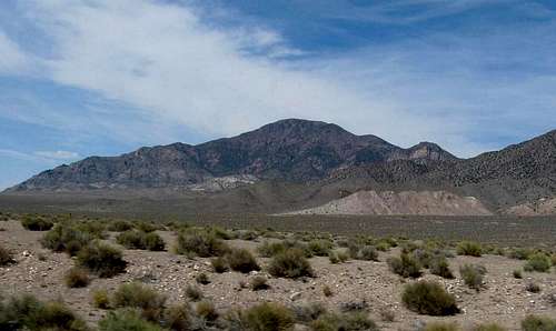 Frisco Peak in the San Francisco Mountains
SAN FRANCISCO MOUNTAINS
The San Francisco Mountains sound out of place in the west desert of Utah. The range was actually named after the San Francisco Mining District. Silver ore was discovered here in 1875. Miners came and soon the town of Frisco was established. Frisco was named after the San Francisco Mountains. It grew into a town of about 6,000 people. By 1885, silver, gold, lead, copper, and zinc had been transported from Frisco from the many mines in the area. The Utah Southern Railroad extension from Milford was built to the area of Frisco. The range is located east of the Wah Wah Mountains, west of the Mineral Mountains, southwest of the Cricket Mountains, and southeast of the Confusion Range. Smaller ranges nearby include the Beaver Lake Mountains to the east and Shauntie Hills and Star Range to the south. It is surrounded by the Escalante Desert and Wah Wah Valley to the west. To the northeast is Beaver Bottoms. Yep, that's its real name. It was named for its location near the Beaver River near the northern part of the range below Red Rock Knoll and Black Rock. Frisco was known to be one of the wildest and most dangerous towns in the West Desert. There were over twenty saloons, gambling halls, and non-stop drinking, among other things. Gun fights and killings were common. This probably isn't the image that many people would expect here. It certainly had an interesting history. You can still see remnants of it today. Frisco ghost town is worth visiting. You can see the cemetery which was one of the largest at the time and seems to have a high number of people who died young buried there. There are many old buildings and charcoal kilns. The kilns are now part of the National Register of Historic Places. Newhouse is the other ghost town that you should see in the area. It was named after Samuel Newhouse. He purchased the Castle Mine in 1900. The area was inhabited before then but never grew until later. The town of Newhouse was established for miners and their families. Newhouse was much more family friendly than the town of Frisco. There was a school, library, dance hall, and cafe. Samuel Newhouse died before finishing the town but his brother Matt completed it for him. The Castle Mine ran for many years but was eventually torn down after the mine went dry. You can still see the old foundations of buildings.
 Frisco View North Frisco View North |
 Frisco Peak Road Frisco Peak Road |
 Frisco View West Frisco View West |
Frisco Peak - (9,660') This is the highest peak in the San Francisco Mountains. It stands over 4,000 feet above the surrounding valley. Its name came from a shortened version of Francisco after the range. You can get to Frisco Peak by taking Highway 21 west of Milford. Near the mountain range, there is a dirt road that turns northwest and goes up Sawmill Canyon. It goes all the way to the top. You’ll need a 4WD vehicle to make it because the road gets rougher the higher you go. You can also hike part of the way up. The summit has a lot of communication towers on it but this shouldn’t distract from the views.
Indian Grave Peak - (8,132') Indian Grave Peak got its name because several Indian graves were found on the slopes of the peak. It is located at the southern end of the San Francisco Mountains and north of Grampian Hill. There are numerous mines in the area including Horn Silver Mine and King David Mine. Another one was the Grampian Mine which was named by a Scotsman miner who said it reminded him of the Grampian Hills in his native land. The shortest route to Indian Grave Peak is from Highway 21 and up Squaw Gulch. A 4WD vehicle will be needed to get higher on the peak.
BEAVER LAKE MOUNTAINS
The Beaver Lake Mountains are located on the east side of the San Francisco Mountains. They were named after Beaver Lake. This was a natural lake that was six miles east of the mountain range. The lake gradually dried out with increased use of Beaver River water and it doesn't exist anymore. The range is mostly known for the Beaver Lake Mining District which was established in 1872. Lead and silver ores were mined here. There are two large mining areas located north and south of Brownfield Canyon. Dirt roads circle around the entire range.
Lime Mountain - (6,895') This is the highpoint of the Beaver Lake Mountains. It consists mostly of limestone rock and that's what it was named after. Lime Mountain is located at the northern part of the range. The Badger Knolls are to the east. The mountain is surrounded by mines on all sides. Lime Mountain can be approached from the south near Skylark Mine or from the east near Independence Mine.
ROCKY RANGE - (6,081')
The Rocky Range is west of Milford and southeast of the Beaver Lake Mountains. It is a small and rugged range. Mining began here in 1872 of copper and tungsten ores. The Montreal Mine and Old Hickory Mine are at the sound end. The highpoint is farther north. A dirt road goes past Copper Ranch Mine toward the southwest part of the range. The south ridge is the shortest route.
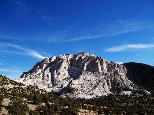 Crystal Peak in the Northern Wah Wah Mountains - by gjagiels
WAH WAH MOUNTAINS
The Wah Wah Mountains run in a north to south direction for fifty-five miles. It's a large area and there are many peaks. The range is located west of the San Francisco Mountains, south of the Confusion Range, southeast of the Tunnel Spring Mountains and Burbank Hills, and east of the Mountain Home Range and Indian Peak Range which are part of the Needle Range. The Wah Wah Mountains are located above Pine Valley to the west and Wah Wah Valley to the east. The range is divided into northern and southern sections by Highway 21 which is paved and travels from the cities of Milford to Garrison and eventually to Baker, Nevada. It meets the Wah Wah Mountains at Wah Wah Summit, a pass on the road, at 6,500 feet elevation. The name of the range is unique. Wah Wah is reported to mean "Good Clear Water". The local Indians named the range after Wah Wah Springs, on the eastern slope of the mountain range. Here is an explanation of why it is called what it is, "Wah Wah Valley was named by the Indians because there is a rumbling noise that sounds like Wah Wah. They say it comes from Wah Wah Springs. You can be 40 miles from the springs and hear the sound is just as loud as if you are right at the springs. We could hear it over in the Escalante Valley 30 miles away just as loud. It would take spells of doing it sometimes 2 months without, sometimes once a day." Some of the other peaks in the southern area of the range include Pink Knolls South, 7,706 feet, located south of Pink Knolls near Jockey Road. Fisher Wash Road goes near the east and north side of the peak where you can follow the north ridge to the summit. Mine Benchmark, 7,182 feet, is located south of Bumblebee Mountain and northeast of Iron Mountain. The peak was named after the many mines in the area. There is a road leading up the south face of the mountain off of Jockey Road just northwest of Miller Meadows. Broken Ridge, 6,893 feet, is at the south end of the Wah Wah Mountains. It is surrounded by Mountain Spring Wash and Fourmile Wash. The ridge highpoint is at the north point and the south point is labeled Pine Benchmark, 6,835 feet, on the map.
 Crystal Peak Crystal Peak |
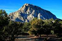 Crystal Peak Crystal Peak |
 Crystal Peak Crystal Peak |
Northern Wah Wah Mountains:
The Northern Wah Wah Mountains are located south of Crystal Peak Road and north of Highway 21. To get there from Milford, take highway 257 north 24 miles to Black Rock, at Black Rock take a left onto Crystal Peak Road and head west for 35.5 miles to Crystal Peak, staying east of the peak to the pass which is near the peak. If coming from the north you can take a more direct route from Delta on Highway 6. It then goes to Skull Rock Pass and then south through Tule Valley. It meets Crystal Peak Road which you can follow to the northern part of range.
Crystal Peak - (7,106') Crystal Peak is the most well known peak in the Wah Wah Mountains. It is a giant geyser tufa cone among the lava fields from past geothermal activity. The white volcanic rock helps it stand out for a long distance. There are thousands of holes in the mountain. You can still see pumice embedded in the rock and there are also quartz crystals. There is a route around the backside where scramblers can get to the summit. You'll get a good view of the Wah Wah Mountains from here and of the Confusion Range across the valley.
Crystal Benchmark - (7,460') Crystal Benchmark is located south of Crystal Peak. It is more prominent and sits over 1,100 feet above its surroundings. While Crystal Peak is where most people are going, few will be hiking to Crystal Benchmark. You can use the same trailhead as for Crystal Peak and hike into the valley south of it to get to the mountain. Another route is from Sand Pass but that road is rougher so most people hike from Crystal Pass.
Upper Pass Peak - (8,460') This peak is located northwest of Upper Pass. It is not officially named. It's the big peak just above the narrowest part of the ridgeline in the Norhtern Wah Wah Mountains. It is also south of Sand Pass which is a couple miles to the north. The route from Upper Pass appears to be the shortest up to the ridgeline though.
 Wah Wah North Wah Wah North |
 Wah Wah North Wah Wah North |
 Wah Wah North Wah Wah North |
Ranch Benchmark - (8,918') Ranch Benchmark is located north of Wah Wah North. The west side of the mountain rises steeply out of the valley. Two routes can be done from the north or south. The northern route, which is probably the easier of the two, goes up Lawson Cove Canyon. The southern route goes up the canyon east of Pierson Cove.
Wah Wah North - (8,980') This is the highest peak in the Northern Wah Wah Mountains. The trailhead is located on a dirt road that is north of Wah Wah Summit on Highway 21. Without a high clearance vehicle, you can park at the pass and hike from there. You’ll see the peak above you to the north. From here it is about 2,000 feet of elevation gain. That may not seem like much but it involves cross country hiking through brush and rocks.
Lime Point Peak - (7,340') Lime Point is west of Wah Wah Summit. It was named for its light colored limestone. Eye of the Needle is a small natural window high up on Lime Point. The peak is shaped like a crescent with three highpoints. The southern is officially named Lime Point, 6,642 feet. The central and highest is what I like to call Lime Point Peak, 7,340 feet. The point farthest north is Peak 6,662.
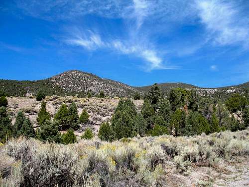 Wah Wah Mountains HP in the Southern Wah Wah Mountains
Southern Wah Wah Mountains:
The Southern Wah Wah Mountains are located south of Highway 21 and then go south until their terminus near the abandoned towns of Zane and Lund. Zane was named after famous author Zane Grey. Lund was named for Robert C. Lund. He was a Utah state legislator and local mine owner from St. George. Lund was also a director of the railroad. There may be a few people who live there. You'll mostly just see old buildings and railroad equipment. The southern mountains start out in Beaver County and farther south enter into Iron County. There are two notable roads that start near the town of Lund. One is Mountain Spring Road which joins up with Pine Valley Road on the west side. The other is Blue Mountain Road on the east side.
Wah Wah Summit South - (8,745') This peak is located south of Wah Wah Summit on Highway 21. It doesn’t have an official name so I gave it a rather simple name. The most obvious route starts from the pass. There may be a dirt road that is a little farther south that you could park at. The north ridge route also goes over another peak along the way. It is labeled as Peak 8,695, Wah Wah, on the map.
Wah Wah Mountains HP - (9,393') This is the highest peak in the Wah Wah Mountains and the southern area of the range. It’s located to the north of Pine Grove Canyon. That area can be reached by getting on Pine Valley Road on the west side of the southern Wah Wahs. The recommended route is from the south but other routes may work too. The summit and the rest of the mountain is covered in trees and shrubs. The point farther north of the summit is only ten feet shorter. It is labeled Peak 9,283, Wah, on the map.
Head of Willow Peak - (9,135') This is the second highest summit in the Wah Wah Mountains but it is unofficially named. It is located in an area of high peaks northwest of Lamerdorf Peak and southwest of the Wah Wah Mountains HP. The peak is west of Head of Willow Creek Spring and Peak 9,066 is to the east. There is a dirt road leading up Rose Spring Canyon from the south to Willow Creek. You could also get to the peak from the north at Pine Grove Road via Burnt Stump Canyon.
 Wah Wah Mountains HP Wah Wah Mountains HP |
 Wah Wah Mountains HP Wah Wah Mountains HP |
 Wah Wah Mountains HP Wah Wah Mountains HP |
Lamerdorf Peak - (8,425') Lamerdorf Peak is located north of Blawn Mountain in the southern Wah Wah Mountains. It is above two large canyons, Lamerdorf Canyon to the east and Rose Spring Canyon to the west. The peak was named after Charles Lamerdorf. He was a miner who produced charcoal near Lamerdorf Spring during the 1870s for the smelters in the town of Frisco.
Blawn Mountain - (8,432') Blawn Mountain is a big mountain with a long ridgeline. The highpoint is at the west end and two other highpoints are on the peaks farther east. Blawn Mountain is south of Lamerdorf Peak and north of The Tetons. The peak was named for Bill Blawn who built cabin near the mountain around 1900. Blawn Wash is on the southeast slopes and Sawmill Canyon is on the southwest slopes.
The Tetons - (7,953') The Tetons are a series of sharply rising peaks in the southern Wah Wah Mountains. I’m sure you already know that Teton is a French term for breasts. These lower elevation peaks are not quite the same as the mountains in Wyoming. Although remote, they are easy to get to with a high clearance vehicle since there is a dirt road off of Jockey Road. It goes right below the two highest points.
Blue Mountain - (7,594') Blue Mountain is located at the southeast corner of the Wah Wah Mountains. It stands over 1,400 feet overlooking the Escalante Desert. Blue Mountain is on a long north to south running ridge. There are two points, the south peak which is 7,262 feet and the northern one which is the highpoint at 7,594 feet. The mountain is best approached west since the east side is quite steep.
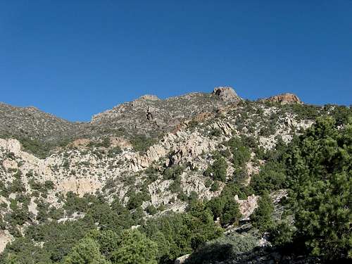 Tunnel Spring Peak in the Tunnel Spring Mountains
TUNNEL SPRING MOUNTAINS
The Tunnel Spring Mountains were named after Tunnel Spring which flows on the western slopes of these mountains. This is a small range that is shaped like an oval. It is about ten miles long and four miles wide. These mountains run in a north to south direction. They are located west of the North Wah Wah Mountains, southeast of the Burbank Hills, southwest of the Confusion Range, and northeast of the Mountain Home Range. The Tunnel Spring Mountains are not that far from the North Wah Wah Mountains. You should be able to spot Crystal Peak quite easily even from a long distance away. The range is located above three valleys that include Antelope Valley to the southwest, Pine Valley to the southeast, and the Ferguson Desert to the north. There are several ridges in the Tunnel Spring Mountains. The lower elevation Little Rough Range, 6,641 feet, runs parallel to the northern part of the Tunnel Spring Mountains. The southern part of the range narrows down and two smaller ridges continue south before meeting the Mountain Home Range. One is named the Warm Cove Ridge, 6,650 feet, and the other is named the Halfway Hills HP, 6,808 feet. These ridges and the range are located on the Desert Biosphere Reserve and Experimental Range. It was established in 1933 by President Hoover. It was made to protect a landscape typical of the Great Basin of north and south running desert ranges and separated by valleys. It was declared a biosphere reserve by UNESCO in 1976.
Tunnel Spring Peak - (8,460') This is the highpoint of the Tunnel Spring Mountains. It is located at the central western part of the range. This peak is not officially named but most people know it as Tunnel Spring Peak or Tunnel Spring Mountains HP. The recommended route starts from the west up the northwest ridge. This is an off-trail route with some scrambling and scree. You could also hike up the mountain from the east from Pine Valley.
 Tunnel Spring Peak Tunnel Spring Peak |
 Tunnel Spring Peak Tunnel Spring Peak |
 Tunnel Spring Peak Tunnel Spring Peak |
BURBANK HILLS
The Burbank Hills were named after Margie Burbank Clay. She was the wife of local Judge E. W. Clay in the 1870s. The small Mormon farming community of Burbank, Utah was also named after her. Where's that you ask? It's located just east of the Nevada border in Millard County south of Garrison. This is in Snake Valley south of Pruess Lake. It's not that far from Great Basin National Park either. There is a local spring called Clay Spring that named after her husband that was used by early settlers. Burbank community was eventually abandoned except for Dearden Ranch which was started in 1886. This range is located northwest of the Tunnel Spring Mountains. They are separated by Antelope Valley and Cowboy Road. The Burbank Hills run in a northwest to southwest direction. The range is larger than the Tunnel Spring Mountains and there are several dirt roads throughout the range. The Burbank Hills are not really known for hiking but ATV riders are familiar with the area. Pruess Lake is located west of the range. It was named after Charles Preuss. His last name somehow got misspelled and became Pruess on the map. He was a cartographer for John C. Fremont during his first and second expeditions.
Burbank Hills HP - (7,815') This is the highest peak in the Burbank Hills. It's located at the east side of the range. It's also just across the valley from Tunnel Spring Peak. You can get to this peak from Cowboy Road. One could start hiking from Cowboy Pass from the east. It looks like you can also get there from the other side. There is a dirt road that goes up Jenson Wash up to Big Jenson Pass, closer to the peak.
Burbank Pass Peak - (7,646') This peak is the highpoint of the west side of the range. It's located above Burbank Pass. It is unofficially named after that location. The peak sits over 1,100 feet over Snake Valley and Pruess Lake to the west. There is a dirt road south of Pruess Lake near Clay Spring that goes east toward the Burbank Hills. This 4WD dirt road goes up toward Burbank Pass below the peak to the south.
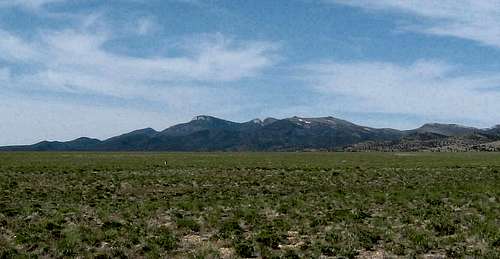 Mountain Home Range in the Needle Range
NEEDLE RANGE
The Needle Range consists of two mountain ranges, the Mountain Home Range in the north and the Indian Peak Range in the south. These mountains are surrounded by the Escalante Desert to the south, Hamlin Valley to the west, Pine Valley to the east, and to the north is Snake Valley which is also known as Antelope Valley. The Needle Range is located south of the Burbank Hills, southwest of the Tunnel Spring Mountains, and west of the Wah Wah Mountains. You're also close to the Nevada border. Great Basin National Park is to the northwest. The White Rock Mountains can be seen across Hamlin Valley. The range was named for its sharp and jagged appearance, specifically the eastern Needle Peaks. These mountains run in a north to south direction for about forty miles. Locals like to separate the Mountain Home Range and Indian Peak Range for easier identification. Sulphur Spring and Vance Spring are usually used as the halfway point. There are not many hikers that travel here so you can enjoy the solitude. This is because of its remote location and its proximity to other places like Great Basin National Park. The Needle Range is known for its wildlife such as deer and antelope and most notably for its wild horses. You may see some of them while you're hiking. The Sulphur Herd of Spanish Horses is the most well known group of wild horses in the range.
Mountain Home Range:
The Mountain Home Range is the northern part of Needle Range. The easiest way to get here is from Highway 21. The road travels from Milford, Utah to Baker, Nevada. The highway goes near the north end of the range. An important point in the road is Halfway Summit. From the turnoff at the pass you can drive west to Mountain Home Pass. A dirt road east of the pass heads south toward Needle Benchmark. Another road turnoff is farther south on Highway 21 near Warm Point and it goes to Beers Pass. It was named after James Beers who had a stage station nearby. Besides going east to west there are dirt roads that run north to south through the range.
Mountain Home Pass Peak - (8,860') This peak is located at the northern part of the range. It's the big mountain north of Mountain Home Pass so I gave it this name. You can get to the mountain by driving to Halfway Summit on Highway 21 and then driving west to Mountain Home Pass. This is where you can hike up the south ridge of the peak. The long ridgeline has many points on it.
Needle Benchmark - (9,480') Needle Benchmark is the highest in the Mountain Home Range. It is located in the central part of the range. A road goes south toward the peak which is east of Mountain Home Pass. The recommended route comes in from the north. Another way is from the east side since a dirt road runs along that side of the range. Just driving to the peak can be an adventure. Needle Benchmark is also known as Needle Peak, The Needle, or simply the Mountain Home Range HP.
 Needle Benchmark Needle Benchmark |
 Needle Benchmark Needle Benchmark |
 Needle Benchmark Needle Benchmark |
The Toad - (7,542') The Toad is an oddly shaped peak north of the Needles Peaks. I'll let you decide if it actually looks like a toad. The peak is southwest of Pine Spring and Upper Pine Spring. They can be reached by driving south of Beers Pass. You could hike to the peak from here or another route which starts east of McCune Pass.
The Needles - (7,749') The Needles are what the entire Needle Range was named after. They are rugged peaks located at the eastern part of the range. There is a dirt road that runs along the entire west side of the Needles. This is where you can hike to them. They could also be reached from the west. There are several points on the ridge and the highest in this area is 7,749 feet.
The Needles South Peak - (7,869') This is the south peak of The Needles on the eastern part of the range. Similar to The Needles farther north, this peak can be hiked to from the west from a nearby dirt road. It is a little higher in elevation than the northern Needles. Jackson Wash is to the north, Mud Spring is located to the south, and Pot Sum Pa Spring is located to the southeast.
Sawtooth Peak - (7,273') Sawtooth Peak was named for its jagged profile. It's located at the southeast end of the Needles Peaks on a formation known as Elephant Back. There are jeep trail on both sides of the peak to the east and west. The road to Vance Spring is located to the south. The south ridge avoids the steepest cliffs on the mountain.
 Indian Peak Range view toward the Mountain Home Range
Indian Peak Range:
The Indian Peak Range is the southern part of the Needle Range. It was named after the highest peak in the area. The boundaries of this range are south of Sulphur Spring and Vance Spring and north of the towns of Zane and Beryl. Beryl was named after the mineral which can be found in some of the West Desert ranges. Beryl was abandoned and it's a ghost town now. It used to be an old Union Pacific Railroad stop. Beryl Junction is farther north and that is an actual town. The east side of the range is accessed from Pine Valley and the west side is accessed from Hamlin Valley. The southern end of the range meets with the southern end of the Wah Wah Mountains. This is where the North Peaks are located and the highest is called North Peaks Highpoint. The southwestern area of the Indian Peak Range ends near the town of Modena, Utah. The Paradise Mountains are located on the border of Nevada and Utah to the west. Indian Peak - (9,790') Indian Peak is the highest in the Indian Peak Range and the entire Needle Range. It is located at the head of Indian Creek to the north and Marys Nipple is located to the west. The local Indians called the peak, "Quich-u-ant" which means Spirit Mountain. It's a prominent mountain that can be seen from many miles away. You can get close to the peak from the many dirt roads in the area. The recommended route to Indian Peak is from the north. There are cliffs along the ridge where you will have to navigate around.
North Twin Peak - (9,576') Twin Peak has two summits as its name says. Twin Peak Benchmark, 9,546 feet, is the lower peak to the south. North Twin Peak, 9,576 feet, is unofficially named but higher. There are several different ways to approach the peaks. Merrils Camp Spring is to the northwest, Atchison Creek is to the southwest, Sheep Creek is to the southeast, and Cottonwood Creek is to the northeast. Holt Bluebell Peak, Peak 9,074, and several other peaks above 9,000 feet are located to the north.
Bob Leroy Peaks - (8,275') The Bob Leroy Peaks are northwest of Steamboat Mountain. There is Bob Leroy Peak North, 8,275 feet, and Bob Leroy Peak South, 8,232 feet. Two other prominent peaks are Peak 8,461 to the southwest and Peak 8,388 to the southeast. There is also Bob Leroy Spring and Bob Leroy Pass in the area. You can hike to both peaks from the pass. These peaks were named after Butch Cassidy whose real name was Robert Leroy Parker. He was from Beaver, Utah.
 Indian Peak Indian Peak |
 Indian Peak Indian Peak |
 Indian Peak View Indian Peak View |
Steamboat Mountain - (8,588') Steamboat Mountain was named for its resemblance to a steamboat. It's located above Bull Valley below its western slopes. Steamboat Mountain is a little more isolated than other mountains in the range. One approach could be from Ponderosa Park and Sawmill Canyon to the northeast since they are not too far from the mountain. A jeep trail goes up to Typhoid Spring on the east side.
White Cliff - (6,858') White Cliff is south of Steamboat Mountain. It was named for its white colored rock. The actual peak isn’t prominent but it is located in a cool area. The peaks located above it are worth checking out too. They are Peak 7,270 to the northwest and Peak 7,170 to the northeast. The area is reached from Trail Draw to the south.
North Peaks HP - (7,222') The North Peaks are located at the southern end of the Indian Peak Range. They are southwest of White Cliff and north of Beryl. There are three prominent points in these mountains. They are from west to east, North Peaks HP, 7,222, Peak 6,898, and Peak 6,782. A dirt road runs parallel south of the North Peaks. The highest peak has steep cliffs on its south face.
Hamblin North Peak - (8,170') This peak is located on the point north of Hamblin Benchmark and is unnamed on the map. The best approach is from a dirt road going past Rosebud Spring to the west. This peak is in the southwestern area of the Indian Peak Range near the Paradise Mountains on the border of Nevada and Utah. The Modena Draw Road connects Hamlin Valley to Modena, Utah on Highway 56.
 Indian Peak seen from Pine Valley
Military Range
Lastly, I want to mention this area for the sake of being thorough. These mountains are located on the military range and are restricted to hikers. I also thought it would help explain why a large portion of the west desert in Utah is off limits.
UTAH TEST AND TRAINING RANGE
The Utah Test and Training Range (UTTR) is the largest overland contiguous block of supersonic authorized restricted airspace in the continental United States. It is located in the Great Salt Lake Desert and is owned by the Air Force. This is where they conduct air-to-ground, air-to-air, and ground force exercises. The Utah Test and Training Range is divided by Interstate-80. The northern unit is located north of Interstate-80. It is east of the Silver Island Mountains. This unit contains the southern tip of the Newfoundland Mountains and the northern area of the Grassy and Lakeside Mountains. The southern unit is south of Interstate-80. It is located east of the Nevada border, west of the Cedar Mountains, and is joined on its south side by Dugway Proving Ground.
UTTR - Northern Unit:
Southern Newfoundland Mountains - The boundary of the military range includes the southern tip of the Newfoundland Mountains. This is south of South Newfoundland BM. No major peaks are located in the test range.
Northern Lakeside Mountains - In the Lakeside Mountains, this includes Sally Mountain, 5,861 feet, Deardens Knoll, 4,869 feet, Scad Ridge, 5,369 feet, Death Ridge, 5,529 feet, and Homestead Knoll, 5,310 feet.
Northern Grassy Mountains - Round Mountain, 5,462 feet, is located in the Grassy Mountains and west of the Lakeside Mountains. The peak is in the test and training range. It's located on Tank Ridge north of German Valley.
UTTR - Southern Unit:
Wildcat Mountain - (5,306') - Wildcat Mountain is located west of the Cedar Mountains. This is a low elevation limestone and dolomite mountain. It is located in the middle of the desert on the military testing range and that is why it is so prominent. Kittycat Mountain, 5,047 feet, is the smaller peak seen to the west.
 Granite Peak in Dugway Proving Ground - by Eric Willhite
DUGWAY PROVING GROUND
The purpose of Dugway Proving Ground is for the military to test U.S. and Allied biological and chemical weapon defense systems in a secure and isolated environment. Some people have their own opinions about what goes on at Dugway. UFO sightings have been reported by alien enthusiasts. Uh, I'll let you decide for yourself. Dugway Proving Ground is surrounded by mountains on three sides, the Deep Creek Range to the west, the Cedar Mountains to the east, the Fish Springs Range to the south and around the north side of the Dugway Range. Dugway Proving Ground works in conjunction with the Utah Test and Training Range. The Pony Express trail travels south of Dugway Proving Ground.
Dugway Proving Ground:
Southwest Cedar Mountains - The Southwest area of the Cedar Mountains is located on the Dugway Proving Ground. Be aware when hiking in the range and stay north of the boundary. This includes Wig Mountain, 5,194 feet, which is off limits.
Granite Peak - (7,082') - Granite Peak is located northwest of the Dugway Range. It is the highest peak in that area which is often referred to as the Granite Peak Range. The range consist mostly of granite rock and is about six miles long and three and a half miles wide. Sapphire Mountain is at the southern end of the range. Granite Peak was used as a U.S. biological weapons testing facility from 1943 to the end of World War II. It was then deactivated and closed.
Camels Back Ridge - (5,501') - The Camels Back Ridge is a north to south running ridge that is located northwest of the Simpson Buttes. It is south of the Ditto Area, also known as the Dog Area. This was where many of the test facilities are located at Dugway Proving Ground.
Simpson Buttes - (5,423') - There are three buttes in this area. They are Simpson Buttes West, 5,401 feet, Simpson Buttes East, 5,423 feet, and Simpson Buttes North, 5,293 feet. Try not to confuse the Simpson Buttes with the Simpson Mountains. The mountain range, farther to the east, is open to the public.
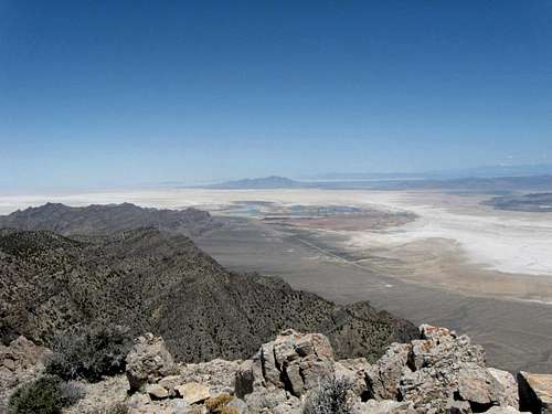 Military Range seen from the Fish Springs Range
Area History
 The 1889 geodetic station at Ibapah Peak
 Hiking a desert range peak
The first among the white people to enter the heart of Western Desert was Jedediah Smith, who camped at Fish Springs in 1827. In 1847, the Northern fringes of the desert earned historical fame as the location of the ill-fated Hastings Cutoff. Donner Party camped in the present-day Stansburies before losing most of the oxen on their push across the salt flats to Silver Island. The following year, Brigham Young led the Latter-Day Saints into the Salt Lake Valley. Tooele and Grantsville was settled by the Mormons by 1850, Nephi in 1851, and Sevier Delta area by 1860. Of the later Mormon settlements, perhaps the most historical was Iosepa in Skull Valley, established in 1899 in a half-hearted effort to segregate away the darker-skinned Mormons of Hawaiian extraction. This attempt folded soon, as did some other agricultural colonization attempts, most notably a Jewish 1911 commune on Sevier River. In 1860, the region sprung to fame with the short-lived but ever-romantic Pony Express Trail, which crossed the area from Tooele Valley to Ibapah, with overland stage stations strewn across the entire desert. After the Overland Company folded, Lincoln Highway followed the same route, and one could even buy gas in Callao. But in 1927 it was rerouted for a more Northern route across the salt flats to Wendover. That's where I-80 crosses today. In late 1860s, mineral exploration and mining started in the desert, first in the Tintic area on its Eastern fringes. In 1871 and 1872, resp., San Francisco Mountains and Drum Mountains Mining Districts were established. In the latter area, the town of Joy has become the first, and the last, larger-scale human settlement in the heart of the desert. In 1870s and 1880s, the Transcontinental Survey triangulated across the desert from mountaintop heliothrope stations on Deseret and Onaqui peaks on the East side, and Ibapah and Moriah on the West side. The remains of the stations are still there at these high peaks. Highway 6 has been constructed further South, crossing through the wilderness of the House Range over Marjum Pass. That's where Bob Stinson, highway maintance worker and a self-styled desert hermit, built a cave-house and a desert garden in 1920. It still stands, but the highway is now rerouted even further South, across Skull Rock Pass.
 Notch Peak View
In 1930s, the CCC, aka Civilian Conservation Corps, was at work in the desert, even in as remote locations at Painter Springs in Tule Valley below the House Range. During WW II, the feds pointed their attention to the desert. Topaz was turned into a huge internment camp for Japanese Americans and for a time it was the biggest town in the whole west desert. A huge army depot was built in Toeele Valley, still the world's largest chemical warfare storage even today, despite years of incineration of old rusting weapons. Aerial target grids crisscrossed the area around salt flats, and a faraway airfield at Wendover was the base of the 509th Composite Group with Col. Tibbets' B-29 mod, the Enola Gay. Mining at Gold Hill resumed, this time not for gold but to churn out toxic arsenic for the military. But perhaps the most destructive and lasting was the establishment of Dugway Proving Ground in 1943, as the prime chemical warfare and the only biowarfare testing facility in the US. Granite Peak area was specifically designated for biological agent testing, rendering it off-limits for the reasonable climbers. Dugway claimed global fame in 1968, when a nerve gas testing accident left thousands of Skull Valley sheep dead or crippled. The Army never admitted much, but compensated the herders and buried the carcasses ... as it turned out, on the tribal land, so the Goshutes had to be paid compensation too. Much to their credit, the Deep Creek farmers then resisted the Army's push to expand Dugway, and won. Our continuing access to Deep Creek Range is thus the legacy of the resolve of the people of West Desert. Notably, the area is now home to three more environmental flukes, the proposed tribal nuclear storage in Skull Valley, the nation's single biggest polluter, MagCorp plant, and the state's biggest coal-burning, acid rain-spewing plant, the IPP.
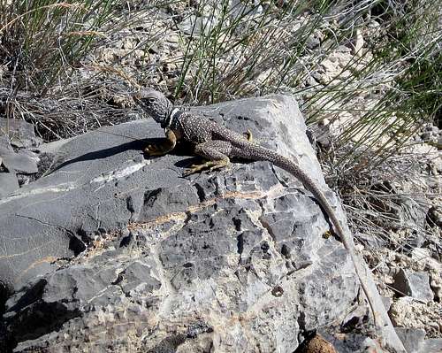 Lizard near the Pony Express Trail
Wildlife
A few special things to mention. Wild Horses can be seen in the desert, especially northeast of the House Range. They are very much in evidence in the Cedar Mountain range just south of I-80 and are found in many areas in the western desert. Pronghorn antelope thrive in this area of Utah. Keep your eyes open for them as they are there but be particularly aware of their presence at night if you are driving on the paved highways (I almost plowed into three of them west of Milford). Also keep an eye out for range cattle and deer. Don't forget that this is also mountain lion country and if you are out there solo, you might have some unseen company that is very curious about your presence. Snakes can be found out in this area, and be aware that rattlesnakes enjoy the desert here as elsewhere. Also the usual lizards can be seen in some areas.
 Pronghorn Antelope Pronghorn Antelope |
 Rattlesnake Rattlesnake |
 Bird of Prey Bird of Prey |
 Desert Horned Lizard Desert Horned Lizard |
 Wild Horses Wild Horses |
 Elk Herd Elk Herd |
The most common mammals you will see in the desert of Utah are mule deer, elk, bighorn sheep, pronghorn antelope, bison, coyotes, foxes, mountain lions and bobcats. Pronghorn antelope are known for their fast speed. They can run over fifty miles per hour. Pronghorn can run for long distances at half that speed. They eat a lot of sagebrush, grasses, and other plants. Both male and female antelope have horns although the females is shorter. Desert bighorn sheep are native to Utah. They are natural climbers and can be seen in steep rugged terrain. Bighorn sheep are mainly grazers. They like to eat grasses, shrubs, sedges, and leaves. Both male and female bighorn sheep have curved horns. Utah has about twenty five wild horse herds. Most of them are in the west desert. American Bison are the main attraction on Antelope Island and can be seen year round. Other animals in this area include rabbits, porcupines, badgers, skunks, raccoons, and ringtail cats. Ringtail cats are usually shy during the day and more active at night. There are desert porcupines which like to feed on tree bark and the fruit of prickly pear cactus. You are most likely to see the black tailed jackrabbit in the west desert. You may also see cottontail rabbits. The brown desert cottontail lives in brushy areas and grasslands. Deer mice and canyon mice are abundant. These are the small rodents that are always looking for food. The reason there are so many of them is because they can live in a variety of habitats. Of course there are squirrels and chipmunks too. The white tailed antelope squirrel is a common animal here.
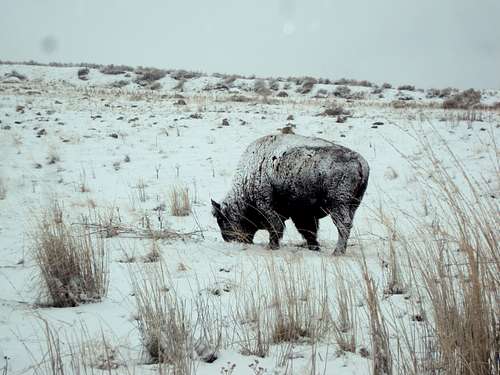 Bison on Antelope Island - by Fleshj27
Snakes can be encountered in the west desert. The Great Basin rattlesnake is typically light tan or light gray in color with dark blotches on its back. Watch out for them while hiking because they're basically the same color as dirt so they blend in well. Their venom is toxic and you should seek medical attention if you are bitten by a rattlesnake. Non venomous snakes include gopher snakes, king snakes, ground snakes, and red racers. Utah is home to several species of lizard. The desert horned lizard is noticeable because of its flat body which has a row of fringed scales down the sides. A toad called the Great Basin spadefoot is grayish green in color and has a wedge shaped spade on each hind foot and a glandular hump between the eyes. Now for the creepy crawlies. Desert tarantulas are large, hairy spiders usually found in washes, on rocks, and in the open desert. The best time to see them is during mating season from June to October. There are also wolf spiders and black widows. There are several species of scorpion but the bark scorpion is the most dangerous. We can't forget about the Mormon crickets. They are actually shield-back katydids and they can't fly. Seeing some of them is not a big deal but seeing large hordes of them may cause problems. The Jerusalem cricket can be seen in the desert foothills. What about killer bees? They have been sighted in southern Utah recently. Thanks to colder weather they aren't able to survive the winters farther north in Utah. The west desert of Utah is home to many species of birds. Birds of prey are also known as raptors. They hunt for food while flying and using their feet to capture other animals. Then they use their claws and beaks to tear the flesh of its prey. You can see bald eagles, golden eagles, Cooper’s hawk, ferruginous hawk, ospreys, kestrels, peregrine falcons, and turkey vultures. Other birds include wild turkeys, cactus wren, Gambel's quail, verdin, ladder-backed woodpecker, horned lark, mourning dove, red-tailed hawk, sage thrasher, sage sparrow, and grouse. I have to end with butterflies since they are so infamous on SP. The West Desert indra swallowtail and the Great Basin Fritillary are two species of butterflies that can be seen in these ranges.
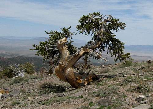 Bristlecone pine in the Mountain Home Range
Flora
Bristlecone pines, the oldest living things on Earth, can be found at 8,000 to over 11,000 feet elevation on many ranges, especially where the soil is alkaline due to limestones. Notch Peak, Swasey Peak and the Wah Wah Mountains are some great bristlecone pine locations. Bristlecone pines belong to the pine family of trees. They were named for their bristle-like cone scales. They are known for their long lifespan. There are some specimens that have lived over four thousand years. The White Mountains of California have the oldest known living trees. These trees are able to live for a long time because they only grow about an inch in diameter every hundred years or so. The oldest trees are usually weathered and oddly shaped. The dead wood of a bristlecone tree can remain solid while the other part of the tree only needs a little living bark to survive. Bristlecone pines can grow to be over sixty feet tall in lower elevations. They are usually smaller in size at higher elevations in the west desert ranges of Utah.
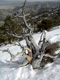 Bristlecone pine Bristlecone pine |
 Indian Peaks Tree Indian Peaks Tree |
 Bristlecone pine Bristlecone pine |
Thanks to ScottyS for the following information. Pinus longaeva, or Great Basin Bristlecone Pine, occur in many central Great Basin ranges where limestones or dolomites form the substrate. These trees are found as low as 8000ft and as high as 11,500ft. While in typical stands they take a fairly standard tall, thin conifer growth form, they are most well-known for the "strip-bark" morphology of the more ancient individuals. The resinous nature of these slow-growing pines and their tolerance for cold temperatures allows them to live to exceptional ages, the oldest (unpublished) living tree being more than 5000 years old in the White Mountains of California. Growth patterns of these trees have been used for over 50 years to reconstruct climate conditions covering an 8700-year continuous timespan, as remnant wood often persists on the landscape long after the death of the tree. Pinus monophylla, or Singleleaf Pinyon Pine, is one of the most ubiquitous and over-looked trees in the Great Basin. Populating the mountain ranges between the Wasatch and the Sierra from below 5000ft to over 10,000ft, these drought-resistant white pines are the only conifer in the world to possess only one needle per bundle, hence the name. A close relative, the two-needled Pinus edulis, inhabits the Colorado Plateau and southern Utah. Both of these trees can also live a fairly long time, the oldest known edulis is in Nine Mile Canyon, Utah, and is over 1100 years old. The oldest known monophylla is over 900 years in age, and lives on the slopes of Pilot Peak north of Wendover. Both of these species have yielded amazingly sensitive and well-replicated drought reconstructions, providing clues to major long-term droughts in the Great Basin and Colorado River basin. These trees are joined by Pinus ponderosa scopulorum (Rocky Mountain Ponderosa), another tree that has been found to exceed 1000 years in age (in the Wah Wah mountains), as well as the juniperus species of osteosperma and scopulorum (Utah and Rocky Mountain Juniper, respectively). All of these trees have been successfully analyzed for development of long tree-ring chronologies useful for both climate and archaeological work in the Great Basin.
 Sego lily Sego lily |
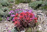 Pea & Paintbrush Pea & Paintbrush |
 Balsamroot Balsamroot |
 Red Cactus Flowers Red Cactus Flowers |
 Mormon tea Mormon tea |
 Juniper Berries Juniper Berries |
The juniper tree can be seen in desert environments. It can be seen at the lower elevation of the mountains and on plateaus. The juniper tree varies in size depending on location. They can be very twisted in shaped from wind and erosion. It lives at elevations between 4,000 and 7,500 feet. These trees can be seen among sagebrush environments. Juniper berries are blue or purple in color. They are green when they are younger. The juniper tree is widespread and abundant in the west desert. These trees form extensive open woodlands that are often mixed with pinyon trees. The pinyon-juniper woodlands are in dry areas with little precipitation of about 10 to 15 inches a year. They are resilient through cold weather and drought. These tress are small to medium size. Pinyon pines have pinyon nuts, also known as pine nuts, which are collected, stored, and eaten by animals such as the Pinyon Jay. Sagebrush is the dominant plant in the west desert. Its scientific name is, Artemisia tridentate, after the ancient goddess, Artemis. The specific name of tridentata is from the three lobes which are found on the end of each leaf. The surface of the leaf is covered with short silver white hairs. This feature helps to minimize evaporation and conserve water. This gives the plant its grayish green color. It usually grows about three feet tall but can grow higher, over six feet tall, in more precipitous areas.
Sagebrush blooms in late summer and early fall. The flowers are not showy and are cream colored and small. They grow in dense clusters and can produce a large amount of pollen. This is why it causes allergies. Many people dislike it for this reason. Sagebrush is a very important plant during winter because many animals that live in the desert feed on it. This includes elk, mule deer and pronghorn antelope. The sego lily was an important plant to Native Americans and early Mormon pioneers. The scientific name for the sego lily is Calochortus nuttallii. Native Americans taught the pioneers how to plant and cook the bulbs and they harvested the sego lily as food. From 1848 to 1849 there was a lack of crops caused by a drought and cricket invasions. The Mormons ate the sego lily bulbs to survive through the harsh winter. They were thankful and the sego lily became the State Flower of Utah. The early Mormon pioneers have the nickname of the "bulbeaters" because of this. Mormon tea is a green shrub which can grow up to three feet tall. The Mormons abstain from regular tea and coffee so they drank the beverage made from this plant. A few plants that can survive in a desert environment with little water include the purple fringe, bitterbrush and rabbitbrush. The purple fringe can be seen in sandy, loose and rocky soil. It is a short plant with blue, purple, or white flower blossoms. Bitterbrush is also known as antelope brush. It is usually seen nearby with big sagebrush. The bitterbrush is gray colored with small yellow flower blossoms. Rabbitbrush is a shrub that grows from two feet to over six feet tall. It is noticeable for its white or yellow colored flowers. Indian Paintbrush is commonly found on dry and rocky slopes with sagebrush, scrub, and pinyon and juniper woodlands. Cactus flowers come in a variety of colors such as red, orange, pink or yellow.
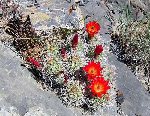 Cactus Flowers west of Lookout Pass
Rocks & Fossils
The west desert of Utah is one of the best places to find rocks, minerals, gems and fossils. The rule is that you may collect small amounts of gemstones and rocks from unrestricted federal lands in Utah without obtaining a special permit. If you want to collect large quantities for yourself or for commercial purposes, you need to obtain a permit, lease, or license from the BLM. Also, mining claims exist in some areas so ask for permission first. There are two things that cannot be collected on public land. The first is vertebrate fossils of animals with backbones. This includes dinosaurs, mammals, turtles, and fish. It is only allowed by permit only. These permits are issued by the Secretary of the Interior specifically to properly accredited museums, universities and other institutions or their representatives. The other thing you cannot collect is Indian artifacts and ruins. This is illegal and punishable by law.
 Fossil Mountain Fossils Fossil Mountain Fossils |
 Cobb Peak Rock Cobb Peak Rock |
 Desert Peak Granite Desert Peak Granite |
The state mineral of Utah is copper. Most of the copper is mined from Kennecott’s Bingham Canyon Mine in the Oquirrh Mountains. It is one of the largest open pit mines in the world. The Tintic area is known for its mining. Eureka is located in the Tintic Mountains as well as several ghost towns from the mining era. This is where they mined gold, silver, copper and other minerals. The Thomas Range is northwest of Delta. This is a popular and well known area for rock hounds. Maynard Bixby first visited the range in the 1890s. He was a mineral collector and mineralogist. His claim was near the Pismire Knolls. He brought attention to this area and the mineral bixbyite was named after him. The state gem of Utah is topaz. The best place to find it is at Topaz Mountain is the southern part of the range. Garnet can be found in Garnet Basin. Minerals which are more difficult to find in this area include red beryl and pseudobrookite. You can also find red beryl in the Wah Wah Mountains. The Vernon Hills area is known for its wonderstone. This rock is a red and yellowish brown color from iron oxides. The Black Rock Desert is southwest of the town of Delta. This is where you will find numerous volcanic fields. There are rhyolite domes such as White Mountain and Twin Peaks. You can find obsidian here too. There is snowflake obsidian which has grayish blotches on it.
The area of Beaver, Milford, and farther across the west desert is rich in minerals. From 1870 to 1900 they established several towns and mined this area extensively. There was gold, silver, lead, copper, and zinc. Then other materials were mines such as limestone, bismuth, sulfur, marble, granite sandstone, antimony, beryllium, manganese, tungsten, molybdenum, fluorspar and potash. The mountain ranges where they mined were the San Francisco Mountains, Beaver Lake Mountains, Shauntie Hills, Star Range, and Rocky Range. The Mineral Mountains were named for their abundance of minerals which includes smoky quartz and feldspar. The House Range is known for its trilobite fossils. Trilobites are extinct and they were a form of invertebrate marine life that lived over 500 million years ago. They can be found in the Wheeler Formation of the west desert. The U-Dig quarry is where most people go. The fossils are found in limestone shale. You can find the fossils and dig around the flat sheets of shale. Other types of fossils in the area include brachiopods, sponges, worm tracks, and phyllocarids. Fossil Mountain in the Confusion Range is a great place to see many fossils. This is where you will see horn corals which are an extinct order of coral known as Rugosa. Invertebrate fossils are animals without a backbone. Reasonable amounts may be collected of trilobites, snails, oysters, ammonites, corals, shellfish, and others. If you want to collect large quantities for yourself or for commercial purposes, you need to obtain a permit, lease, or license from the BLM.
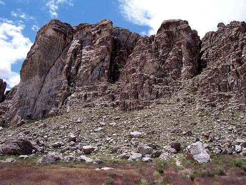 Ibex in Utah's West Desert - by Scott Wesemann
Rock Climbing
This is an overview of some of the rock climbing areas. Ibex is known for its bouldering and rock climbing. It is an area of quartzite cliffs and boulders in the Barn Hills area of the Confusion Range. It faces toward Blind Valley in the West Desert of Utah. The location of Ibex is one of a kind in a remote setting. Ibex is accessible to climbers via dirt roads that you can get to from town of Delta. It is best to go here during the seasons of winter, spring and fall. Summers are very hot. This area of the desert is dry even when much of Utah is covered in a blanket of snow during winter.
More information is in a book called, Ibex and Selected Climbs of Utah's West Desert, by James Garrett.
Ibex Page - by Scott Wesemann
This became a prime destination after the late 1990s when local Utah climbers started developing the area. There are about fifteen or so climbing areas at Ibex today. There are over a hundred boulder problems. Some bouldering areas such as, The Red Monster, are quite popular while other areas are more quiet. In fact, you may see few people while you're at Ibex. There are no fees or permits required to climb here. Just respect the area and pack out all your garbage and waste. There are no campgrounds at Ibex so practice leave no trace techniques if you choose to camp overnight. Ibex is a long way from anywhere. Hinckley and Delta are the closest towns and are an hour and a half away. Ibex was an old ranch and Overland Stage station on the route from Deseret to Frisco. It was named after the nearby Ibex Mine. The ibex animal is not native to America. Indian goats often escaped captivity to run and interbreed with the wild desert sheep. The horns of the offspring had a more gradual curve that made them look similar to an ibex. This may explain why Native American rock art had animals that resembled an ibex. The name of the ranch, town, and climbing area received the name ibex. Ibex is now a ghost town at the southern tip of the Barn Hills of the Confusion Range. It was an old mining and stockman's trading center. The settlement of Ibex had homes, a post office, boarding house, corrals, and dam.
Painter Springs Painter Springs is located northwest of Notch Peak on the west side of the House Range. The area is also known as Pink Rocks. It is not far from the Delta People's Springs. There are many granite cliffs, domes and spires. The granite has a pink color to it which is noticeable next to the limestone. Climbing began here in the 1980s by a small group of Utah climbers. The South Fork of Painter Canyon has a large amount of walls and pinnacles.
West Sawtooth Canyon West Sawtooth Canyon is located west of Notch Peak. The rock on the lower slopes of the canyon is pink colored granite. Every time I go to this area, I see NOLS, the National Outdoor Leadership School. They have several groups of people that they take camping and teach rock climbing. There are bolted routes and trad routes here. The area near the mouth of West Sawtooth Canyon has a lot routes. This is also the trailhead for Notch Peak from the west.
Notch Peak Notch Peak is the ultimate objective in this area for rock climbers. The mountain is known for its huge limestone cliff overlooking Tule Valley. Other peaks in the range have large cliffs too but not as high as Notch Peak. The Swiss Route on the North Face was first climbed in 1986 by Thomas Koch and Peter Deinen. Interest in climbing Notch Peak came back later in the 1990s. The Northwest Ridge was climbed in 1998 by Jim Howe and Jason Keith. Then in May 1999, the Book of Saturday on the North Face was completed by Robert Price and Tom Lyde. It is one of the most popular routes on the face.
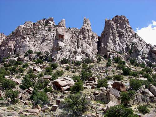 West Sawtooth Spires in the House Range
Key Ranges
Each of these mountain ranges will receive more attention but a sampling can be found below: Stansbury Mountains, Stansbury Island, Oquirrh Range, Indian Peak Range, Northern Wah Wah Mountains, Southern Wah Wah Mountains, Silver Island Mountains, Tunnel Spring Mountains, San Francisco Mountains, Cricket Mountains, Mountain Home Range, House Range, Confusion Range, Drum Mountains, Keg Mountain Range, Deep Creek Range, Fish Springs Range, Desert Mountain Range, Newfoundland Mountains, Hogup Mountains, Lakeside Mountains, Cedar Mountains, Grassy Mountains, Sheeprock Mountains, Tintic Mountains, Burbank Hills, Simpson Mountains, Davis Mountain Range, Dugway Mountains, Gilson Mountains, San Francisco Mountains, Black Mountains, Mineral Mountains, and Canyon Mountains. etc etc etc...(yes, there are more) As you can see, there is a lot that can be added and it will take time. Many of the peaks/ranges in the list above have SP pages and direct links will be provided but bear with us as we try and present this information in an order that will make sense. For instance, what peaks and ranges are best accessible from Milford. The Wah Wahs and the Tunnel Spring Mountains would be examples. How about from Delta? The House and the Confusion Ranges would be more examples. How about from the Pony Express road? Indian Peaks, George Hansen or even the Deep Creeks. Watch for this section to be developed along with maps and some suggestions. (Dean)
Roads, Gas, & Food
Everything is scarce, as befits the desert. Delta, Tooele, Milford and Wendover are the true population centers at its edges. Hwy 6/50 crosses the South part of the desert from Delta to Ely, with a gas station and c-store at the state line. Three strips of blacktop reach into the desert, from route 6 to IPP and Topaz, from I-80 to Dugway, and from Nevada line to Ibapah. No improved campgrounds in the middle of the area, but there are a few in Tooele area (South Willow, Clover Springs), around Little Sahara, and across from the state line in Great Basin National Park. The Pony Express road is a dirt track that cuts through the heart of the desert and is an area rich in history. Many of the ranges are best accessed by utilizing this historical pathway. Overall, the "hubs" presented as gateways are the following cities, towns and routes: Salt Lake City, Wendover, Tooele, Eureka, Delta, and Milford.
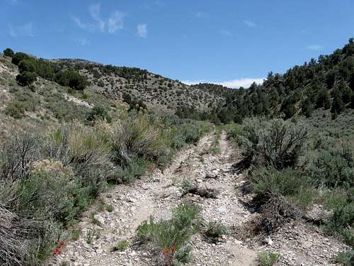 Remote dirt road approaches are common in the West Desert
Disclaimer
Many of these ranges are very very isolated and it is your responsibility to be prepared for the event of emergencies or breakdown. Cell service is sketchy or non existant in many areas and you might find your self on a road that becomes impassable for a while due to a storm. If you venture out into these areas, recognize the risk and go accordingly. It is not a bad idea to let others know where you are going and to have another vehicle along. High clearance and often 4WD is a necessity. Be safe and have fun. This part of Utah is a treasure.
Red Tape
Most of the land in the western desert is managed by the BLM. There are pockets of National forest and wilderness areas but for the most part, administration and protection of the area falls upon the Bureau of Land Management. Thanks to their effort, most of the signs and upkeep of roads are BLM responsibilities with the county governments also helping out on some of the roads that don't fall under the BLM umbrella. The Dugway Proving Ground also occupies a large expanse of the western desert and all mountains and ranges on that land are off limits. Granite Peak is a Utah prominence peak that is most likely never going to be available due to restrictive policy on this area. A couple small Indian Reservations can be found in the west desert as well and travel through Goshute Lands in Ibapah and Skull Valley requires tribal permissions, which might be not as hard to get as usually expected; check Doug Springmeyer's online route description on Ibapah's West flank for details. Deseret Peak area is designated wilderness, and another wilderness area is proposed in Cedar Mountains to the West, to spite the Goshutes' nuclear storage plans. There are many WSA's, Wilderness Study Areas, and more about those will be added at a later.
| BLM Utah State Office | BLM West Desert District | BLM Fillmore Field Office |
| 440 W 200 S, Suite 500 | 2370 South 2300 West | 95 East 500 North |
| Salt Lake City, UT 84119 | Salt Lake City, UT 84119 | Fillmore, UT 84631 |
| Phone: (801) 539-4001 | Phone: (801) 977-4300 | Phone: (435) 743-3100 |
| Fax: (801) 539-4013 | Fax: (801) 977-4397 | Fax: (435) 743-3135 |
The Weather
Mountains in the West Desert can be hiked year round, but Spring and Fall are the most preferred. Winter is a good time to hike the lower elevation peaks. If there has been a big snow storm recently, it is a good idea to wait a week or two for better driving conditions. Some of the more remote access roads might be inaccessible. During springtime, roads can be muddy so be prepared for variable conditions. The months of April through June is the optimal time to climb peaks in this area. During summer temperatures rise and it can be very hot. This is when people go to the higher elevations. Mountain ranges above 10,000 feet include the Deep Creek Range, Stansbury Mountains, and Oquirrh Mountains. Autumn is a great time since temperatures are quite nice. Be aware of hunting season, especially September through October, where you may encounter hunters while hiking. MILFORD -- DELTA -- WENDOVER -- EUREKA 


Books
Kelsey's book with a long winded name, Hiking, Climbing & Exploring Western Utah's Jack Watson's Ibex Country : The Life Stories of Jack Watson & Bob Stinson, History of Ibex, West Desert Sheepmen, ... Mountain Climbing and Fossil Hunting, better known as the Yellow Book, is the most authoritatibe source for most of the desert area. Jack Watson was one his ancestors, who started sheep-herding in the area of today's Route 6 in 1866. The other Kelsey's book, the Green, a.k.a. Utah Mountaineering Guide, covers most of the high summits of the area.
High in Utah and Hiking Utah's Summits are primarily highpointers' guidebooks covering Deseret Peak and Ibapah Peak in good detail. The former book also has a chapter on Notch Peak in the Utah Classics section.
Peak List
| UTAH WESTERN DESERT PEAKS | |||
| Mountain | Range | Elevation | SP Page |
|---|---|---|---|
| 12,000+ foot Peaks | |||
| Ibapah Peak | Deep Creek Range | 12,087 | Page |
| Haystack Mountain | Deep Creek Range | 12,020 | Page |
| 11,000+ foot Peaks | |||
| Red Mountain | Deep Creek Range | 11,588 | Page |
| Trout Benchmark | Deep Creek Range | 11,324 | |
| Deseret Peak | Stansbury Mountains | 11,031 | Page |
| 10,000+ foot Peaks | |||
| Rocky Peak | Deep Creek Range | 10,748 | |
| "South & North Willow Peaks" | Stansbury Mountains | 10,685 | Page |
| "Trout Creek Peak" | Deep Creek Range | 10,621 | |
| Flat Top Mountain | Oquirrh Mountains | 10,620 | Page |
| Lowe Peak | Oquirrh Mountains | 10,589 | Page |
| "Wood Canyon Peak" | Deep Creek Range | 10,462 | |
| Lewiston Peak | Oquirrh Mountains | 10,411 | Page |
| Kelsey Peak | Oquirrh Mountains | 10,373 | Page |
| Vickory Mountain | Stansbury Mountains | 10,330 | Page |
| Rocky Peak | Oquirrh Mountains | 10,278 | Page |
| Bald Mountain East | Oquirrh Mountains | 10,006 | Page |
| 9,000+ foot Peaks | |||
| Indian Peak | Indian Peak Range | 9,790 | Page |
| Fool Creek Peak | Canyon Mountains | 9,712 | Page |
| Swasey Peak | House Range | 9,669 | Page |
| Frisco Peak | San Francisco Mountains | 9,660 | Page |
| Notch Peak | House Range | 9,654 | Page |
| Granite Peak | Mineral Mountains | 9,580 | Page |
| "North Twin Peak" | Indian Peak Range | 9,576 | |
| Needle Benchmark | Mountain Home Range | 9,480 | Page |
| Wah Wah Mountains HP | South Wah Wah Mountains | 9,393 | Page |
| Butterfield Peaks | Oquirrh Mountains | 9,370 | Page |
| Nelson Peak | Oquirrh Mountains | 9,359 | Page |
| Black Crook Peak | Sheeprock Mountains | 9,274 | Page |
| Williams Peak | Canyon Mountains | 9,236 | |
| Pole Benchmark | Deep Creek Range | 9,227 | |
| Clipper Peak | Oquirrh Mountains | 9,207 | |
| Bald Mountain | Stansbury Mountains | 9,203 | |
| Onaqui Benchmark | Stansbury Mountains | 9,143 | Page |
| "Head of Willow Peak" | South Wah Wah Mountains | 9,135 | |
| Bearskin Mountain | Mineral Mountains | 9,099 | |
| West Mountain | Oquirrh Mountains | 9,070 | Page |
| Farnsworth Peak | Oquirrh Mountains | 9,060 | Page |
| Stookey Peak | Stansbury Mountains | 9,020 | Page |
| 8,000+ foot Peaks | |||
| Wah Wah North | North Wah Wah Mountains | 8,980 | Page |
| Dutch Peak | Sheeprock Mountains | 8,964 | |
| Ranch Benchmark | North Wah Wah Mountains | 8,918 | |
| "Mountain Home Pass Peak" | Mountain Home Range | 8,860 | |
| "Pole Canyon Peak" | Mineral Mountains | 8,829 | |
| "South Patterson Peak" | North Pilot Range | 8,721 | |
| Porphyry Hill | Oquirrh Mountains | 8,716 | Page |
| Poorman BM | Black Mountains | 8,674 | Page |
| Blue Mountain | Canyon Mountains | 8,645 | |
| Buck Peak | Canyon Mountains | 8,612 | |
| Steamboat Mountain | Indian Peak Range | 8,588 | |
| George H Hansen Peak | Fish Springs Range | 8,523 | Page |
| Red Pine Mountain | Sheeprock Mountains | 8,516 | Page |
| Tunnel Spring Peak | Tunnel Spring Mountains | 8,460 | Page |
| "Upper Pass Peak" | North Wah Wah Mountains | 8,460 | |
| Blawn Mountain | South Wah Wah Mountains | 8,434 | |
| Lamerdorf Peak | South Wah Wah Mountains | 8,425 | |
| Indian Peaks | Simpson Mountains | 8,420 | Page |
| Tatow Knob | House Range | 8,416 | |
| Howell Peak | House Range | 8,350 | Page |
| Kingtop | Confusion Range | 8,350 | Page |
| "Bonny Stairs Peak" | Confusion Range | 8,348 | |
| "Death Canyon Peak" | Simpson Mountains | 8,334 | |
| Boulter Peak | East Tintic Mountains | 8,308 | Page |
| Bob Leroy Peaks | Indian Peak Range | 8,275 | |
| Barneys Peak | Oquirrh Mountains | 8,242 | Page |
| Tintic Mountain | East Tintic Mountains | 8,218 | Page |
| Twin Flat Mountains | Mineral Mountains | 8,196 | |
| "Hamblin North Peak" | Indian Peak Range | 8,170 | |
| Dome Benchmark | Confusion Range | 8,162 | |
| Conger Mountain | Confusion Range | 8,144 | Page |
| Indian Grave Peak | San Francisco Mountains | 8,132 | |
| Mammoth Peak | East Tintic Mountains | 8,108 | |
| Snag Benchmark | Confusion Range | 8,070 | |
| Bismark Peak | East Tintic Mountains | 8,063 | |
| Maple Peak | West Tintic Mountains | 8,060 | Page |
| Sabie Mountain | West Tintic Mountains | 8,021 | Page |
| "Flux Peak" | Stansbury Mountains | 8,003 | Page |
| 7,000+ foot Peaks | |||
| The Tetons | South Wah Wah Mountains | 7,953 | |
| "Lost Spring Peak" | House Range | 7,921 | |
| Eagle Hill | Oquirrh Mountains | 7,918 | Page |
| "Hell’n Moriah Peak" | House Range | 7,901 | |
| "The Needles South Peak" | Mountain Home Range | 7,869 | |
| Buckhorn Peak | East Tintic Mountains | 7,861 | Page |
| Burbank Hills HP | Burbank Hills | 7,815 | |
| Dutch Mountain | North Deep Creek Mountains | 7,794 | Page |
| "Crystal Pass Peak" | Confusion Range | 7,792 | |
| Double Benchmark | Confusion Range | 7,766 | |
| The Needles | Mountain Home Range | 7,749 | |
| Pinyon Peak | East Tintic Mountains | 7,720 | Page |
| Antelope Benchmark | Mineral Mountains | 7,719 | |
| Cedar Peak | Cedar Mountains | 7,712 | Page |
| "Pink Knolls South" | South Wah Wah Mountains | 7,706 | |
| Lake Mountain Peak | Lake Mountains | 7,690 | Page |
| Center Benchmark | Confusion Range | 7,662 | |
| "Burbank Pass Peak" | Burbank Hills | 7,646 | |
| Wild Horse Peak | Canyon Mountains | 7,631 | |
| Blue Mountain | South Wah Wah Mountains | 7,594 | |
| Dry Willow Peak | Black Mountains | 7,593 | |
| Silver Benchmark | East Tintic Mountains | 7,593 | |
| "Jackrabbit South Peak" | Red Hills | 7,577 | |
| Graham Peak | Silver Island Mountains | 7,563 | Page |
| The Toad | Mountain Home Range | 7,542 | |
| Ochre Mountain | North Deep Creek Mountains | 7,540 | |
| Champlin Peak | Gilson Mountains | 7,504 | Page |
| "Painted Mountain" | Confusion Range | 7,500 | |
| Crystal Benchmark | North Wah Wah Mountains | 7,460 | |
| "North Rim Peak" | Confusion Range | 7,420 | |
| Messix Peak | Promontory Mountains | 7,372 | Page |
| Round Top Benchmark | Confusion Range | 7,372 | |
| Montezuma Peak | Clifton Hills | 7,370 | |
| "Lime Point Peak" | North Wah Wah Mountains | 7,340 | |
| Keg Mountain | Keg Mountain Range | 7,305 | Page |
| Drum Mountains HP | Drum Mountains | 7,298 | Page |
| Sawtooth Peak | Mountain Home Range | 7,273 | |
| Campbell Peak | Silver Island Mountains | 7,272 | |
| Jenkins Peak | Silver Island Mountains | 7,268 | |
| Cricket Mountains HP | Cricket Mountains | 7,231 | Page |
| Black Mountain East | Black Mountains | 7,226 | |
| North Peaks HP | Indian Peak Range | 7,222 | |
| "Chokecherry Peak" | Promontory Mountains | 7,218 | |
| Squaw Peak | Shauntie Hills | 7,212 | |
| Plympton Ridge HP | Confusion Range | 7,197 | |
| Mine Benchmark | South Wah Wah Mountains | 7,182 | |
| "Snow Mountain" | Cricket Mountains | 7,182 | |
| Crystal Peak | North Wah Wah Mountains | 7,108 | Page |
| Thomas Range HP | Thomas Range | 7,106 | |
| Granite Peak | Dugway Proving Ground | 7,082 | |
| "Long Peak" | Promontory Mountains | 7,075 | |
| Tangent Peak | Hogup Mountains | 7,047 | Page |
| Topaz Mountain | Thomas Range | 7,046 | |
| Drum Benchmark | Drum Mountains | 7,045 | |
| Long Ridge | East Tintic Mountains | 7,042 | |
| Cobb Peak | Silver Island Mountains | 7,021 | Page |
| Middle Mountain | North Wah Wah Mountains | 7,006 | |
| Desert Peak | Newfoundland Mountains | 7,005 | Page |
| 6,000+ foot Peaks | |||
| Lady Laird Peak | Drum Mountains | 6,980 | |
| Mount Tarpey | Promontory Mountains | 6,979 | |
| Topache Peak | Star Range | 6,896 | |
| Lime Mountain | Beaver Lake Mountains | 6,895 | |
| Keg Mountain West | Keg Mountain Range | 6,881 | |
| White Cliff | Indian Peak Range | 6,858 | |
| Dugway Range HP | Dugway Range | 6,830 | Page |
| Middle Range HP | Middle Range | 6,830 | |
| Antelope Peak | Shauntie Hills | 6,829 | |
| South Mountain | Oquirrh Mountains | 6,824 | Page |
| Long Lick Mountain | Shauntie Hills | 6,809 | |
| White Mountain | Shauntie Hills | 6,781 | |
| Monument Peak | Black Mountains | 6,780 | |
| Castle Mountain | Dugway Range | 6,765 | |
| Wildcat Hills HP | Drum Mountains | 6,750 | |
| Headlight Mountain | Cricket Mountains | 6,749 | |
| Hastings Benchmark | Cedar Mountains | 6,714 | |
| Scorpio Peak | Hogup Mountains | 6,660 | |
| Disappointment Hills HP | Confusion Range | 6,660 | |
| Fossil Mountain | Confusion Range | 6,649 | Page |
| Stansbury Island HP | Stansbury Island | 6,649 | Page |
| Craner Peak | Lakeside Mountains | 6,625 | Page |
| Race Benchmark | Hogup Mountains | 6,614 | |
| Castle Rock | Stansbury Island | 6,610 | Page |
| South Mountain West | South Mountain Range | 6,597 | Page |
| Grassy Mountain | Grassy Mountains | 6,596 | Page |
| Frary Peak | Antelope Island | 6,596 | Page |
| Little Drum Mountains HP | Little Drum Mountains | 6,594 | |
| Promontory Benchmark | Promontory Mountains | 6,592 | |
| Spor Mountain North | Thomas Range | 6,580 | |
| Stansbury Benchmark | Stansbury Island | 6,553 | Page |
| Black Mountain | Lakeside Mountains | 6,551 | |
| Dugway Ridge | Dugway Range | 6,527 | |
| Topliff Hill | Topliff Hills | 6,510 | Page |
| Painted Rock Mountain | Confusion Range | 6,510 | |
| Granite Mountain | Confusion Range | 6,492 | |
| Desert Mountain | Desert Mountain Range | 6,480 | Page |
| Round Top | Davis Mountain Range | 6,434 | Page |
| Mount Laird | Drum Mountains | 6,424 | |
| Stringham Peak | Antelope Island | 6,374 | Page |
| Vernon Hills HP | Vernon Hills | 6,334 | |
| Law Benchmark | House Range - Black Hills | 6,330 | |
| Foote Range HP | Confusion Range | 6,300 | |
| Lamus Peak | Silver Island Mountains | 6,284 | Page |
| Tetzlaff Peak | Silver Island Mountains | 6,267 | |
| Rishel Peak | Silver Island Mountains | 6,212 | Page |
| Red Rocks | Antelope Island | 6,198 | |
| Thorpe Hills HP | Thorpe Hills | 6,190 | |
| Pyramid Peak | Dugway Range | 6,120 | |
| Step Mountain | Oquirrh Mountains | 6,117 | Page |
| Rocky Range HP | Rocky Range | 6,081 | |
| "Stansbury Island South" | Stansbury Island | 6,070 | Page |
| Twin Peaks North | North Deep Creek Mountains | 6,060 | |
| South Newfoundland BM | Newfoundland Mountains | 6,058 | |
| Salt Mountain | Stansbury Mountains | 6,048 | Page |
| Church Mountains HP | Church Mountains | 6,023 | |
| Volcano Peak | Silver Island Mountains | 6,011 | Page |
| Peaks below 6,000 feet | |||
| Matlin Mountains HP | Matlin Mountains | 5,970 | |
| Mesa Benchmark | House Range - Black Hills | 5,955 | |
| Gandy Mountain | Salt Marsh Range | 5,936 | |
| Sally Mountain | Military Range | 5,861 | |
| Jedediah Mountain | Lakeside Mountains | 5,849 | |
| Black Mountains HP | Black Mountains | 5,830 | |
| Black Rock Hills HP | Black Rock Hills | 5,782 | |
| Table Mountain | Slow Elk Hills | 5,766 | |
| Pahvant Butte (Sugarloaf) | Black Rock Desert | 5,751 | Page |
| Crater Island | Silver Island Mountains | 5,743 | |
| Red Tops | House Range - Black Hills | 5,660 | |
| Camels Back Ridge | Dugway Proving Ground | 5,501 | |
| The Sentry | Antelope Island | 5,446 | Page |
| Pigeon Mountain | Pigeon Mountains | 5,369 | |
| Terrace Mountain | Terrace Mountain | 5,361 | |
| Wildcat Mountain | Dugway Proving Ground | 5,306 | |
| Dooly Knob | Antelope Island | 5,278 | Page |
| Elephant Head | Antelope Island | 5,126 | Page |
| Floating Island | Silver Island Mountains | 5,109 | |
| Buffalo Point | Antelope Island | 4,785 | Page |