
-
 7627 Hits
-
 86.37% Score
-
 22 Votes
|
|
Mountain/Rock |
|---|---|
|
|
45.90660°N / 7.27990°E |
|
|
Mountaineering |
|
|
10584 ft / 3226 m |
|
|
Overview
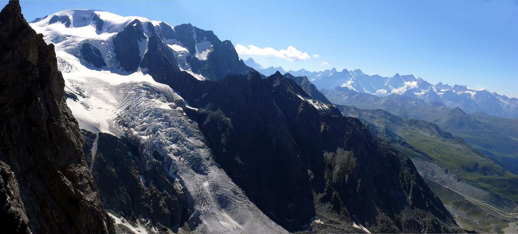
The crest of border between Italy and Switzerland, departing from the Pass of Valsorey (3.107m), it raises again him to the Trois Frères (=Three Brothers) to subsequently form five square towers denominated by the Abbot Joseph Maria Henry, in the Monthly Magazine of the Italian Alpine Club of 1913, Molars of Valsorey for theirs to form in profile of tooth (the most elevated the II° with 3.247m). After them the continuous crest forming a whole series of very jagged pinnacles and from the eccentric forms along a line of almost half Kilometro and with the rated most elevated Peak 3.224m from the Institute Military Geographic (3.225/6m by GPS in 2007); formed the Saddle (3.191m) (Marcel Kurz Map), the same one raises again him forming other elevations thus named: Le Rateau (3.285m), Grand Carré (3.335m), Mont Percé (3.353m) over which Leses the Trois Luisettes are raised that in number for the note of three they precede the Aiguille Verte, always of Valsorey (3.483m). Then our Aiguilles must not be confused with the Trois Luisettes; this whole line of crest is generally called Aiguilles de Valsorey, while in the guide of the C.A.I./T.C.I. 1971 "Alpi Pennine Vol.I°" of Gino Buscaini, page 217 are generically defined what Dents of Valsorey in the drawn by the Five Molars to the excluded Great Carré; instead the Paper National Switzerland precisely individualizes her with the name from us mentioned. Tops rarely slopes, above all for the bad quality of the rock, so much that in their ascension the first ones (?) mountaineers didn't find in 2007 some trace of passage (little fellow in stone or you signal you launch). They deserve a visit instead, if nothing else because they are able he anchors to fascinate for the exploratory search, but also for the views on the neighbor Mont Velan with the beautiful Glacier of Valsorey and to Northeast toward the Chain of the Combins, while in direction SW lengthens the Chain Mont Gelé/Mont Morion.
La cresta di confine tra Italia e Svizzera, partendo dal Colle di Valsorey (3.107 m), si rialza ai Trois Frères per formare successivamente cinque torrioni squadrati denominati dall'Abate Joseph Maria Henry, nella Rivista Mensile del C.A.I. del 1913, Molari di Valsorey per la loro a forma di profilo di dente (il più elevato il II° con 3.247 m). Dopo di loro la cresta continua formando tutta una serie di pinnacoli molto frastagliati e dalle forme bizzarre lungo un tratto di quasi mezzo Kilometro e con la Vetta più elevata quotata 3.224 m dall'I.G.M. (3.225/6 m con GPS nel 2007); formata la Sella 3.191 m (Carta Marcel Kurz), la medesima si rialza formando altre elevazioni così nominate: Le Rateau (3.285 m), Grand Carré (3.335 m), Mont Percé (3.353 m) oltre il quale si elevano Les Trois Luisettes che in numero per l'appunto di tre precedono l'Aiguille Verte, sempre di Valsorey (3.483 m). Quindi le nostre Aiguilles non vanno confuse con le Trois Luisettes; generalmente tutto questo tratto di cresta viene chiamato Aiguilles de Valsorey, mentre nella guida del C.A.I./T.C.I. 1971 "Alpi Pennine Vol.I°" di Gino Buscaini a pagina 217 vengono genericamente definiti quali Denti di Valsorey nel tratto dai Cinque Molari al Grand Carré escluso; invece la Carta Nazionale Svizzera le individua precisamente con il nome da noi menzionato. Cime raramente salite, soprattutto per la cattiva qualità della roccia, tanto che nella loro ascensione i primi (?) salitori non trovarono nel 2007 alcuna traccia di passaggio (ometti in pietra o segnali vari). Meritano invece una visita, se non altro perché possono ancora affascinare per la ricerca esplorativa, ma anche per le vedute sul vicino Mont Velan con il bello Ghiacciaio di Valsorey ed a NE verso la Catena dei Combins, mentre in direzione SW si allunga la Catena Mont Gelé/Mont Morion.
![]()
First Ascents
- First? on the Summit: Osvaldo Cardellina and Emilio Bertona, (Aug 05th, 2007).
- N-NE Ridge and through crossing of the various Summits round trip: Osvaldo Cardellina and Emilio Bertona, (Aug 05th, 2007).
Getting There
BY CAR:- From Torino, Milano, etc: Motorway A5. Exit at Aosta Est.
- From Switzerland: through the Grand Saint Bernard Tunnel or the namesake pass.
- From France: through the Mont Blanc Tunnel or Petit Saint Bernard Pass. It is not necessary to take Motorway A5: you can drive on SS.26, in the direction of Aosta.
- Aeroporto "Corrado Gex" Saint Christophe (Aosta).
Itinerary
From Aosta East exit of the motorway, follow along the SS.27 for the Gran San Bernardo Tunnel After about ten Km turn to the right toward Valpelline (964m), cross it and turn to the left to get Ollomont (1.335m) and the small built area of Glacier (1.549m), where you must start walking.Dall'uscita del Casello Autostradale di Aosta Est, proseguire sulla SS.27 in direzione del tunnel del Gran San Bernardo; dopo circa un decina di chilometri svoltare sulla destra verso il Paese di Valpelline (964 m). Dopo averlo superato svoltare sulla sinistra e raggiungere il Paese di Ollomont (1.335 m); proseguire sino alla Frazione di Glacier (1.549 m), dove inizia l'itinerario a piedi.
![To Saddle 3191m of the Aiguilles des Luisettes de Valsorey]()
![Towards the Saddle 3191m of Valsorey]() From as soon as before the Village of Glacier (1.549m) to take the path n° 3/4/5 that verse is addressed reaching the Alpe Of it Pont (1.690m), it overcomes the Stream of By and it reaches the following of Crottes Pastures (1.733m); progressively becoming steep reaches the Alp Cheval Blanc (1.962m) and the neighbor "Lake Farinet's" (1.987m). From this point, left on the right the paths n° 4/5, to continue by direction West-southwest crossing the emissary of the small lake and reaching the earth road "poderale" to the tornante (= hairpin bend; 2.025m); leaving on the right the continuation in direction of the Les Eveques Alp (2.038m) shortly and along to reach that some Alp Porchère (2.094m) and, through direction North, that that is than above or Tsa de Porchère (Tsa = Higher Pasture, generally the last; 2.290m; spring water). From this, proceeding through a long diagonal to North-northwest, to reach an alternative to quota 2.400m around, from where two possibilities of continuation of the route they are verified:
From as soon as before the Village of Glacier (1.549m) to take the path n° 3/4/5 that verse is addressed reaching the Alpe Of it Pont (1.690m), it overcomes the Stream of By and it reaches the following of Crottes Pastures (1.733m); progressively becoming steep reaches the Alp Cheval Blanc (1.962m) and the neighbor "Lake Farinet's" (1.987m). From this point, left on the right the paths n° 4/5, to continue by direction West-southwest crossing the emissary of the small lake and reaching the earth road "poderale" to the tornante (= hairpin bend; 2.025m); leaving on the right the continuation in direction of the Les Eveques Alp (2.038m) shortly and along to reach that some Alp Porchère (2.094m) and, through direction North, that that is than above or Tsa de Porchère (Tsa = Higher Pasture, generally the last; 2.290m; spring water). From this, proceeding through a long diagonal to North-northwest, to reach an alternative to quota 2.400m around, from where two possibilities of continuation of the route they are verified:
Approach
a) - to directly continue on the path of right (East) reaching the thread of crest of the Dos de Boégno Bà (= Rise of the Down Ear)and to actually follow it to the Quota 2.507m, old which folding up to the left slightly and with a steep final line to reach the Bivouac out Rosazza to the Savoie (2.651m; 3h'00).
b) - from the alternative 2.400 meters around to take the ramification of left (West) that it is addressed toward the Alpe Plan Bagò (2.436m) but not to reach her; to a further intersection in quota as the precedent to climb by a parallel path always initialed n° 3 and coming from the Alp Chesal (2.039m); to go up again at first it toward North, after through a short diagonal to NW to reach the Torrent of Plan Bagò, near a characteristic great boulder. To get further on the right and, by a last upsurge, to reach from left toward right the Bivouac out Rosazza at the Savoie (2.651m; 3h'00).
Da appena prima del Villaggio di Glacier prendere il sentiero n° 3/4/5, che si indirizza verso NE raggiungendo l'Alpe Pont (1.690 m), supera il Torrente di By e raggiunge i successivi Alpeggi di Crottes (1.733 m); diventando progressivamente più ripido raggiunge l'Alpe Cheval Blanc (1.962 m) ed il vicino "Lago Farinet" (1.987 m). Da questo punto, lasciati sulla destra i sentieri n° 4/5, continuare con direzione W-SW attraversando l'emissario del piccolo lago e raggiungendo la strada poderale al tornante 2.025 m; lasciando sulla destra la continuazione in direzione dell'Alpe Les Eveques (2.038 m), brevemente e lungo la medesima raggiungere quello dell'Alpe Porchère (2.094 m) e, tramite direzione N, quella che sta di sopra o Tsa de Porchère (2.290 m; sorgente). Da questa procedendo con un lungo diagonale a N-NW raggiungere un bivio a quota 2.400 m circa, donde si verificano due possibilità di continuazione del percorso:
a) - proseguire direttamente sul sentiero di destra (E) raggiungendo il filo di cresta del Dos de Boégno Bà (= Dosso dell'Orecchia Abbassata) e seguirlo sino alla Quota 2.507 m, superata la quale piegando leggermente a sinistra e con un tratto finale più ripido arrivare al Bivacco Rosazza al Savoie (2.651 m 3h'00).
b) - dal bivio 2.400 m circa prendere la ramificazione di sinistra (O) che si indirizza verso l'Alpe Plan Bagò (2.436 m) ma non raggiungerla; ad un ulteriore incrocio in quota come il precedente salire con un sentiero parallelo sempre siglato n° 3 e proveniente dall'Alpe Chesal (2.039 m); risalirlo dapprima verso N, poi con un corto diagonale a NW raggiungere il Torrente di Plan Bagò presso un caratteristico grande masso. Allontanarsi sulla destra e, con un ultima impennata, raggiungere da sinistra verso destra il Bivacco Rosazza al Savoie (2.651 m; 3h'00).
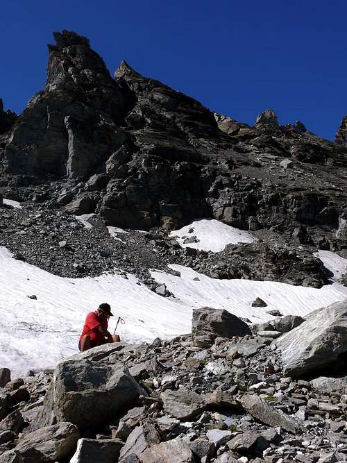
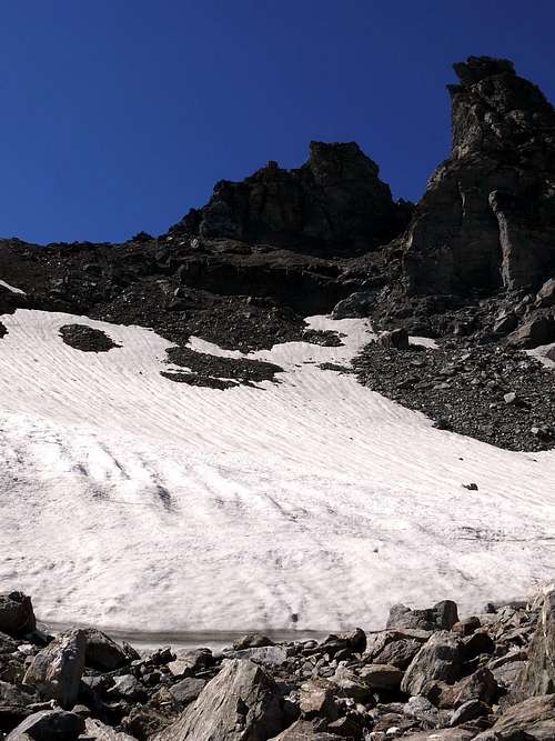
Route
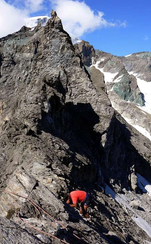
From the Bivacco out Rosazza/Savoye and from the neighbor of Boegno Bas Pass (2.674m) to address him toward Northeast along a trace that with a long diagonal in light, overcoming some small valleys in grass, it brings him in direction of the unnamed lake (quota 2.688m GPS); not to reach it, on the contrary to go up again the rather steep moraine or the snowfields reaching the Southern Glacier of Valsorey. To always go up again it with greater inclination crossing it at the base of the long crest that the Three Brothers of Valsorey unite to the Five Molars and do what it is above doubling on the left (North) the rocky quota 2.931m; here the inclination goes decreasing and the run is mostly turned toward rising. To reach a rocky band that this time wanders on the right (East) or he directly goes up again with easy and amusing climb; to go out so on the snowy superior slant (terrace with spring water of fusion) and to go up again it with a right diagonal toward left interposed by rocks shattered that they go out of the snowfield reaching the Saddle 3.190/1m mail among her Rateau (3.285m) to Northeast and The Aiguilles of Luisettes Valsorey to Southwest (3.225/6m GPS). From the Saddle 3.190/1m, characteristic inherent brèche on the crest but not profit as pass because the Northern slope falls with a tall wall of steep rocks broken on the Northern Glacier of Valsorey, to turn to the left and to overcome a first tower of friable rock (II°); it follows not always a plate of good since very friable rock, while a passage on the thread of a plate (II°+/III°, a lot of statement to North) hands on top of the first point of the Aiguilles of Luisettes. The crossing to the following points is more delicate, always cause the quality of the rock, that not difficult and however such to force to continuous vigilance; through some lines on the thread of ridge or by small avoidances to North or to South the Peak is reached (3.225/6m GPS; A.; PD+/AD-; 2h'00/2h'30).
 |
 |
 |
 |
 |
Dal Bivacco Rosazza/Savoye e dal vicino Col du Boegno Bas (2.674 m) indirizzarsi verso NE lungo una traccia che con un lungo diagonale in leggera, superando alcune piccole valli in erba, si porta in direzione del lago innominato (quota 2.688 m GPS); non raggiungerlo, bensì risalire la ripida morena oppure i nevai soprastanti raggiungendo il Ghiacciaio Meridionale di Valsorey. Risalirlo con pendenza sempre maggiore percorrendolo alla base della lunga cresta che unisce i Tre Fratelli di Valsorey ai Cinque Molari e doppiando sulla sinistra (N) la quota rocciosa 2.931 m; qui la pendenza va diminuendo ed il percorso è rivolto maggiormente verso levante. Raggiungere una fascia rocciosa che questa volta si aggira sulla destra (E) oppure si risale direttamente con facile e divertente arrampicata; uscire così sul nevoso pendio superiore (terrazza con sorgente di acqua di fusione) e risalirlo con un diagonale da destra verso sinistra inframmezzato da rocce frantumate che escono fuori dal nevaio raggiungendo la Sella 3.190/1 m posta tra Le Rateau (3.285 m) a NE e Les Aiguilles des Luisettes de Valsorey a SW (3.225/6 m GPS). Dalla Sella 3.190/1 m, caratteristica brèche insita sulla cresta ma non utile come colle perché il versante Settentrionale precipita con un'alta parete di ripide rocce rotte sul Ghiacciaio Settentrionale di Valsorey, svoltare a sinistra e superare un primo torrione di roccia friabile (II°); segue una placca sempre di roccia non buona poiché molto friabile, mentre un passaggio sul filo di una placca (II°+/III°, molto esposto a N) porta in cima alla prima punta delle Aiguilles des Luisettes. La traversata alle successive punte è più delicata, sempre causa la qualità della roccia, che non difficile e comunque tale da costringere a continua vigilanza; con alcuni tratti sul filo di cresta oppure con piccoli aggiramenti a N od a S si raggiunge la Vetta (3.225/6 m GPS; A; PD+/AD-; 2h'00/2h'30).
Difficulty
This route can be considered PD+/AD-.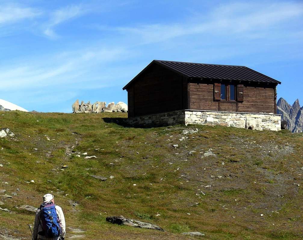
Campings
Remember that free camping is forbidden (except for emergency reasons, over 2.500m, from darkness until dawn).Mountain Conditions
- You can get meteo information at the official site of the Regione Valle d'Aosta:
- Valle d'Aosta Meteo
Webcam
- WEBCAM on Aosta Valley:
- Webcam
Books and Maps
BOOKS:- "Guida delle Alpi Occidentali", di Giovanni Bobba e Luigi Vaccarone C.A.I. Sezione di Torino Volume II (parte II), 25 Maggio 1896.
- "Diari Alpinistici" di Osvaldo Cardellina e Indice Generale accompagnato da Schedario Relazioni Ascensioni 1964-2019 (inediti).
- "Guida dei Monti d'Italia-Alpi Pennine" (Vol.I°) di Gino Buscaini-Club Alpino Italiano/Turing Club Italiano, Luglio 1971 (in Italian).
- "I Rifugi della Valle d'Aosta" di Stefano Ardito, Ed. Guide iter, Febbraio 2003.
 |
 |
 |
 |
- L'Escursionista "Valpelline, Saint Barthélemy" (carta n° 6) 1:25.000.
- C.N.S. "Mont Vèlan", foglio 1366, 1:25.000.
- Kompass "Breuil/Cervinia-Zermatt" Carta turistica 1:50.000.
- I.G.C. Istituto Geografico Centrale "La Valpelline, Ollomont, Saint Barthélemy", (carta n° 115) Map1:30.000.
Important Information
- REGIONE AUTONOMA VALLE D'AOSTA the official site.
- FONDAZIONE MONTAGNA SICURA Villa Cameron, località Villard de la Palud n° 1 Courmayeur (AO) Tel: 39 0165 897602 - Fax: 39 0165 897647.
- SOCIETA' DELLE GUIDE DELLA VALPELLINE Etroubles-Strada Nazionale, n° 13 - Tel +39 0165 78559 - Valpelline-Loc Capoluogo, n° 1 - Tel +39 0165 713502 (AO) Italia.
- A.I.NE.VA. (Associazione Interregionale Neve e Valanghe).
Useful Numbers
- Protezione Civile Valdostana località Aeroporto n° 7/A Saint Christophe (Ao) Tel. 0165-238222.
- Bollettino Meteo (weather info) Tel. 0165-44113.
- Unità Operativa di Soccorso Sanitario Tel. 118.