Just close to the Tête Blanche, sited on the border line between Italy and Switzerland, between the Mont Avril (3.347m) and the Mont Sonadon (3.578m). As all the summits of the ridge it overhangs the Glacier du Mont Durand, but is vanishing in the big himalayan shape of Combins on which it gives a wonbderful view.
Cima parallela alla Tête Blanche, situata sull'asse della cresta di confine italo-elvetica, tra il Mont Avril (3.347 m) e il Mont Sonadon (3.578 m). Domina, come tutte le altre vette della costiera, il Glacier du Mont Durand, ma scompare davanti alla massa himalayana dei Combins sui quale proietta una splendida vista.
First Ascent
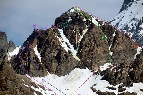
First on the summit: Max Rosenmunbd and company (Jul 07th, 1894).
In winter: Unknown.
S-SE Wall: Alberto d'Annibale, Giovanni Gatti and Benvenuto Treves, (Aug 24th, 1913).
S Arête: Erasmo Barisone, Giorgio Canuto, Sandro Gallo and Massimiliano Strumia, (Jul 20th, 1920).
W Slope: Aldo Bonacossa and Carlo Franchetti, (Dec 03th, 1913).
N-NE Slope: T. H. Dickson and H. V. Reade, (Aug 26th, 1895).
E-NE Wall: Silvia Metzeltin Buscaini and Gino Buscaini, (Sep 18th, 1970). First ? Repetition: Osvaldo Cardellina, lone, (Sep 11th, 2011).
E-SE Slope and E Arête: Joseph Henry and Lino Vaccari, (Jul 26th, 1902).
S-SE Slope and SE Arête: Attilio, Augusto, Giovanni and Giuseppina Porro, (Sep 24th, 1914).
SE Wall (direct line): Osvaldo Cardellina and Camillo Roberto Ferronato, (Jul 15th, 1979).
Getting There
BY CAR:
From Torino, Milano, etc: Motorway A5. Exit at Aosta Est.
From Switzerland: through the Grand Saint Bernard Tunnel or the namesake pass.
From France: through the Mont Blanc Tunnel or Petit Saint Bernard Pass. It is not necessary to take Motorway A5: you can drive on SS.26, in the direction of Aosta.
BY PLANE:
Aeroporto "Corrado Gex" Saint Christophe (Aosta).
Itinerary
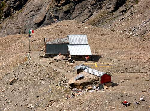
From Aosta East exit of the motorway, follow along the SS.27 for the Gran San Bernardo Tunnel After about ten Km turn to the right toward Valpelline (964m), creoss it and turn to the left to get Ollomont (1.335m) and the small built area of Glacier (1.549m), where you must start walking. Enter the mule track to By before the bridge and follow up to Farinet House where you must take the left branch toward Franco Chiarella-Amiante Refuge (2.979m, 4h'00/4h'30).
Dall'uscita del Casello Autostradale di Aosta Est, proseguire sulla SS.27 in direzione del tunnel del Gran San Bernardo; dopo circa un decina di chilometri svoltare sulla destra verso il Paese di Valpelline (964 m). Dopo averlo superato svoltare sulla sinistra e raggiungere il Paese di Ollomont (1.335 m); proseguire sino alla Frazione di Glacier (1.549 m), dove inizia l'itinerario a piedi. Da Glacier prendere la mulattiera prima del ponte, che sale a By, seguendola sino alla Casa Farinet, ove si prende il ramo di sinistra per il Rifugio Franco Chiarella-Amiante (2.979 m4h'00/4h'30).
Route
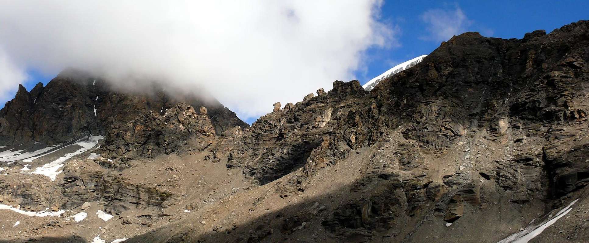
From the Refuge Franco Chiarella-Amiante, immediately to go up again the basin detrital to north of the shelter and the snowfields that conduct more aloft to the left of the Amiante Pass (3.308m) to the feet of the great gully that it engraves the south wall (3.350m~) to entirely Go up again him/it toward left (danger of fall stones), thin to go out on the shoulder of the south crest from where on broken and very insecure rocks the peak is reached (2h'00/2h'30). Descent: from the same route.
Dal Rifugio Franco Chiarella-Amiante, risalire la conca detritica subito a nord del rifugio e i nevai che conducono più in alto alla sinistra del Colle d'Amiante (3.308 m) ai piedi del grande canalone che incide la parete sud (3.350 m~). Salirlo interamente verso sinistra (pericolo di caduta sassi), fino ad uscire sulla spalla della cresta sud da dove su rocce rotte e molto insicure si raggiunge la vetta (2h'00/2h'30). Discesa: lungo la stessa via di salita.
Parents refers to a larger category under which an object falls. For example, theAconcagua mountain page has the 'Aconcagua Group' and the 'Seven Summits' asparents and is a parent itself to many routes, photos, and Trip Reports.

 11326 Hits
 89.01% Score
 28 Votes


Bob Sihler - Nov 12, 2009 7:51 am - Voted 10/10
Primary ImageHi Antonio, I just wanted to say that you forgot to put something for the Primary Image. Bob
Antonio Giani - Nov 12, 2009 9:10 am - Hasn't voted
Re: Primary ImageOpsss... Pardon... Molte Grazie Bob! Ciao Antonio