
|
|
Mountain/Rock |
|---|---|
|
|
40.36062°N / 105.93325°W |
|
|
Download GPX » View Route on Map |
|
|
Mountaineering |
|
|
Summer |
|
|
12524 ft / 3817 m |
|
|
Overview
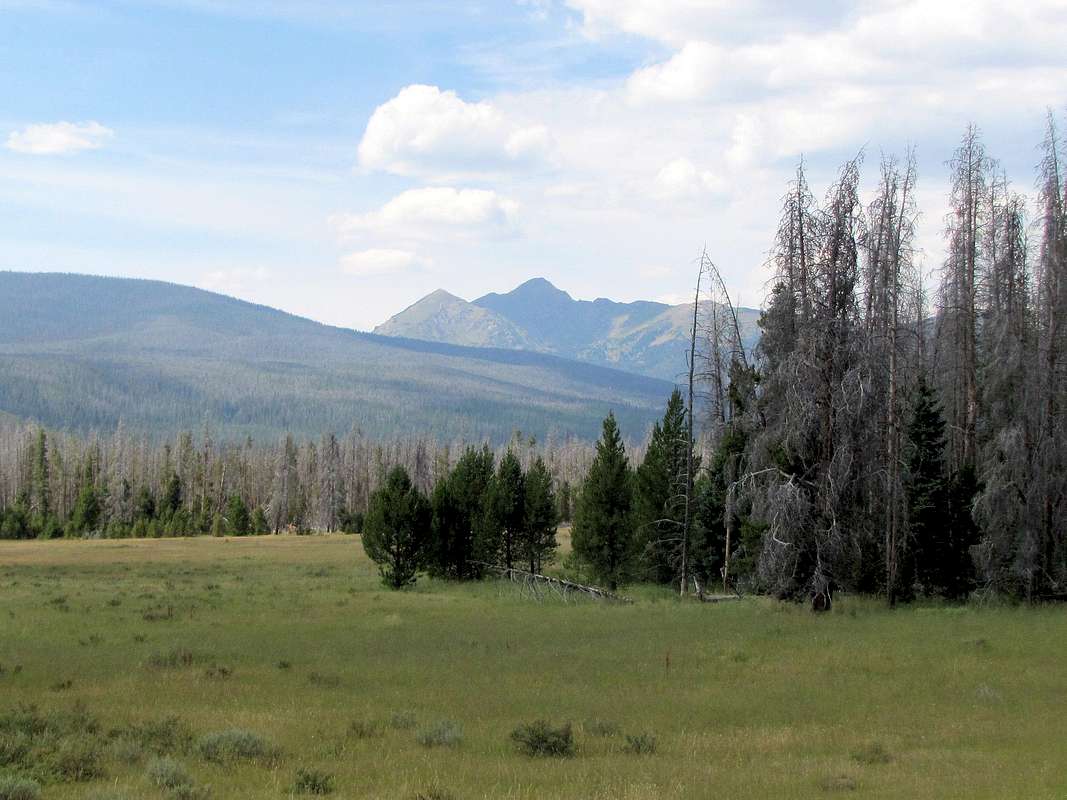
Bowen Mountain and Colorado River Valley, southeastern face
Bowen Mountain sits in the Never Summer Wilderness just outside the boundaries of Colorado’s Rocky Mountain National Park. From the southwestern entrance of the park, Bowen Mountain can be seen as a prominent peak rising above Colorado River Valley. A 7 mile long trail can be followed from Bowen/Baker Trailhead to the 10690 ft high Blue Lake at the base of the summit of Bowen Mountain. Some maps show a trail that continues above the lake up the eastern ridgeline of Bowen Mountain. I saw no sign of that trail but was able to find my own way through the forest above Blue Lake to a 11200 ft high basin where I hiked up the southeastern slopes to reach the summit.
My hike as described above turned out to be 17 miles long roundtrip. The official park map shows another trail starting at a nameless trailhead south of Bowen/Baker Trailhead making the hike probably a couple of miles shorter.
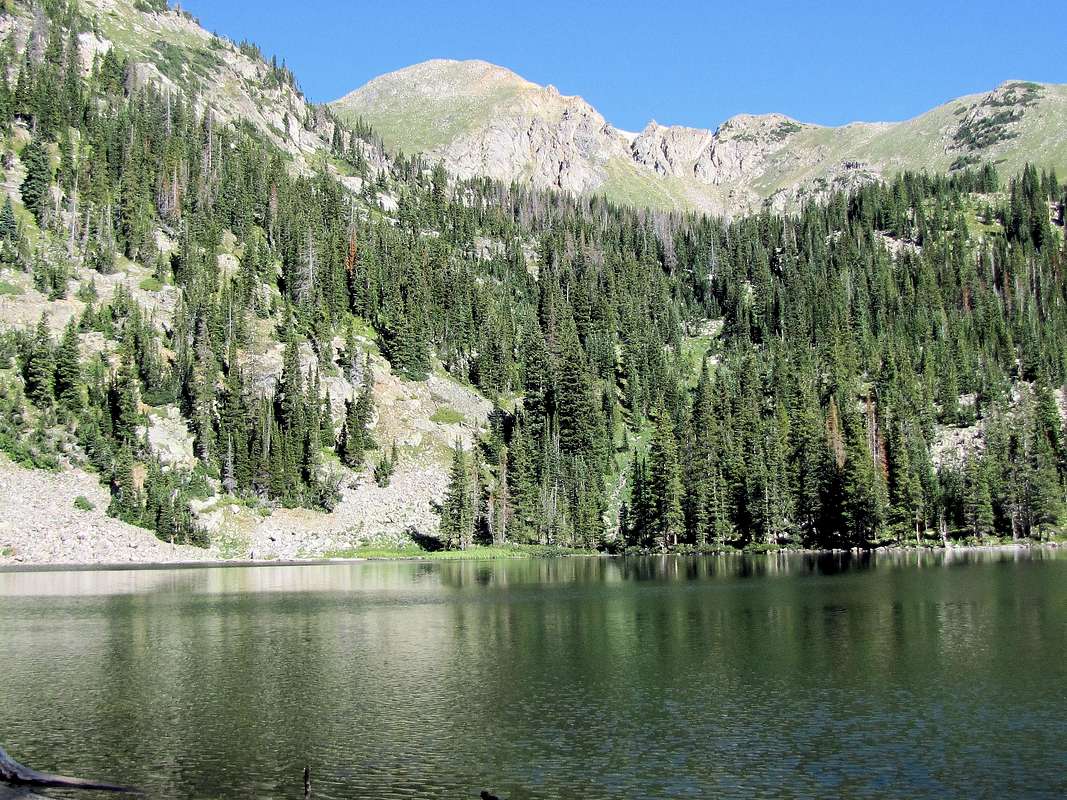
Blue Lake and the summit of Bowen Mountain
Getting There
Bowen/Baker Trailhead sits on Route 34 (Trail Ridge Road) a few miles north of the southwestern entrance of Rocky Mountain National Park.Route
All distances are per my GPS.At Bowen/Baker Trailhead, the trail headed west crossing the Colorado River Valley. The tip of Point 12442 ft could be seen to the west. At first I mistook it for Bowen Mountain.
 Colorado River Valley Colorado River Valley |
 Point 12422 ft & Mineral Point Point 12422 ft & Mineral Point |
At a signed junction, Baker Trail branched to the right. The trail continued left and soon exited Rocky Mountain National Park. It went up a little and began to traverse a slope heading south in a pine forest. After 2.7 miles, the trail reached a T. Left was probably a shortcut back to Route 34 to the nameless trailhead (Bowen Trail). I turned right and continued west up the trail in Bowen Gulch along the stream. The trail crossed the stream twice over a couple of bridges. I did not have any mountain views in that long section.
 |
 Bridge over Bowen Creek Bridge over Bowen Creek |
6.15 miles from trailhead, I reached the signed junction with Blue Lake Trail where I turned right. The trail traversed a meadow with pretty flowers.
 |
 |

Cascade Mountain came to view behind me.
 Cascade Mountain
After 7.1 miles, I reached Blue Lake. Bowen Mountain finally appeared. Its eastern ridge-top was cliffy and not a place I wanted to hike.
 Bowen Mountain & Blue Lake
I looked for a trail beyond the lake but did not find one. Went to the east and north side of the lake and began to whack my way up the slopes through a forest and a boulder field.
 Bushwhacking in the forest Bushwhacking in the forest |
 Blue Lake Blue Lake |
 Bowen Mountain
Longs Peak could be seen to the far east.
 Longs Peak
Looking back at Blue Lake.
 Blue Lake
At around 11200 ft of elevation, I reached a fairly flat area at the base of the peak where there was a small pond.
 Bowen Mountain
The rough looking eastern ridgeline.
 Ridgeline to the east of Bowen Mountain
I went toward the grassy slopes and followed them to the top.
 Summit Summit |
 Summit Summit |
Point 12084 ft to the south of Bowen Mountain.
 Point 12084 ft
Views from the summit.
 Blue Lake Blue Lake |
 Granby Lake Granby Lake |
 Cascade Mountain Cascade Mountain |
 Parkview Mountain Parkview Mountain |
 Fairview Mountain Fairview Mountain |
 Baker, Stratus, Nimbus, Cumulus etc Baker, Stratus, Nimbus, Cumulus etc |
 Specimen Mtn, Grand Ditch seen Specimen Mtn, Grand Ditch seen |
 Ruby Mtn & Lake Ruby Mtn & Lake |
 Longs Peak