
-
 9161 Hits
-
 84.82% Score
-
 19 Votes
|
|
Mountain/Rock |
|---|---|
|
|
38.09776°N / 107.53013°W |
|
|
Hinsdale |
|
|
13241 ft / 4036 m |
|
|
Overview
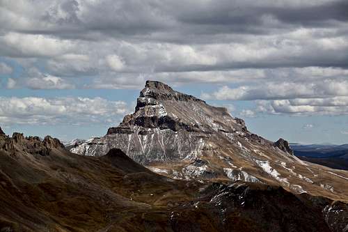
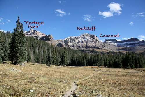 West Fork Trail with overawe of peaks
 Fortress Peak just below the summit
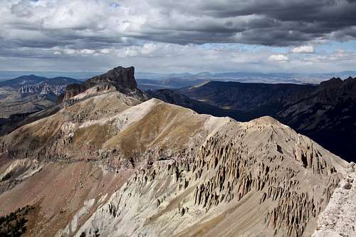
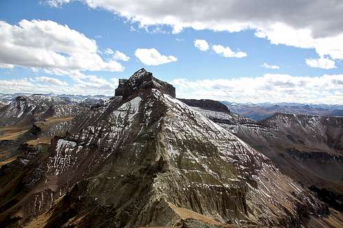
The summit offers excellent views in all directions, especially over Chimney Rock and Courthouse on your way up, Redcliff and Precipice Peak. Once on the top you get great views south towards Uncompahgre Peak and Wetterhorn.
I hiked up the peak in the fall, so no wildflowers. West Fork Valley is a popular place for wildflower seekers during the peak summer months.
![Chimney Rock]() Chimney Rock
Chimney Rock![Road to Owl Creek Pass]() Road to Owl Creek PassTrailhead : West Fork Cimarron River, elevation: 10,750 feet
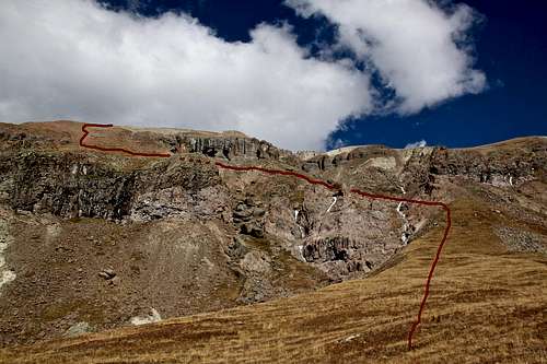
Road to Owl Creek PassTrailhead : West Fork Cimarron River, elevation: 10,750 feet![Route up Fortress Peak]() Route up Fortress Peak
Route up Fortress Peak![Traverse below cliffs]() Traverse below cliffsAs any mountain there are several routes up it. Fortress Peak is a little bit tricky because it is guarded by steep walls and cliffs on many sides. West Ridge provides a relatively easy access and not too challenging: class 2+.
Traverse below cliffsAs any mountain there are several routes up it. Fortress Peak is a little bit tricky because it is guarded by steep walls and cliffs on many sides. West Ridge provides a relatively easy access and not too challenging: class 2+.
Alternate Names: "U 3"
Guide to the Colorado Mountains with Robert Ormes (sort of a Bible of Colorado Mountains) briefly mentions the peak: “For Peak 13,241’ (Fortress Peak), leave the West Fork Trail about a mile from the trailhead and climb around the right - hand side of the prominent buttress to the ridge above".
Colorado Rank: 446
Wilderness: Uncompahgre
Parent Lineage: Redcliff
Nearby Peaks:
- Redcliff 0.75 miles
- Coxcomb Peak 1.24 miles
- Precipice Peak 1.50 miles
- Unnamed 13206 1.66 miles
- “Heishorn” 1.70 miles
- “El Punto” 1.75 miles
- Unnamed 13340 1.87 miles
- Matterhorn Peak 2.92 miles
- Wetterhorn Peak 2.77 miles
- Uncompahgre Peak 4.12 miles
Getting There
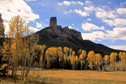 Chimney Rock
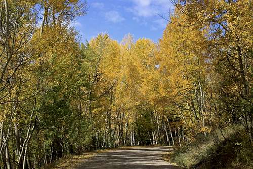 Road to Owl Creek Pass
There are two ways to access the upper West Fork of the Cimarron River. One comes in off US 550 from a little north of Ridgway and the other comes in from US 50 and goes by Silver Jack Reservoir. This is a well kept graded dirt road passable by passenger vehicles. It is very popular in the autumn when aspen are changing colors.
From US 550 turn east onto Country Road 10, well marked for Owl Creek Pass. Stay on CR 10, eventually you will turn onto CR 8. A little further up the valley, the road makes a sharp switchback and begins gaining elevation more seriously through open scrub oak terrain. It takes about 45 min to drive to the top of Owl Creek pass. Consider stopping at the “True Grit” meadow with nice views of Courthouse and Chimney Rock. True Grit film from 1969 with John Wayne was filmed here.
At the top of Owl Creek Pass, there’s a small, unofficial camp area on the north side of the road. Continue down east to the first turnoff you see, less than a half mile from the pass. The turn off is well marked for the West Fork of the Cimarrown (=FR 860). Drive up this usually good road that offers several possible campsites all the way to the Courthouse trailhead (about 1.7 miles from CR 8). A short distance past the trailhead, passenger cars will need to stop. The main road veers to the right and becomes much worse.
If you have 4 WD with good clearance, continue south up the road as it goes up a steep, rocky section. in 0.75 miles, it drops down a little and makes a sharp left to a ford of the West Fork. There are some good campsites here. From the stream crossing it is another 0.7 mile to the trailhead. It is the end of the road.
If coming from Gunnison by way of US 550 turn south on County Road/Forest Road 858 that goes to the Silverjack Reservoir. It's 22 miles on a graded, dirt road.
Route
 Route up Fortress Peak
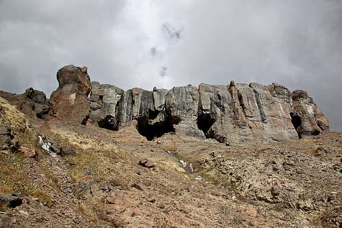 Traverse below cliffs
Climb13ers provides a good description and you can use their link to obtain their information (they provide maps, GPS co-ordinates etc.).
I missed this route, and found a little different approach, which I would rate as class 2, possibly 2+. I followed the the West Fork trail for a greater distance than the one mile recommended in above mentioned link. I suddenly realized that I saw Redcliff and went too far west, so I left the trail and started bushwhacking south and east on mostly grassy slopes with some fallen trees. I had to cross several drainages. The walking was easy even though it was off the trail. Eventually, I ended up on a high meadow with a nice overview of the western slopes of Fortress Peak (see photo on the left). I could even see the route described by Climb13ers, but could not get there. Between my meadow and their route was a very deep gorge with nearly vertical wall. So, I continued further up and was able to find a relative easy way through the cliffs on mostly grassy slopes with some scree. I had to cross several drainages with frozen water (October). I traversed below some cliffs with caves (see photos right) and joined the faint trail in the scree going up the slopes. The views were spectacular especially over Redcliff, Precipice Peak, Chimney Rock with Courthouse and higher up of Wetterhorn and Uncompahgre Peak.
The summit is decorated with a nice cairn and summit register.
 Precipice Peak Precipice Peak | 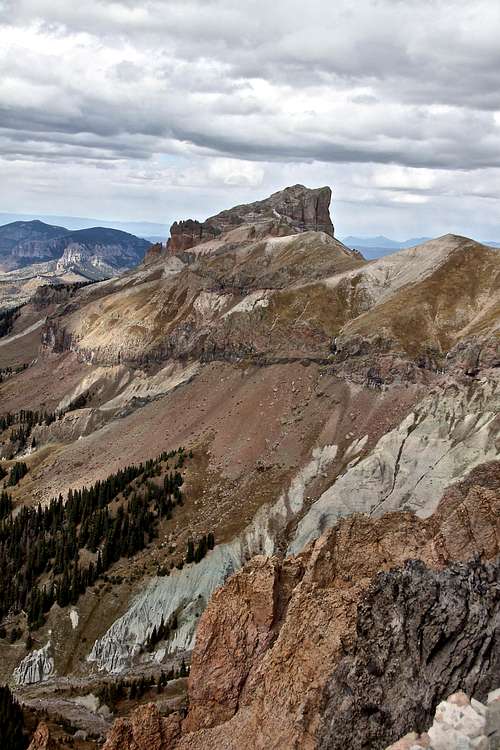 Precipice Peak Precipice Peak | 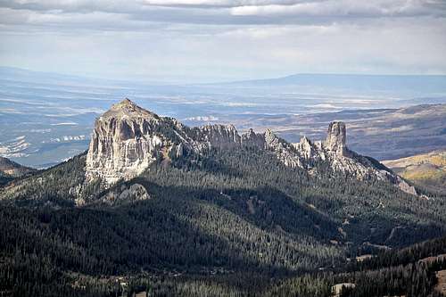 Courthouse and Chimney Rock Courthouse and Chimney Rock |
 Uncompahgre Peak Uncompahgre Peak | 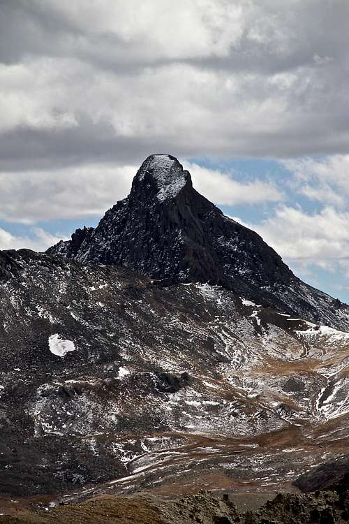 Wetterhorn Peak Wetterhorn Peak | 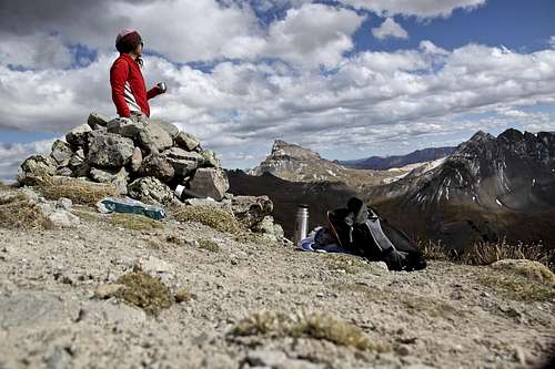 Summit cairn Summit cairn |
 Redcliff Redcliff | 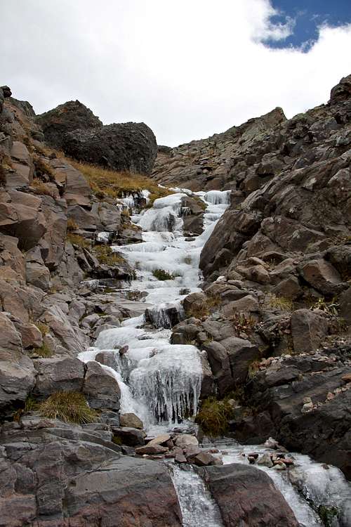 Frozen gullies Frozen gullies | 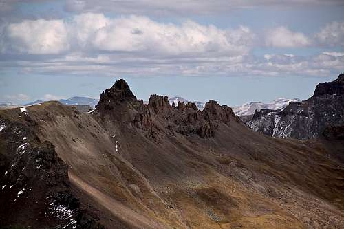 El Punto El Punto |
Red Tape
Driving, parking and hiking is for free, even the camping.
Rules of Uncompahgre Wilderness apply: Motorized equipment prohibited, even bicycles, hang gliders. Entering the wilderness is limited to a max of 15 people per group.