
-
 10691 Hits
-
 78.27% Score
-
 9 Votes
|
|
Mountain/Rock |
|---|---|
|
|
39.46270°N / 106.6354°W |
|
|
Eagle |
|
|
Hiking, Mountaineering, Skiing |
|
|
Spring, Summer, Fall, Winter |
|
|
12050 ft / 3673 m |
|
|
Overview
Charles Benchmark, also known as Charles Peak, is located at the western edge of the beautiful Holy Cross Wilderness of the Northern Sawatch Range. Charles Peak has low angle south and west faces, but its north face is quite steep.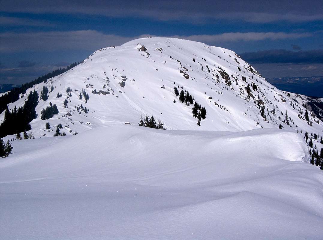
Charles Benchmark from the east
Charles is a low twelver, but ranked, coming in at 1282 highest in the state.
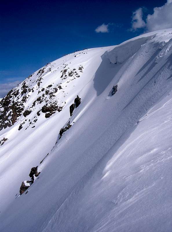
Charles Benchmark from the northwest
The summit provides great views of its parent, Fools Peak, peaks north of East Brush Creek: Gold Dust Peak, New York Mountain, "North Gold Dust", "Pika Peak", 12525 & 12940 C & the lovely Elk Mountains to the south.
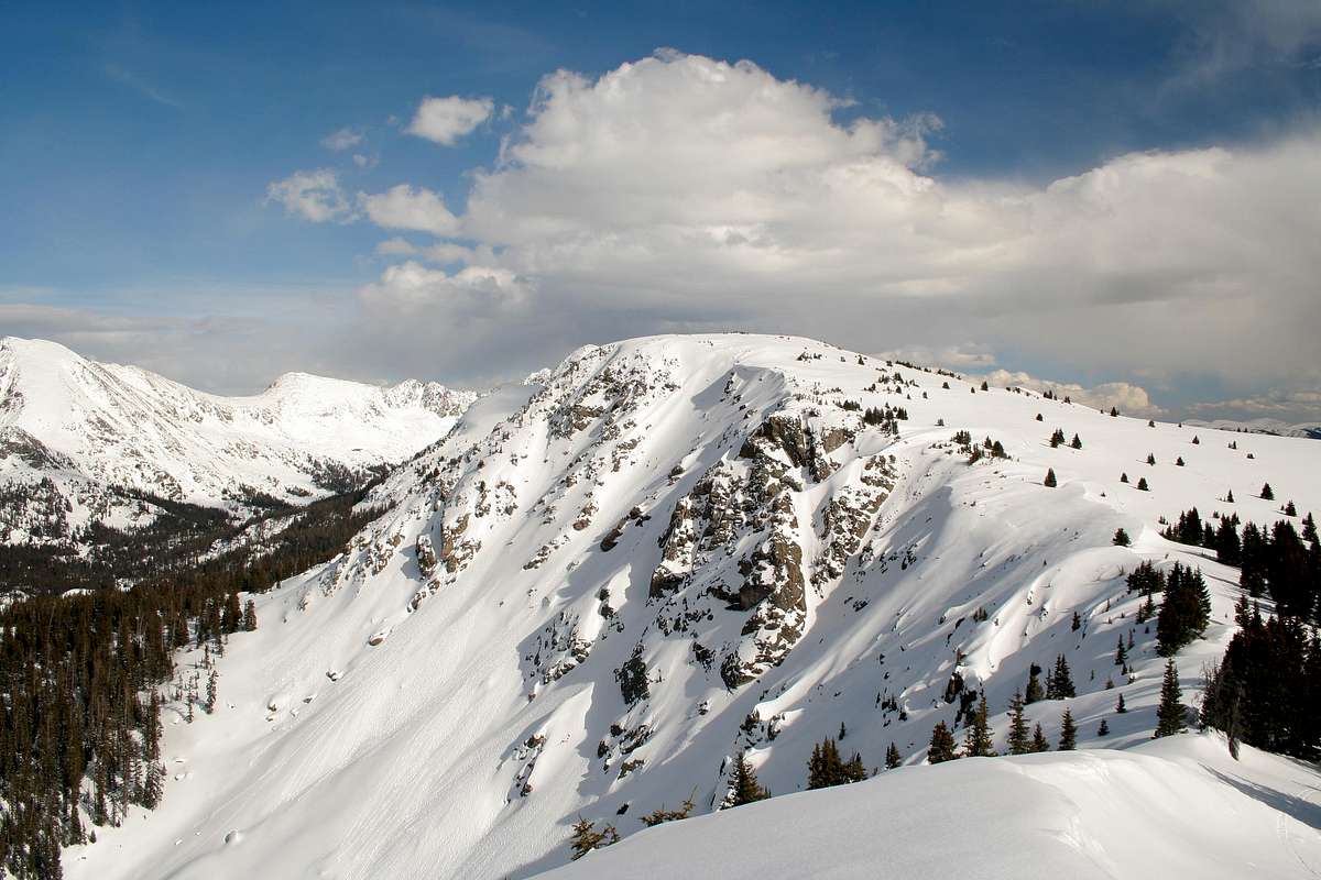
Charles Benchmark from "Prospect Peak"
Getting There
Summer
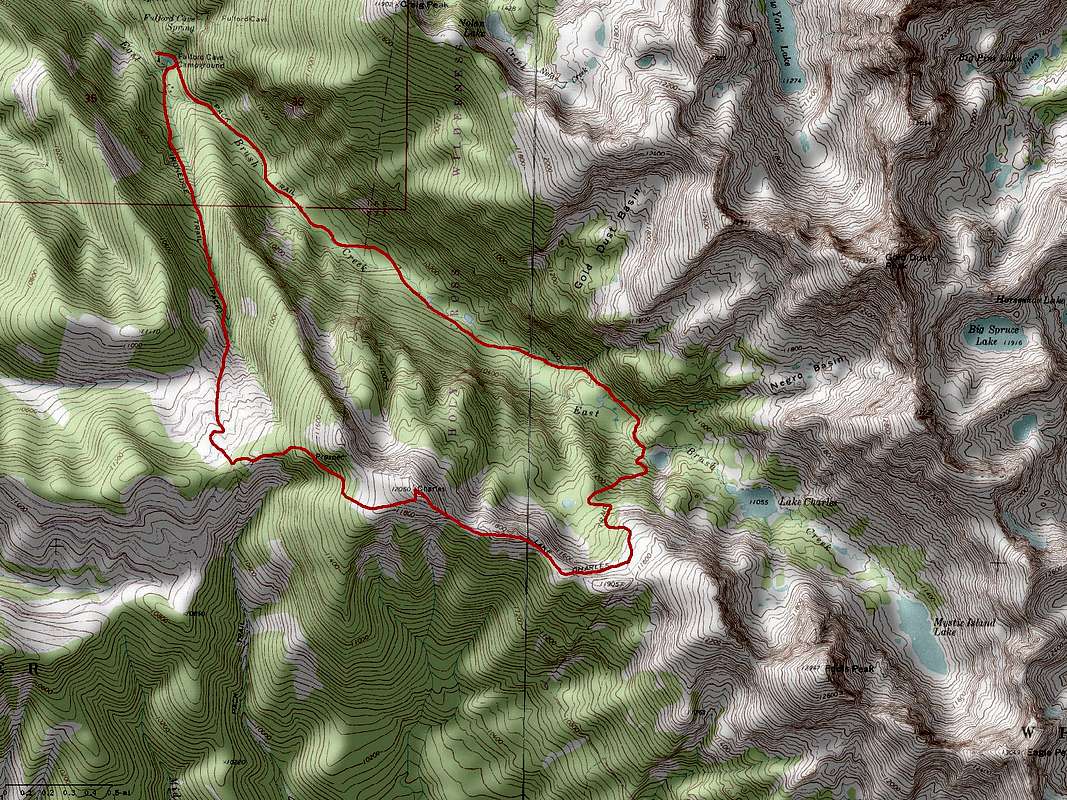
Take exit 147 from Interstate 70, continue on US 6. Turn left on Capitol. Turn left onto Brush Creek Road. Turn left onto East Brush Creek Drive. Follow to road closure at Fulford Campground. Hike either the Ironedge or Lake Charles Trails. Click on map to enlarge.
Charles Benchmark from Fulford Campground
Fall, Winter & Spring
Snow closure is in Yeoman Park, 5.6 miles from the Brush Creek & East Brush Creek Road intersection. Charles Peak is still daytripable, but is easier with an overnight stay at the Peter Estin Hut, especially if attempting Fools Peak in conjunction. Charles offers a beginner ski descent off its west face and advanced ski descents of its east and north faces down into East Brush Creek.