
-
 7104 Hits
-
 78.27% Score
-
 9 Votes
|
|
Mountain/Rock |
|---|---|
|
|
39.07948°N / 106.57707°W |
|
|
Lake&Pitkin |
|
|
Hiking, Mountaineering |
|
|
Spring, Summer, Fall, Winter |
|
|
13198 ft / 4023 m |
|
|
Overview
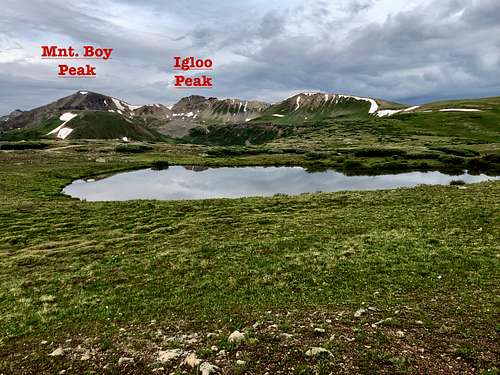
 Mountain Boy Peak
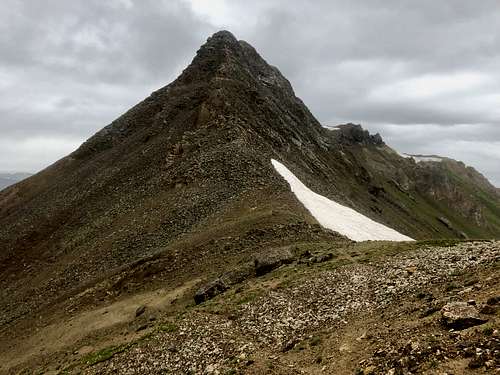 Igloo Peak
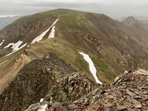
Igloo Peak has a soft rank, elevation 13,060 feet. The saddle between Igloo Peak and Mountain Boy Peak is only 280 feet deep. Another 20 feet more and it would have changed Igloo's status to a ranked summit. Both peaks appear extremely easy when one looks from Independence Pass. There is a nice trail up there. But to my surprise I found a great scrambling on the south side of Igloo Peak. Igloo Peak looks really impressive from Mountain Boy Peak.
This is a highly recommended adventure for those having only a short time. Both peaks are located on Continental Divide.
Independence Pass is a scenic historic byway, part of state Highyway 82. It is paved, narrow and winding, open only seasonally (typically closes with the first heavy snow fall in October and reopens after Memorial Day). The Independce Pass is located 19 miles east of Aspen. The elevation at the summit of Independence Pass is 12,095 feet. There are many peaks to be climbed along Independence Pass Road.
Parent Lineage: Grizzly Peak
Class: 2 (by its easiest route).
Colorado Rank (Mountain Boy Peak): 491
Wilderness: Collegiate Peaks
Nearby Peaks (from Mountain Boy Peak):
- Igloo Peak 0.50 miles
- Grizzly Peak A 2.79 miles
- Unnamed 13500 3.29 miles
- Unnamed 13090 3.47 miles
- Unnamed 13660 B 3.51 miles
- Garfield Peak A 3.52 miles
- Lackawanna 3.62 miles
- Truro Peak 3.73 miles
- Twining Peak 3.88 miles
 Mountain Boy and Igloo Peaks
Getting There
From Aspen (west): continue on Highway 82, well marked road for Independence Pass to the summit of the pass. The distance is about 20 miles and give it plenty of time. The road is very popular and there could be a lot of traffic. Some sections of the road are narrow, so only one vehicle can pass at a time. Keep in mind that road is open from Memorial Day (roughly) to the first big snow of the season (October/early November). The road is paved.
From Twin Lakes (east): again continue through a small historic community of Twin Lakes west for 17 miles to the summit of Independence Pass.
The road is very scenic and there is multitude of peaks to be accessed from this road, including the Colorado's highest Mount Elbert.
Route
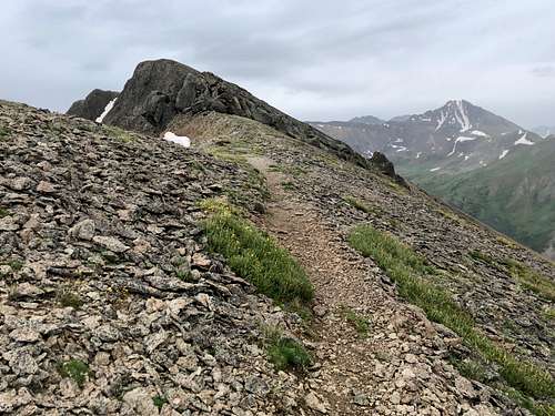 Trail up Igloo Peak from Independence Pass
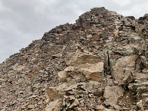 Igloo's nasty south side
The descent from Igloo Peak towards Mountain Boy is nasty. If you continue directly along a ridge, you get cliffed out. I was looking down the cliff and it appeared climbable if you don't mind extremely loose rock and exposure. It was raining and I opted out to bypass these cliffs on the south side. The terrain was loose scree. I traversed towards the saddle between Igloo and Mountain Boy and here I picked up a trail and took it to the summit of Mountain Boy Peak. The rest of the way was easy. The summit of Mountain Boy Peak had a nice cairn and summit register was a plastic Gatorate bottle. I did not bother trying to get the log (a few pieces of paper out). It was raining and the views were limited. Grizzly Peak appears majestic from here. I returned the same way. The scree on the south side of Igloo Peak was much easier on the way up. You can avoid bypass Igloo Peak and drop into the Mountain Boy Park, but 2019 year was snow rich year and there was large cornices guarding this option.
Red Tape
Driving Independence Pass Road is free, also parking at the summit. Expect lots of cars on the road and slow driving during the season.
When to Climb
Summer and early autumn when the Indepence Pass Road is open are obviously the easiest time. Winter and spring mean a long access through avalanche terrain. Always check avalanche conditions prior venturing out.
The peaks are located within Collegiate Peaks Wilderness. Wilderness rules apply: Leave No Trace.
Camping
There are many developed campgrounds along Independence Pass Road. I have slept several times in my car along the road and even on the top of the pass. There is a vault toilet at the summit of Independence Pass.
- Difficult Campground: located 5 miles SE of Aspen. You can make reservation here. For information click here.
- Weller Campground: first come-first serve camping, 5 day limit, about 8 miles east of Aspen, info here.
- Lincoln Gulch Campground: 11 miles SE from Aspen, first come -first serve camping, info here.
- Twin Peaks Campground: on the east side of the pass, info here.
- Lost Man Campground: directly across Lost Man Trailhead. Info here.
- Parry Peak Campground: on the east side of the pass. Info here.
External Links
- Mountain Boy Peak on List of John
- Igloo Peak on List of John
- Mountain Boy Peak on 13ers.com
- Igloo Peak on 13ers.com
- Independence Pass
- Collegiate Peaks Wilderness