
-
 6874 Hits
-
 88.19% Score
-
 26 Votes
|
|
Mountain/Rock |
|---|---|
|
|
45.66710°N / 7.02404°E |
|
|
10699 ft / 3261 m |
|
|
Overview
Atypical and irregular pyramid, positioned on the long crest that from the topographical knot among du Lac Pecks at her (3.405m) and the Testa of the Rutor or Ruitor, (= Rutor Head; 3.486m; between France and Valley of Aosta) it comes down to the small Group of the Mont Paramont, leaning out on the Central Valley of the Dora (= Stream) Baltea above the inhabited area of Derby Village and crossing the whole watershed among the Valleys of La Thuile/Valgrisenche. Before advanced to S, after the of Planaval Pass (3.016m), from the Point Chenal (3.207m) and from the twin one, also for almost equal height, he Pecks at Black (3.262m), it anticipates the crest that, with a last rise, it touches at first the Small Paramont or Quota about 3.230m~ to become exhausted themselves on the Peak of the Mont Paramont (3.301m), stings more elevated than the mini and attractive group to N of the great glaciers of the well more important GROUP of the Rutor. Toward NW introduces a glacial slant of modest steepness, to SW it goes down with a small wall divided by a gully of around 160/70 meters, while to East it allows to fall a repulsive wall of over 400m, incumbent on the Fond Valley. Enough easy trip, not dangerous and even too much fatiguing, if completed in day with departure from the Albert Deffeyes Refuge (2.494m); intense excursion and of good person "endurance", if effected in day with beginning from the small center of La Joux (1.607m). Discreetly frequented in general, above all for the practice of the ski-mountaineering, but less popular than the ascent to the Mont Paramont. Spacious sights toward S on the sea of ices among the Head of the Rutor, Becca of the Loch and the Great Assaly, while toward North the views are an a little limited by the most elevated and near pyramid of the Paramont, on which a beautiful glimpse is had.
Atipica piramide irregolare, posizionata sulla lunga cresta che dal nodo topografico fra la Becca du Lac (3.405 m) e la Testa del Rutor o Ruitor, (3.486 m; tra Francia e Valle di Aosta) discende al piccolo Gruppo del Mont Paramont, affacciandosi sulla Valle Centrale della Dora Baltea, sopra l'abitato di Derby, e percorrente lo spartiacque intero fra le Valli di La Thuile/Valgrisenche. Precededuta a S, dopo il Passo di Planaval (3.016 m), dalla Punta Chenal (3.207 m) e dalla gemella, anche per quasi pari altezza, Becca Nera (3.262 m), anticipa la cresta che, con un ultimo rialzo, tocca dapprima il Piccolo Paramont o Quota 3.230 m~ per esaurirsi sulla Vetta del Mont Paramont (3.301 m), punto più elevato del minusculo e grazioso gruppo a N dei grandi ghiacciai del ben più importante GRUPPO del Rutor. Verso NW presenta un pendio glaciale di modesta ripidezza; a SW scende con una piccola parete divisa da un canalone di circa 160/70 metri, mentre ad Oriente lascia cadere una parete repulsiva di oltre 400 metri, incombente sul Vallone del Fond. Gita abbastanza facile, non pericolosa e neppure troppo faticosa, se compiuta in giornata con partenza dal Rifugio Albert Deffeyes (2.492 m); escursione intensa e di buona "endurance", se effettuata in giornata con inizio dal piccolo centro di La Joux (1.607 m). In generale discretamente frequentata, soprattutto per la pratica dello sci-alpinismo, ma meno popolare dell'ascensione al Mont Paramont. Viste spaziose verso S sul mare di ghiacci tra la Testa del Rutor, la Becca du Lac e la Grande Assaly, mentre verso Settentrione le vedute sono un poco limitate dalla più elevata e vicina piramide del Paramont, sul quale si ha un bel colpo d'occhio.

First Ascents
- First on the summit: Giovanbattista Origoni and Giuseppe Origoni, (Sep 02th, 1891), in ascent.
- First ascent in winter: Unknown.
- W-NW Slope: Giovanbattista Origoni and Giuseppe Origoni, (Sep 02th, 1891), in ascent from Invergneures Point.
- S Crest: Giovanbattista Origoni and Giuseppe Origoni, (Sep 02th, 1891), in descent.
- SW Face: Osvaldo Cardellina, Ivo Chuc and Camillo Roberto Ferronato, (Jul 20th, 1996), in descent.
- W-NW Crest: Osvaldo Cardellina, lone, (Jul 09th, 1998), in descent.
- First Traverse from Planaval Pass - Chenal Point - Becca Nera - Becca Bianca - Invergneures Points: Osvaldo Cardellina, lone, (Jul 09th, 1998).
- Great Traverse from Baulin Village to Baulin: Mollette Pass - Mont Pit - Mont Paramont (by NE Ridge) - Little Paramont - Becca Bianca - Becca Nera - Chenal Point-Planaval Pass: Osvaldo Cardellina, Ivo Chuc and Camillo Roberto Ferronato, (Jul 20th, 1996).
 |
 |
 |
 |
 |
Getting There
BY CAR:
- From the Morgex exit of Motorway A5 (921m), continue for about 3 km on SS.26 towards Pré Saint Didier (1.017m). SS.26 becomes the main street of the small city and then continues toward Colle del Piccolo San Bernardo (2.188m). After several hairpins, and past the Villages of Elevaz (1.302m) and la Balme (1.309m) reach the famous ski resort of La Thuile (1.441m). Turn left on the bridge that crosses Dora di La Thuile in the direction of the Village of La Joux. After about 2 km from the bridge, having past a large square, cross another bridge on the Dora to the right. (From this point on, the road, although paved, is quite narrow. Proceed with caution.) After 1 km get to La Joux (1.607m) and park in one of the two parking lots, which are large but sometimes fill up in August. For this reason, access past the second bridge is limited at certain times. Be there before 9 AM to avoid problems, or take the shuttle bus to cover the last stretch.
IN AUTO:
- Dall'uscita dell'Autostrada A5 nel Comune di Morgex (921 m) proseguire per circa 3 km lungo la SS.26 verso il Paese di Pré Saint Didier (1.017 m), addentrarsi nella via centrale del paese e proseguire sempre lungo la SS.26 che porta al Colle del Piccolo San Bernardo (2.188 m). Dopo numerosi tornanti e superate le Frazioni di Elevaz (1.302 m) e la Balme (1.309 m) si giunge alla famosa località sciistica di La Thuile (1.441 m), svoltare a destra sul ponte che attraversa la Dora di La Thuile e dirigersi verso la Frazione di La Joux (1.607 m). Dopo circa 2 km e superato un ampio piazzale, riattraversare sempre sulla destra un altro ponte sulla Dora (attenzione da questo punto la strada, seppur asfaltata, è molto stretta, procedere con cautela) e dopo circa 1 km. si giunge a La Joux (1.607 m), qui posteggiare l'auto in uno dei due ampi parcheggi a volte insufficienti nel mese di agosto. Per questo motivo relativamente al tratto dopo il secondo ponte c'è una limitazione oraria all'accesso dei mezzi privati, che comunque non tocca chi arriva prima delle 9. In alternativa esiste comunque una navetta bus.
BY PLANE:
-
Aeroporto "Corrado Gex" Saint Christophe (Aosta).
Approach from La Thuile
To begin the slope toward the Shelter Albert Deffeyes on the path in front of the "Cafe of the Falls" marked with the n° 3/High Route 15, after having gone beyond a bridge in wood on the left and later around 0h'15 you'll come to the First of the three spectacular Rutor Falls. Continue along the path and go beyond (on the left) the Parchet Alp (1.770m) set on the right (South), a first brooklet, the Plan Fruitier Alp (2.810m around) and another following small torrent, deriving respectively from the Preuvé Comba (= Basin) and from the Combassa. * Plan Fruitier Immediately detaches later him toward right (Or) a brief ramification towards the" Belvedere", near the quota 1.851m), under the Second and the Third Fall of the Rutor and above the Comba Sozin, deserving of visit through a small and easy digression from the street for the Albert Deffeyes Refuge (E; 0h'15). To always continue along the path what time it climbs him to terraces and, later around 0h'55 the Second Fall is gone beyond (signalled by a poster and not visible from the principal path). Later around as many 0h'15 the poster of the Third Fall meets him (1.996m); go up on the steep trail for other 0h'20, here the path divides him. To take that on the left (East-northeast) well signalled that it conducts to the Albert Deffeyes Hut, after having left (Northeast) immediately towards the entrance into Ussellettes Valley. ** VARYING of TRIP in case of uncertain time or I win: that of right branch, numbered 8/High Route n° 2, door to the two magnificent Lakes of Bella Comba, the most greater of wich to quota 2.379m and the other as soon as under to quota2.378m. The first one, positioned to Western, it is characteristic for a big boulder in his center to form of huddled up mouse (Besides see in SP Mont Charve; E; 2h'00/2h'15). To actually go up again to the Collar (2.130m), for then to slightly go down on the right and continue up to the Loch Glacier (2.143m); go beyond the bridge in wood that overhangs the emissary of the lake and, leaving on the right the homonym pasture (2.158m), to start over decidedly climbing along ample and wide hairpins bends up to reach the plateau through a run first semicircular to of it (Northeast)and subsequently toward and-if (East-southeast), where site is the Shelter Albert Deffeyes (2.494m), not after having just abandoned first to the left (Northeast) the path n° 15/High Route n° 2 that sindirizza towards the Ussellettes Valley (itinerary to be faced in the following day for Becca Bianca at her). This is a good place to spend the night (2h'45/3h'00' from La Joux).
Iniziare la salita verso il Rifugio Albert Deffeyes sul sentiero davanti al "Bar delle Cascate", contrassegnato con il n° 3/15, dopo aver oltrepassato un ponte in legno sulla sinistra e dopo circa 0h'15 si incontra la Prima del tre spettacolari Cascate del Rutor; proseguire lungo il sentiero e oltrepassare (sulla sinistra) l'Alpeggio di Parchet posto sulla destra o S (1.770 m), un primo torrentello, l'Alpeggio di Plan Fruitier (2.810 m circa) ed un atro successivo piccolo torrente provenienti rispettivamente dalla Comba Preuvé e dalla Combassa. * Subito dopo Plan Fruitier si distacca verso destra (O) una breve diramazione adducente al "Belvedere", presso la quota 1.851 m, sotto la Seconda e la Terza Cascata del Rutor e sopra la Comba Sozin, meritevole di visita tramite una piccola nonché facile divagazione dalla via per il rifugio Albert Deffeyes (E; 0h'15). Continuare sempre lungo il sentiero che ora si inerpica a gradoni e, dopo circa 0h'55, si oltrepassa la Seconda Cascata (segnalata da un cartello e non visibile dal sentiero principale). Dopo circa altrettanti 0h'15 si incontra il cartello della Terza Cascata (1.996 m); continuare sul ripido sentiero per altri 0h'20; qui il sentiero si divide. Prendere quello sulla sinistra (E-NE) ben segnalato che conduce al Rifugio Albert Deffeyes, dopo aver lasciato subito a sinistra (NE) il Vallon des Usselletes. ** VARIANTE di GITA in caso di tempo incerto o cattivo: quello di destra recante il n° 8/Alta Via n° 2 porta ai due magnifici Laghi di Bella Comba, il maggiore dei quali a quota 2.379 m e l'altro appena sotto a quota 2.378 m; il primo, posizionato ad Occidente, é caratteristico per un gran roccione nel suo centro a forma di topo rannicchiato (Vedere inoltre in SP Mont Charve; E; 2h'00/2h'15). Risalire sino al Colletto (2.130 m), per poi scendere leggermente sulla destra e proseguire fino al Lago Glacier (2.143 m); oltrepassare il ponticello in legno che sovrasta l'emissario del lago e, lasciando sulla destra l'omonimo alpeggio (2.158 m), riprendere a salire decisamente lungo ampi tornanti fino a raggiungere l'altipiano tramite un percorso semicircolare prima a NE e successsivamente verso E-SE, dove è sito il Rifugio Albert Deffeyes (2.494 m), non dopo aver abbandonato appena prima a sinistra (NE) il sentiero n° 15/Alta Via n° 2 che sindirizza al Vallon des Ussellettes (itinerario da affrontare nel giorno seguente per la Becca Bianca). Qui giunti, conviene pernottare (2h'45/3h'00 da La Joux).
 |
 |
 |
 |
 |
Route
From the Albert Deffeyes Refuge to return back shortly toward of it with the path of the shelter; leaving to the left this (NW) to advance himself in the Comba (= small basin) des Ussellettes with the path n° 15/High Route n° 2 and to go up again her with the same one for the Passo Alto (2.859m). Continuous to, after having gone beyond a ruin, at first with the same direction then folding up more toward East, near the rates 2.502m. To abandon on the left (N) the steep ramification for the hill and to advance himself toward right in a small plateau debris, characterized by the presence of the Lakes of Ussellettes (in number of eight, the most greater of which to quota 2.754m and 2.762m); after having them old to go up again the inclusive valley among the Point of Invergneures (3.019m) to SW and the Head of the Paramont (3.140m) to of it, but mostly holding herself against this last. With run that increases in steepness and with the same street for Ussellettes's Pass (2.989m; by Standard Route for the Paramont) to reach the Glacier of Ussellettes to quota 2.950/3.000m around; to always cross it with direction being contemplating 3.160m to the Saddle, sets among the Mont Paramont and Becca Bianca at her. Don't reach her, on the contrary, gradually turning toward if, to actually go up again the easy one and snowy Northern Slope of this to the Peak. More recently, because of the progressive withdrawal of the glaciers, however the snowy mantle leaves always greater space to the breakthrough of small rocky bands (see photo in OVERVIEW) that, in presence of "verglass", they could constitute some unexpected difficulties. Under these conditions to expect a completely different and more binding ascension: *** in this case to mostly hold him on the right (West-southwest) with greater possibility to come upon him in crevasses bringing herself under the wall, where this introduces a less wide band of rocks, but rather steep (I°+/II°-; 40/45 meters). To overcome bringing her him (38°, even 40° along 20 meters) on the suspended and superior glacier. Doubling on the right a rocky islet, to continue for the W-NW Slope (30°/35°) snowy actually to the Summit and actually concluding easily more and more to the same (EE/A; F+; 1h'45/2h'15 from the hut; 5h'00/6h'00 from the Village of La Joux).
Dal Rifugio Deffeyes ritornare brevemente indietro verso NE con il sentiero del rifugio; lasciando questo a sinistra (NW), inoltrarsi nella Comba des Ussellettes con il sentiero n° 15/Alta Via n° 2 e risalirla con il medesimo per il Passo Alto (2.859 m). Continuare, dopo aver oltrepassato un rudere, dapprima con la stessa direzione poi piegando più verso Oriente, nei pressi della quota 2.502 m Abbandonare sulla sinistra (N) la più ripida diramazione per il colle ed inoltrarsi verso destra in un piccolo altipiano detritico caratterizzato dalla presenza dei Laghi di Ussellettes (in numero di otto, i maggiori dei quali a quota 2.754 m e 2.762 m); dopo averli superati risalire il vallone compreso tra la Punta di Invergneures (3.019 m) a SW e la Testa del Paramont (3.140 m) a NE, ma tenendosi maggiormente contro questa ultima. Con percorso che aumenta in ripidezza e con la stessa via per il Colle des Ussellettes (2.989 m; Via Normale per il Paramont) raggiungere il Ghiacciaio di Ussellettes a quota 2.950/3.000 m~; attraversarlo sempre con direzione E mirando alla Sella 3.160 m, posta tra il Mont Paramont e la Becca Bianca. Non raggiungerla, bensì, volgendo gradualmente verso SE, risalire il facile ed innevato Versante Settentrionale di questa sino alla Vetta. Più recentemente, a causa del progressivo ritiro dei ghiacciai, però il manto nevoso lascia sempre maggior spazio all'affioramento di piccole fasce rocciose (vedere foto in OVERVIEW) che, in presenza di "verglass", potrebbero costituire delle difficoltà impreviste. Con queste condizioni aspettarsi un'ascensione completamente diversa e sicuramente più impegnativa: *** in questo caso tenersi maggiormente sulla destra (W-SW) con maggior possibilità di imbattersi in alcuni crepacci portandosi sotto la parete, dove questa presenta una fascia di rocce meno estesa, ma abbastanza ripida (I°+/II°-; 40/45 m); superarla portandosi sul ghiacciaio sospeso e superiore (38°, anche 40° per 20 metri). Doppiando sulla destra un isolotto roccioso, continuare per il pendio W-NW (30°/35°) innevato sino alla Sommità e concludendo sempre più facilmente sino alla stessa (EE/A; F+; 1h'45/2h'15 dal rifugio; 5h'00/6h'00 dal Villaggio di La Joux).
Variant
From the last and more elevated one of the Lakes of Ussellettes (2.760m) to actually follow its tributary to a mini little pond to quota 2.885m~ and underlying the Invergneures Point (= Winter Slopes Point), subsequently directing herself, for deposits and snowfields, toward the homonym Point NW (3.019m); from this to easily enough cross to the Point if (3.054m) and, after a brief descent on Crest if, to lean on himself to the easy glacial slant W-NW and for this to the Summit, as they did in the first ascension of the peak in 1891 (same notes and same times of the preceding itinerary).
Dall'ultimo e più elevato dei Laghi d'Ussellettes (2.760 m) seguirne l'immissario sino ad un mini laghetto a quota 2.885 m~ e sottostante la Punta des Invergneures, dirigendosi successivamente, per detriti e nevati, verso l'omonima Punta NW (3.019 m); da questa attraversare abbastanza agevolmente alla Punta SE (3.054 m) e, dopo una breve discesa sulla sua Cresta SE, appoggiarsi al facile pendio glaciale W-NW e per questo alla Sommità, come fecero nella prima ascensione della vetta nel 1891 (stesse note e stessi tempi dell'itinerario precedente).
Difficulty
This route can be considered from F+ to PD-, according to the conditions of the slant snowy.
L'itinerario è classificato EE/A; da F+ a PD-, a seconda delle condizioni del pendio innevato.
Equipment
Ice axe, crampons and rope.
Piccozza, ramponi e corda.
Campings
Remember that free camping is forbidden (except for emergency reasons, over 2.500m, from darkness until dawn).
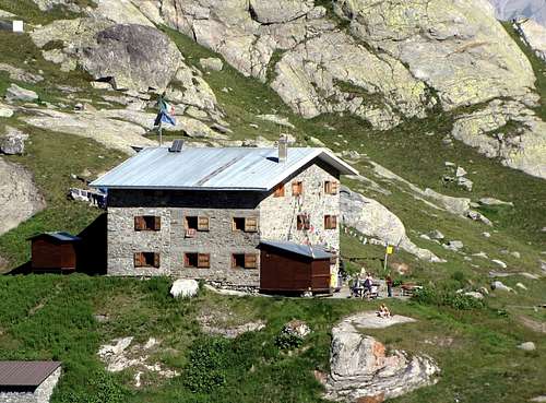
Huts
 |
Mountain Condition
- You can get meteo information at the official site of the Regione Valle d'Aosta:
- Valle d'Aosta Meteo
- Meteo: You can find more weather information on the website 3B Meteo:
- La Thuile
Webcam
- WEBCAM on Aosta Valley:
- Webcam
Books and Maps
BOOKS:
- "Guida delle Alpi Occidentali", di Giovanni Bobba e Luigi Vaccarone C.A.I. Sezione di Torino Volume II (parte II), 25 Maggio 1896.
- "Rifugi e bivacchi in Valle d'Aosta", di Cosimo Zappelli aggiornata da Pietro Giglio, Musumeci Editore.
- "I Rifugi della Valle d'Aosta" di Stefano Ardito, Ed. Guide iter, Febbraio 2003.
- "Guida dei Monti d'Italia–Alpi Graie Centrali" di Alessandro Giorgetta - Club Alpino Italiano/Touring Club Italiano, 1985 (in Italian).
- "80 itinerari di Escursionismo Alpinismo e Sci Alpinismo in Valle d'Aosta", di Osvaldo Cardellina, Ed. Musumeci, Giugno 1977 (in Italian); seconda Ed. Luglio 1981; terza Ed. Luglio 1984; (in French), prima Ed. Febbraio 1978; seconda Ed. Marzo 1980.
- "Diari Alpinistici" di Osvaldo Cardellina e Indice Generale accompagnato da Schedario Relazioni Ascensioni 1964-2019 (inediti).
 |
 |
 |
 |
 |
 |
MAPS:
- Kompass "Gran Paradiso Valle d'Aosta Sentieri e Rifugi", Carta turistica 1:50.000.
- L'Escursionista "La Thuile-Piccolo San Bernardo", (carta n° 2) 1:25.000.
- A.I.A.T. La Thuile, "La Thuile Pianta dei Sentieri", 2004 (Plastico).
- Carta Comunità Montana "Valdigne e Mont Blanc Les Sentiers", 2001 1:50.000.
- I.G.C. Istituto Geografico Centrale "Il Parco Nazionale del Gran Paradiso", 1:50.000.
- I.G.C. Istituto Geografico Centrale Torino "Monte Bianco-Courmayeur-Chamonix M.B.-La Thuile", (carta n° 107), 1:25.000.
- Studio F.M.B. "Monte Bianco-Mont Blanc", Bologna 1988 1:50.000.
 |
 |
 |
 |
Important Information
- REGIONE AUTONOMA VALLE D'AOSTA the official site.
- FONDAZIONE MONTAGNA SICURA Villa Cameron, località Villard de la Palud n° 1 Courmayeur (AO) Tel: 39 0165 897602 - Fax: 39 0165 897647.
- SOCIETA' DELLE GUIDE DI VALGRISENCHE
- COMPAGNIE DES GUIDES RUTOR Fraz. Entrèves tel/fax 0039.0165.885574 e-mail Guidealpine@lathuile.it
- A.I.NE.VA. (Associazione Interregionale Neve e Valanghe).
Useful numbers
- Protezione Civile Valdostana località Aeroporto n° 7/A Saint Christophe (Ao) Tel. 0165-238222.
- Bollettino Meteo (weather info) Tel. 0165-44113.
- Unità Operativa di Soccorso Sanitario Tel. 118.