
-
 9706 Hits
-
 89.39% Score
-
 29 Votes
|
|
Mountain/Rock |
|---|---|
|
|
45.63060°N / 7.10764°E |
|
|
Mountaineering |
|
|
10833 ft / 3302 m |
|
|
Overview
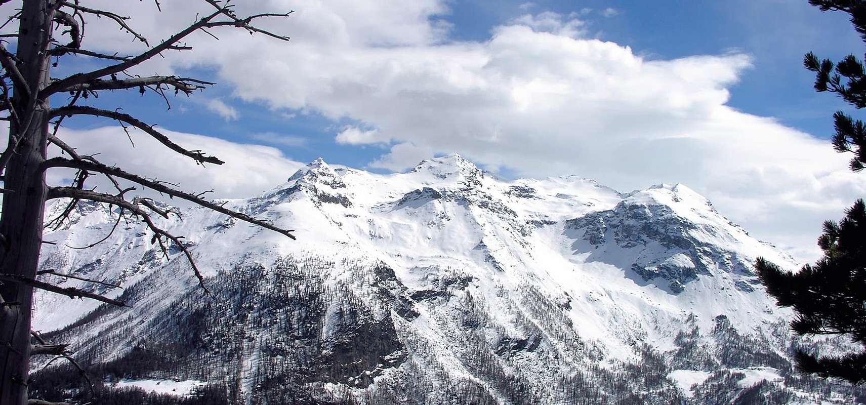
Important mountain, looking like a truncated pyramid, situated in the middle of the ridge dividing Valgrisenche and Val di Rhemes and well in full view from Aosta Town. This is also a classic spring ski-mountaneering trip.
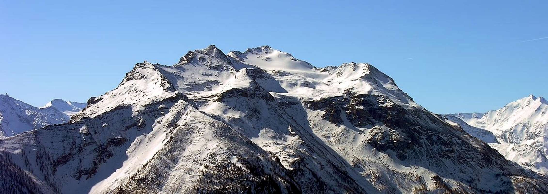
Importante elevazione a forma piramidale schiacciata al centro della dorsale che divide la Valgrisenche dalla Valle di Rhêmes, ben visibile ad ovest della Città di Aosta. E' anche una classica gita primaverile di sci alpinismo.
![]()
First Ascents
- First on the summit (W Slope): Captain Casalegno dello S. M. Sardo, (1932).
- First Winter: Unknown.
- First Ski: E. Giraudo N. Morino and R. Venco, (Nov 15th, 1948).
- E Slope: Unknown, (Giovanni Bobba?).
- S Arête (from col Tzaboc): Beniamino Henry and Friends, (1948).
- W Slope: Unknown.
Getting There
BY CAR:- From Torino, Milano, etc: Motorway A5. Exit at Aosta Ovest.
- From Switzerland: through the Grand Saint Bernard Tunnel or the namesake Pass.
- From France: through the Mont Blanc Tunnel or Petit Saint Bernard Pass: It is not necessary to take Motorway A5: you can drive on SS.26, in the direction of Leverogne.
- Aeroporto "Corrado Gex" Saint Christophe (Aosta).
Route
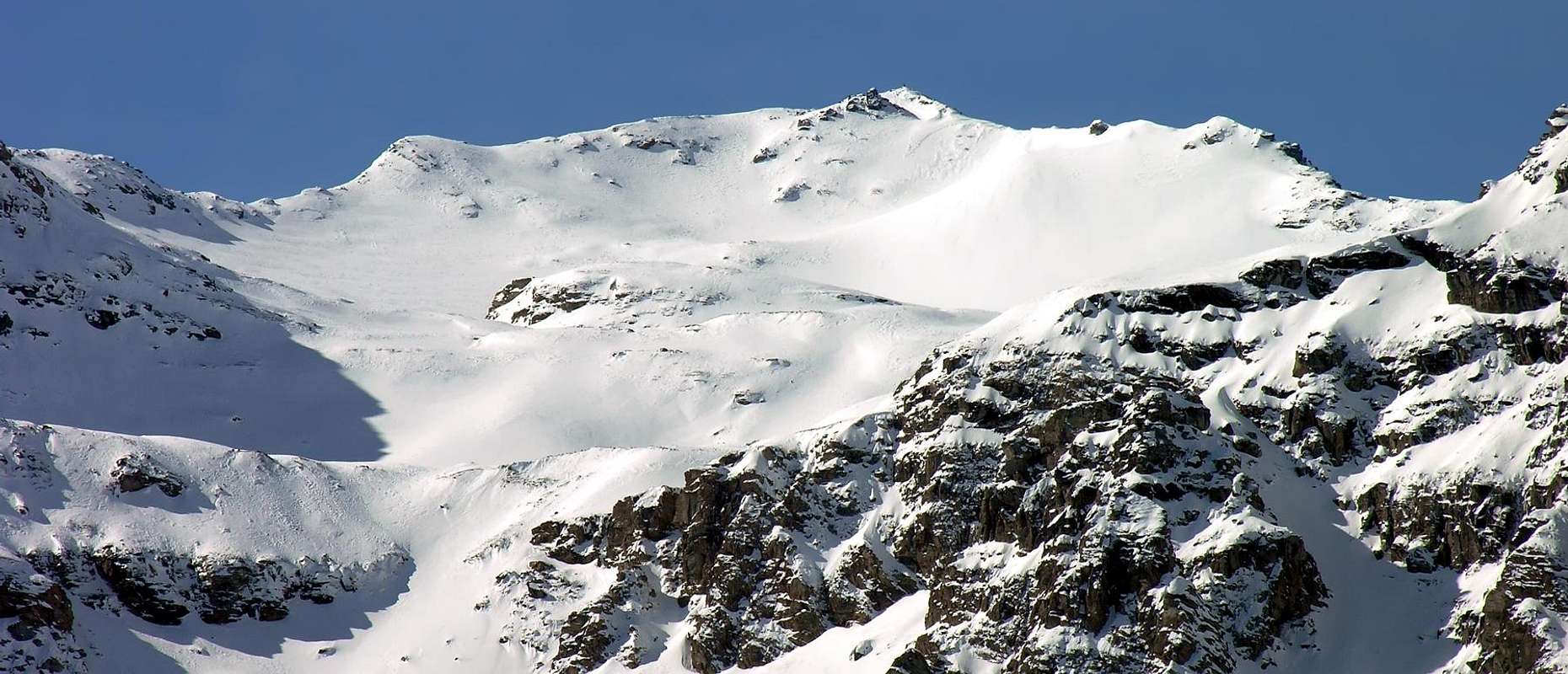
From Aosta (583m) follow along the SS.26 (Mont Blanc Road) and once near Leverogne (780m), turn on the left, entering the Regional Road of Valgrisenche. After the small Villages of Rochefort and La Ravoire you arrive in Chamençon where you have to turn on the left toward the small Village of Chamin (1.399m) where you can park your car. Here, crossing the woody slopes behind the houses, you arrive to an open ground (no paths or tracks) that allows to get the slopes leading to the Tos Glacier: on, straight along it, toward the summit. The difference in elevation is not low and the slopes are tiring so a good training and fit are required: time required from Chamin to the summit 5h'30/6h'00.Dalla Città di Aosta (583 m) si percorre la SS.26 per il Monte Bianco e giunti nei pressi dell'abitato di Leverogne (780 m) si imbocca sulla sinistra la Strada Regionale per la Valgrisenche, dopo aver superato le Frazioni di: Rochefort, La Ravoire e raggiunto Chamençon voltare a sinistra verso il Villaggio di Chamin (1.399 m). Da qui, attraverso i pendii boscosi alle spalle del villaggio, si raggiunge un terreno più aperto (senza tracce di sentiero), che consente di accedere ai pendii che accedono al Ghiacciaio di Tos; risalire il ghiacciaio puntando direttamente alla vetta della montagna. E’ una gita abbastanza lunga e faticosa che richiede una buona preparazione fisica. Tempo di salita da Chamin 5h'30/6h'00.
Difficulties
The rating is Easy (hiking) or BSA (ski-mountaneering).L'itinerario è classificato F. Per la sci alpinistica la classificazione è Buoni Sciatori Alpinisti (BSA).
Equipment
Mountaineering equipment including rope, and crampons.

|

|

|
Campings
Remember that free camping is forbidden (except for emergency reasons, over 2.500m, from darkness until dawn).
|
|

|
Mountain Condition
- Meteo: you can find all the needed informations at the official site of the Valle d'Aosta Region:
- Valle d'Aosta Meteo
Webcam
- WEBCAM on Aosta Valley:
- Webcam
Books and Maps
BOOKS:- "Guida della Regione Autonoma Valle d'Aosta" di Mario Aldrovandi; Ed. S.P.E. di Carlo Fanton, Torino 31 Dicembre 1964.
- "La Valle di Rhêmes" di Lorenzo Rossi di Montelera, Edizioni Tamari Bologna, Giugno 1978.
- "Guida delle Alpi Occidentali" di Giovanni Bobba e Luigi Vaccarone C.A.I. Sezione di Torino Volume II (parte II), 25 Maggio 1896.
- "Scialpinismo in Valle d'Aosta", di Pietro Giglio e Emile Noussan, Musumeci Editore 1993.
- "Guida dei Monti d'Italia–Alpi Graie Centrali" di Alessandro Giorgetta - Club Alpino Italiano/Touring Club Italiano, 1985 (in Italian).
- "Pelli di Foca in Valle d'Aosta", di Franco Lenzi Editoriale Pedrini, Torino 1988.
- "Dal Monviso al Sempione" di Roberto Aruga e Cesare Poma, Edizioni CDA Torimo, Maggio 1979.
 |
 |
 |
MAPS:
- Kompass "Gran Paradiso Valle d'Aosta Sentieri e Rifugi" Carta turistica 1:50.000.
- L'Escursionista "Valgrisenche Val di Rhêmes" Carta dei Sentieri" (carta n° 3) 1:25.000.
- I.G.C. Istituto Geografico Centrale "Parco Nazionale del Gran Paradiso" (carta n° 3) 1:50.000.
- Enrico Editore Ivrea-Aosta "Gruppo del Gran Paradiso" 1:50.000.
Important Information
- REGIONE AUTONOMA VALLE D'AOSTA the official site.
- FONDAZIONE MONTAGNA SICURA Villa Cameron, località Villard de la Palud n° 1 Courmayeur (AO) Tel: 39 0165 897602 - Fax: 39 0165 897647.
- SOCIETA' DELLE GUIDE DI VALGRISENCHE
- A.I.NE.VA. (Associazione Interregionale Neve e Valanghe).
Useful numbers
- Protezione Civile Valdostana località Aeroporto n° 7/A Saint Christophe (Ao) Tel. 0165-238222.
- Bollettino Meteo (weather info) Tel. 0165-44113.
- Unità Operativa di Soccorso Sanitario Tel. 118.
Acknowledgements
In addition I want to thank Gabriele Roth for the translation of the text from italian.