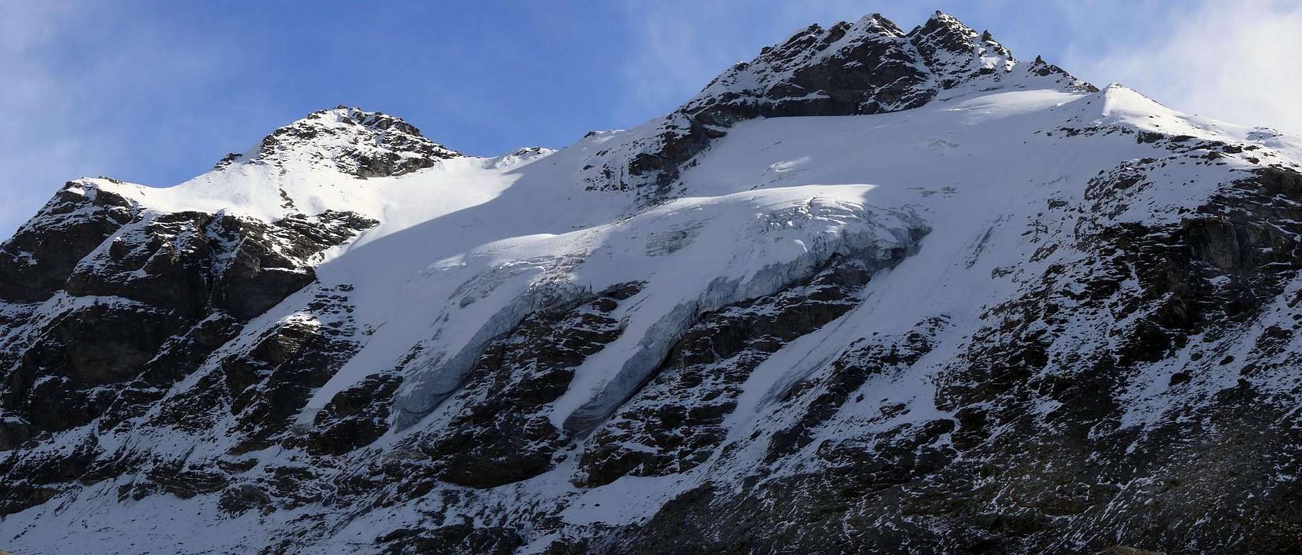
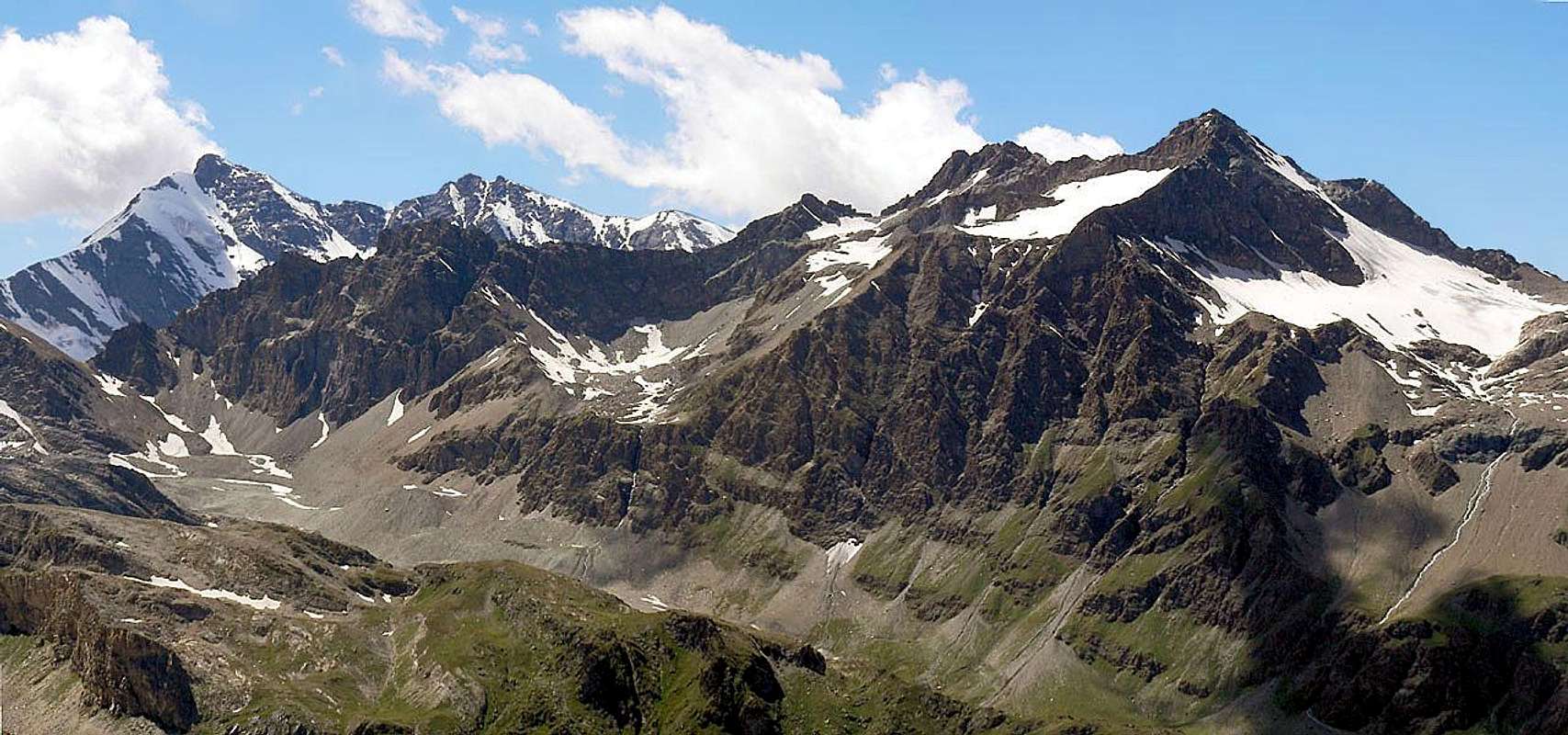
The Bassac summits surround, like satellites, the Grande Traversière (3.496m), on the ridge between Valgrisenche and Val di Rhêmes. The N summit (3.387m) is placed to the N, beyond the Colle Bassac (3.154m) while to the S there are the S summit (3.461m) and the Punta Bassac Deré (3.352m), just before the homonymous pass. Good view on the Grande Sassière, Tsanteleina and the Granta Parei.
Le Punte Bassac contornano come "satelliti" la Grande Traversière (3.496 m), a cavallo delle Valli di Valgrisenche e di Rhêmes. La Punta Nord (3.387 m) ne è situata a N, oltre il Colle di Bassac (3.154 m), mentre a S di elevano la Punta Sud (3.461 m) e la Punta Bassac Deré (3.352 m), prima dell'omonimo Colle. Ottimo colpo d'occhio sulla Grande Sassière, Tsanteleina e la Granta Parei.
First Ascents
First on the summit: Giovanni Bobba and Casimiro Thérisod, (Jul 16th, 1889).
In winter: Unknown.
NE Arête (normal route): Unknown.
S Arête (from Glacier Sud of Traversière): Giovanni Bobba and Casimiro Thérisod, (Jul 16th, 1889).
S Arête (integral from Colle Bassac Deré): Mario Borelli, Nunzia Borelli, Gustavo A. De Petro and Pompeo Viglino, (Aug 24th, 1917).
E Wall (direct): Osvaldo Cardellina, (Oct 27th, 1996).
Getting There
BY CAR:
From France: through the Mont Blanc Tunnel or the Col du Petit Saint Bernard: you can drive on SS.26, following directions for Aosta and, before arriving in Villeneuve, turn right towards Introd. Alternatively, you can take Motorway A5 (at Courmayeur or Morgex) and exit at Aosta Ovest.
From all the other directions: get to the Aosta Ovest exit of Motorway A5. Then drive on SS.26 Aosta, in the direction of Courmayeur; just after Villeneuve turn left towards Introd.
BY PLANE:
Aeroporto "Corrado Gex" Saint Christophe (Aosta).
Itinerary
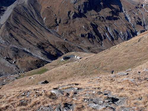
Beyond the built up area of Introd (884m) drive along the Val di Rhêmes leaving to the left the fork of the road leading to Valsavarenche. Cross Rhêmes Saint Georges (1.190m) and Rhêmes Notre Dame (1.723m) to get the Pastures of Thumel (1.879m) where you can find a big car parking.
Oltre l'abitato di Introd (884 m), proseguire verso la Valle di Rhêmes lasciando a sinistra il bivio che conduce alla Valsavarenche. Superare il Paesi di Rhêmes Saint Georges (1.190 m) e Rhêmes Notre Dame (1.723 m) sino a raggiungere l'Alpeggio di Thumel (1.879 m), ove esite un'ampio parcheggio.
Route
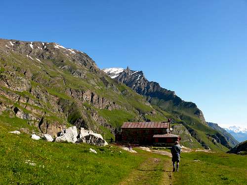
From Thumel alpage (1.879m), along a comfortable path on the W side of the Dora di Rhêmes river, you can arrive to the Refuge Gian Federico Benevolo (2.285m). Cross a wooden bridge and start ascending along the path 13d (Haute Route Glaciaire) to get the Goletta Comba; once passed a terrace at 2.615m and after a short descend, cross toward SW the highland to arrive to the Goletta Lake (2.706m). Pass along its N side, and after a small waterfall you get the rocks at about 2.896m; climb toward N a debris conoid for about 100m to get the small Southern Glacier, placed on the NE side of the Pointe Bassac Deré. Cross the glacier toward NE and after another debris slope of about 100 meters you arrive to the Central Glacier, Cross it toward the notch 3.414m, at the starting point of the SW ridge of the Grande Traversière. Follow the edge of the ridge (I° e II°) along the last 50 meters leading to the summit (6h'30/7h'00). Descent along the same route.
Dal Rifugio Gian Federico Benevolo (2.285 m), raggiungibile dall'Alpeggio di Thumel (1.879 m) su comodo sentiero fiancheggiante ad W la Dora di Rhêmes, salire lungo il sentiero 13d dell'Haute Route Glaciaire verso la Comba di Goletta; superato uno spalto a circa 2.615 m, si percorre verso SW l'altipiano, dopo aver effettuato una breve discesa. Raggiunto l'omonimo lago (2.706 m), lo si doppia N e si oltrepassa una piccola cascata dell'immissario W toccando le rocce a quota 2.896 m circa; risalire verso N una conoide detritica per un centinaio di metri ed in altrettanti raggiungere il minuscolo Glacier Méridional, situato a NE della Pointe Bassac Deré. Attraversarlo verso NE e, superando un nuovo spalto di un'altro centinaio di metri per sfasciumi, si perviene al Glacier Central, che si percorre in direzione della Sella 3.414 m, alla base della cresta SW della Grande Traversière. Da questo punto si percorre sul filo di cresta (I° e II°) gli ultimi 50 metri che portano in vetta (6h'30/7h'00). Discesa lungo la via di salita.
A.I.NE.VA. (Associazione Interregionale Neve e Valanghe).
Useful numbers
Protezione Civile Valdostana località Aeroporto n° 7/A Saint Christophe (Ao) Tel. 0165-238222.
Bollettino Meteo (weather info) Tel. 0165-44113.
Unità Operativa di Soccorso Sanitario Tel. 118.
Acknowledgements
I am greatly indebted to my friend "Osva" for the detailed description of the route. In addition i want to thank Gabriele Roth for the translation of the text from italian.
Parents refers to a larger category under which an object falls. For example, theAconcagua mountain page has the 'Aconcagua Group' and the 'Seven Summits' asparents and is a parent itself to many routes, photos, and Trip Reports.

 8688 Hits
 90.13% Score
 31 Votes