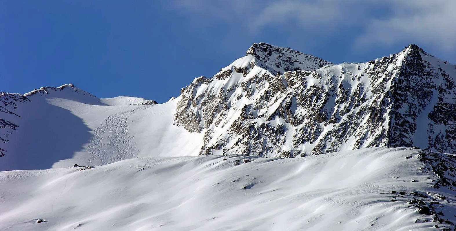
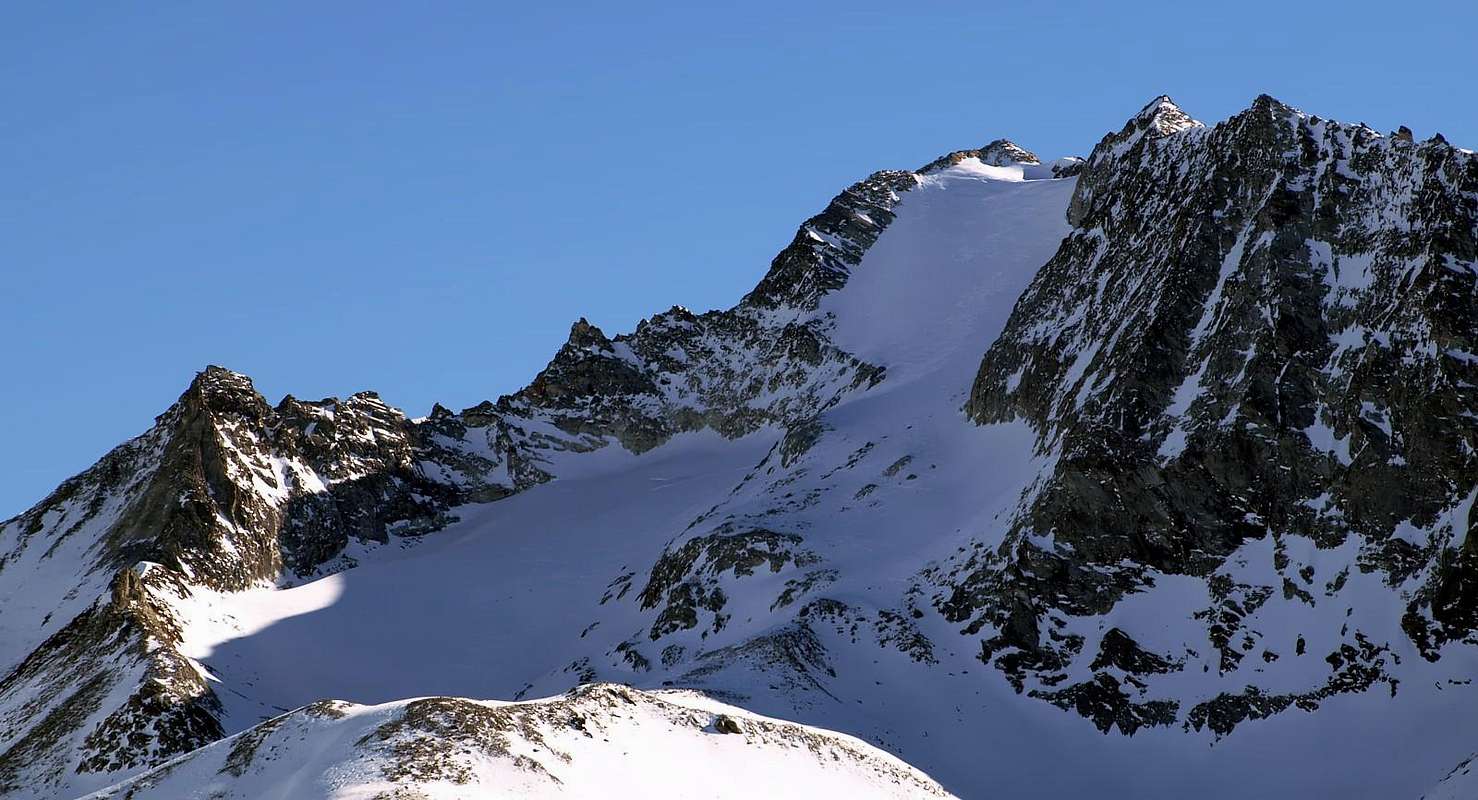
A complex mountain with 2 summits: the E (3.244m) and the W (3.185m). This mountain is the big western shoulder of the Punta Rabuigne (3.261m) whose ridge ends above Alpe Nouva (2.135m) and the Bois (wood) des Ceingles overhanging the Dora of Valgrisenche river, entering in the big Artificial Lake of Beauregard. From its summit very fine view above the Grande Sassière and on the grand Grande Rousse.
Montagna complessa a due vette: la Punta E (3.244 m) e la Punta W (3.185 m) che funge da grande spallone occidentale della Punta Rabuigne (3.261 m), terminante sopra l'Alpe Nouva (2.135 m) ed il Bois des Ceingles sovrastanti la Dora di Valgrisenche, qui immissaria del grande Lago Artificiale di Beauregard. Dalla sua vetta si gode di un'ottima la vista sulla Grande Sassière e sulla grandiosa Grande Rousse.
First Ascents
Punta Orientale:
First on the summit: G. B. Bozzino and B. Ségor, (Jul 14th 1910).
In winter: Unknown.
N-W Arête: Osvaldo Cardellina, Marco Cossard, Luigi Gadin and Giuseppe Lamazzi, (Oct 05th 1980).
S-W Arête: Osvaldo Cardellina, Marco Cossard, Luigi Gadin and Giuseppe Lamazzi, (Oct 05th 1980), in descent.
Getting There
BY CAR:
From Torino, Milano, etc: Motorway A5. Exit at Aosta Ovest.
From Switzerland: through the Grand Saint Bernard Tunnel or the namesake Pass.
From France: through the Mont Blanc Tunnel or Petit Saint Bernard Pass: It is not necessary to take Motorway A5: you can drive on SS.26, in the direction of Leverogne.
BY PLANE:
Aeroporto "Corrado Gex" Saint Christophe (Aosta).
Itinerary
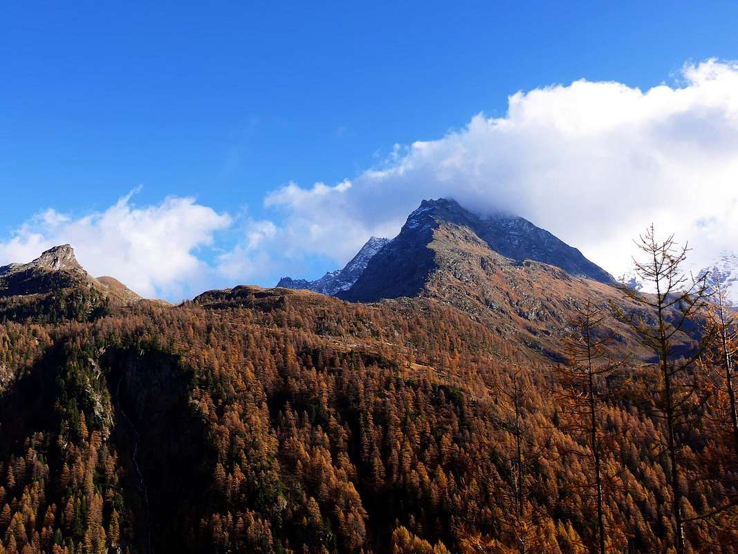
From the City of Aosta (583m) follow SS.26 toward Mont Blanc. Once close to the Village of Leverogne (780m), turn left on the Regional Route for Valgrisenche. Pass many small Villages, including Rochefort, La Ravoire, Chamençon, La Bethaz, and the Town of Valgrisenche. Turn right for the Village of Bonne (1.810m) located near the huge dam that forms the Beauregard Reservoir. Past the small Village of Menthieu (1.842m), continue for approximately 5 km along the paved road, which follows the shore and leads to the old Pasture of Surier (1.758m), near the Village of Usellières (1.758m).
Dalla Città di Aosta (583 m) si percorre la SS.26 per il Monte Bianco e, giunti nei pressi dell'abitato di Leverogne (780 m), si imbocca sulla sinistra la Strada Regionale per la Valgrisenche, dopo aver superato le Frazioni di: Rochefort, La Ravoire, Chamençon, La Bethaz ecc ecc e, dopo aver superato il capoluogo di Valgrisenche, proseguire sulla destra per la Frazione di Bonne (1.810 m) situata proprio di fianco all'enorme sbarramento artificiale che racchiude il Lago di Beauregard. Dopo aver oltrepassato il piccolo Villaggio di Menthieu (1.842 m), si prosegue per circa 5 km lungo la strada asfaltata che costeggia il lago e che porta al vecchio Alpeggio di Surier (1.758 m) vicino al Villaggio di Usellières (1.758 m).
Route
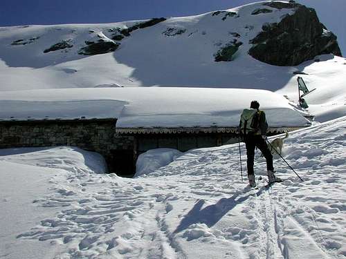
From Usellières walk on toward SE (Arolla Pastures - 1.921m), cross the road and go along the path to Montagna di Mont Forciaz (2.180m). Going on toward NNE and, after passing the Fortchat Stream and another secondary one, you can get the Rifugio Chalet de L'Epée (2.370m). On along the Bouc (or Epée) Valley and, leaving on the left side a small lake (2.439m), walk up a debris-snow small valley toward the small Lepère Glacier, getting it at about 2.870m. On, along about 35° slopes, to the notch (3.030m), turn to NE and scrambling and climbing small needles and blades (I°-III°) get the NW Summit and, after a small notch, keeping the ridge, to the SE Summit, the highest (5h'00/5h'30). Descent: Along the same route or climbing (20 minutes) the Punta Rabuigne (3.261m) where you must descend along the NW side the Glacier de Bouc (30°-38°). Da Usellières continuare a S-E verso l'Alpeggio di Arolla (1.921 m); oltrepassare la strada poderale e salire il sentiero per la Montagna di Mont Forciaz (2.180 m).
Continuare verso N-NE e, guadato il Torrente de Fortchat e un rivo secondario, si raggiunge il Rifugio Chalet de L'Epée (2.370 m). Risalire il Vallone del Bouc o de l'Epée e, lasciato sulla sinistra un minuscolo laghetto (2.439 m), percorrere il sovrastante valloncello detritico-nevoso in direzione del piccolo Ghiacciaio di Lepère, raggiungendolo a circa 2.870 m Salire con pendenze di circa il 35°, il pendio che porta al Colletto (3.030 m); volgere a NE e su roccette con diverse possibilità di arrampicata su pinnacoli e lame dal I° al III°. Salire dapprima alla Punta NW e, dopo un piccolo colle, sempre sul filo di cresta alla Punta SE, la più elevata (5h'00/5h'30). Discesa: Per lo stesso itinerario di salita, oppure raggiungendo in circa 0h'20 la Punta Rabuigne (3.261 m) e scendendo per il versante NW lungo il Glacier de Bouc (30°-38°).
Difficulty
This route can be considered F/PD-/II°.
L'itinerario è classificato F/PD-/II°.
Gear
Standard mountaineering equipment: Rope, iceaxe, crampons and helmet.
A.I.NE.VA. (Associazione Interregionale Neve e Valanghe).
Useful numbers
Protezione Civile Valdostana località Aeroporto n° 7/A Saint Christophe (Ao) Tel. 0165-238222.
Bollettino Meteo (weather info) Tel. 0165-44113.
Unità Operativa di Soccorso Sanitario Tel. 118.
Acknowledgements
I am greatly indebted to my friend "Osva" for the detailed description of the route. In addition i want to thank Gabriele Roth for the translation of the text from italian.
Parents refers to a larger category under which an object falls. For example, theAconcagua mountain page has the 'Aconcagua Group' and the 'Seven Summits' asparents and is a parent itself to many routes, photos, and Trip Reports.

 7349 Hits
 86.37% Score
 22 Votes