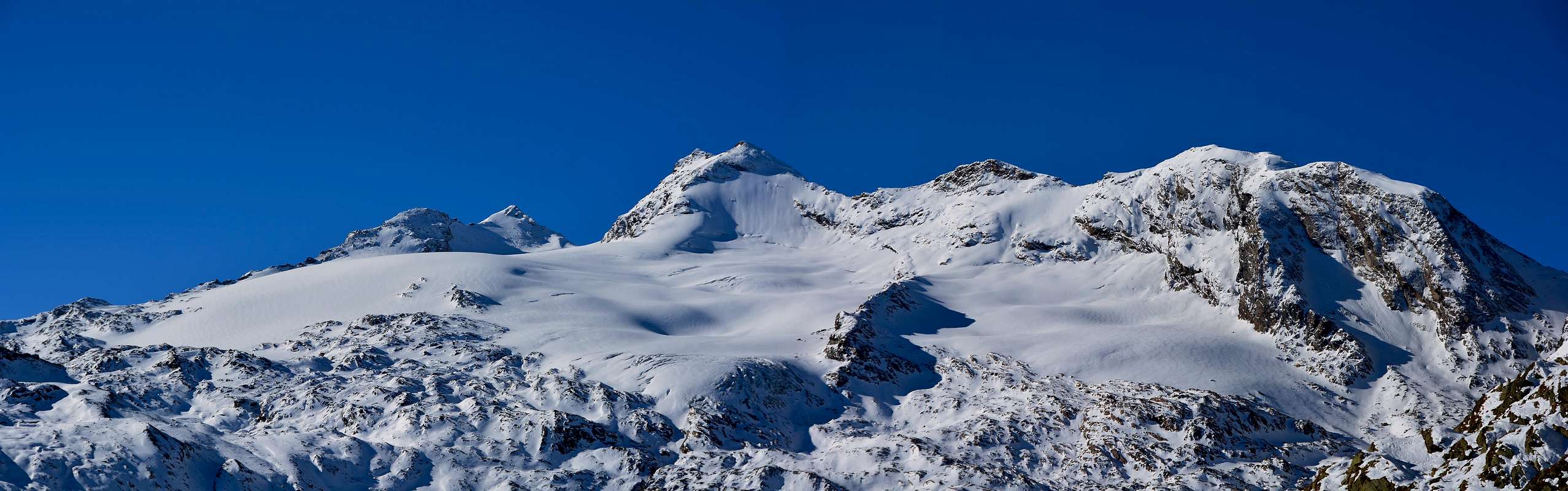
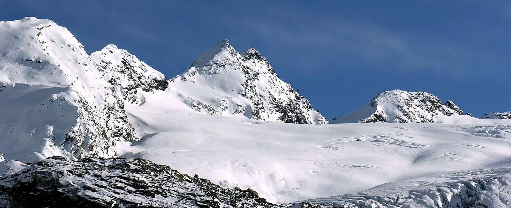
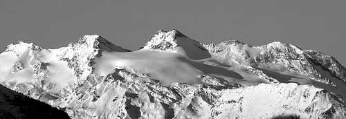
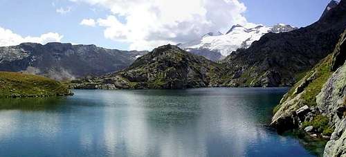
Monte Doravidi(3.439m) is a fine pyramidal mountain with a twin summit that grows, immediately N of the Château Blanc (3.408m), on the ridge dividing the La Thuile Valley and the Valgrisenche. From its summit a wide spectacular panorama on the Rutor Glacier and all Val d'Aosta mountains. A third summit (Quota 3.337m) raised to the north end makes up the Old Doravidi, so called by the first alpinists in 1879.
Il Monte Doravidi (3.439 m) bella cima piramidale formata da due punte della medesima altezza s'innalza subito a settentrione del Monte Château Blanc (3.408 m), sulla costiera divisoria delle Valli di La Thuile e Valgrisenche. Dalla sua cima si gode uno spettacolo eccezionalmente vasto e spettacolare sul Ghiacciaio del Rutor e su tutte le montagne della valle d'Aosta. Una terza punta (Quota 3.337 m) si innalza più a nord e costituisce l'Antico Doravidi, così battezzato dei primi salitori nel 1879.
First Ascents
Punta Meridionale:
E Slope: W. Mathews, F. W. Jacomb, J. B. Croz and M. Croz, (Aug 13th, 1861).
Integral Crossing (from Planaval Pass to Testa del Rutor): Osvaldo Cardellina, Christian Cardellina, Marco Cossard and Giuseppe Lamazzi, (Aug 07th, 1993).
First in winter: D. Arnod, G. De Tommasi, P. Creux, P. Brunodet and R. Willien, (Feb 26th, 1940).
Punta Settentrionale:
N Arête: Mario Velasco, Ignazio Belfrond and Vittorio Belfrond, (Aug 20th, 1890).
N-E Wall: E. Andreis and E. Denina, (Aug 07th. 1926).
Old Summit (Quota 3.337m): Abbé Chanoux and Luigi Vaccarone, (1879).
Getting There
BY CAR:
From the Morgex exit of Motorway A5 (921m), continue for about 3 km on SS.26 towards Pré Saint Didier (1.017m). SS.26 becomes the main street of the small city and then continues toward Colle del Piccolo San Bernardo (2.188m). After several hairpins, and past the Villages of Elevaz (1.302m) and la Balme (1.309m) reach the famous ski resort of La Thuile (1.441m). Turn left on the bridge that crosses Dora di La Thuile in the direction of the Village of La Joux. After about 2 km from the bridge, having past a large square, cross another bridge on the Dora to the right. (From this point on, the road, although paved, is quite narrow. Proceed with caution.) After 1 km get to La Joux (1.607m) and park in one of the two parking lots, which are large but sometimes fill up in August. For this reason, access past the second bridge is limited at certain times. Be there before 9 AM to avoid problems, or take the shuttle bus to cover the last stretch.
IN AUTO:
Dall'uscita dell'Autostrada A5 nel Comune di Morgex (921 m) proseguire per circa 3 km lungo la SS.26 verso il Paese di Pré Saint Didier (1.017 m), addentrarsi nella via centrale del paese e proseguire sempre lungo la SS.26 che porta al Colle del Piccolo San Bernardo (2.188 m). Dopo numerosi tornanti e superate le Frazioni di Elevaz (1.302 m) e la Balme (1.309 m) si giunge alla famosa località sciistica di La Thuile (1.441 m), svoltare a destra sul ponte che attraversa la Dora di La Thuile e dirigersi verso la Frazione di La Joux (1.607 m). Dopo circa 2 km e superato un ampio piazzale, riattraversare sempre sulla destra un altro ponte sulla Dora (attenzione da questo punto la strada, seppur asfaltata, è molto stretta, procedere con cautela) e dopo circa 1 km. si giunge a La Joux (1.607 m), qui posteggiare l'auto in uno dei due ampi parcheggi a volte insufficienti nel mese di agosto. Per questo motivo relativamente al tratto dopo il secondo ponte c'è una limitazione oraria all'accesso dei mezzi privati, che comunque non tocca chi arriva prima delle 9. In alternativa esiste comunque una navetta bus.
BY PLANE:
Aeroporto "Corrado Gex"; Saint Christophe (Aosta).
Route from La Thuile
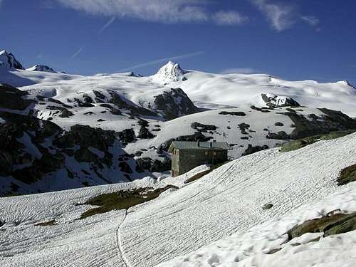
First day The ascent for Rifugio A. Deffeyes starts in front of "Bar Delle Cascate" on trail n° 3. Pass a wooden bridge on the left and after about 15 minutes you'll come to the first of the three spectacular Rutor Falls. Continue along the trail and leave Alpeggio di Parchet (1.772m) to your right. The trail continues up large steps and in a bit less than one hour passes by the second waterfall, which is not visible from the trail, but is marked by a sign. After another 15 minutes you'll reach the sign for the the third waterfall. Continue on the steep trail for another 20 minutes to a fork. Take the well-marked left branch that leads to the hut. (The right branch, numbered 8, leads to the beautiful Lakes of Bella Comba.) Climb to the Small Col (2.130m) and then descend bending slightly to the right until Lago Glacier (2.143m). Cross the small wooden bridge over the lake outlet and, leaving Alpeggio Glacier to your right, climb steeply along wide hairpins to the plateau where Rifugio A. Deffeyes is located at 2.494m This is a good place to spend the night (2h'45/3h'00 from La Joux).
1°giorno Iniziare la salita verso il Rifugio A. Deffeyes sul sentiero davanti al "Bar delle Cascate" contrassegnato con il n° 3, dopo aver oltrepassato un ponte in legno sulla sinistra e dopo circa 0h'15 si incontra la prima del tre spettacolari Cascate del Rutor, proseguire lungo il sentiero e oltrepassare (sulla destra) l'Alpeggio di Parchet posto sulla destra (1.772 m). Continuare sempre lungo il sentiero che ora si inerpica a gradoni e dopo circa 0h'55 si oltrepassa la seconda cascata (segnalata da un cartello e non visibile dal sentiero principale), dopo circa altri 15' si incontra il cartello della terza cascata; continuare sul ripido sentiero per altri 20'; qui il sentiero si divide, prendere quello sulla sinistra ben segnalato che conduce al rifugio (quello di destra recante il n° 8 porta ai magnifici Laghi di Bella Comba). Risalire sino al Colletto (2.130 m) per poi scendere leggermente sulla destra e proseguire fino al Lago Glacier (2.143 m); oltrepassare il ponticello in legno che sovrasta l'emissario del lago e, lasciando sulla destra l'omonimo alpeggio, riprendere a salire decisamente lungo ampi tornanti fino a raggiungere l'altipiano dove è sito il Rifugio A. Deffeyes (2.494 m): qui conviene pernottare (2h'45/3h'00 da La Joux).
Second Day Descend for about 50m the trail for the inlet stream of Lago Azzurro. Cross the small wooden bridge and keep the right trail that leads to the Upper Rutor Lakes (2.539m). After about 10 minutes the trail forks. Keep left and reach shorlty after a small lake known by the names of "Dans la Roche" or "Lac Sans Nom" (2.602m). Continue up to a small col at approximately (2.680m) and on to the left moraine of the Huge Rutor Glacier. (Here at 2.790m you'll find fixed ropes that have been recently placed after the moraine slid on the glacier. This is perhaps the most difficult spot of the entire ascent.) Past this point, leave on your left the small valley that leads to Colle di Planaval (3.016m)). Continue the ascent to reach the left branch of the glacier, located directly under Flambeau (3.315m). Bordering on the left the rocks and icefields of Flambeau, pass through the Doravidi Saddle (3.337m), once at the Colle of Château Blanc (warning: crevasses!), follow the ridge scrambling on easy rocks and regular gradient, some easy needles, up just a little below the summit. Cross to the right (Eastern side) to avoid a steeper step, then straight on to the summit along easy broken rocks. From Refuge to the summit 3h'00/4h'00 hours. Coming down is along the same route.
2°giorno Ridiscendere per circa 50 metri il sentiero che porta all'immissario del Lago Azzurro, attraversare il ponticello in legno e portarsi sul sentiero di destra che porta ai Laghi Superiori del Rutor (2.539 m), dopo circa 10' il sentiero si divide, continuare su quello si sinistra; poco dopo si costeggerà un laghetto conosciuto come Dans la Roche o "Lac Sans Nom" (2.602 m). Salire sino al piccolo colle posto a circa (2.680 m), continuare sul sentiero fino a raggiungere la morena sinistra dell'enorme Ghiacciaio del Rutor (attenzione: qui a quota 2.790 m circa si incontra un passaggio da superare con corde fisse a causa del recente franamento della morena sul ghiacciaio, forse il punto più difficile dell'intera salita). Oltrepassato questo punto si lascia sulla sinistra il valloncello che porta al Colle di Planaval (3.016 m). Continuare la salita fino a raggiugere la branca di sinistra del ghiacciaio, posta subito sotto il Flambeau (3.315 m). Salire rasentando sulla sinistra le rocce e i ghiacci del Flambeau, oltrepassare il Colle di Doravidi (3.337 m), dal Colle dello Château Blanc (attenzione ai crepacci!), seguire il filo di cresta su rocce rotte con pendenza abbastanza regolare con qualche facile gendarme salire fin sotto la vetta. Un salto più ripido lo si supera traversando a destra sul versante Est, quindi per rocce rotte si raggiunge la cima. Tempo di salita dal rifugio 3h'00/4h'00. Discesa per la stessa via di salita.
Equipment
Mountaineering equipment including rope, ice axe, and crampons.
"Guida delle Alpi Occidentali", di Giovanni Bobba e Luigi Vaccarone C.A.I. Sezione di Torino Volume II (parte II), 25 Maggio 1896.
"Monte Bianco Valdigne" di Alessio e Giuseppe Nebbia, Ed. Musumeci, (1989).
"La Thuile e dintorni" di Giuseppe Alliod, Ed. G. Alliod (1994).
"Rifugi e bivacchi in Valle d'Aosta", di Cosimo Zappelli aggiornata da Pietro Giglio, Musumeci Editore.
"I Rifugi della Valle d'Aosta" di Stefano Ardito, Ed. Guide iter, Febbraio 2003.
"Guida della Regione Autonoma Valle d'Aosta" di Mario Aldrovandi, Ed. S.P.E. di Carlo Fanton, Torino 31 Dicembre 1964.
"Guida dei Monti d'Italia–Alpi Graie Centrali" di Alessandro Giorgetta - Club Alpino Italiano/Touring Club Italiano, 1985 (in Italian).
"Valdigne gli itinerari escursionistici", di Alessandro Giorgetta, Ed. Zanichelli, Giugno 1981.
"La Thuile" di Giuseppe Alliod, Ed. Musumeci (1989).
"80 itinerari di Escursionismo Alpinismo e Sci Alpinismo in Valle d'Aosta", di Osvaldo Cardellina, Ed. Musumeci, Giugno 1977 (in Italian); seconda Ed. Luglio 1981; terza Ed. Luglio 1984; (in French), prima Ed. Febbraio 1978; seconda Ed. Marzo 1980.
"Diari Alpinistici" di Osvaldo Cardellina e Indice Generale accompagnato da Schedario Relazioni Ascensioni 1964-2019 (inediti).
MAPS:
Kompass "Gran Paradiso Valle d'Aosta Sentieri e Rifugi", Carta turistica 1:50.000.
L'Escursionista "La Thuile-Piccolo San Bernardo", (carta n° 2) 1:25.000.
A.I.A.T. La Thuile, "La Thuile Pianta dei Sentieri", 2004 (Plastico).
Carta Comunità Montana "Valdigne e Mont Blanc Les Sentiers", 2001 1:50.000.
I.G.C. Istituto Geografico Centrale "Il Parco Nazionale del Gran Paradiso", 1:50.000.
I.G.C. Istituto Geografico Centrale Torino "Monte Bianco-Courmayeur-Chamonix M.B.-La Thuile", (carta n° 107), 1:25.000.
Studio F.M.B. "Monte Bianco-Mont Blanc", Bologna 1988 1:50.000.
Children refers to the set of objects that logically fall under a given object. For example, the
Aconcagua mountain page is a child of the 'Aconcagua Group' and the 'Seven Summits.' The
Aconcagua mountain itself has many routes, photos, and trip reports as children.
Parents refers to a larger category under which an object falls. For example, theAconcagua mountain page has the 'Aconcagua Group' and the 'Seven Summits' asparents and is a parent itself to many routes, photos, and Trip Reports.

 9757 Hits
 92.04% Score
 37 Votes