
-
 8072 Hits
-
 83.1% Score
-
 16 Votes
|
|
Mountain/Rock |
|---|---|
|
|
45.65113°N / 7.11914°E |
|
|
Mountaineering |
|
|
9715 ft / 2961 m |
|
|
Overview
Last summit north of the watershed between Valle di Rhêmes and Valgrisenche. It's an easy, nice hike, with wonderful views on Rhêmes Saint Georges below and, in the distance, of the Dora Baltea river and the City of Aosta.
Ultima vetta a nord della cresta spartiacque (Valle di Rhêmes-Valgrisenche); bella gita, facile con splendide viste sulla sottostante Rhêmes Saint Georges e in lontananza sulla Dora Baltea e la Città di Aosta.
First Ascents
- First on the summit: Unknown.
- In winter: Unknown.
Getting There
BY CAR:- From Torino, Milano, etc: Motorway A5. Exit at Aosta Ovest.
- From Switzerland: through the Grand Saint Bernard Tunnel or the namesake Pass.
- From France: through the Mont Blanc Tunnel or Petit Saint Bernard Pass: It is not necessary to take Motorway A5: you can drive on SS.26, in the direction of Arvier.
- Aeroporto "Corrado Gex" Saint Christophe (Aosta).
Itinerary
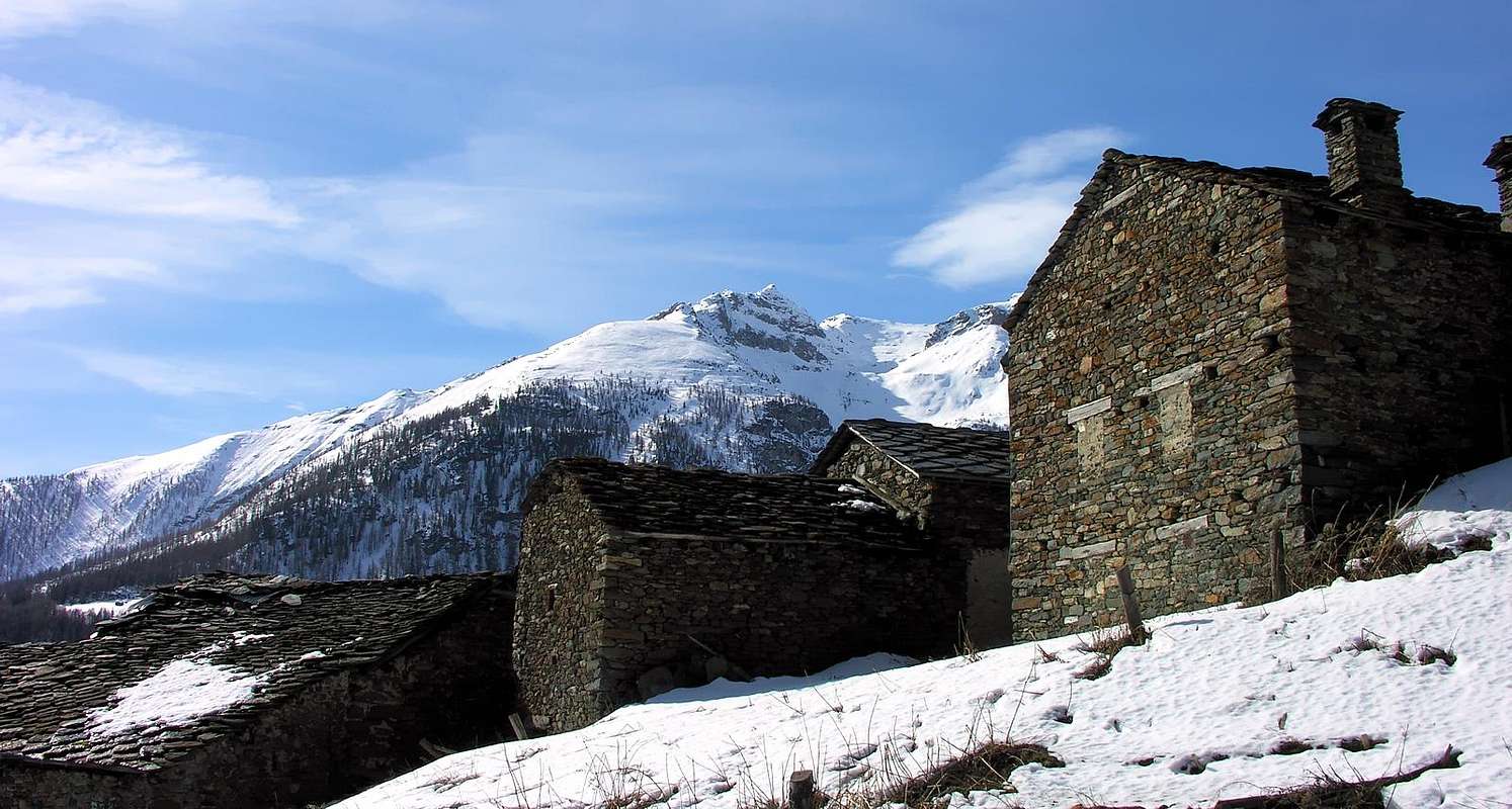
From Aosta (583m) follow SS.26 toward Mont Blanc. Once near Arvier (751m), turn left on the road that goes up to the Villages of La Crête (830m), Petit Haury (1.081m), Grand Haury (1.177m), and Les Combes (1.323m, the site of Pope John Paul II last visits to the Valley), where the hike begins.Dalla Città di Aosta (583 m) si percorre la SS.26 per il Monte Bianco e, giunti nei pressi dell'abitato di Arvier (751 m), si imbocca sulla sinistra la strada che sale alle Frazioni di La Crête (830 m), Petit Haury (1.081 m), Grand Haury (1.177 m) e Les Combes (1.323 m, sede delle ultime visite di Papa Giovanni Paolo II°), dove inizia l'itinerario a piedi.
Route
From Les Combes (1.323m), continue on the trail that runs parallel to the road that winds through farms, until the trail forks (at 1.537m), at the western end of Plan de la Pera. There, the trail goes on to Alpe Leytin (1.787m), eventually merging back into the road. Head southeast, avoiding the wide switchback for Moccossoney (1.900m). Once at Plan Bry (1.918m), turn east toward the watershed, which you reach near Maison Clou (2.219m). Head southwest on a faint trail, go around Mont dell'Âne (2.367m), ad reach Croce (2.439m). Keep on the Northeast ridge and pass a hump (2.610m); turn slightly westward, climb up the North ridge and scramble to the airy summit--a dizzying balcony with a drop of about 600m to the southeast on Vallone di Balanche (3h'30/4h'00 from Les Combes).Da Les Combes (1.323 m), proseguire per la strada interpoderale sul sentiero parallelo sino al bivio (1.537 m), al margine occidentale del Plan de la Pera, dove il sentiero prosegue per l'Alpe Leytin (1.787 m) congiungendosi nuovamente nell'ultimo tratto con la strada poderale. Proseguire a sud-est evitando il largo tornante per Moccossoney (1.900 m) e, raggiunto il Plan Bry (1.918 m), voltare ad est indirizzandosi alla cresta spartiacque, raggiungendola nei pressi di Maison Clou (2.219 m). Proseguire su tracce a sud-ovest e, doppiato il Mont dell'Âne (2.367 m), raggiungere la successiva Croce (2.439 m); sempre sulla cresta Nord-Est superare un dosso (2.610 m), e, volgendo leggermente più ad ovest, risalire la cresta Nord sino a raggiungere per roccette facili l'aerea vetta, vertiginoso balcone con un salto di circa 600 metri a sud-est sul Vallone di Balanche (3h'30/4h'00 da Les Combes).
Difficulty
This route can be considered EE/F.L'itinerario è classificato EE/F.
Equipment
Standard mountaineering equipment. |
 |
 |
 |
Campings
Remember that free camping is forbidden (except for emergency reasons, over 2.500m, from darkness until dawn).Mountain Condition
- You can get meteo information at the official site of the Regione Valle d'Aosta:
- Valle d'Aosta Meteo
Webcam
- WEBCAM on Aosta Valley:
- Webcam
Books and Maps
BOOKS:- "Diari Alpinistici" di Osvaldo Cardellina e Indice Generale accompagnato da Schedario Relazioni Ascensioni 1964-2021 (inediti).
- "Guida delle Alpi Occidentali" di Giovanni Bobba e Luigi Vaccarone C.A.I. Sezione di Torino Volume II (parte II), 25 Maggio 1896.
- "Guida dei Monti d'Italia – Alpi Graie Centrali" di Alessandro Giorgetta, Club Alpino Italiano/Touring Club Italiano, 1985.
 |
MAPS:
- L'Escursionista "Valgrisenche Val di Rhêmes" Carta dei sentieri (n° 3) 1:25.000.
- I.G.C. Istituto Geografico Centrale Torino "Valsavarenche Val di Rhêmes Valgrisenche P.N.G.P.", 1:25.000.
- I.G.C. Istituto Geografico Centrale Torino" Il Parco Nazionale del Gran Paradiso" 1:50.000.
- Enrico Editore Ivrea-Aosta "Gruppo del Gran Paradiso" 1:50.000.
- Kompass "Gran Paradiso Valle d'Aosta Sentieri e Rifugi" Carta Turistica 1:50.000.
- Studio F.M.B. "Gran Paradiso" Bologna 1:50.000.
- Comunità Montana Valdigne Mont Blanc, "Les Sentiers" Edizione 2001, 1:50.000.
Important Information
- REGIONE AUTONOMA VALLE D'AOSTA the official site.
- FONDAZIONE MONTAGNA SICURA Villa Cameron, località Villard de la Palud n° 1 Courmayeur (AO) Tel: 39 0165 897602 - Fax: 39 0165 897647.
- SOCIETA' DELLE GUIDE DI VALGRISENCHE.
- A.I.NE.VA. (Associazione Interregionale Neve e Valanghe).
Useful numbers
- Protezione Civile Valdostana località Aeroporto n° 7/A Saint Christophe (Ao) Tel. 0165-238222.
- Bollettino Meteo (weather info) Tel. 0165-44113.
- Unità Operativa di Soccorso Sanitario Tel. 118.
Acknowledgements
I am greatly indebted to my friend "Osva" for the detailed description of the route. In addition I want to thank Fabio (Brenta) for the translation of the text from italian.