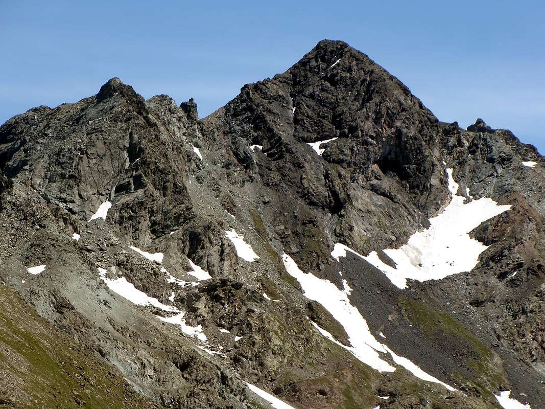
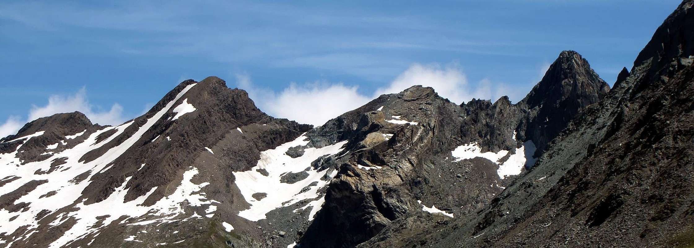
Attractive pyramid, the first important top that is seen entering in the Urtier Valley (Cogne, Lillaz); is the more raised Summit, in the Piedmont and Aosta Valley, between the Torre di Lavina (3.308m) and the Rosa dei Banchi (3.164m). Its peak however is entirely "valdostana", because it is slightly shifted to the North over the watershed Aosta Valley/Piedmont. Related to this is via a short ridge running down South over a fairly wide gap known as the "Nozzle of Punta Nera"; over the dividing crest reaches the Punta della Scaletta or Echellette (3.020m) and then continue, indented into the waters of the Acque Rosse and the much more famous Tower of Lavina marking the "real entrance" in the Mountain Chain of Gran Paradiso (4.061m). In addition to this ridge, its Summit is formed by another much longer than that falls first to the North over a narrow carving with a distinctive Bell tower and later more in the Northwest over the rocks overlying the Alp Broillot or Broillà (2.399m). The same acts as a divider between the small Miserino Walloon on the East and the wider of Acque Rosse. Another little mentioned edge down to the East for separating the Northeast Face, on the West Lake of Miserino, from the Southeast, where rises the Normal Route. The third side is constituted by a steep and rotten West Wall that ends with a great leap above some ponds to the input of the second walloon. On the same crossing "quietly" herds of chamois and ibex females, indicating, if you're lucky, the transition to follow. Above all down, otherwise you have a little "sharpen the wits". All these sides, including the Northeast Corner, are not recommended because they are too exposed to falling rocks. For the thing which should keep the two main ridges, or the South and, excluding the first long climb from the base by Yeld with Guides Valtournanche Beniamino & Alessandro Pession in 1912, the North. Big panorama to 360° on: Tersiva, Rosa dei Banchi, Apostoli Group and the Monte Emilius Group. It possesses rocks of varied colors, mainly black, from that the name.
Bella piramide, la prima cima importante che si vede entrando nel Vallone dell'Urtier (Cogne, Lillaz); è la Sommità più elevata nel tratto di confine Piemonte/Valle d'Aosta, tra la Torre di Lavina (3.308 m) e la Rosa dei Banchi (3.164 m). La sua vetta, però, è interamente valdostana, poiché rimane leggermente discosta a Settentrione rispetto allo spartiacque Valle di Aosta/Piemonte. A questo si collega tramite una corta Cresta Meridionale discendente sopra una abbastanza larga sella conosciuta come "Bocchetta della Punta Nera"; oltre la cresta divisoria raggiunge la Punta della Scaletta o Echellette (3.020 m) per poi proseguire, frastagliata, verso il Colle di Acque Rosse e la ben più famosa Torre di Lavina che segna il "vero ingresso" nella Catena del Gran Paradiso (4.061 m). Oltre a questa cresta, la sua Sommità é formata da una'altra molto più lunga che scende dapprima a Nord sopra uno stretto intaglio con caratteristico Campanile e, successivamente, più a Nordovest sopra le pietraie soprastanti l'Alpe Broillot o Broillà (2.399 m). La medesima funge da divisorio tra il piccolo Vallone del Miserino ad Est e quello più esteso di Acque Rosse. Un altro spigolo poco accennato scende ad Est atto a separare la Faccia Nordest, sopra il Lago Occidentale del Miserino, da quella Sudest, dove sale la Via Normale. Il terzo versante é costituito da una ripida e rotta Parete Ovest che termina con un gran salto al di sopra di alcuni laghetti all'ingresso del secondo vallone. Sopra la stessa attraversano "tranquillamente" branchi di camosci e femmine di stambecco, indicando, se si ha fortuna, il passaggio da seguire. Soprattutto in discesa, altrimenti bisogna un pò "aguzzar l'ingegno". Tutti questi versanti, compreso lo Spigolo Nordest, non sono consigliabili poiché troppo esposti alla caduta di pietre. Per la quale cosa conviene mantenersi sulle due creste principali, ovvero la Sud e, escludendo la prima lunga parte salita dallo Yeld con le Guide di Valtournanche Beniamino ed Alessandro Pession nel lontano 12 Agosto del 1912, la Nord. Gran panorama a 360° su: Tersiva, Rosa dei Banchi, Gruppo degli Apostoli e Gruppo dell'Emilius. Possiede rocce di vari colori, prevalentemente nere, da cui il nome.
From the muletrack of Arietta Pass to East Slope of Miserino Punta Nera with two (outline left/right) Standard Routes
First Ascents
First on the summit (S Arête): Cloza and soldiers of Engineer Corps, (Jul 13th, 1880).
In winter: Unknown.
S Crest (from "Bocchetta della Nera"): Cloza and soldiers of Engineer Corps, (Jul 13th, 1880).
SW Eperon: Osvaldo Cardellina and Emilio Bertona, (Jul 06th, 2000), in descent from Summit and Emilio Bertona, lone, in ascent.
W Wall (from Summit): Osvaldo Cardellina, solo, (Jul 06th, 2000), in in ascent.
N-NW Ridge: George Yeld and Mountain Guides of Valtournenche Beniamino Pession and Alessandro Pession, (Aug 12th, 1912).
E Slope and N Ridge (with crossing to Miserino Pass): Alessandro Cardellina, Osvaldo Cardellina and Giuseppe Lamazzi, (Oct 16th, 1994).
NE Face (from Miserino W Lake): Osvaldo Cardellina and Emilio Bertona, (Jul 06th, 2000).
E Edge (from of Miserino W Lake): Osvaldo Cardellina, Nicola Colajanni and Gianfranco Vicentini, (Aug 18th, 1999).
SE Wall (from Miserino W Lake): Alessandro Cardellina and Osvaldo Cardellina, (Jul 18th, 1993).
Historic Remark: since the first ascent in 1880, and up to half of the last century was the Normal Route via the South Crest reaching the large saddle of "Bocchetta della Nera" on the side of Miserino or for this last through that of Acque Rosse by means a rocky couloir just South of the Southwest Spur at an altitude of 2.702 meters. But it was also rising, reaching a carving, on both sides, by a canal with rocky debris that reached from the Acque Rosse (front for the above photo), also from Miserino, in the altitude 2.960 meters between the "Bell tower" and the North Ridge, whence by this last to the Summit. These routes side Acque Rosse today have been abandoned and are used both almost exclusively by the slope Miserino or through the North Ridge or by the South Crest. All other ways are not to be considered useful, because you play a lot of rock route with relative risk of falling of stones. In good snow conditions, the best way is that of the South Ridge.
Getting There
BY CAR:
From Torino, Milano, etc: Motorway A5. Exit at Aosta Ovest. Drive to the near Aymavilles. Follow the directions for Valle di Cogne.
From Switzerland: through the Grand Saint Bernard Tunnel or the namesake Pass. Drive to Aosta, then follow the direction for Courmayeur on SS.26. Just after Sarre, turn to the left, in the direction of Valle di Cogne.
From France: through Mont Blanc Tunnel or Petit St. Bernard Pass. It isn't necessary to take Motorway A5: you can drive on SS.26, in the direction of Aosta.Before arriving at the Village of Sarre, turn right following the sign for Valle di Cogne. After Aymavilles, the SR.47 crosses the Villages of Vieyes, Epinel and Cretaz and after about 25 Km arrives at Cogne (1.534m). From Cogne you can get the Village of Lillaz (1.617m).
BY PLANE:
Aeroporto "Corrado Gex" Saint Christophe (Aosta).
Approach & Standard Route
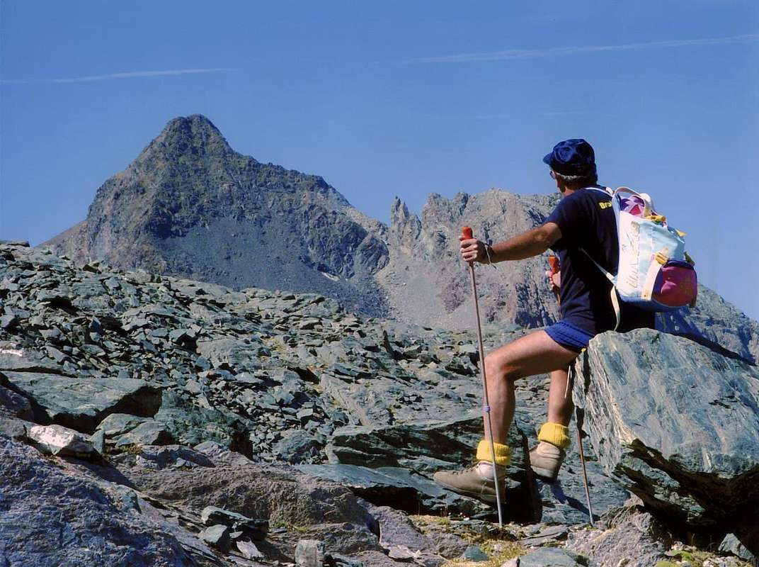
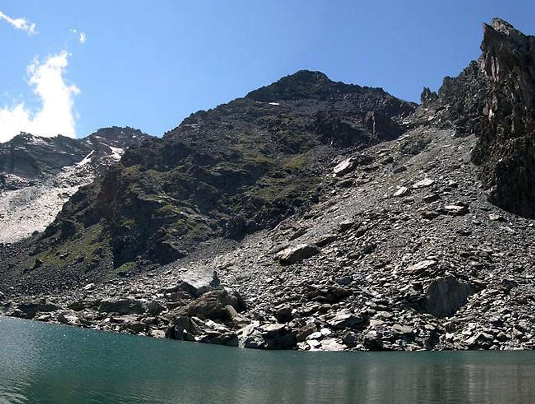
Starting from Cogne (1.534m) you must arrive (bus or car) to the car parking of Lillaz (1.617m). Follow the path below upaved road, until reach Baite di Gollies. Move on until tiny church of Crêt, clearly visible from lowlands. Once gone beyond Tsavanis Pastures (2.296m) and Waterfull. To continue in Southeast direction leaving the Urtier Valley for the small valley of the two Lakes of the Miserino (wonderfuls!). Reached and passed on the left the Western Miserino Lake (2.665m) to go back, with a long diagonal on the stony ground below the East Corner and the next Southeast Face, the East Side of the "Bocchetta della Punta Nera" (2.956m; small pass). Go up through the steep stony, characterized by the many diversifications of the rocks highlighted by different colors, up to a snowfield, usually frozen. Exceeding this can cause problems, especially during descent, forcing you to look for a pass against the Southeast Face, or on the opposite side of the ladder against the Punta della Scaletta (3.020m). In both cases there is a possibility of falling rocks, for which what is the best thing done off as quickly as possible and to keep a good alertness. The next stretch is less problematic and can reach easily the above broad saddle; from this easily to Summit along the Southern Crest (4h'00/4h'30).
Descent:
a) - down along the same route. Or
b) - down on the opposite Ridge North-northwest, but only in its most elevated part or Northern, through steep rocks and quite exposed, but not difficult (I°+). Reached a notch at a quaint Bell tower overhanging descend directly to the East on the steep scree that leads through the stones even more diverse and attractive colors, the starting point to the West of Lake Miserino. This route can also be done in reverse and then is to be considered a Normal alternative Route; in this case provide for a climb a little more difficult, however, offset by a more rapid descent and perhaps, in consideration of this design, more secure because the limiting exposure to falling rocks from the looming Southeast Wall.
Dall'abitato di Cogne (1.534 m) in bus o in auto raggiungere la ridente frazione di Lillaz (1.617 m), dove si parcheggia l'auto nel grande piazzale sito quasi al centro del villaggio. Percorrere il sentiero al disotto della strada poderale fino alle Baite di Gollies (1.854 m); continuare fino alla Chiesetta di Crêt, ben visibile dal basso, alla Cascata e all'Alpeggio di Tsavanis (2.296 m). Proseguire in direzione Sud Est, abbandonando il Vallone principale dell'Urtier per il valloncello dei due Laghi del Miserino (splendidi!). Raggiunto e oltrepassato a Est il Lago del Miserino Occidentale (2.665 m), risalire, tramite un lungo diagonale sulla pietraia sottostante lo Spigolo Est ed la successiva Faccia Sudest, il Versante Orientale della "Bocchetta della Punta Nera"(2.956 m). Salire tramite la ripida pietraia, caratteristica per gli innumerevoli diversificazioni delle rocce evidenziate dai vari colori, fino a raggiungere un nevaio, in genere ghiacciato. Il superamento di questo può creare qualche problema, soprattutto in fase di discesa, obbligando a cercare un passaggio contro la Faccia Sudest, oppure sul lato opposto contro la Punta della Scaletta (3.020 m).In entrambi i casi esiste la possibilità di caduta di sassi, per la quale cosa risulta miglior cosa il fatto di scendere il più rapidamente possibile e di tenere una buona vigilanza. Il tratto successivo é meno problematico e permette di raggiungere in modo facile la soprastante larga sella; da questa facilmente in Vetta lungo la Cresta Sud, formata da facili pendii erboso-rocciosi (4h'00/4h'30). Discesa:
a) - lungo l'itinerario di salita. Oppure
b) - scendendo sulla opposta Cresta Nord-nordovest, ma esclusivamente nel suo tratto più elevato o Settentrionale, per mezzo di rocce ripide ed abbastanza esposte, ma non difficili (I°+). Raggiunto un intaglio presso un caratteristico Campanile strapiombante, scendere direttamente verso Est sulla ripida pietraia che conduce, tramite pietre ancora di più diversificate e dai colori attraenti, al punto di partenza ad Ovest del Lago Miserino. Questo itinerario può essere anche effettuato al rovescio e quindi deveessere considerato una Via Normale alternativa; in questo caso prevedere una salita un poco più faticosa, compensata però da una discesa più rapida e forse, in considerazione di ciò, più sicura poiché limita maggiormente l'esposizione alla caduta di sassi dall'incombente Parete Sudest.
Difficulties
This route can be considered EE/I+°. To lend much caution to the ascent of the E-SE Side of the "Bocchetta della Punta Nera", in hard case of snow. In this case: rope, ice axe, crampons and helmet, for possible falls of stones from the SE Wall.
L'itinerario è classificato EE/I+°. Prestare molta attenzione alla salita del versante E-SE della "Bocchetta della Punta Nera", in caso di neve dura. In questo caso: corda, picozza, ramponi e casco, per possibili cadute di pietre dalla Parete SE.
Equipment
Standard mountaineering equipment.
Campings
There are plenty of camping sites along the Gran Paradiso valleys. Remember that free camping is forbidden (except for emergency reasons, over 2.500m, from darkness until dawn).
Mountain Condition
Meteo: you can find all the needed informations at the official site of the Valle d'Aosta Region:
"Guida delle Alpi Occidentali" di Giovanni Bobba e Luigi Vaccarone C.A.I. Sezione di Torino Volume II (parte II), 25 Maggio 1896.
"Guida dei Monti d'Italia–Emilius Rosa dei Banchi Parco del Mont Avic" di Giulio Berutto e Lino Fornelli-Club Alpino Italiano/Touring Club Italiano, Marzo 2005 (in Italian).
"I Rifugi della Valle d'Aosta" di Stefano Ardito, Ed. Guide iter, Febbraio 2003.
"Il Parco Nazionale del Gran Paradiso (Valli di Champorcher-Clavalitè-Saint Marcel-Laures-Cogne-Valsavarenche-Conca di Pila" di Giulio Berutto 3/volume 2°, I.G.C., Torino 1981, 2a Ed. 2000. (in Italian).
"Diari Alpinistici" di Osvaldo Cardellina e Indice Generale accompagnato da Schedario Relazioni Ascensioni 1964-2019 (inediti).
MAPS:
Enrico Editore Ivrea-Aosta "Gruppo del Gran Paradiso" 1:50.000.
Kompass "Gran Paradiso Valle d'Aosta Sentieri e Rifugi" Carta Turistica 1:50.000.
L'Escursionista "Valle di Cogne Carta dei Sentieri" 1:25.000.
Parents refers to a larger category under which an object falls. For example, theAconcagua mountain page has the 'Aconcagua Group' and the 'Seven Summits' asparents and is a parent itself to many routes, photos, and Trip Reports.

 8052 Hits
 84.27% Score
 18 Votes