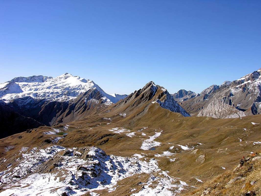
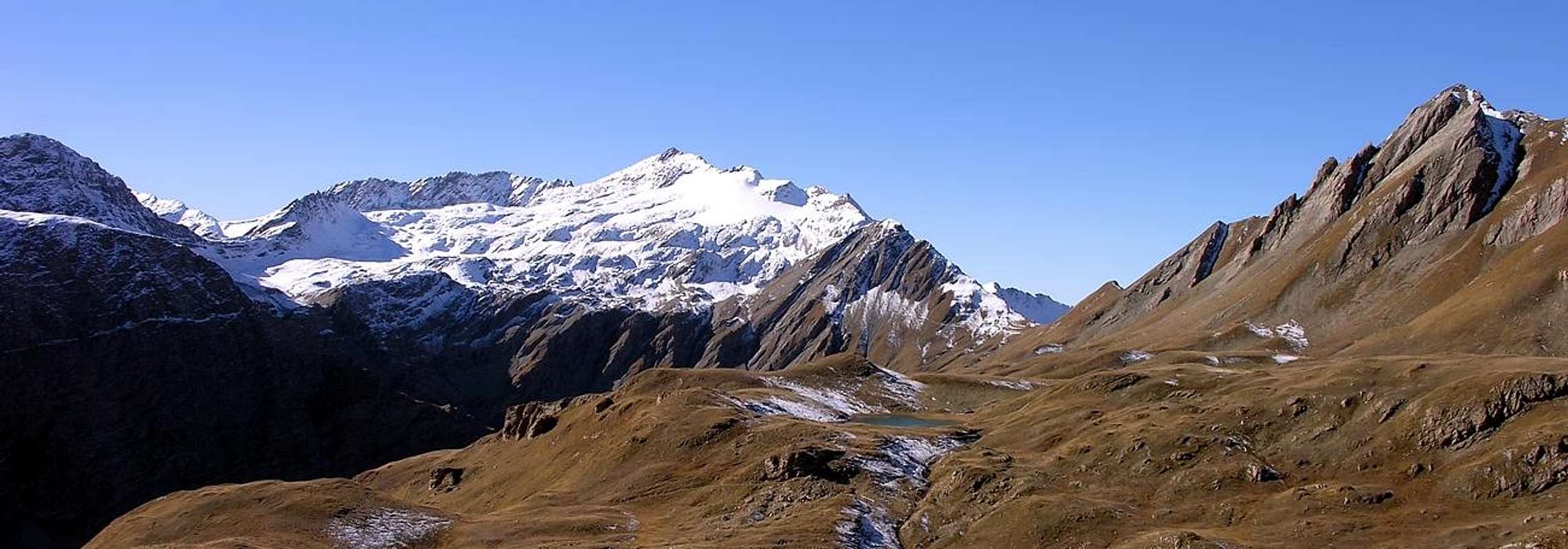
Small pyramidal mountain made of broken rocks and debris (with a characteristic hole made of big slabs on its northern ridge) between the Monte Berio Blanc (3.252m) to the North and the Punta Lechaud (3.127m) to the South, placed on the long ridge dividing the Lex Blanche Valley from Chavannes Valley. From its summit a wonderful panorama on Aiguille des Glaciers (3.816m), Aiguilles de Trélatête (3.940m) and Mont Blanc (4.811m).
Modesta vetta piramidale di rocce rotte e sfasciumi (con una caratteristica caverna di grandi lastroni nella cresta a nord della cima), tra il Monte Berio Blanc (3.252 m) a nord e la Punta Lechaud (3.127 m) a sud; posto sulla lunga cresta che separa il Vallone de la Lex Blanche dal Vallone di Chavannes. Dalla sua sommità si gode un grandioso panorama sull'Aiguille des Glaciers, (3.816 m), sull'Aiguilles de Trélatête (3.940 m) e sul Monte Bianco (4.811 m).
First Ascents
First on the summit: Unknown.
In Winter: Unknown.
Getting There
BY CAR:
From the Morgex exit of Motorway A5 (921m), continue for about 3 km on Strada Statale n°26 towards Pré Saint Didier (1.017m). SS.26 becomes the main street of the small city and then continues toward Colle del Piccolo San Bernardo (2.188m). After several hairpins, and past the Villages of Elevaz (1.302m) and la Balme (1.309m) reach the famous ski resort of La Thuile (1.441m). Turn left on the bridge that crosses "Dora di La Thuile", a go on along the same road till the bridge before the Village of Pont Serrand, turn to the right following for Orgère (1.740m), where you must leave the car.
BY PLANE:
Aeroporto "Corrado Gex" Saint Christophe (Aosta).
Route
On foot, along the dirt road of the Chavannes Valley, after passing the Pastures of Chavannes di Sotto (2.128m), Chavannes di Mezzo (2.183m) and Chavannes di Sopra (2.421m) aim toward South to get the Colle di Chavannes (2.603m). Herefrom follow, just a little under the ridge, along a slope of debris and broken rocks and once on the small grassy area under the summit cross to the left (to avoid a slab full of debris) and few meters after you get the summit. Coming down: along the same route.
Proseguire a piedi sulla strada in terra battuta il lungo Vallone di Chavannes, dopo aver superato gli omonimi Alpeggi: Chavannes di Sotto (2.128 m), Chavannes di Mezzo (2.183 m) e Chavannes di Sopra (2.421 m); puntare decisamente verso sud sino a raggiungere il Colle di Chavannes (2.603 m). Da questo punto risalire la cresta lungo un pendio di detriti e rocce rotte, appena al di sotto del filo della cresta. Dopo aver raggiunto una piccola zona erbosa, poco al di sotto della cima, attraversare sulla sinistra evitando una placca inclinata di detriti e sfasciumi e dopo pochi metri si perviene alla vetta. Discesa: lungo la stessa via di salita.
Equipment
Normal hiking equipment.
Da escursionismo.
Difficulties
Easy anf for Experienced Hikers E/F.
Campings
Remember that free camping is forbidden (except for emergency reasons, over 2.500m, from darkness until dawn).
Mountain Condition
You can get meteo information at the official site of the Regione Valle d'Aosta:
Parents refers to a larger category under which an object falls. For example, theAconcagua mountain page has the 'Aconcagua Group' and the 'Seven Summits' asparents and is a parent itself to many routes, photos, and Trip Reports.

 5893 Hits
 89.01% Score
 28 Votes