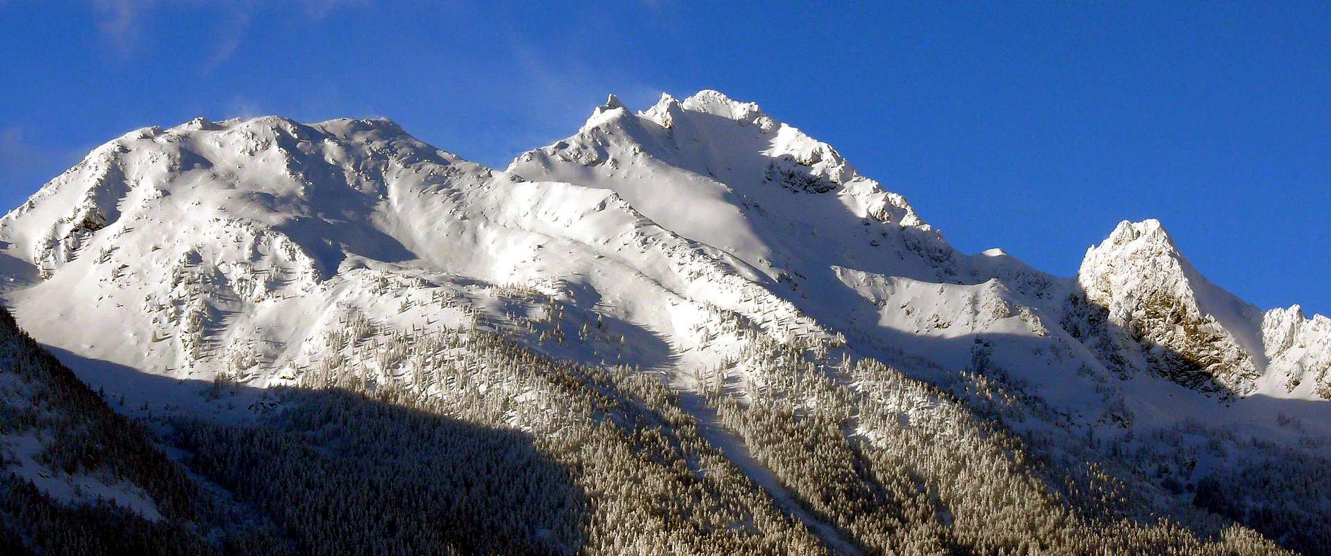
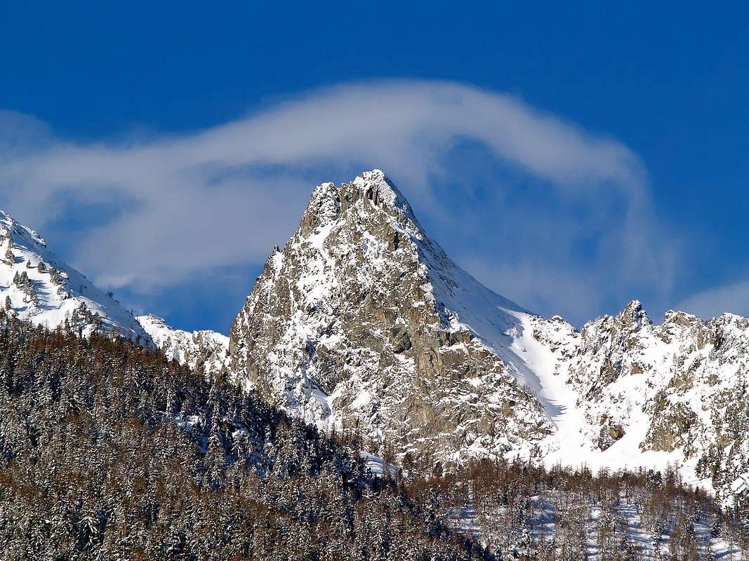
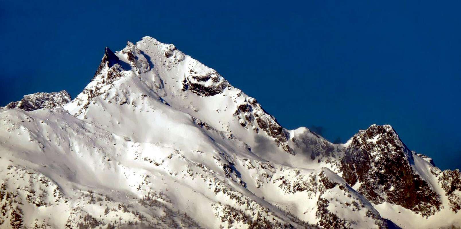
This mountain is located on the North Buttress that descends from the Col de la Crosatie (2.826m), located between Punta same name (2.926m) and Bec tailla (2.983m), the highest elevation of this small subgroup in the Northeast of Mont Paramont (3.301m), the tip of which is best known, however, certainly the Tower of Tighet or Tignet (2.976m), slightly less elevated. Atypical pyramid with only two sides (Eastern and Western) and a third just "mentioned" in North-northeast content by as many ridges or edges, is visible from most of the Central Valley of Baltea although not very well known and poorly attended because hidden by the other hilltop above. The climbs are really rare in spite of the views that have to be exceptional, dominating from the top, as well as the Central Valley, the Vallons d'en Haut (West) and Tillac. Short ascent short, but never banal.
Questa piccola montagna situata sul Contrafforte Settentrionale che scende dal Col de la Crosatie (2.826 m), posto tra l'omonima Punta (2.926 m) ed il Bec Taillà (2.983 m, la massima elevazione di questo minuscolo Sottogruppo a Nordest del Mont Paramont (3.301 m), la punta più conosciuta del quale è però sicuramente la Torre del Tighet o Tignet (2.976 m), di poco meno elevata. Piramide atipica con due soli versanti (Orientale ed Occidentale) ed un terzo appena "accennato" a Nord-nordest contenuti da altrettante creste o spigoli, risulta ben visibile da quasi tutta la Valle Centrale della Dora Baltea anche se non molto conosciuta e scarsamente frequentata poiché nascosta come secondaria appendice, almeno a Mezzogiorno, dalle altre Sommità sopra citate. Le ascensioni sono veramente rare a dispetto delle ottime vedute, dominando dall'alto, oltre che la Valle Centrale della Dora Baltea, i Valloni d'en Haut (Ovest) e Tillac. Presenta un'ascensione breve, ma mai banale ed a tratti piuttosto esposta su roccia non sempre troppo buona.
First Ascents
Firs on the Summit: Unknown.
First ascent in winter: Unknown.
Getting There
BY CAR:
From Torino, Milano, etc: Motorway A5. Exit in Morgex.
From Switzerland: through the Grand St. Bernard Tunnel or the homonym Pass.
From France: through Mont Blanc Tunnel or Petit St. Bernard Pass.
BY PLANE:
Aeroporto "Corrado Gex" Saint Christophe (Aosta).
Approach and Route
From Peia (982m; reachable by the Municipality of Derby and from that of Morgex) climb through the trail n° 11 towards the Southeast reaching the Pré-Maudit Pasture (1.118m); here the same changes direction twice to arrive to the upper of Lazey (1.510m), at the Torrent de Leseney. Abandoning the previous trail to the Southwest instead continue towards Southeast through the n° 5 which crosses twice the Torrent de la Bouilla Boatton, will then approach the subsequent Pastures of Joux (1.616m), Val di Matten (1.630m) and Val Fond (1.649m). The same, leaving to the right the desolate small valley that is directed towards the Mont Lussé, by the Alp of Premoud (2.021m) turned decidedly the opposite side or Southeast following the path of the Alta Via n° 2 that reaches Col de la Crosatie (2.836m), between the homonym Summit and Bec Taillà. Follow it until about halfway where, passing three furrows torrents, rooms with narrow bends more or less at the Lac de Lenteney on the opposite slope (2.130m). Abandoned the same head decidedly East and, with free route and not numbered path but traces through the three small torrents, reaching the watershed that falls secondary towards North starting from Col de la Crosatie, dividing this wild valley from the next of Tillac at the foot of Bec Taillà (2.983m) and the Tower of Tighet or Tignet (2.976m). From this, turning decisively to the North, take the short, steep but enough easy Southern Crest who, through very broken rocks and covered by debris, after a first portion which terminates in a rocky promontory with a pinnacle followed by a small fork, leading to the South Antetop via a second length less steep. From this more easily to the Northern Summit, the highest and just at the junction of the Edges North and North-northeast (EE/A/F+; 4h'00/4h'30 from Peia Pasture; 3h'00/3h'30 from Lazey Alpage).
Da Peia (982 m; raggiungibile sia dal Comune di Derby oltre che da quello di Morgex) salire tramite il sentiero n° 11 verso Sudest raggiungendo l'Alpeggio di Pré-Maudit (1.118 m); qui il medesimo cambia direzione due volte per raggiungere quello superiore di Lazey (1.510 m), presso il Torrent de Leseney. Abbandonando il precedente sentiero verso Sudovest continuare invece a Sudest tramite il n° 5 che, attraversando due volte il Torrent de la Bouilla Boatton, raggiunge in successione gli Alpeggi di Joux (1.616 m), Val di Matten (1.630 m) e Val di Fond (1.649 m). Lo stesso, lasciato sulla destra il desolato vallone che s'indirizza verso il Mont Lussé, dall’Alpe di Premoud (2.021 m) volge decisamente dalla parte opposta o Sudest seguendo il sentiero dell’Alta Via n° 2 che arriva fino al Col de la Crosatie (2.836 m); seguirla fino a circa metà strada dove, passando tre solchi torrentizi, sale con stretti tornanti più o meno all'altezza del Lac de Lenteney sull'opposto versante (2.130 m). Abbandonato il medesimo dirigersi decisamente ad Oriente e, con percorso privo di sentiero numerato ma tracce in mezzo ai tre torrentelli, raggiungere lo spartiacque secondario che scende verso Settentrione dal Col de la Crosatie, dividendo questo vallone dal successivo di Tillac ai piedi del Bec Taillà (2.983 m) e della Torre del Tighet o Tignet (2.976 m). Da questo, volgendo decisamente a Nord, si percorre la breve, ripida ma abbastanza facile Cresta Sud che, tramite rocce molto rotte e ricoperte da detrito, dopo un primo tratto che termina in un promontorio roccioso sormontato da un pinnacolo nonché seguito da una forcelletta, conduce all'Antecima Meridionale tramite un secondo percorso meno ripido. Da questo più facilmente alla Sommità Settentrionale, la più elevata e dove vanno a congiungersi gli Spigoli Nord e Nord-nordest (EE/A/F+; 4h'00/4h'30 dall'Alpe Peia; 3h'00/3h'30 dall'Alpeggio di Lazey).
Difficulty
The routes can be rated as F/F+.
L'itinerario è classificato F/F+.
Gear
Normal hiking equipment.
Da escursionismo.
Mountain Conditions
Meteo: you can find all the needed informations at the official site of the Valle d'Aosta Region:
Parents refers to a larger category under which an object falls. For example, theAconcagua mountain page has the 'Aconcagua Group' and the 'Seven Summits' asparents and is a parent itself to many routes, photos, and Trip Reports.

 1928 Hits
 83.69% Score
 17 Votes