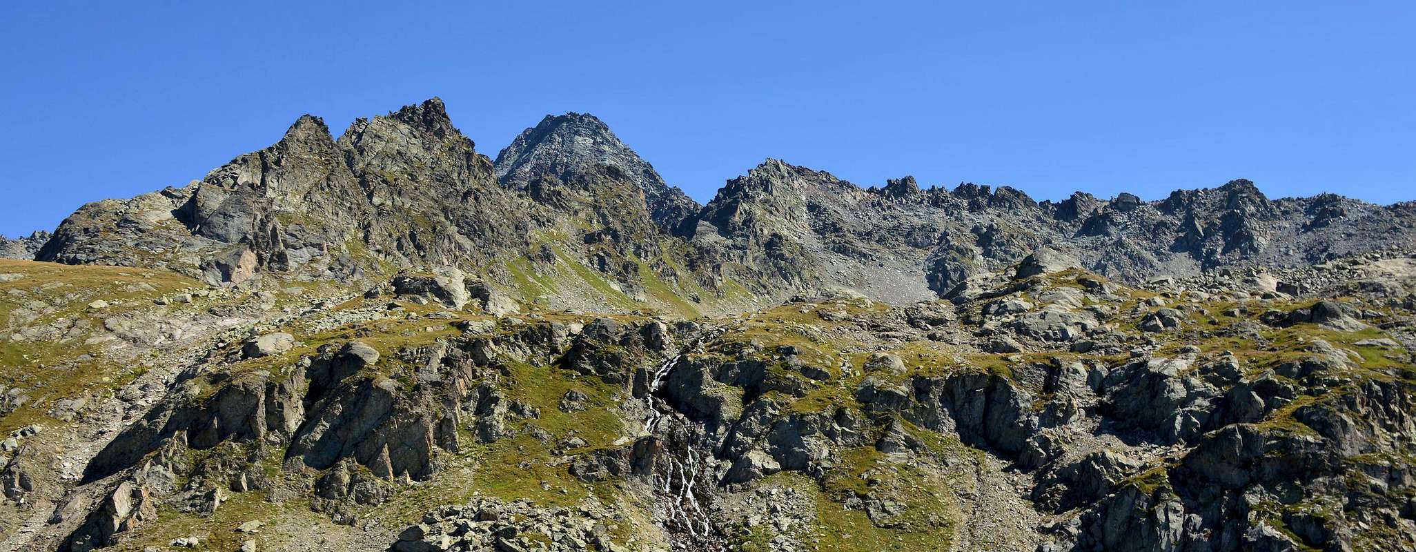
This mountain is located in the Valley of La Thuile and those of Isère in France; more precisely, between the Vallon of Bellecombe with its two magnificent lakes, below the Mounts Fréduaz (2.938m), and the Vallon de la Sassière with the Natural Park of La Vanoise. The terms of topography, is located between the Great Assaly (3.174m) and Mont Charve (2.909m) and is divided by the latter from the Col du Tachuy (2.673m), while a secondary collar separates it from the first. Consists of three crests and as many sides is quite easily accessible from the hill of the same name along the Arête du Tachuy, almost 1 Kilometer long. On its Slope Northeast is "nested" a small glacier, increasingly being regressive and said Glacier du Tachuy and content from his short but indented Ridge North-northwest and, in North direction, that from Grande Assaly reaches the Petite Assaly (2.930m). Summit rarely climb, presents beautiful views towards Southeast over the Rutor Glacier up to the Testa (3.486m), while in the Southwest rise front the Mont Pourri (3.779m) and the nearby Aiguille Rouge (3.226m).
Questa montagna é collocata tra la Valle di La Thuile e quella dell'Isère in Francia; più precisamente tra il Vallone di Bellecombe con i suoi due magnifici laghi, al di sotto dei Monts Fréduaz (2.938 m), ed il Vallone de la Sassière con il Parco Naturale della Vanoise. Dal punto di vista orografico, si trova tra la Grande Assaly (3.174 m) ed il Mont Charve (2.909 m) ed è divisa da questo ultimo dal Col du Tachuy (2.673 m), mentre un colletto secondario la separa dalla prima. Formata da tre creste ed altrettanti versanti risulta abbastanza facilmente raggiungibile dallo omonimo colle percorrendo la Arête du Tachuy, lunga quasi 1 Kilometro. Sul suo Versante Nordest è "annidato" un piccolo ghiacciaio, sempre più in fase regressiva e detto Glacier du Tachuy nonché contenuto dalla sua breve ma frastagliata Cresta Nord-nordovest e da quella Settentrionale che dalla Grande Assaly raggiunge la Petite Assaly (2.930 m). Cima raramente salita, presenta belle viste verso Sudest sopra il Ghiacciaio del Rutor fino alla Testa (3.486 m), mentre a Sudovest si elevano frontalmente il Mont Pourrì (3.779 m) e la vicina Aiguille Rouge (3.226 m).
First Ascents
First ascent on the summit: Giovanni Bobba and Casimiro Thérisod, (Aug 22th, 1895).
First ascent in winter: Unknown.
SW Ridge: Giovanni Bobba and Casimiro Thérisod, (Aug 22th, 1895), in descent from Grande Assaly.
Getting There
BY CAR:
From the Morgex exit of Motorway A5 (921m), continue for about 3 km on SS.26 towards Pré Saint Didier (1.017m). SS.26 becomes the main street of the small city and then continues toward Colle del Piccolo San Bernardo (2.188m). After several hairpins, and past the Villages of Elevaz (1.302m) and La Balme (1.309m) reach the famous ski resort of La Thuile (1.441m). Turn left on the bridge that crosses Dora di La Thuile in the direction of the Village of La Joux. After about 2 km from the bridge, having past a large square, cross another bridge on the Dora to the right. (From this point on, the road, although paved, is quite narrow. Proceed with caution.) After 1 km get to La Joux (1.607m) and park in one of the two parking lots, which are large but sometimes fill up in August. For this reason, access past the second bridge is limited at certain times. Be there before 9 AM to avoid problems, or take the shuttle bus to cover the last stretch.
IN AUTO:
Dall'uscita dell'Autostrada A5 nel Comune di Morgex (921 m) proseguire per circa 3 km lungo la SS.26 verso il Paese di Pré Saint Didier (1.017 m); addentrarsi nella via centrale del paese e proseguire sempre lungo la SS.26 che porta al Colle del Piccolo San Bernardo (2.188 m). Dopo numerosi tornanti e, superate le Frazioni di Elevaz (1.302 m) e La Balme (1.309 m), si giunge alla famosa località sciistica di La Thuile (1.441 m); svoltare a destra sul ponte che attraversa la Dora di La Thuile e dirigersi verso la Frazione di La Joux (1.607 m). Dopo circa 2 km e, superato un ampio piazzale, riattraversare sempre sulla destra un altro ponte sulla Dora (attenzione da questo punto la strada, seppur asfaltata, è molto stretta, procedere con cautela) e dopo circa 1 km. si giunge a La Joux (1.607 m); qui posteggiare l'auto in uno dei due ampi parcheggi, a volte insufficienti nel mese di agosto. Per questo motivo, relativamente al tratto dopo il secondo ponte, c'è una limitazione oraria all'accesso dei mezzi privati, che comunque non tocca chi arriva prima delle 9. In alternativa esiste comunque una navetta bus.
BY PLANE:
Aeroporto "Corrado Gex" Saint Christophe (Aosta).
Route
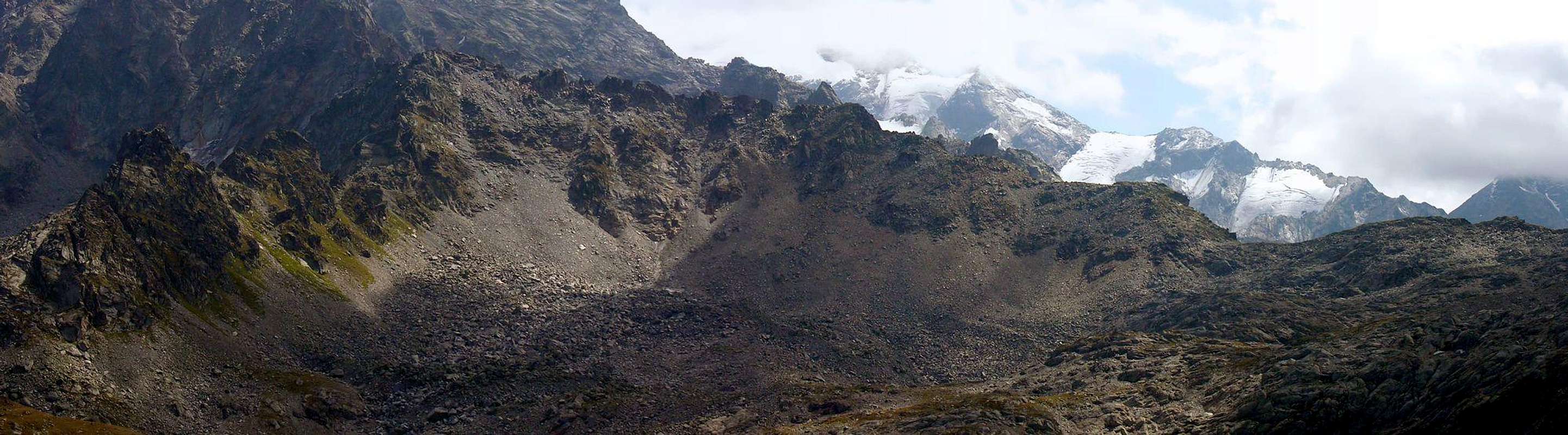
From La Joux (1.607m) up along the path bordering to the E the Rutor Stream and its 3 fine waterfalls. At the fork 2.100m turn to the right along the path n° 8 leading to Belle Combe Valley, cross (bridge) the stream coming down from the Lake of Seracs, arriving into a valley with smooth slabs; a step leads to a plain with the remains of a barrack. Follow the path up to a first lake then to a second one near the effluent (2.379m) and follow the S bank. To SE then to SW follow along the path leading, after passing the five lakes, up to the Tachuy Pass (2.673m). Along the easy SW Ridge along what is called "Arête du Tachuy", on easy stones and blocks, after passing a rocky promontory and with a little more sharpest crest to the Summit (4h'45/5h'15).
Descent: Coming back is along the same route.
Dalla Frazione di La Joux (1.607 m) risalire il sentiero, che a E fiancheggia il Torrente du Rutor e le sue tre belle cascate. Raggiunto il bivio a quota 2.100 metri svoltare verso destra sul sentiero che conduce al Vallone di Belle Combe (sentiero n° 8); attraversare su comodo ponte il torrente proveniente dal Lac des Seracs, arrivando in una valletta tra antiche banconate levigate dal ghiacciaio. Superato un gradone, si raggiunge un successivo pianoro con i resti di una casermetta. Il sentiero, sempre a N del Torrent de la Belle Combe, raggiunge il primo omonimo lago sovrastandolo e raggiunge il secondo presso il suo emissario (2.379 m); seguire per breve la sponda S. Con direzione SE prima e SW dopo, superare su in piccolo sentiero, i magnifici cinque Laghi del Tachuy (2.550 m e 2.569 m i più grandi). Per pietraie e nevai raggiungere il Colle del Tachuy (2.673 m). Percorrere la facile Cresta SO di frontiera lungo quella che viene chiamata "Arête du Tachuy" e per facili rocce a blocchi, dopo aver oltrepassato un promontorio roccioso e con la cresta un poco più affilata, alla Vetta (4h'45/5h'15).
Discesa: Lungo la stessa via di salita.
Difficulty
The route is rated EE/F/F+.
L'itinerario è classificato ER/F/F+.
Gear
Hiking.
Da escursionismo.
Campings
Remember that free camping is forbidden (except for emergency reasons, over 2.500m, from darkness until dawn).
Mountain Condition
You can get meteo information at the official site of the Regione Valle d'Aosta:
Parents refers to a larger category under which an object falls. For example, theAconcagua mountain page has the 'Aconcagua Group' and the 'Seven Summits' asparents and is a parent itself to many routes, photos, and Trip Reports.

 2116 Hits
 81.84% Score
 14 Votes