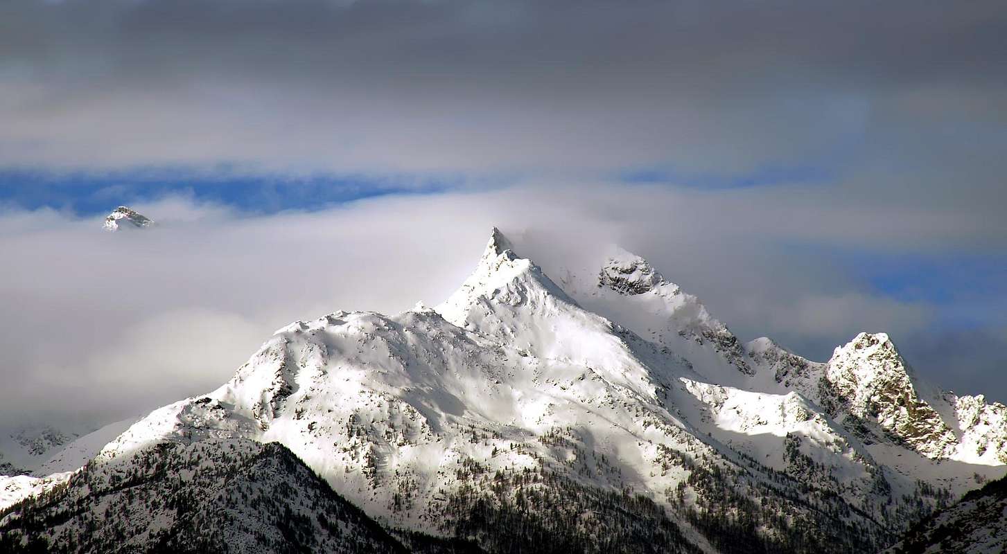
The important ridge dividing the Valleys of La Thuile and Valgrisenche from Testa del Rutor (3.486m) down to Mont Paramont (3.301m) and, after this summit, forks in two big branches to Northwest and Northeast: the first one hosts the Testa of Paramont, the Mount Monchette and the Mount Lussè. The second one, after the Mount Pit goes down to the Molette Pass (above the Fond Lake) and goes on, turning to the East with the Point of the Crosatie, the Bec Taillà, the Tighet and Tonda Towers, the two little Faveroy Points and the Monte Colombo.
L'importante cresta che divide le Valli di La Thuile e della Valgrisenche, partendo dalla Testa del Rutor (3.486 m) fino al Mont Paramont (3.301 m), dopodiché, si biforca inviando due grandi ramificazioni a Nordovest ed a Nordest; la prima forma la Testa del Paramont, il Mont Monchette e il Mont Lussè. La seconda, formato il Mont Pit, scende al Colle delle Molette (sopra il Lago di Fond) e prosegue voltando progressivamente ad Est con la Pointe de la Crosatie, il Bec Taillà, la Torre del Tighet, la Torre Tonda, le due piccole Punte di Faveroy e il Monte Colombo.
First Ascents
First on the summit: Unknown.
In winter: Unknown.
E Arête (Integral): Osvaldo Cardellina, Luigi Gadin and Giuseppe Lamazzi, (Oct 27th,1985), in ascent.
N Slope: Osvaldo Cardellina and Giuseppe Lamazzi, (Oct 08th, 1995), in ascent.
S Wall: Osvaldo Cardellina and Giuseppe Lamazzi, (Oct 08th, 1995), in descent.
Getting There
BY CAR:
From Torino, Milano, etc: Motorway A5. Exit at Aosta Ovest.
From Switzerland: through the Grand Saint Bernard Tunnel or the namesake Pass.
From France: through the Mont Blanc Tunnel or Petit Saint Bernard Pass: It is not necessary to take Motorway A5: you can drive on SS.26, in the direction of Leverogne.
BY PLANE:
Aeroporto "Corrado Gex" Saint Christophe (Aosta).
Itinerary
From the City of Aosta (583m) follow SS.26 toward Mont Blanc. Once close to the Village of Leverogne (780m), turn left on the Regional Route for Valgrisenche. Pass many small Villages, including Rochefort, La Ravoire and, after some 10 km turn to the right toward Planaval (1.580m) and beyond the small village of La Clusaz (1.628m) you arrive in Baulin (1.775m): starting point.
Dalla Città di Aosta (583 m) si percorre la SS.26 per il Monte Bianco e, giunti nei pressi dell'abitato di Leverogne (780 m), si imbocca sulla sinistra la Strada Regionale per la Valgrisenche; dopo aver superato le Frazioni di Rochefort, La Ravoire, e percorso una decina di chilometri, svoltare a destra verso la Frazione di Planaval (1.580 m) e, oltrepassato il villaggio di La Clusaz (1.628 m), si raggiunge Baulin (1.775 m) dove inizia l'itinerario.
Route
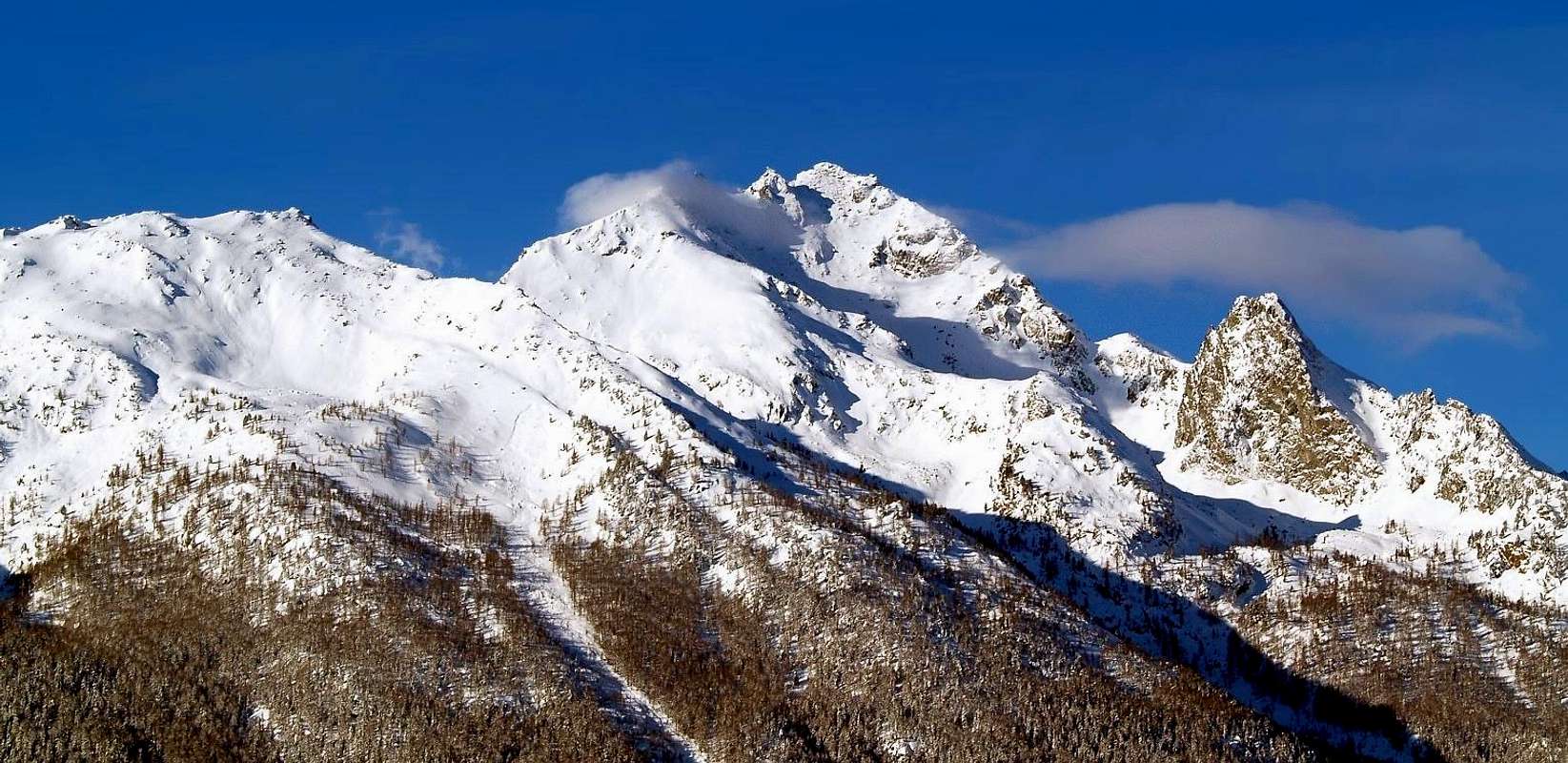
From Baulin (1.775m) along the path for the Monte Colombo (1.854m), up to the saddle descending to Pesse (1.441m); here turn to the West and pass over, using small traces, the twin Point of Faveroy and their pass. Along the East Ridge, easy and made of grassy slopes and big stones up to the summit of the Torre Tonda (2.583m). From Tighet Pass (2.533m) start climbing along the East ridge, easy till a grey slab of about 20 meters, follow a crack with a jammed rock (III°+), then some passages on slabs with small grips (II°). After the "Gobba" (2.794m) you get the "Gendarme a Cannone" (2.817m), climb it on the right side for 1 pitch (III° e III°+), leaving on the left side a blade. Along easy rocks (I° e II°) up to the next quota and after some slabs (often iced), you get the cairn on Summit (2.976m) 5h'00.
Descent: Along the West ridge after turning a short drop (exposed).
Da Baulin (1.775 m), per il sentiero che porta al Monte Colombo (1.854 m), portarsi alla selletta discendente a Pesse (1.441 m); da questa volgere ad Ovest e, su tracce ed alcuni roccioni superare le due Punte di Faveroy e l'omonimo colle. Per la facile cresta Est, di pendii erbosi inframmezzati da grandi blocchi sparsi, si raggiunge la vetta della Torre Tonda (2.583 m). Dal Colle del Tighet (2.533 m) iniziare la salita della Cresta Est facile sino ad una placca grigiastra di circa 20 metri, seguita da una fessura con un blocco incastrato (III°+); seguono alcuni passaggi in placche su piccoli appigli in aderenza (II°). Superata la "Gobba" (2.794 m) si raggiunge il "Gendarme a Cannone" (2.817 m); salirlo a destra per un tiro di corda (III° e III°+), lasciando a sinistra una lama staccata e pendente. Su rocce facili (I° e II°) si raggiunge la quota successiva e, dopo aver superato alcuni lastroni (spesso verglass), si raggiunge l'ometto di vetta (2.976 m)5h'00.
Discesa: Lungo la cresta Ovest dopo aver aggirato un breve salto (esposto).
Difficulty
The route can be rated as AD inf (low-middle difficulty).
L'inerario è classificato AD-.
Gear
Mountaineering equipment.
Campings
Remember that free camping is forbidden (except for emergency reasons, over 2.500m, from darkness until dawn).
Mountain Conditions
You can get meteo information at the official site of the Regione Valle d'Aosta:
"Guida delle Alpi Occidentali" di Giovanni Bobba e Luigi Vaccarone C.A.I. Sezione di Torino Volume II (parte II) 25-05-1896.
"Guida della Regione Autonoma Valle d'Aosta" di Mario Aldrovandi; Ed. S.P.E. di Carlo Fanton Torino 1964.
"80 itinerari di Escursionismo Alpinismo e Sci Alpinismo in Valle d'Aosta", di Osvaldo Cardellina, Ed. Musumeci, Giugno 1977 (in Italian); seconda Ed. Luglio 1981; terza Ed. Luglio 1984; (in French), prima Ed. Febbraio 1978; seconda Ed. Marzo 1980.
"Guida dei Monti d'Italia Alpi Graie Centrali" di Alessandro Giorgetta - Club Alpino Italiano-Touring Club Italiano, 1985 (in Italian).
"Diari Alpinistici" di Osvaldo Cardellina e Indice Generale accompagnato da Schedario Relazioni Ascensioni 1964-2019 unpublished).
MAPS:
Kompass "Gran Paradiso Valle d'Aosta" Sentieri e Rifugi Carta turistica 1:50.000.
Enrico Editore Ivrea-Aosta "Gruppo del Gran Paradiso" 1:50.000.
L'Escursionista "La Thuile-Piccolo San Bernardo" Carta dei sentieri (n° 2) 1:25.000.
L'Escursionista "Valgrisenche Val di Rhêmes" Carta dei sentieri (n° 3) 1:25.000.
I.G.C. Istituto Geografico Centrale Torino "Il Parco Nazionale del Gran Paradiso" (3) 1:50.000.
I.G.C. Istituto Geografico Centrale Torino "Valsavarenche Val di Rhêmes Valgrisenche P.N.G.P.", 1:25.000.
Hapax "Les Sentiers Comunità Montana Valdigne-Mont Blanc", 1:50.000.
Parents refers to a larger category under which an object falls. For example, theAconcagua mountain page has the 'Aconcagua Group' and the 'Seven Summits' asparents and is a parent itself to many routes, photos, and Trip Reports.

 7547 Hits
 81.18% Score
 13 Votes