
-
 9881 Hits
-
 83.69% Score
-
 17 Votes
|
|
Mountain/Rock |
|---|---|
|
|
38.02694°N / 107.73384°W |
|
|
Ouray |
|
|
Hiking, Mountaineering |
|
|
Spring, Summer, Fall, Winter |
|
|
13100 ft / 3993 m |
|
|
Overview
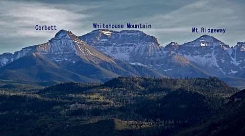
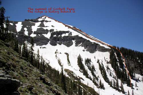
Corbett Peak as seen from US 550 (Corbett Ridge is hiding behind the peak)
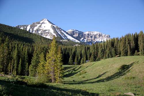
Whitehouse Mountain, Corbett Ridge and Corbett Peak
There is no established trail to this peak and off trail navigation is a must. Expect lots of scree unless hiking in the winter or spring when terrain is covered with snow.
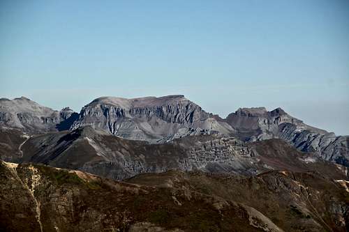
![Corbett Peak and Whitehouse Mnt.]()
Corbett Peak and Whitehouse Mnt.![Mount Sneffels]()
Mount SneffelsYou can either access the peak from Ouray via Dallas Trail - longer approach with more elevation gain, or from Ridgway - provided you have 4WD vehicle and can drive towards backcountry Burn hut. I have done it both ways and enjoyed hiking Dallas Trail towards Burn hut. This trail can be also mountain biked. Whatever access you choose, both trails eventually meet near the Burn Hut on a large meadow where you start you bushwhack experience.
Burns hut is one of the back country ski huts and is available for booking - check out San Juan back country huts site here.
Burn Hut is available for rent.
Colorado Rank: 571
Parent Lineage: Whitehouse Mountain
Class: 2+
Other names: Sultan Peak, Chipeta Peak, Unnamed 13100 C
Nearby Mountains: Whitehouse Mountain 13,492 feet 0.52 miles
Mount Ridgway 13,468 feet 1.39 miles
Teakettle Mountain 13,819 feet 2.37 miles
"Coffeepot" 13,568 feet 2.46 miles
Cirque Mountain 13,686 feet 2.62 miles
Potosi Peak 13,786 feet 2.70 miles
"Kismet" 13,694 feet 3.35 miles
Mount Sneffels 14,150 feet 3.56 miles
Getting There
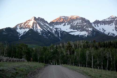
Corbett Peak and Whitehouse Mnt.
Mount Sneffels
From the town of Ridgway, drive west towards Telluride. Just before leaving the town take the last street left - south on Amelia street. Drive sought and turn right onto County Road 5. Drive on a graded dirt road (snow plowed year round) for about 5.3 miles onto Miller Mesa, Elk Meadows. There is a large parking area. Passenger cars should park here, high clearance 4WD vehicles can continue to the closer trailhead.
Continue driving on Forest Road 852 (great views). Follow this road for 3.7 miles to Forest Service boundary, the road does several turns and continue towards Burn Hut and our trailhead for Corbett Ridge. The last section of the road becomes more difficult, it has deep mud holes. Park near a large meadow (the road here is part of the Dallas Trail).
Round Trip: 8 miles
Elevation: 3,680 feet
From the large meadow parking lot = Dallas Trail - hike south southeast through the grassy meadow to its end. You will enter a forest and loose views of Corbett Peak, orientation here becomes more difficult. There are some game trails which lead northeast of Corbett's north ridge. Once on the ridge move southwest, following game trails and trying to avoid many fallen trees.
Drop down and intersect a large drainage on the north side of the peak. Cross this open drainage and hike steeply 500 feet to gain the main north northwest ridge at tree line. From here, the walking is easy, on a scree like stuff. I was lucky with snow fields and hiked up in the snow, which was more comfortable. The Corbett Peak is covered with tundra and large flat boulders. This is the false summit. Descend south to the saddle cca 75 feet. The real summit appears very steep and rocky here. Bypass it on the east side, past the cliffs and walk up the real summit. The real summit is only about 10 feet higher.
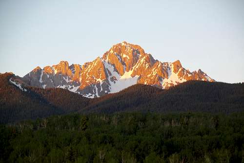
Enjoy the views. The Whitehouse Mountain appear like a true giant. The views of Sneffels are spectacular.
Enjoy the views. The Whitehouse Mountain appear like a true giant. The views of Sneffels are spectacular.
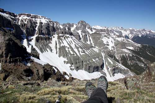 View of Mount Sneffels | 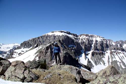 Whitehouse Mountain |
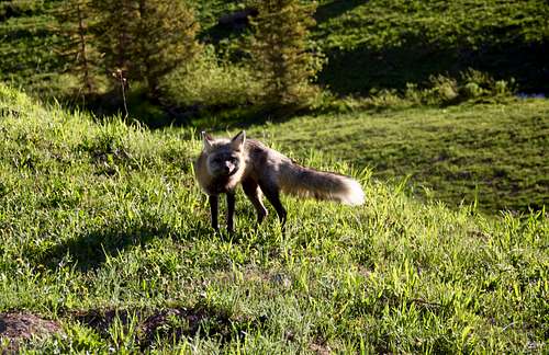 Fox | 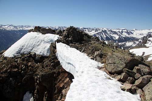 Cornice along the summit of Corbett |
Red Tape
There are no fees - parking at the trailheads is free. The mountain lies within Mount Sneffels Wilderness and wilderness rules apply here. The following are prohibited: Entering or being in the area with more than 15 people. Camping within 100 feet of any lake, stream, or National Forest System Trail. Building, maintaining or using a fire within 100 feet of any lake, or stream, or National Forest System Trail, above treeline. Storing equipment, personal property, or supplies for longer than seven days.When to Climb
Summer is obviously the easy time with the 4 WD road up Miller Mesa and toward's Burn's hut open. Winter adds more approach length and travel through an avalanche terrain. Always check avalanche terrain prior venturing out.Burns hut is one of the back country ski huts and is available for booking - check out San Juan back country huts site here.
Camping
Wilderness camping is available anywhere. You can car camp near the trailhead.Burn Hut is available for rent.