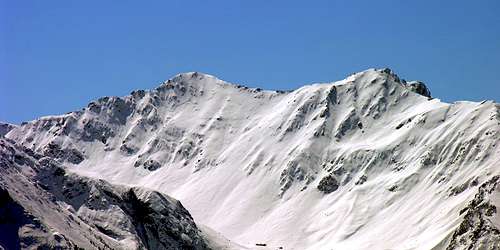
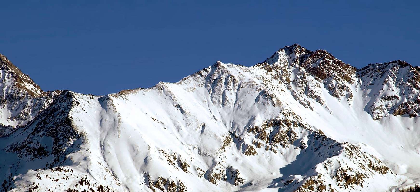
Remarkable trigonometrical point, rises to the East on the watershed of the Colle di Tsa Setze (2.820m) (a Ferrata goes along its SW ridge). From the summit 2 more ridges/spurs: the first (north) toward the Lake of Chamolé (2.311m) ending to the Punta del Dard (2.033m); the other one (east) toward the Colle Garin (2.815m), on this ridge the Quota 3.081 (Punta di Pian Bessey). Its summit is often climbed, from the West side of the Testa Nera, to enjoy the fantastic views on the Grivola and the whole Alps Range.
Notevole punto trigonometrico, sorge ad oriente sullo spartiacque del Colle di Tsa Setze (2.820 m). Collegata dalla cresta Sud-Ovest (Via Ferrata). Invia altri due contrafforti di cui uno in direzione nord verso il Lago di Chamolé (2.311 m) e terminante alla Punta del Dard (2.033 m); l'altro in direzione est verso il Colle Garin (2.815 m), dopo aver superato la Quota 3.081 o Punta di Punta di Pian Bessey. La cima è molto frequentata salendo dal versante Ovest della Testa Nera a scopo panoramico con viste eccezionali sulla Grivola e su tutta la cerchia alpina.
First ascents
First on the Summit: P. L. Guignard, (1877), from Charvensod and, more probably Northern Slope of Valletta Pass (see relation 1877).
S-W Slope or Northeast?: P. L. Guignard, (1877). Remark: More likely as indicated by the 9.000 and 9.900 feet mentioned by the Author, which correspond to the Pass and Summit Valletta (3.000m, 3.090m) and most easily accessible from the Valley of Arbolle; in fact, it makes no sense, coming from the North, the climb from the Southwest.
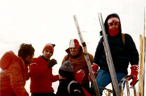
First in winter: Osvaldo Cardellina, Corrado Covi, Edy Covi, Camillo Roberto Ferronato Giuseppe Lamazzi and Armando Poli, (Dec 30th, 1977).
S-W Arête (Integral): Osvaldo Cardellina and Ilario Antonio Garzotto, (Aug 31th, 1969), in ascent from Pila, Plan de l'Eyve, Tsa Setze Pass. First repetition: Osvaldo Cardellina and Nicola Colajanni (Aug 06th, 2000), from Punta Tsavanis and through Tsa Setze Pass.
N Wall and W Crest (Directly to Quota 3.002/7): Osvaldo Cardellina, lone (Apr 25th, 2007), in ascent from Pila, Plan de l'Eyve, small basin below Tsa Setze Pass.
N-NW Wall (Right Via directly to Summit): Osvaldo Cardellina, lone (Oct 20th, 1991), in ascent from Pila, Plan de l'Eyve small basin.
NW Eperon and N Crest (Left Route): Osvaldo Cardellina and Christian Cardellina, (Jul 22th, 1990), in ascent from Plan de l'Eyve.
N Arête (Normal Route): Unknown, in ascent from Chamolé Pass with crossing towards Testa Nera and Mont Bellefaçe.
E-NE Arête (Integral): Osvaldo Cardellina and Christian Cardellina, (Jul 22th, 1983), in descent from Summit to Garin Pass through Punta Pian di Bessey.
Getting There
BY CAR:
From Torino, Milano, etc: Motorway A5. Exit at Aosta Est.
From Switzerland: through the Grand Saint Bernard Tunnel or the namesake Pass.
From France: through Mont Blanc Tunnel or Petit Saint Bernard Pass. It isn't necessary to take Motorway A5: you can drive on SS.26, in the direction of Aosta.
BY PLANE:
Aeroporto "Corrado Gex" Saint Christophe (Aosta).
Approach & Route
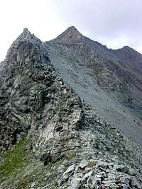
From Pila (famous ski area just above Aosta - public bus and cableway) up to the Upper Station of the Chairlift of Chamolé (2.311m), and follow toward South a path know as "Sentiero degli Alpini". From the Crucified icon of the "Cristo delle Nevi" along some hairpin bends up to a small hut belonging to the skiarea. Follow the narrow path leading toward the West side of the Testa Nera, on, along it to get the upper plain. Follow toward South (the summit is on the left) and, after passing a small bump, staying under the ridge on the W side you get a little exposed part of the path leading just beneath the Mont Belleface (2.970m). A short descent to get a small saddle, keep the eastern side of the ridge, pass a crunched rocks prominence, back on the w side of the ridge up to a small secondary summit (salle à manger); from the next saddle, along an easy path (a little exposure on Cogne side) up to the summit. Here a big metallic Cross of the A.N.A., in its base the summit book. Time required: about 2h'30 from the upper Station of the Chairlift.
Various Routes from Chamolé, Tsa Setze and Garin Hills, by Ilario Antonio Garzotto, Andrea Perino, Osw & marco87
Da Pila (nota località sciistica, raggiungibile da Aosta in auto pullman o funivia), raggiungere la Stazione Superiore della Seggiovia di Chamolé (2.311 m). Seguire verso sud un sentierino conosciuto con il nome "Sentiero degli Alpini". Superato il crocefisso dedicato al "Cristo delle Nevi" si sale lungo i numerosi tornanti sino a raggiungere una piccola struttura appartenente agli impianti di risalita. Continuare per lo stretto sentiero che porta verso il versante Occidentale della Testa Nera; risalirlo sino a raggiungere il pianoro superiore. Da qui, lasciata subito a sinistra la cima, continuare verso sud e, dopo aver oltrepassato una piccola gobba, tenendosi sotto cresta ad ovest si raggiunge un tratto leggermente esposto su sentiero franoso che conduce appena sotto il Mont Belleface (2.970 m). Con una leggera discesa, tra alcune faglie, pervenire a una piccola sella dalla quale, tenendosi sotto cresta ad est e aver superato un primo risalto su roccia a blocchi frantumati, per poi ritornare nell'ultimo tratto, nuovamente ad ovest, raggiungere una quota ad est della punta (salle à manger). Scendere alla successiva selletta e con sentiero su blocchi facili, esposto sul versante di Cogne, in breve si tocca la vetta, ove è posizionata una grande croce metallica con targa A.N.A. (Alpini), dove sul basamento è posto il libro di vetta. Tempo di salita 2h'30 dalla Stazione della Seggiovia.
Equipment for the Route
Standard mountaineering equipment.
Da escursionismo.
Difficulty
Normal route: Easy anf for Experienced Hikers E/F.
Campings
Remember that free camping is forbidden (except for emergency reasons, over 2.500m, from darkness until dawn).
Mountain Condition
Meteo: you can find all the needed informations at the official site of the Valle d'Aosta Region:
"Diari Alpinistici" di Osvaldo Cardellina e Indice Generale accompagnato da Schedario Relazioni Ascensioni 1964-2019 (inediti).
"80 itinerari di Escursionismo Alpinismo e Sci Alpinismo in Valle d'Aosta", di Osvaldo Cardellina, Ed. Musumeci, Giugno 1977 (in Italian); seconda Ed. Luglio 1981; terza Ed. Luglio 1984; (in French), prima Ed. Febbraio 1978; seconda Ed. Marzo 1980.
"Guida del Monte Emilius", di Osvaldo Cardellina Editore in collaborazione con il Club Alpino Italiano Sezione di Aosta, Dicembre 1978.
"Guida dei Monti d'Italia – Emilius Rosa dei Banchi Parco del Mont Avic" di Giulio Berutto e Lino Fornelli-Club Alpino Italiano/Touring Club Italiano, Marzo 2005.
"Guida delle Alpi Occidentali" di Giovanni Bobba e Luigi Vaccarone C.A.I. Sezione di Torino Volume II (parte II), 25 Maggio 1896.
MAPS:
Kompass "Gran Paradiso Valle d'Aosta Sentieri e Rifugi" Carta turistica 1:50.000.
Hapax "Les Sentiers Comunità Montana Monte Emilius" Luglio 2000 1:25.000.
Enrico Editore Ivrea-Aosta "Gruppo del Gran Paradiso" 1:50.000.
I.G.C. Torino "Carta delle Passeggiate ed Escursioni in V.D.A. Conca di Pila-Gressan" 1:20.000.
Children refers to the set of objects that logically fall under a given object. For example, the
Aconcagua mountain page is a child of the 'Aconcagua Group' and the 'Seven Summits.' The
Aconcagua mountain itself has many routes, photos, and trip reports as children.
Parents refers to a larger category under which an object falls. For example, theAconcagua mountain page has the 'Aconcagua Group' and the 'Seven Summits' asparents and is a parent itself to many routes, photos, and Trip Reports.

 10099 Hits
 86.85% Score
 23 Votes