|
|
Mountain/Rock |
|---|---|
|
|
36.06414°N / 51.51550°E |
|
|
Mountaineering |
|
|
Summer |
|
|
13510 ft / 4118 m |
|
|
Overview
Click for Introduction to the Central Alborz Mountains.Click for Introduction to Kholeno Massif.
Click for a detailed map of the Central Alborz Mountains.
Click for a detailed map of the Kholeno Massif.
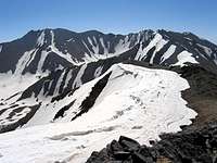
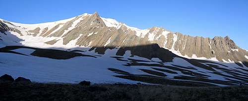 Bandalkoli and its jagged ridgelines
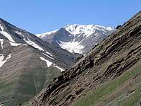 Summit
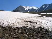 Summit
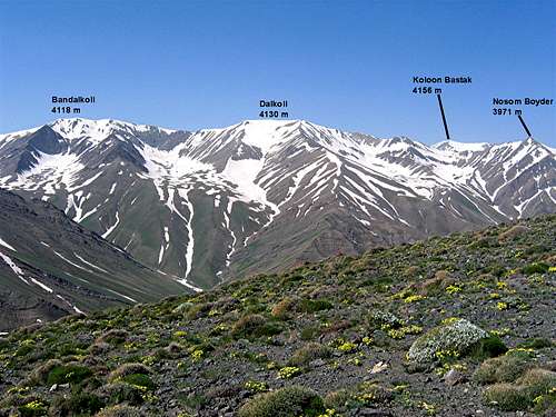
Bandalkoli is one of the 4000 m peaks of the Kholeno massif in the Central Alborz Mountains of northern Iran. To the west, Bandalkoli is connected to the 4130 m Dalkoli Peak and to the east, it connects to the 4253 m Khers Chal/Farakhe No Peaks (via Peak 4051 m). The southern slopes of Bandalkoli are steep scree slopes that go down to the upper portions of the Velayat Rood River Valley (3500 m) and its northern slopes drop down to a branch of the Varengeh Rood River Valley (3100 m).
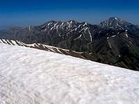
 From Gavan Poshteh Pass
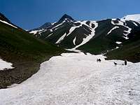 Bandalkoli
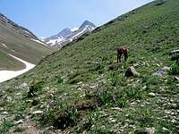 Bandalkoli
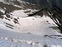
On the northern slopes of Bandalkoli, you will find two descending jagged ridgelines that give rise to many rocky spires. When Bandalkoli is viewed from the north, these ridgelines appear as a couple of impressive horns that sit in front of the summit of Bandalkoli. In between the ridgelines on the northern slopes of Bandalkoli and its neighbors, there are high snow-filled alpine bowls.
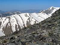
 (L) Bandalkoli 4118 m & (R) Dalkoli 4130 m
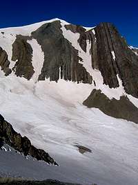 Summit view from east
 Summit view from west
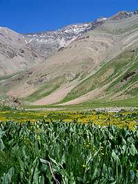
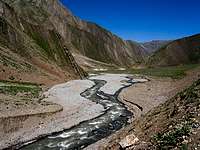
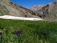
A round trip to the summit of Bandalkoli will take at least one and a half days. The shortest route is to start at the village of Laloon (2400 m) to the southeast and hike to the Varzab Pass (3910 m), Khers Chal summit (4253 m) and then follow the ridgetop to Bandalkoli. A southwesterly approach from the bottom of the Dizin ski slopes and the Velayat Rood River Valley is also possible. You will have the best views, however, if you approach Bandalkoli from the north via the Varengeh Rood River Valley. You will start at the Varengeh Rood Village (2450 m) and then hike 21.5 Km (13.3 miles) along the length of the Varengeh Rood River to reach the Kholeno Lake (3830 m) where you will find a perfect spot to set up your base camp (The hike will take you past the remains of monstrously large winter avalanches and provide you with spectacular views of snow-capped peaks and alpine meadows). From your base camp, you will then be able to access many of the local peaks
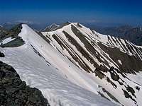
 Bandalkoli
Views From the Summit of Bandalkoli