Aug 11th, 2017 Started to modify the page and the other sections.
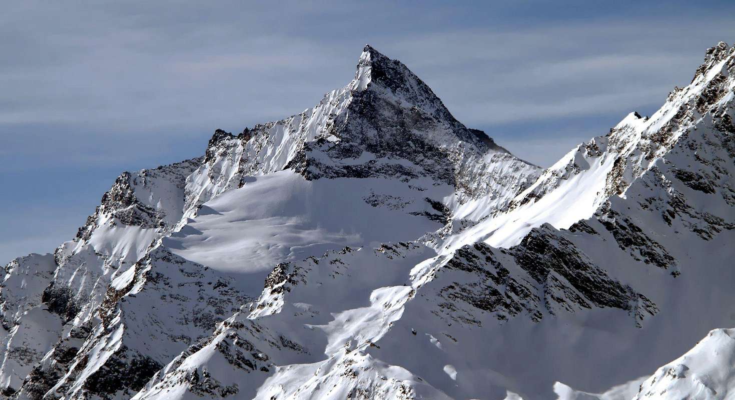
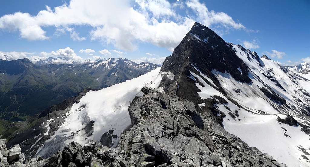
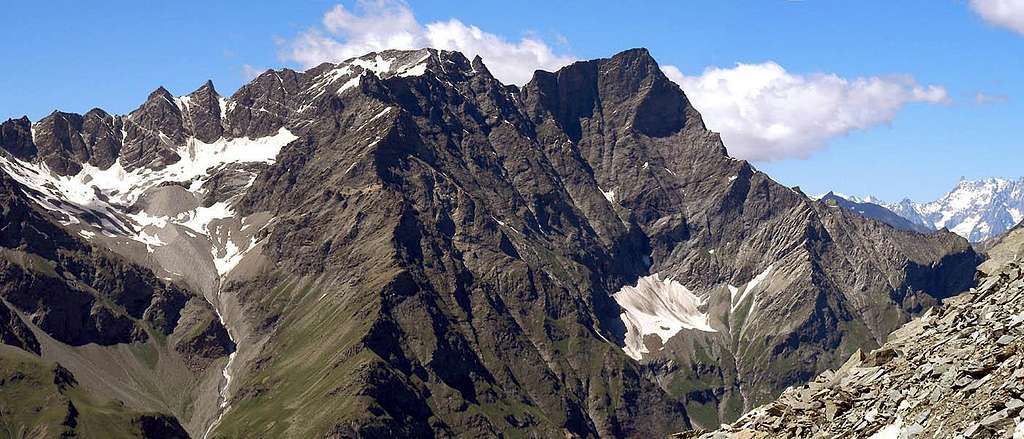
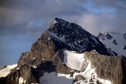
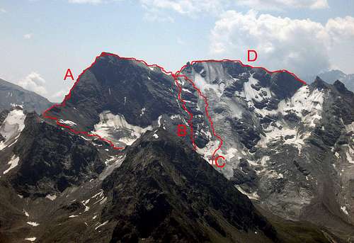
Very nice shaped mountain, with a very complex morphology. It is placed on the ridge watershed, that divides Valgrisenche from Val di Rhemes, where it is the highest mountain. The summit is constituted from two peaks distant 800 meters from eachothers. The north (3.607m) and the south (3.577m). The lowest point between them is called "Colle della Grande Rousse"(3.516m). The side of Val di Rhêmes is characterized by 3 section: The one in the center that overhung from the crest that connects the two tops, composed by a big cliff high 800 meters.The northern that culminates with the north summit, and raises with a rocky spur called "Fort de Bard". And that southern formed from the Glacier di Fos and the Becca di Fos, that culminates with the south summit. The west side on Valgrisenche is nearly totally fleeced of ice, and divisible in 3 parts: The glaciers of Mount Forciaz, Invergnan and Giasson. The total lack of huts on the east side, makes it a wild mountain with difficult approach. On the west side,the bivouac Ravelli (2.860m) gives the possibility to divide the climb in two days and to approach the mountain from the easyest and most logical route. The sense of the name "Grande Rousse", probably came from the Aosta Valley dialet. Which could be "Big glacier" or "Big summit of the glacier".
Montagna molto bella, con una morfologia molto complessa. Si trova sul versante che divide la Valgrisenche dalla Valle di Rhêmes, dove è la montagna più alta. Il vertice è costituito da due cime distanti l'una dall'altra circa 800 metri, Ia cima nord (3.607 m) e la cima sud (3.577 m). Il punto più basso tra di loro è chiamato "Colle della Grande Rousse" (3.516 m). Il lato della Val di Rhêmes è caratterizzato da 3 settori: Quello nel centro che si affaccia dalla cresta che collega le due cime, composta da una scoscesa parete alta circa 800 metri che precipita sul sottostante e oramai quasi estinto ghiacciaio del Pellaud. Il versante occidentale che culmina con la cima nord, si solleva con una bastionata rocciosa chiamata "Fort de Bard". Quella meridionale formata dal Ghiacciaio di Fos e dalla Becca di Fos, che culmina con il vertice sud. Il lato occidentale di Valgrisenche è quasi totalmente ricoperto di ghiaccio, e divisibile in 3 parti: i ghiacciai del Monte Forciaz, di Invergnan e di Giasson. La mancanza totale di bivacchi o rifugi sul lato est, la rende una montagna selvaggia con un approccio difficile. Sul lato ovest, il bivacco Ravelli (2.860 m) dà la possibilità di compiere la salita in due giorni e di avvicinarsi alla montagna dal percorso più facile e logico.
Approach
FROM ITALY:
From Valgrisenche: From the motorway A5 Montebianco (from Geneve, Turin, Milan), take the exit Aosta Ovest and follow the direction to Arvier-Valgrisanche.
From Valle di Rhêmes: From the motorway A5 Montebianco (from Geneve, Turin, Milan), take the exit Aosta Ovest and follow the direction to Villeneuve - Val di Rhêmes.
FROM FRANCE:
From Val d'Isere: From the village of Val d'Isere, enter in the area called "Reserve Naturelle de la Grande Sassiere". From here, few routes, through Col de Rhême Golette and Col de la Tsanteleina, permits to reach the Italian side the foot of this mountain.
FROM OTHERS PARTS:
Is possible to reach the Aosta Valley also through the: France - pass of Piccolo St. Bernardo (closed in winter). France - Tunnel of Mont Blanc. Swiss - Tunnel of Grand St. Bernardo. Swiss - pass of Grand St. Bernardo (closed in winter).
- Northwest spur - W. Coolidge and C. Almer 25/08/1885.- North wall - D. Garin, A. Sciardi 07/1980.- North ridge - F. Vallino, G. Bich, A. Castagneri 30/07/1885.- East ridge - V. Gayda, C. Therisòd 29/07/1906.- East flank - L. Barale, A. Gorret, A. Martinelli 05/08/1974.- South ridge - G. Bobba, C. Therisod 04/08/1888.- WNW spur - Aldo e Ester Bonacossa 07/08/1926.
Routes
- From Glacier Invergnan and Colle Grande Rousse - Normal route (from biv. Ravelli PD+/AD)(C in the pic). - Northwest spur - 2° Normal route (from biv. Ravelli PD+/II+)(B in the pic). - North wall - Bad rocks (600m AD+/D). - From Glacier Forciaz and north ridge - Friable rocks (from biv. Ravelli III°/IV°)(A in the pic). - East ridge - Difficult but safe (III°/IV°). - From east flank and Colle Grande Rousse - Very long and not recommended (PD+). - South ridge - Safe and most logic (AD/III°)(D in the pic). - SKI route - Very hard ascent. From biv. Ravelli OSA.
Gear
Standard mountaineering equipment: Rope, iceaxe, crampons and helmet.
Da alpinismo: Corda, picozza, ramponi e casco.
Refuges and Bivouacs
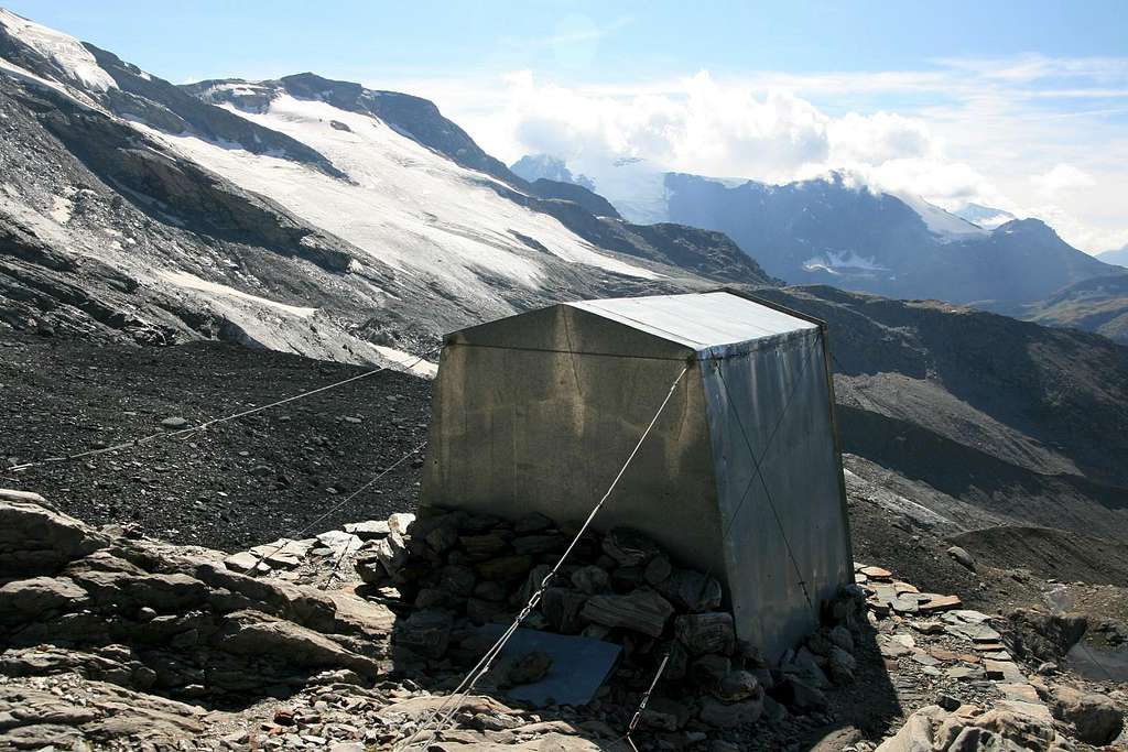
Bivouac Luigi Ravelli 2.860m 9 places, always open. From Uselleres (1.778m), take the path n°10 (3h'00 diff. T).
Campings
Remember that free camping is forbidden (except for emergency reasons, over 2.500m, from darkness until dawn).
Mountain Conditions
You can get meteo information at the official site of the Regione Valle d'Aosta:
Parents refers to a larger category under which an object falls. For example, theAconcagua mountain page has the 'Aconcagua Group' and the 'Seven Summits' asparents and is a parent itself to many routes, photos, and Trip Reports.

 14512 Hits
 92.04% Score
 37 Votes