


-
 1520 Hits
-
 81.18% Score
-
 13 Votes
|
|
Mountain/Rock |
|---|---|
|
|
45.65350°N / 7.31283°E |
|
|
Hiking, Scrambling, Via Ferrata, Skiing |
|
|
Spring, Summer, Fall, Winter |
|
|
9029 ft / 2752 m |
|
|
Note
|
La montagna chiama i suoi figli, ed essi rispondono fedelmente al suo appello… Osvaldo Cardellina, Diario alpinistico, 1964-65 Page texts: @ OsvaldoCardellina "Osva", passed away on May 2, 2022. Page owners: Christian Cardellina e Osvaldo Cardellina. Any updates from September 12, 2022: Antonio Giani, page administrator, friend and climbing companion. Testi della pagina: @ OsvaldoCardellina "Osva", scomparso il 2 maggio 2022. Proprietari pagina: Christian Cardellina e Osvaldo Cardellina. Eventuali aggiornamenti dal 12 settembre 2022: Antonio Giani, amministratore della pagina, amico e compagno di salite. |
Overview
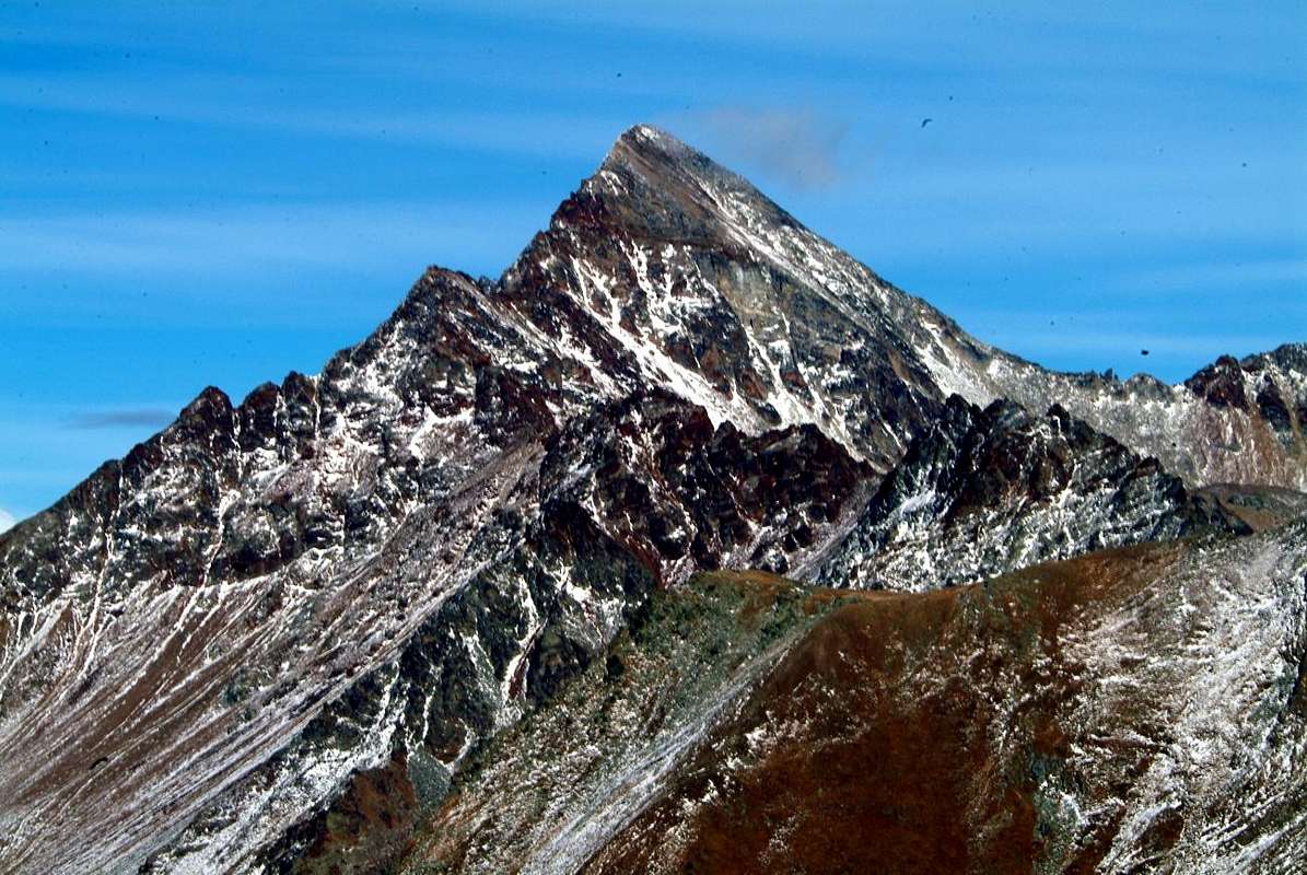
This large and flat Summit is located amidst Punta de Montpers or Monpers even Mompers and Pointe du Couìs or Pic de la Tombe, between the "lower" Val de Cogne and the "Conca"/Basin of Pila Resort.
This long spur takes beginning, after the Punta della Valletta (3.090m), from the Hill of Tsa Sétze or Chasèche (dry higher pasture; 2.820m), real input port between the Valley of Cogne (higher left branch or Western ramification of Vallon of Arpisson) and Pila 's Basin into the Municipality of Gressan. This divide between the Central Valley of Baltea and Grand'Eyvia (Big Water Stream) form the for the route the Punta Tsa Sètze (2.824m), the Punta di Monpers or Mompers even Montpers (2.793m), the "Piatta" (Flat Plateform) of Grevon (2.752m), the Punta del Couis or Couìss and even "Pic de la Tombe" (2.661m) to reach the Colle and Punta of Drinc, also known as Drink (2.555m, 2.663m), and finally die out with the Col de la Pierre and Punta with the same name (about 2.600 meters, 2.653m) above Gressan, Jovençan and Aymavilles Municipalities. Like nearby Punta del Couìs ("Top of the Blizzard") that was also known as Pic de la Tombe, from the name of the small and semi abandoned valley just South after the great overlying rocky cliffs drops the Vieyes Village, last Aymavilles before Cogne 's main Municipality. Hiking very busy in the years before the laying of some repeaters around Summit (1960?) of Drinc is today an intermediate transit point along "Pano Via" equipped by 2000 and then linked in 2003 with the "Via Ferrata" on the Crest Southwest of Punta della Valletta. All this buttress, which acts as a partition between the Central Valley of the Dora Baltea and the diagonal (From Southeast to Northwest) Cogne Valley, in summer can be covered during the day with a highly spectacular and panoramic semicircular route. The same, in fact, can be extended from the Punta della Valletta towards the North, reaching Mont Bellefaçe (2.970m) and the subsequent Testa Nera (2.820m), just above the Chamolé Lake (2.325m). While the stretch between Pointe de la Pierre (2.653m) and Colle Tsa Sètze or Chasèche is defined as: "24. Cresta di Pila" (see in "EMILIUS - ROSA DEI BANCHI PARK OF M. AVIC" by Giulio Berutto - Lino Fornelli , pages 78/9; Edit. CAI / TCI, March 2005), in "Guide of Monte Emilius", pages 66/7, by Osvaldo Cardellina and Edit. from the same in collaboration with the Aosta Section of the C.A.I. December 1978, we find it as "GIRO DELLA CONCA DI PILA" also "TOUR OF THE PILA BASIN". In fact, completing the route, not only to the Black Head, but continuing along the ridge that from Colle di Chamolé (2.641m) reaches the altitude (2.033m) called Punta del Dard (of the waterfall, being above that of Ponteilles), or Becca de Rien (of little or no importance) and again Becca du Rem (of the copper). In this last case, after the descent from the Testa Nera (Black Head) on the hill, reach the altitudes of the Chamolé Coast (2.509m, 2.485m), the Col Gran Plan (2.437m), the Punta di Replan (2.451m), the Col Replan ( 2.366m), of the Signal Sismonda (2.356, 2.343 meters; old observatory dedicated to the geologist Angelo Sismonda), of the Colle Plan Fenetre (2.221m); from this point, which establishes the entrance door between the Alpe di Chamolé and the Vallone del Comboé or Combuì, the watershed crest still has a "jolt" foming the Pointe de Ponteilles (2.263m), the Punta Valletta (2.164m) and that of the Dard, above the Foresta Nera (Black Forest) of Combatissière and the Alps of Les Pousses (1.601m), Les Leyzères (1.517m) and Les Gorres (1.385m), this last nearby the Regional Road toward Pila Resort. A tour that at first glance may appear to be "oceanic", but which can actually be done in one day. A path that requires a total of 5 to 7 hours, depending on the degree of training.
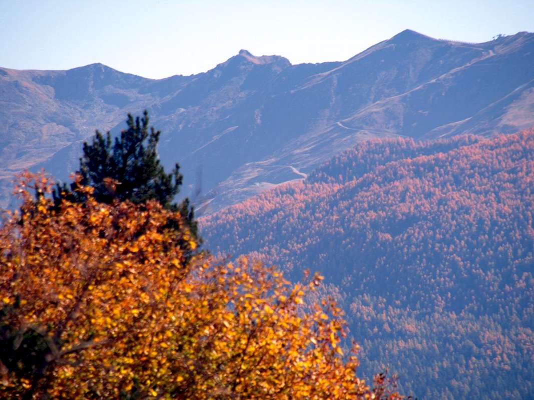
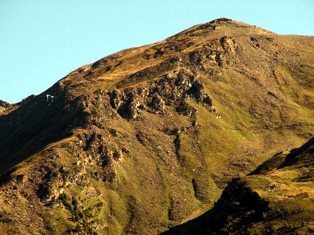
Reached also through the practice of the Ski-Mountaineering, although much less (although in recent seasons there has been a significant turnaround, at least compared to the Pointe de la Pierre, which becomes more and more a ski mountaineering itinerary or with snowshoes starting from the junction of Dailleu (1.480m), just above the Hamlet of Ozein) than neighboring Punta de la Pierre (just as just said, usually from Ozein for the Northern slope) and Punta del Couis at which it was rebuilt by the Company Pila SpA Refuge Simone Facchinello "Arno" (2.660 meters; always open but without any equipment for the night and even for the kitchen), above the perimeter ruins of an old shelter used by skiers of Aosta in the Fifties. Around the ridge "grandiose" views of the bottom of Cogne's Valley and the Conca or Basin of Pila on which dominate Grand Nomenon, La Grivola (3.969m), Punta Rossa, Pointe du Pousset, Pic Garin and Monte Emilius (3.559m). But if you its true lovers & love the particular features, the view stretched over the steeples of Aosta, Vieyes and, just down below in distance, towards Cogne ...
Larga e piatta Sommità collocata tra Punta di Montpers o Mompers ed anche Monpers e Pointe du Couìs o Pic de la Tombe, a cavallo della parte "bassa" della Val de Cogne con il Comprensorio della Conca di Pila.
Questo lungo, e ben in vista dalla Città di Aosta come dal Comune di Cogne, contrafforte prende inizio, dopo la Punta della Valletta (3.090 m), dal Colle di Tsa Setze oppure Chasèche (2.820 m), vera porta di ingresso tra la Valle di Cogne (Vallone di Arpisson) ed il Bacino di Pila nel Comune di Gressan. Questo spartiacque tra la Valle Centrale della Dora Baltea e la Grand'Eyvia (Grande Acqua) forma per strada la Punta di Tsa Sèche (2.824 m), la Punta di Mon(m)pers o Pointe de Monptpers (2.793 m), la Piatta di Grevon (2.752 m), la Punta del Couis o Couìss (2.661 m) per raggiungere il Colle e la Punta del Drinc, conosciuto anche come Drink (2.555 m, 2.663 m), ed infine estinguersi con il Col de la Pierre ed omonima Punta (2.600 metri circa, 2.653 m) al di sopra dei Comuni di Gressan, Jovençan ed Aymavilles. Come la vicina Punta del Couis (cioé Punta della Tormenta) la quale era un tempo conosciuta anche come Pic de la Tombe, dal nome del valloncello subito a Sud dopo i grandi salti rocciosi soprastanti il Villaggio di Vieyes, ultimo di Aymavilles, nonché anticipante quello di Cogne. Molto frequentata nello Escursionismo negli anni precedenti la posa di alcuni ripetitori nelle vicinanze della Sommità (1960?) della Punta del Drinc costituisce oggi punto di transito intermedio sulla "Via Panoramica" attrezzata dal 2000 e poi collegata nel 2003 con la "Via Ferrata" sulla Cresta Sudovest della Punta della Valletta. Tutto questo contrafforte, che funge da divisorio tra la Valle Centrale della Dora Baltea e la diagonale Valle di Cogne, in estate può essere percorso in giornata con un percorso semicircolare altamente spettacolare e panoramico. Il medesimo, infatti, può essere prolungato dalla Punta della Valletta verso Settentrione, raggiungendo il Mont Bellefaçe (2.970 m) e la susseguente Testa Nera (2.970 m), proprio al di sopra del Lago di Chamolé (2.325 m). Mentre il tratto tra la Pointe de la Pierre (2.653 m) ed il Colle Tsa Sètze o Chasèche viene definito come: "24. Cresta di Pila" (vedi in "EMILIUS - ROSA DEI BANCHI PARCO DEL M. AVIC" di Giulio Berutto - Lino Fornelli, pagine 78/9; Edit. C.A.I. / T.C.I., Marzo 2005), in "Guida del Monte Emilius", pagine 66/7, a cura di Osvaldo Cardellina con Edit. dello stesso in collaborazione con la Sezione di Aosta del C.A.I. Dicembre 1978, lo troviamo come "GIRO DELLA CONCA DI PILA". Infatti completando il percorso, non solo fino alla Testa Nera, ma con proseguimento lungo il crinale che dal Colle di Chamolé (2.641 m) raggiunge la Quota (2.033 m) chiamata Punta del Dard (della cascata, essendo al di sopra di quella di Ponteilles), oppure Becca de Rien (di niente o di poco conto) ed ancora Becca du Rem (del rame). In questo ultimo caso, dopo la discesa dalla Testa Nera sul colle, andranno aggiunte le altitudini della Costa di Chamolé (2.509 m, 2.485 m), del Col Gran Plan (2.437 m), della Punta di Replan (2.451m), del Col Replan (2.366 m), del Segnal Sismonda (2.356, 2.343 metri; vecchio osservatorio dedicato al geologo Angelo Sismonda), del Colle Plan Fenetre (2.221m); da questo punto, che sancisce la porta d'ingresso tra l'Alpe di Chamolé ed il Vallone del Comboé o Combuì, la cresta spartiacque ha ancora un "sussulto" fomando la Pointe de Ponteilles (2.263m), la Punta Valletta (2.164 m) e quella del Dard, sopra la Foresta Nera di Combatissière al di sopra dell'omonima alpe (1.723 metri; due splendidi ed antichi "rascards" il legno)e gli Alpeggi di Pousses (1.601 m), Les Leyzères (1.517 m) e Les Gorres (1.385 m), con questo ultimo posizionato a non molta distanza dalla Strada Regionale verso il Comprensorio di Pila. Un tour che a prima vista potrebbe apparire come "oceanico", ma che in realtà si può compiere in un'unica giornata. Un percorso tale da richiedere complessivamente dalle 5 alle 7 ore, a seconda del grado di allenamento, che, comunque, necessita d'esser buono.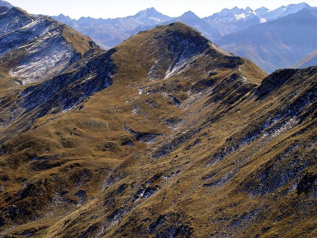
Raggiunta anche con lo Sci-Alpinismo, anche se molto meno (pur se nelle ultime stagioni si é evidenziata una notevole inversione di tendenza, almeno rispetto alla Pointe de la Pierre, che diventa sempre più itinerario di sci-alpinismo o con rachette da neve con partenza dal bivio di Dailleu (1.480 m), appena sopra l'abitato di Ozein) rispetto alle vicine Punta de la Pierre (per l'appunto come appena detto, in genere da Ozein (1.349/59 m) per il versante Settentrionale) e Punta del Couìs o Pic de la Tombe presso la quale é stato ricostruito da parte della Società Pila S.p.A il Rifugio Simone Facchinello "Arno" (2.660 metri; sempre aperto ma non attrezzato), sopra i ruderi d'un vecchio ricovero rettangolare in pietra utilizzato dagli sciatori aostani negli Anni 50. Dal crinale viste grandiose sulla parte inferiore della Val di Cogne e sulla Conca di Pila sulle quali troneggiano Grand Nomenon, Grivola (3.969m), Punta Rossa, Pousset, Pic Garin, Emilius e Becca di Nona. Ma se siete proprio veri amanti delle peculiarietà, allungate la vista sopra i Campanili d'Aosta, Vieyes e laggiù, guardando in fondo, Cogne e "Prato di St. Orso" ...
First Ascents
- First on the Summit: unknown.
- In winter: unknown.
Getting There
BY CAR:
- From TORINO, MILANO, etc: Motorway A5. Exit at IVREA or Quincinetto (PIEDMONT) AOSTA West/Aymavilles, Cogne Municipalities.
- From Gressan (alternaive Regional Road by the small square Chez-le Ru 610m) towards Leysettaz Dèsott, Tivet Villages and Pila-Resort up to Les Fleurs Fraction (1.414m). But in this case, then you must descend to the Regional Road from Charvensod to the junction 951 meters for Reverier du Tzat and Dessous Alpages. From Aymavilles (646m) towards Cogne Valley: reaching Vieyes (1.132m), Epinel, Crétaz Hamlets to Cogne (1.534m); through Main Road. Or from this by Regional Road towards Montroz and Gimillan (1.785m) Villages; from the last in Northwest towards the above Arpisson/Tsa Sètze Vallons.
- From FRANCE: through the Mont Blanc Tunnel to Entrèves-crossroads to Vény/Ferret Valleys - Mountain Guides of Courmayeur - La Saxe Rock Gym - Courmayeur. By Little Saint Bernard Hill, closed since November until half May to La Thuile Valley - Pré Saint Didier - Courmayeur.
It is not necessary to take Motorway A5: you can drive on SS.26, in the direction of AOSTA - IVREA - TURIN.
BY PLANE:
- Aeroporto "Corrado Gex" Saint Christophe (Aosta).
Route
Route: from Touristic Center Pila Resort in Gressan Municipality. From the Center Touristic of Pila (attainable from the City of Aosta through the Regional Road that from the Bridge Suaz (567m) above the River Dora Baltea climbs to the inhabited area of Charvensod (746m) for then to continue, through a whole small series of fractions of this Municipality, reaching at first Péroulaz renowned Hamlet (1.359m) to the border with Gressan and then Les Fleurs Village (1.414m), already inside this last. Touching in progression the Villages of the Petite and the Grande Cerise, Eaux-Froides, Charémoz, Bettères and Perchu the same one reaches the center of Pila (1.800m about). Also, always pivot of reference the Pont Suaz to climb up to Les Fleurs with the road that, long the same stream, it reaches the Commune of Gressan (600m about). From the rotunda really in front of the Commune, between the inhabited areas of Taxel and Chez the Rus, to go up again at first toward Southeast among a series of small scattered fractions, but adjacent; then to a first winding road to form of elbow the same one clearly changes direction in East and, doubling the characteristic Hill of the Gargantua, just above Gressan Municipality. The same one reaches the Village of Plan David (745m) and subsequently with a series of wide windings road those of Perriail, Champlan Dessous, Leysettaz, Champlan Dessus, Barrier, Tivet and Gerdaz (1.340m; intermediary station of the Cableway Aosta/Pila) that it discards as soon as on the left. With other two windings the same reaches Les Fleurs Village to the conjunction with preceding Regional Road, from where whence towards Pila. Interesting and fun approach that should be done with one and go down with the other in asphalt road.From Pila "lower", through the great tunnel in cement, to reach the breadth superior square-parking lot (1.870m), where he leaves the car, since all the dirt farms roads in dirt earth to follow introduces the poster of prohibition. From this to reach an i cross of three roads "poderali", site between Gorraz and Gorraz Damon, taking that in right, concomitant with the path n° 23 and to follow it with direction Southwest (abundant posters and signals). Passing below the Cableway Gorraz/Leissé Damon, to reach at first the Pasture of Lap (2.076m), that he leaves as soon as on the left, introducing then himself in the homonym Bois (Wood). Immediately after to reach the Grand Grimod Dessous (2.158m), where a new triplex intersection of paths happens (to the right or North for the Grimondet Pastures (2.105m) and to the left or Southeast for the Grand Grimod Dessus (2.232m; arrival of the "Funivia"). Instead leave the deviation between the two with trail n° 23A toward the hairpin bend 2.294 meters, just below the chairlift that from Alpe Grivel reaches just above and addressed to the Col de la Pierre. Changing direction to the South reach the arrival station of the Grand Grimod (2.193m) and the nearby Grimod Dessus Alpage (2.232m; arrival of the cable car from Gorraz) and continue towards the South through bumps grassy meadows and small-debris basins reaching a height of 2.382 meters a short detour of the trail n°22A to the Colle del Couis (2.637m), as well as the private dirt road that reaches 2.258 meters from the junction between Grimod Dessous and Grand Grimod. With the latter, addressed to the Pointe du Couis (2.661m), achieve in a short time with a small deviation of a small path in Northwest the Col du Drinc (2.565m) and, via a steep but brief deviation, get to the Pointe du Drinc or Drink along its "Crestina" East-southeast. Outflanking the right or East a short rocky passage at an altitude 2.601 meters easily reach the Summit (2.663m) with the small path n° 1 leading to some repeaters (E or BSA; 0h'45 from Drinc Hill; 3h'45/4h'30 by Pila-Gorraz Upper). From this go on the watershed and crossing the next Punta del Couìss (or "Blizzard's" Point with the Simone Faccarello "Arno" Bivouac) and the Grevon Platform with easy, but more aerial route as well as exposed, through the Northern Crest to the Top. In descent:
A) - down with the same crest or quickly and easily with the Northwest to the Col de la Pierre (between Pila Basin and Ozein's Area or of the Alpe de La Pierre), whence with the trail n° 23A at the Grand Grimod, or West towards the Alpe la Pierre (2.119m) via the small path n° 8 and reached Dailleu (1.480m) between Ozein Turlin Dessus Hamlets. First with the road, which reaches Turlin Damon or of Aymavilles (1.557m), and then with the farms dirt road in winter known as "the Premù" (Cross-country skiing Run) you reach Brin di Milieu (1.642m) and again, in the locality Posse and by a brief but steep shortcut n° 21A to Pila (1.776m; 1h'00 Turlin Dessus). Or
B)- descend indifferently along steep and consisting of moraines and blocks slopes along the North-northeast or East Sides in the direction of the Plan de l'Eyvie (2.330m), from where, through the path n° 22TVC ed along the Plan de l'Eyvie Torrent towards Pila Resort also to the Northeast to the Chairlift of Chamolé (2.311m).
Via dal Centro Turistico del Domaine Skiable di Pila nel Comune di Gressan. Dal Centro Turistico di Pila (raggiungibile dalla Città di Aosta tramite la Strada Regionale che dal Ponte Suaz (567 m) sopra il Fiume Dora Baltea sale all'abitato di Charvensod (746 m) per poi proseguire, attraverso tutta una piccola serie di frazioni di questa Municipalità, raggiungendo dapprima Péroulaz (1.359 m) al confine con Gressan e poi Les Fleurs (1.414 m), già all'interno di questo ultimo. Toccando in progressione i Villaggi della Petite e della Grande Cerise, Eaux-Froides, Charémoz, Bettères e Perchu la stessa raggiunge il centro di Pila (1.800 metri circa). Oppure, sempre perno di riferimento il Pont Suaz salire fino a Les Fleurs con la strada che, lungo la Dora, raggiunge il Comune di Gressan (600 metri circa). Dalla rotonda proprio davanti al Comune, tra gli abitati di Taxel e Chez le Ru, risalire dapprima verso Sudest tra una serie di piccole frazioni sparse, ma adiacenti; poi ad un primo tornante a forma di gomito la stessa cambia nettamente direzione in Est e, doppiando la caratteristica Collina del Gargantua. La medesima raggiunge il Villaggio di Plan David (745 m) e successivamente con una serie di "tornantoni" quelli di Perriail, Champlan Dessous, Leysettaz, Champlan Dessus, Barrier, Tivet e Gerdaz (1.340 m; stazione intermedia della Funivia Aosta/Pila), che scarta appena a sinistra. Con altri due tornanti la stessa raggiunge Les Fleurs alla congiunzione con la precedente Regionale, donde a Pila. Avvicinamento interessante nonché divertente, che conviene effettuare con l'una e scendere con l'altra strada. Da Pila, tramite il grande tunnel in cemento, raggiungere il largo piazzale-parcheggio superiore (1.870 m), dove si lascia l'automobile, poiché tutte le strade "poderali" in terra battuta a seguire presentano il cartello di divieto. Da questo raggiungere un'incrocio di tre strade poderali, site tra Gorraz e Gorraz Damon, prendendo quella di destra, concidente con il sentiero n° 23 e seguirla con direzione Sudovest (abbondante cartellonistica). Passando al di sotto della Funivia Gorraz/Leissé Damon, raggiungere dapprima l'Alpe di Lap (2.076 m), che si lascia appena sulla sinistra, introducendosi poi nell'omonimo bosco o Bois de Lap. Subito appresso raggiungere il Grand Grimod Dessous (2.158 m), dove avviene un nuovo triplice incrocio di sentieri (a destra o Nord per il Grimondet (2.105 m) ed a sinistra o Sudest per il Grand Grimod Dessus (2.232 m; arrivo della Funivia). Abbandonare invece la deviazione tra i due con sentiero n° 23A verso il tornante 2.294 m, proprio al di sotto della Seggiovia che dall'Alpe Grivel lo raggiunge appena al di sopra ed indirizzato al Col de la Pierre (2.584 m). Cambiando direzione in Sud raggiungere la stazione di arrivo del Grand Grimod (2.193 m) e la viciniora del Grimod Dessus (2.232 m; arrivo della funivia da Gorraz) e proseguire verso Meridione attraverso dossi prativi e piccole conche erboso-detritiche raggiungendo a quota 2.382 metri una breve deviazione del sentiero n° 22A verso il Colle del Couis (2.637m), nonché la poderale che arriva dal bivio 2.258 metri tra Grimod Dessous e Grand Grimod. Con quest'ultima, indirizzata alla Pointe du Couis, raggiungere in breve tempo con una piccola deviazione su sentierucolo a Nordovest il Colle del Drinc (2.565 m) e, tramite un tratto più ripido ma breve, raggiungere la Pointe du Drinc lungo la sua Crestina Est-sudest. Aggirando a destra od Est un breve passaggio roccioso a quota 2.601 metri raggiungere facilmente la Sommità (2.663 m) con il sentiero n° 1 che conduce ad alcuni ripetitori televisivi della R.A.I. (E o BSA; 0h'45 dal Colle del Drinc; 3h'45/4h'30 da Pila località Gorraz di Sopra 1.860 metri). Da questa proseguire sullo spartiacque e, scavalcando la successiva Punta del Couìss (cioé "della Tormenta" e sormontata dal Bivacco Simone Faccarello "Arno") e la Piatta di Grevon con percorso sempre facile, ma più aereo nonché esposto, tramite la Cresta Nord alla Sommità. In discesa:
A) - scendere con la medesima cresta oppure rapidamente e facilmente con quella Nordovest al Col de la Pierre (collocato tra il Bacino di Pila e l'area soprastante Ozein o dell'Alpe de La Pierre , donde con il sentiero n° 23A al Grand Grimod, oppure ad Ovest verso l'Alpe la Pierre (2.119 m) tramite il sentiero n° 8 per poi raggiungere Dailleu (1.480 m) tra Ozein e Turlin. Dapprima con la carrozzabile, che raggiunge Turlin Damon o di Aymavilles (1.557 m), e poi con la strada poderale conosciuta in inverno come "la Premù" si raggiungono Brin di Milieu (1.642 m) e nuovamente Pila in località Posse (1.776 m) e, con breve ma ripida scorciatoia n° 21A, risalire a Pila. Oppure
B) - scendere indifferentemente lungo gli abbatanza ripidi e pietrosi versanti Nord-nordest od Est in direzione del Plan de l'Eyvie (2.330m), donde, con sentiero n° 22TVC e"tallonando" il Torrente Plan de l'Eyvie in direzione del Comprensorio di Pila; oppure a Nordest verso la seggiovia di Chamolé (2.311 m).
When to Climb
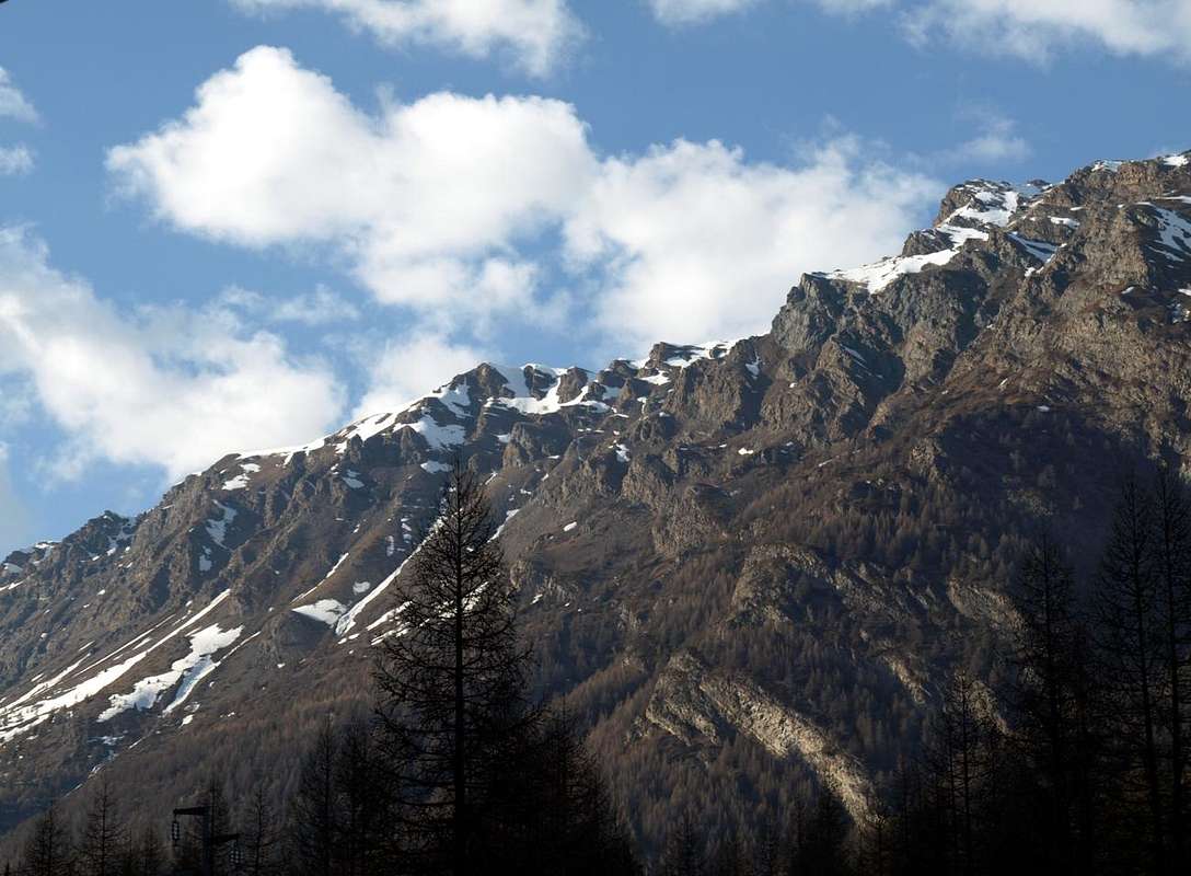
Street from the Tourist Center of the Domaine Skiable of Pila within the Municipality of Gressan. This excursion is feasible in every season, also thanks to the ski lifts that from Pila (Gorraz Dessus Station) go up the Northeast side reaching the dividing counter with the Cogne Valley. While on the opposite side, that is from the Cogne Valley as well as departing from the Village of Epinel (1.434m), the excursion is only recommended from late Spring to early Autumn (from mid-June to the end of October). Also due to the fact that this Southern slope of the buttress (rather steep and in any case not practicable on the slopes of the Piatta itself, but such as to force you to reach Colle del Drinc (2.584m) with the path N° 1/TVC, now in the territory of the adjacent Municipality of Aymavilles) is during the whole winter and for most of the Spring somewhat exposed to the danger of avalanches and avalanches. Otherwise it is necessary to go to the watershed through the path N° 2A that from Epinel Village or from the Gimillan Hamlet (1.800m) reaches the Colle di Tsa Sètze or Tsa Sèche (2.815m) and then crosses the ridge on the watershed bypassing before the Punta di Mompers or Montpers (2.793m). In any case it is better to reserve the trip through this side for the summer, during which it is possible to make various connections reaching the North end of the watershed up to the Pointe de la Pierre (2.653m) otherwise going backwards and then towards the South (South-souteast) reaching the Colle Tsa Sètze or Chasèche and, with the Via Ferrata, the Spallone (great shoulder) of the Punta della Valletta (3.002/7 meters), as well as, in short time, the same (3.090m).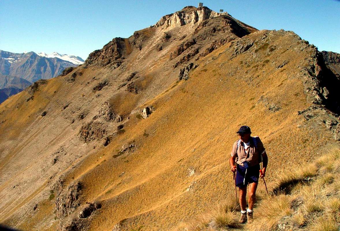
Via dal Centro Turistico del Domaine Skiable di Pila all'interno del Comune di Gressan. Questa escursione risulta fattibile in ogni stagione, anche grazie agli impianti di risalita che da Pila (Stazione di Gorraz Dessus) risalgono il Versante Nordest raggiungendo il contafforte divisorio con la Valle di Cogne. Mentre dal lato opposto, ovvero dalla Valle di Cogne nonché con partenza dal Villaggio di Epinel (1.434 m), é consigliabile l'escursione esclusivamente dalla tarda Primavera agli inizi dell' Autunno (da metà Giugno a fine di Ottobre). Anche per il fatto che questo versante Meridionale del contrafforte (piuttosto ripido e comunque non praticabile sulle pendici della Piatta medesima, ma tale da costringere a raggiungere con il sentierucolo N° 1/TVC il Colle del Drinc (2.584m), ormai in territorio dell'adiacente Comune di Aymavilles) risulta durante l'intero inverno e per quasi tutta la Primavera alquanto esposto al pericolo di slavine e valanghe. Altrimenti risulta necessario portarsi sullo spartiacque tramite il sentiero N° 2A che da Epinel oppure dalla Frazione Gimillan (1.800 m) raggiunge il Colle di Tsa Sètze o Tsa Sèche (2.815m) per poi attraversare in cresta sullo spartiacque oltrepassando la Punta di Mompers o Montpers (2.793m). In ogni caso conviene riservare la gita tramite questo versante alla bella stagione, durante la quale é possibile effettuare diversi collegamenti raggiungendo verso Settentrione l'estremità dello spartiacque fino alla Pointe de la Pierre (2.653m) altrimenti tornando all'indietro e quindi verso Mezzogiorno (Sud-sudest) raggiungere il Colle Tsa Sètze o Chasèche e, con la Via Ferrata, lo Spallone della Punta della Valletta (3.002/7m), nonché la medesima (3.090m).
Equipment and Difficulties
This route can be considered EE/F for both the crests watershed (Northwest from Arno Bivouac or East-southeast by Col Tsa Sètse).L'itinerario è da classificare in EE/F per entrambe le creste spartiacque (Nordovest dal Bivacco Arno oppure Est-sudest dal Col Tsa Sètse).
For Hiking. Calculate that at Bivacco Simone Facchinello "Arno" (always open and free) you can camp out, but the same is not equipped for that.
Da Escursionismo. Calcolare che al Bivacco Simone Facchinello "Arno" (sempre aperto e gratuito) si può bivaccare, ma lo stesso non é attrezzato in merito.
Campings
Remember that free camping is forbidden (except for emergency reasons, over 2.500m, from darkness until dawn).
Mountain Condition
- Meteo: you can find all the needed informations at the official site of the Valle d'Aosta Region:
- Valle d'Aosta Meteo
Books and Maps
BOOKS:
- "Guida del Monte Emilius", di Osvaldo Cardellina Editore in collaborazione con il Club Alpino Italiano Sezione di Aosta, Dicembre 1978.
- "Guida dei Monti d'Italia – Emilius Rosa dei Banchi Parco del Mont Avic" di Giulio Berutto e Lino Fornelli - Club Alpino Italiano/Touring Club Italiano, Marzo 2005.
- "Guida delle Alpi Occidentali" di Giovanni Bobba e Luigi Vaccarone C.A.I. Sezione di Torino Volume II (parte II), 25 Maggio 1896.
- "80 itinerari di Escursionismo Alpinismo e Sci Alpinismo in Valle d'Aosta", di Osvaldo Cardellina, Ed. Musumeci, Giugno 1977 (in Italian); seconda Ed. Luglio 1981; terza Ed. Luglio 1984; (in French), prima Ed. Febbraio 1978; seconda Ed. Marzo 1980.
 |
 |
 |
MAPS:
- Kompass "Gran Paradiso Valle d'Aosta Sentieri e Rifugi" Carta turistica 1:50.000.
- L'Escursionista "Conca di Aosta-Pila-Monte Emilius" Carta dei sentieri (n° 4) 1:25.000.
- Hapax "Les Sentiers Comunità Montana Monte Emilius", Luglio 2000 1:25.000.
- Enrico Editore Ivrea-Aosta "Gruppo del Gran Paradiso" 1:50.000.
- I.G.C. Istituto Geografico Centrale, Torino "Carta delle Passeggiate ed Escursioni in V.D.A. Conca di Pila-Gressan, 1:20.000.
Important Information
- REGIONE AUTONOMA VALLE D'AOSTA the official site.
- FONDAZIONE MONTAGNA SICURA Villa Cameron, località Villard de la Palud n° 1 Courmayeur (AO) Tel: 39 0165 897602 - Fax: 39 0165 897647.
- A.I.NE.VA. (Associazione Interregionale Neve e Valanghe).
Useful numbers
- Protezione Civile Valdostana località Aeroporto n° 7/A Saint Christophe (Ao) Tel. 0165-238222.
- Bollettino Valanghe Tel. 0165-776300.
- Bollettino Meteo Tel. 0165-44113.
- Unità Operativa di Soccorso Sanitario Tel. 118.