La montagna chiama i suoi figli, ed essi rispondono fedelmente al suo appello…
Osvaldo Cardellina, Diario alpinistico, 1964-65
Page texts: @ OsvaldoCardellina"Osva", passed away on May 2, 2022. Page owners: Christian Cardellina e Osvaldo Cardellina. Any updates from September 12, 2022: Antonio Giani, page administrator, friend and climbing companion.
Testi della pagina: @ OsvaldoCardellina "Osva", scomparso il 2 maggio 2022. Proprietari pagina:Christian Cardellina e Osvaldo Cardellina. Eventuali aggiornamenti dal 12 settembre 2022: Antonio Giani, amministratore della pagina, amico e compagno di salite.
Towered Overview
This tiny Tower (3.073m) is part of the small Subgroup Grande Roise (3.357m) into the Monte Emilius Group (3.559m). Although, geographically and orographically speaking, it belongs more to the Group of Tersiva (3.515m) than in the latter. For a very long watershed originates from the border with Piedmont at the Saddle 2.946 meters nearby Tip Peradzà and passed Bec Costazza, Tours Ponton and Pontonnet the reach; over the divider splits the Punta del Tessonet (3.266m) sending to the North-northeast branching reaching the Group of Grand Avert (2.991m) and North-northwest an almost parallel to the small Chain of Rouèses. This, starting from the Tip Leppe (3.305m), ending with just the Tour de Salé, or climbed on site, (3.073m), placed after the same name Becca (3.187m) and the two Roises (Petite 3.273/9m, Grande 3.356/7m). So a small tower, almost a shoulder close to the South Becca di Salé but that, when viewed from the North, completely vindicates their independence and autonomy. In fact, on this side it stands as imposing tower that dominates the Dora Baltea, right in the middle of the Central Valley over the Municipality of Grand Brissogne. Is formed from two sides, one of which, Eastern, turned over the wild Vallone Arpisson and Alpe Salé and the other to the West in the direction of the lower-middle part of Vallon des Laures. A third is formed to the North by the division of the North-Northeast Ridge that the altitude of about 2.960 meters sends a branch to the Punta of Bonplan (2.664m) and Testa Selva Plana (Head Flat forest) with the Croix de Salé (2.349/66m; +; 2.382m) and the opposite on wooded promontory above the Selva Plana Alp (2.007/1.932m) and Meyes Pastures (1.666m).
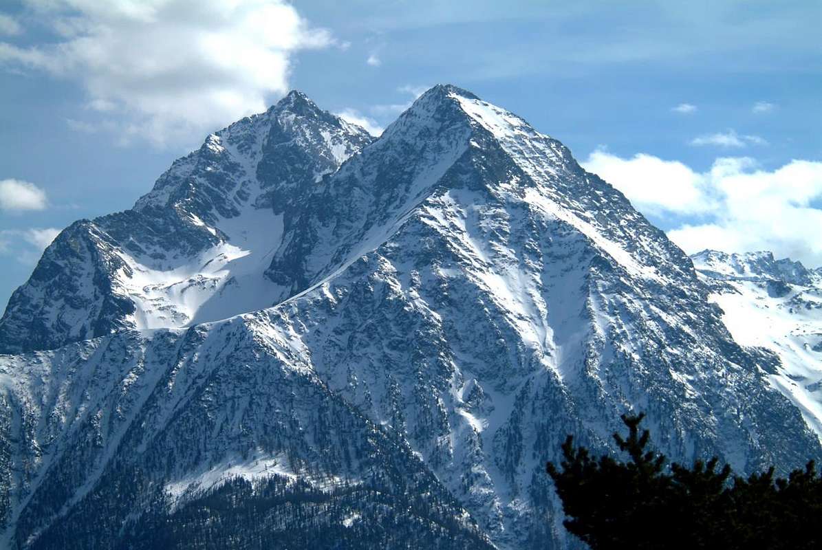
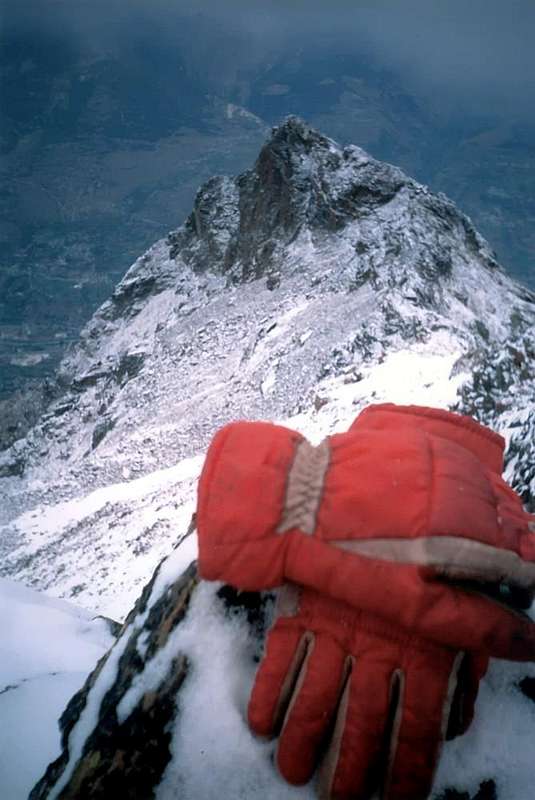
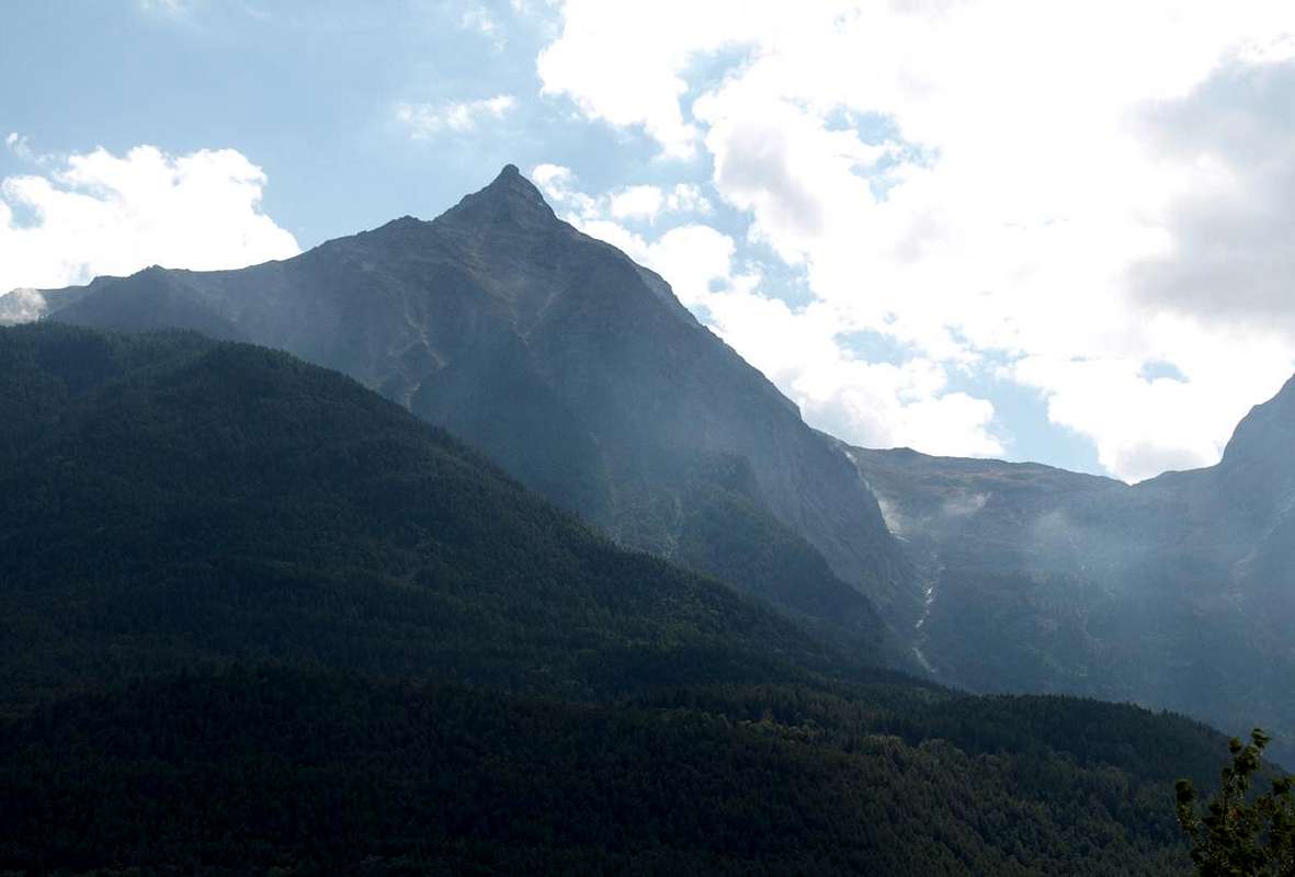
Salé or Salì Tower before homonym Pass & Petite Roise from Northeast, by Osw
The Summit, really shaped tower, presents surely few visitors, due to the length and complexity of the approaches and the lack of specific knowledge of the territory, which is preferred the easier ascension to nearby Becca di Salé, aided by the presence of Refuge Ernesto Menabreaz to the Laures. Is was climbed in some rare occasion of which we report in First Ascents, not being aware of any further ascents as incidentally confirmed to me by Giovanni Matteo "Agostino" Zulian (+ Luin of Grand Brissogne, Aosta + 25th July 2012), an expert hunter and mountaineer really strong and deep expert in this area of mountains little known and rarely visited by the precise reasons above. From The Summit unusual views of the Central Valley of Baltea in its middle part, on the below City of Aosta and to the Eastern and Northern Walls of Mount Emilius.
In foreground the Salé or Salì Tower before Becca & Little Roise, by Emilio Bertona aka emilius
Questa minuscola Torre fà parte del piccolo Sottogruppo della Grande Roise (3.357 m) all'interno del Gruppo del Monte Emilius (3.559 m) Anche se, orograficamente parlando, appartiene più al Gruppo della Tersiva (3.515 m) che non a questo ultimo. Infatti un molto lungo spartiacque si origina dal confine con il Piemonte presso la Punta di Peradzà e, oltrepassato Bec Costazza, Torri Ponton e Pontonnet la raggiunge; oltre il divisorio si sdoppia alla Punta del Tessonet inviando verso Nord-nordest una ramificazione che raggiunge il Gruppo del Grand Avert ed a Nord-nordovest una quasi parallela verso la piccola Catena delle Rouèses. Questa, iniziando dalla Punta di Leppe (3.305 m), termina proprio con la Tour de Salé, od in loco Salì, (3.073 m), collocata dopo la omonima Becca (3.187 m) e le due Roises (3.273/9 m, 3.356/7 m). Quindi una piccola torre, quasi una spalla della vicina a Meridione Becca di Salé ma che, se osservata da Settentrione, rivendica completamente la propria indipendenza ed autonomia. Infatti da questo lato si erge come imponente torre che domina il corso della Dora Baltea, proprio nel mezzo della Valle Centrale sopra il Comune di Grand Brissogne. Risulta formata da due versanti dei quali uno, Orientale, rivolto sopra il selvaggio Vallone di Arpisson e l'Alpe di Salé e lo altro ad Occidente in direzione della parte medio-bassa di quello des Laures. Un terzo viene formato verso Nord dalla spartizione della Cresta Nord-nordest che dalla quota di 2.960 metri circa invia un ramo verso la Punta si Bonplan (2.664 m) e Testa di Selva Plana con la Croix de Salé (2.349/66 m; +; 2.382 m) e quello opposto sopra il promontorio boschivo di Selva Plana (2.007/1.932 m) e dell'Alpeggio delle Meyes (1.666 m).
Petite Roise, Becca & Tour de Salé amid a strong afternoon thunderstorms, by Osw
Risulta Cima sicuramente scarsamente frequentata, soprattutto a causa della lunghezza e complessità degli avvicinamenti e mancanza di conoscenza specifica del territorio, alla quale viene preferita la più facile ascensione alla vicina Becca di Salé, favorita dalla presenza del Rifugio Ernesto Menabreaz alle Laures. Risulta salita in qualche rara occasione della quale diamo resoconto in First Ascents, non essendo a conoscenza di ulteriori come daltronde confermatomi da Giovanni Matteo "Agostino" Zulian (+ 25 Luglio 2012), esperto cacciatore e forte alpinista, nonché profondo esperto in questo settore di montagne poco conosciute ed assai raramente visitate per i precisi motivi già sopra espressi. Dalla Sommità inconsuete vedute sulla Valle Centrale della Dora Baltea nella sua parte media, sulla sottostante Città d'Aosta e sulle Pareti Orientali e Settentrionali dell'Emilius.
Grande Roise Chain into Monte Emilius Group, by emilius
First Ascents
First on the Summit: Osvaldo Cardellina, lone, (Sep 23th, 2007), in ascent from Pouria Pasture, Arpisson Eastern Vallon to Salé Alp.
In winter: unknown.
North-northeast Ridge: Osvaldo Cardellina, lone, (Sep 23th, 2007), in ascent from Pouria Pasture, Arpisson Eastern Vallon to Salé Alp; in descent through the South-sutheast Crest up to the Becca di Salé.
Second and in descent: Mountain Guides Instrunctor Matteo Giglio with Aspirants Guides Stefano Carrel, Christophe Clos and Francesco Perrone, after integral traverse from Col di Leppe, Punta Ilario Antonio Garzotto, Grande Roise, Punte Gianni Junod Southern and Northern, Petite Roise, Col de Salé or de la Grande Roise also of Brissogne, Becca di Salé and Tour de Salé, during the Mountaineering Course VDA 2020, (June 23th).
South-sutheast Crest (Integral on the edge of the ridge): Osvaldo Cardellina, lone (Sep 30th, 2007), in descent round trip from Pt. Roise towards Tour de Salé.
Second in ascent: Mountain Guides Instrunctor Matteo Giglio with Aspirants Guides Stefano Carrel, Christophe Clos and Francesco Perrone, (June 23th, 2020).
Third and in traverse round trip: via a mixed path under the ridge to the East and on the thread of the crest or Normal Route Federico Rossetti, solo, (Aug 19th, 2020), in ascent from Les Laures through Col de Salé, round trip.
Western Face (Southern Sector or of Right): Osvaldo Cardellina, lone, (Jun 26th, 2008), with traverse to Becca di Salé and Petite Roise, Gr. Brissogne.
Eastern Face (between third and fourth rocky ribs): Osvaldo Cardellina, lone, (Oct 30th, 2011), fron Vargney/Roquillod Pastures, Servette, Eteley, fork 1836m nearby Choulet Alpage towards Arpisson Vallon, Salé and Bonplan Alps with traverse to Becca di Salé and Petite Roise through Northern Slope, Gr. Brissogne.
Painful ascent to Salé's Pass (3008m) in snowystorm1996: towards Salé Pass in winter conditions but not in winter, by Osw
Getting There
BY CAR:
From TORINO, MILANO, etc: Motorway A5. Exit at IVREA or Quincinetto (PIEDMONT).
From IVREA Town: in West towards Pont Saint Martin, Donnas, Arnad, Bard, Verrès, St. Vincent, Châtillon, Fénis, Saint Marcel, Grand Brissogne Municipalities.
From Courmayeur Resort: in East to Morgex, La Salle, Arvier, St. Pierre, Sarre, Aosta, Charvensod, Pollein, Grand Brissogne and St. Marcel Municipalities.
FromSaint Marcel(630m) towards Saint Marcel Vallon and Turati Reserve up to the Mulac & Grande Chaux Hunting Houses & Alp (1.937m, 2.370m), by path n° 3.
FromGrand Brissogne(827m) to L'Arp, dirt road, Les Laures Vallon-Ernesto Ménabreaz Shelter at Lower Laures Lake (2.546m), path-muletrack.
From FRANCE: through the Mont Blanc Tunnel to Entrèves-crossroads to Vény/Ferret Valleys - Mountain Guides of Courmayeur - La Saxe Rock Gym - Courmayeur. By Little Saint Bernard Pass, closed since November until half May to La Thuile Valley - Pré Saint Didier - Courmayeur. It is not necessary to take Motorway A5: you can drive on SS.26, in the direction of AOSTA - IVREA - TURIN.
BY CAR:
Aeroporto "Corrado Gex" Saint Christophe (Aosta).
Approaches & Routes
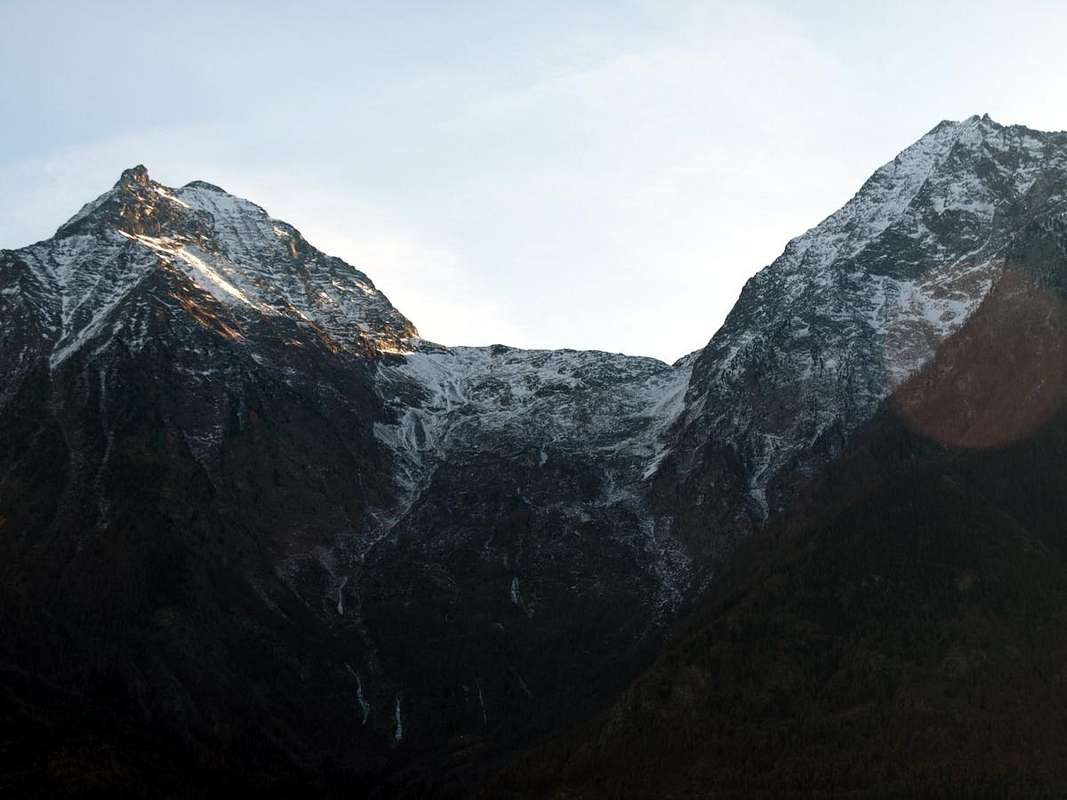
Tour de Salé from Becca de Salé, by Osw
Amongst the three routes climbed, actually only two on the edge of the ridges are worth seeing, while the other via are turning being dangerously exposed to falling rocks:
A) - North-northeast Ridge This long ridge shaped scimitar can be traveled either starting from Les Druges in the Valley of St. Marcel that the Vallon Laures, then with two well differentiated approaches:
1) - (By Les Druges into Vallon of St. Marcel) The Eastern Vallon between the Points of Vauvire and those of Praborna (2.852m, 3.128m), Little Roise, Pass, Becca and Tower of Salé. Secondary Valley Saint Marcel rises somewhat wild in the direction of the Northeastern sector of the small Mountain Chain of Grande Roise or Roize and still Rouèse and Roizà (3.357m). Specific Regional Road towards St. Marcel Valley: from the rotunda to the entry of the Country of Saint Marcel, to go up over on a wide bridge the River Dora Baltea, bringing himself in the center of the same in direction of his great Church; to edge it and to continue (manifold indications for which thing, with the purpose not to be wrong, to follow the poster of brown color with the wording "Sanctuary of Plout". To go up again toward South with the regional road in succession toward the Fractions of Crétaz (653m) and then, decidedly toward East, of Jayer (693m) and Mezein (793m); immediately after this point, leaving on the left a ramification that goes down to the Country of Fénis (prohibition of transit for the cars), the road changes completely direction toward Southwest to reach the Village of Réan (898m) and, through a long diagonal, the famous Sanctuary of Plout (898m; * splendid "Via Crucis" in the covered communication trench and before), where from centuries a procession happens departing really from Saint Marcel. Doubling it same the road is again addressed to thin East to a wide hairpin-road, where it reenters toward the preceding direction reaching the Village of Seissogne (1.066m) and, through great grasslands, the following one of Sazailland (1.220m); they follow those of Ronc (1.359m), Viplana (1.346m), Champremier (1.383m), over which he leaves on the left a deviation for the tall alpis of the Commune of Fénis (passable and open to the traffic) to reach the alternative for Porteron and the following place of Leycher (1.506m; famous "Inn of the Devil"). Returning to East, the road leaves in low the short deviation for Low Les Druges (1.567m) to reach later immediately to High Les Druges (1.600m around; beautiful fountain near a small square "rascard" in wood and votive tiny Chapel dedicated to Saint Bernard; path n° 14 to Fontanafredda Pasture (1.810m). From Les Druges through the Salé Pass: from upper Les Druges Hamlet locality Pouria Alp (1.586m after the "Les Druges Picnic Area) along the coincident earth road with the path n° 3 that, passing through Vargney Pasture (1.676m; various iron and copper dumpings of mine) and doubling from West to South the terminal rocky-woody promontory of Mont Roux (2.277m), it forwards him in the long Vallon of Saint Marcel, that arrives to homonym hill before the Cogne Valley (* Preserve of Hunting Marquis Turati and the Baron ex Reserve Beck Peck(c)oz) passing under the abandoned coppermines of Servette, among the 1.720meters and the 1.810meters. Beautiful turn tourist-excursion through paths n° 15/16, as well as different small paths of connection between the entrance of the various mines and huts in stone of the miners, protected from cyclopic great boundaries and supporting walls, and remains of great cableways. Wanting to effect complete to turn reconnaissance with different departures and slightly crossed to slighty more elevated quota. Departing from the near of the Alp Pouria (place "garages" in to beautiful clearing of lawns with demolished pasture, just immediately under the road; present system of signs as soon as awry near the small torrent) and reaching the first one dark or lower part and old hand the miners' installation, in downfall but with fireplace to standing wall still, for finally to connect him to the precedent itinerary. Besides possibility of prosecution and variation of excursion for the Alpe Lavanché (2.271m), with the path n° 18, along the forest, through the muletrack uses to the transport of the copper and iron minerals ones, with a characteristic passage on stony wall; from the same reenter to soil road through the small path n° 3 to crossroads 1.836m, near Praborna Pasture (1.882m) and its manganesemine. From immediately before Praborna take the trail n° 4G, via the Alp Choulet (1.822m) reach the promontory with Cross above the Arpisson Pasture (1.846m) and, bending more to the West, reaches the old Alp Salé (2.215m) right at the mouth of the valley. From this, climb towards West-northwest always with trail n° 4G, leaving to right the promontory with the Croix de Salé (+; 2.382m) goes on the watershed going to join up with the n° 6A) comes from Les Laures. Here begins the actual climb, first with easy semicircular path, past the elevation (2.664m) called Punta Bonplan, reaches the altitude 2.959 meters and, after four more roughness (two small and as many larger), that of 3.071 meters just below the Summit. This easy but aerial stretch should always resting on the edge of the ridge meeting short passages of I°+ and II°/II°+ (A/PD-/PD; 2h'45/3h'15 from the Alp Salé).
Salì Tower above the connection with Laures, by Osw
2) - (From Vallon des Laures through the connection with Vallone of St. Marcel) From Rifugio Ernesto Menabreaz, neighboring the of Les Laures Dessous Loch (2.546m), reached starting from L'Arp Pasture (1.310m; see in greater detail the next route B) to return briefly to the Northwest, reaching a height of 2.567 meters the Northern shore of Lac Dessous (Lower). From this point back to the Chapel of the brothers "Dino" and Jean-Charrey Cino Norat (2.613m; fallen 25th August 1929 on the East Face of Mount Emilius) and always using the "old" route n° 6A cross and passed between the walls Northwest Becca di Salé and tour up to the altitude of 2.722 meters, where this meets the trail n° 4G comes from the Alps of Salé. This tract is exposed and, as restructured, it has small landslides; however it is currently feasible. Conclude with the previous route on North-northeastern Ridge (more or less the same travel time and difficulties).
B) - South-southeast Ridge
3) - Starting from Grand Brissogne-Primaz (894m) Go along the road till the Gremonenche Alp (1.000m). From here along the dirt road up to l'Arp (1.310m) at the end of the same; then, along a path that, bordering the stream (Des Laures Torrent), leads to La Vieille (1.623m) and to Le Tramail or Tramouail (1.951m; intermediate pasture for cows, good shelter when weather is bad, always open). Crossing some small wooden bridges up to the altitude around 2.200 meters, (starting from this point a steep but faster path goes, at right (West), toward the slopes of Becca di Seneva. Better go on toward East forwarding the Becca di Salè (called by inhabitants "Black Fountains") and climb the last 400 meters on wide slopes till the top of the great rocky terraces in altitude of about 2.600 meters. A short descent leads to the Refuge Ernesto Mènabreaz, partisan by Nazi-Fascist execution firing squad (2.542m, private); the refuge has an open free part (with covers, wood-burning stove and provisioning) usable as winter room (8 places), on the Eastern bank of Laures Lower Lake. From Refuge Ernesto Menabreaz, neighbor the Dessous (Lower) Laures Lake, follow along the path leading to the Long Lake of Laures (2.632m); after about a hundred of metres decisively turn left (Northeast) towards a clear reddish scree below the Salé Pass also called in old times "Colle della Grande Roise", even called "Brissogne Pass" (3.008m), meet in the final part a little couloir that becomes narrower and steepper (keep close, especially in case of the presence of fresh snow, possibly to the rocks on the right side or South). Once there climb toward North, through a small track on soil, the easy South Crest with moderate slope to the Summit of Becca di Salé (3.187m; 1h'30 from refuge). By Becca di Salé down quite easily via the Northeast Ridge reaching a large detrital saddle (3.068m) from which you continue with first winding path towards more North reaching the Southeast Ridge of the Tour de Salé with which, after a small rocky promontory shaped a pinnacle, ends the Summit (A/F+/PD-/PD; 0h'45/1h'00 from Becca di Salé).
4) - Starting from Les Druges "Alte" (1.580/1.600m) through Salè Pass Logically the Colle di Salé can also be reached from the Valley of St. Marcel as in the itinerary A)-. Reached through this trail the old Alp of Salé, continue to the West with a wide hairpin bend in the path of connecting with Les Laures Vallon, but arrived in altitude of (2.341m), at the junction of two small torrents, leave the same; go instead to the South via a track leading to the ancient Alpage of Bonplan (2.374m), now semi abandoned. This is situated near the end of the North-northeast Ridge that descends from Petite Roise (3.273/9m) or, more precisely, from the Eastern shoulder of Pointe de Praborna (3.128m), doubling itself in altitude 2.873 meters, as well as a seedy vallon that goes back in the direction of the first. Climb through scree and "clapeys"; or large blocks reaching an altitude of 2.763 meters above the terminal parts of the ancient Glacier of the Petite Roise, now in effect "permafrost" and reduced to glacial-snowfield below its North Wall. Sharpening the view, you can still see the miserable remains of a more high and old alp. Leaving the Southbound and turning decidedly to the West, you reach the point 2.934 meters just in North of the vertical drops from the large and rounded saddle which is the Salé Pass. This rock band, high eighty metres allows several steps between small rock outcrops alternate with grooves soil; should grab the one on the South, that with rising diagonally left/right, leads easily to the hill as the result of a bottom-analysis. In any case, be careful to avoid falling stones of the same move over who is behind (EEA/F/F+; 2h'20/2h'50 from Salé Alp).
Delle tre vie finora percorse, in realtà soltanto due meritano d'essere visitate e si rivolgono ai percorsi in cresta essendo l'altro pericolosamente esposto alla caduta di pietre:
A) - Cresta Nord-nordest La lunga cresta a forma di scimitarra può essere percorsa sia partendo da Les Druges nella Valle di St. Marcel che dal Vallone delle Laures, quindi con approcci ben differenziati:
1) - (Da Les Druges nel Vallone di St. Marcel) Trattasi del Vallone Orientale, compreso tra la Punta di Vauvire e quelle di Praborna (2.852 m, 3.128 m), Petite Roise, Colle, Becca e Tour di Salé. Secondario della Valle di Saint Marcel si innalza alquanto selvaggio in direzione del settore Nordorientale del Gruppo montuoso della Grande Roise o Roize ed ancora Rouèse e Roizà (3.357 m). Strada Regionale specifica verso il Vallone di Saint Marcel: dalla rotonda all'ingresso del Paese di Saint Marcel, scavalcare su d'un largo ponte il Fiume Dora Baltea, portandosi nel centro dello stesso in direzione della sua grande Chiesa; contornarla e proseguire (molteplici indicazioni per la quale cosa, al fine di non sbagliare, seguire i cartelli di colore marrone con la dicitura "Santuario di Plout". Risalire verso Sud con la Strada Regionale in successione verso le Frazioni di Crétaz (653 m) e poi, decisamente verso Est, di Jayer (693 m) e Mezein (793 m); subito dopo questo punto, lasciando sulla sinistra una diramazione che scende al Paese di Fénis (divieto di transito per gli automezzi), la strada cambia completamente direzione verso Sudovest per raggiungere il Villaggio di Réan (898 m) e, tramite un lungo diagonale, il celebre Santuario di Plout (898 m; * splendida Via Crucis nel camminatoio ricoperto ed antistante), dove da secoli avviene una processione partendo proprio da Saint Marcel. Doppiando lo stesso la strada si indirizza nuovamente ad Oriente fino ad un largo tornante, dove rientra verso la precedente direzione raggiungendo il Villaggio di Seissogne (1.066 m) ed, attraverso grandi praterie, il successivo di Sazailland (1.220 m). Seguono quelli di Ronc (1.359 m), Viplana (1.346 m), Champremier (1.383 m), oltre il quale si lascia sulla sinistra una deviazione per le alte alpi del Comune di Fénis (transitabile ed aperta al traffico) per raggiungere il bivio per Porteron e la successiva località di Leycher (1.506 m; rinomata "Locanda del Diavolo"). Ritornando ad Est, la strada lascia in basso la breve deviazione per Les Druges Basse (1.567 m) per pervenire subito dopo a Les Druges Alte (1.600 m circa; bella fontana presso un piccolo e squadrato "rascard" in legno e Cappelletta votiva dedicata a San Bernardo, all'inizio del sentiero n° 14 per l'Alpeggio di Fontanafredda (1.810 m). Dal Villaggio di Les Druges Alte e Col di Salé: da Les Druges "Alte" località Pouria (1.586 m) lungo la poderale coincidente con il sentiero n° 3 che, doppiato il roccioso e boschivo promontorio terminale del Mont Roux (2.277 m), si inoltra nel lungo Vallone di Saint Marcel, pervenente sino all'omonimo colle a cavallo con la Valle di Cogne ( * Riserva di Caccia Marchese Turati ed ex Riserva del Barone Beck Peck(c)oz; passando al di sotto delle miniere abbandonate di rame di Servette tra i 1.720 metri ed i 1.810 m. Bel giro turistico-escursionistico tramite sentieri n° 15/16, nonché diversi sentierucoli di collegamento tra l'imbocco delle varie miniere, resti di grandi teleferiche e baracche in pietra dei minatori, protette da ciclopici muraglioni di cinta, nonché di sostegno. Volendo effettuare un giro perlustrativo più completo, con partenze diverse, ed attraversata a quota leggermente più elevata: partendo dai pressi dell'Alpe Pouria (località "garages" in una bella radura prativa con alpe diroccata, subito sotto la strada; segnaletica presente appena a monte, presso il torrentello) e raggiungendo il primo o più basso e vecchio insediamento dei minatori, in rovina ma con camino a muro ancora in piedi, per infine ricollegarsi al precedente itinerario. Inoltre possibilità di prosecuzione per l'Alpe Lavanché (2.271 m) con sentiero n° 18, lungo la foresta per mezzo della mulattiera usa al traporto dei minerali del ferro e del rame, con un caratteristico passaggio su di un muraglione di pietra; dall'alpeggio rientrare sulla poderale per mezzo del sentierino n° 3 in direzione dell'incrocio 1.836 m, nei pressi dell'Alpe di Praborna (1.882 m) e della sua miniera di manganese. Da appena prima di Praborna prendere il sentiero n° 4G che, passando per l'Alpe Choulet (1.822 m) raggiunge il promontorio con Croce sopra quella di Arpisson (1.846 m) e, piegando più ad Ovest, raggiunge l'Alpe Salé (2.215 m) proprio all'imbocco del vallone. Da questa salire verso Ovest-nord ovest sempre per mezzo del sentiero n° 4G che, lasciato a destra il promontorio con la Croix de Salé (+; 2.382 m) si porta sullo spartiacque andando a congiungersi con quello n° 6A che arriva dalle Laures. Qui inizia la salita vera e propria, dapprima con facile percorso semicircolare che, oltrepassata una elevazione (2.664 m) detta Punta di Bonplan, raggiunge la quota 2.959 metri e, dopo altre quattro asperità (due piccole ed atrettante più grandi), quella 3.071 metri che precede la Sommità. In questo tratto facile ma aereo conviene restare sempre sul filo di cresta incontrando brevi passaggi di I°+ e II°/II°+ (A/PD-/PD; 2h'45/3h'15 dall'Alpe Salé).
Salì Tower over connection with Laures Vallon, by Osw
2) - (Dal Vallone des Laures con il collegamento al Vallone di St. Marcel) Dal Rifugio Ernesto Menabreaz alle Laures (2.546 m), raggiunto partendo da L'Arp (1.310 m; vedi in maggior dettaglio il successivo itinerario B) ritornare brevemente verso Nordovest raggiungendo a quota 2.567 metri la sponda Settentrionale del Lac Dessous o Inferiore. Da questo punto risalire verso la Cappella dei fratelli "Dino" e Jean Charrey-Cino Norat (2.613 m; caduti il 25 Agosto 1929 sulla Parete Est dell'Emilius) e sempre tramite l'"antico" sentiero n° 6A attraversare passando in mezzo alle Pareti Ovest-nordovest della Becca di Salé e della Tour fino a raggiungere l'altitudine di 2.722 metri, dove questo si riunisce al sentiero n° 4G arrivante dall'Alpe di Salè. Questo tratto é esposto e, per quanto ristrutturato, presenta delle piccole frane; comunque risulta attualmente percorribile. Concludere con la precedente via (stesso tempo e difficoltà).
B) - Cresta Sud-sudest
3) - Da Gran Brissogne-Primaz (894 m) Salire lungo la strada poderale verso l'Alpe di Gremonenche (1.000 m) trovando il cartello di divieto prima del Villaggio di Luin. Da qui sempre per mezzo della medesima raggiungere l'Alpe di L'Arp (1.310 m) al termine della stessa) ; poi, con il sentiero fiancheggiante il Torrent des Laures, le successive di La Vieille (1.623 m) e di Tramail o Tramouail (pascolo intermedio per le mucche; ottimo ricovero in caso di cattivo tempo; sempre aperto; 1.951 m). Attraversando alcuni ponticelli in legno, raggiungere la quota di circa 2.200 metri (partendo da questo punto si snoda verso destra (Ovest) in direzione delle pareti della Becca di Seneva un sentiero più ripido ma anche più veloce nel prender dislivello). Migliore è la salita però portandosi ad Oriente contro la Becca di Salé (cosiddetta Via delle Fontane Nere) risalendo gli ultimi 400 metri su larghi pendii adducenti a grandii terrazzamenti rocciosi a quota 2.600 metri circa. Una piccola discesa porta al Rifugio Ernesto Ménabreaz, intitolato al partigiano fucilato dai nazi/fascisti (2.542 m; privato ma con un locale sempre aperto per gli alpinisti e attrezzato con 8 posti letto, coperte, stufa a legna e vettovagliamento), posizionato sulla sponda Orientale del Lac Dessous des Laures. Dal Rifugio Ernesto Menabreaz proseguire per breve tempo sul sentiero che conduce al Lago Lungo di Laures (2.632 m), dopo circa un centinaio di metri, svoltare a Nordest in direzione d'una evidente pietraia rossiccia sottostante al Colle di Salé detto pure della Grande Roise od anche "di Brissogne (3.008 m), incontrando nella parte finale un canalino che diventa sempre più angusto e ripido (appoggiarsi, soprattutto in caso di presenza di neve fresca, eventualmente sulle roccette a destra o Sud). Da qui risalire verso Nord, tramite una piccola traccia di passaggio sul terriccio, la facile cresta Sud adducente alla Vetta della Becca di Salé (3.187 m; 1h'30 dal rifugio). Dalla Becca di Salé scendere abbastanza facilmente tramite la Cresta Nordest raggiungendo una larga sella detritica (3.068 m) dalla quale si continua con percorso sinuoso dapprima più verso Nord raggiungendo la Cresta Sudest della Tour de Salé con la quale, dopo un piccolo promontorio, si conclude alla Sommità (A/F+/PD-/PD; 0h'45/1h'00 dalla Becca di Salé).
4) - Partendo da Les Druges "Alte" (1.580/1.600m) tramite il Col de Salè
Logicamente il Colle di Salé può essere raggiunto anche dal Vallone di St. Marcel come nell'itinerario A)-. Raggiunta con questo l'Alpe di Salé continuare verso Occidente con un largo tornante sul sentiero di collegamento con Les Laures, ma giunti a quota 2.341 metri, presso la congiunzione di due torrentelli, abbandonare il medesimo. Dirigersi invece verso Meridione tramite una traccia conducente all'Alpe di Bonplan (2.374 m). Questa é collocata nelle vicinanze della parte terminale della Cresta Nord-nordest discendente dalla Petite Roise (3.273/9 m) o, più precisamente, dallo spallone Est detto Punta di Praborna (3.128 m), sdoppiandosi a sua volta all'altitudine di 2.873 metri, nonché di uno squallido valloncello-macereto che risale in direzione della prima. Salire tramite pietraie e "clapeys" o grossi blocchi raggiungendo a quota 2.763 metri le parti terminali dell'antico Glacier della Petite Roise, oggi in effetto "permafrost" e ridotto a glacio-nevato al di sotto della sua Parete Nord. Aguzzando la vista, si vedon ancora i miseri resti d'un alpe più elevata ed antica; abbandonando la direzione Sud e volgendo decisamente ad Ovest, si raggiunge il punto 2.934 metri subito a Settentrione della verticale che scende dall'ampia ed arrotondata sella costituente il Colle di Salé. Questa fascia rocciosa, alta una ottantina di metri consente diversi passaggi tra piccole costole rocciose alternate con canalini di terriccio; conviene afferrare quello più a Mezzogiorno contro la Petite Roise che, con salita in diagonale dalla sinistra alla destra, porta più facilmente al colle di quanto non appaia da un analisi dabbasso. In ogni caso prestar attenzione alla caduta di pietre evitando di smuovere le stesse sopra chi segue (EEA/F/F+; 2h'20/2h'50 dall'Alpe di Salé).
Difficulties & Equipment
From F+ to PD-/PD+ for the two ways described above.
Dal F+ al PD-/PD+ per le due vie descritte.
For Hiking, preferably with rope.
Da Escursionismo, meglio se con corda.
Campings
Remember that free camping is forbidden (except for emergency reasons, over 2.500m, from darkness until dawn).
Mountain Condition
You can get meteo information at the official site of the Regione Valle d'Aosta:
"Guida delle Alpi Occidentali" di Giovanni Bobba e Luigi Vaccarone C.A.I. Sezione di Torino Volume II (parte II), 25 Maggio 1896.
"Guida del Monte Emilius" di Osvaldo Cardellina Editore in collaborazione con il Club Alpino Italiano Sezione di Aosta, Dicembre 1978 (in Italian).
"Guida dei Monti d'Italia – Emilius Rosa dei Banchi-Parco del Mont Avic" di Giulio Berutto e Lino Fornelli - Club Alpino Italiano/Touring Club Italiano, Marzo 2005.
"Diari Alpinistici" di Osvaldo Cardellina e Indice Generale accompagnato da Schedario Relazioni Ascensioni 1964-2019 (unpublished).
Kompass "Gran Paradiso Valle d'Aosta Sentieri e Rifugi" Carta Turistica 1:50.000.
Hapax "Les Sentiers" Comunità Montana Monte Emilius, Luglio 2000 1:25.000.
L'Escursionista "Conca di Aosta-Pila-Monte Emilius" Carta dei sentieri (n° 4) 1:25.000.
Enrico Editore Ivrea-Aosta "Gruppo del Gran Paradiso" 1:50.000.
L'Escursionista "Valle di Cogne" Carta dei Sentieri 1:25.000.
Hapax "Les Sentiers de Charvensod" Comune di Charvensod, Giugno 2003 1:25.000.
Parents refers to a larger category under which an object falls. For example, theAconcagua mountain page has the 'Aconcagua Group' and the 'Seven Summits' asparents and is a parent itself to many routes, photos, and Trip Reports.


 5172 Hits
 84.27% Score
 18 Votes

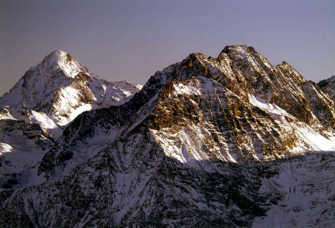
 In foreground the Salé or Salì Tower before Becca & Little Roise, by Emilio Bertona aka emilius
 Petite Roise, Becca & Tour de Salé amid a strong afternoon thunderstorms, by Osw
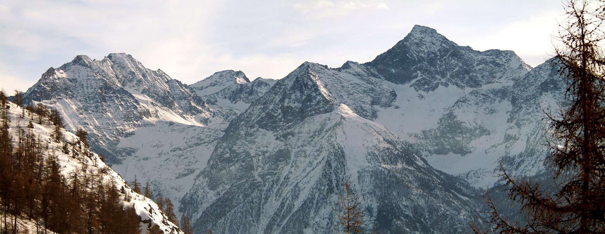 Grande Roise Chain into Monte Emilius Group, by emilius
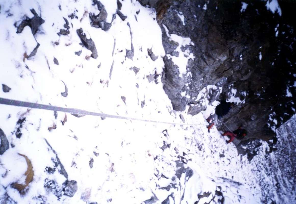
 Tour de Salé from Becca de Salé, by Osw
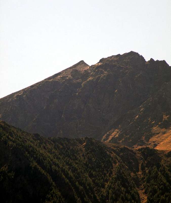 Salì Tower above the connection with Laures, by Osw


 Salì Tower over connection with Laures Vallon, by Osw


