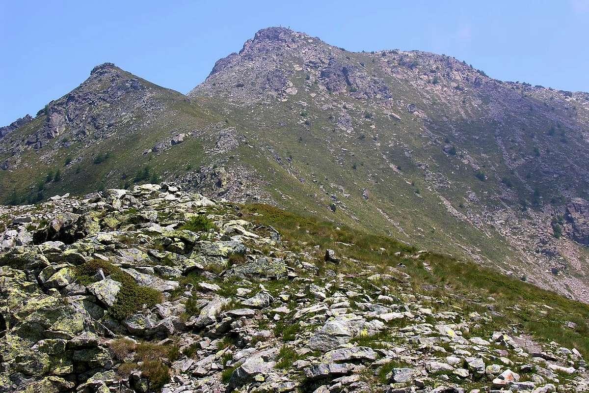
The chain that comes down from Mount Avic (3.006m), after rising in the reaches Mount Ruvic (2.922m) down with a jagged ridge called "Les Fouchettes" to Valmeriana Pass (2.281m), from this, going Northeast, reaches the Mount Barbeston, last peak relevant in this part of the dividing ridge between the Valleys of Ponton/Cima Nera/Valmeriana in the West and that of Champdepraz the opposite side. Over the Top declines with a small buttress in Northeast direction towards Mount Lyan (2.178m; iron ore mines into the vallon below Champdepraz), to end up with a tiny rocky rampart formed from the Mont-Bec (2.088m). The Barbeston overlooking the Central Valley of the River Dora Baltea above the Municipality of Pontey (550m) with its magnificent Castle of Ussel, right at the foot of the mountain. Top hiking frequented by lovers of the Middle and Lower Valley, has a good view towards the north on the Central Valley and beautiful eye-catchers on the neighbors Ruvic and Avic Natural Park of the same name.
La Catena che scende dal Monte Avic (3.006 m), dopo essersi alzata nel Mont Ruvic (2.922 m), scende con una cresta frastagliata detta de "Les Fouchettes" al Colle di Valmeriana (2.281 m); da questo, procedendo verso Nordest, raggiunge il Mont Barbeston, ultima cima rilevante in questo tratto di cresta spartiacque tra i Valloni di Ponton/Cima Nera Valmeriana ad Occidente e quello di Champdepraz nel lato opposto. Oltre la Cima declina con un piccolo contrafforte in direzione Nordest verso il Monte Lyan (2.178 m; miniere di Ferro verso il Vallone di Champdepraz), per terminare poi con un roccioso minuscolo spalto costituito dal Mont Bec (2.088 m). Il Barbeston domina la Valle Centrale del Fiume Dora Baltea sopra il Comune di Pontey (550 m) con il suo magnifico Castello di Ussel, proprio ai piedi Settentrionali della montagna. Cima escursionistica molto frequentata dagli appassionati della Media e della Bassa Valle, presenta un buon panorama verso Settentrione sulla Valle Centrale e bella vista sui vicini Ruvic ed Avic nel Parco Naturale con lo stesso nome.
View of Monte Rosa group from the summit of Barbeston
Moving the cursor you can see the overall view of Monte Rosa group from the summit of Barbeston
Moving the cursor you can see the overall virtual view of Monte Rosa group
First Ascents
First on the summit: Unknown.
In winter: Unknown.
SE Face (Directly): Osvaldo Cardellina, Camillo Roberto Ferronato and Franco Lucianaz; May 10th, 1987, in ascent.
Getting There
BY CAR:
From Torino, Milano, etc: Motorway A5. Exit Country of Châtillon.
From Switzerland: through the Grand St. Bernard Tunnel or the homonym pass. Drive to Aosta, for Châtillon.
From France: through Mont Blanc Tunnel or Petit St. Bernard Pass. It isn't necessary to enter in Motorway A5, you can drive through SS.26 Aosta direction. Exit Châtillon.
BY PLANE:
Aeroporto "Corrado Gex" Saint Christophe (Aosta).
Approaches
APPROACH A: from Verthuy Hamlet (Northwest) From the Villages of Verthuy-Cloutra (1.028m), reached by the road that goes from the Village of Arlier, South of Dora and the A5 towards Southeast start with the path n° 1/4 in Plan Coca (1.675m), at the foot of the Northern Cima Nera (2.698m), after discarding the right (South) on the path n° 2 going up to Northern walloon of this summit, continue in the same direction reaching Torrent Molinaz at an altitude of about 1750 meters. From this point continue on the same path along the valley floor, or lean to the left on the private dirt road that reaches the Valmeriana Alpage (1.791m; 1h'30/2h'00).
AVVICINAMENTO A: dal Villaggio di Verthuy (Nordovest) Dai Villaggi di Verthuy-Cloutra (1.028 m). Raggiungibili con la carrozzabile che sale dal Villaggio di Arlier, a Sud della Dora e dell'Autostrada A5, iniziare verso Sudest con il sentiero n° 1/4 raggiungendo Plan Coca (1.675 m), alle falde Settentrionali della Cima Nera (2.698 m); dopo aver scartato a destra (Sud) il sentiero n° 2 che sale verso il vallone a Nord di questa cima, continuare con la stessa direzione raggiungendo il Torrent Molinaz a quota 1.750 m~. Da questo punto continuare sullo stesso sentiero lungo il fondo valle, oppure appoggiare a sinistra sulla strada poderale che raggiunge l'Alpe di Valmeriana (1.791 m; 1h'30/2h'00).
APPROACH B: from Ussel/Bellecome Fractions (North) From Pontey (523m) go up with asphalt road in the Hamlet of Ussel (608m; beautiful Castle built by Counts of Challants in 1350, not long since collapsed and renovated, well worth a visit) and continue with the same to the Village of Bellecombe the input of the same name Walloon, up to this point is also, for the purists, can come with paths n° 1 and n° 3 respectively starting from Ussel and Pontey-Torin (466m). From Bellecombe (1.018m, famous for its mineral typical of Vesuvius and garnets) always proceed to the South by the private dirt farm road that reaches the alpine pastures of Mont Ros Desot (1.385m), crosses the Moriola Torrent and ends to Upper Mont Ros Pasture (1.429m), from where a unnumbered path to the Alp Toule (1.841m). VARIANT: a path n° 2 with a semicircular turn more to the west brings you to this 1.780 meters in altitude through the small villages of Biolasse Under and Over (1.609m). From Alpage climb to Southeast with a trace of an area of bushes and with a sudden progressively steeper, formed by a large casting blocks of greyish-white (furthest to the West not to be confused with the one that comes down from the Antetop West of Mont Lyan) and some small crushed rock in the terminal, reach the Goddet or Valcrusa Hill (about 2.105/10 meters) between Mount Lyan (2.178m) to the East and the Barbeston (3h'00/3h'15 from Bellecombe Village).
AVVICINAMENTO B: dalle Frazioni di Ussel/Bellecombe (Nord) Da Pontey (523 m) salire con la strada asfaltata alla Frazione di Ussel (608 m; bel Castello costruito dai Conti di Challant nel 1350, crollato e da non molto tempo ristrutturato, meritevole d'una visita) e proseguire con la medesima fino al Villaggio di Bellecombe all'ingresso dello omonimo Vallone; fino a questo punto é inoltre, per i puristi, possibile giungere con i sentieri n° 1 e n° 3 che partono rispettivamente da Ussel e da Pontey-Torin (466 m). Da Bellecombe (1.018 m; famoso per i suoi minerali con vesuviane e granati) procedere sempre verso Sud tramite la strada poderale privata raggiungente gli Alpeggi di Mont Ros Desot (1.385 m), attraversa il Torrente Moriola e termina al Mont Ros di Sopra (1.429 m); da qui un sentiero non numerato raggiunge l'Alpe di Toule (1.841 m). VARIANTE: un sentiero n° 2 con giro semicircolare più ad Ovest si riunisce a questo a quota 1.780 metri circa passando per i Villaggetti di Biolasse di Sotto e di Sopra (1.609 m). Dall'alpe salire verso Sudest con una traccia tra una zona di cespugli e con un tratto progressivamente più ripido, formato da una grande colata di blocchi bianco-grigiatri (quella più verso Ovest da non confondere con quella che scende dalla Antecima Ovest del Mont Lyan) e qualche piccola roccia frantumata nel tratto terminale, raggiungere il Col Goddet o di Valcrusa (2.105/10 m~) tra il Monte Lyan (2.178 m) ad Est ed il Barbeston (3h'00/3h'15 da Bellecombe).
APPROACH C: from Valmeriana Pasture (Northwest) or from Salé Alp (Northeast) It is also possible, in order to climb the "Crestone" North-northwest, making the approach through two possibilities:
1)- From Valmeriana Pasture (1.791m) with a semicircular path and continue downhill through the path n° 3 which is directed towards the Higher Salé Alp (1.742m), but did not reach it, in fact, where the path changes direction from the Northeast to the Southeast, leave the same going into the woods along the unmarked route in the direction of a small, narrow vallon that leads to the rocks at the base of the great ridge (0h'15 from Valmeriana).
2) - By the Variant of the previous Approaching with the junction between the paths n° 2/3 near the Alpage Biolasse continue through the second West-northwest direction, reaching, after crossing the small walloon of the Torrent Pessey, Pragarin Pasture (1.526m), from this (also accessible from Pontey-Lassolaz (523m) with the n° 4/3 trails that pass by small Villages Ussert (991m) and Crete Chardon (1.452m) that come from the Northwest) leave the first alternative to the right (North) and continue towards the Torrent of Molinaz and continue on the left that climbs steeply to the South towards the Alps of Upper and Lower Salé. Going first to the Northwest and Southwest after it reaches to the opportunities offered by the previous (0h'30 by Biolasse).
AVVICINAMENTO C: dalle Alpi di Valmeriana (Nordovest) oppure di Salé (Nordest) Inoltre é possibile, onde salire il Crestone Nord-nordovest, d'effettuare l'avvicinamento tramite due possibilità:
1)- dall'Alpe di Valmeriana (1.791 m) proseguire con percorso semicircolare ed in leggera discesa tramite il sentiero n° 3 indirizzantesi verso l'Alpe di Salé Superiore (1.742 m), non raggiungendola; infatti, laddove il sentiero cambia direzione da Nordest verso Sudest, abbandonare il medesimo salendo nel bosco con percorso non obbligato in direzione d'uno stretto valloncello che porta alle rocce alla base del crestone (0h'15 da Valmeriana).
2) - dalla Variante del precedente Avvicinamento al bivio tra i sentieri n° 2 e n° 3 nei pressi dell'Alpeggio Biolasse proseguire per mezzo del secondo con direzione Ovest-nordovest raggiungendo, dopo aver attraversato il piccolo vallone del Torrent Pessey, l'Alpe Pragarin (1.526 m); da questa (raggiungibile inoltre da Pontey-Lassolaz (523 m) con i sentieri n° 4/3 che passano dai piccoli Villaggi di Ussert (991 m) e Crete Chardon (1.452 m) provenienti da Nordovest) lasciare un primo bivio a destra (Nord) che prosegue verso il Torrent de Molinaz e continuare su quello di sinistra che sale decisamente verso Sud in direzione delle Alpi di Salé Inferiore e Superiore. Procedendo dapprima in Nordovest ed in seguito a Sudovest si raggiunge il punto offerto dalla precedente opportunità (0h'30 da Biolasse).
APPROACH D: from Barbuste(l) or from Crestaz Hamlets (East) From the Village of Barbustel (1.240m), on the road from Champdepraz to Voella, leave this turning right (North) to reach with a short descent to the village Capiron (1.221m), from this part of the trail n° 8A with a series of switchbacks and a diagonal toward the Northeast, passing near the Canal Montjovet, reaches the Village Herin (1.463m; 1h'10). VARIATION: to Herin can also be reached by another diversion farther down the same road that, after the last winding road Champdepraz, salt, accompanied by the path n° 8, to the Hamlet of Crestaz (1.293m) to continue this Northwest towards achieving progressively the subsequent Cugnon, Losson (1.353m) and Herin, from which through another into the two-way or continue with the path or with the adjoining farm road to Alp of L'Arp (1.642m; 2h'00/2h'15 from Crestaz or Barbustel), where he began the route along the East-southeast Slope.
AVVICINAMENTO D: dai Villaggi di Barbuste(l) oppure Crestaz (East) Dal Villaggio di Barbustel (1.240 m), sulla strada tra Champdepraz e Voella, abbandonare questa svoltando a destra (Nord) raggiungendo tramite una breve discesa quello di Capiron (1.221 m); da questo si diparte il sentiero n° 8A con una serie di tornantini, seguiti da un diagonale a Nordest, passando dappresso al Canale di Montjovet, raggiungere il Villaggio di Herin (1.463 m; 1h'10). VARIANTE: ad Herin può giungersi tramite una deviazione più in basso sulla medesima strada, dopo l'ultimo tornante da Champdepraz, accompagnata dal sentiero n° 8, verso il Villaggio di Crestaz (1293 m); continuare per mezzo di questo verso Nordovest raggiungendo progressivamente i susseguenti di Cugnon, Losson (1.353 m) ed Herin. Da questa località procedere verso l'Alpeggio di L'Arp (1.642m utilizzando la strada poderale o l'attiguo sentiero (2h'00/2h'15 rispettivamente da Crestaz oppure Barbustel), laddove prende inizio la via lungo il Versante Est-sudest.
APPROACH E: from Voella Fraction (Southeast) From Champdepraz, reachable by Verres, the Hamlet of La Ville-Veulla also Volla (1.248m); parking) for the private dirt road to the "Magazzino" until the junction for Praz Orsie or Pra Oursi (1.791m), just across the creek Treby at an altitude of 1.340 meters~ come up with a westerly direction through the path n° 7 towards the Varotta Hill passing a first small torrent and, in the vicinity of a according to a fork, take to the right (North), the path n° 7B to Plan Tsatsè or Pian Pian Castello, on your left (South) and then the previous path without reaching the Alp of Oursì (the same goes to the South going to the Mines of Lake Gelato). Continue instead with the North in the woods with a series of steep switchbacks enough out in a more "open" and less slope reach the Pasture at an altitude of 1.996 meters(0h'30; 1h'45). Doubling the same and proceed through a series of hairpin bends that go gradually, reaching more towards the Northwest with a diagonal decidedly to the West of the Hill Valmeriana (0h'30; in total 2h'15/2h'30), Top whence in the previous way.
AVVICINAMENTO E: dalla Frazione di Voella (Sudest) Da Champdepraz, raggiungibile da Verrès, alla Frazione di La Ville-Veulla (1.248 m; parcheggio), per la strada poderale verso il "Magazzino" sino al bivio per Praz Orsie o Pra Oursi 1.791 m, appena oltre il Torrente di Tréby a quota 1.340 m~; salire con direzione Ovest tramite il sentiero n° 7 verso il Col Varotta superando un primo torrentello e, nei pressi d'un secondo ad un bivio, prenderere a destra (Nord) il sentiero n° 7B per Pian Tsatsè o Pian Castello, lasciando sulla sinistra (Sud) il precedente sentiero e quindi senza raggiungere l'Alpe di Oursì (lo stesso prosegue verso Meridione salendo alle Miniere del Lago Gelato). Proseguire invece con direzione Nord in mezzo al bosco con una serie di tornanti abbastanza ripidi uscendo in una zona più "aperta" e con minore pendenza arrivare all'alpeggio a quota 1.996 m(0h'30; 1h'45). Doppiare il medesimo e procedere tramite una serie di stretti tornanti che vanno, gradualmente, più verso Nordovest raggiungendo con un diagonale decisamente ad Ovest il Colle di Valmeriana (0h'30; in totale 2h'15/2h'30), donde in Cima con la precedente Via.
Moving the cursor you can see the overall scene
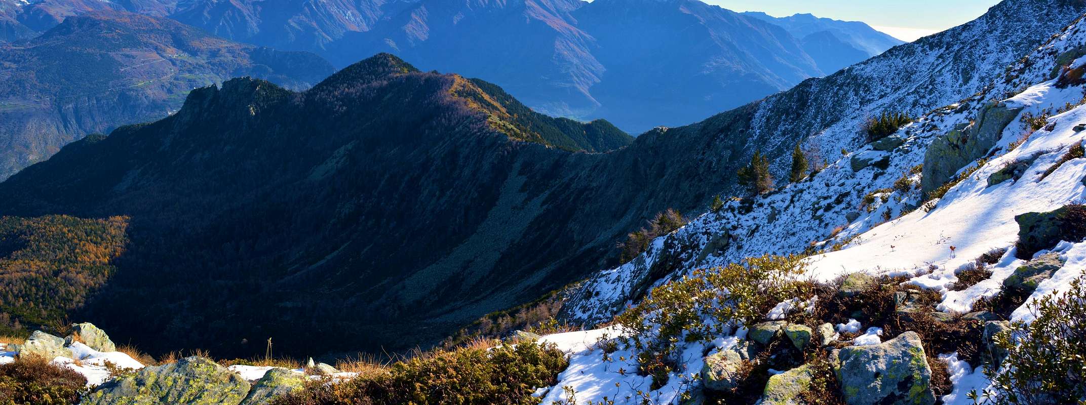
From left: Mont Avic (3.006m), Mont Ruvic (2.922m), Mont Giron (2.699m) and Cima Nera (2.698m)
Routes
ROUTE A (Little Crest Southwest) From this pasture, take the path n° 3/4 rejoining the previous not long after. Continue to a junction (small mound) that separates the way to the Giron Pass in the Southwest (path-route n° 3) from the one that dates back to Valmeriana Hill (path n° 1). Proceeding Southeast direction with the same back with hairpin bends, supported by a nice "escalier" formed by wooden steps fixtures from Forest Guard. The beautiful trail, not long ago renovated, the hill rises rapidly (1h'15). From this, turning to the Northeast, follow a trail that leads to the small castle the end rocks. Zigzagging between the same and amongst large boulders easily reach the Summit (0h'45/1h'00 from hill, in total 4h'00/4h'30).
VIA A (Crestina Sudovest) Prendendo le mosse da questo alpeggio, proseguire con il sentiero n° 3/4 ricongiungendosi al precedente non molto dopo. Continuare fino ad un bivio (piccolo tumulo) che separa le vie per il Col Giron a Sudovest (sentiero n° 3) da quello che risale al Colle di Valmeriana (segnavia sentiero n° 1). Procedendo con direzione Sudest risalire con stretti tornanti il medesimo, supportati da un bel "escalier" formato da gradini in legno infissi dalla Guardia Forestale. Lo splendido sentiero, da non molto tempo ristrutturato, sale rapidamente al colle (1h'15). Da questo, volgendo a Nordest, seguire una traccia che conduce al castelletto delle rocce terminali. Zigzagando tra le medesimi tra grandi massi facilmente raggiungere la Cima (0h'45/1h'00 dal colle; in totale 4h'00/4h'30).
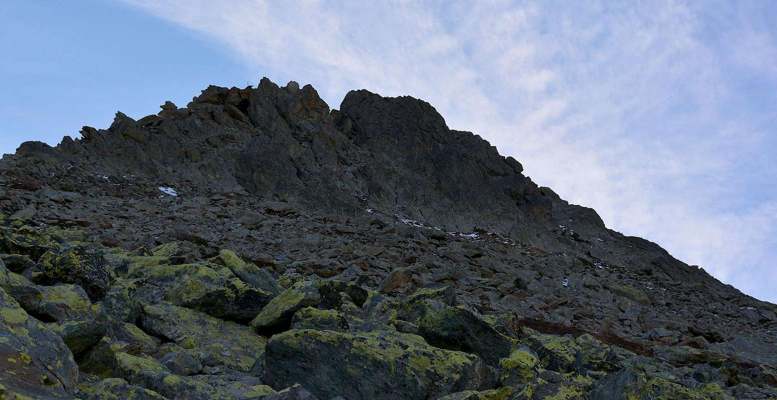
ROUTE B (North-northwest "Crestone") Approaching from the previous C, abandon the paths n° 3/4 by Valmeriana or from Salé and move close to the basal rocks of the "Crestone" North-northwest. More precisely, first climbing a wooded stretch of stony followed by bluish-green color (see various photos)bringing with tedious and tiring journey to the basis of the same, so not easy to climb the dark rocks of the "castle" summit with the possibility of varied path and many difficulties associated with an elevation of over 700 meters from the abandonment of the paths (from 2h'00 to 3h'00, depending on the path followed).
VIA B (Crestone Nord-nordovest) Dal precedente Avvicinamento C, abbandonare i sentieri n° 3/4 da Valmeriana oppure da Salé e portarsi a ridosso delle rocce basali del Crestone Nord-nordovest. Più precisamente, salire dapprima un tratto boscoso seguito dalle pietraie di colore verde-bluastro (vedi foto varie) portandosi con percorso noioso e faticoso alla base delle medesime; quindi scalare le scure rocce non facili del "castello" sommitale con possibilità di percorso variegato ed altrettante correlate difficoltà con un dislivello di oltre 700 metri dall'abbandono dei sentieri (da 2h'00 a 3h'00 ore, secondo la via percorsa).
ROUTE C (East-northeast Crest) Using Approach B, from Goddet Pass, locally also said Colle di Valle Valcrusa or Closed Walloon, easy climb along the ridge West-southwest direction with a small rocky promontory reaching first, followed not long after by a hump insignificant, with linear path to reach a large mound in stone, which promises to be the final part. From this point proceed with two possibilities:
1) - passing just below the ridge on the South Side of the traces by quickly and easily get to the Top;
2) - fully climb the rocks of the ridge finding, by choice, some amusing passages (I°/I°+/II°-).
VIA C (Cresta Est-nordest) Utilizzando l'Avvicinamento B, dal Col Goddet, detto in loco anche Colle di Valcrusa o della Valle Chiusa, risalire lungo la facile cresta con direzione Ovest-sudovest raggiungendo dapprima un piccolo promontorio roccioso, seguito non molto dopo da una gobba insignificante; con percorso lineare pervenire ad un grosso tumulo in pietra, preannunciante la parte finale. Da questo punto procedere con due possibilità:
1) - passando immediatamente sotto al filo di cresta tramite delle tracce sul Versante Sud in breve tempo e facilmente arrivare alla Cima;
2) - salire integralmente le rocce della cresta trovando, a scelta, alcuni passaggi divertenti (I°/I°+/II°-).
ROUTE D (East-southeast Slope and Crest) By the approach of Arp D, continue to the West-northwest path through the n° 8 through the forest and after a diagonal in the same continue with five small and narrow hairpin bends more to the South and then proceed with the first direction until reaching the brink of a secondary ridge above the 2.051 meters altitude. Continue on the same, and bowing slightly to the Northwest, join the Crest East-Northeast, which comes from the Mount Lyan and with the same to the Summit (1h'15 from L'Arp; in total 3h'00/3h'30 from Barbustel or from Crestaz).
VIA D (Versante e Cresta Est-sudest) dall'Avvicinamento D di L'Arp, proseguire verso Ovest-nordovest tramite il sentiero n° 8 attraverso la foresta; dopo un diagonale dentro la medesima continuare con cinque piccoli e stretti tornanti maggiormente a Sud per poi procedere con la prima direzione fino a portarsi sull'orlo di una cresta secondaria sopra la quota 2.051 metri. Continuare sul medesimo e, piegando leggermente a Nordovest, congiungersi alla Cresta Est-nordest, che proviene dal Mont Lyan e con la stessa alla Sommità (1h'15 dall'Arp; in totale 3h'00/3h'30 sia da Barbustel che da Crestaz).
ROUTE E (Directly through Southeast Slope) With the Approach E, it is also possible to climb directly the Face Southeast starting from Alp Pian Tsaté (1.996m). Instead of leaning to the left on the path directed to Valmeriana Hill, move more to the right (East) and pass directly through the Southeast Slope steep grassy slopes interspersed with small bands of rock. In the last part, before the small summit "castle", a double pulpit of blackish rocks offers the possibility besides not mandatory, a fun and also challenging climbing. Via carried out with the purpose of finding minerals, however, proved ineffective (0h'45/1h'00 from Alp).
VIA E (Direttamente dal Versante Sudest) Tramite l'Avvicinamento E, esiste inoltre la possibilità di salire direttamente la Faccia Sudest partendo dall'Alpe di Pian Tsaté (1.996 m). Invece di appoggiarsi a sinistra sul sentiero indirizzato al Colle di Valmeriana, spostarsi più verso destra (Est) e superare direttamente il Versante Sudest attraverso ripidi pendii erbosi inframmezzati da piccole fasce rocciose. Nell'ultima parte, prima del "castelletto" sommitale, un doppio pulpito di rocce nerastre offre la possibilità, tralaltro non obbligatoria, di una divertente ed anche impegnativa arrampicata. Via effettuata con lo scopo della ricerca di minerali, peraltro risultata vana (0h'45/1h'00 dall'Alpe).
Difficulties
All the routes is rated E/F.
Tutti gli itinerari son da classificarsi in E/F.
Gear
Hiking gear.
Da escursionismo.
Campings
Remember that free camping is forbidden (except for emergency reasons, over 2.500m, from darkness until dawn).
Mountain Conditions
You can get meteo information at the official site of the Regione Valle d'Aosta:
"Guida delle Alpi Occidentali" di Giovanni Bobba e Luigi Vaccarone C.A.I. Sezione di Torino Volume II (parte II), 25 Maggio 1896.
"Guida dei Monti d'Italia – Emilius Rosa dei Banchi-Parco del Mont Avic" di Giulio Berutto e Lino Fornelli - Club Alpino Italiano/Touring Club Italiano, Marzo 2005.
"Guida della Regione Autonoma Valle d'Aosta" di Mario Aldrovandi; Ed. S.P.E. di Carlo Fanton, Torino 1964.
"Diari Alpinistici" di Osvaldo Cardellina e Indice Generale accompagnato da Schedario Relazioni Ascensioni 1964-2021 (inediti).
MAPS:
Ingenia "Parco Naturale del Mont Avic" Carta dei sentieri 1:25.000.
Hapax "Les Sentiers" Comunità Montana Monte Emilius, Luglio 2000 1:25.000.
L'Escursionista "Parco Naturale del Mont Avic" Carta dei sentieri 1:25.000.
Enrico Editore Ivrea-Aosta "Gruppo del Gran Paradiso" 1:50.000.
I.G.C. Istituto Geografico Centrale Torino "Il Parco Nazionale del Gran Paradiso" (n° 3), 1:50.000.
I.G.C. Istituto Geografico Centrale Torino "Ivrea Biella Bassa Valle d'Aosta" (n° 9), 1:50.000.
Parents refers to a larger category under which an object falls. For example, theAconcagua mountain page has the 'Aconcagua Group' and the 'Seven Summits' asparents and is a parent itself to many routes, photos, and Trip Reports.

 5969 Hits
 84.82% Score
 19 Votes