
-
 13650 Hits
-
 83.69% Score
-
 17 Votes
|
|
Mountain/Rock |
|---|---|
|
|
37.70529°N / 107.53139°W |
|
|
San Juan |
|
|
Hiking, Mountaineering, Scrambling |
|
|
Spring, Summer, Fall, Winter |
|
|
13136 ft / 4004 m |
|
|
Overview
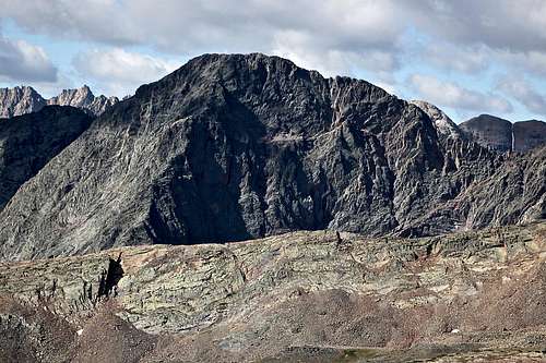
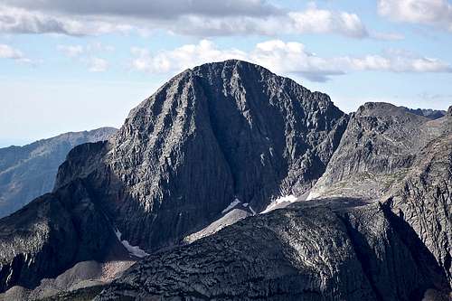
 Hunchback Mountain with Kite Lake
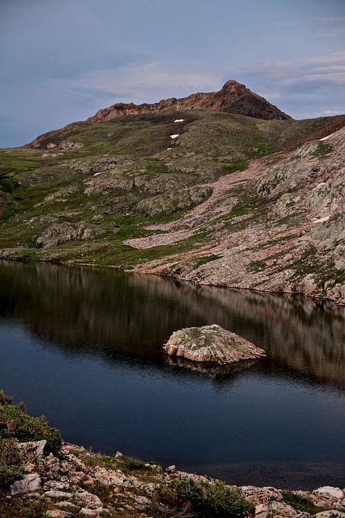 Hunchback Mountain from Eldorado Lake
Hunchback Mountain is a nice summit easily accessible from Hunchback Pass in the remote area of San Juan Mountains. The summit is just a little trail side distraction and definitively worth checking it out. The mountain does not seem like much from the top of the pass, but I encountered a pleasant scramble along the ridge. The summit views are spectacular especially over the eastern range of Grenadiers. Three beautiful lakes are seen from the summit: Kite Lake, Eldorado Lake and Vallecito Lake.
Colorado Rank: 540 (low 13er, but still a fun summit)
Parent Lineage: White Dome
Class: 2
Hunchback Pass Trail is popular hiking destination for many backpackers. The main trail continues all the way to Vallecito Reservoir 19.5 miles in length, or you can turn off towards Continental Divide trail - Weminuche pass to Hunchback Pass trail is 20.4 miles long.
Hunchback Pass provides access to eastern range of Grenadier Mountains and to Needle Mountains deep within the Weminuche wilderness area. (Weminuche is named after Indians of the Ute tribe). You also access Mt. Oso group of mountains via Hunchback Pass.
Weminuche Wilderness is one of the largest wilderness areas in the contiguous 48 states. It includes three of Colorado's famous 14ers: Mt. Eolus, Mt. Windom, and Sunlight Peak. Size: almost 500,000 acres.
Neaby Peaks: most of these remote peaks still have no SP pages.
White Dome 0.83 miles
Peak One 1.52 miles
Peak Three 2.59 miles
Peak Two 2.45 miles
Mt. Nebo 2.36 miles
The Guardian 2.93 miles
Mt. Silex 2.59 miles
Storm King Peak 2.52 miles
East Trinity 2.9 miles![Crossing Rio Grande]() Crossing Rio Grande
Crossing Rio Grande![Wildflowers - Stony Pass]() Wildflowers - Stony PassAs mentioned above Hunchback Mountain is located deep within the Weminuche Wilderness of the San Juan Mountain Range. The shortest way to reach it is via 4WD road to Beartown. You need a high clearance vehicle since you will need to cross several streams, including Rio Grande. Water levels vary based on conditions, e.g. recent rain or spring time run off from melting snow. We found it pretty deep even in early September.
Wildflowers - Stony PassAs mentioned above Hunchback Mountain is located deep within the Weminuche Wilderness of the San Juan Mountain Range. The shortest way to reach it is via 4WD road to Beartown. You need a high clearance vehicle since you will need to cross several streams, including Rio Grande. Water levels vary based on conditions, e.g. recent rain or spring time run off from melting snow. We found it pretty deep even in early September.
Getting There
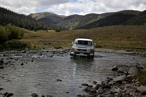 Crossing Rio Grande
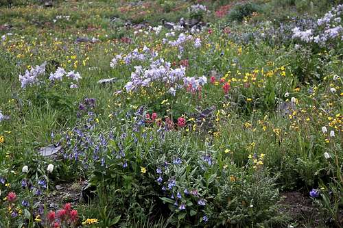 Wildflowers - Stony Pass
The road to Beartown is accessible either from Silverton or from Lake City/Creede/Rio Grande Reservoir. I would recommend driving in from Silverton - shorter, and easier. I drove it both ways and found the road towards Rio Grande Reservoir in a bad shape - mostly water damage, would not want to take my car on it again. The road from Silverton is in much better shape and faster.
From Silverton drive northeast past the courthouse and were right on Colorado Highway 110, County Road 2 toward Howardville. Pavement end after a couple of miles. Around 4.2 miles you reach Howardsville (mostly mining buildings). Take a right turn here on a well signed road Stony Pass/Cunningham Gulch, FS 589. Shortly you come to an intersection - one to the left is signed for Old Mine Tour, the other one close to the creek continues straight. It does not matter which one you choose, both reconnect after 1-2 miles, and neither is technically challenging. You have to leave Cunningham Gulch and start climbing on a narrow 4WD road towards Stony Pass - FS 737. It is again marked and hard to miss. Mid July to August there are amazing wildflowers along the road. Stony Pass elevation is 12,590 feet. The road from the summit has relatively gentle grade. The road down from the pass all the way to Rio Grande Reservoir is numbered as FS 520. At 11.6 miles you reach an important intersection - well signed for Beartown/Kite Lake to the right, or straight (left) to Creede.
From Lake City/Creede: again, I am not recommending taking this route, longer and in worse condition, especially after a rain. Take Colorado Highway 149 to FS 520 and turn west toward Rio Grande Reservoir. There are several river crossings, deeply rutted sections, lots of deep puddles after a rain, narrow rocky steep sections making passing vehicles in an opposite direction impossible. It is about 25 miles long to get to the turn off for Beartown.
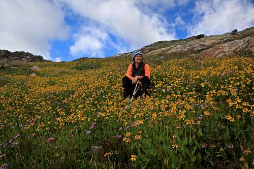
Once you have reached FS 506, the road to Beartown is another 6.1 miles (6.5 miles to Kite Lake). You have to cross Rio Grande right at the start of this road, the water can be pretty deep. The rest of the road is not bad, can get muddy after a rain and towards the end there are some rocky sections. There is a sign/kiosk at the start of the trail and enough place to park 2-3 cars, there are a few more car parks nearby (above the kiosk). ![September wildflowers]() September wildflowers
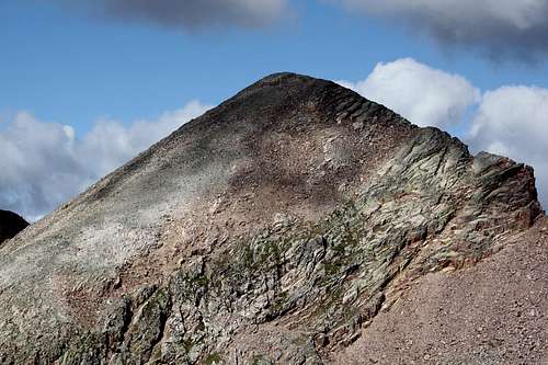
September wildflowers![Hunchback Mountain]() Hunchback MountainWestern slopes - standard and most easily accessible route from the summit of Hunchback Pass.
Hunchback MountainWestern slopes - standard and most easily accessible route from the summit of Hunchback Pass.
Route
 September wildflowers
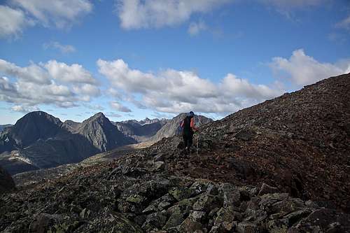 Hunchback Mountain
As every mountain more routes are possible - tons of scrambles from the south. The route from White Dome appeared a little more rugged.
Little Statistics:
Trailhead Elevation at Beartown: 11,756 feet
Top of Hunchback Pass: 12,493 feet and 1.3 miles from the Beartown Trailhead.
Summit of Hunchback Mountain: 13,136 feet
Elevation Gain: 1,380 feet from Beartown TH and only 643 from the summit of Hunchback Pass
Approximate distance from the pass to the actual summit: 0.6 miles (it took us about 35 min of non-rushed hike).
The summit and the whole route overview is seen from the Hunchback Pass. You can't get lost. Follow tundra with wildflowers towards the peak finding the easiest path possible. ![Hunchback Mountain]() Hunchback Mountain
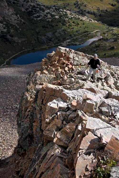
Hunchback Mountain![Hunchback Mountain]() Hunchback MountainThere is not established trail, but I thought that on occasion I found a trace of human travel. You will have to bypass some rocky sections, nothing more difficult than class 2. You can follow the ridge, which gives some exposure on its northern side and beautiful views towards Kite Lake below, or you can stay below the ridge for a more safe, but also more boring approach.
Hunchback MountainThere is not established trail, but I thought that on occasion I found a trace of human travel. You will have to bypass some rocky sections, nothing more difficult than class 2. You can follow the ridge, which gives some exposure on its northern side and beautiful views towards Kite Lake below, or you can stay below the ridge for a more safe, but also more boring approach.
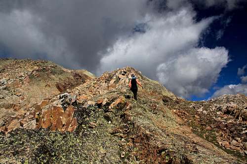 Hunchback Mountain
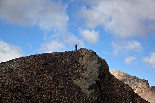 Hunchback Mountain
Red Tape
There are no fees to access Weminuche Wilderness, drive the 4WD road to Beartown, hike the trails or summit the mountain. Just remember that the parking by the Beartown Traihead is limited to a few vehicles. You may need to drive past the trailhead to find your parking spot. Remember this is a remote area, and Beartown has no facilities, no structures - bring all you need with you.I could not find much historical information on Beartown on the internet. I have not even found any reminding structures suggesting past human population. It sounds like it was a remote mining community with mostly gold mines, some silver, lead and copper. Area prospected as early as 1878, and at least 3/4 of the production value from district came before 1900. Rich telluride pockets accessible from surface cuts and by adits in shallow underground workings. Development slowed by difficulty in hand steeling in hard quartzite and by lack of transportation. All ore was packed on mule trains.
Summit Views
 Storm King Peak 13,752 feet Storm King Peak 13,752 feet |  Hunchback Mountain Hunchback Mountain |
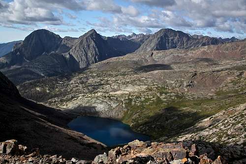 Vallecito Lake Vallecito Lake | 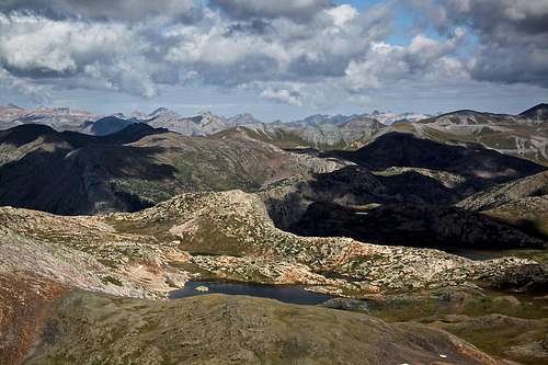 Eldorado Lake Eldorado Lake |
 The Guardian 13,617 feet The Guardian 13,617 feet | 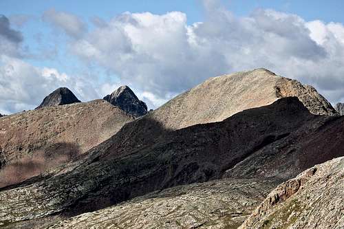 Peak One and Trinities peaking out Peak One and Trinities peaking out |
 White Dome 13,627 feet White Dome 13,627 feet | 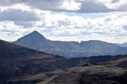 Rio Grande Pyramid 13,821 feet Rio Grande Pyramid 13,821 feet |