
-
 64732 Hits
-
 99.23% Score
-
 102 Votes
|
|
Area/Range |
|---|---|
|
|
41.38279°N / 111.97451°W |
|
|
Hiking, Mountaineering, Trad Climbing, Sport Climbing, Bouldering, Ice Climbing, Scrambling, Skiing |
|
|
Spring, Summer, Fall, Winter |
|
|
9764 ft / 2976 m |
|
|
Overview
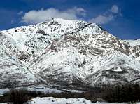
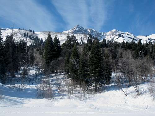
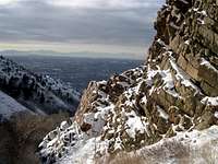
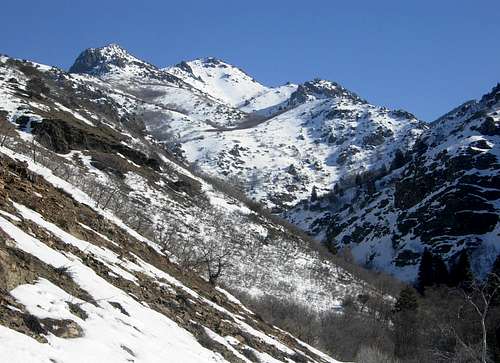
The Northern Wasatch Mountains are a largely unknown and serene mountain wilderness. This forest land is within minutes of many cities along the Wasatch Front. The area covers over two hundred square miles. These mountains are not as well known as the Central Wasatch above Salt Lake City. This does not mean that they are not worth climbing. Several miles of trails provide many hiking possibilities. There are many canyons that lead into these mountains. The wasatch fault line runs along their lower slopes. This part of the Wasatch is located north to south from the town of Brigham City to Parleys Canyon.
Easy access to these mountains attracts hikers to certain areas. For the most part, it won't be crowded on the lesser known trails. These mountains are not as jagged and alpine in nature as the mountains to the south so they are a lack of interest to some climbers. They tend to be rounded peaks connected by several ridges. A few exceptions include Mount Ogden's east face and the west side of Willard Peak which contains many cliffs and pinnacles. Also noticeable is that the western faces drop down steeply toward the valley while the eastern side has more foothills.
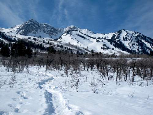
The Great Western Trail traverses these mountains along the Wasatch Crest, a high ridge dividing the mountains into west and east facing slopes. Much of the land is part of the Wasatch-Cache National Forest. The Bonneville Shoreline Trail is a ninety-mile long trail across the foothills of the Wasatch Range along a route that follows the eastern shoreline of ancient Lake Bonneville. The Bonneville Bench, at approximately 5,100 feet elevation, is actually the preserved shoreline, called a terrace or bench, of the ice age Lake Bonneville. This shoreline marks the highest level attained by the Pleistocene lake approximately 15,500 years ago. The shoreline trail allows hikers to link together many canyons without the need for a shuttle vehicle. For ridge runners this is a big advantage and allows you to climb several peaks in one day. Willard Peak is the highest mountain in the area and all of the peaks are below 10,000 feet in elevation.
The Wasatch Range
The Wasatch Range is part of the Rocky Mountains. The Wasatch Range rises to elevations of more than 11,000 feet and stretches for over 200 miles from Soda Springs, Idaho to Nephi, Utah. It starts with the Bear River Range in southeastern Idaho and northern Utah, then the Wellsville Mountains near the city of Mendon and Sardine Canyon, the Northern Wasatch above the cities of Ogden and Bountiful, the Central Wasatch above Salt Lake Valley, and Southern Wasatch, which has the highest mountains, from Provo to Nephi. The Wasatch Range is an imposing and important geographic feature in the western United States. From a geologic perspective, the mountains are a complex mix of igneous, sedimentary, and metamorphic rocks.
From a demographic perspective, these mountains, and their western base, is a corridor known as the Wasatch Front. Over 80 percent of Utah's population lives within 15 miles of the Wasatch range. Salt Lake City lies between the Wasatch Range and the Great Salt Lake. Not only those that live in the areas around Salt Lake City but Logan, Ogden, and Provo have the Wasatch Mountains as a spectacular backdrop each morning. Hiking, rock climbing, skiing, camping, mountain biking, and fishing are a few things that the Wasatch Mountains have to offer. This mountain playground is an ideal place for all kinds of outdoor enthusiasts.
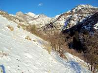
 Peaks on the north side of Ogden Canyon
When to Climb

Ogden Reflection
Spring is the best time to do steep couloirs and snow routes. Consolidated snow develops in the high basins. Early in the day, you will have firm and icy snow that allows for a fast ascent. In the afternoon, the snow softens and you will be plunge stepping all the way down. Glissading is the best way to descend most snowfields. This is also a good time to travel to areas with talus and boulderfields because much of the loose rubble will be covered in snow. The foothills are the safest place to hike during spring. South facing slopes will have small snow patches but will be passable by most people. Many trails will be muddy and wet. Popular mountain climbs in spring are Lewis Peak, Francis Peak, Bountiful Peak, and Lookout Peak.
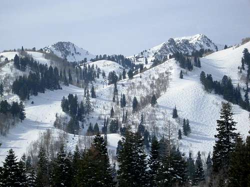
Summer is the normal climbing season in the Wasatch Mountains. It lasts from July to September. This is also when everybody else is out hiking and climbing. Like most areas, the season is determined by the amount of snow in the mountains. During a heavy snow year, it may be until late summer for snow to melt from sheltered areas. Going to the higher elevations is the best way to escape the heat. When the city temps are hot, it may be very windy and cold on top of a mountain. North facing slopes offer the most shade during summer. Popular mountains to climb in the summer are Willard Peak, Ben Lomond, Mount Ogden, and Thurston Peak.
Fall is a great time to climb. Long hikes and climbs are made easier by the cooler temperatures. The amount of daylight will be shorter though. These mountains have spectacular fall colors which make even the less interesting mountains beautiful. In September, the first big snowstorm of the season usually hits the Wasatch. A period of nice weather usually follows before winter comes. Popular mountains to climb in the fall are Ben Lomond, Grandview Peak, and Mount Ogden.
Winter has become a popular time to climb these mountains. This is generally from December to February. In the mountains, the season extends into March and April. Climbing the high peaks in winter should not be taken lightly because of the continuous threat of avalanches which have claimed several lives. An avalanche beacon, probe, and shovel are recommended, as well as the knowledge to use them. Winter usually requires that you walk longer distances because normal trailheads are closed. Most mountains in the Wasatch can be climbed in one long day. Popular mountains to climb in winter are Chilly Peak, Malans Peak, Sardine Peak, Big Beacon, Little Black Mountain, Avenue Twin Peaks, Mount Van Cott, and Ensign Peak.
 De Moisy Peak and The Needles
Getting There
The Northern Wasatch Mountains are north of the Central Wasatch. They are parallel to Interstate 15. They are not in one general area like the Central Wasatch. The city of Ogden is located about an hour north of Salt Lake City. The mountains at the southern end will be a shorter drive for people who live in Salt Lake. Listed below are the main canyons and trailheads for these mountains. Almost all of these trailheads can be accessed by exiting from I-15 and heading east toward the mountains. This is the major highway that goes north to south all the way through Utah.

Willard Peak
North Ogden Canyon
Dale Peak

Little Mountain View
From Interstate 15, take the Pleasant View/Farr West exit (#352). Turn right to North Ogden. At U.S. 89, right 0.1 mile then left on 2550 North. At 400 East (stop light), turn left and continue up hill to 3100 North. Turn right to North Ogden Pass. There is a parking area at the pass that is the standard trailheads for Ben Lomond and Lewis Peak. The road continues to descend down to the town of Liberty.
Ogden Canyon
Drive on I-15 toward the city of Ogden. In Northern Ogden take exit 347 (12th St) east and follow 12th Street through the city to the mouth of Ogden Canyon. If coming from downtown Ogden, get on Harrison Blvd. and follow it north to where it intersects with 12th St. and turns east into the canyon. A sign designates the beginning of the road into the canyon. The road continues toward Pineview Reservoir and the city of Huntsville.
Weber Canyon
Drive on I-15 and take exit 324. Merge onto US-84 eastbound. Drive through the canyon which goes toward the city of Mountain Green. From this city you can exit onto Road 167 which connects with Ogden Canyon. Weber Canyon is located south of Mount Ogden and north of Thurston Peak.
Emigration and East Canyons
Take the UT-65 exit number 134 toward Emigration and East Canyons. Turn left onto UT-65. Follow all East Canyon signs: You will pass the Mountain Dell Golf Course and shortly after you’ll see Mountain Dell Reservoir. Stay to the right, on this road, until you pass the little ranger station for the reservoir. Continue up the road for about two miles, and on the left-hand side you will see a sign for Affleck Park.
Parleys Canyon
From I-15 in Salt Lake City, turn into 1-80 East which goes into Parleys Canyon. You will pass the turn off to Mountain Dell Road which goes to Emigration Canyon. The road continues toward Park City. Parleys Canyon is the dividing line between the northern and central Wasatch. There are many lower elevation mountains in this area.
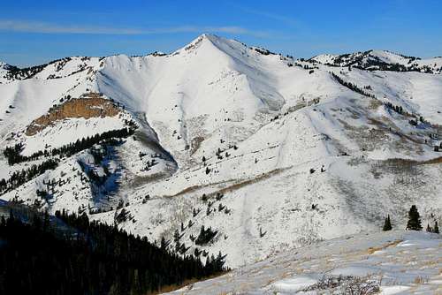
 Willard Peak seen from the south - by Phenom
Willard to Lewis Peak
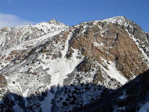
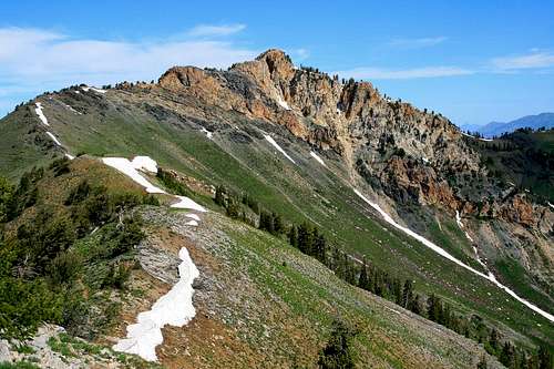
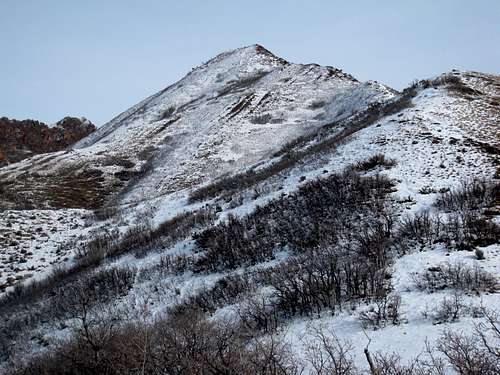
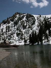
Willard Peak and Ben Lomond are the northernmost major peaks in this area. They form a long ridgeline that runs for several miles. Willard Peak is also the highest peak in the Northern Wasatch. The Wellsville Mountains are located to the north above Sardine Canyon and North Ogden Canyon is located to the south. Lewis Peak is lower in elevation and sits alone to the north of Ogden Canyon.

Willard Peak
Willard Peak - (9,764 feet)
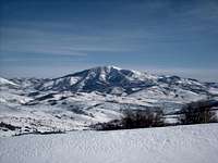
Willard Peak is the highest mountain in the Northern Wasatch and the highpoint of Weber County. From most vantage points Ben Lomond looks taller but Willard Peak happens to be 52 feet higher. Willard Peak has a mountain dirt road that was built in the 1930's by the Civilian Conservation Corps to Willard Basin. The trail from the basin is the shortest route. The summit is a large rounded rocky knob. Willard Peak can also be combined together with Ben Lomond from North Ogden Pass for a long day hike. This peak was named after Willard Richards who was an apostle under Brigham Young.
Ben Lomond
Ben Lomond - (9,712 feet)
Ben Lomond is the most well known mountain in the Northern Wasatch. It is the prominent, pyramid shaped, peak which is located above the northern corner of Ogden that is visible from many miles around. It isn't the highest mountain on the ridge but it stands out the most. Several steep couliors are on the southwest face along the base of several cliffs. The regular route starts from North Odgen Pass. It can also be climbed from the east from the Cutler Basin Trail or North Fork Park. It was named Ben Lomond from a woman who said it reminded her of the mountain of the same name in her country of Scotland.

Chilly Peak
Chilly Peak - (8,620 feet)
Chilly Peak is on the long ridgeline south of Ben Lomond. It is usually not considered an objective to climb on its own. It does make a good winter climb though. Ben Lomond is a long hike in winter and Chilly Peak is a good alternative or a nice addition to your hike. The views from the summit are good and you can see the whole south side of Ben Lomond. The trail starts from North Ogden Pass but doesn't go to the top of Chilly Peak. Instead, it traverses around its western side. Most mountains in winter are usually refered to as a "chilly" peak but why this one is named Chilly Peak is unknown.

Eyrie Peak
Eyrie Peak - (8,136 feet)
Peak 8,136 is known locally as Eyrie Peak. It's located on the ridge leading to Lewis Peak. It is actually higher in elevation along with several other points on the ridge. This is a Utah prominence peak and probably the only reason why anyone would hike up to it. You may see other people riding their mountain bikes or dirt bikes to the summit. In my opinion, the view from Lewis Peak is much better than from Eyrie Peak. So my suggestion is to climb both of them on the same hike. This is usually done from the trailhead at North Ogden Divide.

Lewis Peak
Lewis Peak - (8,031 feet)
Lewis Peak is located right in between Ben Lomond and Mount Ogden which are both higher in elevation. It is seperated from other peaks with North Ogden Divide to the north and Ogden Canyon to the south. It is a large a plateau consisting of several peaks along a ridgeline. The highest is Eyrie Peak. Lewis Peak has steep cliffs on its south and west face. The mountain was named for Lewis Warren Shurtliff who was the Weber Stake of Zion president. He joined a hiking group in the 1880's who were probably the first white men to reach the summit. The standard route starts from North Ogden Divide.
 Mount Ogden seen from the east
Mount Ogden Area
This area is located above the city of Ogden. The highest mountain in the area is Mount Ogden which was named after the city of the same name. The mountains on this ridge are south of Ogden Canyon and north of Weber Canyon. The Bonneville Shoreline Trail provides access to several mountains from the west. Snowbasin Ski Resort is located on the east side of the mountain.

Allen Peak
Allen Peak - (9,465 feet)
Allen Peak is located on the ridgeline north of Mount Ogden. Its east slopes are where the downhill ski racing for the 2002 Winter Olympics took place. Allen Peak can easily be combined with a climb up Mount Ogden. Steep cliffs drop down it's east face from the summit. It is connected to Malans Peak by its long west ridge. This route has some bushwhacking but is straight forward. There are many jagged points along Allen Peak's north ridge. The mountain was named for Lawrence Allen who was a forest employee. He was killed in 1963 by an avalanche on the west side of the mountain.

Mount Ogden
Mount Ogden - (9,572 feet)
Mount Ogden is the mountain directly east of the city of Ogden. It is very recognizable due to the fact that there is a large communication tower on the summit. Mount Ogden seems larger than it really is because it has many subpeaks. Snowbasin Ski Resort is on its east side. A road from Snowbasin provides the shortest route to the top. More strenuous hikes from Taylor, Waterfall and Beus Canyons are on the west side. For many years it was called Observatory Peak because an eight member U.S. Geological Survey crew traveled to its summit in 1881 to study astronomy. The name was later changed for its proximity to Ogden.

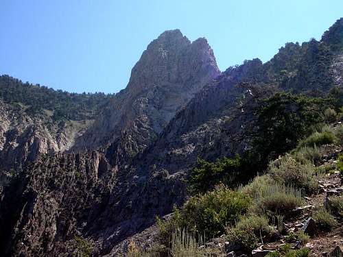
De Moisy Peak
De Moisy Peak - (9,370 feet)
De Moisy Peak is about two miles southwest of Snowbasin. It is on the ridgeline southeast of Mount Ogden and The Needles. It sits directly on the Weber-Morgan County line. The most common theory is that it is named for a local World War II hero. It is can be approached from the Beus Canyon trail. This trail is well maintained and probably the easiest way to climb Mount Ogden from the west side. You can also hike from Snowbasin and follow the ridge south to the peak.

Strawberry & De Moisy
Strawberry Peak - (9,265 feet)
Strawberry Peak is located south of De Moisy Peak. It sees traffic during winter because the Strawberry Express Gondola goes to the point between Strawberry and De Moisy Peak. Skiers know the large canyon to the east as the Sisters’ Bowl. You can combine Strawberry Peak and De Moisy Peak with Mount Ogden for a nice day of hiking. No one really knows why it was named Strawberry Peak. Some people say wild strawberries can be found on its slopes.

Hidden Valley Dome
Hidden Valley Dome - (7,017 feet)
This dome shaped point was named for its location overlooking Hidden Valley above Ogden. It is noticeable because of the cliff bands below its west face. There isn't a maintained trail to the summit so it isn't climbed often. The Hidden Valley trail is located below the mountain and that is the recommended route used for the approach. Then an off trail hike is needed to get to the top of Hidden Valley Dome. It can be hiked year round but the brush is easier to negotiate in winter.

Taylor Peak
Taylor Peak - (7,596 feet)
Taylor Peak is an unofficially named point, 7596 feet, that is located on the ridge that makes up the north side of Taylor Canyon. It isn't the highest point on the ridge but it stands out because of its knobby appearance which makes people wonder what's over there. The highpoint, 7,730 feet, is located a little farther to the southeast. The long ridgeline is sometimes referred to as Taylor Ridge. Hidden Valley Dome is located on the ridge to the west. All of these points can be approached from Hidden Valley or Taylor Canyon.

Malans Peak
Malans Peak - (6,980 feet)
This diminitive peak is located west of Mount Ogden. Actually, it's more like a bump at the end of a ridge. This is a popular mountain that has year round hiking. Malans Peak has a long and interesting history. In the late 1800's Bartholomew Malan built a 3 mile road into Malans Basin. Within two more years, there was a two-story hotel, campground, and lodge. Malans Heights Resort became a favorite retreat for both locals and tourists. A memorial plaque is in the basin but nothing is left of the resort. You can also see the remains of an old steam engine near the creek. It's a short and steep hike from either Taylor or Waterfall Canyon.

Strongs Peak
Strongs Peak - (8,260 feet)
Strongs Peak is often overlooked in an area of higher peaks. You can get there from the Bonneville Shoreline trail. The peak is above Strongs Canyon which is south of Waterfall Canyon. I think the summit is best approached from the west ridge above the Bonneville Shoreline trail. The canyon is quite rugged with quartzite rock walls and buttresses which makes off trail travel slower. The mountain was named for William Strong who was a member of Captain Howard Stansbury's survey team who were in the area in the 1850s.

Sardine Peak
Sardine Peak - (7,485 feet)
Sardine Peak is a great peak to climb in winter. Snowshoeing and cross-country skiing are the prefered methods of getting there. The route starts from Snowbasin Ski Resort. The trails goes through Maples Campground and then follow the trail toward an saddle that overlooks Ogden Canyon and Coldwater Canyon. During winter you may see tracks left by skiers or snowshoers who have climbed the peak. The view down toward Ogden Canyon and Pineview Reservoir is good.
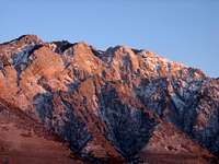
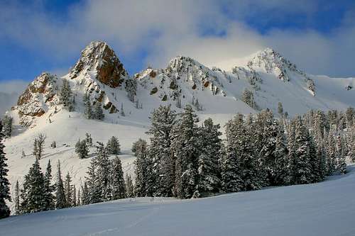
 Thurston Peak seen north of Francis Peak - by MikerHiker
Thurston Peak Area
This area is located above the cities of Layton, Centerville, and Bountiful. The mountains are south of Weber Canyon. Farmington Canyon provides access via a dirt road to goes to the summit of Francis Peak. It also goes south toward Bountiful Peak. Thurston Peak is the highest mountain on the ridge. All of the mountains in this area can also be hiked directly from the valley.

Layton Nipple
Layton Nipple - (6,689 feet)
Layton Nipple is a foothill on the west side of Francis Peak and Thurston Peak. It received its name for its resemblance to a nipple. It is also known locally as Little Peak. Layton Nipple is approached from Fernwood Trailhead. You can hike along the Community Trail to get near the peak. The Layton stone cabin is located north of the Nipple and is something worth checking out. To get to the summit requires off trail hiking through thick brush in summer. It is easier to navigate this part when it is covered in snow. Layton Nipple is best climbed during the cooler weather months.

Layton Peak
Layton Peak - (9,571 feet)
This mountain is unofficially named and located above the city of Layton. It is connected to the same ridgeline that is north of Thurston and Francis Peak. It is located above and south of Weber Canyon. Two routes that go to the summit include the Great Western Trail and Community Trail which is a name given by locals who live nearby. It is a more direct route that is easy to follow all the way to the top. The route is a little over four miles in distance to the top of Layton Peak. Elevation gain will be around 3,600 feet from the trailhead. The trail is very steep and has few switchbacks but the views are worth the effort.

Thurston Peak
Thurston Peak - (9,707 feet)
Thurston Peak is the highest mountain in this area. It is also the highpoint of Davis and Morgan counties. The standard route is a nice ridge walk from Francis Peak. Hiking up directly from the valley will require considerably more effort. Thurston Peak was officially named in July 1993 for Morgan County pioneer Thomas Jefferson Thurston. He lead a way through Weber Canyon and helped to settle in the valley on the other side of the mountain. The Kays Creek trail starts north of Thurston Peak and climbs up to the ridgeline.
Peak 9491
Peak 9491 - (9,491 feet)
This unnamed peak is located on the ridge between Thurston Peak and Francis Peak. It forms the summit at the top of the south ridge of Adams Canyon. The Smith Creek Lakes are in a basin to the southeast of the peak. There are several ways to hike to the peak but the most common is during a ridge traverse. Other route options include Bair Canyon to the southwest and Adams Canyon to the west.

Francis Peak
Francis Peak - (9,540 feet)
Anyone driving down Interstate-15 will notice this mountain because of the huge white radars on the summit. It is above the city of Farmington. The radar facility is located at over 9,000 feet in elevation. The peak was named for Esther Charlotte Francis who was a pioneer woman that helped early surveyers in the area. A dirt road can be driven all the way to the summit. For those of you who would enjoy a more strenuous route, and a lot of exercise, a trail from Baer Canyon can be hiked all the way from the valley. It tops out about a mile north of Francis Peak on the ridgeline.

Bountiful Peak
Bountiful Peak - (9,259 feet)
Bountiful Peak is the southern neighbor of Francis Peak seperated by Farmington Canyon. You've probably already guessed that the mountain is located above the city of Bountiful. The same road that goes to Francis Peak branches off at an intersection that goes south near the top of Bountiful Peak. A short trail goes to the summit. This is an easy peak to get to in summer. It can also be hiked from Parrish Creek, a 4,000+ foot climb, which is much more difficult. This trail actually starts from the city of Centerville. Bountiful Peak is a good early season snow climb.

Centerville Peak
Centerville Peak - (8,904 feet)
Centerville Peak is a highpoint on the ridge south of Bountiful Peak. It is unofficially named after its location above Centerville. There are two main routes. The most strenuous is from Parrish Creek which starts from the valley and gains a lot of elevation. The other route starts from the Skyline Road and Sessions Mountains Trailhead. This route follows the southeast ridge over several points. You can also do a ridge traverse from Bountiful Peak to the summit of Centerville Peak.

Gold Ridge
Gold Ridge - (8,396 feet)
Gold Ridge is located east of Bountiful Peak. It is reached by driving up Farmington Canyon. A high clearance vehicle is helpful for getting to the trailhead or you can add some mileage to the hike. The route follows an ATV trail. The hike along the ridge is about two miles long. The first point is 8,085 feet and the summit is 8,396 feet. The trail goes to within a short distance of the summit. The ridge offers good views of the Wasatch and also the Uintas on a clear day. The upper gate on the Farmington Canyon road is usually shut in November so the approach will be longer in winter.

ZigZag Hill
ZigZag Hill - (6,470 feet)
Peak 6470, known locally as ZigZag Hill, is above the cities of Centerville and Bountiful. It is actually part of the same ridge that is west of Centerville Peak, 7,382 feet, which is unofficially named. These two points are located southwest of Bountiful Peak and accessed from the Parrish Creek trail. This maintained trail doesn't go all the way to the summit. It continues around the south side. It's not far and you can leave the trail and scramble up the last part. The top is tree covered. This peak and Centerville Peak are nice winter hikes and have a good view of the Great Salt Lake.
 Grandview Peak in winter - by Phenom
Grandview Peak Area
Grandview Peak is the highest mountain in this area. It is located south of Bountiful Peak and north of Parleys Canyon. Other canyons in this area include City Creek, Emigration, and East Canyon. Many of the trailheads are easily reached from the north end of Salt Lake City.

Sessions Mountains
Sessions Mountains - (9,260 feet)
Sessions Mountains is a long ridgeline of several peaks located north of Grandview Peak. The two most prominent points are Peak 9,260 and Peak 9,158. This ridge can be accessed by hiking on the Great Western Trail. The trail goes near the summits of many peaks on this ridgeline. Another route starts from Mueller Park and goes up the Kenney Creek Trail. This trail gains a lot of elevation and climbs up the northwest ridge of the mountain and continues until it meets the Great Western Trail on the east ridge. The mountain was named after Perrigrine Sessions who helped settle the city of Bountiful.

Burro Peak
Burro Peak - (8,958 feet)
Burro Peak is located southwest of Grandview Peak. The two peaks are connected by a long ridge that runs west to east. The best way to climb Burro Peak is from North Canyon. The trail goes toward Rudys Flat. The ridge located to the west is near Burro Mine and Cottonwood Gulch. In 1907, Pierre Peugeot, a consulting engineer living in Woods Cross, spent his summer vacation with two burros and a prospecting outfit in the mountains above Bountiful. He discovered lead, silver, and gold there. Work began shortly afterwards on the mine and the necessary activities supporting it. This was known as Burro Mine which operated less than twenty years and by 1926 the mine was closed.

Dude Benchmark
Dude Benchmark - (7,212 feet)
Dude Benchmark is simply labeled as Dude on maps. The peak is usually approached from the west. The easiest way to get there is by hiking up to Ensign Peak first. Then follow the trail going east from here. There are many ups and downs along the ridgeline. Another way to approach the peak is from North Canyon going toward Rudys Flat. From this direction, you could follow the east ridge to the summit. Another possible way is from City Creek Canyon which is done less often. Dude Benchmark can be hiked during much of the year even when snow covered.

Cave Peak
Cave Peak - (6,803 feet)
Cave Peak is located east of the city of Bountiful. Two trails can be used to access the mountain. Mountain bikers often ride through both of these canyons which are sometimes done as a loop. The first one starts from Canyon Creek Road and goes up North Canyon. It heads toward Rudys Flat but you can leave the trail before that if you want to climb up the mountain. The other route starts from Mueller Park which is located farther north. It goes toward Big Rock which is also known as Elephant Rock. The trail continues southeast toward Rudys Flat. The northeast ridge of Cave Peak can be climbed from here.

Grandview Peak
Grandview Peak - (9,410 feet)
Grandview Peak is the large mountain located east of Bountiful and northeast of City Creek Canyon. It's connected by several ridges and can be climbed from every direction. It always seems to be hidden behind other mountains and is not easy to see without hiking some distance. The Great Western Trail runs along Grandview Peak's east ridge. You can get there from the north on Bountiful Peak Road or the south from Mountain Dell Road off Parleys Canyon. The west ridge can be climbed from Mueller Park or North Canyon. City Creek Canyon can be used to climb the southwest ridge of the peak. Access to City Creek Canyon is limited due to vehicle restrictions. It is a long hike from any of these routes.
Lookout Peak
Lookout Peak - (8,954 feet)
Lookout Peak is located northwest of Mountain Dell Canyon. It is a good mountain to climb in early season when all of the higher peaks are still covered in snow. The mountain has several points along its ridgeline. Like its name suggests, the view of the surrounding mountains from the summit is very good. In winter, the road isn't plowed all the way to the regular trailhead. It will probably require walking extra miles. It does have the advantage of being packed down by snowmobiles. Affleck Park and Killyon Canyon are the two most commonly used routes. It can also be climbed from City Creek Canyon.

Swallow Rocks
Swallow Rocks - (8,901 feet)
Swallow Rocks are located northeast of Grandview Peak and east of the Sessions Mountains. They are also north of Lookout Peak and northwest of Big Mountain. There are two points. The one labeled Swallow Rocks on the map is Peak 8,620 and the highpoint is farther west at 8,901 feet elevation. You can get to these peaks from Big Mountain Pass or by hiking over Lookout Peak. Another route is south from the Sessions Mountains including a drive up Skyline Drive. All routes are can be done as a long dayhike or overnight trip with other peaks in the area.

Big Beacon
Mount Wire (Big Beacon) - (7,143 feet)
Mount Wire is located south of Red Butte Gardens and north of Emigration Canyon. This Is The Place Heritage Park is below the peak. The park is the home to a living community called the Old Deseret Village. Mount Wire is also called Big Beacon for having two big microwave reflectors on its summit. The mountain is easy to recognize because of these two structures. It has an aircraft beacon where you can climb up a ladder to get an even better view. Big Beacon can be climbed year round and gives a good view of the area. Despite its low elevation, the mountain is a good workout. Routes to the top include Georges Hollow and Pioneer Park.

Red Butte
Red Butte - (6,472 feet)
Red Butte is connected to the northwest ridge of Big Beacon. It is above Red Butte Gardens in Salt Lake City and just behind the University of Utah campus. The mountain is a nice short hike which makes it a good winter climb when all the other mountains are covered in snow. Red Butte Gardens is a wealth of information for gardeners and has many different types of flowers. Red Butte Canyon is located on the north side of Red Butte containing Red Butte Reservoir. This place was set aside as a Research National Area.

Little Black Mountain
Little Black Mountain - (8,040 feet)
This mountain is the highest point on the ridge forming the south side of City Creek Canyon. Little Black Mountain is usually climbed from Dry Creek or Perrys Hollow. Because of new homes being built I have found that starting from the trailhead at the end of Terrace Hills Drive to be the best route. It is a good winter climb with a gentle slope to the summit. The actual highpoint is part of a much longer ridge. Avenue Twin Peaks can be climbed in combination with Little Black Mountain.

Avenue Twin Peaks
Avenue Twin Peaks - (6,291 feet)
There are three Twin Peaks in the Wasatch Mountains. They are American Fork Twin Peaks, Broads Fork Twin Peaks, and the small foothills of Avenue Twin Peaks. They are the easiest of the three to climb. For such a low elevation you get a great view of the Salt Lake City valley from these peaks. Both summits are a ten minute walk from each other. This is a good winter hike. There are numerous routes to choose from that lead up to the ridge. They include Morris Reservoir, Perrys Hollow, Limekiln Gulch, Dry Creek, and Terrace Hills Drive.
Mount Van Cott
Mount Van Cott - (6,348 feet)
A good little peak to climb in a short amount of time. Only a few hours or less are needed to hike to the top of Mount Van Cott. The trail starts right above the upper parking lot of the University Medical Center. A jeep track heads directly north of the ridge. Mount Van Cott is south of where the jeep road levels off. You can make the hike longer by continuing to the top of Dry Creek and coming back down along the drainage. Hiking up Cephalopod Gulch is another possibility. It is in the drainage northeast of the parking lot. Hiking up Battle Gulch is one of the most direct routes to the top.

Meridian Peak
Meridian Peak - (5,978 feet)
Meridian Peak is a low elevation foothill overlooking northern Salt Lake valley. The peak can be hiked year round. It is north of Ensign Peak which is the more popular destination of the two. They can be combined together. The route between the peaks may also include other points along the ridge, which have radio towers, so it is sometimes referred to as the antennas loop. The name of the peak comes from the Salt Lake Meridian which crosses over it.

Ensign Peak
Ensign Peak - (5,414 feet)
This is where Brigham Young had his vision to settle in Utah. It has good views and year round access. This isn't really a mountain but I thought I should mention it because of its historical importance to the area. To get there, drive up East Capitol Boulevard past the Utah State Capitol building and turn left on Ensign Vista Drive. You can park next to The Ensign Peak Nature Park. There are commemorative plaques throughout the park explaining its history. The name of the peak comes from the biblical prophecy "He will lift up an ensign unto the nations; He lifteth up an ensign on the mountains." (Isa 5:26; 18:3).

Dale Peak
Dale Peak - (7,376 feet)
Dale Peak is the lower neighbor to Perkins Peak and located on the same ridge above Emigration and Parleys Canyons. The trail leading up toward the peak is obvious and follows the route toward Perkins Peak from Little Mountain Summit. Dale Peak is the first named summit you will arrive at on the ridge. It's an easy hike during the summer but exposed to the sun. It is also a nice ski or snowshoe in winter. There are good views of the Salt Lake Valley, Millcreek Ridge, and Emigration Canyon. Combining both peaks together is a nice day hike.
Perkins Peak
Perkins Peak - (7,491 feet)
Perkins Peak is a highpoint located on Emigration Canyon ridge. The standard route starts from Little Mountain Summit. Park at the trailhead near the pass and start walking on the jeep road near the gate. After a quarter mile there is a second gate. Dale Peak is the first named summit that you will get to. Two miles farther along the ridge is Perkins Peak. You may also be interested in hiking to Peak 7,500 which is located on the ridge to the northeast. To the west the ridge divides near Pencil Point which can also be used as an ascent route.

Little Mountain
Little Mountain - (7,032 feet)
Little Mountain is located above Little Mountain summit which is a high pass on the road between Emigration Canyon and Parleys Canyon. Little Mountain is also located east of Dale Peak and Perkins Peak on Emigration Ridge. Little Mountain is hiked during all seasons and is a nice snowshoe during winter. The standard route starts from Little Mountain pass and begins as a dirt jeep trail. The route follows the ridgeline until below the top which is a little brushy in summer.

Big Mountain
Big Mountain - (8,472 feet)
Big Mountain is north of Big Mountain Pass. This was an important pass for Mormon Pioneers. It is located northeast of Little Mountain Summit. Of course with a Little Mountain you must have a Big Mountain in the same area. Big Mountain Pass is one of the highpoints along the road from the East Canyon exit in Parleys Canyon. The route from the pass is easy to follow and a trail goes north along the ridge. It leads to just below the summit of the peak.

Bald Mountain
Bald Mountain - (7,869 feet)
Here is another Bald Mountain in Utah. This peak has a rounded open appearance so that is where the name came from. Bald Mountain is located south of Big Mountain Pass. You can get there from Parleys Canyon from the Mountain Dell exit. Big Mountain is located in the same area to the north on the opposite side of the pass. The Great Western Trail is easy to follow. The first point has a fallen airway beacon. Bald Mountain is farther south along the ridge.
 Jack's Mountain seen from the west
Eastern Peaks Area
The main crest of the Northern Wasatch Mountains is located above the Wasatch Front. There is a huge wilderness that is east of this area. It is separated by the main group of mountains by Morgan Valley and is south of the Bear River Range and Monte Cristo Range. Mountains in this area range between 6,000 to 9,000 feet in elevation. Many peaks remain unnamed. I listed some of the more prominent named peaks below.

Durst Mountain
Durst Mountain
Durst Mountain – (9,284 feet)
Durst Mountain is one of the highest peaks in the area that is located east of the main Northern Wasatch crest. It stands above all of the other mountains east of the valley. It is located east of the town of Mountain Green and north of Morgan. The Cottonwood Creek Road provides the shortest approach from the north side of the mountain. Durst Mountain is also one of the Utah prominence peaks. Access is limited due to private property and this is one of the reasons why the mountain is not climbed often.
Herd Mountain – (8,059 feet)
Herd Mountain is located at the top and east end of Cottonwood Canyon. The mountain is southeast of Huntsville and farther northeast of Durst Mountain. Big and Little Buck Canyon are on the southern end of the mountain. A dirt road goes near the summit of Herd Mountain.
Elk Mountain – (7,409 feet)
Elk Mountain is located on the north side of Cottonwood Canyon. It is connected to Herd Mountain by a long ridge that goes over several other points. Some 4-wheel drive roads are on the north side of the mountain. They start from Pineview Reservoir to the northwest.
Big Mahogany Mountain – (7,748 feet)
There are three large mountains on the west side of the range. They include Big Mahogany Mountain, Little Mahogany Mountain, 7,254 feet, and Haystack Mountain, 7,054 feet. East of the Mountain Green are several canyons that provide access. They include Bohman Hollow, Dry Hollow, and Spring Hollow. At the north end is Brushy Canyon and on the south end is Roswells Canyon.
Bybee Knoll – (8,588 feet)
There are three knolls located on the east side the range. They include Bybee Knoll, Goat Knoll, 7,939 feet, and Bolly Knoll, 7,192 feet. Bybee Knoll is the highest and is located at the northern end. It was named after Bybee Creek which is a side canyon of Cottonwood Canyon. Goat Knoll is located at the top of Folley Ridge. Bolly Knoll is southwest of Goat Knoll above Branch Canyon.
The central area is located east of Francis Peak and Bountiful Peak near the southern end of Morgan Valley. Redrock Peak is the highest in the area. The peak is located north of East Canyon Reservoir. I didn’t see very many hikers here. It is mostly hunters that come to this area during fall looking for deer, elk, and moose. There are extensive views along the ridge from the Northern to the Central Wasatch.

Redrock Peak

Redrock Peak
Redrock Peak - (8,170 feet)
Redrock Peak is located in the eastern area of the Northern Wasatch Mountains. This is south of Durst Mountain and north of Lewis Peak aka Wanship Benchmark. It is also located south of the city of Morgan which is not far from Ogden. Despite its location, the peak is not climbed often. Redrock Canyon provides a good route from which to climb up the peak. The view is very good especially when the higher peaks to the west and south have a layer of snow on them. The name of the peak comes from the red cliffs and red rocks and soil in the area.
The southern area is located east of the main Northern Wasatch crest near the Sessions Mountains and Grandview Peak area. This group of mountains is near three reservoirs. They include Rockport Reservoir to the southeast, East Canyon Reservoir to the northwest, and Echo Reservoir to the northeast.

Lewis Peak

Lewis Peak View
Lewis Peak – (9,304 feet)
This mountain shouldn't be confused with the other one of the same name which is located between Ben Lomond and Mount Ogden on the main divide. This Lewis Peak is relatively unknown and is located northwest of the city of Wanship. It is one of the Utah prominence peaks. The mountain is on the Morgan and Summit County line. There are several dirt roads on all sides of the mountain that allow access. They may require a high clearance vehicle or hiking on the road. I know that these roads are located on private property and you should get permission to hike here.
Porcupine Peak - (8,266 feet)
Porcupine Peak is located west of Lewis Peak. On maps it is simply labeled as Airway Beacon. The peak located east of it is higher in elevation but is not named. It has a road to its summit and is 8,559 feet high. The right fork above East Canyon Reservoir provides the best access.
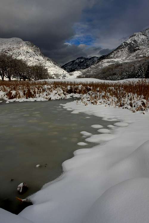
 Green Pond in winter
Rivers, Waterfalls & Lakes
RIVERS:
Ogden River
The Ogden River is a 35 mile long river in Northern Utah. The river has three forks including North, Central, and South. It begins in the Wasatch Mountains in Weber County and converges at Pineview Reservoir near the city of Huntsville. The river then flows southwest through Ogden Canyon, Ogden City, and the border of West Haven where it joins the Weber River. The Ogden River Scenic Byway follows the river as it cuts through the landscape to create beautiful Ogden Canyon. The canyon is about six miles long with several smaller side canyons. There are quartzite cliffs and higher in the canyon is steep limestone. The city of Ogden is at the western end of Ogden Canyon with the eastern end at Pineview Dam. The river and city were named after fur trapper Peter Skene Ogden. The Ogden River has been a valuable resource to the area since the early 20th century.
Weber River
The Weber River is a 125 mile long river that empties into the Great Salt Lake. The river was named for fur trapper John Henry Weber. The Weber River rises in the northwest of the Uinta Mountains near Bald Mountain, Notch Mountain, and Mount Watson. It passes by the city of Oakley, and fills the reservoir of Rockport Lake, then turns north, receiving the flow of major tributaries Silver Creek and at Coalville, Chalk Creek. Coalville is also at the upper end of Echo Reservoir. The river then passes the town of Henefer and turns more westerly. Then it passes the city of Morgan where it receives East Canyon Creek. When it meets Weber Canyon, it turns north again where it is joined by the Ogden River. The combined stream meanders and enters mud flats near where it goes into the Great Salt Lake. The Weber River contributes about twenty five percent of the total water.
WATERFALLS:
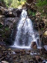
Waterfalls of the Wasatch List - by andrew david
It seems that almost every canyon in the Northern Wasatch has a waterfall. Some of these falls only last a month or so from melting snow. In spring, the area becomes verdant and it's the best time to see cascades and falls. The most well known are Malans Waterfall in Waterfall Canyon and Adams Canyon Falls.
 Adams Canyon Adams Canyon |
 Baer Canyon Baer Canyon |
 Farmington Canyon Farmington Canyon |
 Waterfall Canyon Waterfall Canyon |
|---|
LAKES:
Willard Lake
This small pond or lake is located in Willard Basin below Willard Peak. The lake sits at about 8,800 feet elevation. It is largest during spring runoff but dries out during summer. It is seen by people hiking to Willard Peak from the north.
Green Pond
Green Pond is located east of Mount Ogden. There is a signed trailhead located on the road toward Snowbasin. This parking area is also the beginning of other trails in the area for hikers, snowshoers and skiers. A trail in summer goes to the pond and in winter it will usually be packed down. You can take the same trail back or follow an alternate loop back to the parking area.
Smith Creek Lakes
These are three small lakes located north of Francis Peak. They are over 9,000 feet in elevation. Most people get there by driving up to Francis Peak. The hike is 3.2 miles one way. The trail rises over ridges then falls into the cirque basin of each lake. The trail loses about 600 feet descending to the last lake. Total elevation gain back is only about 900 feet.
Farmington Lake
Farmington Lake is located north of Bountiful Peak. You can get there by driving up Farmington Canyon from which the lake recieved its name. At the junction, drive south toward Bountiful Peak. The lake is located in a small cirque. I have seen people fishing there but am not sure how well stocked the lake is.
 Little Dell Reservoir Little Dell Reservoir |
 Willard Lake Willard Lake |
 Willard Lake Willard Lake |
 Farmington Lake Farmington Lake |
|---|
SMALL RESERVOIRS:
Red Butte Reservoir
Red Butte Reservoir is located in Red Butte Canyon. This is south of Mount Van Cott and north of Red Butte which is connected to Mount Wire also known as Big Beacon. It is one and a half miles east of the University of Utah. Red Butte Reservoir is located on land acquired by the U.S. Army in 1906. The dam was constructed in 1930 to provide a water supply for Fort Douglas. Red Butte Canyon is located in a Research Natural Area. This area consist of 7.25 square miles of watershed. It is one of the smallest canyons in the area.
Mountain Dell Reservoir
Mountain Dell Reservoir is located just below and southwest of Little Dell Reservoir. It is north of Parleys Canyon. The Mountain Dell Dam provides a water equalizing and storage reservoir for people that live in the Salt Lake City area. It was designed by John S. Eastwood, and constructed between 1914 and 1925, the dam is an example of a mixed buttress dam and multiple arch dam construction. At the time the plans were made, the city was in need of a sufficient supply of water, especially during late summer and the middle of winter. Mountain Dell Reservoir was closed to fishing and all public use in 2005 by the Salt Lake City and Utah Division Of Wildlife Resources.
Little Dell Reservoir
Little Dell Reservoir is located above and to the northeast of Mountain Dell Reservoir. It is an impoundment on Dell Creek. This reservoir also stores water diverted from Parleys Creek located immediately downstream. The reservoir was constructed between 1987 and 1993 for drinking water supply and flood control. The Little Dell Reservoir dam is a rolled earthfill structure. It has a maximum height of 224 feet above the streambed and is 1,700 feet in length. Fishing is currently allowed in Little Dell Reservoir unlike nearby Mountain Dell Reservoir. Little Dell contains several types of fish including Brook trout, Brown trout, and native Bonneville cutthroat trout. Special fishing regulations exist to protect those cutthroat trout.
 Willard Bay Willard Bay |
 Pineview Reservoir Pineview Reservoir |
 Pineview Reservoir Pineview Reservoir |
|---|
LARGE RESERVOIRS:
Willard Bay
Willard Bay is a 9,900-acre freshwater reservoir located northwest of the city of Ogden. It sits on the northeastern flood plains of the Great Salt Lake. Willard Bay State Park is located on its eastern shore. This is a very popular park which has two state owned facilities, a north marina and a south marina. It provides an area for boating, waterskiing, and fishing. This includes crappie, walleye, wiper, smallmouth bass, and catfish. A campground is also in the park which is most popular with RVs. The reservoir is at 4,200 feet elevation.
Mantua Reservoir
Mantua Reservoir is located in Sardine Canyon at the edge of the small town of Mantua. This is where the access road to Willard Peak from the north is located. The name of the reservoir is pronounced as "man' a way". It sits at an elevation of 5,000 feet and offers fishing, boating, and water skiing. In winter, ice fishing is popular. The reservoir offers a boat ramp, picnic areas, campground, swimming beach and is stocked with fish. The main season for the reservoir is May through October.
Pineview Reservoir
Pineview Reservoir is located east of the city of Ogden in Ogden Valley. This reservoir is located in a small valley that is surrounded by mountains. Because of this, the reservoir is oddly shaped resembling a bird with wings flying through the air. The reservoir has sandy beaches and paved launch ramps for boats. Pineview Dam is located above Ogden Canyon which is about seven miles east of Ogden. It was developed as a means of providing reliable irrigation to 25,000 acres located between the Wasatch Mountains and the Great Salt Lake. It was built as part of the Ogden River Project, which included the Pineview Dam and Reservoir, Ogden Canyon Conduit, Ogden-Brigham Canal, South Ogden Highline Canal and a gravity-pressure distribution located in the South Ogden Conservation District.
East Canyon Reservoir
This reservoir is located east of Bountiful Peak. Lewis Peak and Porcupine Peak are located to the southeast. East Canyon State Park & Reservoir is a 680-acre area used for boating and year-round fishing. East Canyon and the surrounding area are rich in pioneer history. The Donner Party, also known as the Donner-Reed group, were a group of farmers from Iowa and Illinois going west to find fertile land for their crops. On their way to California, they passed through East Canyon in 1846. They were the first wagon train to pass through the area. The group experienced many obstacles including high brush and rocky cliffs which slowed them down a great deal. Only 47 of the original 87 people reached their destination.
Echo Reservoir
Echo Reservoir is located over the ridge to the east of East Canyon Reservoir. It is in Henefer Valley and Interstate-80 travels along its shore for about three miles. It was created in the early 1930s to help retain the water that thawed from the nearby Uintas Mountains. The reservoir's sole tributary is the Weber River. It was one of several reservoirs constructed at the time. Echo Reservoir's main purposes are irrigation, recreation, flood control, and hydropower. Fishing is great in this area and includes yellow perch, brown trout, rainbow trout, small and largemouth bass, and channel catfish. The reservoir is at 5,560 feet elevation.
 London Spire seen from the west - by vanman798
Rock Climbing
Rock Climbers have been climbing in this area for a long time. It is not well known to most people who live outside of the Northern Wasatch Front. For this reason, rock climbing areas have remained relatively quiet for the most part. I have written a few short descriptions below.
Willard Peak West Face

Willard Spires
Willard Spires
These are the rugged and impressive looking peaks that overlook Willard Bay. To rock climbers they seem like the premiere place for multi-pitch trad climbing but access to the area is difficult. Climbing here is often runout with loose rock and difficult route finding. Approach times vary from two to three hours. London Spire is the tallest spire and stands out the most. There are new houses at the approach canyons so finding a suitable parking spot is not always easy. Access is usually given to people who get permission from local land owners ahead of time. An alternative way for hikers is to drive to Willard Basin, go up to the ridge, and then hike down to the spires from there. Adventurous people will find great alpine climbing and outstanding views.
Back in the early pioneer times, the three Willard spires were refered to as "The First Presidency", refering to the leadership of the LDS Church. Last summer I noticed that the centermost & tallest spire had something on it. Through binoculars I discovered it was a large American Flag on a pole. Not sure who got it there, but its a neat addition. Thanks to madman1892 for the info about the First Presidency.

Birdie's Wall
Birdie's Wall - This is the northernmost spire located south of Willard Canyon. The West Face is the only known route on the spire. The approach up Cook Canyon is long and difficult and takes three hours. West Face is rated (III 5.8) 8-9 pitches.
London Spire - This is the pointed central spire. It has a slightly lighter color compared to the other spires. All routes on the north and west use the Birdie's Wall approach. South facing routes are approached from Holmes Canyon. Approach time can be shortened by driving up to the mouth of Holmes Canyon.
The Direct North Face - (III 5.9) 10-12 pitches
The Original North Face - (IV 5.9) 15-20 pitches
Northwest Ridge and West Face - (III 5.7 and 10 pitches)
Southwest Ridge and South Face are - (III 5.7 and 10 pitches)
The Ogre - This is the southernmost spire of the group. It has some of the longest approach hikes. It goes up Pearsons Canyon which is steep and rugged. Permission by local land owners is advised. The Great Book - (II 4th class) and the South Face - (II 5.5).
The Prow - This is the buttress south of the Ogre. It uses the same approach for the Ogre but branches off into the right fork. There is some moderate 5th class climbing on the approach. Like all of the other spires, this approach is strenuous. Most popular routes on The Prow include: Prow Center - (II 5.8) and Prow Right - (II 5.7).
 Weber Canyon east side cliffs - by imontop
Ogden Rock Climbing Areas
Schoolroom
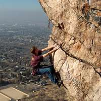
Ogden isn't exactly as well known for its rock climbing due to the popularity of Big and Little Cottonwood Canyon near Salt Lake City. There are actually many good quality climbing areas. Climbing is mostly on quartzite with both trad and sport climbing. The eastern end of Ogden Canyon near Causey Reservoir has steep limestone cliffs. Some of the climbing is in a very wilderness setting where you're pretty much on your own. The first routes were recorded as early as the 1940's. Some of the best climbers have climbed at these crags. The most well known are Greg and Jeff Lowe who grew up in the area.

Schoolroom
Ogden Canyon - The Ogden Canyon road is narrow and windy and finding a place to park on the side of the road may be the hardest part. It is a good place to go if you don't like hiking very far to the crags. Some areas are very close to the road. Most of these cliffs are located in gullies within the first mile up the canyon. Several easy to moderate routes are located on the popular crags. These areas include: Nuts and Bolts (5.8 - 5.10), Utah Wall (5.5 - 5.10), and 5.8 Wall (5.7 - 5.9)

Mount Ogden
9th Street - The most popular area in Ogden. This is because of the short approach and easy access to topropping hard routes. It's not unusual to see a dozen people climbing up these cliffs at the same time. Routes are mostly in the 5.10 - 5.12 range. The obvious hard routes are located on the overhanging wall. The Gibbon Man Cave is located a short distance from 9th Street. It has a 5.12 route and 5.13 project up the roof.
Macabre Wall - This is a favorite area for trad climbers. The wall is located on the west face of Lewis Peak. It is a 500 foot wall that is home to the famous route up Macabre Roof. People who have tried climbing it have described it as being incredibly scary. The forty foot roof was free climbed by Greg Lowe in 1967. It wasn't until 35 years later that the late Ken Gygi would repeat this climb. It is rated 5.12B but some people say it is harder.
Schoolroom - This is considered the gem of the Odgen rock climbing areas. This is the huge cliffband located to the north of Taylor Canyon. It is above St. Joe's Boulderfield. The approach is a steep hike up the talus fields to the base of the cliffs. If you like solitude then you've come to the right place. There are numerous routes on excellent quartzite. Routes go from 5.8 - 5.12
St. Joe's Boulderfield - This is the best place to go bouldering in the Ogden area. Most people notice these boulders when hiking on the trail below Schoolroom Wall. The area is full of problems that should keep you busy for a long time. It is located at the end of 26th street. Get there from either 22nd street or 29th street trailheads and walk along the Bonneville Shoreline trail. Watch out for poison ivy, wasp nests and rattlesnakes!
Mount Ogden - East Face
A few people have asked me about routes and have showed interest in climbing the east face of Mount Ogden. So I decided to add this to the climbing areas list. Despite being an obvious climbing goal, the east face isn't climbed often. There isn't that much information available on climbing the face. The normal approach is from the Snowbasin Ski Resort. The hike is along a dirt road built near the top of Mount Ogden. You should allow about one hour to hike to the base of the northeast sloping slabs. The rock is reported to be very sound and solid and has many cracks and ledges. There are several major lines up the face and one on the eastern shoulder. The most difficult route is rated 5.7. The majority of routes are in the 5.5 - 5.6 range.
 Malans Waterfall
Ice Climbing
Ice Climbing in the Northern Wasatch Mountains began as early as the mid-1960’s. The interest in ice climbing was led by the Lowe brothers, Greg and Jeff, as well as several other Ogden climbers. The Lowes started climbing in the cliffs above Ogden when they were kids. Years later, they began climbing the steep waterfalls and snow couloirs in the mountains above their backyard.
The Great White Icicle in Little Cottonwood Canyon was climbed in the 1960’s by Rick Reese and Ted Wilson. The Lowe brothers thought that climbing Malans Waterfall in Ogden would be good training for climbing other areas in winter. Several years later Greg Lowe made a solo ascent of the falls. This was the first major waterfall ice route to be climbed in the Northern Wasatch. Then the Lowes climbed Bridal Veil Falls as well as many other ice climbs in Provo Canyon.
 Malans Waterfall Malans Waterfall |
 Malans Waterfall Malans Waterfall |
 Malans Waterfall Malans Waterfall |
 Waterfall Canyon Waterfall Canyon |
|---|
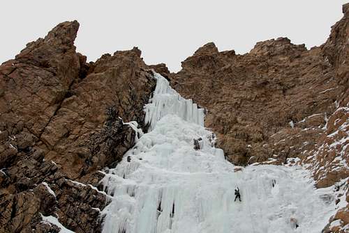
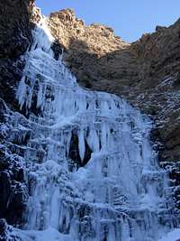
Ogden Area Ice Climbs
Willard Falls: II, WI2-3 - Willard Falls is located in Willard Canyon. It is approximately 800 feet high. The narrow falls flows over a steep rock wall. It is best climbed from the end of December through January depending on current conditions.
Jumps Off Canyon Falls: I, WI3-4 – Jump Off Canyon is the steep canyon filled with quartzite cliffs on the west side of Lewis Peak. This is located to the south of Macabre Wall. The route is 200 feet high and only forms when conditions are right and the weather is cold enough to freeze for a while.
The Great Amphitheater Gully: III, WI3 - This route is located above Third street in Ogden. It climbs up the obvious gully in the cliffs for 600 feet. The approach will take over an hour. It faces the sun so it is only in condition for a short period of time.
Ogden Canyon Waterfall: I, WI4-5 - This waterfall is located at the mouth of Ogden Canyon on the north side. It is 250 feet high. The window of time to climb is short because of its low elevation so it must be very cold and snowy for good conditions.
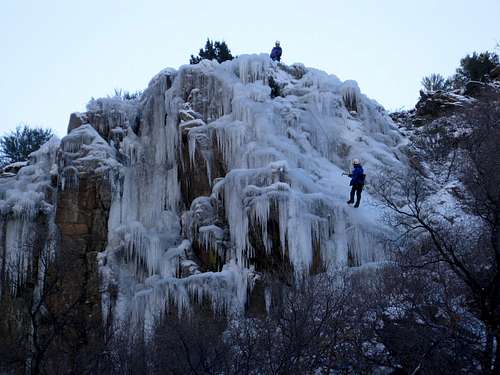
Malans Waterfall: II, WI5 - Malans Waterfall is located in Waterfall Canyon. There can be up to 310 feet of ice climbing to the top of the falls. The route is usually done in 2 to 3 pitches. It faces toward the south so an early start is usually needed.
 Waterfall Canyon Ice Climbing
The Canyons
This area of the Wasatch has an abundance of canyons. Many of these canyons have maintained trails and others have more primitive trails which are used less. Below is a table with a list of canyons in the Northern Wasatch with Summitpost pages.
| Canyon | SP Page | Comments |
| Waterfall Canyon | Page | South of Taylor Canyon below Malans Peak and Mount Ogden |
| Beus Canyon | Page | Southwest side of Mount Ogden and south of Strongs Canyon |
| Burch Creek Canyon | Page | South of Beus Canyon on the southwest side of Mount Ogden |
| Adams Canyon | Page | The North Fork of Holmes Creek below Thurston Peak |
| Bair Canyon | Page | North of Farmington Canyon and west of Francis Peak |
| Centerville Canyon | Page | South of Parrish Creek near the city of Centerville |
| Farmington Canyon | Page | Farmington Creek flows in this canyon not far from Skyline Drive |
| Holbrook Canyon | Page | Above Bountiful south of Ward Canyon and north of Mueller Park |
| North Canyon | Page | South of Mueller Park near the city of Bountiful |
 Adams Canyon in winter
Recommended Hikes
The Northern Wasatch offers year round hiking ranging from easy trails to longer more strenuous hikes. The foothills are one of the best places for hiking in early or late season. Many of these places have great snowshoeing during winter. I listed some of the well known areas below. The Ogden River Parkway is a paved trail which is accessible to anyone. For this reason it can be crowded on weekends especially on Saturday.
Hikes Around Ogden List - by Fleshj27
Wheeler Creek / Icebox Canyon
Wheeler Creek can be accessed from two trailheads. The first trailhead is located on the east side of Ogden Canyon not far from Pineview Reservoir. There is an easy to miss dirt road that goes off to the right to a trailhead near some summer homes. The trail leads south on a dirt road which is easy to walk on in winter. Farther up the canyon is a junction. The left trail goes to the Art Nord Trailhead which is where the other trailhead is located. The right trail goes up Icebox Canyon. This is a shaded canyon which is cool during much of the year which is probably where it got its name from. It leads to an overlook near the road leading to Snowbasin. You'll get a good view of Mount Ogden and other peaks in the area from here. You can descend back down Icebox Canyon or make a loop hike to Art Nord Trailhead and then follow Wheeler Creek back to Ogden Canyon.
 Wheeler Canyon Wheeler Canyon |
 Wheeler Canyon Wheeler Canyon |
 Icebox Canyon Icebox Canyon |
 Icebox Canyon Icebox Canyon |
|---|
Indian Trail
This trail was built using the approximate location of a prehistoric route developed by Native Americans as the primary route up Ogden Canyon to what was called Ogden's Hole (Ogden Valley). The trail traverses the mountains along the south side of Ogden Canyon. The trail starts by climbing north to the mouth of Ogden Canyon. It then levels off once you get into the canyon. There are several avalanche gullies along the way. The trail goes all the way into the next canyon and then around the bend and up to a hut. It is a small shelter but you can probably fit six people in there. There is a plaque with the names of all of the mountains that are visible. The trail continues and the rugged peaks on the north side of Mount Ogden can be seen. The trail descends Coldwater Canyon. At the bottom of the canyon the trail follows the creek down. Start at either 22nd street trailhead Ogden or Coldwater Canyon trailhead in Ogden Canyon.
 Indian Trail Indian Trail |
 Indian Trail Indian Trail |
 Indian Trail Indian Trail |
 Indian Trail Indian Trail |
|---|
Hidden Valley
This is somewhat of a hidden trail as the name suggests. It is located in a substantial mountain bowl north of Taylor Canyon. It was for centuries a favored hunting ground for Indians, trappers and the early pioneers. Follow the Indian Trail for one-half mile. Anyone could easily walk by the trail turn-off and not see it. It will be near a rock that has Hidden Valley painted on it. Look for a trail that heads diagonally south up the hill. The trail gains about 2,220 feet in 2.5 miles to an overlook of Taylor Canyon. Mount Odgen will be directly southeast. Even though the trail ends, the ridge continues. The knoblike peak to the east is unnamed but is very prominent. You can continue up the ridge and it will be mostly off-trail hiking. Starts at 22nd street trailhead Ogden.
Taylor Canyon
Taylor Canyon is located north Malans Peak and south of Hidden Valley. It begins by going up to the Bonneville Shoreline Trail which is quite wide here. At the junction it goes left or north. Walk along the road until a smaller trail branches off to the right. Follow this trail which heads into the mouth of Taylor Canyon. There will be a bridge crossing that takes you to the left side of the stream. The trail meets up with the junction of Malans Peak and Basin Trail that goes right at the next bridge. Instead, just keep walking up canyon. The trail is easy to follow and goes near a large rock buttress and into upper Taylor Canyon. Then the trail ends below the northwest side of Allen Peak. It starts at 29th street trailhead in Ogden.
 Taylor Canyon Taylor Canyon |
 Malans Peak Trail Malans Peak Trail |
 Allen Peak Allen Peak |
 Allen Peak Allen Peak |
|---|
Waterfall Canyon
Waterfall Canyon is on the west face of Mount Ogden. It forms the south side of Malans Peak between Taylor Canyon and Strongs Canyon. This is a popular hike in the Ogden area. Expect to see many people on summer weekends. From the trailhead hike up the trail to a junction with the Bonneville Shoreline Trail and go right or south. This road will go around the bend and into the mouth of Waterfall Canyon where it becomes a smaller trail. The creek is nearby and sometimes overflows onto the trail. During winter, this trail is very icy. It is a steady ascent up to the waterfall. It doesn't have an official name but most people call it Malans Waterfall. It is a beautiful waterfall especially during spring run-off. It is surrounded by large quartzite cliffs. Starts at 29th street trailhead in Ogden.
Beus Canyon
Beus Canyon is located below the west side of Mount Ogden. It is south of Strongs Canyon and north of Birch Canyon. There is a maintained trail that climbs up the canyon. Along the way, there is an area known as Fern Valley and you will see a lot of those plants in late spring and summer. The trail eventually reaches the top of the ridge south of Mount Ogden. This is one of the primary routes used from the west side of the mountain. You can also hike to De Moisy Peak and Strawberry Peak while you’re there. The canyon was named for Italian immigrants who came as Mormon settlers to the area. The Beus family used the creek running from the canyon to water their farm land. The trailhead for Beus Canyon is located at the top of 46th Street in Ogden.
 Beus Canyon Beus Canyon |
 Beus Canyon Beus Canyon |
 Beus Canyon Beus Canyon |
 Beus Canyon Beus Canyon |
|---|
Bair Canyon
Bair Canyon is also known as Baer Canyon. It was named after John Baer whose last name was incorrectly spelled on maps. Either spelling is commonly used today. He was an early settler who built a sawmill in the canyon. Baer Canyon is located about three miles east of Kaysville. The canyon is below the west face of Francis Peak. The trail into the canyon is a strenuous workout. This is why the trail was chosen as the site of the infamous Bair Gutsman Race. This is a mountain race held each year in August. It starts at the Fruit Heights City Hall building and then goes to the start of the trail head. The race goes up Baer Canyon all the way to Francis Peak road and then ends down at the winter gates of Farmington Canyon. It follows the creek for much of the way as it cascades down the mountain. The trail then starts heading north and is the steepest near the top. The elevation gain will be around 4,400 feet as it meets the ridge near Francis Peak. To get there, drive on Highway 89 in the Kaysville / Fruit Heights area and turn on to Mountain Road. Go east on East Oaks Drive and turn left on 1800 East. At the end of the road is a sign that says Trailhead Parking. Turn right you will find good parking at the top of a steep lane where the trail begins.
 Bair Canyon Bair Canyon |
 Bair Canyon Bair Canyon |
 Bair Canyon Bair Canyon |
 Bair Canyon View Bair Canyon View |
|---|
Adams Canyon
Adams Canyon is located near the city of Layton. The trail into the canyon is a well used and in good conditon. It is a popular day hike in the area. The canyon was named after Elias Adams who was a pioneer in the late 1850s. He settled at the mouth of the canyon and established a small whip-saw lumber operation. Elias Adams was one of the first Utahns to realize the value of water storage. He built a dam a few miles east of Layton in 1852 and filled it with water from Adams Canyon. This was called Adams Reservoir and he later built other reservoirs in the area. There is a nice waterfall located 1.5 miles up the canyon that is about 40 feet high. A series of switchbacks goes through the forest to the ridge above. It passes through some interesting rock formations. Another trail goes up the north ridge toward a small cabin. You can follow this ridge all the way to the top of Thurston Peak. This hike takes most of a day. To get there drive to East Layton. From U.S. 89 turn east onto the frontage road at 700 North which is 1/4 mile north of Oakhills Drive. Turn right and head south on the frontage road until you reach a dirt parking lot adjacent to an irrigation pond. The trailhead is above East Layton 700 North Oakhills Drive.
 Adams Canyon Adams Canyon |
 Adams Canyon Adams Canyon |
 Adams Canyon Adams Canyon |
 Adams Canyon Adams Canyon |
|---|
Davis Creek
Davis Creek is located above the city of Farmington. This is a pretty hike that follows the creek near several waterfalls. It is best done in Spring or Fall. The first waterfall is reached on a trail and can be seen on the left heading up canyon. The trail continues up toward a higher waterfall. Another junction will be met later. The trail goes up toward the last two waterfalls in Davis Creek with a total of four. The trail on the right goes toward a rock formation nicknamed El Capitan. The trail in this section is not as maintained as it was below. It gets steeper as it climbs higher. There is a meadow near a horse camp and the route up Davis Creek continues all the way to Bountiful Peak. The trail is still being built but should be a nice one when it is finished. To get there take the exit in Farmington and drive east up 500 South off 200 East and follow the bending road south. The road winds up the hill and the trailhead is located south of Davis Canyon. Look for a draw after passing the first small canyon you come to with a sign labeled as Davis Creek. There is room for a few cars here and also near the reservoir.
Holbrook Canyon
Holbrook Canyon is located above the city of Bountiful. It was named after Joseph Holbrook who was a judge in Davis County. The creek flowing through the canyon is named Barton Creek. It was named after John Barton who was an early Bountiful pioneer. Holbrook Canyon is easy to find because it's located not far from the Bountiful LDS Temple. A nice trail goes through the canyon following the creek. It has a strong flow during spring runoff and your boots will probably get wet from crossing the water several times. Summer weekends can be crowded and the canyon is popular with families. Autumn might be the best time to visit because there will be less people and the fall foliage is very good.
 North Canyon North Canyon |
 North Canyon North Canyon |
 North Canyon North Canyon |
 North Canyon North Canyon |
|---|
Mueller Park
Mueller Park is a short distance from the city of Bountiful. This area is popular with mountain bikers. Mueller Park is lower in elevation than many other trails in the Wasatch Range. The trail can be hiked in winter and snow usually melts by spring. The Mueller Park Trail is about six and a half miles one way. The route begins at the Mueller Park Picnic Grounds in the east Bountiful foothills and ends at a small grassy clearing called Rudy's Flat. Most of the trail is smooth and hard packed dirt that rises at a moderate grade, but there are a few steep, rocky sections too. When the path goes around the hills, you should be able to get a good view of the valley below and the Great Salt Lake in the distance. Most people hike to Big Rock as a half day hike and turn around because the lower half of the trail is a little easier. Those who want a longer hike can continue toward Rudys Flat. The trail from Mueller Park can be combined with North Canyon.
North Canyon
North Canyon is located near the city of Bountiful. It is south of Mueller Park. They are similar in the fact that the trails start close to neighborhoods and you’ll be passing some houses near the beginning. There is a trail through the canyon that leads to Rudys Flat. The flat is a pass on the ridgeline with a good view. From the pass, you can return back down North Canyon or make a loop hike down to Mueller Park. A few miles of road are located between the two trailheads. This is often done by mountain bikers. If you want to enjoy solitude, it is best hiked in winter. The route in North Canyon can be used to hike to Cave Peak which divides the two canyons. More adventurous people can go off trail to Burro Peak and Grandview Peak for a long day hike.
 The Needles north of De Moisy Peak - by Phenom
Skiing History

Snowbasin from Powder Mountain
Snowbasin Ski Resort
Snowbasin is a well known ski resort in the Northern Wasatch Mountains. It is located on the east side of Mount Ogden. This is also one of the oldest operating ski areas in the United States. Snowbasin was operational shortly after Brighton in Salt Lake City became a resort. Ski pioneer and forest service recreation advisor Alf Engen and several other forest service employees hiked into Wheeler Basin in 1938. They determined that the area would be a great place to build a ski resort. They held a contest for what they should name the new resort. Geneveve Woods won with the name Snowbasin saying that the area was a natural winter wonderland that held snow in a huge basin. Snowbasin's first ski tow went into operation in 1939. The Civilian Conservation Corps built an access road to the resort in 1940. By word of mouth, skiers from all over came to this area. In 1941, more ski runs were cut by Engen and the CCC's including the steep runs off of Mount Ogden.

Snowbasin Ski Resort
For many years the resort was closed due to World War II. It reopened in 1945 and the Wildcat chairlift was completed. After the war, recreational skiing took off again because of the enthusiasm of the 10th Mountain Division. Many of the veterans had trained at Snowbasin in preparation for the war. During the 1950's there was little improvement in Snowbasin. Then in the 1960's, the Glendale Inn Lodge was constructed. In the late 1970's and early 1980's, the resort improved dramatically. During the 2002 Olympic Winter Games, the men's and women's Downhill, Super G, and Combined Races were skied at Snowbasin. There is almost 3,000 feet of skiing on twelve ski lifts. Runs range from easy to difficult with a lot of steep terrein for experts. About 60% of Snowbasin remains on National Forest land and 11,800 acres are on private land. The dirt road leading up to Mount Ogden is open to hikers in summer.

Snowbasin Ski Resort
Wolf Mountain Ski Resort
This resort was formally known as Nordic Valley. The name was changed when Wolf Creek Resort became the owner. It is located in the city of Eden east of Ogden. Wolf Mountain is open to both skiing and snowboarding from mid-December through March. It averages about 350 inches of snow a year and the place never seems to be crowded either. It has access to one of the best beginner runs in Utah. There are also plenty of runs for intermediate and advanced skiers. This place is also known to be Utah's most affordable resort. All runs are also open at night.
Powder Mountain Resort
Powder Mountain is actually located in the Bear River Range. It is about 19 miles northeast of Ogden. The area is more accessible to the people who live near Ogden than the people who live near Cache Valley. It prides itself in not having any man-made snow and only having the genuine white stuff that falls from the sky. The highest mountain in the area is James Peak. The resort is known for its deep powder and uncrowded skiing. The mountains are just below 9,000 feet in elevation. It is open to skiers and snowboarders and the season lasts from mid-November to mid-April. The resort receives about 500 inches of snow a year. The terrein covers 5,500 acres spread over three different mountains. Hiking and mountain biking are also good during summer.
 Wildflowers in Hidden Valley during spring
Ogden Area
Ogden Canyon in winter - by therockimage
The city of Ogden is located below the Northern Wasatch Mountains. The most prominent mountains in the area are Mount Ogden, Lewis Peak, Ben Lomond, and Willard Peak which are east of the city. Several peaks rise above 9,000 feet in elevation. They are cut by large canyons including North Ogden Canyon, Ogden Canyon and Weber Canyon. Ogden has one of the oldest settlements in the state of Utah because of the founding of a small picket enclosure, known as Fort Buenaventura, in 1845.
Miles Goodyear was a mountain man working in the northern Utah area who founded the fort. He met the Mormons coming west in 1847, and offered his fort and claim, which the Mormons bought in November 1847. His claim included the fort and the area approximating the present Weber County boundaries. Weber County, Weber Canyon, and Weber State University were all named for John H. Weber, who was an explorer and trapper in the Wasatch Mountains.
In the fall of 1847 and the spring of 1848, Captain James Brown and several other settlers, were sent by Brigham Young. They began settlement of the area which was known as Brown's Fort. In 1851, the name Ogden was given to the city. It was named for Hudson's Bay Company trapper, Peter Skene Ogden, who was trapping in the valleys and mountains north and east of the Ogden area. In early years, the settlement was limited by the amount of resources available. Then later on, Pineview Dam and canal systems were built. Water resources and the community consequently expanded.
Brigham Young and the Mormon leadership made an agreement with the Union Pacific and Central Pacific railroad companies that the city of Ogden would be the main terminal of the transcontinental line. Ogden became a major railroad town, with nine rail systems. The Union Pacific Railway building from the east and the Central Pacific Railway building from the west met at Promontory, Utah, for the famous Golden Spike Ceremony on May 10, 1869. This place is now a National Historical Site that is located west of Brigham City. With the development of the railway, the city of Ogden changed considerably and then the population more than doubled.
World War II brought a renewed significance to Ogden as a transportation hub and center of government agencies and war industries. The Ogden Chamber of Commerce convinced the government to build Hill Air Base in the Ogden area in 1938. Ogden was considered a safe place with good railroad transportation for war materials. They built the Naval Supply Depot in Clearfield and the Utah General Depot in Ogden. Jobs were in demand during the war and Ogden and its neighboring cities had a strong economy. Hill Air Force Base is one of the most important resources to the Ogden area. It is located near the cities of Roy, Clearfield, Riverdale, Sunset, and Layton. Ogden is located to the south.
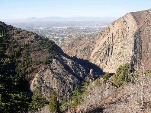 Ogden Canyon seen from the Indian Trail
Davis County

Mount Van Cott
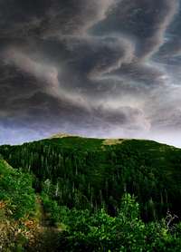
Grandview Peak
The city of Bountiful was settled by the Mormons on September 27, 1847. It was led by Perrigrine Sessions and his family. In September 1847, Sessions moved his family into their wagon and herded 300 head of cattle into the South Davis Valley. Bountiful was settled not long after the Mormon pioneers arrived in the Salt Lake Valley. The original settlement was called "Session's Settlement," and later "North Mill Creek Canyon," and then shortened to "North Canyon." On February 17, 1855 the name Bountiful was accepted unanimously by the people of the community. The name was appropriate because of the city's reputation as a garden place and because "Bountiful" is the name of a city in the Book of Mormon.
On February 12, 1857, the Mormons started their plans for building Bountiful's landmark five-spire LDS tabernacle. It took six years to complete the structure. A two-day dedicatory service on March 14-15, 1863 brought more than 150 visitors. Brigham Young presided while Heber C. Kimball offered the dedicatory prayer. The Bountiful tabernacle remains the oldest chapel in continuous use in the state of Utah. On December 14, 1892 Bountiful was officially incorporated by the territorial legislature. Joseph L. Holbrook served as its first mayor. Bountiful originally included all of the south Davis region, but it was soon reduced. In November, 1895 the Woods Cross and West Bountiful areas voted to separate from Bountiful. Then the city of Centerville soon followed.
Layton is Davis County's largest city. It is located eleven miles south of Ogden and twenty-three miles north of Salt Lake City. Edward Phillips, John H. Green, and William Kay came with their families in the spring of 1850 and were followed by others same year. It is easily seen that the city of Layton, an outgrowth of Kaysville, was not a planned settlement as were many Mormon communities. In 1854, a survey outlined Kaysville's town plot where the business center was located. The Farmers Union and Barton and Sons, were operative several miles to the north in an area that was called Kays Creek. By 1886, the area had become known as Layton. It was named after Christopher Layton, a prominent early settler of the area.
Kays Creek provided water much of the water for the area. The construction of the East Canyon Dam and Reservoir finally assured a dependable water supply. It enabled Layton settlers to become commercially successful with farming cash crops. In the mid-1970s Centerville adopted the slogan "Friendly City Beside the Great Salt Lake." Centerville is situated some twelve miles north of Salt Lake City. It encompasses the area north of Bountiful and extends from the mountains on the east to the shores of the lake. All of these towns are bordered by the Wasatch Mountains on the east and the Great Salt Lake to the west. The area is located south of Ogden and north of Salt Lake City which has made it an ideal place for suburban commuters.
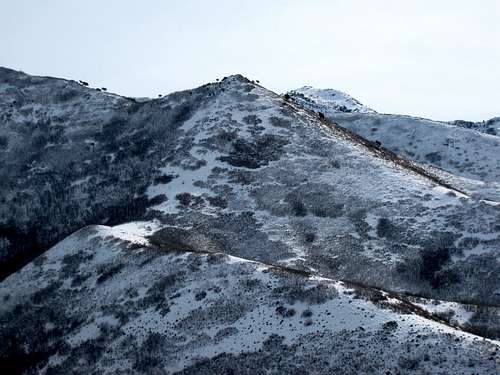 Pencil Point seen from the north
The Weather
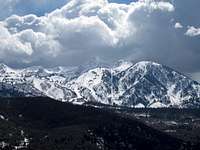
Mount Ogden

Jack's Mountain
The Northern Wasatch has a warm and sunny climate during summer and cold snowy weather during winter. The mountains are usually 15 to 20 degrees cooler. The Winter season brings huge amounts of snow to the mountains with an average of 400" to 500" at the highest elevations. The city of Ogden gets about 60" of snow a year and temperatures are relatively mild. It is located in a large valley that is separated by the Wasatch Mountains to the east and The Great Salt Lake to the west. The metro area below the mountains is known commonly as the Wasatch Front. The Wasatch Faultline runs along the eastern benches of these cities along the foothills. The valley floor is the lake bed of the ancient Lake Bonneville.
During the season of Spring the weather and climate can be variable, with sudden showers occurring in the mountains. During spring, temperatures warm up drastically and days are marked by the highest humidity and some of the wildest daily temperature swings of the year. The first summer-like weather usually comes in mid-to-late May. Snowfall is common through the month of March, but the last snowfall of the season usually occurs in early or mid-April. In April, the average high is 57 °F and the average low is 33 °F. In May, the average temperature is 68 °F with 41 °F for the low. Measurable snow falls on average from November 6 through April 18.
In Summer, the season last from June through mid-September. The hottest months of the year are July and August, when daytime temperatures can reach around 90 °F, followed by cool nights. Summer thunderstorms can occur, with wet weather and occasional downpours. The low humidity and the altitude combine to produce a large daily range in temperatures, and rather cool nights in summer. The warmest month is July and the high temperature in July is 89 °F and the low is 57 °F.
Autumn weather and climate begins in September through November. Unsettled weather and storms can be expected. The wet weather doesn't last long and it is usually a pleasant season with warm, sunny days and cool nights. During Fall, temperatures drop drastically, with a 50 °F maximum average temperature drop being experienced within three months. The first winter-like weather is usually experienced in early-to-mid October. Ogden's high temperature in October is 62 °F and the low is 35 °F. The freeze-free period lasts an average of 167 days, from April 30 to October 15.
The Winter season in Ogden is from November through March. The coldest months are December and January, when daytime temperatures drop to around 30 °F. Night temperatures are much colder and snowy weather occurs from December onwards, with heavy snowfalls in the mountains, but much less in the city. Winter temperatures are moderated by the Great Salt Lake to the west. The Rocky Mountains to the north and east of the state serve as barriers to frigid arctic air. The temperatures in Ogden seldom fall below 0 °F for a long length of time, usually only a few days. The high temperature is around 33 °F and the low is 16 °F.
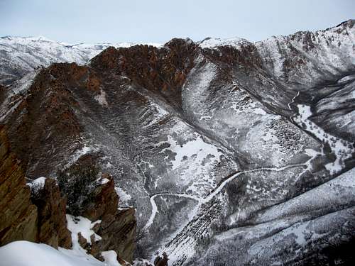 Spring Canyon Ridge
Mountain Conditions
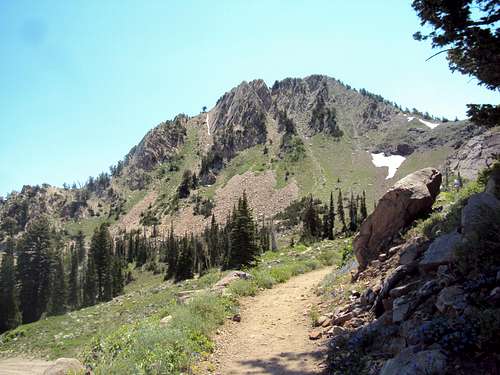

Wasatch Front
Summer is the normal season for these mountains. Nice weather usually last from July through mid-September. In summer, temperatures can reach 90 degrees in the daytime and 30 degrees at night. Afternoon thundershowers can be expected.
Experienced climbers can climb year round. In winter, temperatures will be around 30-40 degrees and much colder in the higher elevations of the Wasatch Range. Be prepared with full winter gear if you plan on climbing any mountains in winter.
This is the local weather forecast for Ogden and the NWS website and an area weather cam
This is a weather forecast for Bountiful and the NWS website
Red Tape
The Northern Wasatch Mountains are located in Wasatch-Cache National Forest
There are no fees or passes needed for climbing in the Northern Wasatch.
Some mountains in the Grandview Peak Area are accessed from City Creek Canyon. This canyon is open from the last weekend in May to the last weekend in September. Vehicles are only permitted on even numbered days. Here is more information about City Creek Canyon
A high clearance vehicle is recommended for anyone wanting to climb Willard Peak from Willard Basin. The road can get a little rough in places.
The Francis Peak road in Farmington Canyon is a windy dirt road that is narrow in a few places. You'll have to be careful going around corners but it shouldn't be a problem for any vehicle in the summer. In winter, a 4-WD vehicle is needed for the Trailhead
The Bountiful Peak road branches off from the turnoff to Francis Peak in Farmington Canyon. It can be driven by most cars in summer. During winter and spring, expect to see snow on the road at the higher elevations. The Great Western Trail can be accessed south of Bountiful Peak.
Contact information can be found here
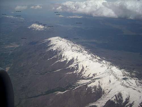
Aerial View of the Northern Wasatch Mountains - by imontop
Wasatch-Cache National Forest
8236 Federal Building
125 S. State Street
Salt Lake City, UT 84138
Phone: (801)236-3400
Public Lands Information Center
For all your recreation questions
on the Wasatch-Cache National Forest
Phone: (801) 466-6411
Hours: Tuesday - Saturday
10:30am - 7:00pm
Salt Lake Ranger District
6944 South 3000 East
Cottonwood Heights, UT 84121
Phone: (801) 733-2660
Ogden Ranger District
507 25th Street
Ogden, UT 84403
Phone: (801) 625-5112
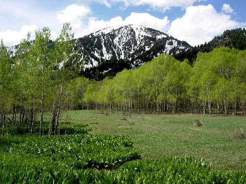 No Name Peak seen from Maples Meadow
Camping
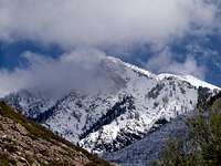
Mount Ogden
Willard Peak Campgrounds
Willard Basin Campround is located 8 miles south of the town of Mantua on forest road 084. There are only 4 tent sites here. The season is from June to late September. Box Elder Campground is located 5 miles east of Brigham City. Many of the sites are near Box Elder creek. The town of Mantua is closeby and has restrooms and drinking water. Most of the recreation is for water sports on Mantua Reservoir. There are 26 individual sites and a few group sites available.

Willard Peak
Campground reservations can be made for Box Elder Campground
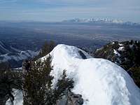
Little Black Mountain
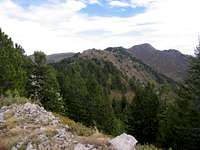
Grandview Peak
Snowbasin Campgrounds
Maples Campground is at located at 6,200 feet near Snowbasin Ski Resort on the east side of Mount Ogden. The normal season is June through Labor day weekend. There are 26 sites available here. It makes a nice camping spot for people wanting to climb Mount Ogden or other mountains in the area.

Layton and Thurston Peak
Campgrounds around Ogden Overview
Pineview Reservoir Campgrounds
Anderson Cove Campground is located on the south shore of Pineview Reservoir. It is a scenic place by the water. There are over 50 individual sites that are flat and grassy. It is usually open from May to mid-September. Jefferson Hunt Campground is located near the south fork of the Ogden River inlet. There are 29 sites here.
Campground reservations can be made for Anderson Cove Campground
South Fork Ogden River Campgrounds
There are eight different campgrounds in this area. Most recreation is access to the river that is popular with fishing. The campgrounds are located all along the river. Good secluded sites can be found if you were to look around for one. Although, some campgrounds are more developed than others. Three campgrounds east of Huntsville are Magpie, Botts, and South Fork Campgrounds. South Fork has about 30 sites with all of the basic facilities. Three other campgrounds include Upper Meadows, Lower Meadows, and Willows Campgrounds. The season for these goes from mid-May through the end of September. Perception Park Campground is the nicest one in the area. It has 24 individual sites and special facilities for the handicapped.
Campground reservations can be made for South Fork Campground and Perception Park Campground
Farmington Canyon Campgrounds
Sunset Campground is located 5.3 miles up Farmington Canyon on the right side of the road. It is the lower of the two campgrounds at 6,400 feet. There are 16 individual sites and one small group site. Francis Peak road is located above the town of Farmington. There will be a junction higher up. Francis Peak is north and Bountiful Peak is south. Turn left (south) for 0.6 miles to Bountiful Peak Campground. It is at 7,500 feet and the season usually last from mid-June to the end of September depending on the weather. There are over 20 individual sites and 1 large group site. They are all on a first come - first serve basis.
Farmington Canyon Campgrounds Overview
Other Public Campgrounds
Weber County Memorial Park is near Highway 39 on the road to Causey Dam. There are 75 individual sites available and 3 large group sites. North Fork Park is close to the town of Liberty. There is a small campground here. This would be a good campground for people who want to climb Ben Lomond and other mountains in the area. North Fork Park is also an alternative trailhead that has a route that goes up the east side of Ben Lomond. It isn't hiked very much.
Backcountry camping regulations:
1) Camp 1/2 mile from any road, 200 feet from any water source, and 200 feet from any trail.
2) Group size of 10 or less people.
3) Practice leave no trace techniques.
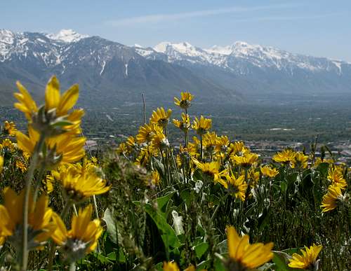 Avenue Twin Peaks Wildflowers - by Rocky Alps
Wasatch Flora
In the Northern Wasatch Mountains, mountains and plateaus are covered with trees and vegetation. They include Englemann spruce, Limber pines, Lodgepole pines, Douglas fir, Alpine Fir, and Quaking aspen. Willows grow along mountain streams, and in the valleys several species of cottonwoods line the banks of streams and canals. In the lower elevations are Cottonwood trees, Box Elder trees, sagebrush mixed with maple oak, chokeberry, and serviceberry.
You will see pine trees located on almost every mountain in the range. The Limber Pine is typically a high elevation pine. It is usually found near timberline by itself or with Whitebark Pine, Bristlecone Pine, or Lodgepole Pine. Juniper Trees vary in size and shape from tall trees, about 20 to 40 meters tall, to columnar or low spreading shrubs with long trailing branches. They are evergreen in color with either needle like and scale-like leaves.
 Lookout Peak Flowers Lookout Peak Flowers |
 Goosefoot Violet Goosefoot Violet |
 Tapertip Onion Tapertip Onion |
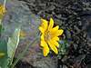 Adams North Ridge Flower Adams North Ridge Flower |
 Skyline Trail Flowers Skyline Trail Flowers |
 Utah Milkvetch Utah Milkvetch |
 Baer Canyon Flower Baer Canyon Flower |
|---|---|---|---|---|---|---|
 Skyline Trail Flowers Skyline Trail Flowers |
 Baer Canyon Baer Canyon |
 Baer Canyon Baer Canyon |
 Ben Lomond Flowers Ben Lomond Flowers |
 Red Elderberry Red Elderberry |
 Mules Ear Mules Ear |
 Primrose Primrose |
Maple Trees are a small to medium sized deciduous tree growing to 10 to 15 meters tall and a trunk of 20 to 35 cm. diameter. The bark is dark brown to gray, with narrow fissures and flat ridges creating plate-like scales that are thin and easily damaged. Aspen Trees are also known as Quaking Aspen. It is not fully understood why these trees quake. The unusual ability of their leaves to twist and bend due to the flattened petioles helps protect the trees from severe winds and to help dissipate energy more efficiently.
Wild flowers cover the mountainsides with color from April to September. Some of the flora that can be found in the Northern Wasatch Mountains include lupines, sego lilies, Indian paintbrush, arrowleaf balsamroot, dogtooth violets, goosefoot violets, sunflowers, monkshood, clematis, mallow, spring beauty, white geranium, columbine, fireweed, scarlet monkey flower, wild rose, prickly pear, sweet pea, iris, western wallflower, flax, yarrow, and mountain aster.
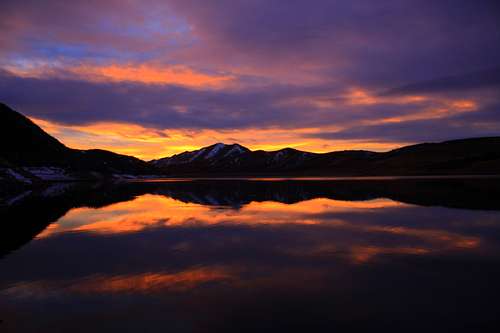 Sunset above Little Dell - by TyeDyeTwins
Sunsets & Sunrises
This area of the Wasatch is closest to the Great Salt Lake. One of the best things about hiking here is seeing a sunrise or sunset above the lake from a mountain. Many trails in the Northern Wasatch Mountains start directly from the valley and offer a great view the entire way. The colors are always amazing with yellow, red, and orange hues. Twilight happens between sunset and dusk and may produce a purple and blue hue of color. Alpenglow usually happens when the sun is just below the horizon. This is when you will see mountains illuminated with light for a short period of time. Of course, we also have inversions which occur most notably in winter. This isn’t a good thing but it does make for interesting photos. Winter has the shortest days while the longest days happen in late June through July. Any of the mountains in the Northern Wasatch will be good for taking photos of the sunrise or sunset. The easiest peaks to access are Lewis Peak, Francis Peak, Bountiful Peak, and any of the lower elevation foothills. Here are a few photos from SP members below.
Great Salt Lake Sunsets Album - by imontop
Great Salt Lake Sunset Album - by Garfimi
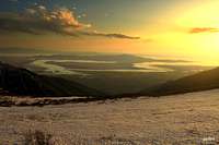 Farmington Canyon Sunset Farmington Canyon Sunset |
 Morgan Valley Sunrise Morgan Valley Sunrise |
 Centerville Sunset Centerville Sunset |
 Northern Wasatch Sunrise Northern Wasatch Sunrise |
|---|---|---|---|
 Lewis Peak Sunset Lewis Peak Sunset |
 Antelope Island Sunset Antelope Island Sunset |
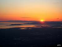 Great Salt Lake Sunset Great Salt Lake Sunset |
 Little Dell Sunset Little Dell Sunset |
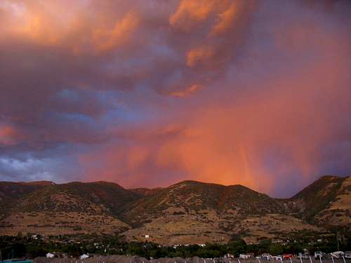 Sunset above Centerville - by Rocky Alps
Trailheads
Listed below are several trailheads for the Northern Wasatch. Thanks to SP member Fleshj27 for adding these pages.
| TRAILHEADS | |||
| Trailhead | Elevation | Main Access | SP Page |
|---|---|---|---|
| North Ogden Divide | 6,200 | Ben Lomond, Willard Peak, Chilly Peak, Eyrie Peak, Lewis Peak | Page |
| Indian Trail | 4,840 | Indian Trail, Coldwater Canyon, Bonneville Shoreline Trail | Page |
| Art Nord Trailhead | 5,400 | Wheeler Canyon, Icebox Canyon, East & Middle Wheeler Creek, Sardine Peak | Page |
| Snowbasin | 6,350 | Mount Ogden, Allen Peak, Strawberry Peak, De Moisy Peak, Sardine Peak | Page |
| Ogden 22nd Street | 4,600 | Indian Trail, Hidden Valley, Bonneville Shoreline Trail | Page |
| Ogden 29th Street | 4,800 | Malans Peak, Mount Ogden, Taylor Canyon, Waterfall Canyon | Page |
| Ogden 36th Street | 4,800 | Bonneville Shoreline Trail, Beus Canyon, Strongs Canyon, Waterfall Canyon | Page |
| Beus Canyon | 5,200 | Beus Canyon, Mount Ogden, De Moisy Peak, Strawberry Peak | Page |
| Skyline Sessions | 8,114 | Bountiful Peak, Centerville Peak, Gold Ridge, Sessions Mountains | Page |
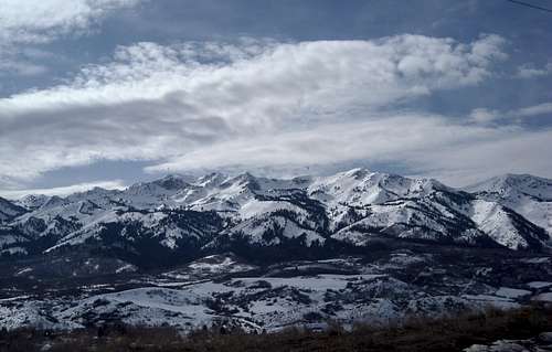 Thurston Peak and Layton Peak seen from Morgan Valley - by imontop
Peak Lists
Here are links to several Utah Peak Lists. For the Northern Wasatch Mountains, they include the Utah County Highpoints List, Utah’s 2,000 foot Prominence Peaks List, and Utah's 100 Most Prominent Peaks List.
Utah County Highpoints List
This is a list of the Utah County Highpoints by SP member Dean. This includes Willard Peak and Thurston Peak.
Utah’s 2,000 foot Prominence Peaks List
This is a list of Utah’s 2,000 foot Prominence Peaks by SP member redsplashman23. There are over 80 of these peaks in Utah.
Utah’s 100 Most Prominent Peaks List
The 100 most prominent peaks in Utah by SP member redsplashman23. Some are located on private land so this is difficult to complete.
This is a list of mountains in the Northern Wasatch. Many of the peaks have pages on Summitpost. The highest mountains in this area reach above 9,000 feet in elevation. The foothills are a good place to hike during winter and spring. Most of these peaks, by their standard routes, are class 1 to 2 hiking. There are a few which require scrambling to get to the summit.
| NORTHERN WASATCH MOUNTAINS | ||
| Mountain | Elevation (Feet) | Summitpost Page |
|---|---|---|
| 9,000 foot Peaks | ||
| Willard Peak | 9,764 | Page |
| Ben Lomond | 9,712 | Page |
| Thurston Peak | 9,706 | Page |
| Mount Ogden | 9,572 | Page |
| "Layton Peak" | 9,571 | Page |
| Francis Peak | 9,540 | Page |
| Peak 9491 (South Thurston) | 9,491 | Page |
| Grandview Peak | 9,410 | Page |
| De Moisy Peak | 9,370 | Page |
| Lewis Peak (Wanship BM) | 9,304 | Page |
| Durst Mountain | 9,284 | |
| Strawberry Peak | 9,265 | Page |
| Sessions Mountains | 9,260 | Page |
| Bountiful Peak | 9,259 | Page |
| "No Name Peak" | 9,061 | |
| 8,000 foot Peaks | ||
| Burro Peak | 8,958 | |
| Lookout Peak | 8,954 | Page |
| "Centerville Peak" | 8,904 | Page |
| Swallow Rocks | 8,901 | Page |
| Grizzly Peak | 8,727 | |
| "Holbrook Peak" | 8,722 | |
| "Ward Peak" | 8,650 | |
| Chilly Peak | 8,620 | Page |
| Bybee Knoll | 8,588 | |
| Big Mountain | 8,472 | Page |
| London Spire | 8,400 | Page |
| Gold Ridge | 8,396 | Page |
| Deadox Benchmark | 8,376 | |
| Guilder Peak | 8,358 | |
| Porcupine Peak | 8,266 | |
| Black Mountain | 8,260 | |
| Strongs Peak | 8,260 | |
| "China Town Peak" | 8,220 | |
| Perry Benchmark | 8,207 | |
| Redrock Peak | 8,170 | Page |
| "Eyrie Peak" (Peak 8136) | 8,136 | Page |
| Herd Mountain | 8,059 | |
| Little Black Mountain | 8,040 | Page |
| Lewis Peak | 8,031 | Page |
| 7,000 foot Peaks | ||
| The Hogsback | 7,947 | |
| Goat Knoll | 7,939 | |
| Bald Mountain | 7,869 | Page |
| "Jumpoff Peak" | 7,862 | |
| "Parleys Summit Peak" | 7,779 | |
| "Taylor Peak" (Point 7596) | 7,596 | Page |
| Middle Peak | 7,509 | |
| Perkins Peak | 7,491 | Page |
| Sardine Peak | 7,485 | Page |
| "West Table Mound" | 7,460 | |
| Elk Mountain | 7,409 | |
| Dale Peak | 7,376 | Page |
| Dude Benchmark | 7,212 | Page |
| Mount Wire (Big Beacon) | 7,143 | Page |
| Haystack Mountain | 7,054 | |
| Little Mountain | 7,032 | Page |
| "Hidden Valley Dome" | 7,017 | Page |
| Peaks below 7,000 feet | ||
| Malans Peak | 6,980 | Page |
| Cave Peak | 6,803 | Page |
| "Layton Nipple" | 6,689 | Page |
| Red Butte | 6,561 | Page |
| "ZigZag Hill" (Peak 6470) | 6,470 | Page |
| North Ogden Peak | 6,380 | |
| Mount Van Cott | 6,348 | Page |
| Avenue Twin Peaks | 6,291 | Page |
| Nielsons Peak | 6,187 | |
| White Rock | 6,140 | |
| Meridian Peak | 5,978 | Page |
| Ensign Peak | 5,414 | Page |
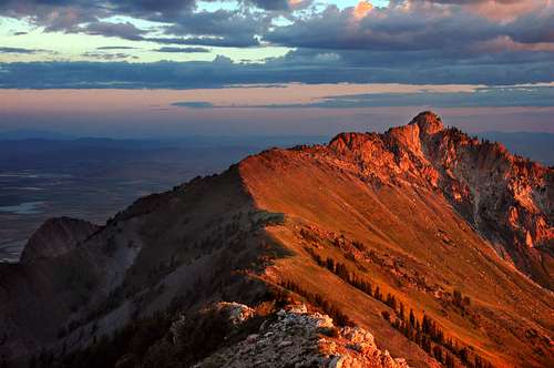 Willard Peak seen from Ben Lomond - by Digiclimber
Although the Northern Wasatch is the lowest area of the range, there are several peaks that are among the most prominent in Utah. The prominence rank on the list below is based on peaks in the state which have over a thousand feet of prominence.
| NORTHERN WASATCH MOST PROMINENT PEAKS | |||
| Mountain | Elevation | UT Rank | Prominence |
|---|---|---|---|
| Mount Ogden | 9,572 | 17 | 3,810 |
| Willard Peak | 9,764 | 33 | 3,244 |
| Lewis Peak (Wanship BM) | 9,304 | 48 | 2,784 |
| Thurston Peak | 9,706 | 51 | 2,690 |
| Durst Mountain | 9,284 | 78 | 2,064 |
| Eyrie Peak (Peak 8136) | 8,136 | 86 | 1,956 |
| Grandview Peak | 9,410 | 91 | 1,910 |
| Redrock Peak | 8,170 | 92 | 1,910 |
| China Town Peak | 8,220 | 202 | 1,280 |
| Bountiful Peak | 9,259 | 218 | 1,239 |
Here is a list of the county highpoints in the Northern Wasatch. There are two mountains to climb here, Willard Peak and Thurston Peak. You’ll notice that Thurston Peak is one of those mountains where you get two counties for the price of one.
| NORTHERN WASATCH COUNTY HIGHPOINTS | ||
| Mountain | County | Stardard Route |
|---|---|---|
| Willard Peak | Weber | From Willard Basin : Class 2 |
| Thurston Peak | Davis and Morgan | From Francis Peak : Class 2 |
Books and Maps
1) Utah Mountaineering Guide
By Michael R. Kelsey. Descriptions are brief but this is the best book available for an overall guide to many of the major mountains in Utah. There is a sketch map and photo of each peak. He also describes winter routes up many of the mountains.
2) High In Utah (County Highpoints)
By Michael Weibel. Utah County Highpointers book has information on hiking every county in the state.
3) Utah Atlas and Gazetter
Delorme Atlas Book that is very detailed and is a must for anyone planning on doing a lot of hiking and climbing in Utah.
External Links
Utah Avalanche Center
Avalanche conditions, advisories, lists, and accidents for the Wasatch Range. Updated every morning during winter.
Mick's Mountain Page
Mick's website has many trip reports and photos for mountains in the Northern Wasatch and other places.
Bair Gutsman Race
This is a mountain race held each year at the beginning of August that takes place on the Baer Canyon aka "Bair Canyon" trail in the Northern Wasatch. It starts east of the city of Kaysville at the Fruit Heights City Hall building and then goes to the start of the trailhead. The race goes up Bair Canyon all the way to Francis Peak road and then ends down at the winter gates of Farmington Canyon.
Wahsatch Steeplechase
The Wahsatch [sic] Steeplechase is a mountain run which includes rock scrambling. It has a vertical gain and loss of about 9,000 feet in 17.5 miles. The race starts from Memory Grove and climbs up to Black Mountain, past Smuggler's Notch, over Lookout Peak, east to The Brink, down to City Creek Pass, up towards the Session Mountains, and west to Grandview Peak. It then goes back to City Creek Pass and descends City Creek Canyon back to Memory Grove.
Wasatch Front 100 Mile Endurance Run
This endurance run stretches from Layton, Utah to The Homestead in Midway, Utah and covers a lot of terrain in the Wasatch Mountains. It is held annually on the first Saturday after Labor Day. The race gains 26,000 cumulative feet in elevation as it traverses the Wasatch Front. The trail goes from 4,700 feet to 10,460 feet at its highest point. The fastest runners typically finish the race in 20 hours or so, while the field is given 36 hours to finish the race.