"A mind that is stretched by a new experience can never go back to its old dimensions." -Oliver Wendell Holmes
This was the greatest adventure of the year and is the longest road trip I have ever been on. We traveled from Mount Hood, Mount Whitney, Golden Canyon, and ended with Wheeler Peak in Nevada. There could not have been better timing to push for winter ascents of these peaks with amazing success rates and wonderful conditions. I felt as though this was a new experience that made me feel like we were on the far edges of the Earth.
Michael Blake originally met me though SummitPost, mistakenly contacted me as a Josh who wanted to climb Denali. At first the plan was to climb the Mountaineers Route until secretly both of us wanted to go on a Grand Tour and climb other great peaks along the way. Michael asked me about avalanche training which I told him I had the perfect partner to invite who is known as Gimpilator. We now had a solid team for our grand adventure.
Day 1: Heading out to Mount Hood
I had never gone on an adventure like this making it hard to gauge exactly how much food one would need for the entire trip. So I made a good call by building up the biggest food stock pile I have ever made in my life. I filled a huge bin of food that overflowed and was enough for almost a month. I had snickers, muffins, powdered milk, hot chocolates, Pasta's, Top Ramen, Sandwiches, Burritos, almonds, and a whole lot more. I was well supplied with gear while still bringing as little of gear as possible making it possible to pack up the car. I had so much preparations that had to be done that I stayed up all night until Michael arrived at my house at 5:00 a.m.
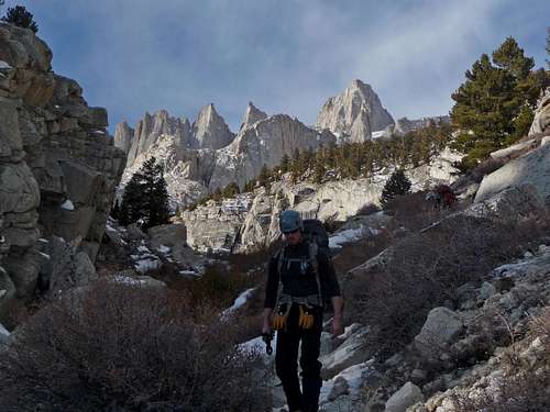
We then went over to Gimpilator's house to pick him up for the adventure and have a gear check just to make sure everyone had the right supplies. The sky was cloudy making us a bit skeptical of how the conditions would be on Mount Hood. During the car ride I slept most of the way until we were near the trailhead (Timberline).
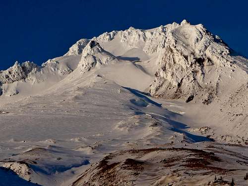
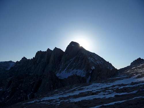
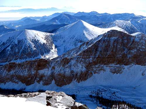
Mount Hood's South Side
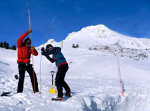
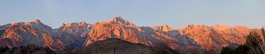
As we arrived in the parking lot, the clouds started lifting and soon enough we could see Mount Hood shining brightly in glowing snow. We were all excited to see this, and knew that there was a good chance that we could climb up the West Face via the Leuthold Couloir. After having lunch we decided it was time to practice using our avalanche beacons and probes. Gimpilator tough us how to use them and buried one of the beacons multiple times to get the full practice. One of the times he buried it we had to dig quite deep just to retrieve it. After this we went on to practice Z-Pulley, always good to practice before an alpine climb.
Digging for the Beacon
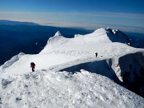
The Hogs Back from Timberline
Mt. Jefferson Above the Clouds
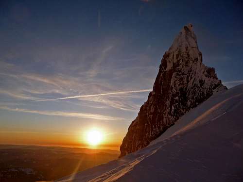
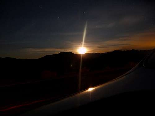
Sunset from the Parking lot
Probing for Avalanche Training
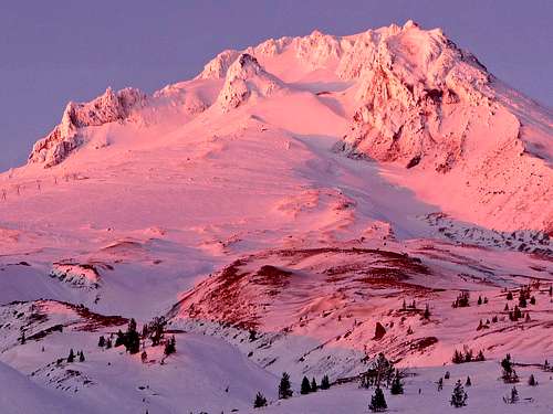
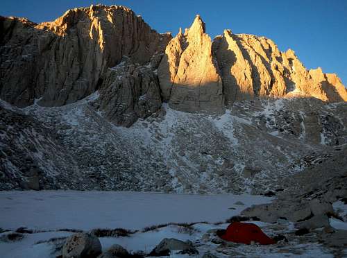
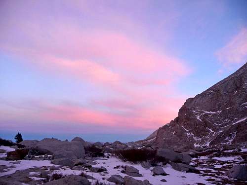
At the parking lot we watched the sunset on Mount Hood which was quite fabulous. While we sorted our gear for the Mount Hood climb, Michael was blasting the music loud giving a party like atmosphere. Gimpilator dug out a snow cave for himself to sleep in while Michael and I slept in the car. Before I went to sleep I couldn't help but stay up from the excitement of what adventures awaited me.
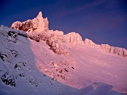
Alpenglow on the Hogsback
Evening View Above the Clouds
Mount Hood during Evening
Mount Hood in Winters Splender
Day 2: Hectic Winds at Camp
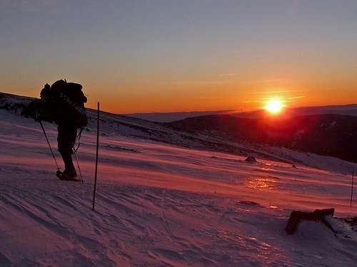
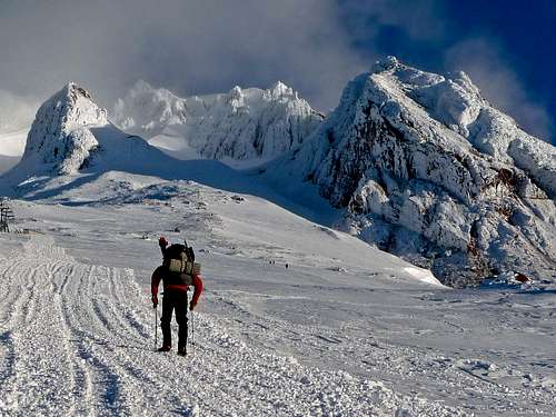
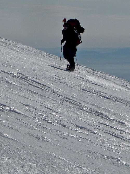
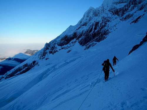
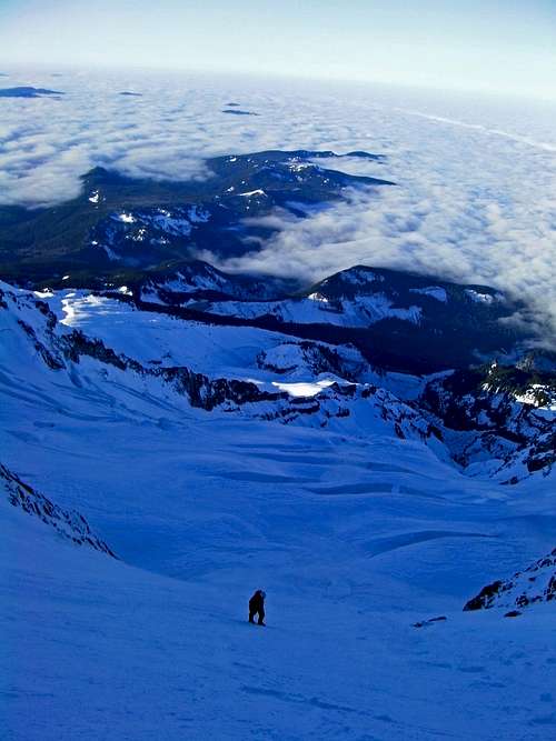
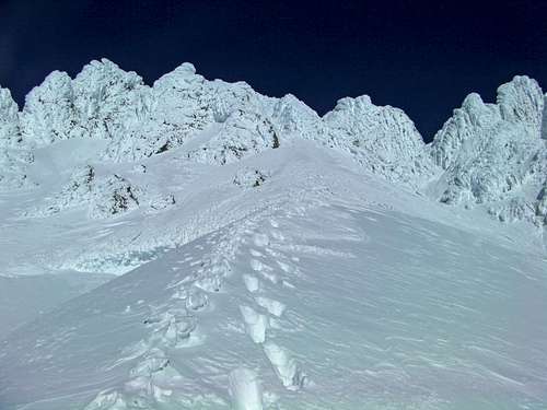
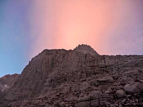
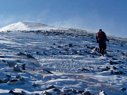
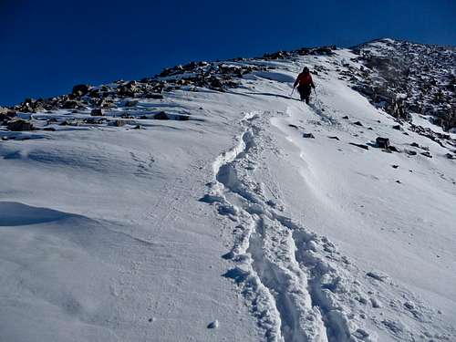
We woke up around 6 a.m. and left the trailhead by around 6:25 a.m. After 10 minutes of hiking it seemed as though snowshoes were almost worthless, I couldn't believe how solid the snow was. We kept the snowshoes on just in case of deeper snow on the upper part of the mountain. It was a lovely morning with blue-purple snow and red lighting on the horizon which meant it was going to be a good day of weather. The traveling was made even easier because of the snow cat tracks, although the heavy weight on our backs made it still a bit of a challenge. Michael had no problem because he had been training by stair stepping with 80 pounds of gear. This was hardly any challenge for him.
Hiking up to the end of the last chair lift actually tired me out quite a bit. After taking a rest, enjoying a burrito, and having a drink I felt much better. Michael started taking out wands which he placed every 100 or so feet just in case we get into a whiteout. We crossed the Triangle Moraine (ZigZag Glacier) towards Illumination Saddle and where making great time.
Approaching the Triangle Moraine
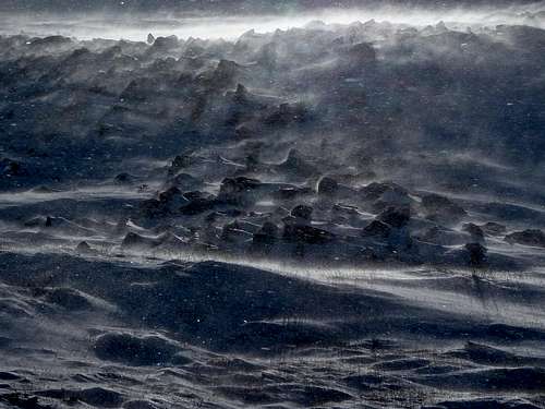
As we approached Illumination saddle we found what appeared to be a perfect place to set up a tent. As we descend onto the flat spot the winds start picking up. I knew that this was because it was coming in from the West Face where it is constantly pounded by winds. We set down our gear to start the process of setting up the tent. In a matter of minutes Winter's Fury was unleashed and the winds were roaring...
Michael with Illumination Rock
Gimpilator on the Snowfield
Digging a Snow Cave:
I took a look behind me and I saw that our gear was starting to blow away. I frantically grab and dive after all the loose gear and immediately start anchoring things with ice axes. A few seconds later one of my snowshoes blows away and gets caught hundreds of feet away, I run over and caught them just in time before the winds blew hard again. When I arrived back at camp I found out my eating bowl had blown away as well as some other gear from the group. Things were not looking good, the next gust of wind must have been at least 70-80+ miles an hour. As Gimpilator and Michael were setting up the 4 season tent, the heavy winds blew on it so hard that not only did the tent polls completely snap, but also it ripped right through the fabric. At the moment there was hardly anything I could do, as it was I was holding down gear to prevent it from blowing away. "Guys...." I yell in the roaring winds, no one could hear me. Fortunately someone saw that I was having a bit of trouble holding down some of the group gear and came in to help anchor it down.
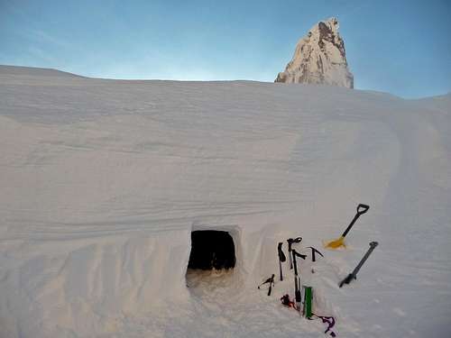
At this point we had two choices, turn around, or dig a snow cave. We all wanted in on the adventure and were not willing to back down so easily so we all agreed to help dig a snow cave. After much running back and forth I managed to save a lot of gear and small pieces of the tent. Gimpilator had the look of disappointment, not only was the tent broken now, but the tent bag had blow away. Blowing in the wind I could see a object floating around high on the mountain. While the snow cave digging process was taking place, I ran a ways up the mountain to try and salvage as much gear as possible. I said a prayer in hopes to get the tent bag back. I could now see it rolling back and forth up and down the mountain, side to side. It seemed almost impossible for me to ever be able to get it with the rate it was going up. 10 minutes later the winds stop and it was tumbling my way, I immediately make a run for it and dive for it just in time before the winds pick up again. I must have saved hundreds of dollars worth of gear that day including my own. When given the chance to be a hero, I never hesitate.
Excited now I dash down to camp with the gear and get ready to help with the snow cave process. Eventually there was enough room to have two people dig in the inside while the person on the outside dug out the debris and made a pathway for it to slide out. Digging a full sized snow cave is tiring work, after 3 hours we finally finished making just enough room for all of us to lay down inside. I had to bury the snowshoes to prevent them from blowing away in the winds as well as some other gear. Cooking inside the cave sometimes became a hassle because not only was there a lack of room, but when ever anyone was near the entrance, the carbon monoxide was filling the room. So the only safe alternative was to allow the "warm" air to escape.
Our Snow Cave on the Ridge
I became the gear guy, many times I was asked "Hey Josh, can you please get me some water..." or what ever it might be. Each time I went out it was a chilling experience with the winds blowing hard, and my gloves that were soaking wet. But I stayed in motion a lot making it a bit more enjoyable. I had to avoid wearing my heavy duty gloves to prevent them from getting wet, or else I would be in big trouble the next day. When most of the work for preparing for the next day was finished our gear was still very scattered inside the tent. Nobody cared if someone had many items of someone else. When there was no work I became quite cold resting, at one point I decided I needed to get out of the cave for a spell. The wind blew one of the hats on my head right off and into the winds. "Nooooooo...." I yell as I chase the hat as fast as I could across the snowfield. This was one of Gimpilator's Special OSAT hats which I felt as though I would not allow it to be lost. I caught it once again just in time and look over to see the sun setting over the distant hills. All around the landscape was glowing with beautiful colors. Below me a skier was heading up, I figured he would turn around soon.
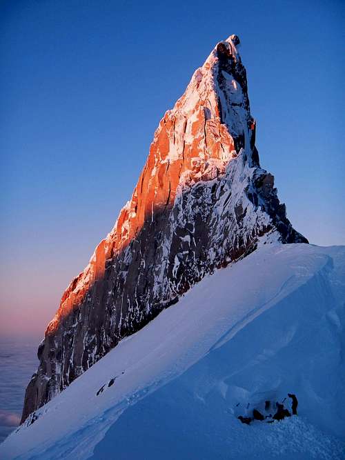
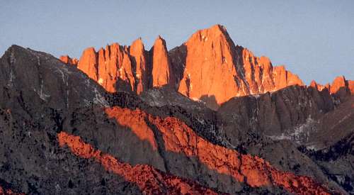
Alpenglow on Illumination Rock
Illumination Rock during Evening
Sunset with Illumination Rock
Alpenglow from our Snow Cave
I get back to the snow cave to try and warm up again. Just before taking off my boots Gimpilator tells me "Looks like he's having a hard time putting up his tent". Immediately I slide out of the snow cave and dash to the scene. I knew that there was not a second more that could be hesitated. Like our earlier situation, he too was having a very difficult time with his tent. I immediately caught his helmet, as well as other various gear that almost blew away. "Come join us in our snow cave" I told him without hesitation. So we grabbed his bunched up tent and gear and threw it inside the cave. I went back out to salvage small pieces of gear before the winds claimed it for the mountain. I staked down his skies using an ice axe as an anchor. I was pleased that very little was lost.
Sunset from our Camp
Lost Confidence
A bit Tired
Making the Best of our Situation
The inside of the tent was heavily disorganized and quite cramped. We decided it was time to get digging a bit more to provide more room for a place to be able to sleep. After the digging process we had enough room to lay down and set packs near the door. Who knew a snow cave would be so much nicer than a tent? But non the less, it had it's cold moments inside. The atmosphere was incredible, I had never done anything like this. Outside you could hear the pounding of winds that sounded like that of the movies and every now and then fresh dustings of snow would blow in the tunnel and cover everything with powder. It was both exciting and dramatic being in a place like this. But at the same time Michael decided to give the place a bit more class and turn on the music while we cooked up some food making it feel more lively.
After coming in and out to fetch more gear, Michael told me "Josh, I would be happy to invite you on any mountaineering trip". No one seemed very interested in climbing the Leuthold Couloir, we decided unless things improve we would do the standard route. An hour later we finally decided it was time to get some rest for the next day.
Day 3: Climbing the Leuthold Couloir
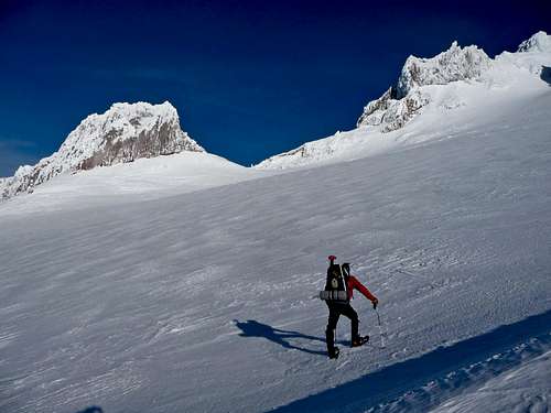
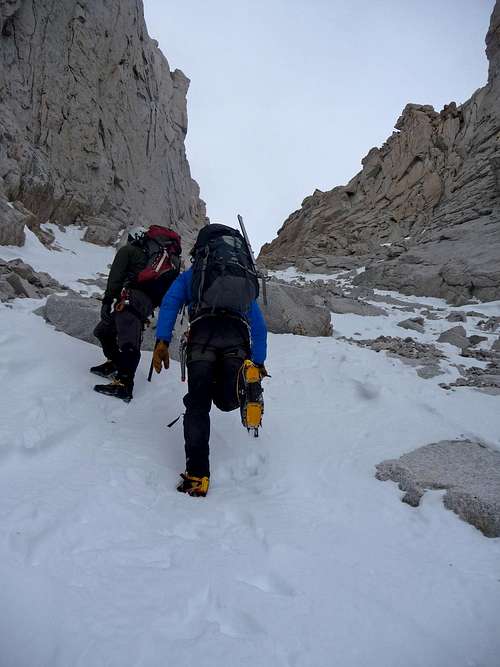
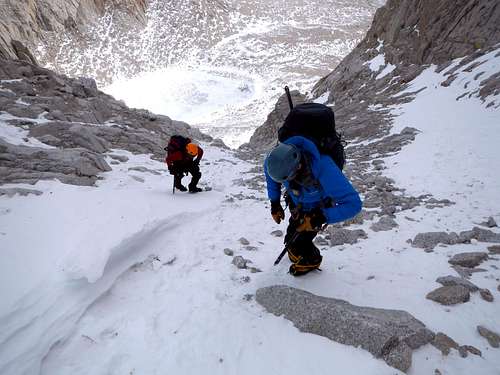
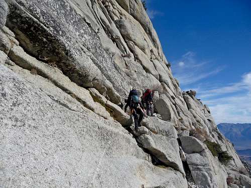
The next morning we woke up which it was a bright sunny day and the winds died down. We all looked at each other thinking "Lets climb the the Leuthold Couloir!". Instantly we all agreed out loud, and the next thing I did was pulled off the caps of my ice tools. After having a quick snack we all got ready and put our harness on for crossing the Reid Glacier. There was a little bit of winds as we start heading onto the glacier, but for the most part it was decent.
Ready to Head Out
West Face of Mount Hood
Mount Hood Shadow
Michael Excited to Climb
Crossing The Reid Glacier
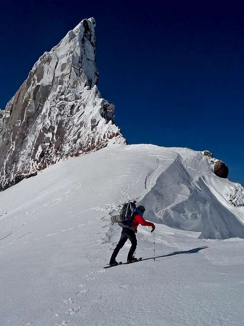
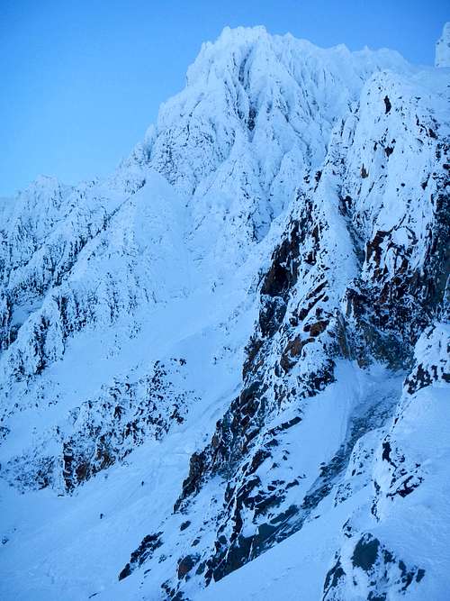
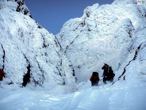
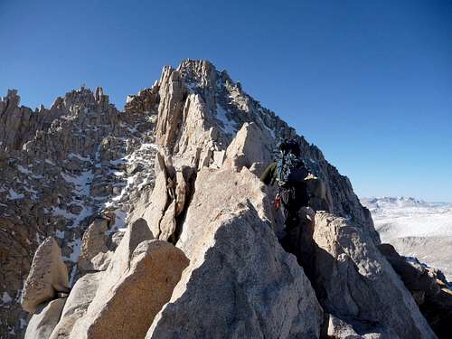
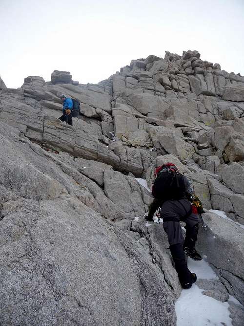
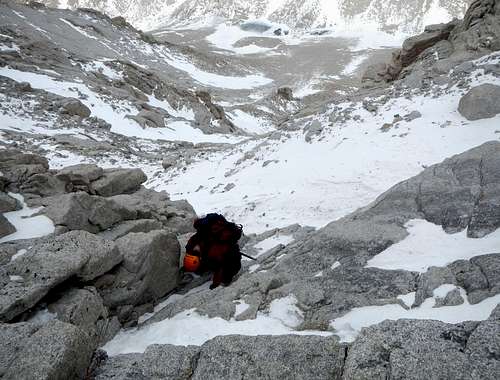
The Reid Glacier was an easy traverse across the South Western section of Mount Hood. Finally we arrive below the Leuthold Couloir, tiny pieces of snow and ice started floating past us as we started the ascent. 300 feet later we unroped, Gimpilator wore it like a backpack in exchange for me carrying his gear. I was becoming quite excited as we were climbing towards "The Hour Glass". As it became icier, I decided to bring out my ice tool for extra support. In the Hour Glass the winds picked up showering down ice chunks and snow drifts. I would probably have been blinded had I not been wearing my ski goggles from the ice pouring down and hitting them. The wind blown snow suddenly found a way of getting into my shirt, making for a cold moment. "I see why they call it Mount Hood" I joked to myself as I put on my hood. A moment later we came up to a 2 man group.
Two Climbers heading up the Leuthold Couloir
Gimpilator Climbing High up on Mount Hood
Below The Leuthold
Nearing The Hourglass
Climbers at the Reid Headwall
We reached a fork in the climb which no one knew exactly which way to go. Michael proceeded on to the right (the wider gully) and the other guys went towards the left. When Gimpilator caught up we both wondered what to think of the situation. Both of us had read in a climbing description that you don't go left. We yelled for Michael in the winds, but he could hardly hear us. I randomly remembered that the description said that after the hour glass we don't go left. I told this to the other climbers and they decided to stick with us.
Entering the Hourglass
I dreaded the idea of going left because the traverse section was a bit dicey. Not something I would feel comfortable down climbing. It wasn't just the fact that it was steep, icy, and you could not afford to fall, but also the constance of ice pelting you that made looking up undesirable. I had to make good ice tool/axe placements when swinging into the ice. I had never done any alpine climbing like this where you climb on pure water ice on thin holds. There was at least one spot that felt thin where my axe was not going in well at all. But I knew that this was the only way, and I couldn't have Michael down climb this.
Once we were out of the hour glass, things eased up a bit, or at least in the technical sense. There were many spots where we encountered water ice patches that we had to climb though. I became quite hungry and thirsty as we climbed up, not only was it too ice and steep but when I grabbed a snack once I got pelted in the side of the head with a big chunk of ice that made me loose all interest in further sit stops.
Later on Michael became quite worried about how much time it was taking and the fact that it was past 11:00 a.m. "Should we turn around?" he asked. Immediately both Gimpilator and I say "No, it would be too dangerous to down climb what we climbed up". As we got higher in elevations my toes started becoming quite cold, and my hands we getting semi numb. I had some of the worst pulsing sensation in my hands making me wish that I was at home or somewhere were warm. The next moment I started cramping up, "Awwwwwwwwww..." I instantly fall to the ground. Michael looks at me with a worried look, but in attempts to look strong I try and get up until the next cramp comes in. I was feeling quite miserable and worn out, but I knew that if I just press on a little further we would top out and be near the summit ridge.
Looking Down what we Climbed
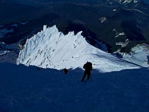
Finally the ice chunks stop coming down the mountain, which meant that I could get a drink of water. I must have drank almost a liter in a single sitting. Suddenly a small piece of my water bottle breaks off from the freezing temperatures. I didn't think much of it at the time, but later on in the trip it becomes a big deal. After a bit more ice scrambling and hiking up we arrive onto the summit ridge.
Ice Near the Summit Ridge
Michael on the Summit Ridge
Yocum Ridge Glowing Bright
Climbers on the Ridge
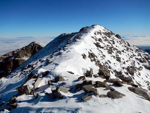
Mount Hood's Summit Ridge
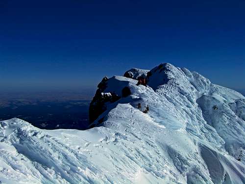
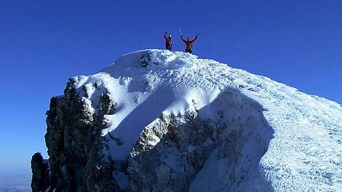
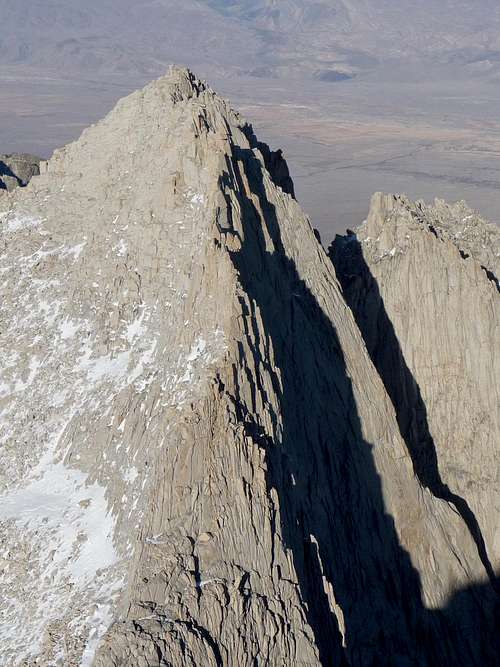
Like many summit ridges, it looked a bit intimidating at first. There was a 10 foot or so section that required careful walking and a mini jump down over a lot of exposure. Most climbers can do it just fine as long as you take your time. After this we arrived at the top of the Old Chute. It was jolly walking from there to the summit.
Michael and I approaching the Summit
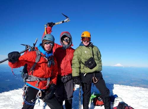
Gimpilator and Michael on the Summit
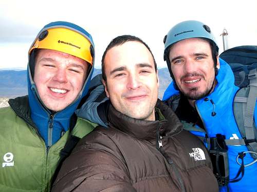
Michael, Gimpilator and I on the Summit
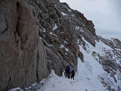
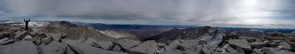
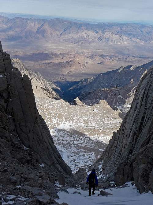
We arrived on the summit at about 1:30 p.m. and stayed for about 25 minutes enjoying the almost windless summit. Both Gimpilator and I went down the Old Chute while Michael took a slight variation to make it more fun for him. The conditions were perfect, one could practically glissade down. For safety reasons I plunge stepped down instead. After Crater Rock we traversed completely around it to get back down to Illumination saddle where our camp was.
Looking up the Old Chute
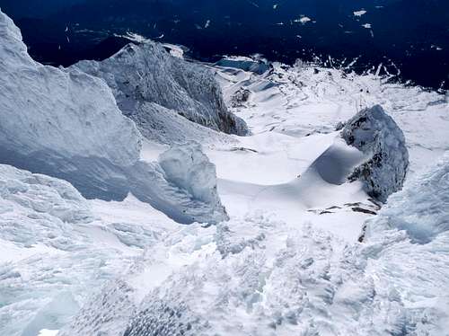
Bergschrund
Looking Down the Mountain
Crater Rock Below
A Long Ways Down
Looking up the Hogsback
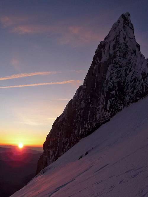
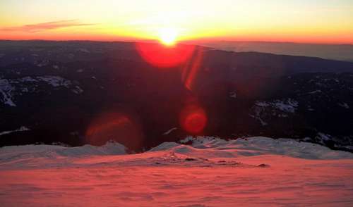
At camp we took a bit of a rest, enjoyed some food and started the packing up process. By the time we started heading down it was already sunset. The winds were picking up making the snow all around glow with pink color as well as the entire mountain side. I considered this moment to be on the top 10 most beautiful things I have ever seen. It was too windy to capture the moment and we were in a hurry down. This photo gives one an idea of what it looked like.
Alpenglow on our way Down
The rest of the way down was an evening walk down the south slopes of Mount Hood. We reached the parking lot just before dark. After a good nights rest and hydrating we proceeded on with our road trip.
Day 4&5: The Long Drive to Southern California
The tent had to be fixed, there was no compromising this. After doing a bit of research we found out that there was a tent repair place in Vancouver Washington which was a little out of the way from where we were, but we had little choice so we went up to the place. The repair guy was friendly and got us new polls in a reasonable amount of time which we were all very excited that it would be possible to use the tent. From here Michael drove for many hours down all the way to Northern California. We pulled over on the side of the road to get some sleep and proceeded on the next day with the road trip.
It started to seem like a tradition, every day we would stop and go to a taquería to enjoy some wonderful burritos. I gotta agree with Gimpilator, often times when you see a restaurant that says "Mexican Food" it is often American Mexican which in our opinions is not as tasty as taquería's. After what seemed like a life time we arrived in Southern California where Michael's mom invited us over to stay over and have dinner. They were very good hosts and provided wonderful food. It was so nice to sleep in a real bed after being on the road trip for so long.
Day 6: Heading Out to Whitney
In the morning before we left Michael invited to take me to the gym and warned me that I was going to be soar from this. I knew I was setting myself up, but can't say no to a fun exciting challenge. Michael and I did some pushups, then curl like reps, and then did more pushups. We did other exercises as well that went on for a while. This was one of the more harder gym work outs I have ever done. By the end of it I felt quite dizzy and weak. For the next 4-5 days I felt very soar in the arms which did have an effect on me on Mount Whitney.
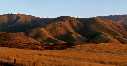
Desert Hill on the Car Ride
After packing up our gear we were finally on our way to Mount Whitney. By night time we arrive at the city of Lone Pine where we set up our tent for the night. As we assemble the tent Gimpilator discovered that the repair place accidentally made one of the polls too short on one of them. I giggled saying one of my favorite lines "If your not prepared, Rig It!". So we busted out the duct tape and started snapping pieces off one of the bamboo polls (snow flags) to make a tent poll extension. We found out that if you use 2 pieces of a mambo stick, use a knife and shave it a bit you can duct tape it together to the tent poll. Yeah it was a little rigged, but it worked just fine. But it only lasts until your done using the tent.
Gimpilator Rigging a Tent Piece
Day 7: Hiking up to Upper Boyscout Lake
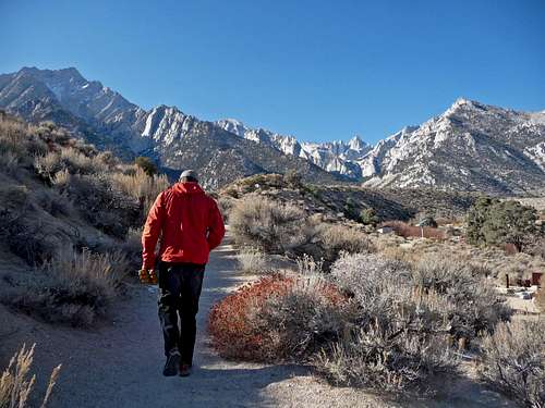
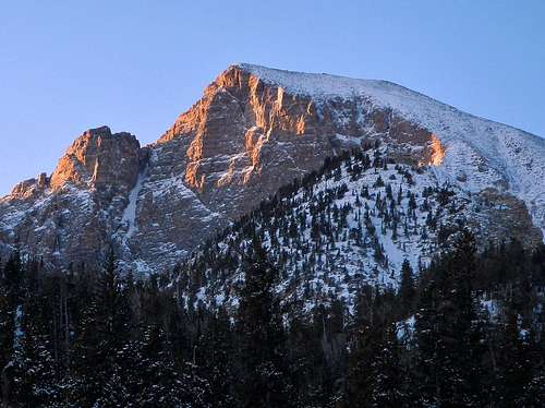
In the morning from our camp spot we could see Mount Whitney glowing brightly during the sunrise as well as some other cool peaks in the area. We went to the ranger station to get our free permit as well as some beta. The rangers told us that there was 6 feet of snow which non of us even slightly believed. From the ranger station we could see how dry Whitney's East Face was as well as much of the landscape below it. I decided that snowshoes would be a mistake to bring, which was a great decision. We wanted to park at Whitney Portal but the road was semi blocked off 4 miles before the trailhead. "Technically you can park there, but if any bad weather comes in you could be in trouble" the ranger told us before we left.
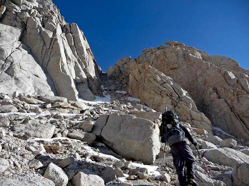
So we did a compromise, we drove to the Whitney trailhead, dropped off Gimpilator as well as most of our climbing gear. Then Michael and I went down 4 miles to the camp ground to park the car and start the adventure. This added 2,300 feet of gain (Whitney Portal is 8,360 ft. while Lone Pine Camp Ground is at about 6,000 feet) and four extra miles to the trip. Rather than taking the road we decided it might be faster to take the Whitney Portal trail. Eventually we decided that it might be best to take a short cut by cutting right up the slope to the road to Whitney Portal. It was mostly loose class 2 with a touch of class 3 getting up to the road. After getting all the rocks out of my shoes we walk along the boulder covered road to the trailhead.
Approaching Mount Whitney
Looking Back Down the Road
Road to Mount Whitney
The Santa Man on the Trail
Looking towards Thor Peak
Cactus
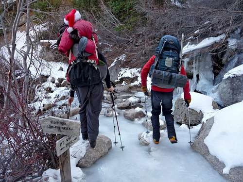
Semi Frozen Creek Crossing
The Scramble up to the Road
When we arrived Gimpilator was reading his book with a bored look on his face. I guess it took us a while to get there. I quickly change out of my shoes and into my climbing boots and get ready for the climb. The approach started out as a easy walk on the Whitney trail. Eventually we come across the North Fork Lone Pine Creek sign which was our turn off spot. As we get higher we encounter a lot of icy sections on the trail, in at least a few places it was blue water ice over a creek. I found that it's best to waddle like a penguin in slow speed rather than to put on crampons at these sections. One of the coolest water falls that I've ever seen was rushing with water in the inside while frozen solid on the outside which we walked over the edge of it.
One of the Many Icy Sections on the Trail
Ice Waterfall
To avoid much icy trail I found a side route that goes up on the side of Carillon Peak that has some scrambling and slab walking. Soon we arrive at Lower Boyscout Lake where we start getting close up views of Mount Whitney, Keeler Needles, and Thor Peak.
Keeler Needles in the Distance
The Edge of Mount Irvine
Getting out of the Forest
Ice Slabs Above
Lower Boyscout Lake
The Detour Route
View from Lower Boyscout Lake
Our Short Cut Up
There was still much ice along the trail to upper Boyscout Lake so we decided to take a variation that went up on the right of some cliffs. This involved some class 2-3 scrambling that had some decent rock. Michael had a bit of trouble because of all the elevation gain we did and some back problem that he has. I helped him find the holds and held onto his trekking polls as we scrambled the rest of the gully. As evening came on we pressed on though the woods and finally arrived at Upper Boyscout lake where we set up our camp. Michael seemed very exhausted from the climb. He is relatively new to mountaineering, but picked up at it at a very rapid rate. But somethings take years to build up including endurance.
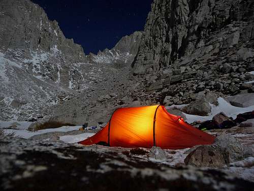
A Beautiful Night on Mount Whitney
Gimpilator and I did the usual chores around camp which included cooking, filtering water from the lake, and packing our gear for the next day. Michael looked very cold and miserable. I told him to use my sleeping bag, at first he refused but eventually he changed his mind and took up my offer. Gimpilator had a kind sized mattress which he slept in the middle of the tent. Michael and I were on the sides and were crammed into the tent wall. But it was some what humorous. My feet were quite cold before I went to sleep so Gimpilator let me borrow his booties to sleep in. As I went to sleep we all could hear the sounds of the lake, almost as if it was humming to us. In all my mountaineering I have never heard a lake make such a noise.
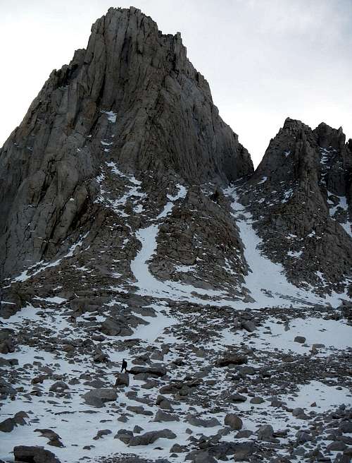
Day 8: Going for Russell and Carillon
Though out the night I could feel my feet getting colder and colder with a wet feeling. "Why are my feet so wet and cold?" I whispered to myself as I roll over in my sleeping bag. Curiosity gets the better of me just before sunrise which instantly as I get up snow is dripping down on me the more I move. I look above and see that the inside of the tent is lined with frost that is as fine as snow. Now I know something wasn't right as I looked towards my feet. "Ohhhhhhhhhhhh... No..." I say aloud as I see chunks of ice at the end of the tent. The tent had a big sheet of ice because my water bottle leaked out the entire liter of water making many things either soaking wet or frozen. The water bottle had a very slight chip in it from Mount Hood (as mentioned earlier) which was just enough to allow water to flow though. My head lamp was frozen solid and completely unusable for a while. Michael was still feeling quite tired so we figured out the best thing to do was to have him wait at camp and dry things out while Gimpilator and I climb Russell and Carillon Peak.
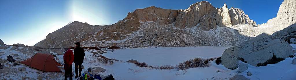
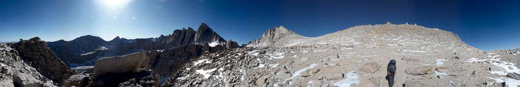
Upper Boyscout Lake Panorama
Upper Boyscout Lake
The climb starts out as a hike around Upper Boyscout Lake until it gets to the boulder field which turns into a easy scramble. Our directions were accidently left at the trailhead so we had to make an assumption of which way to go. Gimpilator and I decided to head up a gully we found on the right which for the most part was decent, but had a interesting section. After scrambling up a ways we came to a section that Gimpilator did not feel comfortable climbing without protection. At first it looked like just a class 4 move, but it was a bit to weird and had too much of a lack of hand holds to be standard class 4. I decided I would lead up it considering that it was either this or going back down. I do admit at first I was worried I was climbing up something that I could not down climb, but figured out at one spot that if you lean your back against a rock you can hold your self up as you climb even though there is not very good holds there. The next move there was a bit of loose rock on a small slab making it a little tedious, but nothing too bad. Once I got past this section I brought out the rope, Gimpilator tossed up his personal anchor to me to use for the belay. I belayed Gimpilator up this section using a nice horn for the anchor.
Mount Whitney to the West
Gully on the North Side of Whitney
Mount Russell's Burly South Face
Gimpilator getting to the Bottom of the Gully
After doing a bit more scrambling up slabs and such we arrived in the Carillian Basin which was mostly flat and provided a decent pathway to the base of Mount Russell's East Ridge. The east ridge was both exciting and exposed, there were many sections of icy snow that we had to be careful on. I noticed that my gloves were starting to shred from the rock scrambling, but it was worth it to keep my hands warm. As were climbing along we do some interesting moves to traverse a few spots.
Russell Basin Panorama
Thunnabora Peak
Mount Williamson to the North
Heading Around a Corner
The Walkable Section
Gimpilator carefully Traversing the Ridge
The Ridge gets Thinner Here
Looking up at the sun we could see that it was late in the day. The fact that there was ice over a very exposed section made Gimpilator and I nervous about the idea of continuing. We were within reach of the summit of Mount Russell, but it still would be a long time before we get off the mountain if we continued. Gimpilator finally announces "Look deep down inside yourself. Is it worth continuing for?". I gave it a moments thought and decided to call it. Yes it was possible for us to continue, but it seemed like we could get ourselves into more scary terrain with limited day light.
Views to the North
Table and Thunder Mountain
Mount Tyndall to the North
Mount Barnard
Views to the North of Mount Russell
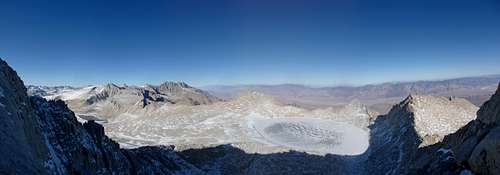
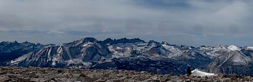
A while later we carefully scramble down Mount Russell and back into the basin where we start heading for Carillon Peak. Carillon took us about a half hour, the high altitude slowed us down a little bit. On the summit we enjoyed good views of Whitney, Russell, Lone Pine, and many other peaks of the Sierra's.
Mount Carillon Summit Panorama
The Ridge We Attempted on Mount Russell
The Cleaver
The Sun Setting over Mount Whitney
As we scramble down Carillon, Mount Whitney was already blocking out the sun light. Then we get back to the scrambling and into our gully down to Upper Boyscout Lake. Gimpilator decided it would be best to rappel down the section was climbed up, so he finally gave up the personal anchor that he had been using for years as a repel sling. After the repel it was mostly a walk down the rest of the way to the lake.
Gimpilator on the Summit
Mount McAdie
Gimpilator Scrambling Down
Contrast on Bright Hills
Hiking down with Lone Pine
Blue Lighting on the Mountain
The Edge of Thor Peak
Looking across Owen's Valley
Heading Towards the Gully
Looking back at Mount Russel
Alpenglow on Mount Russel
Down Climbing the Gully
Repelling Down
Hiking with Mt. Russell
Looking up the Gully
Looking back at Camp
Evening over the Lake
I pressure breathed to get Michael attention in the distance which sure enough he heard me and returned the favor of the previous night and started boiling up some water for us. It was nice to drink unfrozen water at camp and enjoy some hot food with the evening light on Mount Whitney. One of the annoying things about filtering water is not only does the water pump freeze making you have to warm it up, but also the water bottles partly freeze within 2 minutes or so. Michael was feeling a lot better and was feeling ready for Mount Whitney. I was finally able to pick off the last ice chunks from my headlamp to get it to work that night.
Day 9: Summit Day on Mount Whitney
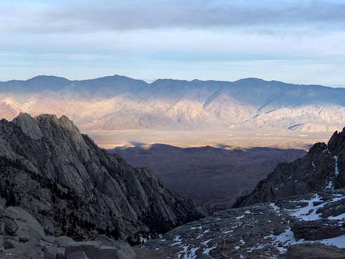
This was summit day for Mount Whitney which got me very excited, but at the same time I realized that it was December 10th which was my brother Kevin's birthday. I was sad that I could not visit him, especially the fact that he was in the hospital and last I heard he was in critical condition. I would go many moments during the trip remembering this fact, almost as if haunting me hoping that he was alright. As we get out of the tent the sun light starts arriving on the lower part of Owen's Valley now drizzled in contrasting light. We start out hiking in the lower basin of Iceburg Lake, like all the days I was amazed to see so much nice weather. In Washington you would pretty much never get this much good weather in December.
Approaching Iceberg Lake
Approaching Mount Whitney
Looking at the Alabama Hills
Iceberg Lake
Clouds over Mount Whitney
Looking up the Mountaineers Route
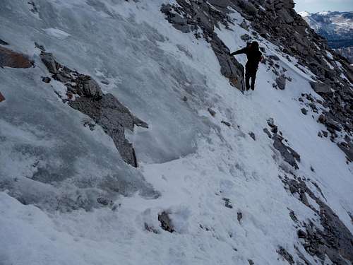
Pretty soon we arrive near Iceburg lake excited to look up the Mountaineers Route of Mount Whitney. A few hundred feet later we decide to put on our crampons and pull out our ice axes for the gully. The snow conditions were superb, every step was nice and solid but at the same time not icy either. It took us about an hour to get to the top of the gully which we took our time going up. After topping out we start traversing into the north side of Mount Whitney. Very soon we realize that there is a bit of an icy section that has a bit of exposure. Looking up the North Face we see repel slings and decide that it would be a better route. We didn't know a lot about the face, but figured we were close to the summit and would at least give it a shot.
Above The Coulior
Climbing Steps up the Face
Peaks to the North
High In The Coulior
Hiking up the Mountaineers Gully
Climbing up the North Face
Hiking up the Mountaineers Coulior
Approaching the North Face
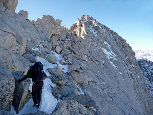
For the most part it was very solid class 3 scrambling that was exciting to climb up. Michael started heading over to the right more while I followed Gimpilator towards the left. I took a bit of a different variation than Gimpilator and some how found myself on a class 5 move. I can be pretty sure it was class 5 because I had to use good technique of using my crampons on the rock and doing a bit of a move. It did make me feel a bit uncomfortable, but I knew that I would not have to down climb that spot. Gimpilator scored pretty well and found a few slings and climbing nuts which of course he didn't take them all. After a bit more scrambling we reached flatter terrain where it was a super easy walk up to the summit. Michael and I kept our crampons on to prevent the hassle of putting them on later.
Final Scramble Section
Looking down on Carillon
Looking towards Mount Russel
The Relatively Flat Summit
Myself Climbing up the North Face
We were all very pleased to make it to the summit of Mount Whitney in December, especially with wonderful weather and doing it via the North Face. We had heard that week earlier winds were blowing well over 100 miles an hour. The summit register papers were scattered and shredded, the summit house door was completely broken. After snapping a few more pictures we decided that it was time to start heading down.
Mount Whitney Summit Panorama
Sauce Boss on the Summit
Mount Whitney's Summit House
Gimpilator Excited
Heading back Down
Josh, Adam, and Michael Happy to be on the Summit
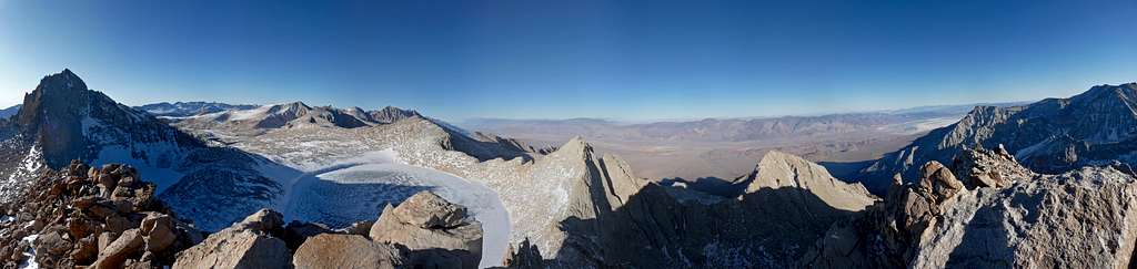
Views to the North Panorama
We went down the normal mountaineers route to make the descent easier. For the most part it was a walk down with a pinch of scrambling in a few spots. Pretty soon we came across the ice step section that had made us not want to go up the rest of the mountaineers route. When searching for an easier alternative there was none. Michael and I took our time to cross it, the main reason I felt a little nervous was the fact that my crampon spikes were short (they were the only pair that worked with this boot) making for a not so great purchase on the ice. I certainly did not bring them on Mount Hood. Anyways I managed to get though by taking careful steps.
The Mountaineers Route
Crossing the Ice Step
Setting up the Belay
Looking Down the Ice Step
Gimpilator Approaching the Ice Step
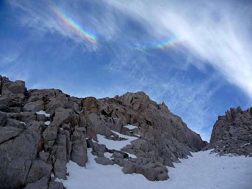
Gimpilator did not like the look of it so he requested a belay across. Michael brought out the ice screws for an anchor and set them in the ice. He also made a great rope throw to Gimpilator which then he tied into and I was the belayer. After a few minutes I belayed Gimpilator across the ice section, we were now able to proceed with the descent. In the gully itself I was able to speedily plunge step, I was tempted to glissade the rest of the way down but figured I better not with all the mini rocks everywhere. As I looked up I could see a rainbow above Mount Whitney with cirrus clouds.
Rainbow in the Clouds
Lone Pine Peak
Exiting the Mountaineers Route
Iceburg Lake Frozen Over
Last Light on the Mountain
Michael with Nice Scenery
Heading on Out
Iceberg Lake Basin
Heading Down the Mountaineers Route
Myself Heading Down
Rainbow Above Mount Whitney
Evening Light on the Mountains
Going back to camp was an easy walk. The sun was starting to set which meant that it would be wise to make good time for the rest of the way down. But the fact was that we had to pack the tent away, eat and drink for the way down which took time. I tried warming up the water filter and going to the lake to filter water, but the tube had already froze again. So I had to run to camp and stuff it in my puffy jacket to thaw it out.
Sunset from our Camp
By now we were all almost completely packed, but I knew that I had to filter water for the way down. Michael seemed very tired and he too was out of water. "Josh, you have 5 minutes!" Michael yelled back to me as I was running back towards the lake. The filter was once again not working which I furiously started pumping for about a minute until I finally got it to work. I started working on my first bottle and heard "3 minutes!"... after what felt like a few seconds I heard "2 minutes!" which I was in a bit of a panic because there is no way that I would compromise our hydration. The filtering process was very slow going and required me to go slow to make the pumping work faster. By the time I got to the next bottle I hear Michael yell "Times up! We gotta go!". I yell back "Ok, leave me!". There are two aspects to what I said, either a. he would not actually leave me b. even if they both left without me, what I was doing was more important. After all with Michael as tired as he was without water, he would not be getting too far without me.
Pink Sky Above the Mountain
Out of breath I screw on the lid and dash back to camp feeling tired from all the running around and stress. Sometimes you have to stick up for the team, even when one of your team members doesn't realize it at the time. Finally we started heading down the mountain which I led us down a ways. There were many ice slabs which I saw one that was pretty scary. It looked almost like a frozen river which appeared to go all the way down to the cliffs below which worried me a bit. Gimpilator sees this and decides that it would be best for us to go down the way we scrambled up a few days earlier. We had to hike up hill a little bit. Michael finally announces "Guys, we gotta stay another night. I can't go on doing this for hours more". I glance over at Gimpilator and tell him that we have to stay another night. We set down our packs and did some searching around for a place to bivy, Gimpilator happened to find a flat spot which seemed almost impossible on this section of the mountain. We carried up our packs and set them down next to our camping spot. Non of us felt like dealing with the hassle of using a tent so we brought out our sleeping bags and pads to rest for the night. Gimpilator helped make water while I was the snow fetcher trying to get the freshest snow as possible. Even with that in mind, there were quite a few interesting things including pine needles in our water. "Pine Needle Tea" Gimpilator joked. After drinking some warm water it was time to get some rest for the next day.
Day 10: Death Valley and Manly Beacon
During the night the clouds and winds picked up a little making me wonder if a storm was coming in. In the morning I was pleased to still see that the weather was decent. After packing up our gear we had a few minutes walk until we came across the scramble section. This time we decided to go down the slabs instead. It looked a bit dangerous at first, but as long as you slowly walked along, everything was just fine. There was at least one tedious spot where you should be on all fours climbing down. In about 20 minutes we were down at the bottom.
Our Shortcut Route
One of the many Ice Slabs
Looking Back towards Whitney
Blue Jay
View from our Bivy
Another Minute Please
Looking Down Below
Hiking over a small Creek
Cirrus Clouds above Carillon
Hiking down the Slabs
From Lower Boyscout lake it took almost 2 hours to hike back down to Whitney Portal. We had the usual scrambling and walking over a few icy spots on the trail. On the way down we met up with a guy who climbed the Mountaineers Route in a single day, he offered to drive Michael down to the Lone Pine Camp Ground from the Whitney Portal which was mighty decent of him to do that. It was out of his way because it would be a while before his buddies got back down to the trailhead which he was there driver (I think, considering that he drove back up). At the trailhead it felt so nice to relax and take off my boots which I consider the single best thing that one does when they finish a climb.
Michael with Mount Whitney in the Background
Scrambling Down
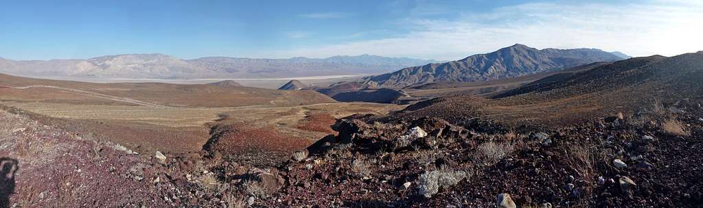
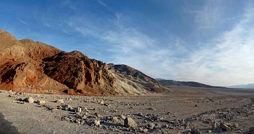
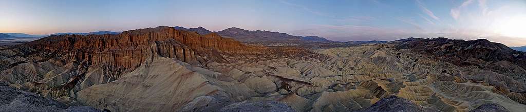
A while later Michael drove up to the Whitney Portal, and just like that we were on our way to Death Valley. It was the first time I had ever been to Death Valley which I was impressed at how vast the valley actually was. It was during this moment that I could finally announce "wow, I'm far away from home!". We were on our way to Las Vegas where Michael's sister and brother lived. But it just so happened that there was a cool canyon just a few miles out of our way called "Golden Canyon" which sounded interesting.
Death Valley Panorama
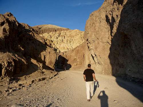
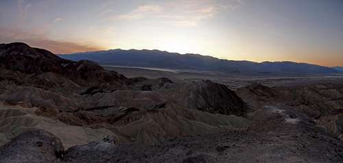
Heading into Golden Canyon
The Edge of Golden Canyon
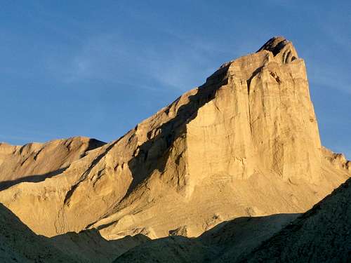
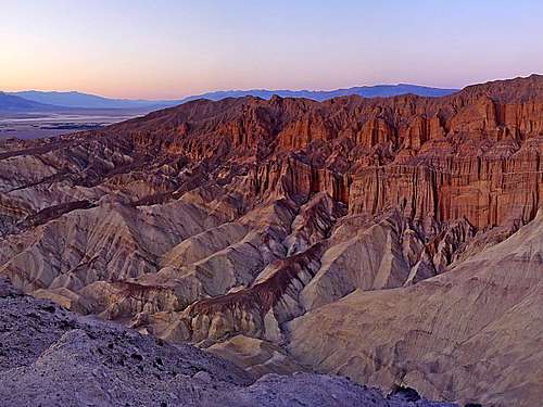
It was late in the day by the time we started the hike, but that didn't discourage us. All around there were interesting formations that I never see on "my side of the world". Gimpilator pointed out a large prominent rock called "Manly Beacon" which he said that there was a scramble route up. It looked massive, in my opinion it was more impressive that Whitney's East Face and had the appearance that it was at least 3,000 feet high up. But Gimpilator explained that it was an optical illusion and that it wasn't very high. It looked impossible, but I could tell by Gimpilator's explanation that there had to be a way.
Interesting Rock Formation
View Inside Golden Canyon
Golden Light on Golden Canyon
One of the many Side Turns
Looking back at Golden Canyon
Canyon towards the Red Rocks
The Trail on Manly Beacon
Approaching Manly Beacon
Evening Light on Manly Beacon
Looking Above Us in Golden Canyon
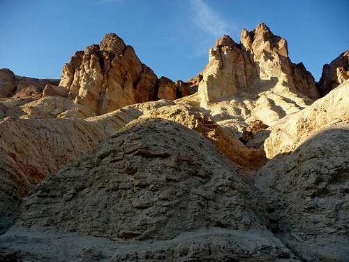
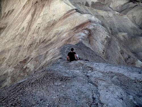
After a mile of hiking though Golden Canyon Michael turned around because not only was he tired but he also was wearing mountaineering boots which were hard on his feet. Gimpilator and I immediately started running as soon as it was just the two of us. The excitement was on, we both very much wanted to get up Manly Beacon. The sun was going to set any minute which in a sense we were racing the sun as we got above the canyon and were back into the light. Within minutes we were at the bottom of the West Face of Manly Beacon. At first it was a decent trail that led us around Manly Beacon until it disappeared. Suddenly I could see that there was a maze of ridges which looked very exciting. Never in all of my climbing had I gone though a literal maze to climb to my summit. Both Gimpilator and I were having the time of our lives going up and down ridges that were made out of some sort of clay. At one point we went up the wrong ridge which I wasn't sure if Gimpilator would call it quits because the sun already set. Nope, he wanted this peak at least as bad as I did. So we ran back down and finally got onto the correct ridge for the summit.
Gimpilator with Manly Beacon
Mountain Alpenglow
Sunset to the South
Evening on Golden Canyon
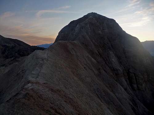
Manly Beacon's Summit Ridge
As we go up the ridge there was a little bit of exposure on each side, but as long as you stay in the middle of the trail it's fine. There was one section I recall that seemed a little steep making it worry some considering that if it was loose clay it would be a dangerous spot. Once we found out it was solid we got up it with ease. Very soon we were on the summit of Manly Beacon. All around it looked like we were surrounded by thousands of ridges in the canyons below. This route certainly wins 5 stars from me!
Even getting down Manly Beacon was exciting, after passing the crux we considered going down one of the Northern gullies, but something didn't look right about one of them. I announce this to Gimpilator, so we figured then it would be best to come down the way we came up. Neither of us could remember exactly where we had come up from with all the ridges in the way. So to make it easier we decided to follow a drainage down a ways and go back up another. We had to get to the main trail before dark because not only did both of us not have headlamps, but the only gear with us was a water bottle that was partially empty.
Gimpilator Crawling down Manly Beacon
After doing some more fun navigating I steered us back to the Golden Canyon trail that led us back into the canyon. It was almost dark by the time we were on the main trail, but the fact that it has hardly anything on it made it hikeable even if it was pitch black. Soon we arrived at the trailhead and immediately start our way to Las Vegas. On our way I had to get a 60 second shutter speed shot of the moon rising above the mountains.
Moonrise on the way to Las Vegas
Nevada seemed pretty dark for the first 30 minutes or so, but then when we arrived near Las Vegas I was amazed at how much light was coming from the city. In mid day it looks like a normal city, but at night the lights appear to go from one horizon to the other. After a while we arrive at Michael's brothers house who let us stay over. It was nice once again to freshen up.
Day 11-13: Las Vegas
When I woke up in the morning I almost couldn't believe it, it was raining outside. "What is this Washington?" I joked to myself. But unlike Washington, you were still able to see the mountains in this weather. Later that day Michael's sister invited us to see the Vegas strip which was a new experience for me. Although it was certainly interesting, I can't quite fully explain why, but it was in that moment that I wished that I was in some other city. If I lived in Las Vegas for a long time I would either have to move out, or I would go crazy living there. Part of it has to do with seeing the life style there that goes against what I stand for. Well anyways, it's true what they say. What goes in Vegas stays in Vegas.
We visited quite a few Mexican Styled restaurants while we were in Vegas, the buffet was the only exception to the Mexican food places we stopped at. Gimpilator hear that Redwic was staying in Las Vegas, so he decided to visit us for dinner. I played many card games with Michael's younger nephew and niece. We had all sorts of good laughs, the kids were quite disappointed when they found out that we were heading out. They certainly helped cheer me up in Las Vegas. After packing up our gear we set out for our last peak of the trip called Wheeler Peak which was the second highest peak in Nevada.
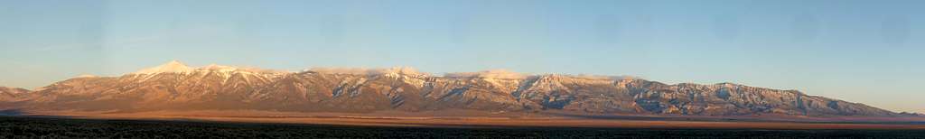
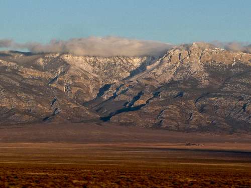
Great Basin National Park Panorama
Great Basin National Park
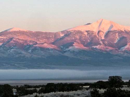
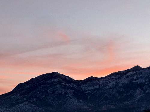
Alpenglow on Wheeler Peak
Day 14: Lehman Cave & Wheeler Camp
In the morning Michael decided that he would stay at the car while Gimpilator and I climbed Wheeler Peak. Looking at the surrounding landscape I felt as though I was on the far ends of the Earth. Hardly anyone seemed to live in these lands, but that's what made this place special. Before heading out we all went for a cave tour at the near by Lehman Caves.
The road to Wheeler Peak was closed a few miles from the trailhead, so to save time we took a trail that went to the trailhead from the upper Lehman Campground. The snow was so soft and powdery that we decided that shoeshoes would be a waste to carry up. Once we arrived near the trailhead we set up our camp on the road itself. The snow was so powdery that we were able to quickly kick off the snow down to solid ground in speedy time. After the usual troubles of filtering water we were able to rest for the night.
It was a very cold morning when we woke up, Gimpilator's thermometer read 0 Degrees Fahrenheit. It is very possible that it might have been colder depending on if it can read below 0 degrees, plus the fact that it was touching our tent. But Whitney felt colder even though in reality it wasn't as cold. After making some quick breakfast oat meal we were on our way for the summit of Wheeler.
Sunrise on Wheeler Peak
Photography was very difficult because not only would it come at the costs of making your hands very cold from taking them out of your thicker gloves but the camera would freeze up making it impossible for me during the morning hours. In the woods there was a bit of trail breaking Gimpilator and I had to do. Once we got out of the woods and onto the main ridge of Wheeler things suddenly got a lot easier. The ridge often gets windy which it blows most of the snow off down the mountain, or makes other parts of the slope nice and wind loaded.
Wheeler Peak with Winds
The Start of the Ridge
Myself Climbing Wheeler
Jeff Davis to the East
Gimpilator Hiking up Wheeler Peak
Wind Blowing on the Rocks
The winds forced me to put on not only all my long sleeve shirts, but also my puffy jacket that I almost never wear while climbing. As we near the summit I start to feel the altitude quite a bit. I didn't feel this way on Whitney or Russel. I suppose it has to do with the fact that we did this climb in much less time, plus of course all the rime. After pressing on for a while we arrived on our last summit of the road trip.
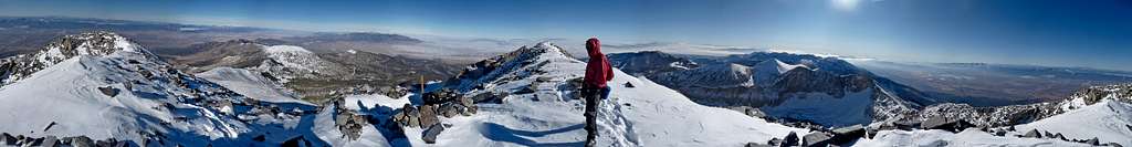
Wheeler Peak Summit Panorama
Climbing towards the Sun
Taking a Summit Nap
On The Summit Of Wheeler
Baker Peak to the South
Wheeler Peak's Summit
The View to the South
After taking a bit of a rest and hydrating we started heading down. At the time it seemed like wishful thinking, but we wanted to get to the car before dark. It turns out that we made very good speed dashing down the mountain. When we arrived back at camp we speedily packed up our gear for the way down to the trailhead.
Wheeler Peak's Summit
Wheeler Peak and Jeff Davis
Gimpilator High Up on Wheeler
The Side of Wheeler Peak
Heading Down Wheeler Peak
Gimpilator and I had some decent conversations on Wheeler Peak and was certainly like always a good partner to have on the mountain. We arrived back at the car around sunset, it felt good setting down the pack for the final time. I requested for us to use the ranger station rest room for me to change my clothes. Both Gimpilator and Michael told me that my feet reeked which is very true. I had to use the bathroom sink to wash them off, I discovered that there was a little bit of mold on my feet. I guess that's what happens when you go on a 15 day mountaineering tour.
The Final Sunset of the Trip
Going Home
At first I wasn't sure how many days it might take to get home, Michael drove on for hours and hours though out the night. Eventually I fell asleep for a while until around 12 a.m. in the morning. For the rest of the drive home I had to stay awake talking to Michael to help keep him awake. All the way from Eastern Nevada to Western Washington it was almost always foggy which I couldn't believe how long it was lasting. After many hours of driving we finally arrive at Gimpilator's house where we exchanged gear and such. Then I was dropped off at my house with my gear. After having a glass of milk and a warm shower I could finally get some rest.
A Big thanks goes out to Michael Blake for doing most of the driving, helping us find places to freshen up at his families places, and for everything else.
Special Thanks to Gimpilator for helping out with cooking, having great talks, taking many of the photographs and videos, and being a awesome climbing partner.
This was an incredible experience that I hope to do many others like this in the future. This story feels like a summary of the things that we did on this trip, but I figure this will give you a taste of what I experienced. I encourage anyone who reads this to try something like this someday.
I thought for sure you'd do Mt. Muir when you did Whitney. That's my plan anyway. Very nice write up Josh. Whitney and Muir as a day climb is going to be a tough one!
Believe me, I really wanted to! Even on the summit I was interested in climbing that peak. One of our partners was not feeling up to it and was happy enough just with Whitney. Plus he wanted to get down to the car the day we summited. But that didn't work out either. As long as you can drive to the trailhead and have good weather, I'm confident that you'll make it in a single day without too much trouble. Thanks for the comment Matt.
Thanks EB, didn't you mention something a while back about wanting to have me climb up your routes and have me take some photos for the pages? I'm still game for that idea.
Sounds like a heck of a trip. Sorta wished I lived over on that side.
Also, what type of tent was it that ripped/snapped? Hilleberg Nallo or Nammatj? I was about to drop some monies on one and that is a bit disconcerting.
Thanks Monster5. It was a Exped Tent made an Austria. We used it in the Enchantments before which it worked well, but I guess it can't put up with "Winters Fury". And believe me it was Fury!
So, you guys went from eastern Nevada to the Seattle area without
stopping ?
Geez, that's pretty incredible ... if you took the
Winnemucca, NV / Lakeview, OR cutoff, that's STILL well over 500
miles of driving time.
I'm going to take a wild guess that Michael is an avid coffee drinker. I'm not as young as I used to be, but I've ALWAYS had
to spend the night at a rest stop in Oregon on that drive.
Of course, we didn't have Power Drinks back then .. BOO-HOO !
(Don't get me wrong ... the "speed limit" has probably gone UP over the past ten years, but if you
averaged 60 MPH, it would have taken you nearly 10 hours to get to Lynnwood, WA, which is the cloudiest place on Earth.)
Too bad you didn't have two extra days for the driving time ..
Did Michael have a GPS on board? ... suppose that would have saved you time right there.
Also, a fuel-efficient vehicle really helps. Think I averaged 30-mpg with a Chevy sedan. But, I just
had one other passenger, who was my wife.
Thanks Larry. Michael was a very dedicated driver. Sometimes he would get a drink with caffeine. But sometimes not. Beyond my abilities when it comes to driving as many hours as he did. At the end of the trip he drove for over 12 hours if I remember right. He did not have GPS but did have a phone that gave directions. It was certainly a journey I won't soon forget.
Children refers to the set of objects that logically fall under a given object. For example, the
Aconcagua mountain page is a child of the 'Aconcagua Group' and the 'Seven Summits.' The
Aconcagua mountain itself has many routes, photos, and trip reports as children.
Parents refers to a larger category under which an object falls. For example, theAconcagua mountain page has the 'Aconcagua Group' and the 'Seven Summits' asparents and is a parent itself to many routes, photos, and Trip Reports.


Comments
Post a Comment