
|
|
Mountain/Rock |
|---|---|
|
|
49.18806°N / 20.05361°E |
|
|
Mountaineering, Trad Climbing, Mixed, Scrambling |
|
|
Spring, Summer, Fall, Winter |
|
|
7795 ft / 2376 m |
|
|
Overview
|
This is an inconspicuous summit on the main ridge of the High Tatras, overshadowed by its big neighbour Mięguszowiecki Szczyt Wielki / Veľký Mengusovský Štit, but very important in terms of Tatra geography – here begins a big lateral ridge with Kôprovský Štit / Koprowy Wierch, Hrebeň Bašt / Grań Baszt with Satan / Szatan, Hrubý Vrch / Hruby Wierch, Soliska / Grań Solisk and Krivaň / Krywań at its end. Moreover, the main European watershed between the Black Sea and the Baltic Sea leaves the main ridge of the Tatras here and turns south. 
Not only for its geography is Cubryna featured here. It is one of my favorite Tatra mountains because of a very nice panorama from its summit. 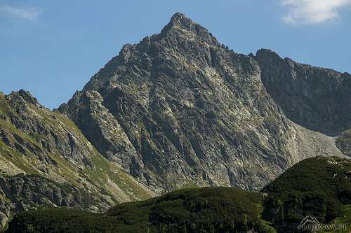 W face - photo by Tomek Lodowy W face - photo by Tomek LodowyCubryna rises over Rybiego Potoku / Rybiho Potoka Valley in the north-west, its branch Za Mnichem Valley in north, Piargova / Piarżysta Valley in the east and Mengusovská / Mięguszowiecka Valley in the south. By the north-west ridge connects with Zadni Mnich / Druhý Mnich (through Przełączka Pod Zadnim Mnichem / Štrbina za Druhým Mnichem), to the south-east connects with Wielki Mięguszowiecki Szczyt / Mengusovský Štit through Hińczowa Pass / Hincovo Sedlo and to the south-west with Kôprovský Štit / Koprowy Szczyt. 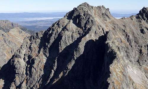
The name comes from the highlander dialect: Cubryna means a crop of hair. Why? Well, its crest is said to look dishevelled :) 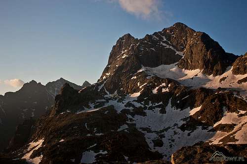
|
Summit Views
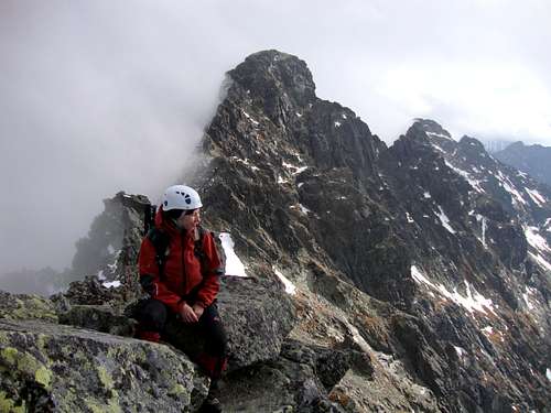 A view of Mięguszowiecki Szczyt Wielki - photo by Ivona A view of Mięguszowiecki Szczyt Wielki - photo by Ivona
|


When To Climb
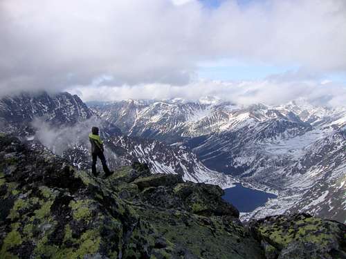 Looking west from the summit (25 October 2009) - photo by Ivona Looking west from the summit (25 October 2009) - photo by IvonaCubryna is available all year. The best time for scrambling to the summit is summer and early autumn (July to September). In winter Cubryna's walls are a climber's paradise. |
Routes Overview
|
NORMAL ROUTES: 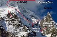
1. Via Galerie Cubryńskie to Hińczowa/Hincovo Pass. At the pass turn right and follow a distinct path up the rather broad here Cubryna’ south-east ridge. Bypass the first crag on the ridge, then come back onto the main ridge, rocky and pretty narrow, to the summit (big exposure, rock difficulty about UIAA I). ROCK CLIMBING ROUTES |
Maps
|
There are plenty of options available. One of the best is the 1:25,000 map of the Polish and Slovak Tatras by WiT. It is waterproof, durable and cheap. |

Other Information
For Getting There, Red Tape, Accommodation and Mountain Conditions, please see the page for Mięguszowiecki Szczyt Wielki.