
|
|
Mountain/Rock |
|---|---|
|
|
38.64445°N / 106.41748°W |
|
|
Chaffee/Gunnison |
|
|
Mountaineering |
|
|
Summer |
|
|
12858 ft / 3919 m |
|
|
Overview
 Tunnel Lake
 12ers
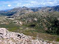
12ersMount Helmers sits on the Continental Divide in the Sawatch Mountains of central Colorado near the town of Buena Vista. To the northwest, Helmers connects to Peak 12954 ft and to the east it is separated from Mt. Poor (12442 ft) via a 11950 ft saddle. The beautiful Tunnel Lake (11950 ft) sits in the upper portions of Tunnel Gulch on the north side of Mt. Helmers.
 Mt. Helmers from Saddle with Mt. Poor
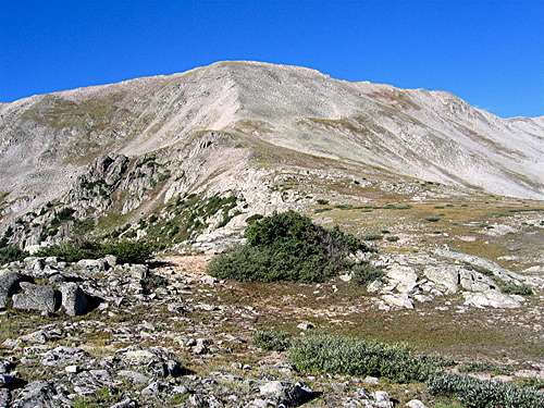
Except for a short segment of steep talus on the east face of its summit, Mt. Helmers has gentle slopes on all sides and can theoretically be approached from any direction. One of the most direct approaches is from the east via the ghost town of Hancock. From there, you will follow the Alpine Tunnel Trail (see below) to the collapsed east portal of the tunnel where the summit can be accessed.
Mt. Helmers and the nearby Mt. Poor have been named after the railroad historians Dow Helmers and Mac Poor.
 Helmers
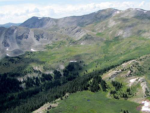 (L) Mt. Helmers, (R) Peak 12954 ft
ALPINE TUNNEL
 East Portal
The 1772 foot long narrow gauge Alpine Tunnel was completed in 1882 by the Denver, South Park & Pacific Railroads as a connecting route from Denver to the town of Gunnison. It was the first railroad tunnel through the Continental Divide and sat at an elevation of 11600 ft under the 11950 ft saddle between Mt. Helmers & Mt. Poor.
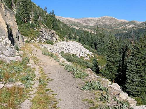 Alpine Tunnel Trail
 West Portal & Turntable
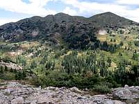 Peak 12643
The tunnel operated until 1910. Today, the railroad bed on the east side of the tunnel has been converted into a hiking trail and the west side serves as a Jeep route. The east portal of the tunnel has completely collapsed and the west portal is reported to be blocked by land slides. From the summit of Mt. Helmers you can see the remains of old buildings and what looks like a turntable on the west side of the tunnel.
 Alpine Tunnel Trail
 Trees
Trees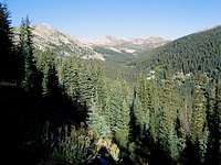 Helmers not seen
From the Alpine Tunnel Trail (on the east side), Mt. Helmers can not be seen. Peak 12954 ft and Peak 12850 ft, however, will be well visible and can be mistaken for Mt. Helmers. Just before reaching the tunnel, the trail turns into a shelf road traversing the rocky northern slopes of Mt. Poor providing the hiker with magnificent views of slender pine trees growing among the white cliffs above.
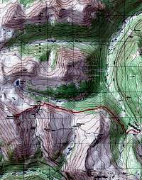
Getting There
Directions to the ghost town of Hancock:From the town of Buena Vista drive 8 miles south on Route 285 to a place known as Nathrop and then turn west onto Route 162. Drive this road 15.3 miles to just before the ghost town of St. Elmo (the first 10 miles are paved and the rest is a well graded dirt road).
Turn left onto Route 295. This road is rougher but is still passable by most/any car. Continue 2.7 miles until you see a detour around an old decaying railroad bridge (The detour is rather steep and the road beyond it is much rougher. I did not need to use 4 wheel drive but I will probably not drive this road in anything less than an SUV). Continue another 2.8 miles to the remains of the old mining town of Hancock
Red Tape/Camping
No fees or permits neede for hiking. For other regulations see the official site for San Isabel National Forest.Weather
See the forecast for the town of Buena Vista, CO.External Links
Alpine Tunnel Historic District.Alpine Tunnel in Wikipedia.