

-
 675235 Hits
-
 100% Score
-
 258 Votes
|
|
Mountain/Rock |
|---|---|
|
|
41.41000°N / 122.195°W |
|
|
Siskiyou |
|
|
14179 ft / 4322 m |
|
|
"As Lone As God And White As A Winter Moon"
"As lone as God and white as a winter moon, Mount Shasta starts up suddenly from the heart of the great black forests of California.
You would hardly call Mount Shasta a part of the Sierras; you would say rather that it is the great white tower of some ancient and eternal wall, with here and there the white walls overthrown.
It has no rival! There is not even a snow crowned subject in sight of its dominion. A shining pyramid in everlasting mail of frosts and ice, the sailor sometimes, in a day of singular clearness, catches glimpses of it from the sea a hundred miles away to the west; and it may be seen from the dome of the capitol 340 miles distant. The immigrant coming from the east beholds the snowy, solitary pillar from afar out on the arid sage-brush plains, and lifts his hands in silence as if in answer to a sign."
- Joaquin Miller, Life Amongst The Modocs, 1874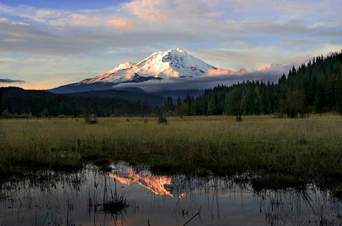
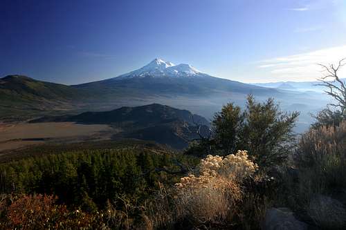
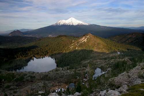
Mount Shasta Overview
Mount Shasta viewed from the Squaw Creek Valley
Majestic and solitary, Mount Shasta is the undisputed monarch of northern California. The magnificent cone soars more than 5,000 feet above its tallest neighbor and more than 10,000 feet above its base elevation. Mount Shasta is the superlative mountain in a state of superlatives. Cloaked in glaciers and boasting epic displays of lenticular cloud formations, the stratovolcano is one of the grandest summits in the American West.
Mount Shasta is the second highest peak in the Cascade Range, surpassed only by Mount Rainier which is just 249 feet taller. Nonetheless, with a base diameter of more than 17 miles, Mount Shasta has the greater volume. The mountain is one of the southernmost volcanoes in the Cascades, with only Lassen Peak further south. Shastina, Mount Shasta's largest subordinate peak, is the third highest summit in the range. Shasta is also one of the youngest of the Cascade's major volcanoes. This is visible in the mountain's pointed, conical cap. Other major peaks like Mounts Rainier, Adams and Hood are older and have broader, more rounded summits. The last eruption occured in 1786; the sulphur springs near the top of Mount Shasta give warning that the mountain will reawaken in the future.
Although Mount Shasta is a formidable mountain, it offers recreational opportunities to people of all abilities. Whether one seeks extreme, multi-day treks up massive glaciers or peaceful hikes through lush meadows, it is found on Shasta. From skiing to backpacking, waterfalls to wildflowers, Mount Shasta has it all and is a world unto itself.
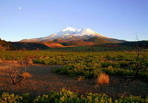
Mount Shasta Wilderness
Ash Creek Falls in the Mount Shasta Wilderness
"The Shasta region is still a fresh unspoiled wilderness, accessible and available for travelers of every kind and degree. Would it not be a fine thing to set it apart like the Yellowstone and Yosemite as a National Park for the welfare and benefit of all mankind, preserving its fountains and forests and all its glad life in primeval beauty?"
- John Muir, "Picturesque California", 1888
John Muir's vision of a Mount Shasta National Park never came to fruition and many trees in the region and even on the slopes of the mountain itself fell to the loggers axe. Nonetheless, at least an aspect of his dream was realized with the creation of the Mount Shasta Wilderness. The upper portions of the mountain are contained within the wilderness area, which was established by the 1984 California Wilderness Act. It currently encompasses 38,200 acres. The preserve is one of six protected wild regions in the California Cascades. It is the third largest, behind the Lassen Volcanic and Ishi Wilderness areas and ahead of the Caribou, Lava Beds and Thousand Lakes Wilderness areas.
Nearly 7,000 feet of Mount Shasta’s height is above the timberline. Consequently, this is among the most barren wilderness areas in northern California. The lushest forest within the boundary is found on the northeast and southeast slopes of the mountain. Glaciers, tundra and massive screefields dominate the rest of the area, although small meadows punctuate the lower flanks of Mount Shasta. The wilderness area also contains several lava flows, most of which are found on the north side of the mountain. The newest flows are in the northwest, nearest the Bolam trailhead. Older flows can be observed in the North Gate area.
Most of the prominent features on the mountain fall within the wilderness boundary, including important subordinate peaks, Shastina, Red Butte and Shastarama Point. Notable exceptions to this are Green Butte and Gray Butte. The latter is accessible by a rough 4x4 road as well as by trail. Green Butte, on the other hand is, is well above the nearest road and it is unclear why the wilderness boundary was drawn around it. Four named waterfalls; Whitney, Coquette, Mud Creek and Ash Creek are also found within the wilderness, though only Whitney Falls has a (rarely) maintained trail leading to it. All other waterfalls require off trail hiking to view them.
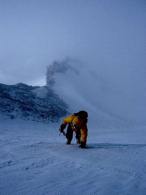
Climbing Mount Shasta
Climbing Green Butte Ridge
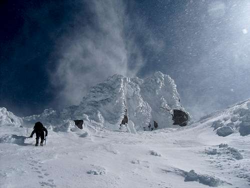
Over 15,000 summit attempts are made every year, only a third of which are successful. Avalanche Gulch is the least difficult and most popular route, and many people with no mountaineering experience are able to climb it (many more such people are not). An ice axe and crampons are necessary for all routes. One-day ascents are possible, but beginners will want to take two days so they can have more time to acclimatize.
Avalanches and rapidly changing weather conditions make winter climbs more dangerous, however rock fall is a threat year round. Visit the Shasta-Trinity National Forest web-site for more general information regarding other activites and safety information for The Shasta-Trinity National Forest.
Useful phone numbers:
The Fifth Season's (climbing & skiing report) 24 hour recorded message: (530) 926-5555
Mt. Shasta Ranger Station (Forest Service): (530) 926-4511
Mt. Shasta Ranger Station (Avalanche Report): (530) 926-9613
McCloud Ranger Station (Forest Service) for East side route and access road conditions: (530) 964-2184
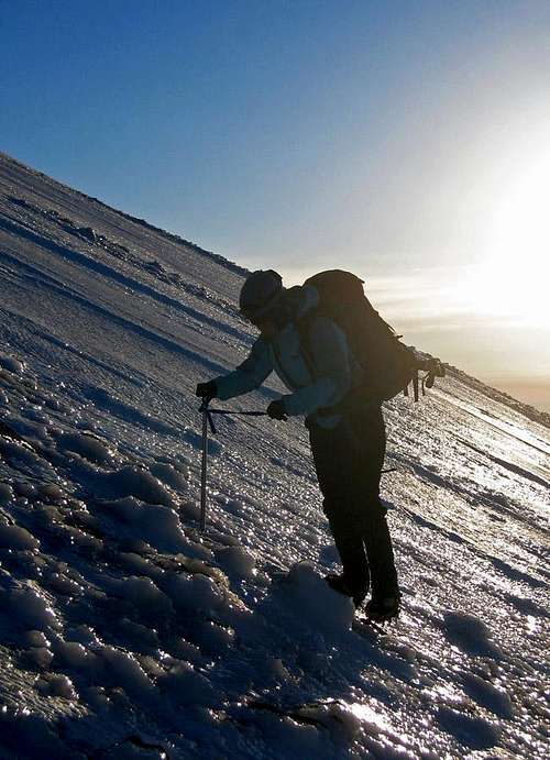
Southwest Route Information
Just Below 12000 Feet on Casaval Ridge
Bunny Flat Trailhead (41.35379° N, 122.23327° W)
The Sierra Club Lodge approach via Bunny Flat is the most popular approach. Avalanche Gulch, Old Ski Bowl, Sargents Ridge, Green Butte Ridge, Casaval Ridge and Cascade Gulch are accessible from Bunny Flat. From Interstate 5 in Mount Shasta City take the central Mount Shasta exit onto West Lake Street and continue about a mile until it bears left and becomes N Washington Drive. The road soon turns into Everitt Memorial Highway and leads directly to Bunny Flat at elevation 6950 feet, 12 miles from the interstate. From the trailhead take a two mile trail to Horse Camp (7900 ft) for all Bunny Flat routes except Green Butte and Sargent’s Ridge.
| Route | Trailhead (alternate) | Grade | Elevation Gain |
|---|---|---|---|
| Avalanche Gulch | Bunny Flat | I | 7300 Feet |
| Green Butte Ridge | Bunny Flat (Old Ski Bowl) | III | 7300 Feet |
| Sargents Ridge | Old Ski Bowl (Bunny Flat) | III | 6400 Feet |
| Casaval Ridge | Bunny Flat | III | 7300 Feet |
| West Face Gully | Bunny Flat | II | 7300 Feet |
| Cascade Gulch | Bunny Flat | II | 7300 Feet |

East Route Information
Sunrise on the Clear Creek Route
Clear Creek Trailhead (41.36561° N, 122.12745° W)
To reach the Clear Creek Trailhead take the McCloud exit off Interstate 5 onto Highway 89 just south of Mount Shasta City. Head east on Highway 89 for 13 miles and turn left onto Pilgrim Creek Road (3 miles past McCloud). Follow Pilgrim Creek Road north for 5 miles and turn left onto Widow Springs Road (Forest Road 41N15). After another 5 miles on Widow Springs Road cross over Forest Road 31 where the road changes to 41N61. After another half mile the road turns right, then left again one mile from Forest Road 31. Continue to the trailhead at the end of the road (about 8 miles from Pilgrim Creek Road and 13 miles from Highway 89).
| Route | Trailhead (alternate) | Grade | Elevation Gain |
|---|---|---|---|
| Clear Creek | Clear Creek | I | 7600 Feet |
| Wintun Ridge | Clear Creek | I | 7600 Feet |
| Wintun Glacier | Clear Creek (Brewer Creek) | III | 7600 Feet |

North/Northeast Route Information
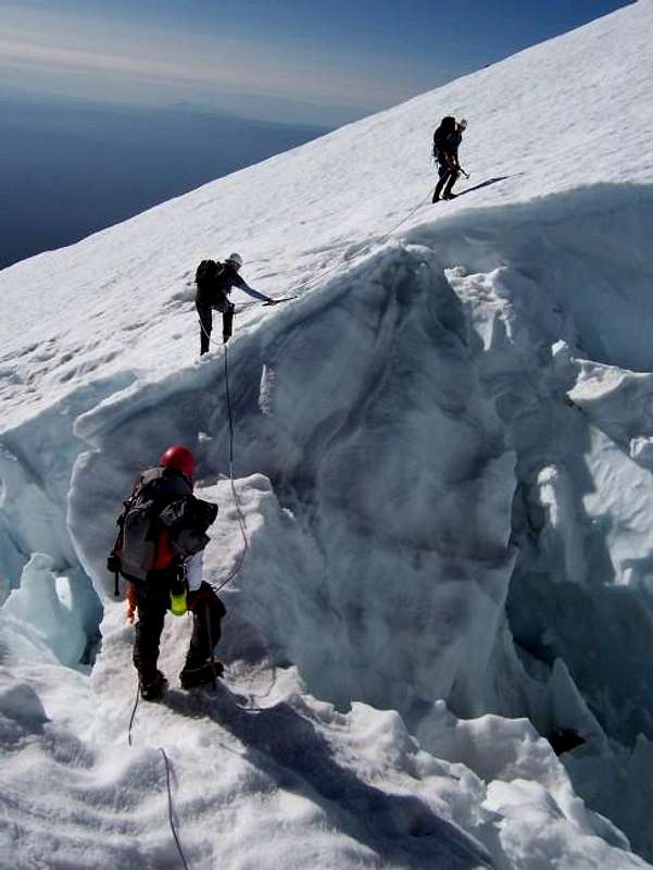
Crevasses on the Hotlum Glacier
Brewer Creek Trailhead
Brewer Creek is reached by taking US 97 north from Weed. 12 miles after Weed, turn right on Forest Service Road 19. Go more than 10 miles down this road, where you join with Forest Service Road 31 for a short period. Then, go right onto Road 42N02. After around 2.5 miles turn left onto 42N10, and take this to the trailhead at the end.
North Gate Trailhead (41.46840° N, 122.17401° W)
From Interstate 5 in Weed head northeast on Highway 97 for 15 miles until reaching Military Pass Road. Follow Military Pass Road for 3.6 miles to a junction with Andesite Logging Road and bear right as indicated by road signs. Continue on Andesite Logging Road for approximately five miles passing several forks and junctions en route to the trailhead. The drive is well signed from Military Pass Road and drivers should have no issue navigating the route (other than the rough terrain and possible bump of the oil pan).
Coquette Falls (41.45841° N, 122.21615° W)
From Interstate 5 in Weed head northeast on Highway 97 for 12 miles until reaching Bolam Road (aka Forest Service Road 4321). On Bolam Road keep right at 0.3 miles and cross over railroad tracks 1.7 miles from Highway 97. Turn left 2.3 miles from Highway 97 onto Bolam Logging Road. Follow the main road here as various spurs are passed. The road splits into 2-3 forks after about 4 miles, soon coming back together (none of choices are very good… quite brushy here). Keep right at junctions 4.8 and 5.1 miles from Highway 97. Continue on the sometimes rough, sometimes not, logging road keeping left at 6.7 miles, right at 7.1 miles, left at 7.5 miles, and right at 7.7 miles from the highway. The end of the road is reached at the trailhead about 8.5 miles in.
Whitney Falls Trailhead
Bolam/Whitney Creek is approached by taking US 97 north from Weed, then right on Road 43N21 (before US97 intersects with A12). Stay on Road 43N21 until its end.
| Route | Trailhead (alternate) | Grade | Elevation Gain |
|---|---|---|---|
| Whitney Glacier | Whitney Falls (Coquette Falls) | III | 8562 Feet |
| Whitney-Bolam Ridge | Coquette Falls (North Gate) | I | 6800 Feet |
| Bolam Glacier | Coquette Falls (North Gate) | III | 6800 Feet |
| Hotlum-Bolam Ridge | North Gate | II | 7200 Feet |
| Hotlum Glacier | Brewer Creek (North Gate) | III | 6900 Feet |
| Hotlum-Wintun Ridge | Brewer Creek | II | 6900 Feet |
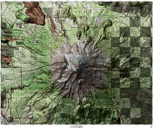
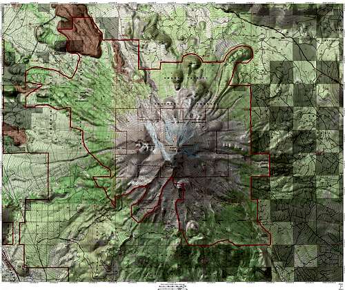
North Side GIS Image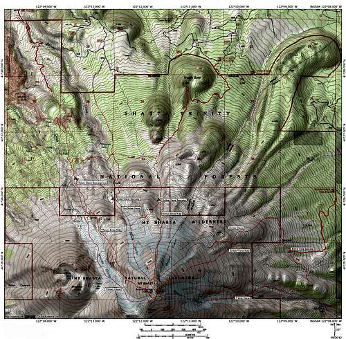
Northside Route Map
Mountain Conditions
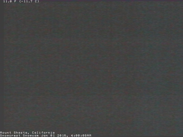
Mount Shasta Snowcrest Webcam
Because Shasta towers over neighboring mountains, it tends to “create its own weather.” Moisture condenses on the mountain forming lenticular clouds, so even on clear days the mountain can be covered by clouds. Weather conditions can change rapidly on the mountain, especially in winter. One of the best sources for obtaining current mountain conditions can be
found at the Mt. Shasta Avalanche Center. Here you will find many links to sites that cover all aspects of climbing safely on Mt. Shasta.
Mount Shasta Avalanche Center Online Avalanche Advisory
USFS Mount Shasta Climbing Advisory
Current NOAA / National Weather Service Forecast for the Summit Plateau
Current NOAA / National Weather Service Forecast for Mount Shasta City
Red Tape
Quotas:
There are NO quotas for climbs of Shastina or Mount Shasta from any trailhead. YAY!!!
Climbing Permits:
Shastina is located in Shasta National Forest, and all visits to both Shasta and Shastina require climbing permits (necessary for all trips over 10,000 feet in the Mount Shasta Wilderness). Three day summit passes are $20 and available self issue at open trailheads and outside the Mount Shasta Ranger Station 24 hours a day. Annual Passes are good for a calendar year, cost $30, and are available during business hours at the Mount Shasta and McCloud Ranger Stations, The Fifth Season in Mount Shasta City, and REI locations in Sacramento.
Wilderness Permits:
In addition to a climbing pass, wilderness permits are required for any overnight stays in the wilderness and are most easily obtained 24/7, self issue at open trailheads or the Mount Shasta Ranger Station.
Human Waste Pack-out Bags:
Pack-out bags for human waste are REQUIRED and can be obtained free at open trailheads and the Mount Shasta Ranger Station. Please don't take shortcuts here, as the routes can experience heavy traffic throughout the course of the year and easily ruined for following parties. Pack out all solid waste. If you are concerned about the integrity of the packaging take an extra gallon-sized ziplock bag (recommended), a trash compactor bag (not necessary), or several doses of loperamide (not recommended!!!).
Hiking On Mount Shasta
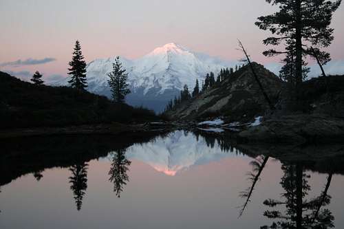
Alpenglow on Mount Shasta, seen from Heart Lake
"Regarding Mount Shasta from a bee point of view and beginning at the summit, the first 5,000 feet is clothed in summer with glaciers and rags of snow, and is, of course, almost entirely honeyless. The next 1,000 feet of elevation is a brown zone tufted and matted with brush penstemon and bryanthus. Next come the silver fir-zone, about 2,500 feet in height...follow the bees and be showerd with blossoms; take a baptism and a honey-bath and get some sweetness into your life"
- John Muir, "Shasta Bees. A Honeyful Region - The Bee Lands - A Summer Paradise", 1874
While many come to Mount Shasta to scale its epic heights, there are many great options around its base for those who wish only to hike. All the established trails are of the out-and-back variety. Only the Red Butte route providing a loop of sorts. The trails on the south side offer the most diverse destinations and are easiest to get to. Those on the north provide some of the best vistas of the mountain.
South Side Trailheads
Hiking trails marked in blue.
Routes marked in red.
Dotted lines note established off-trail routes.
Bunny Flat/Sand Flat Trailhead
The trail to Horse Camp departs from here. While Horse Camp is a worthy destination in its own right, route leading to Hidden Valley and Green Butte make excellent, day long hiking trips. The maintained trail leads only as far as the Sierra Club hut. Beyond there, only use trails lead to further destinations.
Panther Meadows Trailhead
While Panther Meadows itself is only a short distance from the trailhead, the trail continues to a number of destinations. Gray Butte is the closest destination. Squaw/South Gate Meadows is also accessed from here, as is the loop around Red Butte.
Old Ski Bowl Trailhead
A connector trail leads from here to the route to Squaw/South Gate Meadows and Red Butte. An unmaintained route to the top of Green Butte also begins here.
Clear Creek Trailhead
The Clear Creek trail departs here. Most who hike this trail are heading up Mount Shasta via the Clear Creek route. Nonetheless, this is a great trail for day hiking and offers great views of the mountain.
North Side Trailheads
Hiking trails marked in blue.
Routes marked in red.
Dotted lines note established off-trail routes.
Most of the trails on the northside of Mount Shasta are used primarily as access trails leading to routes to the summit. While all the trails simply fade out as they gain elevation, they are still great hikes with wonderful views of the mountain.
Brewer Creek Trailhead
This trail leads to the east side of the mountain and offers great views of the eastern glaciers. An unmaintained route departing the trail near its terminus leads south to Ash Creek Falls, Mount Shasta's most spectacular waterfall. The best vantage point for the falls is gained by crossing the creek above the falls and traversing around until the falls comes into view.
North Gate Trailhead
Again, the trail leads to route headed for the summit. This trail also provides access to the top of North Gate, a large volacnic dome on the north side of Mount Shasta.
Bolam Trailhead
While this trail leads to summit routes headed up the Whitney Glacier, it also provides access to Whitney Falls, one of Mount Shasta's better (albeit fickle) waterfalls.
Circumnavigating Mount Shasta
"Far better than climbing is going around its warm fertile base, enjoying its bounties like a bee circling around a bank of flowers... As you sweep around so grand a centre the mountain itself seems to turn... One glacier after another comes into view, and the outlines of the mountain are everchanging."
- John Muir, "Shasta Bees. A Honeyful Region - The Bee Lands - A Summer Paradise", 1874
It is said that Muir preferred the trip around the Mount Shasta rather than up it. This was due in part to the ever changing profile of the mountain and the vistas of the glaciers. Today, few undertake this trailless endeavor.
A backpacking trip around the mountain would generally take three to four days to complete the roughly 35 miles. Those who do make the trip generally stay around the treeline. This makes travel easier and the views excellent. Most trips begin and end at Horse Camp. Major obstacles include the scree on the west side of the mountain near Shastina, crossing the foot of many glaciers (particularly the Whitney Glacier) and climbing into and out of Mud Creek Canyon.
Selters and Zanger's book on Mount Shasta includes and a description of the approximate route. A route page and more detail will be added to Summitpost this summer (2009).
Camping
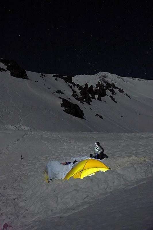
Camp on Casaval Ridge
Trailhead camping is common and allowed at the Bunny Flat trailhead. Dispersed camping is allowed throughout the greater Mount Shasta area, including at and en route to other trailheads. Camping is also allowed at the Sierra Club maintained Horse Camp. They charge $5.00 per tent and $3.00 per bivy. This is a good basecamp for trips up many of the south side routes.
The Forest Service maintains two campgrounds on Mount Shasta, both of which are located off of Everitt Memorial Highway. McBride Springs Campground is only a couple miles outside of the town of Mount Shasta and has a lot of shade. Panther Meadows Campground is located near 8,000 feet, just a bit below the Old Ski Bowl.
Other great campgrounds are found in the area, though not on Mount Shasta itself. One such is Fowlers Camp, on the McCloud River. This campground is located right along the river and the trail that connects the three McCloud River Waterfalls passes through it. This is a good place to camp when accessing Mount Shasta trailheads on the east side of the mountain. Other good campgrounds in the area include Castle Lake and Gumboot Lake, both of which are high in the mountains west of Mount Shasta but are only minutes from town.
Several of the attached route pages overview possible camping options for staying on the mountain.
Geography
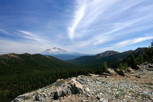
Mount Shasta from the Trinity Divide
Regional Geography
Mount Shasta is one the southern most volcanic peaks in the Cascade Range, which stretches from Canada to northern California. Of the major volcanoes in the range, only Lassen Peak lies further south. Oregon’s Mount McLoughlin is the next prominent volcano in the chain. Mount Shasta lies west of the main crest of the California Cascades (which is rather ill-defined). The Klamath Mountains, which make up much of northwestern California, come within miles of Shasta. The Strawberry Valley separates the massive Klamath Range from Shasta. The range’s highpoint, Mount Eddy, is only 16 miles away from the summit of Mount Shasta. Considering Shasta’s great diameter, the Klamath actual proximity to the volcano is much greater.
A number of volcanic cones are found immediately east of Mount Shasta. Chief among these peaks are the Whaleback (8,528), Ash Creek Butte (8,378) and Haight Mountain (8,081). Further east, the Medicine Lake Highlands rise out of the Modoc Plateau, reaching a maximum height of 7,913 on Mount Hoffman. Despite these peaks’ respectable elevation, they are all well over 5,000 feet shorter than Mount Shasta.
Mount Shasta and the Whaleback from Herd Peak
North of Mount Shasta, two large valleys spread all the way to the Oregon border. The Cascade crest forms the divide between the two plains. To the west is the Shasta Valley, through which flows the Shasta River, tributary of the Klamath River. This is the larger of the two valleys. The valley is within Mount Shasta’s rainshadow. This results in the valley’s high desert climate. Several tall knobs and domes are found throughout the area, particularly at the southern end of the valley. These are remnants of a vast rock slide that poured off the northern flanks of Shasta at some point in the dim past. Due to the arid conditions and poor soils, cattle raising is the largest industry in the Shasta Valley. To the west of the Cascade crest is the Butte Valley. Although smaller than Shasta Valley, Butte Valley is nearly 2,000 feet higher. This results in a bit more precipitation and somewhat milder climate. This allows for a more diversified economic base and agriculture is common in the Butte Valley, particularly the growing of strawberries.
The Cascade crest north of Mount Shasta is one of the most forgotten regions in the entire range. Containing no lakes and few creeks, the area is completely overshadowed by Mount Shasta (with good reason). The best reason to explore this area is for the one thing that can’t be found on Shasta itself; great views of the mountain. Willow Creek Mountain (7,829), the Goosenest (8,280) and Herd Peak (7,071) are the highest peaks in the range. The Goosenest is of particular note, beings a large cinder cone with a classic crater at its summit. If this peak were in Oregon, it would be one of the state’s major summits.
Mount Shasta from the north. Shastina is on the right, North Gate is the point on the left
Mountain Topography
Although Mount Shasta is a solitary mountain, many important features populate its flanks. Some of these features would rank as major peaks in their own right if they did not fall under Shasta’s overpowering shadow. Canyons, waterfalls, points and glaciers are also found on Mount Shasta.
Shastina
If Shastina were separated from Mount Shasta it would be the third highest peak in the Cascades at 12,330 feet. The formation is a massive subordinate cone on Shasta’s northwest flank. A clearly discernable crater is found on the summit, which contains the small Clarence King Lake. Equally small Sisson Lake is on Shastina’s eastern flank, in the saddle between Shastina and Shasta. The peak sees far less attention than its overwhelming neighbor, but is still a worthy destination in its own right. Diller Canyon, on Shastina’s western slope is a popular skiing route.
Shastarama Point
Reaching a height of 11,195, Shastarama Point is one of the dominant features on Sargents Ridge. The point is prominently visible from Mount Shasta City. Mud Creek Glacier curls around the north side of the prominence. Squaw / Southgate Meadows is one of the best locations to view this magnificent chunk of rock.
Green Butte
Taken by itself, Green Butte would be the sixth highest peak in the California Cascades at 9,193 feet. The peak is large prominence on the southern side of Mount Shasta. Green Butte is the highest of a series of prominent points in the area, all of which carry colors as their monikers. The peak rises directly above the Old Ski Bowl parking lot and can be reached by a non-maintained route that originates there. It can also be reached via a cross-country route from Horse Camp. Green Butte is a frequent target of lightening strikes.
Red Butte
At 8,377 feet, Red Butte is the second highest of the “color buttes” on Mount Shasta’s southern flank. The peak rises high above The Gate, a narrow, barren pass that leads to the lush Squaw / Southgate Meadows area. An excellent cross-country spur off the trail leading to the meadow forms a loop around the base of Red Butte.
Gray Butte
Gray Butte is the shortest of the “color buttes” reaching an elevation of 8,108. The peak houses an array of antennas at its southern end, which is reached via a round. A trail beginning at Panther Meadows also reaches the summit, which offers spectacular views of Mount Shasta. The peak is outside the Mount Shasta Wilderness boundary.
North Gate
North Gate is a large volcanic dome on the north side of Mount Shasta. The Northgate trail winds near the 7,915 foot summit on its way to the climbing routes up the Bolam and Hotlum Glaciers.
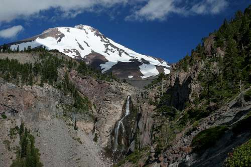
Mud Creek Canyon
The largest chasm on Mount Shasta, Mud Creek Canyon is also one of the oldest features on the mountain. Glaciers scoured it out during previous glacial periods. The Mud Creek and Konwakiton Glaciers feed Mud Creek. Mud Creek Falls is one of the four major waterfalls on Mount Shasta. The Clear Creek Trail follows the canyon rim for nearly a mile.
Mount Shasta rises above Shastina and Diller Canyon
Diller Canyon
One of the larger canyons on Mount Shasta, Diller Canyon occupies Shastina’s western slope. The canyon is wide and deep and is prominently visible from the Weed area. It is a popular route of descent for skiers.
Casaval Ridge
Casval Ridge is one of the most rugged features on Mount Shasta. The ridge runs up the southwest side of the mountain, terminating near the beginning of the Whitney Glacier. A seemingly endless number of crags and spires give the ridge an incredibly serrated and unforgiving look. A popular route to the summit follows the ridge.
Sargents Ridge
Sargents Ridge is a massive rampart extending southeast from Mount Shasta’s summit. The ridge’s cliffs rise more than 1,000 feet above the slopes below. Sargents Ridge is another feature that is prominently visible from Mount Shasta City. Shastarama Point forms the rough halfway point between Shasta’s summit and the ridge’s southern terminous. A trail leading to Squaw / Southgate Meadow climbs its lowest flanks.
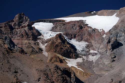
Konwakiton Glacier
Glaciers
Seven glaciers are found on the slopes of Mount Shasta. Only the western side of the mountain does not contain glaciers. The southern side of the mountain is home to the three smaller glaciers: Mud Creek, Konwakiton and Watkins. Mud Creek and Konwakiton Glaciers feed Mud Creek while springs fed by the Watkins Glacier are the source of Clear Creek. The northern and eastern sides of Mount Shasta are covered by the four major glaciers; Whitney, Bolam, Hotlum and Wintun. These are California’s largest and most active glaciers. The Whitney Glacier is the longest in the state, reaching a length of nearly 2 miles. The Hotlum Glacier is California’s largest in terms of volume and surface area. A section of this glacier has separated from the main formation and is unofficially referred to as the Chicago Glacier. This appellation is a result of the University of Chicago’s long-term glaciology research conducted in the area.
A study conducted in the early 00’s revealed that the glaciers on Mount Shasta had grown. Some had seen 50% increases in size while others had doubled. This is in sharp contrast to the glaciers in the Sierra Nevada, which are receding.
History
A lenticular cloud develops on Mount Shasta
Native Americans originally inhabited the region around Mount Shasta. Three tribes occupied the area, their territories roughly intersecting at the mountain. To the east the Modocs occupied the marshy lands of the Modoc Plateau. Northward, the Klamaths lived in the greater Klamath River area. South of Mount Shasta dwelt the Wintun. It was this tribe that lived closest to the mountain. The massive volcano held special religious significance to all the tribes.
Mount Shasta was the last major peak of the Cascades to be discovered by Europeans. All the other major peaks had been identified prior to the 19th century. This is due to Shasta’s remote location, far from the original population centers of California and Oregon. The first sighting by a European is believed to have occurred in 1786 when a French explorer saw a volcanic eruption from sea. Scholars are unsure the eruption spotted by the explorer was Shasta, but that was roughly the time of the last known eruption. No other record of Mount Shasta appears until 1827 when mountain man Peter Ogden spotted a large snowy cone and a nearby river. He named the peak and river “Sastise”. While the name eventually stuck, it is now believed that rather spotting Mount Shasta and the Shasta River, Ogden actually spotted Mount McLoughlin and the Rogue River in Oregon. References to Mount Shasta continued to be sporadic after Ogden’s possible discovery. John Fremont passed beneath the mountain in 1846 and declared the mountain unclimbable. So it remained for 8 more years until Elias Pierce became the first man to reach the summit.
After Fremont had passed through the Shasta area while on a surveying expedition, the Gold Rush had begun in the Sierra Nevada. By 1850 it had moved north, exploiting the parts of the Klamath Mountains that had similar compositions to the Sierras. While regions like the Trinity Alps and the mountains above Yreka yielded great wealth, prospectors in the Castle Crags had not produced significant lodes. Nonetheless, their presence placed enough pressure on the local Wintun that a battle erupted in 1855 near Castle Lake. This battle is believed to have been the last pitched exchange in the West where the Indians fought exclusively with bow and arrow. Famed western poet Joaquin Miller was a resident of the Shasta area at the time and participated in the battle.
As a result of the mining operations, small communities began sprouting up in the Mount Shasta area. The valley to the southwest of the mountain became known as the Strawberry Valley and in 1853 a man named Justin Sisson built an inn that he would operate for many years thereafter. That same year Ross McCloud built the first sawmill in the area, foreshadowing what was to become the regions major industry. By the 1880’s the mines had mostly played out but the Central Pacific Railroad had laid track up the Sacramento River Canyon, opening the area up to logging and tourism. While logging has declined substantially from the mid-19th century to the present, it does continue to this day. Tourism has seen a corresponding increase.
Mount Shasta from the approach to the Whitney Glacier
Famous Visitors
Mount Shasta has always attracted those with an eye for natural world. Many of the luminaries of exploration, wilderness preservation and mountaineering have passed under the mountains shadow. Most who did come to the area did so as guests of Sisson and stayed at his inn.
It has already been noted that John Fremont passed through the Shasta area. Another great explorer of the West, Clarence King made several expeditions to Mount Shasta. He is credited with discovering (and naming) the Whitney Glacier, the first glacier to be found in California.
John Wesley Powell also came to Mount Shasta. The one-armed major from the Civil War reached the summit in 1879. While he is certainly justly known for his epic trips of discovery, he was also an important ethnologist. He came to Shasta to study the Wintun tribe and it was he who named the Bolam, Hotlum, Wintun and Konwakiton Glaciers, using words from the tribe’s language.
Albert Bierstadt, the famed painter of the American West, spent time in Shasta after departing Yosemite and completed several sketches of the mountain from several angles and times of day. He completed one painting of Shasta. Ludlow Fitzhugh, Bierstadt’s traveling companion stated that:
"Certainly no peak which we met in all our large experience of the mountains of this continent ever compared with Shasta in producing the effect of vast height."
-Ludlow Fitzhugh, On Horseback into Oregon, 1864
President Theodore Roosevelt came to Mount Shasta during his famous tour through California. After the trip he declared:
"I consider the evening twilight on Mt. Shasta one of the grandest sights I have ever witnessed."
John Muir, famed lover of the Sierra Nevada, also had a deep love for Mount Shasta. He made several trips to the mountain, many before the railroad up the Sacramento River Canyon had been built. This required a difficult journey through the dense forests north of Redding. It was while making one of these trips that Muir stated:
"When I first caught sight of it over the braided folds of the Sacramento Valley, I was fifty miles away and afoot, alone and weary. Yet all my blood turned to wine, and I have not been weary since."
- John Muir, Letters, 1874-1888
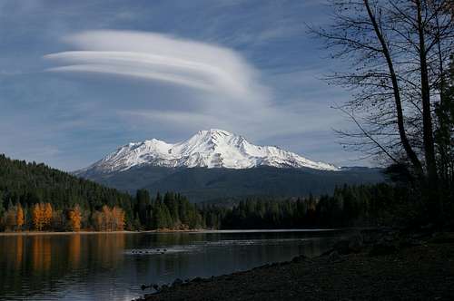
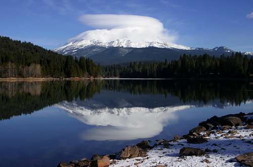
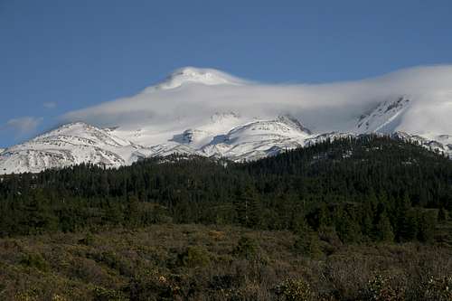
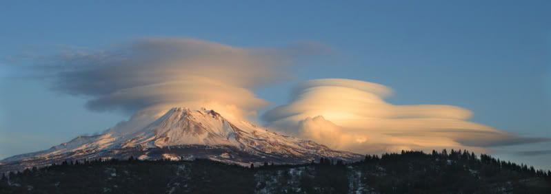
Lenticular Clouds
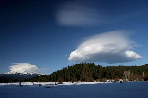
A lenticular cloud hovers on Mount Shasta while another develops to the south
Mount Shasta is known for its magnificent lenticular cloud displays. These clouds tend to form around prominent peaks or mountain ranges. Isolated peaks, such as Mount Shasta, often display lenticular clouds shaped liked lenses near the mountains summit. Mountain ranges usually produce long, running waves rather than the lens shape. The clouds are formed when the mountain forces fluctuating, warmer air currents to go over the mountain. As the air rises it cools. If the rising air reaches the dew point, the water vapor begins to condense. This is the bottom of the lenticular cloud. The water vapor continues to condense as the air current flows over the mountain. This is what causes the arced, lens shape formation. When air drops back down the mountain and warms the condensed water revaporizes and the clouds terminus is formed. The fluctuations in the air flow is what is responsible for the constantly changing appearance of the cloud.
Lenticular clouds form on peaks throughout the world. Nonetheless, Mount Shasta is well known for both the frequency and the magnitude of the clouds that are displayed by the mountain. One cause for the particularly magnificent formations produced by Shasta is the mountains stunning prominence. Rising over 10,000 feet above the surrounding landscape, the air is forced to undergo dramatic and unpredictable fluctuations in both temperature and elevation. The fact that Mount Shasta rises from flat plains and forests only adds to the intensity of the conditions.
As beautiful as Mount Shasta is, the ever-present chance that a lenticular cloud, which is always unique, might develop keeps the mountains appearance fresh and challenging. No matter how many times one sees the peak itself, it is always presenting some new aspect and vista, an unknown nuance to awe the spectator.
 |
 |
 |
 |
 |
 |
 |
 |
Telos, Lemuria And Mother Ships
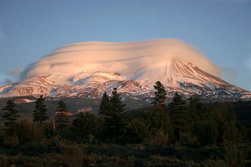
The lenticular mothership settles on Mount Shasta
The towering, forbidding mass of Mount Shasta inspires awe in all who see it. Native Americans revered the mountain since prehistoric times. The mountain continues to be important to Native Americans today. The Panther Meadow area holds particular significance to them. Since the beginning of the 20th century, Shasta has become increasingly central to numerous spiritual groups and cults. Several unusual ideas have been asserted regarding the mountain…and its residents.
Many (this means a lot, not just a handful) believe that those who survived the destruction of Atlantis made their way to Mount Shasta and built a vast city within its core. The city, Telos, is now inhabited by enlightened Atlanteans. Other groups believe that those who live inside the mountain are survivors of the collapse of Lemuria, a lost continent in the Pacific. Like the Telosians, the Lemurians are thought to dwell within the mountain, although some claim to have encountered them while climbing Mount Shasta. Mount Shasta has powers of its own, beyond its mysterious inhabitants. It is considered one the worlds most powerful nexuses of New Age energy. Consequently, one of the gatherings for the Harmonic Convergence occurred on the mountain. Still others believe that Mount Shasta is a beacon to extraterrestrials. As has happened in other places around the world, lenticular clouds are often viewed as UFO’s or cover for the UFO’s.
While these beliefs seem to be wildly outlandish, many people sincerely hold them. Some are prominent members of the Mount Shasta community. It is not uncommon to see people chanting or meditating or praying on the mountain. This is most common at Panther Meadows or at the Old Ski Bowl. Please be aware of these individuals and show them courtesy.
Additional Information
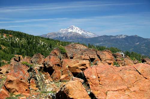
Mount Shasta from the Castle Crags Wilderness
Literature
Several good books addressing various aspects of a trip to Mount Shasta are available. The venerable classic is Selters and Zanger's "The Mount Shasta Book". This book provides overviews of all the major routes to the summit and their variations. Hikes on the mountain and in the greater region are included, as are mountain biking and whitewater rafting options. The Wilderness Press map is included with the book.
If climbing the Avalanche Gulch is one's intent, then Lewis' "Climbing Mt. Shasta: Route 1, Avalanche Gulch" is good. It includes a significant amount of tangential information regarding peripheral issues such as gear. The book is intended more for beginners.
Kohn's "Mount Shasta Book Of Fun" is a great resource for the greater Mount Shasta region, as well as the mountain itself.
Maps
Excellent maps topographic maps are available from Tom Harrison and Wilderness Press. The Forest Service also offers an excellent map that has Mount Shasta on one side and the Castle Crags Wilderness on the other. All aforementioned maps are adaptations of the USGS Mount Shasta map.
Mount Shasta from the Trinity Alps
Logistical Centers
The communities of Mount Shasta, McCloud, Weed and Dunsmuir are all found at the foot of the mountain. While all offer lodging and dining, the town of Mount Shasta is the most centrally located and offers the most amenities. All routes are easily reached from the community and the Everitt Memorial Highway departs from the heart of town to the Bunny Flat trailhead. Supplies are available at Ray's Food Place (off of Lake) and the Mount Shasta Market (on Alma). The town also has a full service hospital available for medical needs. The Forest Service ranger station is located on Alma.
Dining
Mount Shasta has a number of good restaurants. The following are some of the better choices (obviously, this is somewhat objective):
Poncho and Lefkowitz
Absolutely the best food in town. As they say, "locals know Poncho's!" Serves a variety of Mexican food and gourmet German sausages. Run by a great crew who love the mountain, the sun, and great blues and rock. You absolutely can't go wrong here. Located on Mount Shasta Boulevard.
The Billy Goat
Great brews and awesome burgers. This is a popular climber's gathering place. Has indoor and outdoor seating. Located on Mount Shasta Boulevard.
Dos Gecko's
Good option for Mexican food designed on the "build it yourself" model. Many more options than one might expect. Located on Mount Shasta Boulevard.
Vivify
Astoundingly good sushi restaurant. Famed Bay Area sushi chef's retirement project. Far better than one might expect to find in such an isolated region. Located on Chestnut Street.
Say Cheese Pizza
There is a Round Table Pizza in Mount Shasta that is good as always, but Say Cheese is a local joint that that doubles as a sports bar. The pizza is plenty good too. Located on Lake Street.
Trinity Cafe
Higher end, great food and frequented by many post-climb groups. Mellow atmosphere but usually fun. Located on Mount Shasta Boulevard.
Black Bear Diner
Black Bear is a quick and easy favorite for home-style cooking. A chain that has franchises as far east as Colorado Springs, it started right here in Mount Shasta. Located on Lake Street.
 |
 |
 |
 |
 |
Maps
Mount Shasta
Mount Shasta Wilderness
External Links
Historical Accounts
- Life Amongst The Modoc
Digitized version of Joaquin Miller's classic description of the Shasta region published in 1874. - Snow-Storm on Mount Shasta
John Muir's account of a night spent on the summit of Mount Shasta during a blizzard. - Mount Shasta
Chapter 10 of John Muir's book Picturesque California which describes Mount Shasta and the surrounding region.
General Information - Summiting the Volcano, Mount Shasta
Documentary account of the Avalanche Gulch route to the summit of Mount Shasta - Northwest Outdoors Guide
Guide to mountaineering and hiking in the Pacific Northwest - Mount Shasta Snow Cam
Updated pictures every 10 minutes of the mountain. - Avalanche Gulch dayhike - May 12, 2001
- Another Avy Gulch dayhike - May 25, 2002
- Climbing Mt.Shasta
A comprehensive page covering routes, conditions, accident reports, and other current information about Mt. Shasta. It's a wonderful resource. - Shasta Mountain Guides
Summit climbs, ski descents, glacier seminars, rock climbing. All on the the incredible Shasta. Shasta Mountain Guides takes great pride in providing the highest quality experience for our climbers. We specialize in Mt. Shasta. - Mount Shasta Guide
Knowledgable and experienced 4-season guide for trips on Mount Shasta and throughout the region. - Mt. Shasta Wilderness Avalanche and Climbing Advisory
An excellent resource for anyone who plans to climb Mt. Shasta. The site is maintained by the rangers and provides route advisory, description of accidents on Shasta, links to weather reports and more. In the winter months the weather and avalanche report is updated daily. - Zeitcam.com
Time-lapse movie of Shasta Cam, as well as other mountains. - Hotlum-Bolam Ridge to Avalanche Gulch north-south traverse
- www.shastahome.com with updated Shasta cam and Sno Park cam.
- www.climbingmtshasta.org with updated Shasta cam.
- USGS/Cascades Volcano Observatory/Mt. Shasta
- GORP's Shasta Page. for more general information.
A Note On Submitting Images Of Mount Shasta
There is an enormous number of images posted to the Mount Shasta page. Submissions are most definitely welcome. However, in the interest of keeping the visual aspect of the resource as efficient as possible, please refrain from submitting redundant images. If you feel the image does not add something new to people's understanding of the mountain, please refrain from submitting it. This pertains more to scenic images as opposed to images of climbing the mountain. Thanks!Sunset on Mount Shasta
Mount Shasta, January2009.
Perhaps it is fitting, as one arrives at the end of the Mount Shasta page, to conclude with a sunset on the moutain...

seano - Oct 30, 2014 3:00 pm - Hasn't voted
First ascentFWIW, I believe it's Elias *Pearce*, not Pierce, who made the FA, probably via Avalanche Gulch, on August 14, 1854. See e.g. http://www.siskiyous.edu/shasta/out/cli/rec2.htm
molliej - Jul 21, 2015 9:10 am - Hasn't voted
Re: First ascentIndeed, wikipedia confirms.
psycholoco - Jul 5, 2017 2:05 pm - Hasn't voted
Summit PassesWas up there 7/4/17. 3-day summit passes are currently $25. I believe annual passes are still $30.
owl_of_minerva - Apr 13, 2023 11:22 am - Hasn't voted
broken linkthe website http://www.fs.fed.us/r5/shastatrinity/index.shtml no longer resolves at all. Visit https://www.fs.usda.gov/stnf for general Shasta info and https://www.shastaavalanche.org/#/all for Shasta Avalanche information.