
|
|
Mountain/Rock |
|---|---|
|
|
40.01500°N / 107.0832°W |
|
|
12354 ft / 3765 m |
|
|
Overview
Flat Top Mountain is the highest mountain in the Flat Tops of Northwest Colorado. Despite being the highest summit in the Flat Tops, it is one of the easiest of the Flat Tops to climb. It is also one of the most popular mountains to climb in the Flat Tops as well, perhaps only exceeded by the summit of Devils Causeway, which is a "soft ranked" peak.
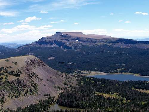
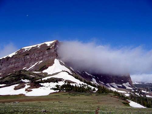
Flat Top Mountain is highly visible from the west, and is seen by many people driving along Highway 131. When viewed from the northeast or south, one might wonder how Flat Top Mountain got its name, but it’s really obvious when viewed from the southeast or northwest. Many beautiful lakes and meadows surround the peak. Flat Top Mountain is an easy climb from its west ridge and the gentle high ridges from the summit of Flat Top extend southeast to Dome Mountain.
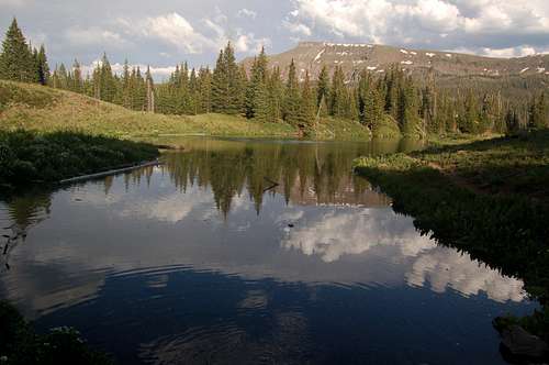
The Flat Tops are more of a huge elevated plateau rather than a typical mountain range, but the plateau has been eroded into many individual peaks and summits, and most of them are flat-topped, or dome-like as are the Lost Lakes Peaks. The mountain area composing the Flat Tops contains over 110 lakes full of fish, and also has some of the most extensive areas above timberline in Colorado.
Flat Tops: 11,000+ Foot Peaks with 300+ feet of Prominence
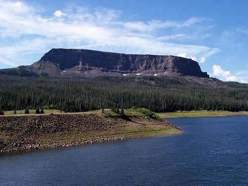
 Flat Top Mountain as seen from Devils Causeway on September 6 2008.
Getting There
The trailhead is at the Stillwater Reservoir. From Yampa, look for the sign on the west side of Highway 131 that points the way to "National Forest Access". Turn west on to County Road 7. Follow County Road 7 for seven miles, to where the road becomes FR 900. Stay on the main road for nine miles and drive to the parking area at Stillwater Reservoir. The road is good for all vehicles in day conditions. A 4wd may be needed early or late season.
The winter road closure varies. From mid-November through mid-April, the road is closed where the pavement ends (10 miles from Stillwater). In late April, another 7 miles of the road opens allowing access to Bear Lake. In early June (when the snow finally clears) the last 3 miles of the road opens allowing access to Stillwater Resevoir.
 This is the un-named peak west of Flat Top as seen from the trail up Flat Top from Stillwater Reservoir. August 13, 2005.
Routes Overview
West Ridge Route
The West Ridge of Flat Top Mountain is the standard route and by far and away the most popular route on the mountain. From Stillwater Reservoir, the North Derby Trail is followed south for 2.1 miles to the saddle between Flat Top Mountain and Peak 11815. From there, an unofficial trail heads 2.2 miles east along the gentle and beautiful ridge to the summit of Flat Top Mountain.
This route is 8.6 miles round trip with about 2200 feet elevation gain.
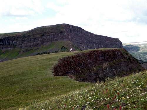 Looking west down the route of Flat Top to the saddle. The route up Flat Top is interesting, but not steep for an off-trail route.
Other Routes
Other routes on Flat Top Mountain are very seldom climbed. You can reach the saddle mentioned above from several trails from the south and from the Stump Park Road, but this requires a much longer high and drive.
The north side of Flat Top Mountain may offer some interesting snow routes early season. The ridge from Dome Mountain to Flat Top would make an interesting route as well.
Red Tape
No permits are required.
Standard Wilderness Regulations apply within the wilderness boundary.
Directly from the National Forest Service:
Basic Rules
• Entering or being in the area with more than 15 people per group, and a maximum combination of 25 people and pack or saddle animals in any one group is prohibited.
• There is no permit system in place in the Flat Tops Wilderness but we do ask that visitors sign in on provided trailhead registration forms.
• Camping within one hundred feet of any lake, stream or trail, or any “No Camping” or “Wilderness Restoration Site” sign or within ¼ mile of Trappers, Hooper, Keener or Smith Lakes is prohibited.
• Building, maintaining, attending or using a campfire within one hundred feet of any lake, stream, or trail or within ¼ miles of Trappers, Hooper, Keener or Smith Lakes is prohibited.
• Storing equipment or personal property or supplies for longer than 10 days is prohibited.
• Hitching, tethering or hobbling any pack or saddle animal within one hundred feet of any lake, stream or trail is prohibited.
• Possessing any pack or saddle animal within ¼ mile of Trappers Lake except for watering or through travel is prohibited.
• Possessing a dog or other animal that is harassing wildlife or people or damaging property is prohibited. There is no leash law in the Flat Tops, however dogs must be kept under verbal control at all times.
• Possessing or using a wagon, cart or other vehicle including a wheelbarrow or game cart is prohibited.
• Shortcutting a switchback in a trail is prohibited.
 Make sure to tread lightly in this beautiful area.
Camping
Campgrounds
CLICK HERE for current campground information for official Routt National Forest campgrounds. The ones in the Yampa River district are in the same general area as Flat Top Mountain.
The Cold Springs and Horseshoe campgrounds are located near Stillwater Resevoir. The Bear Lake campground is located near Bear Lake. And the East Marvine campground is located near Trappers Lake.
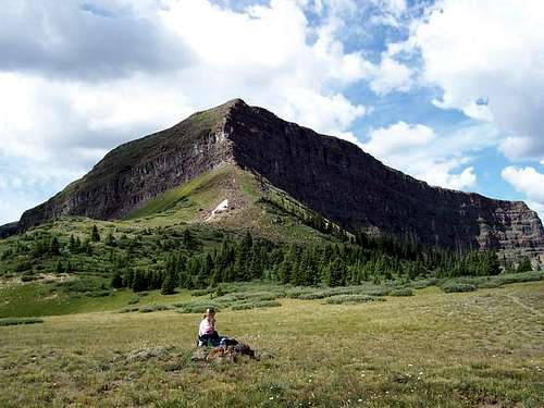
 Flat Top Mountain from Cold Spring Campground.
Backcountry Camping
There are some campsites along the trail between Stillwater Reservoir and the saddle. Beyond and including the saddle is open alpine terrain above timberline, so a perfect weather forecast has to be in place for considering camping there.
There are many beautiful, but popular campsites around Hooper and Keener Lakes south of the saddle.
When To Climb
Flat Top Mountain could be climbed year-round by an experienced climbing party, but the roads to Stillwater Reservoir is open only from around Memorial Day or early June to sometime in November, so outside this time period, this would probably be a three day trip.
The Flat Tops (especially the northern and western section) receive much snow, so despite the lower altitude than the 14'ers, the peaks remain buried in snow until mid-July. Snowshoes are recommended in June.
The Flat Tops have many mosquitoes in July, and sometimes into early August.
Mid August to mid September is good because the mosquitoes are gone.
From September and into December is hunting season, so wear blaze orange and use extreme caution. On the plus side, hunter traffic usually keeps the roads open until around Thanksgiving weekend. Late November might be the best time to make a “winter conditions” ascent because after the road closed, this would be very long trip.
 The peak west of Flat Top Mountain as seen in late June.
Mountain Conditions
Contact the Yampa Ranger District for up-to-date road, trail, and wildfire conditions:
PO Box 7
300 Roselawn St.
Yampa, Colorado 80483
970-638-4516
CLICK HERE FOR WEATHER FORECAST OF THE AREA
Weather and climate data for Marvine Ranch at 7800 feet elevation is below. *National Weather Service Data 1972-1998. Expect much wetter conditions at higher elevations. The area around Flat Top Mountain will average around 10-15 degrees colder in the daytime than Marvine Ranch; nighttime temperatures won't have as big of a difference.
| MONTH | AVE HIGH | AVE LOW | REC HIGH | REC LOW | AVE PRECIP (in) |
| JAN | 33 | 1 | 59 | -38 | 2.43 |
| FEB | 36 | 3 | 56 | -42 | 2.30 |
| MAR | 42 | 11 | 63 | -32 | 2.55 |
| APR | 49 | 18 | 75 | -16 | 2.20 |
| MAY | 61 | 27 | 78 | 5 | 2.41 |
| JUN | 72 | 33 | 92 | 15 | 1.57 |
| JUL | 77 | 38 | 89 | 23 | 1.94 |
| AUG | 75 | 38 | 90 | 21 | 1.91 |
| SEP | 68 | 31 | 87 | 11 | 2.16<TD |
| OCT | 57 | 22 | 76 | -10 | 2.16 |
| NOV | 40 | 11 | 65 | -30 | 2.26 |
| DEC | 33 | 2 | 63 | -44 | 2.53 |
External Links
Gorp Info on the Flat Tops Wilderness
White River National Forest Information from Gorp
Routt National Forest information from Gorp
Wilderness.net Information on the Flat Tops Wilderness
An awesome gallery of pictures and an interactive panarama of the wilderness
White River National Forest Contact Page