-
 49292 Hits
-
 93.1% Score
-
 41 Votes
|
|
Mountain/Rock |
|---|---|
|
|
40.28030°N / 105.6725°W |
|
|
Hiking, Mountaineering, Trad Climbing |
|
|
Spring, Summer, Fall |
|
|
12000 ft / 3658 m |
|
|
Overview
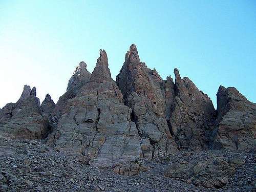
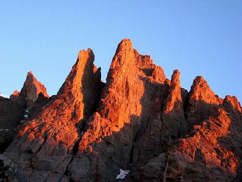
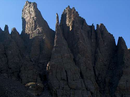
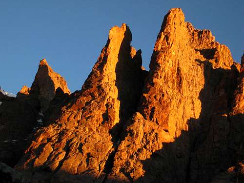
Petit Grepon is an amazing Eiffel Tower shaped pinnacle and the most spectacular of the Cathedral Spires of Rocky Mountain National Park. Nestled between two other great spires, The Sabre on the east and the Shark's Tooth (12,630') on the west, the 800 foot high spire is a draw for climbers around the world. It is located in the eastern section of the park about 3 miles west of Longs Peak and just northeast of Taylor Peak (13,153') on the continental divide. The pinnacle shape, small 10' x 30' summit, and designation of the moderate South Face (III, 5.8, 7-8 pitches) as one of the "50 Classic Climbs of North America" make this an extremely popular climbing objective. The South Face route has been called "perhaps the most popular alpine climb in the country" by Charles Vernon and "one of the most popular, if not the most popular route in RMNP" by others. The route makes a grand tour of the South Face and crosses over to the East Face, finishing with great exposure. When the South Face is overrun (on most fair weather weekends), climbers will find the Southwest Corner (III, 5.9) to be a challenging and attractive alternative. A 5.10c 3-pitch start variation of the Southwest Corner is also available. The Pen Knife (II, 5.6) is on the north side, and while easier, is still vertical and extremely exposed making it a worthy objective.
The first ascent of the South Face occurred in 1961 and was by William Buckingham and Art Davidson. The first ascent of the Southwest Corner was by Bob Culp and B. Beal in 1970.
A less demanding climbing alternative to Petit Grepon is the Shark's Tooth, a nearby spire to the northwest whose summit offers excellent views of Petit Grepon. The Shark's Tooth includes several climbs such as the South Prow (III 5.7), Northeast Ridge (III 5.6) and the East Gully (II 5.4).
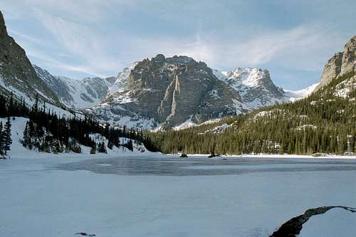
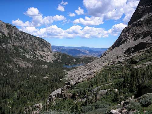
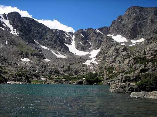
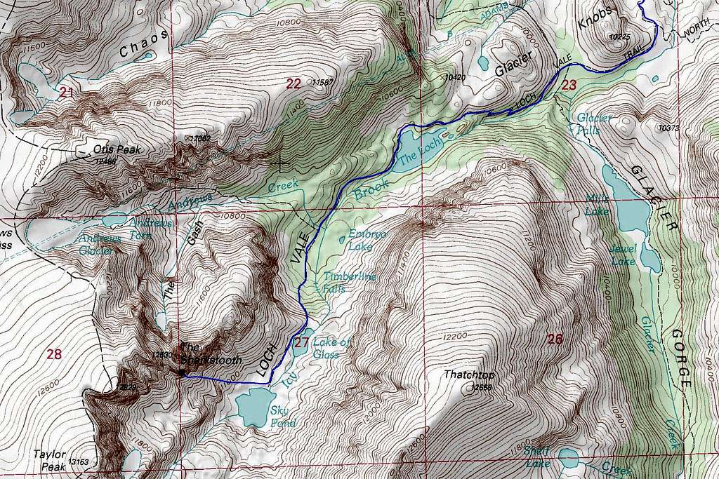
On the hike to Petit Grepon and Sharkstooth, you will pass three lakes. The first is Loch Vale which is a large lake reached just over a couple miles of hiking from the trailhead. About 3/4 mile beyond Loch Vale is a train junction where you should continue left towards Sky Pond. 500 vertical feet above this junction you will arrive at a large alpine cirque at the top of the hill. Glass Lake is the first lake you'll see right as you crest into the cirque. The trail continues around the west side of this lake. Sky Pond is a short ways further and you will see the south face of Petit Grepon to the right just as you arrive at Sky Pond. These lakes are often filled with large trout and The Loch provides great views during sunrise.
Getting There
GLACIER GORGE TRAILHEAD:
The approach for Petit Grepon starts at the Glacier Gorge Trailhead which is accessed from Estes Park, Colorado. From Denver, Take US Highway 36 (Denver-Boulder Turnpike) to Boulder and drive through the city. Once you pass through Boulder, continue north until you reach the end of the road where it intersects State Highway 66. Turn left here and continue west on Highway 66 for a mile into the town of Lyons. In Lyons, follow the signs to the right for Estes Park and continue northwest on Highway 66. Just as you arrive into town, the road will be called North St. Vrain Ave. and you will cross over Lake Estes and just before entering the busy downtown area (right before passing the McDonalds) turn left (south) onto Stanley Avenue. Taking this detour may save you at times a half hour since the downtown Estes Park area can be so filled with tourists that driving through becomes impossible. After a third of a mile on Stanley Drive turn right onto Prospect Ave. and continue around the corner as the road changes to Moccasin Circle Drive. At the fork in the road stay left onto Crags Drive and descend around a switchback, cross the river then continue left onto Moraine Avenue (Highway 66). Enter the National Park and take the Bear Lake Road all the way up to the Glacier Gorge trailhead, which is a mile shy of Bear Lake at the end of the road. There is a huge parking lot on the left side of the road and a bathroom facility here.
APPROACH HIKE:
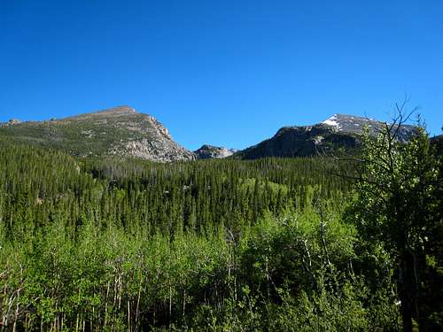
Hike up the trail, following the signed junctions for Loch Vale. Pass by Alberta Falls, Loch Vale and Glass Lake along the way and arrive at Sky Pond a little over 4 miles from the trailhead. The normal approach leaves the trail to the right of Sky Pond and heads toward the spires above a talus field. This is a very scenic approach and time should be taken to enjoy. The trail is very well traveled with distance/direction signs along the way. The total distance to the climb is about 4.6 miles.
Red Tape
ENTRANCE FEE (MANDATORY):
Petit Grepon is in Rocky Mountain National Park and visitors are required to pay an entrance fee to enter the park. As of 2013, this fee was $10 per person or $20 per car, which ever is less. This is good for 7 consecutive days. The cost is $5 per bicycle or motor cycle per person (up to $15). Various passes such as the National Parks Pass will also get you into this park.
BIVY SITE FEES (OPTIONAL):
Camping in the Sky Pond drainage is limited to technical climbers and subject to bivy restrictions. These restrictions include: No tents, No fires, and is only between dusk and sunrise. Sleeping bags and bivy sacks can only be placed on rock or snow. The number of spots is limited and there is a $15 per site fee that must be paid at the Estes Park NPS ranger station center. See the Camping section below for additional details.
When To Climb
Petit Grepon can be climbed most years April through the first big snow fall of the year which is typically in early to mid- October. The approach may have lots of snow but most of the routes are south facing and very steep thus allowing them to dry very quickly. The climb should be started early to avoid the afternoon thunderstorms. To quote from a user on Mountain Project: "Do Not...repeat DO NOT climb the South Face route on a nice summer weekend. This is probably the most popular alpine climb in the country." I made the climb on a Monday in early June and had the entire Sky Pond cirque and all the towers to myself.
Camping
BIVY SITES:
All sites in the Sky Pond area below the climb are bivy only sites. This means that no tents or artificial structures can be put up. The sites are very limited and must be paid for in person at the ranger station at the Estes Park main entrance. The sites are currently around $15 which is in addition to your entry fee into the park. A bivy cave is also available. Also be sure to keep your food secure as mice and other rodents have been known to eat their way through to your food. Please read the other regulations regarding bivies and abide by the rules.
Descent
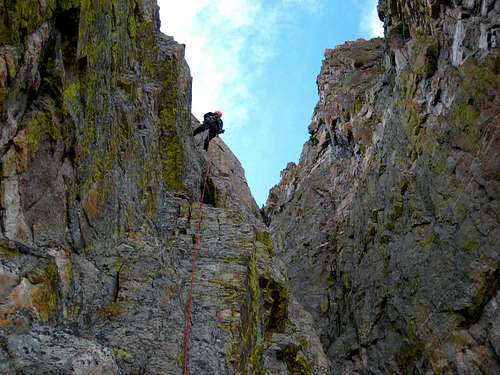
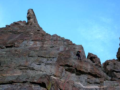
There are new rappel stations on the east side of the peak. When on the summit walk to the northeast end and you'll find two new bolts. Using two 60M ropes you can make a rap straight down to another set of new bolts on a small ledge. You will have to veer to the rappers left to find them. From there you make another full rap past some old slings all the way down to the large grassy ledge. Once on the ledge, walk south to the end of the ledge (maybe 60 feet or so) and locate the third set of bolts one of which has a homemade hanger. There are three more raps to the base from here. See more detailed information about the descent on the South Face Route page.
Map
External Links
Links:Phone Numbers:
Visitor Information: 970-586-1206
Backcountry: 970-586-1242
Campground Reservations: 800-365-2267
Fax: 970-586-1256


Tom Fralich - Jul 14, 2007 9:25 pm - Hasn't voted
Rappel DescriptionThere are now bolted rap stations all the way down for parties with two 60m ropes. Start from the bolts on the summit, then down to another set of bolts. From there, rap straight to the grassy ledge...no need to stop at the convoluted sling anchor. From the grassy ledge, walk south to find another set of bolts atop a chimney. Rap from there to some slings/rope around a big boulder on the second terrace, but find some bolts directly below. From there, a long rap to another bolted station on the first terrace (top of first easy pitch). Then from there to the ground.